SlideShare a Scribd company logo
1 of 25
MODERN SURVEYING
TECHNIQUES
CONTEMPRORY TECHNOLOGIES
WHAT IS SURVEYING?
• Surveying is defined as the science of
making measurements especially of
the earth surface. This is being done
by finding out the spatial
location(relative/absolute) of points
on or near the earth surface.
• Different method and instrument are
being used to facilitate the work of
surveying.
OBJECTIVE OF SURVEYING
1. To collect field data.
2. To prepare plan or map of the area surveyed.
3. To analyze and calculate the field parameters
for setting out operation of actual engineering work .
Surveyors work with elements of geometry,
trigonometry,
physics, engineering, metrology, programming languages
and regression analysis.
MODERN SURVEYING EQUIPMENT
• DIGITAL LEVEL
• EDMI – ELECTRO MAGNETIC
• TOTAL STATION
• REMOTE SENSING
DIGITAL LEVEL
Digital levels use electronic image
processing to evaluate the special
bar-coded staff reading.
• This bar-coded pattern is converted
into elevation and distance values
using a digital image matching
procedure within the instrument.
USES: For measuring elevations, height
difference, levelling of ceiling.
SALIENT FEATURES OF DIGITAL LEVEL
• Fatigue-free observation as visual staff reading by the
observer is not required.
• User friendly menus with easy to read, digital display
of results.
• Measurement of consistent precision and reliability
due to automation.
• Automatic data storage eliminates booking and its
associated errors.
WORKABILITY:
• The purpose of electronic staff reading, a beam
splitter is incorporated which transfers the bar code
image to a detector diode array.
• The light, reflected from the white elements only of
the bar code, is divided into infrared and visible light
components by the beam splitter.
• The visible light passes on to the observer.
• The acquired bar code image is converted into an
analogous video signal, which is then compared with
a stored reference codes.
EDMI: ELECTRO MAGNETIC
EDMI measures slope distance between transmitter
and receiver by modulating the continuous carrier
wave at different frequencies, and then measuring
the phase difference at the master station between
the outgoing and the incoming signals.
OPERATION WITH EDMI
It involves four basic steps:
(a) Set up
(b) Aim
(c) Measure
(d) Record
Setting up: The instrument is centered over a station
by means of tribrach. Reflector prisms are set over
the remote station on tribrach.
Aiming: The instrument is aimed at prisms by using
sighting devices or theodolite telescope. Slow motion
screws are used to intersect the prism centre. Some
kind of electronic sound or beeping signal helps the
user to indicate the status of centering.
Measurement: The operator presses the measure button
to record the slope distance which is displayed on LCD
panel.
Recording: The information on LCD panel can be
recorded manually or automatically.
ERROR IN MEASUREMENT WITH EDMI
1. Instrument error
2. Atmospheric errors
3. Instrumental error
TOTAL STATION
This instruments can record horizontal
and vertical angles together with
slope distance and can be considered
as combined EDM plus electronic
theodolite.
SALIENT FEATURES OFTS
• TS captures the spatial data for a
three-dimensional position fix.
• The angles and distances are
displayed on a digital readout and
can be recorded.
Various components of a typical TS are
shown in Figure:
FIELD OPERATION WITH TS
The programs need at least one identified reference
station so that all subsequent stations can be
identified in terms of (X, Y
, Z).
It include the following functions
• Point location
• Missing line measurement (MLM)
• Resection
• Remote distance and elevation measurement
• Offset measurements
• Layout or setting out operation
• Area computation
Different Types of TS and accessories
• Trimble(5600IR)
REMOTE SENSING
• Science and art of obtaining information about an
object, area, or phenomenon through the analysis of
data acquired by a device that is not in contact with
the object, area, or phenomenon under investigation
Remote sensing system consists of the following sub-systems:
(a) scene
(b) sensor
(c) processing (ground) segment
How remotely sensed data gets converted into useful
information:
1. Source of EM energy (sun/self emission: transmitter
onboard sensor).
2. Transmission of energy from the source to the
surface of the earth and its interaction with the
atmosphere (absorption/scattering).
3. Interaction of EMR with the earth surface (reflection,
absorption, transmission) or re-emission/self
emission.
4. Transmission of reflected/emitted energy from the
surface to the remote sensor through the intervening
atmosphere.
5.Recording of EMR at the sensor and transmission of
the recorded information (sensor data output) to the
ground.
6.Preprocessing, processing, analysis and
interpretation of sensor data.
7.Integration of interpreted data with other data
sources for deriving management alternatives and
applications.
APPLICATION OF REMOTE SENSING
Agriculture:-
• Crop condition assessment.
• Crop yield estimation
Urban Planning:-
• Infrastructure mapping.
• Land use change detection.
• Future urban expansion planning
• Hydrology
• Forestry And Ecosystem
• Ocean applications
• Disaster management
IN CYCLONE:
MITIGATION PREPAREDNESS RESCUE RECOVERY SATELLITES USED:
Risk modelling;
vulnerability analysis.
Early warning;
long-range climate
modelling
Identifyingescape routes;
crisis mapping;
impact assessment;
cyclone monitoring;
storm surge predictions.
Damage assessment;
spatial planning.
KALPANA-1;
INSAT-3A;QuikScat
radar; Meteosat
Cyclone Lehar by KALPANA 1 Cyclone Helen by Mangalayan
Example:
IN EARTHQUAKES:
MITIGATION PREPAREDNESS RESCUE RECOVERY SATELLITES USED
Building stockassessment;
hazard mapping.
Measuring strain
accumulation.
Planningroutes for search
and rescue;
damage assessment;
evacuation planning;
deformationmapping.
Damage assessment;
identifying sites for
rehabilitation.
PALSAR;
IKONOS 2;
InSAR; SPOT; IRS
The World Agency of Planetary Monitoring and Earthquake Risk Reduction (WAPMERR) uses remote sensing
to improve knowledge of building stocks — for example the number and height of buildings. High resolution imagery can
also help hazard mapping to guide building codes and disaster preparedness strategies.
IN FLOODS:
MITIGATION PREPAREDNESS RESCUE RECOVERY SATELLITES USED
Mapping flood-prone
areas;
delineating flood-plains;
land-use mapping.
Flood detection;
early warning;
rainfall mapping.
Flood mapping;
evacuation planning;
damage assessment.
Damage assessment;
spatial planning.
Tropical Rainfall
Monitoring Mission;
AMSR-E; KALPANA I;
Sentinel Asia — a team of 51 organisations from 18 countries — delivers remote sensing data via the Internet as
easy-to-interpret information for both early warning and flood damage assessment across Asia.
It uses the Dartmouth Flood Observatory's (DFO's) River Watch flood detection and measurement system, based on
AMSR-E data, to map flood hazards and warn disaster managers and residents in flood-prone areas when rivers are likely
to burst their banks.
Flood In Uttarakhand Flood In Assam
IN OTHER
DISASTERS:
DISASTER MITIGATION PREPAREDNESS RECOVERY RESCUE SATELLITES USED
DROUGHT Risk modelling;
vulnerability analysis;
land and water
managementplanning.
Weather forecasting;
vegetation monitoring;
crop water requirement
mapping;
early warning.
Monitoring
vegetation;
damage assessment.
Informing
drought
mitigation.
FEWS NET; AVHRR;
MODIS; SPOT
VOLCANO Risk modelling;
hazardmapping;
digital elevation models.
Emissionsmonitoring;
thermalalerts.
Mapping lava flows;
evacuation planning.
Damage
assessment;
spatial planning.
MODIS and AVHRR;
Hyperion
FIRE Mappingfire-prone
areas;
monitoringfuel load;
risk modelling.
Fire detection;
predicting spread/direction of
fire;
early warning.
Coordinatingfire
fightingefforts.
Damage
assessment.
MODIS; SERVIR;
Sentinel Asia; AFIS
LANDSLIDE Risk modelling;
hazard mapping;
digital elevation
models.
Monitoringrainfall and slope
stability.
Mapping affected
areas;
Damage
assessment;
spatial planning;
suggesting
management
practices.
PALSAR;
IKONOS 2;
InSAR; SPOT; IRS
Modern Surveying Instrument.pptx

More Related Content

Similar to Modern Surveying Instrument.pptx

Surveying,ADVANCE EQUIPMENT IN SURVEY
Surveying,ADVANCE EQUIPMENT  IN SURVEYSurveying,ADVANCE EQUIPMENT  IN SURVEY
Surveying,ADVANCE EQUIPMENT IN SURVEYPRAJWAL SHRIRAO
 
Fundamental of Remote Sensing.pptx
Fundamental of Remote Sensing.pptxFundamental of Remote Sensing.pptx
Fundamental of Remote Sensing.pptxSonalGosai2
 
Fundamental of Remote Sensing.pptx
Fundamental of Remote Sensing.pptxFundamental of Remote Sensing.pptx
Fundamental of Remote Sensing.pptxSonalGosai2
 
Total station and its application to civil engineering
Total station and its application to civil engineeringTotal station and its application to civil engineering
Total station and its application to civil engineeringTushar Dholakia
 
Iaetsd concepts of surveying with totalstation-a latest
Iaetsd concepts of surveying with totalstation-a latestIaetsd concepts of surveying with totalstation-a latest
Iaetsd concepts of surveying with totalstation-a latestIaetsd Iaetsd
 
Total station surveying and its application
Total station surveying and its applicationTotal station surveying and its application
Total station surveying and its applicationChavanRavishankar
 
Remote sensing and tunneling.pptx
Remote sensing and tunneling.pptxRemote sensing and tunneling.pptx
Remote sensing and tunneling.pptxpandieswarim1
 
Total_station_and_its_application_in_sur.pptx
Total_station_and_its_application_in_sur.pptxTotal_station_and_its_application_in_sur.pptx
Total_station_and_its_application_in_sur.pptxrahulsharma76abc
 
Remote sensing technology and applications
Remote  sensing technology and applicationsRemote  sensing technology and applications
Remote sensing technology and applicationsShyam Sundar Roy
 
Advanced surveying equipment ppt
Advanced surveying equipment pptAdvanced surveying equipment ppt
Advanced surveying equipment pptNaufil Sayyad
 
Lec (remote sensing).pptx
Lec (remote sensing).pptxLec (remote sensing).pptx
Lec (remote sensing).pptxSarfrazFaiz
 

Similar to Modern Surveying Instrument.pptx (20)

Surveying,ADVANCE EQUIPMENT IN SURVEY
Surveying,ADVANCE EQUIPMENT  IN SURVEYSurveying,ADVANCE EQUIPMENT  IN SURVEY
Surveying,ADVANCE EQUIPMENT IN SURVEY
 
Fundamental of Remote Sensing.pptx
Fundamental of Remote Sensing.pptxFundamental of Remote Sensing.pptx
Fundamental of Remote Sensing.pptx
 
Fundamental of Remote Sensing.pptx
Fundamental of Remote Sensing.pptxFundamental of Remote Sensing.pptx
Fundamental of Remote Sensing.pptx
 
Remote sensing
Remote sensingRemote sensing
Remote sensing
 
Total station and its application to civil engineering
Total station and its application to civil engineeringTotal station and its application to civil engineering
Total station and its application to civil engineering
 
Iaetsd concepts of surveying with totalstation-a latest
Iaetsd concepts of surveying with totalstation-a latestIaetsd concepts of surveying with totalstation-a latest
Iaetsd concepts of surveying with totalstation-a latest
 
Total station surveying and its application
Total station surveying and its applicationTotal station surveying and its application
Total station surveying and its application
 
Total station .pptx
Total station .pptxTotal station .pptx
Total station .pptx
 
Total station
Total stationTotal station
Total station
 
Remote sensing and tunneling.pptx
Remote sensing and tunneling.pptxRemote sensing and tunneling.pptx
Remote sensing and tunneling.pptx
 
RS_GIS_GPS.pdf
RS_GIS_GPS.pdfRS_GIS_GPS.pdf
RS_GIS_GPS.pdf
 
MODERN SURVEYING TECHNIQUES.pptx
 MODERN SURVEYING TECHNIQUES.pptx MODERN SURVEYING TECHNIQUES.pptx
MODERN SURVEYING TECHNIQUES.pptx
 
Total_station_and_its_application_in_sur.pptx
Total_station_and_its_application_in_sur.pptxTotal_station_and_its_application_in_sur.pptx
Total_station_and_its_application_in_sur.pptx
 
Remote sensing
Remote sensingRemote sensing
Remote sensing
 
Remote sensing technology and applications
Remote  sensing technology and applicationsRemote  sensing technology and applications
Remote sensing technology and applications
 
Unit 4.pptx
Unit 4.pptxUnit 4.pptx
Unit 4.pptx
 
Total station .pdf
Total station .pdfTotal station .pdf
Total station .pdf
 
Advanced surveying equipment ppt
Advanced surveying equipment pptAdvanced surveying equipment ppt
Advanced surveying equipment ppt
 
Lec (remote sensing).pptx
Lec (remote sensing).pptxLec (remote sensing).pptx
Lec (remote sensing).pptx
 
Remote sensing overview
Remote sensing overviewRemote sensing overview
Remote sensing overview
 

More from mrunmayee20

Project detail.pptx
Project detail.pptxProject detail.pptx
Project detail.pptxmrunmayee20
 
UNIT 1 CIV 880.pptx
UNIT 1 CIV 880.pptxUNIT 1 CIV 880.pptx
UNIT 1 CIV 880.pptxmrunmayee20
 
Lecture1-2_21636_Lecture1-2_21636_Lecture1-2_18869_GEN531 zero lecture.pptx
Lecture1-2_21636_Lecture1-2_21636_Lecture1-2_18869_GEN531 zero lecture.pptxLecture1-2_21636_Lecture1-2_21636_Lecture1-2_18869_GEN531 zero lecture.pptx
Lecture1-2_21636_Lecture1-2_21636_Lecture1-2_18869_GEN531 zero lecture.pptxmrunmayee20
 
CIV880_23405.pptx
CIV880_23405.pptxCIV880_23405.pptx
CIV880_23405.pptxmrunmayee20
 
iet-201119175041.pptx
iet-201119175041.pptxiet-201119175041.pptx
iet-201119175041.pptxmrunmayee20
 
UNIT 4_CIV 108.pptx
UNIT 4_CIV 108.pptxUNIT 4_CIV 108.pptx
UNIT 4_CIV 108.pptxmrunmayee20
 
research methodolgy CIV 381.pptx
research methodolgy CIV 381.pptxresearch methodolgy CIV 381.pptx
research methodolgy CIV 381.pptxmrunmayee20
 
Lecture1-1_23437_CIV880_Renewable Energy Systems_Zero lecture.pptx
Lecture1-1_23437_CIV880_Renewable Energy Systems_Zero lecture.pptxLecture1-1_23437_CIV880_Renewable Energy Systems_Zero lecture.pptx
Lecture1-1_23437_CIV880_Renewable Energy Systems_Zero lecture.pptxmrunmayee20
 
renewable-energy-170909063718.pptx
renewable-energy-170909063718.pptxrenewable-energy-170909063718.pptx
renewable-energy-170909063718.pptxmrunmayee20
 
zero lecture.pptx
zero lecture.pptxzero lecture.pptx
zero lecture.pptxmrunmayee20
 
Tacheometry 2.pptx
Tacheometry 2.pptxTacheometry 2.pptx
Tacheometry 2.pptxmrunmayee20
 
photogrammetry.pptx
photogrammetry.pptxphotogrammetry.pptx
photogrammetry.pptxmrunmayee20
 
astronomy-advancedsurveying.pptx
astronomy-advancedsurveying.pptxastronomy-advancedsurveying.pptx
astronomy-advancedsurveying.pptxmrunmayee20
 
Disinfection.pptx
Disinfection.pptxDisinfection.pptx
Disinfection.pptxmrunmayee20
 

More from mrunmayee20 (20)

Project detail.pptx
Project detail.pptxProject detail.pptx
Project detail.pptx
 
UNIT 2.pptx
UNIT 2.pptxUNIT 2.pptx
UNIT 2.pptx
 
UNIT 1.pptx
UNIT 1.pptxUNIT 1.pptx
UNIT 1.pptx
 
UNIT 1 CIV 880.pptx
UNIT 1 CIV 880.pptxUNIT 1 CIV 880.pptx
UNIT 1 CIV 880.pptx
 
Lecture1-2_21636_Lecture1-2_21636_Lecture1-2_18869_GEN531 zero lecture.pptx
Lecture1-2_21636_Lecture1-2_21636_Lecture1-2_18869_GEN531 zero lecture.pptxLecture1-2_21636_Lecture1-2_21636_Lecture1-2_18869_GEN531 zero lecture.pptx
Lecture1-2_21636_Lecture1-2_21636_Lecture1-2_18869_GEN531 zero lecture.pptx
 
CIV880_23405.pptx
CIV880_23405.pptxCIV880_23405.pptx
CIV880_23405.pptx
 
iet-201119175041.pptx
iet-201119175041.pptxiet-201119175041.pptx
iet-201119175041.pptx
 
UNIT 4_CIV 108.pptx
UNIT 4_CIV 108.pptxUNIT 4_CIV 108.pptx
UNIT 4_CIV 108.pptx
 
research methodolgy CIV 381.pptx
research methodolgy CIV 381.pptxresearch methodolgy CIV 381.pptx
research methodolgy CIV 381.pptx
 
UNIT 4.pptx
UNIT 4.pptxUNIT 4.pptx
UNIT 4.pptx
 
Lecture1-1_23437_CIV880_Renewable Energy Systems_Zero lecture.pptx
Lecture1-1_23437_CIV880_Renewable Energy Systems_Zero lecture.pptxLecture1-1_23437_CIV880_Renewable Energy Systems_Zero lecture.pptx
Lecture1-1_23437_CIV880_Renewable Energy Systems_Zero lecture.pptx
 
renewable-energy-170909063718.pptx
renewable-energy-170909063718.pptxrenewable-energy-170909063718.pptx
renewable-energy-170909063718.pptx
 
zero lecture.pptx
zero lecture.pptxzero lecture.pptx
zero lecture.pptx
 
Tacheometry 2.pptx
Tacheometry 2.pptxTacheometry 2.pptx
Tacheometry 2.pptx
 
photogrammetry.pptx
photogrammetry.pptxphotogrammetry.pptx
photogrammetry.pptx
 
astronomy-advancedsurveying.pptx
astronomy-advancedsurveying.pptxastronomy-advancedsurveying.pptx
astronomy-advancedsurveying.pptx
 
UNIT 2.pptx
UNIT 2.pptxUNIT 2.pptx
UNIT 2.pptx
 
Disinfection.pptx
Disinfection.pptxDisinfection.pptx
Disinfection.pptx
 
Lec 2.pptx
Lec 2.pptxLec 2.pptx
Lec 2.pptx
 
lec 1.pptx
lec 1.pptxlec 1.pptx
lec 1.pptx
 

Recently uploaded

Application of Residue Theorem to evaluate real integrations.pptx
Application of Residue Theorem to evaluate real integrations.pptxApplication of Residue Theorem to evaluate real integrations.pptx
Application of Residue Theorem to evaluate real integrations.pptx959SahilShah
 
Call Girls Delhi {Jodhpur} 9711199012 high profile service
Call Girls Delhi {Jodhpur} 9711199012 high profile serviceCall Girls Delhi {Jodhpur} 9711199012 high profile service
Call Girls Delhi {Jodhpur} 9711199012 high profile servicerehmti665
 
Heart Disease Prediction using machine learning.pptx
Heart Disease Prediction using machine learning.pptxHeart Disease Prediction using machine learning.pptx
Heart Disease Prediction using machine learning.pptxPoojaBan
 
GDSC ASEB Gen AI study jams presentation
GDSC ASEB Gen AI study jams presentationGDSC ASEB Gen AI study jams presentation
GDSC ASEB Gen AI study jams presentationGDSCAESB
 
Software and Systems Engineering Standards: Verification and Validation of Sy...
Software and Systems Engineering Standards: Verification and Validation of Sy...Software and Systems Engineering Standards: Verification and Validation of Sy...
Software and Systems Engineering Standards: Verification and Validation of Sy...VICTOR MAESTRE RAMIREZ
 
Past, Present and Future of Generative AI
Past, Present and Future of Generative AIPast, Present and Future of Generative AI
Past, Present and Future of Generative AIabhishek36461
 
APPLICATIONS-AC/DC DRIVES-OPERATING CHARACTERISTICS
APPLICATIONS-AC/DC DRIVES-OPERATING CHARACTERISTICSAPPLICATIONS-AC/DC DRIVES-OPERATING CHARACTERISTICS
APPLICATIONS-AC/DC DRIVES-OPERATING CHARACTERISTICSKurinjimalarL3
 
HARMONY IN THE NATURE AND EXISTENCE - Unit-IV
HARMONY IN THE NATURE AND EXISTENCE - Unit-IVHARMONY IN THE NATURE AND EXISTENCE - Unit-IV
HARMONY IN THE NATURE AND EXISTENCE - Unit-IVRajaP95
 
chaitra-1.pptx fake news detection using machine learning
chaitra-1.pptx  fake news detection using machine learningchaitra-1.pptx  fake news detection using machine learning
chaitra-1.pptx fake news detection using machine learningmisbanausheenparvam
 
Decoding Kotlin - Your guide to solving the mysterious in Kotlin.pptx
Decoding Kotlin - Your guide to solving the mysterious in Kotlin.pptxDecoding Kotlin - Your guide to solving the mysterious in Kotlin.pptx
Decoding Kotlin - Your guide to solving the mysterious in Kotlin.pptxJoão Esperancinha
 
What are the advantages and disadvantages of membrane structures.pptx
What are the advantages and disadvantages of membrane structures.pptxWhat are the advantages and disadvantages of membrane structures.pptx
What are the advantages and disadvantages of membrane structures.pptxwendy cai
 
VICTOR MAESTRE RAMIREZ - Planetary Defender on NASA's Double Asteroid Redirec...
VICTOR MAESTRE RAMIREZ - Planetary Defender on NASA's Double Asteroid Redirec...VICTOR MAESTRE RAMIREZ - Planetary Defender on NASA's Double Asteroid Redirec...
VICTOR MAESTRE RAMIREZ - Planetary Defender on NASA's Double Asteroid Redirec...VICTOR MAESTRE RAMIREZ
 
Oxy acetylene welding presentation note.
Oxy acetylene welding presentation note.Oxy acetylene welding presentation note.
Oxy acetylene welding presentation note.eptoze12
 
Churning of Butter, Factors affecting .
Churning of Butter, Factors affecting  .Churning of Butter, Factors affecting  .
Churning of Butter, Factors affecting .Satyam Kumar
 
Sachpazis Costas: Geotechnical Engineering: A student's Perspective Introduction
Sachpazis Costas: Geotechnical Engineering: A student's Perspective IntroductionSachpazis Costas: Geotechnical Engineering: A student's Perspective Introduction
Sachpazis Costas: Geotechnical Engineering: A student's Perspective IntroductionDr.Costas Sachpazis
 
Study on Air-Water & Water-Water Heat Exchange in a Finned Tube Exchanger
Study on Air-Water & Water-Water Heat Exchange in a Finned Tube ExchangerStudy on Air-Water & Water-Water Heat Exchange in a Finned Tube Exchanger
Study on Air-Water & Water-Water Heat Exchange in a Finned Tube ExchangerAnamika Sarkar
 
OSVC_Meta-Data based Simulation Automation to overcome Verification Challenge...
OSVC_Meta-Data based Simulation Automation to overcome Verification Challenge...OSVC_Meta-Data based Simulation Automation to overcome Verification Challenge...
OSVC_Meta-Data based Simulation Automation to overcome Verification Challenge...Soham Mondal
 

Recently uploaded (20)

Application of Residue Theorem to evaluate real integrations.pptx
Application of Residue Theorem to evaluate real integrations.pptxApplication of Residue Theorem to evaluate real integrations.pptx
Application of Residue Theorem to evaluate real integrations.pptx
 
Call Girls Delhi {Jodhpur} 9711199012 high profile service
Call Girls Delhi {Jodhpur} 9711199012 high profile serviceCall Girls Delhi {Jodhpur} 9711199012 high profile service
Call Girls Delhi {Jodhpur} 9711199012 high profile service
 
Heart Disease Prediction using machine learning.pptx
Heart Disease Prediction using machine learning.pptxHeart Disease Prediction using machine learning.pptx
Heart Disease Prediction using machine learning.pptx
 
GDSC ASEB Gen AI study jams presentation
GDSC ASEB Gen AI study jams presentationGDSC ASEB Gen AI study jams presentation
GDSC ASEB Gen AI study jams presentation
 
Software and Systems Engineering Standards: Verification and Validation of Sy...
Software and Systems Engineering Standards: Verification and Validation of Sy...Software and Systems Engineering Standards: Verification and Validation of Sy...
Software and Systems Engineering Standards: Verification and Validation of Sy...
 
Past, Present and Future of Generative AI
Past, Present and Future of Generative AIPast, Present and Future of Generative AI
Past, Present and Future of Generative AI
 
APPLICATIONS-AC/DC DRIVES-OPERATING CHARACTERISTICS
APPLICATIONS-AC/DC DRIVES-OPERATING CHARACTERISTICSAPPLICATIONS-AC/DC DRIVES-OPERATING CHARACTERISTICS
APPLICATIONS-AC/DC DRIVES-OPERATING CHARACTERISTICS
 
HARMONY IN THE NATURE AND EXISTENCE - Unit-IV
HARMONY IN THE NATURE AND EXISTENCE - Unit-IVHARMONY IN THE NATURE AND EXISTENCE - Unit-IV
HARMONY IN THE NATURE AND EXISTENCE - Unit-IV
 
chaitra-1.pptx fake news detection using machine learning
chaitra-1.pptx  fake news detection using machine learningchaitra-1.pptx  fake news detection using machine learning
chaitra-1.pptx fake news detection using machine learning
 
Decoding Kotlin - Your guide to solving the mysterious in Kotlin.pptx
Decoding Kotlin - Your guide to solving the mysterious in Kotlin.pptxDecoding Kotlin - Your guide to solving the mysterious in Kotlin.pptx
Decoding Kotlin - Your guide to solving the mysterious in Kotlin.pptx
 
What are the advantages and disadvantages of membrane structures.pptx
What are the advantages and disadvantages of membrane structures.pptxWhat are the advantages and disadvantages of membrane structures.pptx
What are the advantages and disadvantages of membrane structures.pptx
 
POWER SYSTEMS-1 Complete notes examples
POWER SYSTEMS-1 Complete notes  examplesPOWER SYSTEMS-1 Complete notes  examples
POWER SYSTEMS-1 Complete notes examples
 
VICTOR MAESTRE RAMIREZ - Planetary Defender on NASA's Double Asteroid Redirec...
VICTOR MAESTRE RAMIREZ - Planetary Defender on NASA's Double Asteroid Redirec...VICTOR MAESTRE RAMIREZ - Planetary Defender on NASA's Double Asteroid Redirec...
VICTOR MAESTRE RAMIREZ - Planetary Defender on NASA's Double Asteroid Redirec...
 
Oxy acetylene welding presentation note.
Oxy acetylene welding presentation note.Oxy acetylene welding presentation note.
Oxy acetylene welding presentation note.
 
Exploring_Network_Security_with_JA3_by_Rakesh Seal.pptx
Exploring_Network_Security_with_JA3_by_Rakesh Seal.pptxExploring_Network_Security_with_JA3_by_Rakesh Seal.pptx
Exploring_Network_Security_with_JA3_by_Rakesh Seal.pptx
 
Call Us -/9953056974- Call Girls In Vikaspuri-/- Delhi NCR
Call Us -/9953056974- Call Girls In Vikaspuri-/- Delhi NCRCall Us -/9953056974- Call Girls In Vikaspuri-/- Delhi NCR
Call Us -/9953056974- Call Girls In Vikaspuri-/- Delhi NCR
 
Churning of Butter, Factors affecting .
Churning of Butter, Factors affecting  .Churning of Butter, Factors affecting  .
Churning of Butter, Factors affecting .
 
Sachpazis Costas: Geotechnical Engineering: A student's Perspective Introduction
Sachpazis Costas: Geotechnical Engineering: A student's Perspective IntroductionSachpazis Costas: Geotechnical Engineering: A student's Perspective Introduction
Sachpazis Costas: Geotechnical Engineering: A student's Perspective Introduction
 
Study on Air-Water & Water-Water Heat Exchange in a Finned Tube Exchanger
Study on Air-Water & Water-Water Heat Exchange in a Finned Tube ExchangerStudy on Air-Water & Water-Water Heat Exchange in a Finned Tube Exchanger
Study on Air-Water & Water-Water Heat Exchange in a Finned Tube Exchanger
 
OSVC_Meta-Data based Simulation Automation to overcome Verification Challenge...
OSVC_Meta-Data based Simulation Automation to overcome Verification Challenge...OSVC_Meta-Data based Simulation Automation to overcome Verification Challenge...
OSVC_Meta-Data based Simulation Automation to overcome Verification Challenge...
 

Modern Surveying Instrument.pptx

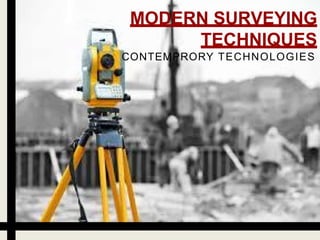
  • 2. WHAT IS SURVEYING? • Surveying is defined as the science of making measurements especially of the earth surface. This is being done by finding out the spatial location(relative/absolute) of points on or near the earth surface. • Different method and instrument are being used to facilitate the work of surveying.
  • 3. OBJECTIVE OF SURVEYING 1. To collect field data. 2. To prepare plan or map of the area surveyed. 3. To analyze and calculate the field parameters for setting out operation of actual engineering work . Surveyors work with elements of geometry, trigonometry, physics, engineering, metrology, programming languages and regression analysis.
  • 4. MODERN SURVEYING EQUIPMENT • DIGITAL LEVEL • EDMI – ELECTRO MAGNETIC • TOTAL STATION • REMOTE SENSING
  • 5. DIGITAL LEVEL Digital levels use electronic image processing to evaluate the special bar-coded staff reading. • This bar-coded pattern is converted into elevation and distance values using a digital image matching procedure within the instrument. USES: For measuring elevations, height difference, levelling of ceiling.
  • 6. SALIENT FEATURES OF DIGITAL LEVEL • Fatigue-free observation as visual staff reading by the observer is not required. • User friendly menus with easy to read, digital display of results. • Measurement of consistent precision and reliability due to automation. • Automatic data storage eliminates booking and its associated errors.
  • 7. WORKABILITY: • The purpose of electronic staff reading, a beam splitter is incorporated which transfers the bar code image to a detector diode array. • The light, reflected from the white elements only of the bar code, is divided into infrared and visible light components by the beam splitter. • The visible light passes on to the observer. • The acquired bar code image is converted into an analogous video signal, which is then compared with a stored reference codes.
  • 8.
  • 9. EDMI: ELECTRO MAGNETIC EDMI measures slope distance between transmitter and receiver by modulating the continuous carrier wave at different frequencies, and then measuring the phase difference at the master station between the outgoing and the incoming signals.
  • 10.
  • 11. OPERATION WITH EDMI It involves four basic steps: (a) Set up (b) Aim (c) Measure (d) Record Setting up: The instrument is centered over a station by means of tribrach. Reflector prisms are set over the remote station on tribrach. Aiming: The instrument is aimed at prisms by using sighting devices or theodolite telescope. Slow motion screws are used to intersect the prism centre. Some kind of electronic sound or beeping signal helps the user to indicate the status of centering.
  • 12. Measurement: The operator presses the measure button to record the slope distance which is displayed on LCD panel. Recording: The information on LCD panel can be recorded manually or automatically. ERROR IN MEASUREMENT WITH EDMI 1. Instrument error 2. Atmospheric errors 3. Instrumental error
  • 13. TOTAL STATION This instruments can record horizontal and vertical angles together with slope distance and can be considered as combined EDM plus electronic theodolite. SALIENT FEATURES OFTS • TS captures the spatial data for a three-dimensional position fix. • The angles and distances are displayed on a digital readout and can be recorded. Various components of a typical TS are shown in Figure:
  • 14. FIELD OPERATION WITH TS The programs need at least one identified reference station so that all subsequent stations can be identified in terms of (X, Y , Z). It include the following functions • Point location • Missing line measurement (MLM) • Resection • Remote distance and elevation measurement • Offset measurements • Layout or setting out operation • Area computation
  • 15. Different Types of TS and accessories • Trimble(5600IR)
  • 16. REMOTE SENSING • Science and art of obtaining information about an object, area, or phenomenon through the analysis of data acquired by a device that is not in contact with the object, area, or phenomenon under investigation
  • 17. Remote sensing system consists of the following sub-systems: (a) scene (b) sensor (c) processing (ground) segment
  • 18. How remotely sensed data gets converted into useful information: 1. Source of EM energy (sun/self emission: transmitter onboard sensor). 2. Transmission of energy from the source to the surface of the earth and its interaction with the atmosphere (absorption/scattering). 3. Interaction of EMR with the earth surface (reflection, absorption, transmission) or re-emission/self emission. 4. Transmission of reflected/emitted energy from the surface to the remote sensor through the intervening atmosphere.
  • 19. 5.Recording of EMR at the sensor and transmission of the recorded information (sensor data output) to the ground. 6.Preprocessing, processing, analysis and interpretation of sensor data. 7.Integration of interpreted data with other data sources for deriving management alternatives and applications.
  • 20. APPLICATION OF REMOTE SENSING Agriculture:- • Crop condition assessment. • Crop yield estimation Urban Planning:- • Infrastructure mapping. • Land use change detection. • Future urban expansion planning • Hydrology • Forestry And Ecosystem • Ocean applications • Disaster management
  • 21. IN CYCLONE: MITIGATION PREPAREDNESS RESCUE RECOVERY SATELLITES USED: Risk modelling; vulnerability analysis. Early warning; long-range climate modelling Identifyingescape routes; crisis mapping; impact assessment; cyclone monitoring; storm surge predictions. Damage assessment; spatial planning. KALPANA-1; INSAT-3A;QuikScat radar; Meteosat Cyclone Lehar by KALPANA 1 Cyclone Helen by Mangalayan Example:
  • 22. IN EARTHQUAKES: MITIGATION PREPAREDNESS RESCUE RECOVERY SATELLITES USED Building stockassessment; hazard mapping. Measuring strain accumulation. Planningroutes for search and rescue; damage assessment; evacuation planning; deformationmapping. Damage assessment; identifying sites for rehabilitation. PALSAR; IKONOS 2; InSAR; SPOT; IRS The World Agency of Planetary Monitoring and Earthquake Risk Reduction (WAPMERR) uses remote sensing to improve knowledge of building stocks — for example the number and height of buildings. High resolution imagery can also help hazard mapping to guide building codes and disaster preparedness strategies.
  • 23. IN FLOODS: MITIGATION PREPAREDNESS RESCUE RECOVERY SATELLITES USED Mapping flood-prone areas; delineating flood-plains; land-use mapping. Flood detection; early warning; rainfall mapping. Flood mapping; evacuation planning; damage assessment. Damage assessment; spatial planning. Tropical Rainfall Monitoring Mission; AMSR-E; KALPANA I; Sentinel Asia — a team of 51 organisations from 18 countries — delivers remote sensing data via the Internet as easy-to-interpret information for both early warning and flood damage assessment across Asia. It uses the Dartmouth Flood Observatory's (DFO's) River Watch flood detection and measurement system, based on AMSR-E data, to map flood hazards and warn disaster managers and residents in flood-prone areas when rivers are likely to burst their banks. Flood In Uttarakhand Flood In Assam
  • 24. IN OTHER DISASTERS: DISASTER MITIGATION PREPAREDNESS RECOVERY RESCUE SATELLITES USED DROUGHT Risk modelling; vulnerability analysis; land and water managementplanning. Weather forecasting; vegetation monitoring; crop water requirement mapping; early warning. Monitoring vegetation; damage assessment. Informing drought mitigation. FEWS NET; AVHRR; MODIS; SPOT VOLCANO Risk modelling; hazardmapping; digital elevation models. Emissionsmonitoring; thermalalerts. Mapping lava flows; evacuation planning. Damage assessment; spatial planning. MODIS and AVHRR; Hyperion FIRE Mappingfire-prone areas; monitoringfuel load; risk modelling. Fire detection; predicting spread/direction of fire; early warning. Coordinatingfire fightingefforts. Damage assessment. MODIS; SERVIR; Sentinel Asia; AFIS LANDSLIDE Risk modelling; hazard mapping; digital elevation models. Monitoringrainfall and slope stability. Mapping affected areas; Damage assessment; spatial planning; suggesting management practices. PALSAR; IKONOS 2; InSAR; SPOT; IRS