
Recommended
More Related Content
Viewers also liked
Viewers also liked (14)
Recently uploaded
Recently uploaded (20)
Prokos et al.
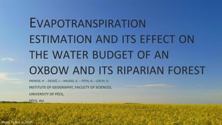
- 1. EVAPOTRANSPIRATION ESTIMATION AND ITS EFFECT ON THE WATER BUDGET OF AN OXBOW AND ITS RIPARIAN FOREST PROKOS, H. - DEZSŐ, J. – HALÁSZ, A. – TÓTH, G. – LÓCZY, D. INSTITUTE OF GEOGRAPHY, FACULTY OF SCIENCES, UNIVERSITY OF PÉCS, PÉCS, HU Photo: Prokos, H. 2015
- 2. Source: www.osdrava.hu Source: Dezső et al. 2015
- 3. MAIN PROBLEMS ➢ Determine the amount of water needed, via ➢ETP (tree species, age, canopy closure, etc) ➢Groundwater flow ➢Different governmental purposes regarding the water management (drainage – retention)
- 4. METHODS NEBIH (Hungarian Forest Management- online database) ETI – Pécs (Institute for Forest Science – Pécs) Scientific papers (related ETP) fieldwork Photos: Dezső, J. 2015
- 5. Online map – Hungarian Forestry Institute; the Cún-Szaporca studied area
- 6. GROUNDWATER – HYDROLOGIC SYSTEMS Dezső, J. 2015
- 7. CALCULATIONS - ESTIMATIONS Tree species % ha m2 ETP (average) m3 ETP/year poplar 35.00 42.00 10000 10000 710 298200 10000 willow 25.00 30.00 10000 750 225000 10000 black locust 23.00 27.60 10000 279 77004 maple 13.00 15.60 10000 sessile oak 2.00 2.40 10000 441 10584 elm 2.00 2.40 10000 100.00 120.00 610788.000 m3 ETP/120ha/170day 3592.871 m3 ETP/120ha/day 29.941 m3 ETP/ha/day 0.347 liter/sec/ha 20.792 liter/min/ha 2495.049 liter/min/120ha
- 8. Tree species composition and the spatial distribution of forestry area in the Cún-Szaporca oxbow-area
- 9. ECOLOGICAL FLOW – ENVIRONMENTAL FLOW As planned – ~10 000 ha → 300 000 m3 water 30 m3/ha/ day, else 3592 m3/current area/vegetation period Water-need supplied by groundwater Decreasing groundwater decreasing water level Sensitivity to drought (warm – moderate dry / moderate warm – moderate dry) WATER SCARCITY Photo: Prokos, H. 2015
- 10. CONCLUSIONS ❖Planned forestry works → ← Planned water level ❖Area is endangered by drought – extra water demand, even for current stands ❖Studied area is under protection of „Ramsar 2000” → must be maintained by stakeholders ❖opposite intentions regarding water management → one must take into account the extra water-quantity needed to maintain environmental flows and forestry areas when planning
- 11. THANK YOU FOR YOUR ATTENTION Photo: Dezső, J. 2015