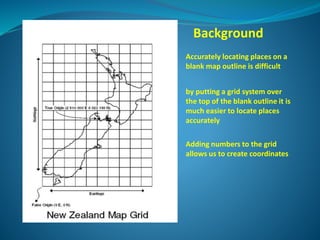
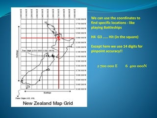
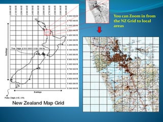
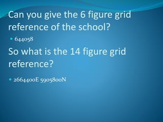
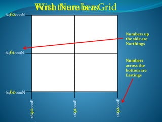
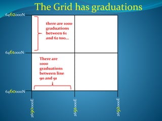
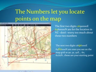
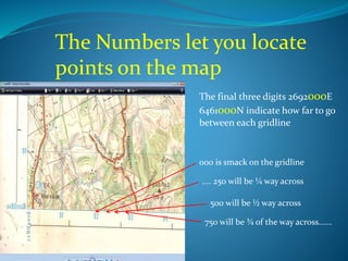
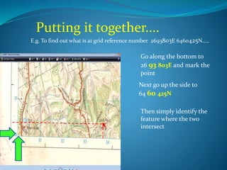
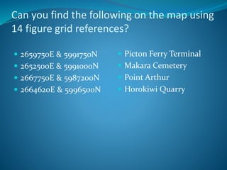
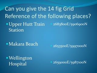
This document explains how grid references are used to accurately locate positions on maps. It describes how placing a grid system over a blank map outline makes it easier to pinpoint locations. Numbers are added to the grid to create coordinates like Eastings and Northings. These multi-digit coordinates precisely identify positions where grid lines intersect. Examples are provided to demonstrate how to use 14-digit grid references to find specific places on a map.