
Recommended
More Related Content
What's hot
What's hot (20)
Similar to Biogeographical classification of India
Similar to Biogeographical classification of India (20)
More from Jagan Kumar Ojha
More from Jagan Kumar Ojha (20)
Recently uploaded
Recently uploaded (20)
Biogeographical classification of India
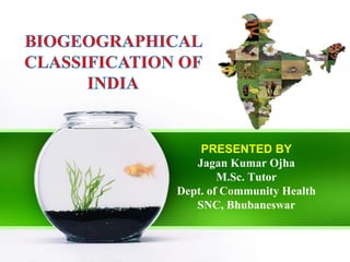
- 1. PRESENTED BY Jagan Kumar Ojha M.Sc. Tutor Dept. of Community Health SNC, Bhubaneswar
- 2. Biogeographic classification of India is the division of India according to biogeographic characteristics. (distribution of species, organisms, and ecosystems in geographic space ) India is the seventh largest country in the world and Asia's second largest nation with an area of 3,287,263 sq.km. encompassing a varied landscape rich in natural resources. India is protected by the world's highest mountains, the Himalayas, in the north.
- 3. The southern part of India takes the shape of a peninsula and divides the Indian Ocean into the Bay of Bengal to the southeast and the Arabian Sea to the southwest. The southern tip of Kanyakumari is washed by the Indian Ocean. The Andaman and Nicobar Islands in the Bay of Bengal and the Lakshadweep group of islands in the Arabian sea are also a part of India. India has a great diversity of natural ecosystems from the cold and high Himalayan ranges to the sea coasts, from the wet northeastern green forests to the dry northwestern deserts, different types of forests, wetlands, islands and the oceans.
- 4. India consists of fertile river plains and high plateaus and several major rivers, including the Ganges, Brahmaputra and Indus. The climate of India is determined by the southwest monsoon between June and October, the northeast monsoon between October and November and dry winds from the north between December and February. From March to May the climate is dry and hot.
- 5. Bio-geographers have classified India into ten Bio- geographic zones with each zone having characteristic climate, soil and biodiversity.
- 7. Within India the classification recognizes 10 Zones, divided into 26 Provinces The zones are: 1. Trans-Himalaya with 2 provinces 2. The Himalaya with 4 provinces 3. The Indian Desert with 2 provinces 4. The Semi-Arid Zone with 2 provinces 5. The Western Ghats with 2 provinces 6. The Deccan Peninsula with 5 provinces 7. The Gangetic Plain with 2 provinces 8. The Coasts with 3 provinces 9. North East India with 2 provinces 10. The Islands with 2 provinces
- 8. SR. NO. BIOGEOGRAPHIC ZONE BIOTIC PROVINCE 1. Trans-Himalayan Upper Regions 2. Himalayan North-West Himalayas ,West Himalayas Central Himalayas ,East Himalayas 3. Desert Kutch ,Thar ,Ladakh 4. 5. Semi-Arid Western Ghats 6. Deccan Peninsula 7. Gangetic Plain 8. 9. North-East India Islands 10. Coasts Central India ,Gujarat-Rajwara Malabar Coast , Western Ghat Mountains Deccan Plateau ,South Central Plateau Eastern Plateau, Chhota Nagpur Central Highlands Upper Gangetic Plain, Lower Gangetic Plain Brahmaputra Valley, North-Eastern Hills Andaman Islands Nicobar Islands Lakshadweep Islands West Coast East Coast
- 9. 1. TRANS-HIMALAYAN REGION The Himalayan ranges immediately north of the Great Himalayan range are called the Trans- Himalayas. .
- 10. The Trans-Himalayan region with its light vegetation has the richest wild sheep and goat community in the world. The snow leopard is found here along with black- necked cranes.
- 11. Chiru Black necked crane Himalayan pit viper Trans - Himalaya Zone
- 12. 2. HIMALAYAS The Himalayas consist of the youngest and tallest mountain chains in the world.
- 13. The forests are very dense with extensive growth of grass and evergreen tall trees. Oak, conifer, ash, pine, are abundant in Himalayas. There is no vegetation above the snowline. Several animals live in the Himalayan ranges. Chief species include monal, wild sheep, mountain goats, shrew, and tapir. Panda and snow leopard are also found here.
- 14. Himalaya zone Ibex Red Panda Monal
- 15. 3. SEMI-ARID AREAS Adjoining the desert are the semi-arid areas, a transitional zone between the desert and the denser forests of the Western Ghats.
- 16. The natural vegetation is thorn forest. This region is characterized by discontinuous vegetation cover with open areas of bare soil and soil-water deficit throughout the year. A few species of xerophytic herbs and some ephemeral herbs are found in this semi-arid tract. Asiatic lions, Birds, leopards, eagles, snakes, fox, buffaloes are found in this region.
- 17. 4. WESTERN GHATS The mountains along the west coast of peninsular India are the Western Ghats, which constitute one of the unique biological regions of the world. The Western Ghats extend from the southern tip of the peninsula (8°N) northwards about 1600 km to the mouth of the river Tapti (21°N).
- 18. Western- Ghats Lion Tailed Macaque Malabar-civet Horn bill
- 20. Western- Ghats Lion Tailed Macaque Malabar-civet Horn bill
- 21. 5. NORTH-WEST DESERT REGIONS This region consists of parts of Rajasthan,Delhi Kutch and other parts of Gujarat. The climate is characterized by very hot and dry in summer and cold in winter. Rainfall is less than 70 cms.
- 22. The plants are mostly xerophytes. Babul, Kikar, wild palm grows in areas of moderate rainfall. Indian Bustard, a highly endangered bird is found here. Camels, wild asses, foxes, and snakes are found in hot and arid deserts.
- 23. 6. DECCAN PLATEAU Beyond the Ghats is Deccan Plateau, a semi-arid region lying in the rain shadow of the Western Ghats. This is the largest unit of the Peninsular Plateau of India.
- 24. plateau are covered with The highlands different types of the of forests, which provide a large variety of forest products. Fauna like tiger, bear, wild boar, gaur, sambar and chital are found throughout the zone along with small relict populations of wild buffaloes, elephants and barasingha.
- 25. 7. GANGETIC PLAIN In the North is the Gangetic plain extending up to the Himalayan foothills. This is the largest unit of the Great Plain of India. The Great Plains cover about 72.4mha area with the Ganga and the Brahmaputra forming the main drainage axes in the major portion.
- 26. The physiographic scenery varies greatly from arid and semi-arid landscapes of the Rajasthan Plains to the humid and per-humid landscapes of the Delta and Assam valley in the east. The plain supports some of the highest population densities depending upon purely agro-based economy in some of these areas. The trees belonging to these forests are teak, sal, shisham, mahua, khair etc.
- 27. 8. NORTH-EAST INDIA North-east India is one of the richest flora regions in the country. It has several species of orchids, bamboos, ferns and other plants. Here the wild relatives of cultivated plants such as banana, mango, citrus and pepper can be found.
- 29. 9. ISLANDS The two groups of islands, i.e., the Arabian Sea islands and Bay Islands differ significantly in origin and physical characteristics. The Arabian Sea Islands (Laccadive, Minicoy, etc.) are the foundered remnants of the old land mass and subsequent coral formations. On the other hand, the Bay Islands lay only about 220 kms.
- 30. Away from the nearest point on the main land mass and extend about 590 kms. With a maximum width of 58 kms the island forests of Lakshadweep in the Bay of Bengal have some of the best-preserved evergreen forests of India. Some of the islands are fringed with coral reefs. Many of them are covered with thick forests and some are highly dissected.
- 31. 10. COASTAL REGION o India has a coastline extending over 5,500 kms. The west coast is narrow except around the Gulf of Canbary and the Gulf of Kutch. o In the extreme south, however, it is somewhat wider along the south Sahyadri. The backwaters are the characteristic features of this coast.
- 32. o Extensive deltas of the Mahanadi, Godavari, Krishna and Kaveri are the characteristic features of east coast. Mangrove vegetation is characteristic of estuarine tracts along the coast for instance, at Ratnagiri in Maharashtra. o Larger parts of the coastal plains are covered by fertile soils on which different crops are grown. Rice is the main crop of these areas. Coconut trees grow all along the coast.
- 33. THANK YOU