GEOGRAPHY IGCSE: RIVER LANDFORMS
•Download as PPTX, PDF•
6 likes•2,367 views

GEOGRAPHY IGCSE: RIVER LANDFORMS. It contains: upper course, middle course, lower course.

Recommended
Recommended
More Related Content
What's hot
What's hot (20)
Similar to GEOGRAPHY IGCSE: RIVER LANDFORMS
Similar to GEOGRAPHY IGCSE: RIVER LANDFORMS (20)
More from George Dumitrache
More from George Dumitrache (20)
Recently uploaded
Recently uploaded (20)
GEOGRAPHY IGCSE: RIVER LANDFORMS
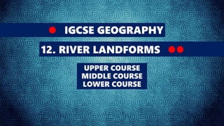
- 1. IGCSE GEOGRAPHY 12. RIVER LANDFORMS UPPER COURSE MIDDLE COURSE LOWER COURSE
- 2. Upper course river features include steep-sided V-shaped valleys, interlocking spurs, rapids, waterfalls and gorges. Middle course river features include wider, shallower valleys, meanders, and oxbow lakes. Lower course river features include wide flat-bottomed valleys, floodplains and deltas.
- 3. As the river moves through the upper course, it cuts downwards. The gradient here is steep and the river channel is narrow. Vertical erosion in this highland part of the river helps to create steep-sided V-shaped valleys, interlocking spurs, rapids, waterfalls and gorges. As the river erodes the landscape in the upper course, it winds and bends to avoid areas of hard rock. This creates interlocking spurs, which look a bit like the interlocking parts of a zip. When a river runs over alternating layers of hard and soft rock, rapids and waterfalls may form.
- 4. Interlocking Spurs Yangtze River
- 5. Interlocking Spurs Yangtze River
- 6. In the middle course the river has more energy and a high volume of water. The gradient here is gentle and lateral (sideways) erosion has widened the river channel. The river channel has also deepened. A larger river channel means there is less friction, so the water flows faster: • As the river erodes laterally, to the right side then the left side, it forms large bends, and then horseshoe-like loops called meanders. • The formation of meanders is due to both deposition and erosion and meanders gradually migrate downstream.
- 7. The force of the water erodes and undercuts the river bank on the outside of the bend where water flow has most energy due to decreased friction. On the inside of the bend, where the river flow is slower, material is deposited, as there is more friction. Over time the horseshoe become tighter, until the ends become very close together. As the river breaks through, eg during a flood when the river has a higher discharge and more energy, and the ends join, the loop is cut-off from the main channel. The cut-off loop is called an oxbow lake.
- 9. Upstream a large bend becomes a horseshoe and is eventually cut-off to become an oxbow lake. Downstream the river is eroding its outer bank and depositing on its inner bank to create a new meander.
- 10. In the lower course, the river has a high volume and a large discharge. The river channel is now deep and wide and the landscape around it is flat. However, as a river reaches the end of its journey, energy levels are low and deposition takes place.
- 11. The river now has a wide floodplain. A floodplain is the area around a river that is covered in times of flood. A floodplain is a very fertile area due to the rich alluvium deposited by floodwaters. This makes floodplains a good place for agriculture. A build up of alluvium on the banks of a river can create levees, which raise the river bank.
- 12. Deltas are found at the mouth of large rivers - for example, the Mississippi. A delta is formed when the river deposits its material faster than the sea can remove it. There are three main types of delta, named after the shape they create. Arcuate or fan-shaped - the land around the river mouth arches out into the sea and the river splits many times on the way to the sea, creating a fan effect.
- 14. Cuspate - the land around the mouth of the river juts out arrow-like into the sea.
- 16. Bird's foot - the river splits on the way to the sea, each part of the river juts out into the sea, rather like a bird's foot.