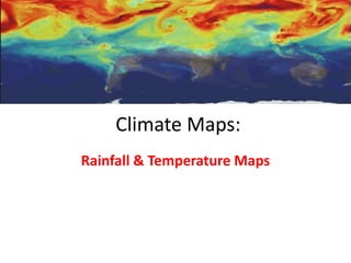
Climate Maps Guide Rainfall & Temperature
•Download as PPTX, PDF•
2 likes•2,825 views

Climate maps show weather conditions like temperature and precipitation for a given area. Temperature maps depict average temperatures, which can be shown annually or for a specific season or month. Precipitation maps show the average amount and type of precipitation in an area, either annually or for a particular season or month. Climate maps use legends to indicate different ranges of the weather variable being displayed.

Recommended
More Related Content
What's hot
What's hot (20)
Similar to Climate Maps Guide Rainfall & Temperature
Similar to Climate Maps Guide Rainfall & Temperature (20)
Recently uploaded
Recently uploaded (20)
Climate Maps Guide Rainfall & Temperature
- 1. Climate Maps: Rainfall & Temperature Maps
- 2. What Is a Climate Map? • A climate map shows the climate for an area. Climate maps usually show one type of weather condition. This helps you understand how that type of weather has an effect on an area. • For example, a climate map might show the amount of precipitation that an area gets. Precipitation is any moisture that falls from the clouds. Rain, snow, and sleet are all types of precipitation. Source: Climate Maps. (n.d.). Retrieved August 14, 2018, from http://www.pkearthandspace.com/article/552/climate-maps
- 3. What Is a Climate Map? • Other climate maps might show the temperature of an area. Temperature maps and precipitation maps are two of the most common kinds of climate maps. Climate maps can show other weather features, such as wind speed, sunshine, or humidity. • You can find out what kinds of weather are represented on a climate map by looking at the legend. Source: Climate Maps. (n.d.). Retrieved August 14, 2018, from http://www.pkearthandspace.com/article/552/climate-maps
- 4. Temperature Maps • Temperature climate maps tell us how warm or cool an area usually is. This type of temperature map can look at the average temperature for a year. • Temperature maps can also show a certain time of year, such as a season or a month. The map to the right shows the average July temperature in New Jersey. Its legend shows the different temperature ranges in New Jersey. Source: Climate Maps. (n.d.). Retrieved August 14, 2018, from http://www.pkearthandspace.com/article/552/climate- maps
- 5. Average Global Temperature Retrieved from: http://www.ecoclimax.com/2016/08/climate-maps.html
- 6. Precipitation Maps • A precipitation map shows how much and what kind of precipitation is common in an area. Precipitation maps can show the average amount of one type of precipitation. • They can also show the average amount of precipitation for a season or a month or the average number of days of precipitation per year. Source: Climate Maps. (n.d.). Retrieved August 14, 2018, from http://www.pkearthandspace.com/article/552/climate-maps
- 7. Average Global Precipitation Retrieved from: http://www.ecoclimax.com/2016/08/climate-maps.html
- 8. Precipitation Map Questions 1. Which section of the island gets the most rainfall? 2. Which parishes on average get below 1000mm of rainfall annually? 3. What is the typical location of those areas receiving less than 1000mm of rainfall each year?