TAC Presentation - Placemaking: Nov. 17, 2020
•
0 likes•601 views

TAC Presentation - Placemaking: Nov. 17, 2020

Recommended
Recommended
More Related Content
What's hot
What's hot (13)
Similar to TAC Presentation - Placemaking: Nov. 17, 2020
Similar to TAC Presentation - Placemaking: Nov. 17, 2020 (20)
More from Fairfax County
More from Fairfax County (20)
Recently uploaded
Recently uploaded (20)
TAC Presentation - Placemaking: Nov. 17, 2020
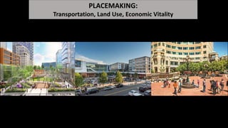
- 1. PLACEMAKING: Transportation, Land Use, Economic Vitality
- 2. 1800s 1900s 1700s Tysons Corner 1900s How Did Fairfax Develop Over Time? 1800s 2000s 2000s 2000s
- 3. 1745: First Map of Fairfax County RURAL: Country Roads, Farms, Forests & Crossroads Villages
- 4. 1745: First Map of Fairfax County
- 5. 1700s: The King’s Highway The Potomac Path (1600s), The King’s Highway (1700s), Accotink Turnpike (1800s), Route 1/Richmond Hwy (1900s)
- 6. 1749: First Map of Alexandria A planned City with a street grid of 3-acre blocks
- 7. 1850s: First Map illustrating Canals and Railroads: The Alexandria, Loudoun & Hampshire RR & the Orange & Alexandria RR
- 8. 1860s: Country Roads, Turnpikes, Railroads, & Crossroads Villages in FxCo Planned City Grids & Ports of D.C. & Alexandria
- 9. RURAL FAIRFAX: LAND USES: Farms and Forests Small Towns & Villages to support farmers and travelers: Colchester, Town of Providence, Centerville TRANSPORTATION: Country roads, Turnpikes, Crossroads, Railroads Crossroads Towns: Bailey’s, Annandale, Centerville, Fairfax C.H. Railroad Towns: Clifton, Fairfax Stn, Vienna Ferry Towns: Colchester and then Occoquan All travel by foot, horse, train, ferry Villages/Towns were typically 5-miles apart – accessible by foot/horse (for local farmers) & by RR/Ferry (for thru-travelers)
- 10. 1800s: Sparsely Developed Countryside with Farmhouses & Barns
- 11. 1700s/1800s: Estates 1734: Mt. Vernon 1754: Gunston Hall
- 12. 1805: Town of Providence (Crossroads of Little River Tpk & Ox Road)
- 13. 1850s: RR Town of Vienna
- 14. Town of Herndon 1850s: RR Town of Herndon
- 15. 1860s: Country Roads, Turnpikes, Railroads Expand
- 16. 1860s: Country Roads, Turnpikes, Railroads Expand
- 17. 1860s: Country Roads, Turnpikes, Railroads Expand
- 18. 1882: Post War -- More Country Roads & 3 Railroad Lines No County Plan
- 19. 1882: Dozens of Towns/Villages Formed by Transportation Systems New RR Line: Alexandria & Frederick RR New Ferry: Occoquan New Crossroads: Lorton, Mills X-Roads (Merrifield), Dranesville
- 20. 1900: Present Day Rt. 1 – Village of Clustered Buildings
- 21. URBAN AREAS: Mixed uses: Residential, Retail, Office, Parks & Plazas Density and Height TRANSPORTATION: Planned with a Grid of Streets – Highly connected Walkable Transit reliant: RRs, Streetcars, subways (Metro)
- 22. 1800s: Alexandria A Well-Planned City with a Walkable Grid of Streets
- 23. 1800s: Alexandria A Well-Planned City with a Walkable Grid of Streets
- 24. 1800: Washington, D.C. A Well-Planned City with a Walkable Grid of Streets
- 25. 1900: Washington, D.C. Active Multi-Modal Streets: Pedestrians, Horses, Bicycles, Streetcars & Automobiles in Street Grid
- 29. MOVIE TIME!
- 32. In 1924, recognizing the crisis on America’s streets, President Herbert Hoover launched the National Conference on Street and Highway Safety.
- 34. 1910s: Broad Street & 4th Street in Richmond, VA
- 35. 2010s: Broad Street & 4th Street in Richmond, VA
- 36. 1940: Washington, D.C. Active Multi-Modal Streets: Pedestrians, Streetcars & Studebakers in Street Grid
- 37. 1950: Washington D.C. population peaks 1980s: Fairfax County surpasses D.C.’s population
- 38. 1950s – 70s: Washington, D.C. Decline Automobile Proliferation
- 39. 1976: Washington, D.C. Metro Opens and Revitalization Begins
- 40. Washington, D.C. Today Walkable, Restored, and Vibrant
- 41. SUBURBAN DEVELOPMENT: Single-Use: “Euclidean” Zoning Residential Subdivisions, Shopping Centers & Malls, Office Parks Low Density, Low Heights, Parking Lots TRANSPORTATION: Auto-Focused Arterial roads, Collector roads, cul-de-sacs Transit: Buses, Some streetcar-accessible, Some Metro-accessible
- 42. 1961: Fairfax Plan 1749: Alexandria Plan
- 43. 1961: Tysons Master Plan 1964: Beltway Vision
- 44. 1950: Pimmit Hills Subdivision First subdivision in Fairfax County
- 45. 1953: Pimmit Hills Subdivision Affordable Housing: Government-subsidized Mortgages (F.H.A. & V.A. Loans) But NOT for most Minority Populations
- 46. 1968: Tysons Corner Mall opens Beltway 123 7
- 47. 1960s + 1970s: Road widenings & overpass @ 123 & 7 Single-use Development: Mall, office buildings
- 48. 1953: Site of the future Seven Corners Shopping Center Note: Roundabout (top of photo) @ the intersection of Rt. 50 and Rt. 7
- 49. 1956: Seven Corners Shopping Center “first major shopping center in suburban Washington, D.C.”
- 50. 1950s-60s: Rt. 50 and Rt. 7 are Widened for Cars Roundabout is Replaced with Overpasses Seven Corners becomes challenging for pedestrians
- 51. NEW URBANISM + REVITALIZATION: A new approach to address a new term: “sprawl” A return to mixed-use development Higher density & building heights - to concentrate development TRANSPORTATION: A return to the street grid – a connected network Priority on walking & biking Transit: Often near Metro Some are planned for BRT (future streetcar) All have Fairfax Connector service
- 52. 1961 – 1963: Reston Master Plan for a New Town A Planned Community on 7,000+ acres of farmland: • Variety of Densities • Variety of Land Uses • Village Centers (5) • Town Center District/Core • Open Space, Parks, Trails • Walkable & Bikeable
- 53. 1980s – 1990s: The “Town Center Urban Core” becomes Reston Town Center 2014: The “Business and R&D” becomes 3 Transit Station Areas (TSAs)
- 54. 1980s: Reston Town Center Master Plan
- 55. 1980s: Reston Town Center
- 56. 2000s: Reston TSAs Halley Rise @ Reston Town Center Metro Reston Station @ Wiehle Metro Station
- 57. 57 $8.7B $11B +26.4% $B $2B $4B $6B $8B $10B $12B 2017 2019 AssessedValue(Billions) Year Real Estate Assessments in Tysons in 2015 and 2019 2017: $8.7 billion in RE assessments 2019: $11 billion in RE assessments Reston TSA Real Estate Growth in the Last 3 years
- 58. 1962: Reston Town Center 2010s: Mosaic District
- 59. Mosaic Real Estate Growth Since 2007 59 $38.3M $678M +1670.2% $M $100M $200M $300M $400M $500M $600M $700M $800M 2007 2020 AssessedValue(Millions) Year Real Estate Assessments in Mosaic in 2007 and 2019 2007: $38.3 million in RE assessments 2020: $673 million in RE assessments
- 60. Connected Autonomous Vehicles (CAV) Pilot in Mosaic - 2020
- 61. 2010: The Tysons Plan is Adopted
- 62. 2010: The Tysons Plan is Adopted
- 63. Tyson’s Corner (Originally named Peach Grove) is based on Country Crossroads
- 64. From 2-Lane Country Road to 10-Lane Auto Strip Rt. 123: 30,000 ADT 11’-12’ Lanes, No On-Street Parking, High Speed, No Street Trees, No Ground Floor Retail, No Peds/Cyclists
- 65. The Tysons Plan envisions Multi-Modal Streets
- 66. 2010s: The Boro in Tysons – Placemaking through Quality Public Spaces and Walkable Streets
- 67. Tysons Real Estate Growth in Last 6 Years 2014: $12.4 billion in RE assessments 2020: $18 billion in RE assessments 67 $12.4B $18B +45.2% $B $2B $4B $6B $8B $10B $12B $14B $16B $18B $20B 2014 2020 AssessedValue(Billions) Year Real Estate Assessments in Tysons in 2014 and 2020
- 70. 1910: Rt. 1 at Popkins Ln
- 71. Civic Plaza Vision: Humanize Richmond Highway
- 72. Image courtesy of Peter Swift Rt. 1 @ Frye Rd: 5 lanes, 40,000 ADT and 45 mph After widening: 10 lanes (6 thru-lanes, 2 turn lanes, 2 BRT lanes)
- 73. Rt. 1 in Alexandria: BRT “Metro Way” @ Custis Way
- 74. Rt. 1 in Alexandria: Strong relationship btwn buildings and street
- 75. Rt. 1 in FxCo: Existing Street Section and Widened Street Section Rt. 1 is categorized as a National Highway System route
- 76. LOWER THE SPEED: 1. Currently design for 45 mph 2. FCDOT and VDOT are exploring a speed of 35 mph (safer, quieter, ped friendly)
- 77. Gum Springs Woodlawn Gardens Woodlawn Area - Northern These residential developments on Rt. 1 may end up with sound walls, due to 45 mph Sound walls not required with 35 mph
- 78. Image courtesy of Peter Swift Woodlawn Area - Southern Mt. Zephyr Area If sound walls are built, this will result in a poor relationship btwn the land uses and the street, creating a “highway” not a “main street”
- 79. Rt. 1 in Arlington is being redesigned as a walkable boulevard
- 80. Crystal City: The type of place that attracted Amazon
- 81. Rt. 1 “North Gateway” (50,000 ADT) Can we transform it to attract economic development?
- 82. Rt. 1 - Alexandria Gateway (75,000 ADT)
- 83. THE CHALLENGE: Fairfax County: Built on a SUBURBAN model The SUBURBAN model is automobile dominant We “solve” for traffic by widening and INDUCING more traffic THE SOLUTION: Design our streets for ALL users: focus on pedestrians Cut single-occupant-vehicle (SOV) rate
- 84. Single-occupant-vehicle (SOV) rate is too high
- 85. 1964: The Beltway (through McLean) – 4 lanes when built
- 86. 2000: The Beltway Gets Wider
- 87. And Wider
- 88. 1946 - 2020: Springfield Auto-Dominated Roads and No Mixed-Use Developments
- 90. Connecticut Ave: Urban Street of Six-Lanes Major Arterial: 29,250 ADT (similar to Rt. 7) 10’ Lanes, On-Street Parking, Slow Speed, Street Trees, Ground Floor Retail, Peds/Cyclists
- 91. From 2-Lane Country Road to 4-Lane Main Street Historic Leesburg & Alexandria Turnpike in Falls Church: 21,000 ADT W. Broad Street/Route 7 10.5’-11’ Lanes, Slow Speed, Street Trees, Ground Floor Retail, Peds/Cyclists
- 92. Lee Highway/Route 29 12’ Lanes, High Speed, No On-Street Parking, No Street Trees, No Ground Floor Retail, No Peds/Cyclists From 2-Lane Country Road to 8-Lane Arterial Poor relationship between buildings and road -- results in minimal economic value
- 93. Monument Drive Sidewalks, street trees, 6 lanes Strong relationship between buildings & road -- results in greater walkability, placemaking, etc.
- 94. From 2-Lane Country Road to 5-6 Lane Through Road Wall between buildings and street – results in poor sense of “place” Leesburg Pike/Route 7 in W Falls Church 12’ Lanes, High Speed, No On-Street Parking, No Street Trees, No Ground Floor Retail, No Peds/Cyclists
- 95. Imagine Rt. 7 like this . . .
- 96. The street has a strong relationship with the buildings & results in community/placemaking
- 97. This Bridge Gives Highest Priority to High-Speed Vehicles
- 98. This Bridge Gives High Priority to Pedestrians and Cyclists
- 99. Streets & Bridges as Great Civic Spaces
- 100. Suburban Roads are designed using the LOS Methodology
- 101. LOS is the Key Determinant of Street Design in Fairfax It Only Measures Vehicle Throughput Level of Service (LOS) Measures Vehicle Delays at Traffic Lights
- 102. Waste Use The Cost of LOS: Infrastructure for Peak Hours 2:00 AM Noon Midnight5:00 PM8:00 AM TrafficVolume LOS F! Capacity
- 103. What’s important depends upon perspective Traffic engineer: 103 F A A FEconomist:
- 104. LOS Mitigations – Widen the Road
- 105. The LOS Methodology is INDUCING More Traffic
- 108. U.S. Averages Source: Smart Growth America “The Congestion Con” 2020
- 109. Source: Smart Growth America “The Congestion Con” 2020
- 110. Source: Smart Growth America Source: U.S. Census Bureau
- 111. ONE SOLUTION: Replace Level of Service (LOS) Arlington, Alexandria, D.C., MoCo Use other TIA Tools: They Give Peds/Cyclists/Transit Higher Priority FCDOT and VDOT have convened a task force to explore TIA options
- 112. There are also Health & Safety Reasons to Reduce Auto Dependency
- 113. Greenhouse Gas (GHG) Emissions From Automobiles are Unhealthy
- 114. Automobiles Can Be Dangerous
- 115. 18,000 children are hospitalized each year for ped injuries
- 116. Slow the Speed!
- 117. Image courtesy of Peter Swift Wide Streets Increase Speed
- 118. V i s i o n C o n e / N AC TO
- 120. PEDESTRIAN FATALITIES ON RT. 1 – 12-month period 5900 block of Richmond Hwy on 02-08-19 (near Old Richmond Hwy) 6100 block of Richmond Hwy on 03-26-19 (morning) (at Fairhaven Avenue) 6300 block of Richmond Hwy – 01-09-20 (evening) (near S. Kings Hwy) 9100 block of Richmond Hwy on 01-16-20 (evening) (near Pohick Road & Backlick Road) 10000 block of Richmond Hwy on 02-11-20 (night) (near Giles Run Road)
- 122. This is where Ms. Alston was Killed
- 123. This is where Ms. Asante was Killed
- 124. This is where Mr. Yeboah was Killed
- 125. COMMON THEMES: 1. Wide Roads: # of lanes, width of lanes 2. High Speeds: Not safe for pedestrians or cyclists 3. Large Block Sizes: Encourages jaywalking 4. Narrow Sidewalks/No Trees: Discourages walking 5. Narrow Bike Lanes: Discourages cycling 6. AUTOMOBILES ARE THE HIGHEST PRIORITY
- 128. The public space needed for automobiles is extensive
- 129. Building Infrastructure for Cars is Very Expensive
- 133. Design “Complete Streets” that are Beautiful and Humane Pedestrians, Cyclists, Cars, Public Transit are ALL Valued
- 134. Metro Expansion into Fairfax
- 135. Fairfax Connector Bus Service
- 137. Capital Bike Share
- 139. Before After Capital Facilities/Utilities Design and Construction Division/Transportation Construction Branch KIRBY RD. SIDEWALK – BIRCH RD. TO IVY HILL DR. KIRBY RD. SIDEWALK – IVY HILL DR. TO CORLISS CT.
- 140. Before After Capital Facilities/Utilities Design and Construction Division/Transportation Construction Branch Innovation Ave Walkway (Innovation Metro Station to Dulles Greene Blvd)
- 141. Before After Capital Facilities/Utilities Design and Construction Division/Transportation Construction Branch Tysons East Sidewalk South Side of Route 123
- 142. Retrofit for Bike Lanes
- 143. New Vesper Trail
- 144. A Thoroughfare with a new sidewalk
- 146. 1. Replace LOS with other TIAs that include all travel modes. Give equal priority to Peds/Cyclists/Transit Riders/Cars 2. Humanize our Streets & Make them “Complete Streets”: a. Slow vehicle speeds to 25-35 mph b. Narrow the lanes to 10.5’ wide c. Limit the number to 6 lanes d. Add on-street parking (this will slow the speed and benefit retailers) e. Shorten the blocks 300’-400’ apart e. Incorporate well-designed sidewalks/bike lanes f. Provide shade trees (they will induce ped/bike travel) FAIRFAX NEEDS A “COMPLETE STREETS” POLICY
- 147. “Tactical Urbanism” – Akron, Ohio - Temporary street improvements to experiment with placemaking
- 148. How about applying Tactical Urbanism here? It is an important GATEWAY to Mt. Vernon and Lee Districts
- 149. Flowers, Trees, Bikes, Lawn Chairs!
- 150. How about closing a slip lane for PEOPLE?
- 151. Engage the Community to Create Community
- 152. Safe Streets, Placemaking and Economic Vitality through Quality Street Design