Building Identification in Satellite Images Using ANFIS Classifier
•
0 likes•133 views

This paper presents to building identification from satellite images. Because of monitoring illegal land usage. Nowadays rapid urbanization leads to increase the land usage, in this case of monitoring illegal land usage is very important. This project implemented to building identification from satellite images, images are provided from Bing maps. Adaptive Neuro Fuzzy Inference System used to check data base information. In this proposed system, I can identify only building images from the satellite images, To improving the image details effectively.
![Asian Journal of Applied Science and Technology (AJAST)
Volume 1, Issue 2, Pages 283-285, March 2017
© 2017 AJAST All rights reserved. www.ajast.net
2.1 Input Image
Input image is obtained from satellite image. Satellite images
are high-resolution image.to using Bing maps for obtaining
building mapping. Bing maps satellite images are given better
photo appearances. Bing maps include certain points of
interest built in, such as metro stations, hospitals, and other
facilities. It is also possible to browse public user-created
points of interest. Searches can cover public collections,
businesses or types of business, locations, or people. Five
street map views are available: road view, aerial view, bird’s
eye view, street side view, and 3D view.
2.2 Filtering
Filtering processing are enhance the appearance of an images.
Filtering used to sharpening or smooth the image. Filtering is
a technique for modifying or enhancing an image. For
example, you can filter an image to emphasize certain features
or remove other features. Image processing operations
implemented with filtering include smoothing, sharpening,
and edge enhancement. The median filter is a nonlinear digital
filtering technique, often used to remove noise. Such noise
reduction is a typical pre-processing step to improve the
results pf later processing. The median filter is an effective
method that can, to some extent, distinguish out-of-range
isolated noise from legitimate image features such as edges
and lines. Specifically, the median filter replaces a pixel by
the median, instead of the average, of all pixels in a
neighbourhood w,
y [m, n] = median {x[i,j], (i,j) ϵ w}
2.3 RGB Band Separation
Red-Green-Blue (RGB) is used to obtain true-colour image.it
is useful for observing land cover, vegetation and
meteorological analysis. Image segmentation is used to locate
objects and boundaries, object detection. The relationship
between the represented RGB values (RGB) and the
corresponding Lab color space is expressed by the following:
RGB = Round (b * 255/ Nr + Ng + Nb)
Where the variables Nr , Ng , Nb denotes the number of red,
green and blue pixels required to Lab color space image of the
currently processed pixel.
2.4 HOG Feature Extraction
HOG (Histogram of Oriented Gradients) used for image
processing in the purpose of object detection, edge orientation
histograms. It is a feature descriptor used in computer vision
and image processing for the purpose of object detection the
technique counts occurrences of gradient orientation in
localized portions of an image. This method is similar to that
of edge orientation histograms, scale-invariant feature
transform descriptors, and shape contexts, but differs in that it
is computed on a dense grid of uniformly spaced cells and
uses overlapping local contrast normalization for improved
accuracy.
2.5 ANFIS Classifier
Adaptive Neuro-Fuzzy Inference System (ANFIS).Checking
data set to test for overfitting of the training data. An adaptive
neuro-fuzzy inference system or adaptive network-based
fuzzy inference system is a kind of artificial neural network
that is based on Takagi-Sugeno fuzzy inference system. The
technique was developed in the early 1990s. Since it
integrates both neural networks and fuzzy logic principles, it
has potential to capture the benefits of both in a single
framework. Its inference system corresponds to a set of fuzzy
IF-THEN rules that have learning capability to approximate
nonlinear functions. Hence, ANFIS is considered to be a
universal estimator. For using the ANFIS in a more efficient
and optimal way, one can use the best parameters obtained by
genetic algorithm.
Fig.2. ANFIS structure
Fig (b) Training data
Fig (c) Results of building detection](data:image/gif;base64,R0lGODlhAQABAIAAAAAAAP///yH5BAEAAAAALAAAAAABAAEAAAIBRAA7)
Recommended
Recommended
More Related Content
What's hot
What's hot (19)
Viewers also liked
Viewers also liked (20)
Similar to Building Identification in Satellite Images Using ANFIS Classifier
Similar to Building Identification in Satellite Images Using ANFIS Classifier (20)
More from Associate Professor in VSB Coimbatore
More from Associate Professor in VSB Coimbatore (20)
Recently uploaded
Recently uploaded (20)
Building Identification in Satellite Images Using ANFIS Classifier
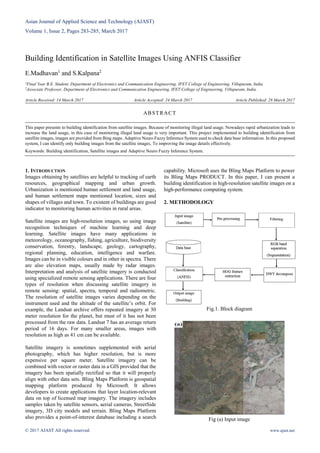
- 1. Asian Journal of Applied Science and Technology (AJAST) Volume 1, Issue 2, Pages 283-285, March 2017 © 2017 AJAST All rights reserved. www.ajast.net Building Identification in Satellite Images Using ANFIS Classifier E.Madhavan1 and S.Kalpana2 1Final Year B.E. Student, Department of Electronics and Communication Engineering, IFET College of Engineering, Villupuram, India. 2Associate Professor, Department of Electronics and Communication Engineering, IFET College of Engineering, Villupuram, India. Article Received: 14 March 2017 Article Accepted: 24 March 2017 Article Published: 28 March 2017 1. INTRODUCTION Images obtaining by satellites are helpful to tracking of earth resources, geographical mapping and urban growth. Urbanization is mentioned human settlement and land usage, and human settlement maps mentioned location, sizes and shapes of villages and town. To existent of buildings are good indicator to monitoring human activities in rural areas. Satellite images are high-resolution images, so using image recognition techniques of machine learning and deep learning. Satellite images have many applications in meteorology, oceanography, fishing, agriculture, biodiversity conservation, forestry, landscape, geology, cartography, regional planning, education, intelligence and warfare. Images can be in visible colours and in other in spectra. There are also elevation maps, usually made by radar images. Interpretation and analysis of satellite imagery is conducted using specialized remote sensing applications. There are four types of resolution when discussing satellite imagery in remote sensing: spatial, spectra, temporal and radiometric. The resolution of satellite images varies depending on the instrument used and the altitude of the satellite’s orbit. For example, the Landsat archive offers repeated imagery at 30 meter resolution for the planet, but must of it has not been processed from the raw data. Landsat 7 has an average return period of 16 days. For many smaller areas, images with resolution as high as 41 cm can be available. Satellite imagery is sometimes supplemented with aerial photography, which has higher resolution, but is more expensive per square meter. Satellite imagery can be combined with vector or raster data in a GIS provided that the imagery has been spatially rectified so that it will properly align with other data sets. Bling Maps Platform is geospatial mapping platform produced by Microsoft. It allows developers to create applications that layer location-relevant data on top of licensed map imagery. The imagery includes samples taken by satellite sensors, aerial cameras, StreetSide imagery, 3D city models and terrain. Bling Maps Platform also provides a point-of-interest database including a search capability. Microsoft uses the Bling Maps Platform to power its Bling Maps PRODUCT. In this paper, I can present a building identification in high-resolution satellite images on a high-performance computing system. 2. METHODOLOGY Fig.1. Block diagram Fig (a) Input image ABSTRACT This paper presents to building identification from satellite images. Because of monitoring illegal land usage. Nowadays rapid urbanization leads to increase the land usage, in this case of monitoring illegal land usage is very important. This project implemented to building identification from satellite images, images are provided from Bing maps. Adaptive Neuro Fuzzy Inference System used to check data base information. In this proposed system, I can identify only building images from the satellite images, To improving the image details effectively. Keywords: Building identification, Satellite images and Adaptive Neuro Fuzzy Inference System.
- 2. Asian Journal of Applied Science and Technology (AJAST) Volume 1, Issue 2, Pages 283-285, March 2017 © 2017 AJAST All rights reserved. www.ajast.net 2.1 Input Image Input image is obtained from satellite image. Satellite images are high-resolution image.to using Bing maps for obtaining building mapping. Bing maps satellite images are given better photo appearances. Bing maps include certain points of interest built in, such as metro stations, hospitals, and other facilities. It is also possible to browse public user-created points of interest. Searches can cover public collections, businesses or types of business, locations, or people. Five street map views are available: road view, aerial view, bird’s eye view, street side view, and 3D view. 2.2 Filtering Filtering processing are enhance the appearance of an images. Filtering used to sharpening or smooth the image. Filtering is a technique for modifying or enhancing an image. For example, you can filter an image to emphasize certain features or remove other features. Image processing operations implemented with filtering include smoothing, sharpening, and edge enhancement. The median filter is a nonlinear digital filtering technique, often used to remove noise. Such noise reduction is a typical pre-processing step to improve the results pf later processing. The median filter is an effective method that can, to some extent, distinguish out-of-range isolated noise from legitimate image features such as edges and lines. Specifically, the median filter replaces a pixel by the median, instead of the average, of all pixels in a neighbourhood w, y [m, n] = median {x[i,j], (i,j) ϵ w} 2.3 RGB Band Separation Red-Green-Blue (RGB) is used to obtain true-colour image.it is useful for observing land cover, vegetation and meteorological analysis. Image segmentation is used to locate objects and boundaries, object detection. The relationship between the represented RGB values (RGB) and the corresponding Lab color space is expressed by the following: RGB = Round (b * 255/ Nr + Ng + Nb) Where the variables Nr , Ng , Nb denotes the number of red, green and blue pixels required to Lab color space image of the currently processed pixel. 2.4 HOG Feature Extraction HOG (Histogram of Oriented Gradients) used for image processing in the purpose of object detection, edge orientation histograms. It is a feature descriptor used in computer vision and image processing for the purpose of object detection the technique counts occurrences of gradient orientation in localized portions of an image. This method is similar to that of edge orientation histograms, scale-invariant feature transform descriptors, and shape contexts, but differs in that it is computed on a dense grid of uniformly spaced cells and uses overlapping local contrast normalization for improved accuracy. 2.5 ANFIS Classifier Adaptive Neuro-Fuzzy Inference System (ANFIS).Checking data set to test for overfitting of the training data. An adaptive neuro-fuzzy inference system or adaptive network-based fuzzy inference system is a kind of artificial neural network that is based on Takagi-Sugeno fuzzy inference system. The technique was developed in the early 1990s. Since it integrates both neural networks and fuzzy logic principles, it has potential to capture the benefits of both in a single framework. Its inference system corresponds to a set of fuzzy IF-THEN rules that have learning capability to approximate nonlinear functions. Hence, ANFIS is considered to be a universal estimator. For using the ANFIS in a more efficient and optimal way, one can use the best parameters obtained by genetic algorithm. Fig.2. ANFIS structure Fig (b) Training data Fig (c) Results of building detection
- 3. Asian Journal of Applied Science and Technology (AJAST) Volume 1, Issue 2, Pages 283-285, March 2017 © 2017 AJAST All rights reserved. www.ajast.net 3. RESULT AND DISCUSSION The system was implemented by building identification by Bing mapping in satellite images. To image recognition process to applied Convolutional Neural Network (CNN) by deep learning method. In this paper MATLAB are used to running code for Deep Learn Toolbox. Fig. 3. An example of misclassifications caused by different color contrast among the satellite image tiles. Red pixels represent detected building 4. CONCLUSION This paper presented to finding the building using high-resolution satellite images obtain from the web map service. To improving the image detail, useful to classify building pixel and non-building pixels and it is useful to monitoring land usages, avoid illegal land usages. REFERENCES [1] Hiroyuki Miyazaki, Kentaro Kuwata, Wataru Ohira, Zhiling Guo, Xiaowei Shao, Yongwei Xu and Ryosuke Shibasaki, “Development of an automated system for building detection from high-resolution satellite images”, 2016. [2] European Commission Joint Research Center, “Global Human Settlement Layer,” 2014. [3] T. Esch, M. Marconcini, A. felbier, A. Roth, W. Heldens, M. Huber, et al., “Urban Footprint Processor–Fully Automated Processing Chain Generating Settlement Masks From Global Data of the TanDEM –X Mission,” 2013. [4] Z. Guo, X. Shao, Y. Xu, H. Miyazaki, W. Ohira, and R. Shibasaki. “Identification of Village Building via Google Earth Images and Supervised Machine Learning Methods,” 2016. [5] R. B. Palm, “Deep Learn Toolbox,” 2012. [6] D. Steinkraus, I. Buck, and P. Y. Simard, “Using GPUs for machine learning algorithms,” in Eighth International Conference on Document Analysis and Recognition, 2005.