Hacking the Cybernetic Grid: Filling Gaps in Digital Representations of Marginalized Populations in Mumbai Using 'Social Geoviz'
•
1 like•204 views

Poster presented at the Canadian Geomatics Conference. Calgary, Canada. 17 June 2010.
Recommended

Recommended
More Related Content
Viewers also liked
Viewers also liked (20)
Similar to Hacking the Cybernetic Grid: Filling Gaps in Digital Representations of Marginalized Populations in Mumbai Using 'Social Geoviz'
Similar to Hacking the Cybernetic Grid: Filling Gaps in Digital Representations of Marginalized Populations in Mumbai Using 'Social Geoviz' (20)
More from Independent Consultant | Research, data, tech policy
More from Independent Consultant | Research, data, tech policy (16)
Recently uploaded
Recently uploaded (20)
Hacking the Cybernetic Grid: Filling Gaps in Digital Representations of Marginalized Populations in Mumbai Using 'Social Geoviz'
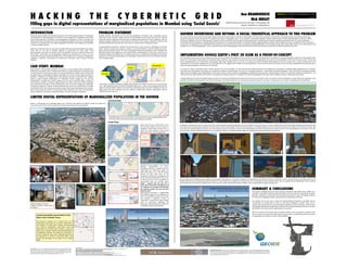
- 1. H A C K I N G T H E C Y B E R N E T I C G R I D! Filling gaps in digital representations of marginalized populations in Mumbai using 'Social Geoviz'! SPATIAL INTERFACE RESEARCH LAB SIMON FRASER UNIVERSITY CANADA INTRODUCTION! This paper explores digital and theore1cal responses to the limited representa1ons of marginalized real popula1ons in social geographic environments such as Google Earth. Geographers and ci1zens have recently observed a revolu1on in social geographic compu1ng as a way to represent and disseminate spa1al informa1on. The arrival and widespread adop1on of tools such as Google Earth are part of an emerging shi> in the range of geographic informa1on tools making up the GeoWeb in internet‐enabled countries. O>en free to download and use, tools such as Google Earth have achieved incredible social uptake. While they are not (yet) as spa1ally rigorous as conven1onal GIS tools, these ‘social geovisualiza1on’ tools play an important role in the GeoWeb, and exert a powerful influence on how people, communi1es and real geographic problems are represented. In future, we must incorporate emerging social geovisualiza1on tools of the GeoWeb into our repertoire of geographic methods to represent, communicate and disseminate informa1on about pressing real‐world problems. CASE STUDY: MUMBAI Approximately 1 billion people worldwide currently live in slums. However, Much of Mumbai’s 13 million‐person popula1on lives in marginal slums (Baud et al. 2009). Reloca1on of individuals living in slums has been promised by the state, but not executed (Bharucha 2009). There are thousands of people living in unacceptable condi1ons, with lible or no access to clean water, electricity or sanita1on. In addi1on to the largest slum in Asia (Dharavi), the slums in Mumbai fill the ‘nega1ve spaces’ or gaps between infrastructure of mainstream society. Visually, we can see this marginaliza1on in Google Earth satellite imagery. One such slum is Ambedkar Nagar ‐ situated on the Southwest coastline of Mumbai wedged between the World Trade Center (WTC) buildings, luxury apartments and hotels. To the untrained eye, slums are ad hoc, disorganized, ephemeral, unsanitary, homogenous. However, informal seblements are much more complex than an outsider would believe them to be. Structure and order do exist. Social classes and hierarchies are present, where various groups are vital for the well being of their inhabitants. Slums o>en risk demoli1on, because despite the community’s marginalized status, the land is valuable to developers. PROBLEM STATEMENT! GeoWeb interface technologies are far more than geographic informa1on tools. Increasingly used by mainstream media networks, Google Earth and similar GeoWeb environments have become norma1ve spaces that impose mappings of the world that are rapidly disseminated into society. By doing so, they are steadily inscribing a limited view of the world into the minds of their viewers, restricted to whatever that par1cular GeoWeb tool does (and does not) include in its representa1on of geographic space. As ‘geovisualiza1on interfaces’, GeoWeb tools should help to reveal unknowns (MacEachren and Kraak, 2001). However, GeoWeb tools suppress, modify or omit representa1ons of informal seblements (slums, shanty towns, townships, favelas). The nature of geographic data and visualiza1ons used in GeoWeb tools effec1vely define these seblements, and inscribe limited representa1ons of them into society due to widespread adop1on of GeoWeb tools. To explore these issues, we developed both digital and theore1cal responses to the GeoWeb representa1on of a marginalized, impoverished community in Southern Mumbai, India: Ambedkar Nagar. Ambedkar Nagar slum is not indicated or documented at any scale in OpenStreetMap. Only three main roads and the World Trade Center buildings are depicted. SELECTED REFERENCES: Baud, I.S.A., Pfeffer, K., Sridharan, N. and Navtej N. (2009). Matching deprivation mapping to urban governance in three Indian mega-cities. Habitat International 33: 365-77; Bharucha, N. (2009, July 31). ‘Move to postpone Dharavi bid opening raises eyebrows’. The Times of India. Retrieved from http://www.dharavi.org/F._Press/A.2009/A1.2009.07.31%3a_Postponing_Raises_Eyebrows Dobson, J.E. (1983). Automated geography. The Professional Geographer 35(2):135-43. Haraway, D. (1991). A cyborg manifesto. Simians, cyborgs, and women: The reinvention of nature, 149-81. New York: Routledge. Kraak, M-J. 2005. Geovisualization and GIScience. Cartography and Geographic Information Science, 32 (2): 67-68. MacEachren, A.M. 2001. Cartography and GIS: Extending collaborative tools to support virtual teams. Progress in Human Geography, 25 (3): 431-444. Map Kibera. (2010). ‘Kibera’s first complete free and open map, November 2009. Retrieved from http://www.mapkibera.org/ Pickles, J. (1993). Discourse on method and the history of discipline: Reflections on Dobson’s 1983 ‘Automated Geography’. The Professional Geographer 45, 451-55. ACKNOWLEDGEMENTS: Ana Brandusescu will graduate with a double major BA in Environmental Geography and Economics from SFU in June 2010. She has been working on this 3D social geovisualiza1on project independently with Dr. Nick Hedley since Fall 2009. She has also just started working for a separate GEOIDE Project. Dr. Nick Hedley is a GEOIDE Researcher, and is currently funded by GEOIDE Project 24. 1986 photograph “No jobs in villages, no shelter in ci1es, where do we go?” Comparing GeoWeb representaCon of the Kibera slum in Nairobi, Kenya. We should be cau1ous not to assume that not all marginalized communi1es are so poorly represented in the GeoWeb. The Map Kibera ini1a1ve demonstrates how informal marginalized communi1es could be represented. On the upper right, we have a map of the Kibera slum in Nairobi, created using OpenStreetMap by the MapKibera ini1a1ve. The makeup of a community ‐‐ schools, academies, water points, vegetable gardens are all represented. In contrast, to the lower right, is the present day descrip1on of the Kibera slum in Google Maps. Extent of exis1ng 3D models in Google Earth in Ambedkar Nagar area IMPLEMENTING GOOGLE EARTH’s FIRST 3D SLUM AS A PROOF-OF-CONCEPT Our mo1va1on for this research was to explore how slums (and by extension, the people who live in them) are currently (mis)represented in mainstream ‘social geovisualiza1on’ plaforms of the GeoWeb. Close inspec1on of 2D GeoWeb representa1ons of Ambedkar Nagar at different scales revealed inconsistencies and serious homogeniza1on occurring in the representa1on of these informal communi1es. The fact that these misrepresenta1ons are implemented using popular, high‐impact GeoWeb tools, in turn acts to inscribe and reinforce (limited) mispercep1ons of slums by society. Also, a review revealed that no 3D visualiza1ons of slums exist in Google Earth or in its 3D Warehouse. This suggests that in addi1on to being marginalized in the real world, these communi1es are now also being marginalized and misrepresented in major social geovisualiza1on environments of the GeoWeb. As one part of a larger mul1‐plaform plan to beber represent slums via the GeoWeb, we have developed and implemented the first 3D Google Earth visualiza1on of Ambedkar Nagar zopadpa. (slum) in Mumbai, India. More than just building a 3D mashup, we considered the design and representa1on of a slum as a ‘social geovisualiza1on’ – with broader theore1cal implica1ons. These include how social geovisualiza1on might be used to mi1gate virtual marginaliza1on of real ci1zens, and as a way to change social geographic compu1ng environments from ‘cyberne1c grids of control’, to ‘cyberne1c networks of transparency’, and mul1‐scalar human representa1on. We intend for this Google Earth mashup to become a ‘receptacle’ for volunteered geographic informa1on (VGI), enabling structured, mul1modal representa1on. A Google SketchUp 3D model of Ambedkar Nagar was built in its en1rety. We decided that the whole slum had to be constructed in order to be able to view the landscape as a whole, filled with dilapidated, small dwellings. We believe that being able to view and move through a scene filled with these structures will have a powerful impact on the viewer in showing the current state of marginaliza1on and depriva1on. LIMITED DIGITAL REPRESENTATIONS OF MARGINALIZED POPULATIONS IN THE GEOWEB! Ana BRANDUSESCU! Nick HEDLEY! Spatial Interface Research Lab, Dept. of Geography, SFU! Contact: anab@sfu.ca, hedley@sfu.ca! GEOWEB INVENTORIES AND BEYOND: A SOCIAL THEORETICAL APPROACH TO THIS PROBLEM! Our research aims to do more than just fill a gap in digital inventories of spa1al objects accessible in the GeoWeb. If we were only to contribute new collec1ons of 2D and 3D assets, we would be reinforcing a reduc1onist approach to the representa1on of complex human systems in geographic space – such as Dobson’s ‘Automated Geography’ (Dobson 1983). Haraway’s (1991) Cyborg Manifesto, and Pickles’ (1993) subsequent integra1on of it into a cri1cal approach to GIScience help us to iden1fy a more progressive theore1cal basis for the development of beber GeoWeb representa1ons of (in this case) marginalized communi1es and their inhabitants. Haraway ques1oned the impacts of ‘new automated prac1ces’ on individual iden1ty, sugges1ng that they impose “cyberne1c grids of control” on people and the structuring of communi1es. She argued that more sophis1cated representa1ons of society than those of simple “automated and applied geography” were needed (Haraway, 1991; Pickles 1993). Clearly, much representa1on in the GeoWeb is of an ‘automated geographic’ nature. Volunteered and mul1‐modal geographic informa1on will help to improve the situa1on, and we hope our efforts contribute to this end. ‘Zopadpa.’ ‘Slums’ Mumbai Construc1on of wealthy residen1al buildings and businesses has rapidly increased over the past decade such. DSK Durgamata towers overlook the Ambedkar Nagar slum – a stark contrast of great poverty found right next to great wealth. However, only landmarks represen1ng status and power (Gateway of India, Taj Mahal Hotel, and WTC buildings) have been added to Google Earth, whereas marginalized, informal seblements (slums) have not. OpenStreetMap Below is a photograph of the Ambedkar Nagar slum in Mumbai. We explored the degree to which the spa1al and human dimensions of this informal seblement are being represented and communicated to Google Maps No1ce that the area is 1tled ‘Slums’ when the area was zoomed out more. Now it is changed to ‘Zopad Pan’ meaning ‘slum’ in Hindi. The same altera1on occurs, when exploring our slum area in Google Earth. Photo credits: An aerial view of Ambedkar Nagar, hbp://www.panoramio.com/photo/4355560; (1986 black and white): Jha, S. S. 1986. Structure of urban poverty: The case of Bombay slums; (all of the photos with the excep1on of the World Trade Center by Flickr photojournalist nweum. hbp:// www.flickr.com/photos/nweum/2871797084/; Lloyd‐Jones, Alasdair. 2008. Ambedkar Nagar Slum Ini1a1ve. hbp://chahana.org/Fish_%26 _Slum/Pages/Ambedkar_Nagar_Slum.html SUMMARY & CONCLUSIONS! The number of Google Earth users alone has been es1mated at 400 million (Jones, 2008). As an accessible, user friendly interface, giving both experts and non experts the opportunity to explore geometric, qualita1ve, conven1onal and volunteered informa1on, it exerts considerable influence on what and how geographic objects, phenomena and rela1onships of all kinds. The purpose of this work was to review the representa1onal limita1ons of GeoWeb tools to communicate the characteris1c of slums as more than homogenous ‘problem areas’, and to consider both the geoma1c and social theore1cal implica1ons of these limita1ons. We have been using Google SketchUp and Google Earth to implement social geovisualiza1ons that aim to increase the visibility of slums by society, using Mumbai as a case study. We do not presume that the best way to represent poverty is a 3D visualiza1on. Instead we view this as one part of a range of alterna1ve ways to communicate an understanding the dimensionality of marginalized communi1es to society, via the GeoWeb. (Le>) We find more evidence of inconsistent GeoWeb representa1on of slums. Completely zoomed‐in, clickable labels for ‘Zopad Pa.’ and ‘Dhobi Ghat’ appear. The laber label leads us to a link for laundry services. At the same 1me as the mainstream GeoWeb has homogenized the human dynamics/rela1onships of the slum, we also see here its use by inhabitants to communicate with the outside world. Finally – evidence that the slum has a pulse, and is more than a homogenous, ad hoc se7lement. And evidence that GeoWeb can represent people who live and work inside the slum! (Above) Scalar transi1ons in Google Maps with satellite imagery show simplifica1on of ‘Slums’ as homogenous areas. At the same 1me however, a significant number of ‘mainstream’ human/urban objects appear (such as restaurants, landmarks and residences) demonstra1ng stark differences in GeoWeb‐mediated representa1on. In addi1on to showing the ‘macro’ structure of the slum, we also wanted to enable Google Earth users to go inside some of the structures, in order to beber understand how densely packed typical living quarters are. The audience has the opportunity to explore one main street in detail, incorpora1ng a selec1on of living quarters. In Ambedkar Nagar, the homes are built very close to one another, and the street is narrow, with many ropes and clothes hanging across from one roof to another, to give the audience a sense of the claustrophobic and chao1c senng (that can clearly be seen in the real photographs on this poster). The main house provides a detailed, first‐person glimpse of a slum dwelling. Views of our detailed Ambedkar Nagar slum dwelling interior environment are shown below. We were able control, building textures, ligh1ng and atmospheric abenua1on in an abempt to implement as representa1ve 3D mashup of the slum as possible. For the ‘main house’ built, a few objects from the 3D Google Warehouse were manually taken apart and altered, in order to give them an aged look as found in the slum. For example, the stove inside the house was not originally clay and falling apart, and the mabress was detached from the bed frame. Together, these macro and micro‐scale mashup details support mul1ple scales of experien1al learning by GeoWeb users. Google Earth representa1on of Ambedkar Nagar, before our 3D mashup was implemented Google Earth representa1on of Ambedkar Nagar, with our 3D mashup added to the view Prototype of next version of our Ambedkar Nagar Google Earth mashup, using building height extrac1on