Engineering Geology Lecture 2
•Download as PPTX, PDF•
6 likes•1,249 views

Engineering Geological site investigation

Recommended
More Related Content
What's hot
What's hot (20)
Similar to Engineering Geology Lecture 2
Similar to Engineering Geology Lecture 2 (20)
More from University of Gondar
More from University of Gondar (8)
Recently uploaded
Recently uploaded (20)
Engineering Geology Lecture 2
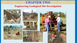
- 1. CHAPTER TWO Engineering Geological Site Investigation
- 2. Chapter 2 outline • Introduction • Objective of site investigation • Elements of site investigation • Stages of site investigation • Methods of site investigation • Types of sample and types of sampling techniques • In situ geotechnical tests • Bore hole and geophysical logging
- 3. Objective of the Chapter At end of this chapter students will be • Understand about site investigation • Familiar with the main objective of site investigation • Know different stages of site investigation • List out methods of site investigation • Understand what types of soil /rock sample will be under take • Know the common sampling techniques • Understand what type of soil or rock description will be undertake in the fieldwork during site investigation
- 4. Introduction What does site investigation and geotechnical investigation mean? • The process of collecting all necessary information for safe and economic design, construction and maintenance of civil engineering structures, environmental management, or extraction/ development of resources. 4 n
- 5. Introduction (Cont’d)… What? Attempt at understanding the subsurface conditions such as: • Soil and rock profile • Geological features of the region • Position and variation of ground water table • Physical properties of soil and rock • Contamination, if any • General data of adjacent structures, hydrological data, topography, soil maps, seismicity, etc. 5
- 6. Introduction (Cont’d)… Why? • To determine the type of foundation required for the proposed project at the site, i.e. shallow foundation or deep foundation. • To make recommendations regarding the safe bearing capacity or pile load capacity. • Ultimately, it is the subsoil that provides the ultimate support for the structures. 6
- 7. Failures
- 8. Leaning Tower of Pisa and Sinkholes
- 9. Introduction (Cont’d)… How? The three important aspect are planning, execution and report writing. 1. Planning • To minimize cost of explorations and yet give reliable data. • Decide on quantity and quality depending on type, size and importance of project and whether investigation is preliminary or detailed. 9
- 10. Introduction (Cont’d)… 2. Execution: • Collection of disturbed and/or undisturbed samples of subsurface strata from field. • Conducting in-situ tests of subsurface material and obtaining properties directly or indirectly. • Study of ground water conditions and collection of sample for chemical analysis. • Geophysical exploration, if necessary. • Laboratory testing on samples 10
- 11. Introduction (Cont’d)… 3. Report writing: • Description of site conditions – topographic features, hydraulic conditions, existing structures, etc. supplemented by plans/drawings. • Description of nature, type and importance of proposed construction • Description of field and lab tests carried out. • Analysis and discussion of data collected information • Preparation of charts, tables, graphs, etc. • Calculations performed and Recommendations 11
- 12. 12 The Leaning Tower of Shanghai (July, 2003) Collapse of highway due to retaining wall failure – Singapore, 2004 Consequences of ignoring site investigation
- 13. General Objective of site investigation is to: Assess the suitability of a site for the proposed structure Evaluate the impact of construction on existing site conditions and existing site conditions on proposed project. Anticipate what can be expected in the future (during construction and performance of the structures). Develop criteria for design and construction based on site specific physical parameters. Recommend some corrective measure, if necessary.
- 14. The specific objectives of site investigation include the following: Determine the depth and nature of soil/rock at the site and its stratification. Observe drainage conditions from and into the site & G-water effects. Assess any special construction problems with respect to the existing structures nearby. Identify potential geological hazards: landslides, earthquakes, flooding, volcanoes, etc. Perform some in-situ tests: permeability, bearing capacity, shear strength, compressibility/settlement behavior, etc. Obtain disturbed and undisturbed soil and rock samples for visual identification and appropriate laboratory tests Assess the quantity, quality and proximity of construction materials for the proposed of project. Specific Objectives of Site Investigation
- 15. On-site and remote investigations one must include: Nature of immediately underlying soil and rock; Geology and geological structures of the project & adjacent areas; Topography & Vegetation; Ground water situations, i.e seepage ,springs, etc; Gullying & Natural slopes; Depth to Bedrock; Types of materials to be excavated; Stability of any excavations; Presence/ absence of toxic wastes; Position of any Utilities, and Permission to access property. If necessary, drill site to assess parameters. All factors influence site selection/ rejection.
- 16. Elements/phases of an investigation 1. Formulating an investigation /stating question 2. Data collection (secondary or primary) 3. Data interpretation- during interpretation of the data the expert should; • Understanding the role of measurement and scales • Making data manageable for analysis • Applying analysis techniques during interpretation 4. Communication (meaningful sense)
- 17. 1. Formulating an investigation Once the questions are framed other aspects of investigation can be defined; The detail or amount of information needed. Scope of the investigation The size of the area (depends on the scope) Time available /required to complete the investigation In some cases time may be limited by some other factors. Time is a function of the need of the engineer, the season and location. E.g. if the scope of the investigation is wide, the time required for investigation is longer An investigation starts from formulating or framing the question or questions to be answered!
- 18. 2. Data collection A. Office study Gathering all the existing information like geology, geomorphology, hydrogeology, population, accessibility, aerial photography, etc. Office study reduces time of field work if conducted properly. Office study/secondary data collection is completed. What else is The available sources have been selected The information extracted and the data organized in a usable form Finally compared with what is required and enable to give a guide to select the appropriate methods for acquiring it. Data collection needs two kinds of studies: Office study and Field study
- 19. B. Field study Involves generating new data through measuring, exploration and testing. Involves surface & subsurface exploration. 1. Surface exploration Such as locating springs, seeps, mapping landslides, measuring the structural parameters of rock outcrops, etc. Data collected are usually transferred to a map. The map may be the end product of the investigation or serve as a means of recording data to establish the spatial distribution of certain information. 2. Subsurface Exploration Direct examination by test pits, trenches, drilling, etc Indirect examination by geophysical Methods Subsurface data compiled in the form of geologic profiles, graphic logs, or other 3-D representations of subsurface conditions.
- 20. • Sampling and testing may occur consecutively with the surface and subsurface exploration. • Sampling & testing will produces either qualitative or quantitative results. • Decide in-situ or laboratory testing. • Need a careful consideration by engineering geologist. • In-situ testing shows site natural condition without any correction. • But Laboratory testing - unable to reflect the natural conditions. • Documentation is important for data collection in both office and field. • Field notes and drilling logs are very important. • Field notes should document during observations. • Should indicate where and when the observation was made. • The type of instrument used • A sketch or cross-section to show the setting is helpful. • Always record the units for any measurement. • Numbering the samples taken. Sampling during Data Collection Taking Note during data collection
- 21. 3. Data Interpretation Interpretation starts with analysis of the data in light of the questions posed for the investigation. Analysis results serve as the basis for developing conclusions and recommendations. In actual investigation data analysis usually occurs throughout data collection. This avoids collecting extraneous data or failure to collect data not initially recognized as relevant to the investigation. To interpret data, we have to; Understand the role of measurements and scales used Make data manageable for analysis Apply analytical techniques
- 22. a. Understanding the role of measurement and scales • It is important to understand the relationship of data to scales of measurement. • Measurement is not limited to using numbers. • It could be attaching a label such as a name or descriptive term to an observation or sample. The different scales of measurement available are: Nominal scale, identification of rock type for collected samples (eg. saturated, unsaturated) Ordinal scale, ordered values of data, low, moderate, high, etc. Interval scale, order among data & relative difference within that order, zero point arbitrarily set permitting –Ve values to be obtained, e.g. Temp. Ratio scale, have a fixed zero point, e.g. length, volume, weight, etc.
- 23. c. Applying analysis techniques Mathematical & Statistical analysis techniques. Mathematical is formula application. All analysis techniques involve some assumptions concerning the data. Choosing analysis techniques must be sufficiently familiar with the underlying assumptions of each techniques. Last step in interpretation is conclusions and recommendations This is the point that analysed results are transformed into answers sought by the investigation. Where there is some uncertainty exists, propose/recommend further detail site investigations or additional drilling.
- 24. 4. Communication Final step in an investigation The answers developed by the investigations should be transferred to the user for action. The user: individual, company manager, governmental board, court, etc. No single way of communication is appropriate in all cases. Presentation to the public, oral communication, written in a defined format, etc. Conclusions should be supported by data & analysis. To have confidence in the conclusions, the user must be able to see how the data supports the conclusions. Assist reader or listener in understanding your findings by stating logical consequences of your conclusions (especially for less-technical background) Use pictures, diagrams and other nonverbal means of communication.
- 25. There are four stages of engineering geological site investigation: 1. Initial or preliminary/reconnaissance study 2. Detailed study (Site exploration) Surface and Subsurface 3. Implementation (construction/monitoring) 4. Post construction stage Stages of Site investigation
- 26. 1. Preliminary or Reconnaissance Study 1. Involves collection of sources of information • Literatures, maps, aerial photo, reports, • Collection of data based on two things: complexity and size of the proposed project, and expected ground condition 2. Collection of data from man’s activities such as Wells, Quarries, Mines, etc 3. Walk over the site: fieldwork for 1-15 days, • To know surface relief • Distribution of soils & rock types • Surface drainage characteristics • Actual or likely land slip areas • Earlier uses of the site, evidence of underground working • Important in determining relative suitability of alternative sites or project • In determining the basis and extent of detailed investigation required • In providing geologic information for basing reasonable cost estimate e.g. time, instruments, borehole, geophysics, pit, etc.
- 27. 2. Site Exploration/ Detail Investigation Stage Intensive and Detailed investigation of a site Have two main goals 1. Determining & interpreting surface & subsurface conditions that influence design & construction projects. 2. Evaluating the behaviour, characteristics & engineering significance of earth materials present or those intended for use in construction Examples Investigation a road route • Exploration along the route would include areas that require special designs, • Wet areas needs drainage, stream channels needing bridges or large fills, & rock outcrops requiring blasting might be among the factors identified during exploration.
- 28. Two Types of Site Exploration/ Detailed Investigation 1. Surface and 2. Subsurface exploration Surface exploration: surface information (soil &rock) understand geological processes which formed the soils and rocks (natural outcrops, river cut, etc) Subsurface exploration: applicable to; to know thickness of overburden/ soil, in the absence of exposures permitting identification of underlying bedrock, if there is uncertainty of the relation of springs & seeps to the regional groundwater table. If there is a need to identify nature of discontinuities and orientations in the subsurface.
- 29. • Test Pits/Trenches • Boreholes/Probes • Cores 1. Direct Methods 2. Indirect Methods • Geophysical Techniques Methods of Subsurface Exploration
- 30. 31
- 31. 32 A) Direct Subsurface Exploration Why Drilling / Borings? • To establish correlation between lithologic units of vertical succession. • To evaluate the physical conditions of rocks such as rock quality designation. • To collect samples of various rock units for laboratory tests • To carry out water pressure tests 1. Types of Borings 1.1 Auger borings (a) Solid (continuous) Flight Augers: are continuous augers added in 1.5m; having a diameter varying from 102 to 204mm; Limited to non caving soils and depths <10m; with finger or fish tail bit at the front end to loosen soil. • Due to their limited application, continuous flight augers are generally not suitable for use in investigations requiring soil sampling
- 32. (b) Hollow Stem Augurs (HSA) : • In general hollow stem augers are very similar to the continuous flight auger except, it has a large hollow center. Has: added in 1.5m increment: allow soil sampling with out removal acts as temporary casing to stabilize borehole. generally limited to depths < 30m Limitations: The cuttings produced from this drilling method are mixed as they move up the auger flights and therefore are of limited use for visual observation purposes. 33 Truck mounted Rig with HSA
- 33. (c) Bucket Augers Borings 34
- 34. Bucket auger borings are typically advanced by a truck-mounted drill. The boring is advanced by a rotating drilling bucket with cutting teeth mounted to the bottom. The drilling bucket is attached to the bottom of a "kelly bar", which typically consists of two to four square steel tubes assembled one inside another enabling the kelly bar to telescope to the bottom of the hole. Fig: Setup of Bucket Auger & Rig (from ASTM D 4700) 35
- 35. Auger Borings: Simplest method of exploration and sampling. Power driven or hand operated. Max. depth 10 m. Suitable in all soils above groundwater table but only in cohesive soil below groundwater water table. Hollow stem augers used for sampling or conducting Standard Penetration Tests
- 36. 1.2. Rotary drilling: Used in clay, sand and rocks Not used for materials containing large percentage of gravel size and larger 1.3. Percussion drilling: Used for making holes in rocks, boulders and other hard strata Advantage: it is used for all types of materials including drilling holes in glacial tills. Disadvantage: the material at the bottom of the hole is disturbed by heavy blows. It is quite expensive than others 1.4. Core drilling: Used for drilling holes and obtaining rock cores. Drilling bits in rotary drilling: Drag bits for clays and loose sands. Tricon roller bits for dense coarse-grained granular soils, cemented zones, and soft or weathered rock. Diamond bits for core able hard formation. 37
- 38. Diamond Drill Bit Tricone drill bit
- 39. 2.3 Other simple exploratory methods Manual hand Auger method. Hand operated Power Augers. Test Pits. 40
- 40. Drifting Exploratory drifts are made horizontally into the ground to know the subsurface geological condition and to know the depth of fresh sound rock. These are commonly used for dam abutment investigations. 3 drifts are commonly used 1 2 3
- 41. Test pits: For shallow visual investigations and to take sample from top few meters of soil. Economical and rapid. Excavation with hand tools, backhoe etc. 1 to 3 m deep, can be extended to 6m. Trenches Pits
- 42. Soil Sampling Methods Disturbed Sampling Disturbed samples are those obtained using equipment that destroy the macro structure of the soil but do not alter its mineralogical composition (a) Bulk Sampling (from auger cuttings or test pit excavations): Used for testing of borrow materials for controlled fill (compacted samples) Testing includes index, classification, moisture-density, and higher- order tests on compacted specimens. (b) Drive Samples (Split-Barrel /Split-Spoon): Most Common for geotechnical exploration ASTM D 1586: Samples obtained in conjunction with the Standard Penetration Test (SPT) 50-mm O.D. thick tube with 38 mm I.D. Sampler length: 457 mm to 610 mm 43
- 43. Undisturbed Sampling Undisturbed samples are obtained in clay soil strata for use in laboratory testing to determine the engineering properties of those soils Push Tubes (Shelby, Piston, Laval, Sherbrook) Rotary & Push (Denison, Pitcher) Block Samples Undisturbed sampling is used to determine: In-situ strength Compressibility (settlement), Natural moisture content, Unit weight Permeability 44
- 44. Split-Barrel for disturbed Sampling Thin-Walled Tube for Undisturbed Sampling 45
- 45. Undisturbed soil core sample 46
- 48. Projects boring spacings One-story buildings 25-30m Multi-story buildings 15-25m Highways 250-300m Earth dams 25-50m Residential subdivision planning 60-100m *The Test borings should extend through unsuitable foundation materials to firm soils layers. *Minimum depth proposed by Sowers (1970) unless bedrock is encountered for multi-storey buildings. For light steel or narrow concrete buildings: Zb (m)= 3S0.7, Zb is the approximate depth of boring For heavy steel or wide concrete buildings: Zb (m)= 6S0.7, S is the number of stories For dams and embankments: Zb (m) = 1/2H to 2H, where H=embankment height. General Guidelines in Site Investigation Processes
- 49. Rock Sampling Methods • Core barrels – obtain cores from 20 to 150mm diameter • Done with either tungsten carbide or diamond core bits • Single and double tube barrel with varies diameter. Use a double or triple tube core barrel when sampling weathered or fractured rock. • Parameters in bit selection – Abrasiveness of the cuttings and the matrix of the material. – The hardness of the materials For softer material use hardened metal, polycrystalline or carbide drill bits and shorter core runs For harder rock use diamond bit
- 50. Core Recovery Cores should be stored in either wooden boxes or corrugated cardboard wooden boxes.† Box should marked with boring number, depth of core run, type core, bit type, core recovery (CR), rock type and other notes From core sample we can calculate – Core Recovery ratio = Length of sample recovered x 100% Length of run – RQD = Length of samples > 10cm x 100 % Length of run • RQD is measure of the degree of fractures, joints, and discontinuities of rock mass and it is a modified core recovery. • The higher the Recovery and RQD, the higher its quality for engineering use.
- 51. Care & Preservation of Rock Cores • Routine: rock samples in core boxes • Special: enclose core in plastic sleeves • General: avoid exposure to shock and vibration during handling and transport. • Non-natural fractures may result from excessive movements, temperatures, and exposure to air. • Storage for future reference
- 52. In-situ Engineering Geological Test Types Field tests can be used to obtain information concerning in-place subsurface conditions when exploring foundations. These include: • Permeability tests, • In-place density tests, • Penetration tests, • In situ strength and modulus tests, • Hand tests (schmidt Hammer). Several in-situ tests define: 1. The geostratigraphy and obtain direct measurements of soil properties and 2. Geotechnical parameters.
- 53. The common field strength tests for soil include (reading Assignment): 1. Standard penetration test (SPT), 2. Cone penetration test (CPT), 3. Flat dilatometer test (DMT), 4. Pressure meter test (PMT), 5. Vane shear test (VST). 6. Pocket penetrometer test (unconfined compression strength) 7. Plate Load Test
- 55. Selection of in-situ test methods (guidelines)
- 56. Observation During Core Drilling Drilling Rate/Time- should be monitored and recorded on the boring log in the units of minutes per 0.3 m (1 ft). Core Photographs Cores in the split core barrel should be photographed immediately upon removal from the borehole. A label should be included in the photograph to identify the borehole, the depth interval and the number of the core runs (figure ---next page) Rock Quality Designation (RQD) - should be calculated as per- Drilling Fluid Recovery The loss of drilling fluid during the advancement of a boring can be indicative of the presence of open joints, fracture zones or voids in the rock mass being drilled. Therefore, the volumes of fluid losses and the intervals over which they occur should be recorded. Core Handling and Labeling Rock cores from geotechnical explorations should be stored in structurally sound core boxes made of wood or corrugated waxed cardboard (Figure 3-22). Wooden boxes should be provided with hinged lids 57
- 57. Sample Coding and Identification • Location of Holes. • Method used in sampling. • To ensure completeness of the record and to eliminate confusion, test holes should normally be numbered in the order of excavation, and the series should be continuous through the various stages of the work.
- 58. • Normally, test hole numbers are prefixed with a one-, two-, or three-letters designation to describe the type of exploration. The following prefix system is commonly used. DH Drill hole AH Auger hole AP Auger hole, power TP Test pit TT Trench DT Dozer trench PT Pitcher sampling hole DN Denison sampling hole HS Hollow- stem auger hole CH Churn drill hole VT Holes in which field Vane test are made CPT Cone penetration Test MP pressure meter hole DM Dilatometer holes BS Borehole shear test hole SPT Standard penetration test BPT Becker penetration test
- 59. Sample Identification • Should have duplicate identification tags, one on the outside of the container/bag & one inside (on outside can be directly labelled or marked) • All samples shall be marked including all information given below: – Zone: – Woreda with nearest town: – Project: name & type of structure – Location : Dam axis, Diversion site, Reservoir area, Borrow area, quarry site, etc. (and GPS reading) – Test pit or Hole number: – Field sample number: – Depth interval the sample represents (average depth): – Feature or type of sample: – Purpose: embankment, filter, etc – Types of test: proctor compaction, gradation, water content, density, etc. – Date of Sampling: – Name of Sampler:
- 60. Cores from dam foundation of Giba dam , Mekelle water supply 61
- 61. 62 Drilling Documentation & Core Logging Core logging – is the continuous record of data of borehole or shallow excavations . It should contain as many information as possible. Some of the information to be addressed includes the following. Project Information: Name of the project Location of the project Drilling contractor Type of drilling rig Date and time of work Drilling method Name of person logging the core Sample Information
- 62. Core Drilling Documentation (foreman) 63
- 63. Engineering Geological Evaluation of Drilling Cores 64 Total core recovery (TCR%) = (length of total core recovered /length of core run)*100 solid core recovery (SCR %) = (length of total solid core recovered /length of core run)*100 RQD (%) = (sum of lengths of intact pieces of cores with a length ≥ cm /length of core run)*100
- 64. 65 Fig :E. g Core drilling Log format
- 66. B) Indirect Subsurface Exploration Geophysical methods are the indirect methods, which are employed to get sub surface information. Indirect methods are important b/c direct methods are:- Provide definite results which are time consuming and expensive. Sub-surface conditions are known only at the bore or test pit location. It couldn’t give subsurface conditions between the boring. But Geophysical methods provide thorough coverage of the entire area. The results of geophysical testing, however, are less definitive and require subjective interpretation. Therefore both methods are important. When geophysical testing is major in scope, few borings and sampling will be required for accurate determination of soil properties. If boring is major in scope then few geophysical lines will be required to know the conditions in-between the borings.
- 67. The different geophysical methods include: Ground Penetrating Radar (GPR). Electrical Resistivity (VES and Profiling). Seismic: Reflection and Refraction. Electromagnetic (EM). Magnetics. Gravity. Very Low Frequency (VLF). Advantages of the different geophysical methods: • Non-destructive. • Cost effective. • Provides preliminary or supplemental information The most commonly used Geophysical methods are; Resistivity, seismic, magnetic and gravity method. 0 10 20 30 40 50 60 0 10 20 30 40 50 60 70 80 90 7 8 9 10 11 12 13 14 15 16 17 18 19 20 21 22 23 24 Ground Conductivity 0 5 10 15 20 25 30 35 40 45 50 55 60 -10 -5 0 0 5 10 15 20 25 30 35 40 45 50 55 60 -10 -5 0 Resistivity & Induced Polarisation
- 68. Resistivity Method • The resistivity of rocks and soils varies within a wide range. • Their resistivity is determined by the amount of conductivity through mineral constituents and the content of mineralized water in the pores. • Weathering can increase the amount of water that a soil or rock can hold which in turn affects the conductivity of the materials. ♦Electrical resistivity is the resistance of a volume of material to the flow of electrical current. ♦ current is introduced into the ground through a pair of current electrodes ♦ resulting potential difference is measured between another pair of potential electrodes
- 69. Resistivity method may be used to make • Resistivity depth measurements at a selected point in which electrode spacing increasing progressively (VES) • Fixed depth resistivity measurements along a traverse line (electrical trenching) the spacing is fixed and all the electrodes move along a line. There are two symmetric type of configurations (Wenner and Schlumberger). In the Wenner configuration the distance between all four electrodes are equal. The spacing can be progressively increased, keeping the center of the array fixed. In the Schlumberger arrangement the potential electrodes maintain a constant separation about the center of station.
- 70. • Results of resistivity method
- 71. Seismic Methods • Seismic methods may prove useful in this respect as they yield quick and relatively inexpensive results. • The seismic waves travel through the subsurface at a velocity dependent on the density of the soil/rock. • The waves generated can be compressional (P), dilational shear(S) and surface waves. • The P waves travel faster and are more easily generated and recorded than the S. The velocity of a wave is varies from materials to materials (properties of materials). • Thus two methods of seismic surveying can be distinguished, that are, seismic reflection and seismic refraction. Seismic energy is provided by a source (hammer, weight drop or small explosive charge) located on the surface.
- 72. Seismic methods a) Seismic Reflection: • Typically, acoustic pulses are generated at predetermined source locations (S) along the length of the reflection seismic profile. • The travel times and amplitudes of reflected acoustic energy is recorded at predetermined receiver locations (R1, R2, etc.). • It is more applicable to record the deeper strata. b) Seismic Refraction: • In seismic refraction method one ray approaches the interface between two rock types at a critical angle which means that if the ray is passing from a low (Vo) to a high velocity (V1) layer it will be refracted along the upper boundary of the later layer. After refraction, the pulse travels along the interface with velocity (V1). When the seismic wave front encounters an interface where seismic velocity drastically increases, a portion of the wave critically refracts at the interface, traveling laterally along higher velocity layers.
- 73. Seismic methods have been particularly helpful for assessing rock mass quality, excavatability and the moduli for deformability. • The seismic velocity is related with properties of rock that affect the rock quality and excavatability; for example – Weathering of the rock material (increasing weathering leads to decreasing velocity),- easily excavatable – Close spacing of discontinuities (the closer the spacing the lower the velocity), – Openness of discontinuities (the greater the aperture the lower the velocity).
- 76. Magnetic Methods • Magnetometers are designed to measure variations in the magnetic field of the Earth. • These are usually caused by the presence of magnetically susceptible material of natural or human origin (typically magnetite or iron, respectively). • When a ferrous material is placed within the Earth's magnetic field, it develops an induced magnetic field. • In certain instances, magnetic data can be interpreted quantitatively, and transformed into constrained geologic Models. • More typically, however, magnetic data are interpreted qualitatively, and simply used to verify the presence or absence of magnetically susceptible materials. Thus it has many applications in mining and engineering. • Engineering and environmental site characterization projects often begin with a magnetometer survey as a means of rapidly providing a layer of information on where utilities, geological structures and other buried concerns are located.
- 77. Gravity Method • Gravimeters are designed to measure variations in the gravitational field of the Earth, and are typically used to generate 2-D or 3-D density–depth models of the subsurface. • This method is best suitable for stratified formations as the gravitational effects of rocks are proportional to the contrast in density between them and the surrounding rocks. • If external constraints are available, the density–depth models can be transformed into a geologic model. • Gravity varies with elevation, latitude, topography, tides, instrument drift and near-surface density
- 78. • We make a number of corrections to produce a gravity anomaly that only reflects near-surface density Salt domes, sedimentary basins, mine shafts = gravity low Igneous and metamorphic rocks are usually denser than sedimentary Most rocks will have a range of densities, and density is often related to porosity However gravity varies with mineral content in the rock.
- 79. Gravity methods in engineering geology can be used to determine subsurface formation and buried structures.
- 80. Geophysical logs
- 81. Reading Assignments • On the application of Surface and borehole Geophysics for Engineering Geological site investigation • The limitation of Geophysical methods (Engineering Geophysical methods) for Engineering Geological site investigation
- 82. 3. Implementation studies Preliminary & detailed study results are continually revised & involve the recognition & monitoring of the geologic conditions / may differ from what was expected (changed condition). Basis for changing the project design to avoid major problems in project performance. All problems encountered during construction are studied at this stage Preparation of an in-constructed geologic map. This study, some times continue into the post-construction period (regulatory requirements).
- 83. • The behavior of completed engineering work will have been computed on the basis of data acquired in the earlier stages of investigation. • But certain behavior such as settlement, may take many years to become complete after construction of the project. • If the observed behavior is not the same as anticipated behavior this may indicate that the properties of ground are affected by some unforeseen & previously undetected factors. • Hence further investigation may be required to resolve this condition. • Monitoring of behavior of the engineering project and comparison with predicted performance is of vital importance for all engineering works, because major engineering disasters mostly take place after completion of the work. 4. post-construction stage
- 85. Lecture 1Provide solutions, not problems Come early, stay late you need to learn to only have fun after all of your work is done I Will work Hard ,I Will Succeed
- 86. 36 C End of chapter 2 •This is all what I have to say. •Thank you too much for your eyeful attention!
Editor's Notes
- Seismic methods have been particularly helpful for assessing rock mass quality, excavatability and the moduli for deformability. These all parameters are for the quality assessment. The seismic velocity can affect by the rock quality as Weathering of the rock material (increasing weathering leads to decreasing velocity), Close spacing of discontinuities (the closer the spacing the lower the velocity), Openness of discontinuities (the greater the aperture the lower the velocity).