
Recommended
More Related Content
Similar to Various aspects of Precision Farming.pptx
Similar to Various aspects of Precision Farming.pptx (20)
Recently uploaded
Recently uploaded (20)
Various aspects of Precision Farming.pptx
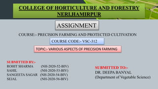
- 1. COLLEGE OF HORTICULTURE AND FORESTRY NERI,HAMIRPUR ASSIGNMENT COURSE:- PRECISION FARMING AND PROTECTED CULTIVATION COURSE CODE:- VSC-312 TOPIC:- VARIOUS ASPECTS OF PRECISION FARMING SUBMITTED BY:- ROHIT SHARMA (NH-2020-52-BIV) SAHIL (NH-2020-53-BIV) SANGEETA SAGAR (NH-2020-54-BIV) SEJAL (NH-2020-56-BIV) SUBMITTED TO:- DR. DEEPA BANYAL (Department of Vegetable Science)
- 2. Contents:- Definition of Precision Farming. Precision Farming Cycle. Need of Precision Farming. Concept & Stages. Components and facilitators of precision farming. Laser Land Leveler. Mechanised direct seed sowing. Seedling and sampling transplanting. Advantages & Disadvantages of precision farming.
- 3. PRECISION FARMING:- • Precision farming or precision agriculture is about doing the right thing, in the right place, in the right way, at the right time. Managing crop production inputs such as water, seed, fertilizer etc to increase yield, quality, profit, reduce waste and becomes eco-friendly. The intent of precision farming is to match agricultural inputs and practices as per crop and agro-climatic conditions to improve the accuracy of their applications. Precision farming is also known as satellite farming.
- 4. Precision farming is the managing variation in the field accurately to get more crops production with the use of fewer resources and reducing the cost of production. OR Precision farming refers to the precise application of agricultural inputs with respect to soil, weather and crop need in order to improve productivity, quality and profitability in agriculture. It enables farmers to use crop inputs more efficiently including pesticides fertilizers tillage and irrigation water. DEFINITION:- So we can say that precision farming is the method of farming uses the information technology to ensure that the soil and crop get exactly what the crop and soil need for the proper growth and Higher productivity.
- 5. 1. To enhance productivity in agriculture with respect to profit. 2. Prevents soil degradation in cultivable land. 3. Reduction of chemical use in crop production 4. Efficient use of water resources 5. Dissemination of modern farm practices to improve quality, quantity & reduced cost of production in agricultural crops Why Precision Farming?
- 7. Need of Precision Farming:- • Agronomical perspective:- Use agronomical practices by looking at specific requirements of crop. • Technical perspective:- Allows efficient time management. • Environmental perspective:- Eco-friendly practices in crop • Economical perspective:- Increases crop yield, quality and reduces cost of production by efficient use of farm inputs, labour, water etc
- 8. The concept of precision farming is strictly based on the Global Positioning System (GPS), which was initially developed by U.S. (United States of America) defense scientists for the exclusive use of the U.S. Defense Department. The unique character of GPS is precision in time and space. Precision agriculture (PA), as the name implies, refers to the application of precise and correct amounts of inputs like water, fertilizers, pesticides etc. at the correct time to the crop for increasing its productivity and maximizing its yields. The use of inputs (i.e. chemical fertilizers and pesticides) based on the right quantity, at the right time and in the right place. This type of management is commonly known as “Site-Specific Management”. CONCEPT OF PRECISION FARMING:-
- 9. Precision farming has usually four stages process to observe a special variability: 1. Data collection 2. Variable 3. Strategies 4. Implementation STAGES:- Data collection: Data collected with the help of GPS to analyse the soil ,water,level, production rate , nutrient level, soil and some other data related to the agriculture. Variable : variability may result from different basis like climate condition, rainfall,soil texture, nitrogen level,crop production, disease in the field and weeds.
- 10. Strategies : After getting data and information of a field, farmer can use soil map and they can choose these two strategies to maintain the input of field. STAGES… Productive strategy: This strategy is based on the analysis of Static indication such as field history. Soil texture etc.during the crop cycle. Control strategy: This type of strategy get information from the static indicator during the crop cycle by sampling the weighing, biomass , weighing fruits and by remote sensing which is generally measured the parameter, temperature of air and soil humidity etc. Implementation: NICT( New information and communication technology) make the field crop management which is more easier for the farmers to achieve good production. In the precision farming, they use technologies for the agriculture like tractor harvesters, thresher and other machines
- 11. 1. Global Positioning System (GPS): It is a set of 24 satellites in the Earth orbit. It sends out radio signals that can be processed by a ground receiver to determine the geographic position on earth. It has a 95% probability that the given position on the earth will be within 10-15 meters of the actual position. GPS allows precise mapping of the farms and together with appropriate software informs the farmer about the status of his crop and which part of the farm requires what input such as water or fertilizer and/or pesticides etc. Components and facilitators of precision farming:
- 12. Devices:-
- 13. 2. Geographic Information System (GIS): ):GIS is an computer based system for storing very large amount of data, retrieving, manipulating and displaying them for easy interpretation. The term geographic should be interpreted to means space or spatial for crop production. It is the spatial analysis of GIS that enable the precision farming. The GIS is the key to extracting value from information on variability. It is rightly called as brain of precision farming. It helps agriculture in two ways; •Integrated GIS data (soil,crop, weather field history with simulation models.) •To support the engeneering component for designing implements. Geographic Information System (GIS) Components and facilitators of precision farming:
- 14. A yield map is a spatially referenced graphical representation of crop yield for a defined area. Yield mapping includes Acquisition, analysis and summarization of crop yield data by location with in a field. The yield data can be collected automatically while harvesting. This data produce a yield map that can be used to compare yield distribution within the field from year to year. This allows the farmers to determine areas of the field. It also allows farmers to show the effect of a change in field management techniques,to develop nutrient strategies for their field and as a record of crop yield to use in securing loans and renters. Example of Yield Map 3. Yield Mapping:-
- 15. Types of yield mapping:- Inference maps : They are developed by associating yield estimates with existing map delination without charging the dealineation on a base map. Interpolation maps : Yield measurement are made at specific location and yield values between data points are estimated using interpolation techniques. Prediction maps : Yield component is not measured but prediction from other spatial data using a prediction function or model. Aggregation maps : Yield maps derived from measured data in which either the original data or some aggregation of the data are mapped, once Yield measurements are determined, no estimation, prediction or interpolation of point yield data is required for mapping.
- 16. Remote sensing holds great promise for agriculture because of Its potential for monitoring spatial variability over time at high revolution. Remote sensing imagery for precision farming can be obtained either through satellite based sensors or CIR video digital camera on board small aircraft. It is the art or science to obtaining information from the distance i.e obtaining information objects and phenomenon without being in physical contact with them. 4. Remote sensing:
- 17. Soil map is the map i.e geographical representation showing diversity of soil types and/or soil properties soil maps etc. Soil mapping is very important for the correct implementation of sustainable land used management. Soil mapping provides important information about the characteristics and condition of the land . Many new maps are derived using soil mapping techniques. Digital soil mapping: It is the computer assisted production of digital maps of soil types and soil properties. 5. Soil mapping:
- 18. In digital soil mapping semi-automated techniques and technologies are used to accurate process and visualise information on soil and auxiliary information. Digital Soil Mapping…. Soil mapping commonly assessed for the accuracy and uncertainty and can be more easily updated when new information comes available.
- 19. A site specific system provides the best opportunity to develop a truly sustainable agriculture system. Managing the right source at the right rate, right time and in the right place is the best accomplished with right tools. Various technologies are available related to nutrient management from soil mapping to fertilizers application to yield measurements. 6. Site specific input application:
- 20. 7. Computer Hardware and Software: In order to analyze the data collected by other Precision Agriculture technology components and to make it available in usable formats such as maps, graphs, charts or reports, computer support is essential along with specific software support. 8. Precision irrigation systems: Recent developments are being released for commercial use in sprinkler irrigation by controlling the irrigation machines motion with GPS based controllers. Wireless communication and sensor technologies are being developed to monitor soil and ambient conditions, along with operation parameters of the irrigation machines (i.e. flow and pressure) to achieve higher water use efficiency. Precision irrigation systems Computer Hardware and Software
- 21. Laser Land Leveler:- Introduction: Uneven soil surface has a major impact on the germination, stand, and yield of crops due to inhomogeneous water distribution and soil moisture. Therefore, land levelling is a precursor to good agronomic, soil, and crop management practices. The advanced method to level or grade the field is to use laser-guided leveling equipment. Laser land leveling is leveling the field within certain degree of desired slope using a guided laser beam throughout the field.
- 23. A laser-controlled land leveling system consists of the following five major components: (i) Drag Scrapper/bucket: The drag bucket can be either 3-point linkage mounted on or pulled by a tractor. This system is preferred as it is easier to connect the tractor’s hydraulic system to an external hydraulic by the 3-point-linkage system. (ii) Laser transmitter: The laser transmitter mounts on a tripod, which allows the laser beam to sweep above the field. (iii) Laser receiver: The laser receiver is a multi-directional receiver that detects the position of the laser reference plane and transmits this signal to the control box. (iv) Control box: The control box accepts and processes signals from the machine mounted receiver. It displays these signals to indicate the drag buckets position relative to the finished grade. (v) Hydraulic system: The hydraulic system of the tractor is used to supply oil to raise and lower the leveling bucket. Components of Laser Leveling System:
- 24. The system includes a laser-transmitting unit that emits an infrared beam of light that can travel up to 700m in a perfectly straight line. The second part of the laser system is a receiver that senses the infrared beam of light and converts it to an electrical signal. The electrical signal is directed by a control box to activate an electric hydraulic valve. Several times a second, this hydraulic valve raises and lowers the blade of a grader to keep it following the infrared beam. Laser leveling of a field is accomplished with a dual slope laser that automatically controls the blade of the land leveler to precisely grade the surface to eliminate all undulations tending to hold water. Laser transmitters create a reference plane over the work area by rotating the laser beam 360 degrees. The receiving system detects the beam and automatically guides the machine to maintain proper grade. The laser can be level or sloped in two directions. This is all accomplished automatically without the operator touching the hydraulic controls. Working mechanism of Laser Leveler: Working of laser land leveler:- https://youtu.be/SLWNqTnjWmc
- 25. Benefits of laser land leveling over conventional land leveling: •Reduction in time and water for irrigation •Uniform distribution of water •Less water consumption in land preparation • Precise level and smoother soil surface • Uniform moisture environment for crops •Lesser weeds in the field •Good germination and growth of crop •Uniformity in crop maturity •Reduced seed rate, fertilizers, chemicals and fuel requirements BENEFITS:- Benefits of precise land leveling: •Saves irrigation water >35 % •Reduced weed in the field •Increase in field areas about 3.5 % •Reduce farm operating time by 10 % •Assist top soil management •Saves labor costs •Saves fuel/electricity used in irrigation • Increase productivity up to 50 %
- 26. Mechanised direct seed sowing: Seed drilling is the term used for the mechanised sowing of an agricultural crops by positioning them in the soil and burying them to a specific depth. This ensures that seeds will distributed evenly. The seed drill sows the seeds at the proper seeding rate and depth, ensuring that the seeds are covered by soil. It allows plant to get proper sunlight, nutrient and water from the soil. The use of seed drill saves the time and lobour. This also facilitates weed control. Working of Seed Drill:- https://youtu.be/r5v66d1L6js Seed drill
- 27. Seedling and sampling transplanting : Mechanical transplanter: Mechanical transplanter is an specialised transplater fitted to transplant seedling into field.
- 28. Components of mechanical transplanter: Seedling feeding pipe: The seedling feeding pipe was made up of PVC and diameter measured was 63 mm. The efforts can be made when the elbow angles of 190° to 170°. Handle: It is used to control,hold and penetrate the jaw in the soil bed. Jaw assembly: It is the soil engaging part of equipment which makes opening for placing the seedlings. Lever: Lever was used to operate the jaw which was made up of mild steel. Marker: The marker was used to operate or was provided in order to indicate the location of seedling to be transplanted. Mechanical transplanter require considerably less time and lobour than manual transplanting. A transplanter is an agricultural machine used for transplanting seedling to the field. Working of seedling Transplanter:- https://youtu.be/oFwSkD_kP0A
- 29. Improve the agriculture field. Reduce potential environment risk. Obtain proper data in real time. Monitor the plant and soil. It saves time and energy. Provide better information and data for the management. It Enhances The Sustainability. It Provides Higher Resolution Of Your Farm Land. It Increases Land Values. Advantages of precision farming :
- 30. Disadvantages of precision farming:- Initial capital costs may be high and so it should seen as a long term investment. It takes several years before you have sufficient data to fully implement the system. Extremely demanding work particularly collecting and then analysing the data. Precision farming techniques are still under development and requires expert advice before actual implementation Lack of success stories or cost benefits studied on precision farming. Knowledge and technological gap. Lack of market perfection. Lack of local technical expertise. Lack of data availability in terms of quality and cost.