Coal india limited
•Download as PPTX, PDF•
1 like•79 views
vacational training ppt
Report
Share
Report
Share

Recommended
This is the Report about Barapukuria Coal Mine, Maddhapara Granite Mine Company Limited and Institute of Mining, Mineralogy and Metallurgy, BCSIR, Joypurhat. So if you need to you will read it. I think it will be support for your education purpose. Thank you.A Report about Barapukuria Coal Mine, Maddhapara Granite Mine Company Limited...
A Report about Barapukuria Coal Mine, Maddhapara Granite Mine Company Limited...Jessore University of Science & Technology
More Related Content
Recently uploaded
Recently uploaded (20)
Software Engineering - Modelling Concepts + Class Modelling + Building the An...
Software Engineering - Modelling Concepts + Class Modelling + Building the An...
Electrical shop management system project report.pdf
Electrical shop management system project report.pdf
Introduction to Machine Learning Unit-4 Notes for II-II Mechanical Engineering
Introduction to Machine Learning Unit-4 Notes for II-II Mechanical Engineering
KIT-601 Lecture Notes-UNIT-3.pdf Mining Data Stream
KIT-601 Lecture Notes-UNIT-3.pdf Mining Data Stream
Online resume builder management system project report.pdf
Online resume builder management system project report.pdf
Introduction to Machine Learning Unit-5 Notes for II-II Mechanical Engineering
Introduction to Machine Learning Unit-5 Notes for II-II Mechanical Engineering
The Benefits and Techniques of Trenchless Pipe Repair.pdf
The Benefits and Techniques of Trenchless Pipe Repair.pdf
The battle for RAG, explore the pros and cons of using KnowledgeGraphs and Ve...
The battle for RAG, explore the pros and cons of using KnowledgeGraphs and Ve...
Cloud-Computing_CSE311_Computer-Networking CSE GUB BD - Shahidul.pptx
Cloud-Computing_CSE311_Computer-Networking CSE GUB BD - Shahidul.pptx
Featured
Featured (20)
How Race, Age and Gender Shape Attitudes Towards Mental Health
How Race, Age and Gender Shape Attitudes Towards Mental Health
AI Trends in Creative Operations 2024 by Artwork Flow.pdf
AI Trends in Creative Operations 2024 by Artwork Flow.pdf
Content Methodology: A Best Practices Report (Webinar)
Content Methodology: A Best Practices Report (Webinar)
How to Prepare For a Successful Job Search for 2024
How to Prepare For a Successful Job Search for 2024
Social Media Marketing Trends 2024 // The Global Indie Insights
Social Media Marketing Trends 2024 // The Global Indie Insights
Trends In Paid Search: Navigating The Digital Landscape In 2024
Trends In Paid Search: Navigating The Digital Landscape In 2024
5 Public speaking tips from TED - Visualized summary
5 Public speaking tips from TED - Visualized summary
Google's Just Not That Into You: Understanding Core Updates & Search Intent
Google's Just Not That Into You: Understanding Core Updates & Search Intent
The six step guide to practical project management
The six step guide to practical project management
Beginners Guide to TikTok for Search - Rachel Pearson - We are Tilt __ Bright...
Beginners Guide to TikTok for Search - Rachel Pearson - We are Tilt __ Bright...
Unlocking the Power of ChatGPT and AI in Testing - A Real-World Look, present...
Unlocking the Power of ChatGPT and AI in Testing - A Real-World Look, present...
Coal india limited
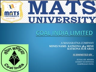
- 1. A MAHARATNA COMPANY MINES NAME- KATKONA 3&4 MINE KATKONA SUB AREA SUBMMITED BY..... KUNAL KR. MISHRA SANJEEV KUSHWAHA HARPRASAD PATEL
- 2. CONTENTS :- INTRODUCTION GEOLOGY ENTRIES MATHODOLOGY MACHINERIES DRILLING BLASTING LOADING AND DUMPING VENTILATION
- 3. INTRODUCTION :- NAME OF THE MINE” : KATKONA 3&4 INCLINE AREA : BAIKUNTHN PUR AREA LOCATION LONGITUDE : 23° 20’ 00 LATITUDE : 82° 41’ 30” MINE ADDRESS : KATKONA 1&2 INCLINE DATE OF OPENING OF MINE ; 15th May,1963 LEASE HOLD AREA : 1033.729 HECT. HISTORY OF OWNERSHIP :since 1973 under WCL and from 1987 under SECL DISPUTE OF BOUNDARY : NOT ANY MANPOWER ON ROLL : 399 (UP TO March- 2017) U/g- 341 and Surface : 52 TARGET OF MINE : 246000 T / Year
- 4. GEOLOGY:- patna (situated in katni –gumla national highway no.78) in The katkona 3&4 incline was located at a distance of about 240 km from the office of the director of mines safety ,bilaspur region,bilaspur and the mine was about 9 km away from katkona village,baikhuntpur,korea district , cg. 1) Date of opening:- The mine was opend on 15th may 1963 and after drivage of two drifts the work was suspended in 1964. The mine was restarted in the year 1973 and coal production started from 1974.
- 5. 2)CHANGE OF OWENRSHIP:- The ownership was transferred to WCL with effect from 1.11.1975 to 31.03.1986 and ultimately from 1.04.1986 ,it came under S.E.C.L, 3)SIZE OF THE MINE:- The mine area is 1033.729 Hect. The extent of the mine working a long dip rise is about 2.0 km and along strike is 4.50 km 4)ADJOINING MINES:- The katkona 3&4 incline is surrounded by (A)towards north –reserve forest (b)toward east side by Pandavpara colliery where seam 2 & 3 is being worked.
- 6. (5)SEAM DESCRIPTION :- THERE WERE FOUR NUMBER OF WORKABLE SEAM EXIST IN THE LEASEHOLD PROPERTY OF THE MINE OUT OF WHICH KHAJURA SEAM (NO 5TH SEAM) WAS THE TOP MOST SEAM AND THE SEAM WAS WORKABLE IN THE PROPERTY THROUGH KATKONA INCLINE NO 3&4 A SEPARATE MINE .
- 8. ENTRIES:-
- 12. MACHINARIES:-
- 21. VENTILATION:-
Editor's Notes
- SUBMITTED BY