Download as PDF, PPTX


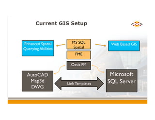
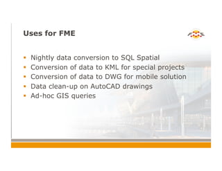
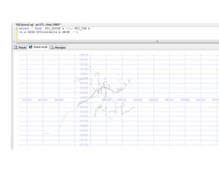
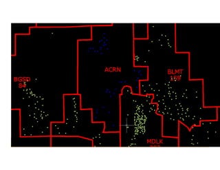

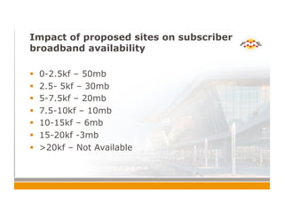

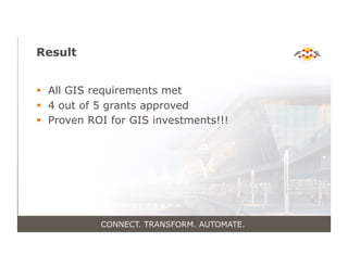


The document discusses the implementation of FME software in enhancing GIS capabilities for Ponderosa, focusing on data connectivity, transformation, and automation across various operations. It highlights the company’s extensive service footprint and the benefits of utilizing spatial queries and automated reporting for improved efficiency in grant applications and data management. The results indicate a significant return on investment, with most GIS requirements met and a high success rate in grant approvals.


