Rmtsp
•Download as PPTX, PDF•
0 likes•45 views

Introduction of Regional Mass Transportation System Planning

Recommended
More Related Content
What's hot
What's hot (20)
Similar to Rmtsp
Similar to Rmtsp (20)
Recently uploaded
Recently uploaded (20)
Rmtsp
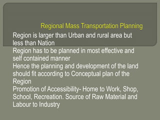
- 1. Region is larger than Urban and rural area but less than Nation Region has to be planned in most effective and self contained manner Hence the planning and development of the land should fit according to Conceptual plan of the Region Promotion of Accessibility- Home to Work, Shop, School, Recreation. Source of Raw Material and Labour to Industry
- 2. Separating the non dependable activity, Combining the dependable activity Development in visually pleasant manner Social Aim : To provide healthy, good, attractive environment to people. To carry out human activity more efficiently and less wastefully.
- 3. Providing transport network in the regional, Urban, Rural area Balancing of population and employment to minimize movement To take best advantage of existing facility and available resources of construction and improvement Strengthening the pattern of service to provide reasonable accessibility
- 4. Location of non agricultural land uses to make the best use of natural resources Regional Transport Planning To locate the population and land development and plan for entire area RTP deals with planning of freeways, express ways, NH, Railways, Air & Waterways. RTP deals with Transport System design, Level of Services to the users. Relationship to Land use and Economic Development, level of Investment.
- 5. Relationship to land use and economic development Regional transport planner must understand the economics of private and public service Technical inventions Relative speeds of different modes Freight and passenger transportation
- 6. Pavement width, Volume/Capacity Ratio Service Frequency Goal- Performance rating of transport facility by 1) Users 2) Service provider 3) Non user public 1) User wants increased mobility, reliability of transportation system, reduced travel time & travel cost, Increased safety , comfort & Aesthetics 2) Service provider wants reduced capital cost, maintenance cost, operating cost
- 7. 3) Non user public wants increased accessibility, reduction in pollution and harmful environment. CONSTRAINTS RELATED TO RTP Geographical distribution, Funding distribution, System Constraint, Inter modal Constraint, Related development Constraint, Fund limitation, Design Time
- 8. 1 Rectangular & Block Pattern 2 Radial & Block Pattern 3 Radial & Circular Pattern 4 Radial & Grid Pattern 5 Hexagonal Pattern 6 Minimum Travel Pattern THEORIES OF DEVELOPMENT FOR REGIONAL PLANNING 1 Concentric Ring 2 Central place theory 3 Growth pole theory
- 9. Conclusion : The pattern of future distribution of population and employment cannot be determined . But the theories of REGIONAL PLANNING development helps us to decide type of network & facilities and their location to be provided.
- 10. 1 Aryans settled along the Indo gangetic plains and developed roads 2 British empire developed roads for the Administration & Military purpose 3 Nagpur Road Plan – 1943 – 1963 All Chief engineers met at Nagpur and discussed the policies and Standards of Road development in India Four Category of roads were recommended NH, SH,MDR.ODR,VR
- 11. Metalled Road NH+SH+ODR=(A/8+B/32+1.6N)+D-R A-AGRICULTURE AREA B-NON AGRICULTURE AREA N- NO OF TOWNS AND VILLAGES WITH POP 2001-5000 T- NO OF TOWNS AND VILLAGES WITH POP > 5000 D- DEVELOPMENT ALLOWANCE-15% R- EXISTING RAIL TRACK
- 12. ODR+VR= (0.32V+0.8Q+1.6P+3.2S)+D V- NO OF VILLAGES WITH POP < 500 Q-NO OF VILLAGES WITH POP 500-1000 P-NO OF VILLAGES WITH POP 1001-2000 S-NO OF VILLAGES WITH POP 2001-5000 D- DEVELOPMENT ALLOWANCE-15% TOTAL LENGTH OF ROADS=532700 KM DENSITY OF ROAD=16KM/100 SQ KM
- 13. TOTAL LENGTH OF ROADS=10,57,330 KM DENSITY OF ROAD=32 KM/100 SQ KM EXPRESS WAYS OF 1600 KM LENGTH D- DEVELOPMENT ALLOWANCE-5% PRADHAN MANTRI GRAM SADAK YOJANA DECEMBER-2000 RURAL ROAD CONNECTIVITY IS ONLY KEY FOR DEVELOPMENT OF RURAL AREA INCREASEDACCESS TO ECONOMIC & SOCIAL SERVICES
- 14. REDUCTION IN POVERTY. 40% OF POP IN THE COUNTRY IS STILL NOT CONNECTED BY METALLED ROAD 100% FUNDS WILL BE GIVEN BY CENTRAL GOVERNMENT DISTRICT PANCHAYAT SHALL BE THE AUTHORITY TO SELECT THE VILLAGES TO BE CONNECTED WITH THE CORE NETWORK PLAN . AFTER RECOMMENDATION OF MLA,MP OF THE AREA, DISTRICT PANCHAYAT WILL APPROVE AND SEND TO STATE GOVERNMENT AND CENTRAL
- 15. SPECIAL ATTENTION WAS GIVEN FOR ROADS SHARING BORDER WITH PAKISTAN,BANGLADESH,NEPAL GOLDEN QUADRILATERAL-GQ LARGEST EXPRESS WAYS PROJECT IN INDIA- CONSTRUCTING 5851 KM OF FOUR/SIX LANE EXPRESS WAY CONNECTING DELHI,MUMBAI,CHENNAI & KOLKATA
- 16. MUMBAI-PUNE EXPRESS WAY WAS CONSTRUCTED UNDER GQ PROJECT
- 17. Population Forecasting is necessary to develop the required facilities in the region for developing housing, schools, hospitals, public transport, road network, electricity and water supply. Also for creating the employment opportunity for the population in the present and future. ( Industry, Agriculture, Commercial sector ) Population Forecasting can be done by knowing the details and trends of Birth, death, Migration in the region.
- 18. Social facilities – education, medical, recreation, good connectivity by Rail/Road links, climatic conditions. Methods of Population Forecasting 1) Arithmatical increase method – Based upon the assumption that population increases at constant rate w.r.t time in a decade - dp/dt is constant Pn=(p0+n*x) where Pn is forecasted population after n decades, p0 is present population, n-No of Decades,x- average population increase in the known decade
- 19. 2) Geometrical Increase Method- Assumed that Percentage Growth rate per decade is constant Pn=p0(1+r/100)n 3)Cohort Analysis Method –Change in population of a city depends upon birth, death, migration Pn=P +Natural Increase + Migration Natural Increase=T(IbP-IdP) T=Forecast Period P= Present population Ib=Average birth rate per year Id=Average death Rate per year