
Recommended
Recommended
More Related Content
What's hot
What's hot (20)
Similar to Planning Patna's Urban Green Corridor
Similar to Planning Patna's Urban Green Corridor (20)
Recently uploaded
Recently uploaded (20)
Planning Patna's Urban Green Corridor
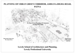
- 1. URP 645 - PLANNING STUDIO-III DETAILED PROJECT REPORT Lovely school of Architecture & Planning Lovely Professional University M.Plan (2018-20) Section – A 1816 PLANNING OF URBAN GREEN CORRIDOR, ASHIANA-DIGHA ROAD, PATNA M. Plan (Urban Planning) (IV-Semester) (Session 2019-2020) Submitted By:- ISHA KIRTI (1180754) Dissertation Supervisor- Ms. Aasna Arora Lovely School of Architecture and Planning, Lovely Professional University
- 2. URP 645 - PLANNING STUDIO-III DETAILED PROJECT REPORT Lovely school of Architecture & Planning Lovely Professional University M.Plan (2018-20) Section – A 1816URP 630 THESIS PLANNING OF URBAN GREEN CORRIDOR IntroductionIntroduction To Exercise Aim To develop Ashiana-Digha Road as a urban green corridor. Objective To develop strategies for the corridor systems. Need This thesis exercise is about the developing of Urban Green Corridor in Patna, Bihar. Urban Green Corridor aims to bridging of habitat populations that have been split by human development such as a road, settlement or other human activity. A green corridor in an urban area could provide an attractive breathing space for local residents and be more acceptable to them. To identify the issues and challenges in the stretch of Ashiana- Digha Road. To prepare green road design concept and beautification plan for enhancing transportation and landscaping. The stretch falls under Sub Arterial Road according to Patna Master Plan 2031 and having different Right of Way maximum of 26m and minimum of 7m. Carriageway is occupied at the margins by vendors, unauthorized structures and parking of vehicles. The road gets blocked by the Vehicular Traffic due to major festivals like Durga Puja and Chathh Puja. There is growing vehicular pollution which is a cause of great concern, changing air quality and noise levels. According to City Development Plan (2010-30), The road provides North-South Connectivity (NH30) which provides entrance towards the main city area. As the area is nearby to Ganga River (0.67 Km), in the month of June- September flood often happens every area and Water logging is the main issue. According to Patna Master Plan 2031, the area is commercializing day by day due to the presence of main market of Patna i.e. Raja Bazaar, increased number of encroachment at Ramnagri More which falls under the stretch and no pedestrian pathways is present which caused reduced road width and leads to increases in the volume capacity ratio causing congestion issues. Carriageway 7m ROW 7m Median 1m Carriageway 12m Carriageway 12m ROW 25m Year Month AQI (PM 2.5) Month AQI (PM 2.5) 2019 Jan 200~300 Sept 100~125 Feb 200~300 Oct 200~300 Mar 150~175 Nov 200~300 Apr 125~150 Dec 300~400 May 125~150 Jun 125~150 Jul 100~125 Aug 100~125 0~50 Good 51~100 Moderate 101~150 Unhealthy for Sensitive Groups 151~200 Unhealthy 201~300 Very Unhealthy 300+ Hazardous Source- IGSC Planetarium Complex, Patna Month Jan Feb Mar Apr May Jun Jul Aug Sept Oct Nov Dec Average Rainfall (in mm) 12.2 14.1 9.4 10.8 38.1 142.5 381.2 281.6 229.3 78.6 8.7 7.1 Source- Doppler Weather Radar, India Meteorological Department, Patna Road Name Max PCU/hr PCU/12 hour Right of way Carriage way Capacity (PCU) Ashiana- Digha Road 953 11434 10.3 3.8 869 Source- Traffic volume survey-2006, Patna Master Plan 2031 Scope To have literature studies on different guidelines, policies and case studies. To have physical surveys for land use, landscape, traffic volume survey, road inventory and parking studies. Limitations Table 1- Air Quality Index of Patna Table 2- Average Rainfall of Patna Table 3- Peak Hour Traffic Volume With Capacity Of Road Considered morning peak hour from 9 AM to 11AM and evening peak hour is between 5 PM to 7 PM Structural and Detailed engineering work in transportation. Finance involved. Working only on limited road stretch length of 5.19 Km.
- 3. URP 645 - PLANNING STUDIO-III DETAILED PROJECT REPORT Lovely school of Architecture & Planning Lovely Professional University M.Plan (2018-20) Section – A 1816 Definitions ➢ According to Cali, Colombia World Bank Report, The Green Corridor will include a network of electric light rail, high-quality public spaces and cycle paths. The corridor aims to improve access to economic opportunities for the population (especially low income groups) and reduce emissions from transportation. ➢ According to Huaiyin Institute of Technology, China, Green corridor is a design concept of road engineering design, in order to harmonize the human, motor vehicle, road and their surrounding environments, which is a comprehensive design concept of moderation, coordination and mutualism. ➢ According to Manchester City Council, Green corridors are linear routes with a primary purpose of providing opportunities for walking, cycling whether for leisure purposes or travel. Green corridors can be particularly valuable in cities, creating links with local residents. Components of Urban Green Corridor Road Design Landscape Pedestrian Pathways Parking Space Traffic Signs, Signages and Signal Fig 1- Urban Green Corridor 1.Road Network and Design The basic objectives in design are to optimize efficiency and safety while minimizing cost and environmental damage. Road cross section design includes carriageway design, median, number of lanes, design speed, gradients, bus shelter. 6. Landscape A landscape includes the physical elements of geophysical defined landforms such as rivers, lakes, ponds indigenous vegetation, human elements including different forms of land use, buildings, and structures, and transitory elements such as lighting and weather conditions. 4. Parking Space A parking space is a location that is designated for parking, either paved or unpaved. The space may be delineated by road surface markings. The automobile fits inside the space, either by parallel parking, perpendicular parking or angled parking. 5. Traffic Sign, Signages and Signals Street Lights Bus Shelters Non Motorized Transport 2. Non Motorized Transport Traffic lights, also known as traffic signals, are signaling devices positioned at road intersections, pedestrian crossings, and other locations to control flows of traffic. Traffic signs give information about the road conditions ahead, provide instructions to be followed at the major crossroads or junctions, warn or guide drivers, and ensure proper functioning of road traffic. Theoretical Framework NMT is often a key element of successfully encouraging clean urban transport. It includes 1.walking, 2.cycling, and 3.cycle rickshaw. NMT is a highly cost-effective transportation strategy and brings about large health, economic and social co-benefits, particularly for the urban poor. URP 630 THESIS PLANNING OF URBAN GREEN CORRIDOR 3. Accident A road accident refers to any accident involving at least one road vehicle, occurring on a road open to public circulation, and in which at least one person is injured or killed. Different factors contribute in Accidents are Drivers: Over- speeding, rash driving, violation of rules, failure to understand signs and fatigue. Pedestrian: Carelessness, illiteracy, crossing at wrong places moving on carriageway.
- 4. URP 645 - PLANNING STUDIO-III DETAILED PROJECT REPORT Lovely school of Architecture & Planning Lovely Professional University M.Plan (2018-20) Section – A 1816 Theoretical Framework Source- The Indian Roads Congress Standard (IRC) code for urban roads, IRC 86-1983, The Geometric Guidelines for Urban Roads in Plains, focuses on the safe and economic operation of the vehicle. Sub Arterial Roads This category of road follows all the functions of an Arterial Urban road and are characterized by mobility, and cater to through traffic with restricted access from carriageway to the side. It carries same traffic volumes as the arterial roads. Due to its overlapping nature, Sub arterial roads can act as arterials. This is context specific and is based on the function and the land use development it passes through and caters to a speed limit of 50 km/h(same as arterial roads ) .The ROW of this category of roads varies from 30-50 m. Fig. 1-Schematic Sketch of traffic • Lighting ➢ To minimize the effect of glare and to provide the most economical lighting installation, luminaires are mounted at heights of at least 9 m [30 ft]. ➢ High mast lighting, special luminaires on masts of 30 m [100 ft], is used to light large highway areas such as interchanges and rest areas. Table 5- Required illumination levels for different types of roads Particulars Illumination Level Roads 30 lux Pedestrian crossings 50 lux Residential street lighting 1 -10 lux Cycle track 20 lux Design Components- Cross Sections • Carriageway ➢ Horizontal clearance- For urban arterials, sub arterials , collectors, and local streets where curbs are utilized, space for clear zones is generally restricted. A minimum offset distance of 500 mm [18 in] should be provided beyond the face of the curb, with wider offsets Table 4- Design Speed And Carriageway Width Criteria Sub Arterial Roads Design Speed 50 km/h ROW 30m – 50m Horizontal curve 30m or more Gradient 2% Number of lanes Minimum 4 lanes divided(using a raised median) Minimum Width for car lane 3.0 to 3.5m width each Minimum Width for bus lane 3.5m -(segregated ) or painted lane • Infrastructure For Non Motorized Vehicles Cycle infrastructure width requirements are based on vehicle dimensions, volume and clearance requirements of moving vehicles (cycle rickshaw, freight rickshaw). Criteria Sub Arterial Roads Non Motorized Vehicle Segregated Cycle Track Location Between Carriageway or street parking and footpath on either edge of the carriageway Gradient 1:12 – 1:20 Lane width 2.2 to 5.0m Minimum Width 2.0 for a two lane cycle track and 1.7m for a common cycle track and footpath Table 3- Infrastructure for NMV • Pedestrian Paths Paths should be shaded and space for facilities such as service providers (hawkers), benches, street light poles etc., should be provided outside the pedestrian path, the edge of which needs to be clearly defined. The spacing of such facilities should be between 18 to 360m. URP 630 THESIS PLANNING OF URBAN GREEN CORRIDOR Criteria Sub Arterial Roads Gradient 1:20 Lane width 1.7 (including curbs) to 5m each. (including curbs ) Effective capacity as per LOS C in persons per/min counted Effective width of footpath (m) Over 15 1.5 23-50 2.5 58-83 3.5 81-116 5.0 Table 4- Pedestrian Paths
- 5. URP 645 - PLANNING STUDIO-III DETAILED PROJECT REPORT Lovely school of Architecture & Planning Lovely Professional University M.Plan (2018-20) Section – A 1816 • Median The divider between the two way traffic lane is called median. In urban areas medians are often used as a pedestrian refuge. Pedestrians can use medians as narrow as 1.2 m but the preferable width is 2m where space permits. • Service Lanes Service lanes provided on the left of bicycle tracks/lanes help in reducing the number of motorized vehicle conflicts on the bicycle infrastructure. Minor vehicular access to properties, and minor roads is channelized through service lanes reducing the number of punctures on bicycle facility to the bare minimum required for accessing this lane. These are generally spaces at an interval of 200m or more. Most urban roads require provision of parking facilities which can be conveniently integrated with service lanes eliminating conflicts between parked vehicles and bicycle lanes. • Parking Criteria Sub Arterial Roads Parking Area No parking on main carriageway. Service lanes to be used for parking. Any other conditions Parking may be provided on any one or both sides of the carriageway as per available space. As arterial roads also serve the flow function, it is desirable that parking be limited to dedicated service lanes. Though some conditions may require provision of on street service/emergency parking as well parking for para transit modes, which may be located between carriageway and bicycle track on each side. This provision should not be continuous for distances longer than 40m . Table 6- Parking Conditions • Bus Shelters ➢ A minimum distance of 500 m is recommended between the bus shelters. Shorter distance maybe required for specific locations like schools or offices. ➢ The distance between the bus stops should not exceed more than 1 km because access distance for bus commuters exceeds 500 m. • Traffic Signal ➢ Green signal – traffic except pedestrians may cautiously enter the intersection to make movement indicated by GREEN ARROWS. ➢ Steady Amber Signal – warn that green movement is being terminated or red indication will be immediately exhibited. ➢ Steady Red Signal – traffic shall stop at a clearly marked stop line. Fig. 2- Traffic Signal ➢ Pedestrian Signal- o Steady Green- Proceed across roadway on the cross-walk. o Flashing Red- Pedestrians already on the carriageway shall quickly proceed to nearest refuge island or footpath and those on footpath or island shall not enter the roadway. o Steady Red- Pedestrians shall not enter roadway. Fig. 3- Pedestrian Signal Theoretical Framework ➢ Bus stops must be located where it is safe and convenient for bus commuters to reach the bus stop. ➢ Bus stops locations must minimize the delays faced by commuters (pedestrians) and motorized traffic at junctions. ➢ Bus stop platform design should minimize boarding and alighting time. ➢ Location & number of signal faces o Minimum of two signal faces for through traffic shall be provided. o One of them shall be erected on near side of intersection (primary) & other on far side (secondary). o If visibility is obstructed, a suitable sign, supplemented by a flashing amber shall be erected in advance to warn driver about approaching traffic. o At least one signal face over the travelled roadway for each approach. o Supports for post-mounted signal heads at the side of street with kerbs shall have a horizontal clearance of not less than 60 cm. URP 630 THESIS PLANNING OF URBAN GREEN CORRIDOR
- 6. URP 645 - PLANNING STUDIO-III DETAILED PROJECT REPORT Lovely school of Architecture & Planning Lovely Professional University M.Plan (2018-20) Section – A 1816 • Traffic Signages Signage is a comprehensive system of Regulatory, Informatory and Warning messages corresponding to the information for all road user groups. Required viewing Distance(m) Maximum Size of Symbol(mm) 0.7 60 x 60 7.18 110 x 110 18+ Min. 200 x 200 Max. 450 x 450 Table 7- Height of Symbol of access for varying viewing distances ➢ Regulatory Signages To inform road users of traffic laws. These include signs such as, STOP, YIELD, SPEED LIMIT, etc. Shape & color: The signs shall be in shape of a circle, with a red (retro-reflective) border and a white background. ➢ Warning Signages To alert the road users of unexpected conditions. These include pedestrian crossing, ‘T’ or ‘Y’ intersection, etc. Shape & color: The signs shall be in shape of an equilateral triangle, with apex pointing upwards. It has a red (retro reflective) border and white background. The symbol will be black. To give emphasis to pedestrians and cyclists certain symbols have yellow background. Theoretical Framework➢ Height of signal face o Bottom of signal face shall be 2.5m above footpath or crown of the roadway. o For signals suspended over a roadway, height shall be 5.5m above crown. o Maximum height of bottom of post-mounted signal face shall not exceed 4.6m & in case of over-head signal face, it shall not exceed 5.8m ➢ Informatory Signages To inform the road users of routes, important destinations, cities, etc. Shape & color: The signs shall be in shape of square or rectangle with a blue background and white legend, symbols and border or white background and black legend, symbols and border. Landscaping and Tree Plantation Sensitive Noise Receptors Water Logging Area All along the sub arterial roads have certain sensitive receptors for noise should be identified, Schools, residential colonies and Hospitals. Special treatment should be given to all these sites in terms of landscaping and planting. If the surrounding area has standing water on both sides of the road, it may not be possible to treat land in the usual way. In such cases, aquatic plants like water lilies, lotus, etc., should be introduced to make the area beautiful. • At these sites the first row should be of tall shrub of 1.5-3 m height with dense foliage for the purpose of maximum possible screening effect. • The intermediate rows may have flowering trees like Amaltas, Gulmohar, Kachnar etc. As far as possible, three rows of plantation may be planted for reducing the noise levels. Planting of such sites after proper drainage is now a common practice. T. Arjuna, Jamun and Eucalyptus are usually recommended for waterlogged areas. Bamboos can also be planted in such areas. Table 8- Trees and Shrubs suitable for Sensitive Areas and Water Logging Area • Improving Landscape Of Existing Roads Distance from preceding rows 3.0 m Spacing between plant to plant 8-12 m (6 m if high mortality expected) Size of the pits 60x60x60 cm No. of plants per km 84 (167 at 6 m spacing) Height of the saplings at the time of planting More than 2 m Survival percentage of plantation 90% after replacement of casualties in first two years. 80% afterwards Table 8- Placing and Size for Landscape Table 9- Trees and Shrubs suitable for Indo Gangatic Plains (Bihar) Botanical Name Common Name Albizzia proeera Safed Siris Dalbergia sissoo Sheesham Ficus sp Peepal, Bagad, Pakur, etc Gravellea robusta Silver Oak Polyalthea longifolia Ashok Syzigium cumini Jamoon Terminalia arjuna Arjun Mengifera indica Desi Mango Shrubs Bougainvellia Garden glory Nerium oleanider Kaner Thevetia nerifolia Yellow Kaner ➢ By properly regulating the advertisement boards and improving the illumination, the road may be made more pleasant to the traveler. ➢ Near market places and congested areas, the trees known for behaving as 'pollution sink' are proposed. Though, trees in general absorb the pollutants, filter the air from pollutants, and act as noise barrier, but some trees like Neem (Azadirachta Indica), Mango (Mangifera Indica), Shisham (Dalbergia Sisso), Imli (Tamarindus Indica), Karanj (Pongamia sp.), and some flowering trees like Amaltas, Gulmohar, Kachnar etc. can do it in a better way. URP 630 THESIS PLANNING OF URBAN GREEN CORRIDOR
- 7. URP 645 - PLANNING STUDIO-III DETAILED PROJECT REPORT Lovely school of Architecture & Planning Lovely Professional University M.Plan (2018-20) Section – A 1816 Theoretical FrameworkGreen Highways Policy 2015 To develop eco friendly roads with participation of the community, farmers, NGOs, private sector, institutions, government agencies and the Forest Department for economic growth and development in a sustainable manner. • Objectives • To evolve a policy framework for plantation. • To reduce the impact of air pollution and dust as trees and shrubs are known to be natural sink for air pollutants. • To provide much needed shade on glaring hot roads during summer. • To reduce the impact of ever increasing noise pollution caused due to increase in number of vehicles. • To prevent glare from the headlight of incoming vehicles. • To moderate the effect of wind and incoming radiation. ➢ The entire road network is to be divided into two categories based on the legal status of the existing road-side plantations. ➢ MoRTH/NHAI has authorized, IHMCL a company promoted by NHAI, for empanelment of Plantation Agencies. ➢ The plantation scheme has been broadly classified into two categories which are as follows :- (i) Tree planting along the Road Turfing with grasses and shrub/ herb. (ii) Planting on medians/special landscapes/embankment slopes. ➢ A study on the local flora and vegetative cover native to these sections will be carried out as part of the field surveys to enable a choice of the suitable species for particular section. ➢ Region-wise specific choices will be made with the help of local experts from the Forest department and Horticulture department. ➢ For successful implementation of plantation in an ecofriendly manner throughout the country, development of green belts along the highways will be done through outsourcing of Plantation work to expert and experienced agencies/ organizations. The Nodal Agency will appoint empanelled agencies for plantation work. The successful agency shall follow the model TOR, IRC SP 21-2009 conditions for plantation and maintenance. Source- Ministry of Road Transport and Highways Non Motorized Transport Policy 2014 The policy aims to arrest the current decline in walking and cycling in the city by creating safe and pleasant network of footpaths, cycle tracks, greenways and other NMT facilities. • For streets where the right-of-way (ROW) is 12 m or less and that do not require access for public transport vehicles, Authorities will employ shared space designs ensuring that vehicle speeds are slow enough for the safe intermingling of vehicles and pedestrians (approximately 15 km/hr). • Footpaths, crossings and other elements of the pedestrian environment are accessible to all users, in compliance with the draft National Building Code/BIS Indian Accessibility Standards (2009). • Multiuse islands for NMT amenities such as trees, public seating, street vending, and cycle parking. • At locations with either high motor vehicle speeds or heavy pedestrian volumes, such crossings will be elevated to the height of the adjacent footpath with ramps for motorized vehicles to mount the crosswalk. The slope for ramp should be at least 1:4 to adequately slow traffic speeds • Medians with at least 1 m clear width that are mountable by pedestrians on all streets with carriageway widths of over 5.5 m per direction. • Prohibit pedestrian cul-de-sacs. The pedestrian network that, when combined with the street network, ensures that pedestrians have access to the shortest path for all journeys. • Bus shelters at key destinations or at frequent intervals. Bus stops will be located in the furniture zone or on bulb-outs in the parking lane, leaving clear space for pedestrian movement behind and allowing bus passengers to board without waiting and/or stepping into the carriageway. • The placement of street lighting with other user amenities (especially advertising panels and utility boxes) to maintain a 2m clear width path of travel to not obstruct through movement of pedestrians and cyclists, and avoid unnecessary clutter. URP 630 THESIS PLANNING OF URBAN GREEN CORRIDOR Source- Institute of Transport and Development Policy
- 8. URP 645 - PLANNING STUDIO-III DETAILED PROJECT REPORT Lovely school of Architecture & Planning Lovely Professional University M.Plan (2018-20) Section – A 1816 Case Studies New Delhi Mumbai Barcelona, Spain Welwyn, UK Length of Stretch 12.5 Km, South Delhi Santa Cruz – Chembur Link Road: 6.5 km, Maximum width along entire stretch 25m 1.2km long, The Rambla 26 Km, From Highgate to Hatfield Concept • Socially interactive environment with vibrancy of activities • Reduction in transport network • Sustainable development • Reduction in CO2 emissions • Liveliness • The Greenway • An environment friendly green transport • Leisure solution • Green space & connectivity. • The Greenway • Sustainable Development • Eco-friendly transportation • Green Space and its Connectivity • Biodiversity • The Greenway • Urban Transportation and Safety • Sustainable development • Greenhouse gas emissions • Air quality • Green Space and its Connectivity Elements • Non Motorized Transport • Mixed Land uses • Greening • Road Design • Sidewalks • Non Motorized Transport • Streetscaping • Road Design • Pedestrian Pathways • Non Motorized Transport • Greening • Eco-friendly development • Climate friendly environment • Affordability and Accessibility • Non Motorized Transport • Public Safety Issues • Road congestion • Lack of dedicated lanes for pedestrians/cyclists • Depleting green cover • Curbed pedestrian movement • Increased traffic movement • Travel delay • Air Pollution • Road congestion • Encroachment by vendors • Lack of dedicated lanes for pedestrians/cyclists • Depleting green cover • Curbed pedestrian movement and increased traffic • Water logging. • Air Pollution • Standing water in scruffy area • Landscape damage • Transportation cost • Delays in travel time • Greenhouse gas emission • Traffic accidents • Air pollution • Greenhouse gas emissions • Lack of transport services • Depleting green cover Right of Way 34 m 24.5 m 30 m 40 m URP 630 THESIS PLANNING OF URBAN GREEN CORRIDOR
- 9. URP 645 - PLANNING STUDIO-III DETAILED PROJECT REPORT Lovely school of Architecture & Planning Lovely Professional University M.Plan (2018-20) Section – A 1816 Urban Green Corridor New Delhi Mumbai Barcelona, Spain Welwyn, UK Proposals • A 4-km stretch from Jawaharlal Nehru stadium to Sarai kale khan near the Barapullah elevated road and another 4 km of kushak nallah near the INA market, the greenway will be lined with food courts and recreational facilities, education and entertainment hubs, medical facilities, IT hubs, business districts and transit hubs. • Critical ‘last-mile’ connectivity to the public transport systems • Connecting Haji Ali to Mahalaxmi Race Course, Mahalaxmi railway station & Jacob Circle via a green walkway to satisfy the mobility needs of people for a better quality of life and to give the public complete access to open spaces, encouraging active interchangeable modes of transport. • Creating a landmark in the city, with street furniture, landscaping, public performances, installation art, public exhibitions, etc. • The construction and improvement of sidewalks and squares around the city. • Building bicycle lanes • Developing priority areas for pedestrians and non-motorized transport. At-grade intersections, first priority will be given to pedestrians, then cyclist, followed by public transport and then private transport. • Alternate routes for mobility of private vehicles. Fig.4: Illustration of the Green Corridor Fig.1: Proposed Green Corridor in South Delhi Fig.2: Green Corridor Model Fig.3: Green Corridor • Create new footways, cycleways and bridleways where required to link up with existing, and create a continuous network of paths along this route. New connections to the Alban Way, Cole Green Way and Lea Valley walk. • Minimal amounts of parking will need to be provided in appropriate locations throughout the corridor to allow those with mobility issues to access the network of paths and promote walkability. • Create new Row including footpaths and cycle routes through all new strategic development sites. URP 630 THESIS PLANNING OF URBAN GREEN CORRIDOR Sources https://naturvation.eu/nbs/barcelona/ur ban-green-corridor Development company: Proeixample S.A.-(city council-barcelona) Welwyn Hatfield Borough Council https://welhat.gov.uk/media/12969/Matter-2- EH-and-WH-JointExamBGS/pdf/Matter_2_- _EH_and_WH_Joint_Exam_BGS.pdf Authority Green Rating for Integrated Habitat Assessment, Abraham John Architects Delhi Development Authority, Municipal Corporation of Delhi http://southdelhigreenway.org/c2.asp http://grihaindia.org/grihasummit/tgs2015/pres entations/Abraham-john-Bombay-Greenway- Project.pdf.
- 10. URP 645 - PLANNING STUDIO-III DETAILED PROJECT REPORT Lovely school of Architecture & Planning Lovely Professional University M.Plan (2018-20) Section – A 1816 Methodology Theoretical Framework Selection of Site Data Identification Kit Case Studies Concept Field Survey Data Presentation Data Analysis and its Interpretations Problems, Potentials and Constraints Conceptual Plan Proposals Definition, and Components - Urban Green Corridor New Delhi, Mumbai, Welwyn(UK), Barcelona(Spain) • Length, Concept used, Elements, Issues, Proposals, Authority Site Selection on the basis of Issues and need for development 1. Introduction to Site (Population, Major Connectivity, ROW, Map) 2. Defining: • Aim • Objective • Need • Scope • Limitations Data Collection SecondaryPrimary • Stakeholder meetings with government and local people • Visiting Smart City Patna, Urban Development Department. • Site features, Land use updating • Reports, Maps which are already done on the large scale like geographic surveys • Policies and Schemes • Transportation data like Accident, Road map • Traffic Volume Count • Road Inventory Survey • Pedestrian Survey • On-Street Parking Presentation of Survey data and data collected from offices. Significance, Implication and Conclusion of the findings from the data collected • Land Use and Land Cover • Traffic Patterns • Right-of-Width • Road Safety • Pedestrian friendly • Ecological • Road Network and Design Plan • Traffic Signs and Signal Plan • Landscape PlanAnalysis of different issues, potential of area for its development and its limitations. • Strategies to improve the road width, traffic congestion and encroachment. • Providing alternative routes, better landscape and road infrastructure. • Guidelines as per IRC 86-1983, IRC 103-2012, IRC SP 021- 2009, IRC SP 67-2001, IRC 93- 1985 URP 630 THESIS PLANNING OF URBAN GREEN CORRIDOR
- 11. URP 645 - PLANNING STUDIO-III DETAILED PROJECT REPORT Lovely school of Architecture & Planning Lovely Professional University M.Plan (2018-20) Section – A 1816 Data Identification Kit URP 630 THESIS PLANNING OF URBAN GREEN CORRIDOR 5 Physical Infrastructure Electricity Main Pipelines, Location of electric poles, drains Urban Development Department Map/ Tabular Data To provide support to the road infrastructure Serial No. Aspect Sub-aspect Data Source/Office Form Relevance 1 Physiography Topography Slope Doppler Weather Radar India Meteorological Department, Anishabad, Patna Diagrams/ Charts/ Graph To know Ecological niches for Green Corridor, Controlling factor for road network expansion, intensification of movement Contour Climate Rainfall Temperature Wind Direction 3 Land Use Residential Location on Map, Distance from selected stretch The Patna Municipal Corporation Urban Development Department Map To know Impact of land use distribution for improving the transport efficiency Commercial Industrial Public-Semi Public Institutional Building 4 Transportation Circulation Road Map, Right-of-Width, Pedestrian Pathway, etc. Bus stand, NMT, Autorickshaws, etc. Traffic Data, Congestion and Encroachment, Vehicular accidents, Parking areas, Availability Transport Department, Govt. of Bihar Vishwesaraiya Bhawan, Bailey Road, Patna Primary Survey/ Maps/ Diagrams/ Sketches/ Tabular Data To know Hierarchy of roads, Motorization rate over a period of time, Existing condition of roads and road infrastructure, Efficiency of road and its safety parameters. Hierarchy of Road Traffic Volume Survey Pedestrian Accidents Public Transport On Street Parking