
Recommended
More Related Content
What's hot
What's hot (20)
Similar to Class lecture 1Hydrology CE 904 by Engr. Rabindra Ranjan Saha, PEng- WUB
Similar to Class lecture 1Hydrology CE 904 by Engr. Rabindra Ranjan Saha, PEng- WUB (20)
More from World University of Bangladesh
More from World University of Bangladesh (20)
Recently uploaded
Recently uploaded (20)
Class lecture 1Hydrology CE 904 by Engr. Rabindra Ranjan Saha, PEng- WUB
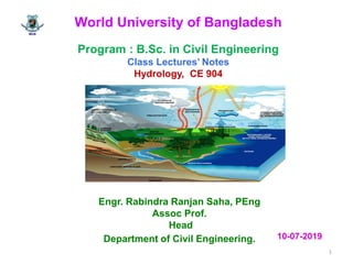
- 1. World University of Bangladesh Program : B.Sc. in Civil Engineering Class Lectures’ Notes Hydrology, CE 904 Engr. Rabindra Ranjan Saha, PEng Assoc Prof. Head Department of Civil Engineering. 1 10-07-2019
- 2. 2 Course Title: Hydrology Course Code : CE 904 Course Outlines Hydrologic cycle. Weather and Hydrology. Precipitation, Evaporation and Transpiration. Infiltration. Stream flow. Application of telemetry and remote sensing in hydrologic data acquisition. Rainfall runoff relations. Hydrographs, unit hydrographs. Hydrologic routing. Statistical methods in hydrology.
- 3. 3 World University of Bangladesh World University of Bangladesh Vision of World University of Bangladesh To create leadership who will make his/he brains as well as the tiniest factory capable of making enormous contributions to economic emancipation and social well being of Bangladesh. Mission of World University f Bangladesh To become a university of quality and distinction enabling students to flourish academically, personally, and socially through utilitarian education at an affordable cost. The academic programs of this university are continually being updated and improved to reflect the latest development in Engineering education. Vision of Civil Engineering Department To be an internationally renowned Civil Engineering Department for producing leader of the leaders who will contribute to economic emancipation as well as national development in the field of Civil Engineering Mission of Civil Engineering Department To advance engineering knowledge and learning through utilitarian education and research in the pursuit of fulfilling aspiration of the University and Nation
- 4. 4 Course Profile Course Title : Hydrology Course ID: CE 904 Rationale This course is intended for hydrologist, civil engineers, highways engineers and environmental engineers. After studying this course they will gain knowledge about the weather system and stream flow. It will also provide knowledge about the discharge measurement and the flow in the channel. Design of flood level and forecasting flood and flood routing. This course will also able them to (i) estimate water resources (ii) the study of processes such as precipitation, runoff, evapotranspiration and their interaction and (iii) study of problems such as floods and droughts and strategies to combat them. Outcomes At the end of this course, students will be able to 1. apply the hydrology and hydrological cycle, weather pattern and temperature; analyze carry out an assessment of rainfall runoff systems and measurement of precipitation 2. understand frequency analysis and planning issues for urban and rural drainage design, evapotranspiration, PET and stream flow measurement, hydrograph 3.ability to solve flooding problems, flood forecasting and flood routing. Table-1
- 5. 5 Unit Learning Outcomes Course content Teaching Learning strategy Assessment strategy Explai hydrology and its application. Illustrate hydrological cycle Differentiate between rainfall and runoff. Illustrate infiltration and Ø-Index Calculate Ø-Index Introduction, hydrology, hydrological cycle, weather and temperature, rainfall and runoff, infiltration Lectures, power point presentation, and feedback. Assignment, Examination and class presentation Elaborate and classify precipitation. List the methods of measuring precipitation Estimate evapotranspiration and PET List the methods of stream flow/ discharge measurement. Calculate stream flow/discharge Precipitation, evapotranspiratio n and PET, estimation, stream flow/discharge measurement Lectures, power point presentation, and feedback. Assignment, Examination and class presentation Course Profile(contd.) Table-1
- 6. 6 Elabortae flood and flood routing and hydrograph Illustrate flood routing method for forecasting flood. Analyze flood hydrograph. Hydrograph and unit hydrograph, flood, flood forecast, and flood routing, Lectures, power point presentation, and feedback. Assignment, Examination and class presentation Main References (1) Elizabeth M. Shaw, Hydrology in Practice (2) Hydrology for Engineers. by Ray K. Linsley. (3) Engineering hydrology by K. Subramanya Course Profile (contd.) Table 2: Course Outcome (CO) and Programme Outcome (PO) relationship Course Code PO CO PO 1 PO 2 PO 3 PO 4 PO 5 PO 6 PO 7 PO 8 PO 9 PO10 PO11 PO12 CE904 1 √ 2 √ 3 √
- 7. 7 Course Title: Hydrology Course ID: CE904 Rationale This course is intended for hydrologist, civil engineers, highways engineers and environmental engineers. After studying this course they will gain knowledge about the weather system and stream flow. It will also provide knowledge about the discharge measurement and the flow in the channel. Design of flood level and forecasting flood and flood routing. This course will also able them to (i) estimate water resources (ii) the study of processes such as precipitation, runoff, evapotranspiration and their interaction and (iii) study of problems such as floods and droughts and strategies to combat them. Outcomes At the end of this course, students will be able to 1. apply the hydrology and hydrological cycle, weather pattern and temperature; analyze carry out an assessment of rainfall runoff systems and measurement of precipitation 2. understand frequency analysis and planning issues for urban and rural drainage design, evapotranspiration, PET and stream flow measurement, hydrograph 3. ability to solve flooding problems, flood forecasting and flood routing. Lesson Plan
- 8. 8 Week Unit Learning Outcome Course content Teaching Learning Strategy Assessment Strategy 1 Program Outcome (PO), Vision, Mission, Objectives, CO-PO relationship Introduction, Description, Conclusion Explain hydrology; List the practical application of hydrology Describe hydrological cycle Hydrology and its application, hydrological cycle Lectures, power point presentation, and feedback. Assignment, Examination and Quiz and class presentation 2 Explain weather Describe different pattern of weather. Illustate the relation between weather and temperature Weather, weather pattern and temperature,Precipit ation, Lectures, power point presentation, and feedback. Assignment, Examination and Quiz and class presentation 3 Elaborate precipitation with its types. Describe the procedure of non recording rain gauge for measuring of precipitation. Solve example Precipitation, types of precipitation and rain gauge Lectures, power point presentation, and feedback. Assignment, Examination and Quiz and class presentation Lesson Plan(contd.)
- 9. 9 4 Describe rainfall runoff and infiltration Derive correlation between rainfall and runoff Estimate Ø-Index Rainfall, runoff, estimate rainfall and runoff, infiltration. Lectures, power point presentation, and feedback. Assignment, Examination and Quiz and class presentation 5. Illustrate wilting point, permanent wilting point, field capacity, Wilting point, permanent wilting point, field capacity Lectures, power point presentation, and feedback. Assignment, Examination and Quizand class presentation 6 List the methods to estimate evapotranspiration PET Eevapotranspiration, methods of measurement of evapotranspiration, PET Lectures, power point presentation, and feedback. Assignment, Examination and Quiz and class presentation 7 Solve problem on evapotranspiration and estimate the daily potential evapotranspiration (PET) using Penman’s equation Evapotranspiration, methods of measuring evapotranspiration, PET Lectures, power point presentation, and feedback. Assignment, Examination and Quiz and class presentation 8. Mid Term Examination Lesson Plan(contd.)
- 10. 10 9. List the different methods for measurement of stream flow Describe area velocity method. Solve example Stream flow/stage , stream flow/stage measurement Lectures, power point presentation, and feedback. Assignment, Examination and Quiz and class presentation 10. Explain hydrograph. with its elements. List the methods of base flow separation, describe straight flow method Hydrograph, elements, base flow separation Lectures, power point presentation, and feedback. Assignment, Examination and Quiz and class presentation 11. Describe DRH and effective rainfall hydrograph (ERH) Estimate the DRH for given stream flow Solve for effective rainfall DRH, Effective rainfall and problems Lectures, power point presentation, and feedback. Assignment, Examination and Quiz and class presentation Lesson Plan
- 11. 11 12 Describe unit hydrograph with assumptions. Derive DRH and ERH Unit hydrograph, weakness, Derivation of DRH from given unit hydrograph Lectures, power point presentation, and feedback. Assignment, Examination and Quiz and class presentation 13. Elaborate the methods for derivation of unit hydrograph for different durations. Solve problem for given hydrograph. Derivations of unit hydrograph of different durations with problems Lectures, power point presentation, and feedback. Assignment, Examination and Quiz and class presentation 14. Narrate flood and flood routing, Describe the hydrological channel routing for storage estimation - Muskingum Equation Floods, predictions of extreme flood values, flood routing Lectures, power point presentation, and feedback. Assignment, Examination and Quiz and class presentation Main References (1) Elizabeth M. Shaw, Hydrology in Practice (2) Hydrology for Engineers. by Ray K. Linsley. (3) Engineering hydrology by K. Subramanya Lesson Plan
- 12. 12 Course Title: Hydrology; Course Code: CE 904 Lecture-1 Hydrology :The term hydrology is from Greek word: hydōr, "water"; and logos, "study". The hydrology means the science of water. It is the science that deals with the occurrence, circulations and distribution of water of the earth and earth’s atmosphere. (i) estimation of water resources (ii) the study of processes such as precipitation, runoff, evapotranspiration and their interaction (iii) study of problems such as floods and droughts and strategies to combat them In general hydrology deals with
- 13. 13 Hydrological Cycle Definition: The various aspects of water related to the earth can be explained in terms of a cycle known as the hydrologic cycle. The various aspects of hydrologic cycle are Evaporation from water bodies Water vapor moves upward Cloud formation Condensation Precipitation Interception Transpiration Infiltration Deep percolation Ground water flow Lecture-1 (contd.)
- 14. 14 Hydrologic cyclic process The hydrological cycle is visualized as beginning with the evaporation of water from oceans. The resulting vapor is transported by moving air masses. Under the proper conditions, the vapor is condensed to form clouds, which in turn may result in precipitation. The precipitation which falls upon land is dispersed in several ways. Hydrologic cycle (contd.) Lecture-1 (contd.)
- 15. 15 Cloud Snow. ` Condensation Precipitation Interception Evaporation Transpiration Water Table Hydrologic cycle(contd.) Earth surface Ocean River Sun Lake Plants Figure 1-1: Hydrological cycle Cloud Lecture-1 (contd.)
- 17. 17 The greater part is temporarily retained in the soil near where it falls and is ultimately returned to the atmosphere by evaporation and transpiration by plants. Rainfall reaching the ground may collect to form surface runoff or it may infiltrate into the ground. The liquid water in the soil then percolates through the unsaturated layers to reach the water table where the ground becomes saturated, or it’s taken up by vegetation from which it may be transpired back into the atmosphere. The surface runoff and ground water flow join together in surface and rivers which may be held up temporarily in lakes but finally flow into the ocean. Water covers 70% of the Earth's surface. Hydrologic cycle(contd.) Lecture-1 (contd.)
- 18. 18 Applications (Practical use of Hydrology) Hydrology mainly used in connection with the design and operation of hydraulic structures Determining the water balance and agricultural water balance of a region Designing riparian restoration projects Mitigating and predicting flood, landslide and drought risk Real-time flood forecasting and flood warning Designing irrigation schemes and managing agricultural productivity Part of the hazard module in catastrophe modeling Providing drinking water Designing bridges, dams for water supply or hydroelectric power generation Lecture-1 (contd.)
- 19. 19 Weather and Hydrology The hydrologic characteristics of a region are determined largely by its geology and geography, climate playing a dominant part. The climatic factors of a region are the amount and distribution of precipitation the occurrence of snow and ice; effects of wind temperature, humidity on evapotranspiration and snow melt. Lecture-1 (contd.)
- 20. 20 Weather Definition: The state of the atmosphere , to the degree that it is hot or cold, wet or dry, calm or stormy, clear or cloudy is called weather. Most weather phenomena occur in the troposphere, just below the stratosphere refers, generally, to day-to-day temperature and precipitation activity. Climate The average atmospheric conditions over longer periods of time is called climate. Lecture-1 (contd.)
- 21. 21 Hydrology The study of the movement, distribution, and quality of water on Earth and other planets, including the hydrologic cycle, water resources and environmental watershed sustainability is hydrology. A practitioner of hydrology is a hydrologist, working within the field of earth or environmental science, physical geography, geology or civil and environmental engineering. Lecture-1(contd.)
- 22. 22 Solar and earth radiation Definition : Solar radiation is the electromagnetic radiation emitted by the sun often called the solar resource. Solar radiation is the earth’s principal source of energy, determines weather and climate. Both earth and sun radiate essentially as black bodies; i.e. they emit for every wave length almost the theoretical maximum amount of radiation for their temperature. Lecture-1 (contd.)
- 23. 23 The unit of radiation wavelengths is micrometers (μm) –10-6 m. Maximum energy of solar radiation is shortwave in visible range of 0.4 to 0.8 μm. Earth radiation is about 10 μm ( long wave). Solar constant : The rate at which solar radiation reaches the upper limits of earth’s atmosphere on a surface normal to the incident radiation and earth’s mean distance from the sun is called solar constant. Measurement have ranged from 1319 t0 1430 W/m2. 1374 W/m-2 is often used as solar constant. Lecture-1 (contd.)
- 24. 24 Measurement of radiation The instruments used for the measurement of the Intensity of radiant energy are : two types- Temperature The state of weather condition whether hot/cold/worm is temperature. The mean daily temperature : may be computed by several methods. The most accurate practical method is to average hourly temperatures. (1) Actinometer (2) Radiometer Lecture-1 (contd.)
- 25. 25 Temperature (contd.) Acceptably accurate results can be obtained by averaging 3-or 6hr. observations. In some countries, climatologically observations are made at hours selected to permit computation of acceptably daily means by a special formula. In the United States the mean daily temperature is the average of the daily maximum and minimum temperature. This yields a value less than a degree above the true average. Once-daily temperature are usually made about 7 am or 5 pm. Lecture-1 (contd.)
- 26. 26 The normal daily temperature is the average daily mean temperature for a given date computed for a specific 30-year period. The daily range in temperature is the difference between the highest and lowest temperature recorded on a particular day. The Mean Monthly temperature is the average of the mean monthly maximum and minimum temperatures The mean annual temperature is the average of the monthly means for the year. The Degree day is a departure of one degree for one day in the mean daily temperature from a specified base temperature. Lecture-1 (contd.)
- 27. 27 Water Vapor The gaseous state of liquid is called vapor. The amount of water vapor in the atmosphere is directly related to the temperature and thus, although lighter than air. Water vapor is restricted to the lower layers of the troposphere because temperature decreases with altitude. The water vapor also varies over the Earth’s surface according to temperature and is lowest at the poles and highest in Equatorial as a vapor pressure . Lecture-1 (contd.)
- 28. 28 The water vapor content or humidity of air is usually measured as a vapor pressure and the units are millibars (mb). Average water vapor values for latitude with temperature Climates (volume %) as shown in Table 1-1. Height (km) Water vapor Height (km) Water vapor 0 1.3 5 0.27 1 1.0 6 0.15 2 0.69 7 0.09 3 0.49 8 0.05 4 0.37 - 0.05 Lecture-1 (contd.)
- 29. 29 Saturation The maximum amount of water vapor in the air that can hold at its prevailing temperature is called saturation air. At typical temperatures near the ground , vapor pressure(ea) ranges from 5 to 50 mb (millibars). At any temperature T = Ta , saturation occurs at corresponding vapor pressure e = ea Dew Point (Td) Dew point is the temperature Td at which a mass of unsaturated air becomes saturated when cooled, with the pressure remaining constant. If the air at temperature Ta is cooled to Td , the corresponding saturation vapor pressure, ed represents the amount of water vapor in the air. Lecture-1 (contd.)
- 30. 30 Saturation deficit The difference between the saturation vapor pressure at air temperature (Ta ) and the actual vapor pressure represented by the saturation vapor pressure at Td the dew point is called Saturation deficit. The saturation deficit vapor pressure = (ea – ed) Lecture-1 (contd.)
- 31. 31 Precipitation The quantity of water falling to earth at a specific place within a specified period of time is called precipitation Canopy interception The precipitation that is intercepted by plant foliage(leaves of tree), eventually evaporates back to the atmosphere rather than falling to the ground. Runoff : The variety of ways by which water moves across the land surface runoff and channel runoff Infiltration: The flow of water from the ground surface into the ground Sublimation: The state change directly from solid water (ice/snow) to water vapor. Deposition: The state change directly from water vapor to ice. Lecture-1 (contd.)
- 32. 32 Advection: The movement of water- in solid, liquid or vapor states-through the atmosphere is advection. Without advection, water that evaporated over the oceans could not precipitate over the land. Condensation The transformation of water vapor to liquid water droplets in the air, creating clouds and fog. Transpiration The release of water vapor from plants and soil into the air. Lecture-1 (contd.)