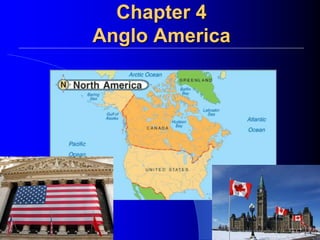
Chapter 4 Anglo America (US& Canada)
•Download as PPTX, PDF•
4 likes•2,693 views

World Geography Notes

Recommended
More Related Content
What's hot
What's hot (20)
Similar to Chapter 4 Anglo America (US& Canada)
Similar to Chapter 4 Anglo America (US& Canada) (20)
More from Minister Terron Brooks
Recently uploaded
Recently uploaded (20)
Chapter 4 Anglo America (US& Canada)
- 3. Topography of the US
- 4. Landforms
- 5. The North American Landscape Traveling from the East to West The Atlantic Coastal Plain is a narrow lowland extending from the northeastern United States into Florida. The Gulf Coastal Plain stretches along the Gulf of Mexico from Florida to Texas. West of the coastal plains are the Appalachian Highlands. The Appalachian Mountains are in this region. This major chain of mountains runs some 1,600 miles from Newfoundland to Alabama.
- 6. 6 Mountain Ranges Sierra Nevada, California. Rocky Mountains: stretch from Canada through the U.S. Appalachian Mountains: stretch length of U.S., from Georgia to Maine.
- 9. The Great Plains spread out west of the Mississippi River. It was flattened by an ancient Glacier. The Canadian Shield (an extension of this interior plain system) is a rocky, flat region that encircles Hudson Bay. West of the plains are the Rocky Mountains. The Rockies are a young and growing range that extends 3,000 miles from Alaska to New Mexico. Between the Rockies and the Pacific Ocean, a series of ranges run parallel to the Pacific coastline from California to Alaska. Major earthquakes occur in the vicinity of the Pacific ranges.
- 12. 12 Canadian Shield Glaciation. Tundra, subarctic climate. Stretches over half of Canada.
- 14. http://www.chrisimages.net/JPG Archive/Science Images/Great Plains/ www.fs.fed.us http://www.wmscnet.com/3506paneof10.jpg
- 17. Water Resources With access to three oceans and the Gulf of Mexico, both countries have important shipping and fishing industries. Inland, large rivers and lakes serve as sources of transportation, hydroelectric power, irrigation, fresh water, and fisheries.
- 18. Eight of the world’s 15 largest lakes are found in the United States and Canada.
- 19. The Mississippi River, part of the continent’s longest and busiest river system, runs almost the length of the United States. Canada’s largest river is the Mackenzie River, which is part of a river system that flows across the Northwest Territories to the Arctic Ocean. St. Lawrence Seaway is an important shipping route that connects the Great Lakes to the Atlantic Ocean.
- 26. 26 The Gulfs Gulf of Mexico: South, warm. Gulf of Alaska: North, cold.
- 28. 28 Great Salt Lake, Utah Transparent -- Clear, see to bottom. Less than 3 feet deep. 22% salt = 6 times more salty than oceans. Float instead of swim.
- 33. Natural Resources Both countries have vast forest resources. 1/3 of the United States is covered in forest. 1/2 of Canada is covered in forest.
- 34. The United States and Canada are both rich in resources. This has attracted immigrants and made both countries global economic powers. Both countries are large (Canada 2nd largest, US 3rd largest) and contain some of the most fertile soils in the world. Because of this, North America is the world’s leading food exporter. Abundant minerals and fossil fuels gave both countries the means to industrialize rapidly. Both countries have substantial deposits of coal, natural gas, and oil.
- 36. Shared Climates The Arctic coastlines of Alaska and Canada have a Tundra climate and vegetation. Winters here are long and bitterly cold. The land is a huge, treeless plain. Much of the rest of Canada and Alaska have a Subarctic climate, with very cold winters and short, mild summers. Needle-leafed evergreens cover the region. The Rocky Mountains and the Pacific ranges have Highland climates. Temperature and vegetation vary with elevation and latitude.
- 37. Shared Climates Northern portions of the United States and much of southern Canada have a Humid Continental climate. The four season climate attracts large populations. The Pacific coast from northern California to southern Alaska has a Marine West Coast Climate. This climate is affected by Pacific Ocean currents and the coastal mountains. Vegetation includes deciduous trees, needle-leafed evergreens, and giant California redwoods.
- 38. Warmer American Climates The southern states have a Humid Subtropical climate. Moist air from the Gulf of Mexico brings rain. The combination of mild temperatures and adequate rainfall provides a long growing season for a variety of crops. The Great Plains have a Steppe Climate. The weather is dry, with only about 15 inches of rain annually. The southwestern states have a Desert Climate, with less than ten inches of rain each year.
- 39. The central and southern coasts of California have a Mediterranean Climate. The islands of Hawaii have a Tropical Wet Climate that supports lush rain forests. Southern Florida has a Tropical Wet and Dry Climate. It is always warm, but has wet and dry seasons.
- 41. Crossing the Distances When Europeans came, they set up colonies along the Atlantic Coast and then moved inland. They created overland trails and used inland waterways. To connect bodies of water, they built a network of canals. North America’s most important deepwater shipping route—the St. Lawrence Seaway —connects the Great Lakes to the Atlantic Ocean using a series of locks. Locks are sections of a waterway with closed gates where water levels are raised or lowered.
- 42. Railroad building began in North America in the early 19th century. The first transcontinental railroad, crossing the United States, was completed in 1869. A trans- Canada railroad was completed in 1885. The development of the automobile in the early 20th century spurred road building. Today, both the United States and Canada have national highway systems. The United States has more than 4 million miles of road.
- 43. Urban Planning Most large cities have a moderate climate and located are near water and resources. Cities with favorable geography must deal with large populations and urban sprawl. While cities without must adapt to their conditions.
- 44. Montreal, Quebec is Canada’s second largest city and a major port, even though its temperature is below freezing more than 100 days each year. Early French explorers liked Montreal’s location— on a large island where the St. Lawrence and Ottawa rivers meet. The French built a permanent settlement there in 1642. The community was founded at the base of Mount-Royal and grew by spreading around the mountain. Because of the city’s severe winters, large areas of Montreal have been developed underground. The Hoover Dam is a Hydroelectric Dam on the Nevada-Arizona border. The dam has helped with irrigation and provided power for cities like Las Vegas, the fastest growing city in the United States.
- 45. Los Angeles had a mild climate and a desirable location on the Pacific Coast. People began pouring into this once small Spanish settlement in the 20th century. By 1990, Los Angeles had the second largest population in the United States. However, rapid population growth meant air pollution, inadequate water supplies, and construction on earthquake-threatened land.
- 46. Humans have impacted North America through over use. Decades of extensive farming damaged the Great Plains. This combined with severe drought brought about the Dust Bowl of the 1930’s.
- 49. Tornadoes Per Year: 1950-2007
- 50. Hurricanes "Hurricane Katrina in 2005 was the largest natural disaster in the history of the United States. Preliminary damage estimates were well in excess of $100 billion, eclipsing many times the damage wrought by other hurricanes making landfall in the U.S. Over 2,000 people lost their lives.
- 51. Droughts More than 700 reservoirs capture flow in major river basins, bringing water to places that could not otherwise be populated – such as Las Vegas & San Diego – for agricultural purposes. The growing urban populations of California use more than 2,500 millions gallons of water per day. This demand coupled with climate change has resulted in one of the worst droughts since the Dust Bowl.
- 52. Floods Floods occurred due to prolonged periods of precipitation causing waters to rise and overflow the river’s bank. Since 1900, floods have taken more than 10,000 lives in the U.S. In 1993, the Mississippi River and the Missouri River flooded approximately 20 million acres across the U.S. Midwest costing upwards of $30 billion.
- 53. Human Geography of Anglo America
- 55. U.S. Population 313,818,286 ♦One birth every 8 seconds. ♦One death every 13 seconds. ♦One international migrant (net) every 22 seconds. ♦Net gain of one person every 10 seconds.
- 56. People – 5% of Earth’ population live in the U.S and Canada US = 300 millionCanada = 33 million – All are immigrants Native Americans thousands of years ago Waves of Europeans/Asians/Africans in past 400 years – Sought political/religious freedom – Improved economic opportunity – Enslaved Africans
- 57. Population Density and Distribution – US and Canada are vastly different US = 78 people per sq mi. Canada = 8 per sq. mi. – Canada 90% live along US border Rugged terrain and brutal climate make most of Canada inhospitable to human inhabitation
- 58. Population Patterns Population Density and Distribution – US and Canada are vastly different US = 78 people per sq mi. Canada = 8 per sq. mi. – United States Population Centers – Northeast and Great Lakes – Pacific Coast – Sunbelt Sparsely populated areas – Alaska – Great Basin and Great Plains
- 59. – US and Canada have experienced urbanization The concentration of population in cities – Jobs, education, health care and cultural opportunities draw people to cities – Metropolitan areas = city with +50,000 people and its outlying communities called suburbs 80% of the U.S.
- 60. Coastal Cities – People tend to live along the ocean coast – Megalopolis – “great city” • Combines Boston-New York-Philadelphia-Baltimore- Washington DC • Over 42 million residents – Other coastal cities include: Miami, New Orleans, Houston, Los Angeles, Vancouver • All are major port cities
- 61. Inland Cities – People tend to live along inland lakes and rivers as well – Great Lakes and St. Lawrence River Cities • Quebec, Montreal, Ottawa, Toronto, Buffalo, Cleveland, Detroit, Milwaukee, Chicago – Mississippi River System Cities • Winnipeg, Minneapolis, St. Louis, Pittsburgh, Cincinnati, New Orleans, Memphis, Nashville – Other inland cities grew from being commercial hub • Kansas City, Dallas, Atlanta, Charlotte, Calgary, Edmonton, Phoenix, Oklahoma City, Las Vegas
- 63. •Both Canada and the US are multicultural societies. •Canadians speak both French and English. •Both have religious freedoms •Both are mobile societies – automobiles. •High SOL (average income $35,000 a year).
- 66. Sports and Recreation •Football (American and Canadian) •Ice Hockey •Baseball •Soccer •Basketball
- 67. The United States: History
- 68. Britain’s 13 American colonies began to resent policies forced on them by a distant government. Their protests led to the American Revolution (1775–1783) and the founding of the United States of America. The U.S. Constitution was adopted in 1787. The United States: History
- 69. 69 In 1803, the United States nearly doubled in size when the government purchased from France the vast plains region between the Mississippi River and the Rocky Mountains. This territory became known as the Louisiana Purchase. The United States: History
- 70. 70 Sectionalism began growing. People placed loyalty to a region above loyalty to the nation. Rising political and economic tensions between an agricultural South and a more industrialized North led, to the Civil War (1861-1865). The United States: History
- 71. The second half of the 19th century saw Westward Expansion, pioneers headed west in covered wagons. To make way for white settlers, the U.S. government removed Native Americans from the land by treaty or by force. When the transcontinental railway was completed in 1869, railroads brought people to the West and western cattle and products to markets in the East. The United States: History
- 72. Urbanization – the movement of people into cities. Some of the new immigrants headed out West. Others settled in rapidly growing and industrializing urban areas. Americans from rural areas also came to cities to work. The United States was being transformed from a rural, agricultural nation to an urban, industrialized one. Industrialization – transition from an agricultural society to one based on industry Industrial Revolution (Early 1900s) Steam Power Diesel Machinery Electricity The United States: History
- 73. The United States was seen as an isolationist country (avoid conflict not directly related to territorial self defense) by many because of its slow entry into the conflict in Europe during WWI & WWII. World War I: 1914-1919. The United States had a healthy economy despite going through the Great Depression and Dust Bowl during the 1930s. World War II: 1939-1945. When World War II ended in 1945, the United States was the only major nation that had escaped physical damage. The United States: History
- 74. The United States had teamed up with the Soviet Union to defeat Germany, but when the war ended distrust between the two allies led to the cold war. Cold War - was the period of conflict, tension and competition between the United States and the Soviet Union 1940’s until the 1990’s. There was never a direct military engagement between the U.S. and the Soviet Union, but there was half a century of military buildup, and political battles for support around the world The United States: History
- 75. 75 During the Cold War the United States played an active role in trying to contain the spread of communism. A major political topic today is how best to deal with the threat of Terrorism. The United States: History
- 76. During the last half of the 20th century, Americans experienced prosperity. Many people began migrating from cities to surrounding suburbs. The civil rights and women’s rights movements worked for equality. Immigrants from Latin America and Asia arrived looking for political stability and economic opportunities. The United States: History
- 78. People from Asia crossed a land bridge into North America thousands of years ago. Some remained in what are now the Canadian Arctic and Alaska. These people were ancestors of the Inuit, or Eskimos. The earliest Canadian literature was the oral tradition of First Nations peoples. Early visual art included Inuit carvings and the totem poles of the First Nations peoples of the West Coast. Later, European settlers influenced the literature and artistic traditions. History of Canada
- 79. In 1497, John Cabot landed in Newfoundland and claimed the region for England. Then, during the 16th and 17th centuries, French explorers claimed much of North America for France. To both countries, the coastal fisheries and the inland fur trade were important. Soon, the French and British challenged each other’s territorial claims. Britain defeated France in the French and Indian War, 1754 to 1763, forcing France to surrender its territory. But French settlers remained. History of Canada
- 80. By the end of the 18th century, Canada had become a land of two distinct cultures—Roman Catholic French and Protestant English. In 1791, the British government split Canada into two provinces. Upper Canada (later, Ontario) had an English-speaking majority, while Lower Canada (later, Quebec) had a French-speaking population. History of Canada
- 81. In 1872, the government began construction of a transcontinental railroad. In 1885, the main railway line, from Montreal to Vancouver, was completed. When gold was discovered in the Yukon, fortune hunters from around the world headed to Canada. Not long after, copper, zinc, and silver deposits were found, prompting the building of new railroads and towns. At the same time, immigrants from other parts of Europe were coming to Canada. For much of the time after settlement, Canadians had lived in rural areas and engaged in farming. But as population grew and natural resources were developed, Canada became increasingly urban and industrial. History of Canada
- 82. Government
- 83. One of the strengths of the United States is the political system created by the U.S. Constitution, adopted in 1787. The United States is a representative democracy, where the people rule through elected representatives. Amendment – in U.S. history, official changes made to the Constitution. Bill of Rights – the first 10 amendments to the United States Constitution. U.S. Government
- 84. Canada was recognized as an independent nation by Britain in 1931. However, Canada’s symbolic head of states remains the British monarch. Canada has a parliamentary government, a system where legislative and executive functions are combined in a legislature called a parliament. The majority party’s leader becomes prime minister. Canada’s Government
- 85. Economics
- 86. Three factors have contributed to the overall success of the American economy—an abundance of natural resources, a skilled labor force, and a stable political system that has allowed the economy to develop. The economy is run largely on free enterprise. Private individuals own most of the resources, technology, and businesses and can operate them with little government control. The government places some regulations on companies to protect the Market System such as law declaring monolopies illegal. Monopoly – total control of a type of industry by one person or one company. The U.S. Economy
- 87. The United States not only feeds itself but also helps to feed the world. The industrial output of the United States is larger than that of any other country in the world. The American economy today is driven by service industries. Three out of four Americans now work in service-related jobs. This economic phase is called a post- industrial economy. The U.S. Economy
- 88. The United States is the world’s major trading nation, leading the world in the value of its exports and imports. Many American corporations engage in business worldwide and are called multinationals. Still, the U.S. has a trade deficit (spending more money on imports than earning on exports). This is due to the high cost of American goods and the tariffs (taxes) placed upon them. The U.S. Economy
- 89. No other country exports more wood pulp and paper products than Canada. Mining is a major industry because of Canada’s extensive mineral deposits. Three ocean coastlines provide Canadians with an abundance of fish, and Canada exports more fish than any other country. Like the US, Canada has a modern post- industrial economy where most of its citizens make their living in service industries. Canada’s spectacular natural beauty has made tourism one of the fastest growing of the service industries. Canada’s economy has always relied on trade. In 1994, Canada and the United States, along with Mexico, signed the North American Free Trade Agreement (NAFTA). Canada’s Economy
- 90. 90 NAFTA (North American Free Trade Agreement) was created to facilitate trade between Canada, The United States, and Mexico. Canada is the United States biggest trading partner. NAFTA
- 91. Regions
- 92. The region’s coastal and inland waters turned it into the heart of trade, commerce, and industry for the nation. The Northeast is one of the most heavily industrialized and urbanized areas in the world. Coal, iron ore, and oil fueled industrialization. Traditional industries still play a role in the region’s economy, but most Northeasterners are now employed in manufacturing and service industries. The U.S. Northeast
- 93. The U.S. Northeast I. Geopolitical Locations: 1. New York 2. Boston 3. Philadelphia *Most densely populated region in US. II. Climate: Humid Continental 4 distinct seasons Freezing cold winters Hot steamy summers III. Vegetation Mixed forests, deciduous, coniferous
- 94. New York, New York! • Shaped by immigration, industrialization, and urbanization. • IMMIGRATION: movement of people. • INDUSTRIALIZATON: use of machines for manufacturing goods. • URBANIZATION: growth & concentration of people living in cities. • One of the first cities of importance in the U.S. • Melting pot of U.S. • Economic center of U.S., & the world.
- 95. Boston: The Hotbed of Revolution • Oldest U.S. cities. Puritans founded in 1630. • Boston Massacre, 1770. • Boston Tea Party, 1773. • Battle of Bunker Hill, 1775. •Industrialization, 1890s. • Fishing, Maritime activities. • Urban renewal program, 1957. • Today, vital economic and medical sectors of U.S. • Has one of the highest standard of living in U.S.
- 96. Philadelphia: The Birth of Liberty • Founded in 1682. • Declaration of Independence signed, 1776. • U.S. Constitution signed, 1787. •Home of the Liberty Bell. • Destination for Irish immigrations, 1840s. • Manufacturing giant in early years of industrialization. • Production of coal, steel. • Led to region being known as The Rust Belt. •Today, shifted to economic and technology.
- 97. The South is often referred to as the “sunbelt” because of its climate. Agriculture was the South’s first economic activity, and cotton, tobacco, fruits, peanuts, and rice are still grown there. Livestock production is important, too. The introduction of air conditioning in the 1950s and the region’s vast stores of energy resources encouraged industrialization. In recent times, the South has attracted many manufacturing and service industries. The U.S. South
- 98. The U.S. Southeast I. Geopolitical Locations 1. Jamestown 2. Charleston 3. New Orleans 4. Houston *Wide coastal plain. No dry season. II. Climate: Humid Subtropical Mild winters Hot summers Gulf of Mexico. III. Vegetation Mixed forests, swamp, everglades.
- 99. Charleston, SC: The South’s First Port Jamestown, VA: The First Settlement
- 100. New Orleans, LA: The Big Easy Bought from Napolean (France) in 1803. Louisiana Purchase doubled size of U.S. Major port THEN and NOW for U.S.
- 101. Houston, Texas • Home of the fourth largest city in U.S. • Pre-Civil War: Agriculture (cotton), slavery. • Confederate. • Post-Civil War: Agriculture, fishing. •Today, oil & gas exploration is BIG business.
- 102. The U.S. Midwest Because of its central location, the Midwest is called the American heartland. Vast, largely flat plains are a distinctive feature of the region. So are numerous waterways, including the Great Lakes and the Mississippi River. The Midwest is the nation’s “breadbasket.” Fertile soil, adequate rainfall, and a favorable climate enable Midwesterners to produce more food and feed more people than farmers in any comparable area in the world.
- 103. The U.S. Midwest I. Geopolitical Locations 1. Chicago 2. Kansas-Nebraska * “Breadbasket of America” II. Climate: Humid Continental 4 distinct seasons Freezing cold winters Hot steamy summers III. Vegetation Mixed forests, deciduous, coniferous
- 104. Chicago Skyline: The “Second” City • Established 1833. Population: 200. • Today, third largest U.S. city. • Growth result of immigration, Great Lakes, & the Mississippi River. • Manufacturing, railroad, labor unions. • Home of Stephen Douglas, Abraham Lincoln, Barack Obama.
- 105. The U.S. West Some areas are sparsely settled, but California is the nation’s most populous state, because of excellent farmland, good harbors, and a mild climate. The West is the most rapidly growing region in the United States. The region’s growth was helped by the introduction of air conditioning and by irrigation.
- 106. The U.S. West I. Geopolitical Locations 1. Los Angeles 2. Hollywood 3. Seattle 4. Portland 5. Hoover Dam Hydroelectric powerplant located on borders of Nevada-Arizona. Supplies irrigation / electricity to western cities such as Las Vegas. 6.NATURAL HAZARDS! II. Climate: MULTIPLE Highlands: Mountain ranges. Climate changes with elevation. Steppe/Desert (Arid/semiarid): Winters pleasant with little rain. Summers are hot and dry. Marine West Coast (Pacific): Rainy winters. Warm, drier summers. Tropical climates: Hawaii. III. Vegetation: Varies with Climate
- 107. Los Angeles: The City of Angels? •1847: U.S. territory following U.S. win of Mexican-American war. •Major port and railroad connects West-to-East. •Beginning of film industry. •Today, second largest city in U.S.
- 108. Hollywood: City of Lost Dreams
- 109. 109 Seattle, WA Portland, OR •Oregon trail. •Timber, fishing. •Pacific, west coast marine. •Today, urban center. •Economies: Range from agriculture (inland) to timber (mountain) to hi-tech industries (cities). •Gold rush. •Port, shipbuilding, lumber. •Pacific, west coast marine. •Today, urban center. •Economies: Range from timber (mountain) to hi-tech industries (cities) & development of “green” energy.
- 110. Second largest country in the world. Shares over 5,000 miles of border with the U.S. 90% of Canada’s population lives within 100 miles of the U.S.-Canadian border. 1/3 of Canada’s population lives in Toronto, Montreal, & Vancouver. Canada’s Facts
- 111. Ottawa: Canada’s Capital • 1857: Queen Victoria declares Ottawa to be the capital of Canada. • Humid Continental climate. 4 distinct seasons! • Urban center with outlying suburbs. Fourth largest city in Canada.
- 112. 112 Canada’s Northwest Territories Directly east of the Pacific Provinces lie the Northwest Territories, which extend into the Arctic. Nunavut was carved out of the eastern half of the Northwest Territories in 1999.
- 113. Canada’s Northern Territories • Yukon, Northwest, Nunavut. •Major towns: Whitehorse, Yellowknife & Iqaluit. • MacKenzie River is Canada’s largest river and flows into the Arctic Ocean. •Sparsely populated. Rural. •Subarctic & Tundra climates. •Economy fueled by vast amounts of natural resources: •Minerals: nickel, copper, uranium mining. •Forestry / pulp manufacturing. •Hydroelectric energy.
- 114. Eastern Canada is the location of the four Atlantic Provinces—Prince Edward Island, New Brunswick, Nova Scotia, and Newfoundland. The Atlantic Provinces are home to just eight percent of Canada’s population. The small population is due largely to the provinces’ rugged terrain and severe weather. Fishing and logging are important in all four provinces. In Nova Scotia, shipbuilding and trade provide more employment and revenue. And Newfoundland’s hydroelectric-power resources supply power to Quebec and parts of the northeastern United States. Canada’s Atlantic Provinces
- 115. Newfoundland, New Brunswick, Nova Scotia, & Prince Edward Island. St. Lawrence River connects the inner portions of southern Canada to the Atlantic Ocean using LOCKS. Humid Continental climate. – 4 distinct seasons. Resources/Economy: – Fishing / fish harvesting. Vegetation: Mixed forests. – Coniferous and deciduous. Canada’s Maritime (Atlantic) Provinces
- 116. The Prairie Provinces — Manitoba, Saskatchewan, and Alberta—are part of the Great Plains of North America. They are the center of Canada’s agricultural yield, responsible for 50% of the nation’s agricultural production. In addition, about 60 percent of Canada’s mineral output comes from this region. Alberta itself has the nation’s largest known deposits of coal and oil and produces 90% of Canada’s natural gas. Canada’s Prairie Provinces
- 117. 117 Manitoba, Saskatchewan, & Alberta. Urban centers: Edmonton, Calgary, Winnipeg. Steppe climate. Arid/semi-arid or dry. Economy: Farming (wheat), petroleum, coal. Canada’s Prairie Provinces
- 118. Canada’s westernmost province is British Columbia. Nearly all of it lies within the Rocky Mountains range. Over half of the land is densely forested, and nearly one-third is frozen tundra, snowfields, and glaciers. This is the location of British Columbia’s two largest cities, Victoria and Vancouver. The economy is built on logging, mining, and hydroelectric- power production. The Yukon Territory lies north of British Columbia and is largely unspoiled wilderness. Canada’s Pacific Provinces
- 119. 119 Vancouver, British Columbia. 1/2 the Province’s population lives in Vancouver. Marine West Coast climate. Economy: Tourism, financial investment, and technology. Canada’s Western Province Vancouver British Columbia
Editor's Notes
- Jamestown: First colony, founded to make money, unsuccessful. Geography: swampy, mosquitos, disease, died. Charleston: First southern port of U.S., used to transport goods. Plantations, slavery. SC first state secede, ALincoln elected. Confederate, Civil War, 1860s. Today, one most important ports for U.S., navy.