MULTIDISCIPLINRY NATURE OF THE ENVIRONMENTAL STUDIES.pptx
earthquake.pptx
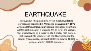
1. EARTHQUAKE
Throughout Philippine history, the most devastating
earthquake happened in Mindanao on August 17, 1976
when an 8.0-magnitude earthquake took place near Sulu.
A little past midnight, it was also felt as far as the Visayas.
This was followed by a massive 4 to 5-meter high tsunami
that covered 700 kilometers of coastline bordering the
island. This calamity claimed 8 000 lives, injured 10 000
people, and left 90 000 homeless.
2. EARTHQUAKE
Today, the Philippine Institute of Volcanology and
Seismology (PHIVOLCS) has confirmed that the “Big One”, a
disastrous earthquake with approximately 7.2 magnitude, is
inevitable and might happen anytime because of irregular
movements in the West Valley Fault. It is expected to
happen three to four years from now. At the event of its
occurrence, a large area of Luzon would be affected and
could cause around 34 000 deaths and 114 000 injuries
because of building collapse.
3. EARTHQUAKE
An earthquake is a natural fast shaking of the lithosphere
caused by the release of energy stored in rocks.
It can also be caused by the movement along faults, a
breakage found in Earth’s crust, or by the movement of magma
within the lithosphere.
A volcanic eruption is another possible cause of earthquakes.
4. EARTHQUAKE
During an earthquake, the potential energy stored in the rocks
is given off as seismic waves, or earthquake waves.
A seismic wave is a wave that travels through the earth.
From Earth’s surface, seismic waves carry an earthquake’s
energy away from the focus, which is the origin from which the
waves are emitted in all directions.
5. EARTHQUAKE
The location on Earth’s land or water surface that is directly
above the focus is called the epicenter.
Epicenters may be frequently seen plotted on maps of surface
during an earthquake event.
6. EARTHQUAKE
Seismologists measure and record earthquake waves by using
a seismograph.
It is an instrument that shows how the earth shakes from the
seismic waves.
A seismograph also records on paper the wiggles or
amplitudes of the wave that represent Earth’s shaking.
The recorded wiggle on paper is called a seismogram.
7. Types of Seismic Waves
A. Body waves
1. Compression waves, or primary waves (P-waves)
2. Shear waves, or secondary waves (S-waves)
B. Surface waves
1. Love waves (L-waves)
2. Rayleigh waves
8. Types of Seismic Waves
A. Body waves
are very fast seismic waves that move through or inside
the earth. They are considered as the most damaging type of
seismic waves and can be classified into two-the compression
waves and the shear waves.
9. 1. Compression waves, or
primary waves (P-waves),
travel the fastest and pass
through rocks or liquids.
2. Shear waves, or secondary
waves (S-waves), travel more
slowly and can travel only in
solids.
10. Types of Seismic Waves
B. Surface waves
are very slow, long waves that move along the surface of
Earth. They produce rocking movements that cause only little
damage on structures. The Love wave and the Rayleigh wave
are considered as types of surface waves.
11. 1. Love waves (L-waves) move
horizontally along the
surface, causing a side- by-
side movement.
2. Rayleigh waves are seismic
waves that cause the surface to
roll like the ocean
waves.
12.
13. A lithosphere is the rigid,
outermost rocky shell of a terrestrial
planet or natural satellite.
On Earth, it is composed of the
crust and the portion of the upper
mantle that behaves elastically on
time scales of up to thousands of
years or more.
14. In geology, a fault is a planar fracture or discontinuity in a volume of
rock across which there has been significant displacement as a result
of rock-mass movements.
15. The focus of an earthquake is a location at some
depth in the earth where seismic wave radiation
begins.
16. The epicenter in seismology is the point on the Earth's surface directly
above a hypocenter or focus, the point where an earthquake or an
underground explosion originates.
17. seismograph - an instrument that measures and
records details of earthquakes, such as force and
duration.
18. A seismogram is a graph output by a seismograph. It is a record of the
ground motion at a measuring station as a function of time.