SWaRMA_IRBM_Module6_#4, Sediment management including landslide and river bank erosion, Keshar Sthapit
•
1 like•212 views

This presentation is the part of 12-day (28 January–8 February 2019) training workshop on “Multi-scale Integrated River Basin Management (IRBM) from the Hindu Kush Himalayan Perspective” organized by the Strengthening Water Resources Management in Afghanistan (SWaRMA) Initiative of the International Centre for Integrated Mountain Development (ICIMOD), and targeted at participants from Afghanistan.

Recommended
Recommended
More Related Content
What's hot
What's hot (20)
Similar to SWaRMA_IRBM_Module6_#4, Sediment management including landslide and river bank erosion, Keshar Sthapit
Similar to SWaRMA_IRBM_Module6_#4, Sediment management including landslide and river bank erosion, Keshar Sthapit (20)
More from ICIMOD
More from ICIMOD (20)
Recently uploaded
Recently uploaded (20)
SWaRMA_IRBM_Module6_#4, Sediment management including landslide and river bank erosion, Keshar Sthapit
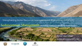
- 1. Strengthening Water Resources Management in Afghanistan (SWaRMA) Sedimentation Management (including Landslide and River bank Erosion) Keshar Man Sthapit keshar.sthapit@gmail.com
- 2. Household Irrigation Hydro-power Industry Forestry River Transportation Multi Stakeholder of Water Resource! Livestock Tourism Holistic Management of Water Management is essential in fulfilling Water needs of Multi Stakeholders!
- 3. Watershed Area: Dominated by Detachment Zone Valley Area: Dominated by Transportation Zone Plain Area: Dominated by Depositional Zone Understanding Upstream – Downstream Linkage
- 4. Upstream and Downstream Linkage in Small Scale (Landslide): Upstream/Valley/Valley Contributing Area Dominated by Detachment Zone Valley Area Dominated by Transportation Zone Downstream Area Dominated by Depositional Zone
- 5. Nature’s law • Water erosion at high elevation and sedimentation at low elevation • Watershed degradation produce sediment, transported through valley and deposit downstream. • Sediment and runoff are the energy of the river writing its own course. • Sediment load Reduces River capacity to accommodate the runoff thus cause the flooding, and • Sediment Deposition Makes the river shift and meander • to distribute the sediment downstream and accommodate runoff.Why do you think the river shift and meander?
- 6. Reason for Shifting of Koshi River Annual Sediment = 128 million cu. m. Annual Av. Runoff = 52,700 million cu. m. Observed at Chatara in Nepal Koshi Basin in Nepal 1300 sq. km in Nepal 7800 sq. km in India Displaced 6.5 million population (H.C, Reiger, 1976) Koshi River Shifted 110 Kilometers from East to West from 1731 to 1975
- 7. What we do in the Afghan watershed?
- 8. What we do in the Watershed will have downstream impacts!
- 9. Guiding Principles of Sediment Management • Therefore, Sedimentation management plays important role in the integrated river basin management. • Three Guiding principles to Manage Sediment: • Reduce Sediment Production from the watershed • If the sediment is produced, try to Hold sediment where it is produced i.e. in the watershed itself • If the sediment is produced, Manage it in the downstream without or with less environmental damage
- 10. Reduce Sediment Production • Foremost important principle of the sediment management is to reduce the sediment production from the watershed. • Reduce the soil erosion in the watershed by applying proper soil and water conservation practice while using land and water • How can we reduce Soil erosion from the watershed?-Key Issue • Before we discuss, it is better we need to Refresh or Understand what is soil erosion?
- 11. We define / understand Erosion as: Process of detaching the soil particles by erosive agents such as water, wind and gravity from the land's surface of one place and it's transportation to another place for deposition. detaching transportation deposition
- 12. Soil 1. Detach 2. Transport 3. Deposit Rain Drop Rain Fall
- 13. Soil Erosion Process consists of Process at micro level Impact at macro / landscape level 3) Deposition 2) Transportation 1) Detachment
- 14. How can we reduce sediment production from the watershed? • Any land use practices that reduce the soil detachment from its place is the first step in reducing the soil erosion. • More the soil disturbed, More will be the erosion. • Tillage detach the soil from its place, but without tillage we can not grow crops. • Conservation tillage or minimum tillage operation in the agriculture is one major technique used in the agriculture to reduce the soil detachment.
- 15. Contour Trenches – A Key Technique used in Afghanistan How can we reduce sediment from Contour Trenches? • Construction of contour trenches to hold the water in the watershed does produce a lot of sediment because of significant soil disturbance while constructing the trenches. • Where contour trenches are practices, most of the trenches down below are filled with the fine sediment produces from trenches above. • Also, the check dams constructed in the gullies are filled with sediment produced from the trench digging.
- 16. Vegetation coverage plays important role in reducing sediment • The runoff study in Nepal indicated that in the lack of vegetation cover • During pre-monsoon (March to June), even though rainfall is less than 30% of the annual rainfall, • Annual soil loss contributed 60% of the annual soil loss
- 17. Promotion of Vegetation covering soil – Key Technique to reduce sediment production
- 18. Techniques to promote the Greenery in the Dry Area Contour Trench Water harvesting pond Spring Runoff Water Harvesting Mulching/PitcherMulching Pitcher Irrigation Efficient Water Utilization Promoting Greenery
- 19. Hold sediment where it is produced! • Growing crops, planting trees and carrying out any development, soil need to be disturbed or dug, which helped first step of soil erosion. • Soil disturbance is inevitable for our survival and development! • Now the question is • How the disturbed soil can be held in place, where it is disturbed. • Second step of sediment management is holding the soil where it is disturbed.
- 20. How could disturbed soil be held where it is produced? • Providing protective coverage • By providing vegetative coverage • Structural coverage such as vegetative stone rip-rap • Reducing carrying capacity i.e. transportation capacity of the eroding agents. • By Slope correction / Terracing • Hedge row planting across the slope Trapping Sediment • Contour ploughing and planting and strip cropping are also agronomic techniques of holding sediment where it is produced. • Check dams construction
- 21. How can disturbed soil could be held in where it is produced? • Water management by • Increasing infiltration and Reducing runoff through water harvesting in ponds • Obstructing the flow through hedgerows / contour trenches • These techniques help in holding sediment in the watershed. Conservation Hedge rows Contour trenches
- 22. Management of sediment downstream • No matter how much less soil is disturbed, and • How much sediment is held in the watershed • There will be some sediment coming down from the watershed in the valley and plain. • Key issue is • How and where these sediments could be managed minimizing downstream environmental degradation • and • Use these sediments for the betterment of the environment and economic returns.
- 23. Trapping Sediment through Dam Construction • Trap sediment and use as appropriate • If the sediment is Good sand use it for the construction. • If the sediment is Good soil spread it over agriculture field. • Mostly Sediments is just good as filling materials. • Proper use of sediment could be an economical incentive for construction of sediment trapping dam apart from reducing environmental damage.
- 24. Spreading Sediment • Irrigation system is built to distribute the water for growing crops and vegetation. • Designed the irrigation system to distribute the sediment uniformly • Spreading flood water through construction of appropriate structures • Spreading Flood Water also distributes the nutrients coming from the watershed to maintain the fertility of the plain area. • “Layers of silt deposited by rivers every year are essential for jute cultivation in Bengal. • Floods in the Nile too are also welcomed (by the people) • In summary, what is needed is watershed management in the Sedimentation Management
- 25. Watershed Management is Nothing But! Putting the cap throughout the watershed area with Conservation Measures (Mainly Vegetation)!!
- 26. Amu River: Stream Bank Erosion and Sedimentation – Key Problems
- 27. • When Kulekhani watershed area observed more than 500 mm of rain in 24 hours (19-20 July 1993), • 1 Ha. of watershed contributed 415 cu. m. sediment • Numerous landslides and stream bank erosion are the main contributor of the sediment. Sediment Contribution
- 28. Stream Bank Erosion main source of sediment
- 29. Toe of the Slope! Common techniques to support the falling house! Mark how a small wooden peg is supporting poles and the pole holding house! If this peg is removed Whole House will collapse!
- 30. When slope cutting disturb the toe of the slope it triggers the slope failure
- 31. Toe of the Slope Toe protection of slopes can greatly reduce the sedimentation downstream!
- 32. Nature’s Law: If slope angle is greater than the Angle of Repose, slope fails! Why slope once stable fails?What do you see?
- 33. Angle of Repose Stable Angle maintained by Land Surface in Nature (when heaped up on a platform)
- 34. Angle of Repose • Angle of repose changes depending upon underlying Materials, Moisture condition, and Conservation status • With weathering: Underlying material changes • With Rain: Moisture status change • With Human Activities: Conservation Status changes • So once the materials, moisture and conservation status change the slope has to change to come to stable position again. With rain moisture status changes, so the slope once stable failed as moisture status changed with Rain. What we have to do to reduce slope failure is understand Angle of repose of the slope and Apply Conservation Measures accordingly!
- 35. Reducing Slope Failure • Generally, underlying material could not be replaced to increase stability! • Controlling the rain to control moisture is not a pragmatic approach. • However, • Draining the moisture out of the slope through piping and improving the drainage could be done effectively. • Construction of diversion drainage to avoid moisture concentration on the slope. • Only way out is apply appropriate / pragmatic conservation techniques to strengthen the angle of repose
- 36. • Different Technique are used to strengthen the angle of repose • Mainly Through • Providing vegetative coverage to the slope, • Improving the infiltration capacity of the slope to reduce the moisture content in the soil, • Improving the soil binding capacity through root development. • While designing conservation techniques to avoid the slope failure. • It is important to understand the casual factor of the slope failure. Conservation Techniques
- 37. Conservation Techniques Title Description Palisade Woody cuttings planted in line across the gully, usually following the contour. Fascine Bundles of live branches laid along the shallow gully. Wattling Rows of fences made of vegetative materials (preferably live cuttings) placed across the slope. Brush layering A layer of woody cuttings planted in line across the slope, usually following the contour. Check dam A small, low dam constructed across a gully or any other water- course. Retaining wall A wall built to resist the pressure of earth filling or backing, deposited behind it after it is built Rip-rap Stone pitching for surface protection with mainly grass inter- planted between the stones. Palisade
- 38. Title Description Conservation plantation Planting of vegetation especially grass, shrubs and trees species along with necessary moisture conservation and protection measures mainly on degraded lands including forests, barren lands and gravelled and sandy river beds. Conservation Techniques Contour Buffer Strip Development Planting of a permanent belt of erosion resistant vegetation (trees, shrubs and grass) generally across the slope. Water Harvesting Conservation Dam Construction of dam for harvesting and storing runoff water. Generally, dams are constructed across the rivulets or gullies or valley to store the harvested runoff water. Ground water recharge pit/trench Construction of pits/trenches to recharge the groundwater mainly through increasing infiltration by holding water in place.
- 39. Title Description Irrigation Channel Improvement Vegetative and structural measures applied to reduce erosion damage to the existing irrigation channel caused by erosion upslope or down slope or to reduce erosion damage caused by the channel upslope or down slope lands. Conservation Techniques Terracing Refers to slope modification (levelling) of sloping agriculture lands, management of drainage, and grass plantation on the raisers to conserve soil and water.
- 40. Title Description Landslide Treatment Vegetative and structural measures applied in the landslide area and its influential catchment to stabilize the landslide. Conservation Techniques River/stream bank protection Vegetative and structural measures to protect the river/stream bank and adjoining properties (habitation and farmland) from erosion.
- 41. Title Description Water and sediment management in flood plain Vegetative and structural activities applied to manage the water and sediment coming to the flood plain so as to minimise adverse impacts on the flood plain. Conservation Techniques Road slope stabilization Vegetative and structural measures applied in the road slope to maintain stability of road and prevent erosion.
- 42. RIVER BASINS & CRYOSPHERE 42 Thank you