SlideShare a Scribd company logo
1 of 52
Download to read offline
Yusuf YIGINI, PhD - FAO, Land and Water Division (CBL)
GSP - Eurasian Soil
Partnership - Dijital
Toprak Haritalama ve
Modelleme Egitimi
Izmir, Turkiye
21-25 Agustos 2017
Introduction, Scope and the Extent
Background
GSP - Eurasian Soil Partnership Training Workshop on Soil Mapping and Modeling- İzmir, Türkiye 21-25/08/2017
During the 5th Session of the GSP’s
Intergovernmental Technical Panel on Soils
(ITPS) held in March 2016, collaboration between
ITPS and the Science Policy Interface (SPI) of the
UNCCD, the Intergovernmental Platform on
Biodiversity and Ecosystem Services (IPBES),
and the Intergovernmental Panel on Climate
Change (IPCC) was discussed.
GSP/ITPS were requested to conduct a global
SOC assessment based on country-level
spatial soil data sets, combined to a new
global SOC map.
GSP - Eurasian Soil Partnership Training Workshop on Soil Mapping and Modeling- İzmir, Türkiye 21-25/08/2017
February,, 2017
.. training/capacity development
Main request from members:
Capacity development
Training on SOC Mapping
GSOCmap - Trainings
▪ FAO/GSP has been organizing 1-3 week training sessions to
support countries.
▪ The aim of the trainings are for each participating country to
produce a national SOC map either at the end of the trainings,
or subsequent to the training with technical support from the
FAO.
▪ The participants are nominated through the Focal Points and
FAO Offices and screened by GSP for their suitability to
participate in the training based on their CVs.
▪ The trainings are tailored to the participants experience,
expertise.
Izmir, Turkey,
21-25 August 2017
GSP - Eurasian Soil Partnership Training Workshop on Soil Mapping and Modeling- İzmir, Türkiye 21-25/08/2017
GSOCMap–Capacity
Development
Technical
Documents
Data
Supply
Online
Support
Training
s
GSP Trainings on DSM/SOC
▪ 108 Countries
▪ 65% Global Coverage*
▪ 87% Developing World Covered*
*Developing and Underdeveloped Countries, (Area Coverage)
*Area Coverage
Aug 2017
GSOCmap – Trainings
Jun 2017
Nov, 2016
Apr, 2017
July 2017
Jun, 2017
Oct, 2016
Nov, 2015
Aug, 2017
Mar, 2015
Status (Aug 2017)
GSOCmap Trainings – Accra, Ghana
Digital Soil Mapping training for Western and
Central African countries
Accra, Ghana from 16 to 27 March 2015
Accra, Ghana
©FAO/Daniel
Dale
Digital Soil Mapping Training with focus on soil
Carbon Modelling,
10 to 14 October 2016, Rabat, Morocco
GSOCmap Trainings – Rabat, Morocco
Training “Digital Soil Organic Carbon
Mapping: towards the development of
national soil organic carbon stock maps”
24-29 April 2017
16 Participants, 15 Countries
GSOCmap Trainings – Bangkok, Thailand
- 3 weeks
- 16 Countries
Bolivia, Costa Rica, Cuba
DRC, Egypt, Iraq,
Kazakhstan, Mongolia
Mozambique, Nigeria
Paraguay, Ukraine
Uzbekistan, Tanzania
Tunisia, Zambia, Egypt
Training “Digital Soil Organic Carbon Mapping: towards the development of national soil organic carbon
stock maps” 06 – 23 June 2017, ISRIC, Wageningen
GSOCmap Trainings – ISRIC
- 31 Participants, Countries
- 2 Trainings (Feb 2015 and July 2017)
Training on Digital Soil Organic Carbon Mapping - Nairobi, Kenya 3-7 July 2017
GSOCmap Trainings – Nairobi, Kenya
Training on Digital Soil Organic Carbon Mapping - Santiago, Chile, July 2017
GSOCmap Trainings – Santiago, Chile
Training on Digital Soil Organic Carbon Mapping - Izmir, Turkey, August 2017
GSOCmap Trainings – Izmir, Turkey
GSP - Tailored Trainings
GSP - Eurasian Soil Partnership Training Workshop on Soil Mapping and Modeling- İzmir, Türkiye 21-25/08/2017
In August 2017, We
circulated a Survey to
the participants and
asked about their
background and
experience on: GIS,
Mapping, Geostatistics
and Modelling Tools
UZMANLIK ALANLARI
uzaktan algılama, CBS
Kuraklık, toprak nemi, havzalar
Toprak Etüd ve Haritalama, CBS
Toprak Bilimi
toprak ve su koruma, toprak erozyonu, toprak fiziği, jeoistatistik
toprak etüt ve haritalama, arazi kullanımı
Uzmanlık Alanım Yok
toprak
Su Erozyonu, toprak muhafaza, su kaynaklarının planlanması
Sulama
Sulama ve Modelleme
Atık suların tarımda yeniden kullanılması
Toprak Fiziği, Bitki Toprak Su İlişkileri
toprak&gis
Ziraat Mühendisi
GSP - Eurasian Soil Partnership Training Workshop on Soil Mapping and Modeling- İzmir, Türkiye 21-25/08/2017
Training Notepad
https://goo.gl/AzSfeK
Program 1. Gün
GSP - Eurasian Soil Partnership Training Workshop on Soil Mapping and Modeling- İzmir, Türkiye 21-25/08/2017
Program 2. Gün
GSP - Eurasian Soil Partnership Training Workshop on Soil Mapping and Modeling- İzmir, Türkiye 21-25/08/2017
Program 3. Gün
Program 4. Gün
GSP - Eurasian Soil Partnership Training Workshop on Soil Mapping and Modeling- İzmir, Türkiye 21-25/08/2017
Program 5. Gün
GSP - Eurasian Soil Partnership Training Workshop on Soil Mapping and Modeling- İzmir, Türkiye 21-25/08/2017
GSOC Map Guidelines
GSP - Eurasian Soil Partnership Training Workshop on Soil Mapping and Modeling- İzmir, Türkiye 21-25/08/2017
Download:Training
Notepad
Training Materials
GSP - Eurasian Soil Partnership Training Workshop on Soil Mapping and Modeling- İzmir, Türkiye 21-25/08/2017
COOKBOOK MANUAL for
Soil Property Mapping
Download:Training
Notepad
Datasets
GSP - Eurasian Soil Partnership Training Workshop on Soil Mapping and Modeling- İzmir, Türkiye 21-25/08/2017
We asked countries to prepare/bring their national soil
profile/topsoil data to be used during the training week.
National Data: Point data from the soil profile and/or
topsoil databases which should be ready for spatial
analyses (Soil Property Mapping Cookbook Manual
Chapter 2)
Step by step instructions and detailed information can
be found in the GSP’s “Soil Property Mapping
Cookbook Manual - Chapter: 2-Preparation of local
soil property data”
Datasets - Covariates
GSP - Eurasian Soil Partnership Training Workshop on Soil Mapping and Modeling- İzmir, Türkiye 21-25/08/2017
National Spatial Covariates: Environmental covariates
(Soil Map, Land Cover/Land Use Maps).
ISRIC World Soil Information has established a data
repository contains raster layers of various biophysical
earth surface properties for each territory in the world. The
data can be downloaded fro ISRIC’s ftp directories;
Datasets - Covariates
GSP - Eurasian Soil Partnership Training Workshop on Soil Mapping and Modeling- İzmir, Türkiye 21-25/08/2017
ftp://gsp.isric2.org/ (user: gsp, pwd: gspisric)
or
ftp://85.214.253.67/ (user: gsp, pwd: gspisric)
Instructions and detailed information can be found in the
GSP’s “Soil Property Mapping Cookbook Manual -
Chapter: 3.6 GSOC Map - Data Repository (ISRIC, 2017)”
Datasets - Covariates
GSP - Eurasian Soil Partnership Training Workshop on Soil Mapping and Modeling- İzmir, Türkiye 21-25/08/2017
You can go now to the following ftp sites and
download the covariates for your countries,
ftp://gsp.isric2.org/ (user: gsp, pwd: gspisric)
or
ftp://85.214.253.67/ (user: gsp, pwd: gspisric)
Datasets - Covariates
GSP - Eurasian Soil Partnership Training Workshop on Soil Mapping and Modeling- İzmir, Türkiye 21-25/08/2017
Datasets - Covariates
GSP - Eurasian Soil Partnership Training Workshop on Soil Mapping and Modeling- İzmir, Türkiye 21-25/08/2017
Datasets - Covariates
GSP - Eurasian Soil Partnership Training Workshop on Soil Mapping and Modeling- İzmir, Türkiye 21-25/08/2017
Datasets - Covariates
GSP - Eurasian Soil Partnership Training Workshop on Soil Mapping and Modeling- İzmir, Türkiye 21-25/08/2017
Datasets - Covariates
GSP - Eurasian Soil Partnership Training Workshop on Soil Mapping and Modeling- İzmir, Türkiye 21-25/08/2017
ftp://gsp.isric2.org/_GISLayer_Description.xlsx
GSP - Eurasian Soil Partnership Training Workshop on Soil Mapping and Modeling- İzmir, Türkiye 21-25/08/2017
NEXT: DSM Software Environment

More Related Content

What's hot

3. Technical introduction to the Digital Soil Mapping
3. Technical introduction to the Digital Soil Mapping3. Technical introduction to the Digital Soil Mapping
3. Technical introduction to the Digital Soil MappingFAO
 
Global Soil Organic Carbon map (GSOCmap)
Global Soil Organic Carbon map (GSOCmap) Global Soil Organic Carbon map (GSOCmap)
Global Soil Organic Carbon map (GSOCmap) ExternalEvents
 
Global Soil Organic Carbon Map GSOC : develop a global SOC by 5th Dec 2017
Global Soil Organic Carbon Map GSOC : develop a global SOC by 5th Dec 2017Global Soil Organic Carbon Map GSOC : develop a global SOC by 5th Dec 2017
Global Soil Organic Carbon Map GSOC : develop a global SOC by 5th Dec 2017FAO
 
Capacity development on Digital soil Mapping
Capacity development on Digital soil MappingCapacity development on Digital soil Mapping
Capacity development on Digital soil MappingExternalEvents
 
Introduction to GSOC map
Introduction to GSOC mapIntroduction to GSOC map
Introduction to GSOC mapFAO
 
Digital Soil Mapping Tools and Methods 1
Digital Soil Mapping Tools and Methods 1Digital Soil Mapping Tools and Methods 1
Digital Soil Mapping Tools and Methods 1FAO
 
2. Technical introduction to the GSOC Map
2. Technical introduction to the GSOC Map2. Technical introduction to the GSOC Map
2. Technical introduction to the GSOC MapFAO
 
Remote Sensing Applications in Agriculture at the USDA National Agricultural...
Remote Sensing Applications in Agriculture at the USDA  National Agricultural...Remote Sensing Applications in Agriculture at the USDA  National Agricultural...
Remote Sensing Applications in Agriculture at the USDA National Agricultural...Phongsakorn Uar-amrungkoon
 
Mapping of degraded lands using remote sensing and
Mapping of degraded lands using remote sensing andMapping of degraded lands using remote sensing and
Mapping of degraded lands using remote sensing andsethupathi siva
 
Applications of GIS in Municipal Solid Waste Management
Applications of GIS in Municipal Solid Waste ManagementApplications of GIS in Municipal Solid Waste Management
Applications of GIS in Municipal Solid Waste ManagementVignesh Sekar
 
Status of global soil information, Adopting new technology and rebuilding ins...
Status of global soil information, Adopting new technology and rebuilding ins...Status of global soil information, Adopting new technology and rebuilding ins...
Status of global soil information, Adopting new technology and rebuilding ins...FAO
 
Introduction to the Soil Survey and Land Management
Introduction to the Soil Survey and Land ManagementIntroduction to the Soil Survey and Land Management
Introduction to the Soil Survey and Land ManagementFAO
 
Application of GIS in Modelling Landuse Changes Of Gurupavanapuri, Kerala, India
Application of GIS in Modelling Landuse Changes Of Gurupavanapuri, Kerala, IndiaApplication of GIS in Modelling Landuse Changes Of Gurupavanapuri, Kerala, India
Application of GIS in Modelling Landuse Changes Of Gurupavanapuri, Kerala, IndiaSharik Shamsudhien
 
Waste management using gis and remote sensing
Waste management using gis and remote sensingWaste management using gis and remote sensing
Waste management using gis and remote sensingAglaia Connect
 
5. Introduction to Digital Soil Mapping
5. Introduction to Digital Soil Mapping5. Introduction to Digital Soil Mapping
5. Introduction to Digital Soil MappingExternalEvents
 
Land Administration in Hungary: Impact of and contribution to the (INSPIRE) d...
Land Administration in Hungary: Impact of and contribution to the (INSPIRE) d...Land Administration in Hungary: Impact of and contribution to the (INSPIRE) d...
Land Administration in Hungary: Impact of and contribution to the (INSPIRE) d...Remetey-Fülöpp Gábor
 
Digital Soil Mapping by Ronald Vargas Rojas
Digital Soil Mapping by Ronald Vargas RojasDigital Soil Mapping by Ronald Vargas Rojas
Digital Soil Mapping by Ronald Vargas RojasFAO
 
APPLICATION OF GEOGRAPHIC INFORMATION SYSTEM FOR EXPLORATION ACTIVITIES IN SO...
APPLICATION OF GEOGRAPHIC INFORMATION SYSTEM FOR EXPLORATION ACTIVITIES IN SO...APPLICATION OF GEOGRAPHIC INFORMATION SYSTEM FOR EXPLORATION ACTIVITIES IN SO...
APPLICATION OF GEOGRAPHIC INFORMATION SYSTEM FOR EXPLORATION ACTIVITIES IN SO...Yudi Syahnur
 
Digital Soil Mapping–Capacity Building Course- Introduction
Digital Soil Mapping–Capacity Building Course- IntroductionDigital Soil Mapping–Capacity Building Course- Introduction
Digital Soil Mapping–Capacity Building Course- IntroductionFAO
 

What's hot (20)

3. Technical introduction to the Digital Soil Mapping
3. Technical introduction to the Digital Soil Mapping3. Technical introduction to the Digital Soil Mapping
3. Technical introduction to the Digital Soil Mapping
 
Global Soil Organic Carbon map (GSOCmap)
Global Soil Organic Carbon map (GSOCmap) Global Soil Organic Carbon map (GSOCmap)
Global Soil Organic Carbon map (GSOCmap)
 
Global Soil Organic Carbon Map GSOC : develop a global SOC by 5th Dec 2017
Global Soil Organic Carbon Map GSOC : develop a global SOC by 5th Dec 2017Global Soil Organic Carbon Map GSOC : develop a global SOC by 5th Dec 2017
Global Soil Organic Carbon Map GSOC : develop a global SOC by 5th Dec 2017
 
Capacity development on Digital soil Mapping
Capacity development on Digital soil MappingCapacity development on Digital soil Mapping
Capacity development on Digital soil Mapping
 
MbiE CV
MbiE CVMbiE CV
MbiE CV
 
Introduction to GSOC map
Introduction to GSOC mapIntroduction to GSOC map
Introduction to GSOC map
 
Digital Soil Mapping Tools and Methods 1
Digital Soil Mapping Tools and Methods 1Digital Soil Mapping Tools and Methods 1
Digital Soil Mapping Tools and Methods 1
 
2. Technical introduction to the GSOC Map
2. Technical introduction to the GSOC Map2. Technical introduction to the GSOC Map
2. Technical introduction to the GSOC Map
 
Remote Sensing Applications in Agriculture at the USDA National Agricultural...
Remote Sensing Applications in Agriculture at the USDA  National Agricultural...Remote Sensing Applications in Agriculture at the USDA  National Agricultural...
Remote Sensing Applications in Agriculture at the USDA National Agricultural...
 
Mapping of degraded lands using remote sensing and
Mapping of degraded lands using remote sensing andMapping of degraded lands using remote sensing and
Mapping of degraded lands using remote sensing and
 
Applications of GIS in Municipal Solid Waste Management
Applications of GIS in Municipal Solid Waste ManagementApplications of GIS in Municipal Solid Waste Management
Applications of GIS in Municipal Solid Waste Management
 
Status of global soil information, Adopting new technology and rebuilding ins...
Status of global soil information, Adopting new technology and rebuilding ins...Status of global soil information, Adopting new technology and rebuilding ins...
Status of global soil information, Adopting new technology and rebuilding ins...
 
Introduction to the Soil Survey and Land Management
Introduction to the Soil Survey and Land ManagementIntroduction to the Soil Survey and Land Management
Introduction to the Soil Survey and Land Management
 
Application of GIS in Modelling Landuse Changes Of Gurupavanapuri, Kerala, India
Application of GIS in Modelling Landuse Changes Of Gurupavanapuri, Kerala, IndiaApplication of GIS in Modelling Landuse Changes Of Gurupavanapuri, Kerala, India
Application of GIS in Modelling Landuse Changes Of Gurupavanapuri, Kerala, India
 
Waste management using gis and remote sensing
Waste management using gis and remote sensingWaste management using gis and remote sensing
Waste management using gis and remote sensing
 
5. Introduction to Digital Soil Mapping
5. Introduction to Digital Soil Mapping5. Introduction to Digital Soil Mapping
5. Introduction to Digital Soil Mapping
 
Land Administration in Hungary: Impact of and contribution to the (INSPIRE) d...
Land Administration in Hungary: Impact of and contribution to the (INSPIRE) d...Land Administration in Hungary: Impact of and contribution to the (INSPIRE) d...
Land Administration in Hungary: Impact of and contribution to the (INSPIRE) d...
 
Digital Soil Mapping by Ronald Vargas Rojas
Digital Soil Mapping by Ronald Vargas RojasDigital Soil Mapping by Ronald Vargas Rojas
Digital Soil Mapping by Ronald Vargas Rojas
 
APPLICATION OF GEOGRAPHIC INFORMATION SYSTEM FOR EXPLORATION ACTIVITIES IN SO...
APPLICATION OF GEOGRAPHIC INFORMATION SYSTEM FOR EXPLORATION ACTIVITIES IN SO...APPLICATION OF GEOGRAPHIC INFORMATION SYSTEM FOR EXPLORATION ACTIVITIES IN SO...
APPLICATION OF GEOGRAPHIC INFORMATION SYSTEM FOR EXPLORATION ACTIVITIES IN SO...
 
Digital Soil Mapping–Capacity Building Course- Introduction
Digital Soil Mapping–Capacity Building Course- IntroductionDigital Soil Mapping–Capacity Building Course- Introduction
Digital Soil Mapping–Capacity Building Course- Introduction
 

Similar to 3. Scope and extent of the training

GSOC Map
GSOC MapGSOC Map
GSOC MapFAO
 
Stephen Owusu - Curriculum Vitae
Stephen Owusu - Curriculum VitaeStephen Owusu - Curriculum Vitae
Stephen Owusu - Curriculum VitaeStephen Owusu
 
Downstream Business Applications (by Norbert Hübner)
Downstream Business Applications (by Norbert Hübner)Downstream Business Applications (by Norbert Hübner)
Downstream Business Applications (by Norbert Hübner)TUS Expo
 
Status of the Asian Soil Partnership 2017 – 2018 | Rapibhat Chandarasrivongs,...
Status of the Asian Soil Partnership 2017 – 2018 | Rapibhat Chandarasrivongs,...Status of the Asian Soil Partnership 2017 – 2018 | Rapibhat Chandarasrivongs,...
Status of the Asian Soil Partnership 2017 – 2018 | Rapibhat Chandarasrivongs,...FAO
 
Soil Organic Carbon mapping by geo- and class- matching
Soil Organic Carbon mapping by geo- and class- matchingSoil Organic Carbon mapping by geo- and class- matching
Soil Organic Carbon mapping by geo- and class- matchingExternalEvents
 
Report on the Eurasian Sub-regional Soil Partnership, 2016 - 2017
Report on the Eurasian Sub-regional Soil Partnership, 2016 - 2017Report on the Eurasian Sub-regional Soil Partnership, 2016 - 2017
Report on the Eurasian Sub-regional Soil Partnership, 2016 - 2017ExternalEvents
 
GEO-N-VIRON webinar talk on Geospatial Technology in Sustainable Environment
GEO-N-VIRON webinar talk on Geospatial Technology in Sustainable EnvironmentGEO-N-VIRON webinar talk on Geospatial Technology in Sustainable Environment
GEO-N-VIRON webinar talk on Geospatial Technology in Sustainable EnvironmentAdityaAllamraju1
 
GSP - GSOC map: Soil Organic Carbon Mapping
GSP - GSOC map: Soil Organic Carbon MappingGSP - GSOC map: Soil Organic Carbon Mapping
GSP - GSOC map: Soil Organic Carbon MappingExternalEvents
 
Pradeep_Bisen_Resume
Pradeep_Bisen_Resume Pradeep_Bisen_Resume
Pradeep_Bisen_Resume pradeep Bisen
 
Ahmed_2016_IOP_Conf._Ser.__Earth_Environ._Sci._37_012044.pdf
Ahmed_2016_IOP_Conf._Ser.__Earth_Environ._Sci._37_012044.pdfAhmed_2016_IOP_Conf._Ser.__Earth_Environ._Sci._37_012044.pdf
Ahmed_2016_IOP_Conf._Ser.__Earth_Environ._Sci._37_012044.pdfAbdirahmanJibril4
 
Report on the Asian Soil Partnership
Report on the Asian Soil PartnershipReport on the Asian Soil Partnership
Report on the Asian Soil PartnershipExternalEvents
 
Item ii ib. global soil organic carbon sequestration map (gsocseq) yusuf yi...
Item ii ib. global soil organic carbon sequestration map (gsocseq)   yusuf yi...Item ii ib. global soil organic carbon sequestration map (gsocseq)   yusuf yi...
Item ii ib. global soil organic carbon sequestration map (gsocseq) yusuf yi...Soils FAO-GSP
 
Data preparation for Digital Soil Mapping
Data preparation for Digital Soil MappingData preparation for Digital Soil Mapping
Data preparation for Digital Soil MappingExternalEvents
 
Project Achievements – Key learning and Recommendations
Project Achievements – Key learning and Recommendations Project Achievements – Key learning and Recommendations
Project Achievements – Key learning and Recommendations Sri Lmb
 
Centre of Excellence on Soil Research in Asia (CESRA)
Centre of Excellence on Soil Research in Asia (CESRA) Centre of Excellence on Soil Research in Asia (CESRA)
Centre of Excellence on Soil Research in Asia (CESRA) ExternalEvents
 
Status and Perspectives of GIS Application in BANGLADESH
Status and Perspectives of GIS Application in BANGLADESHStatus and Perspectives of GIS Application in BANGLADESH
Status and Perspectives of GIS Application in BANGLADESHBayes Ahmed
 
FOSS Geoportal implementation in MESA
FOSS Geoportal  implementation in MESAFOSS Geoportal  implementation in MESA
FOSS Geoportal implementation in MESALuca Battistella
 

Similar to 3. Scope and extent of the training (20)

GSOC Map
GSOC MapGSOC Map
GSOC Map
 
Stephen Owusu - Curriculum Vitae
Stephen Owusu - Curriculum VitaeStephen Owusu - Curriculum Vitae
Stephen Owusu - Curriculum Vitae
 
Downstream Business Applications (by Norbert Hübner)
Downstream Business Applications (by Norbert Hübner)Downstream Business Applications (by Norbert Hübner)
Downstream Business Applications (by Norbert Hübner)
 
Status of the Asian Soil Partnership 2017 – 2018 | Rapibhat Chandarasrivongs,...
Status of the Asian Soil Partnership 2017 – 2018 | Rapibhat Chandarasrivongs,...Status of the Asian Soil Partnership 2017 – 2018 | Rapibhat Chandarasrivongs,...
Status of the Asian Soil Partnership 2017 – 2018 | Rapibhat Chandarasrivongs,...
 
Soil Organic Carbon mapping by geo- and class- matching
Soil Organic Carbon mapping by geo- and class- matchingSoil Organic Carbon mapping by geo- and class- matching
Soil Organic Carbon mapping by geo- and class- matching
 
Report on the Eurasian Sub-regional Soil Partnership, 2016 - 2017
Report on the Eurasian Sub-regional Soil Partnership, 2016 - 2017Report on the Eurasian Sub-regional Soil Partnership, 2016 - 2017
Report on the Eurasian Sub-regional Soil Partnership, 2016 - 2017
 
GEO-N-VIRON webinar talk on Geospatial Technology in Sustainable Environment
GEO-N-VIRON webinar talk on Geospatial Technology in Sustainable EnvironmentGEO-N-VIRON webinar talk on Geospatial Technology in Sustainable Environment
GEO-N-VIRON webinar talk on Geospatial Technology in Sustainable Environment
 
GSP - GSOC map: Soil Organic Carbon Mapping
GSP - GSOC map: Soil Organic Carbon MappingGSP - GSOC map: Soil Organic Carbon Mapping
GSP - GSOC map: Soil Organic Carbon Mapping
 
CVformat_syed_final
CVformat_syed_finalCVformat_syed_final
CVformat_syed_final
 
Pradeep_Bisen_Resume
Pradeep_Bisen_Resume Pradeep_Bisen_Resume
Pradeep_Bisen_Resume
 
Ahmed_2016_IOP_Conf._Ser.__Earth_Environ._Sci._37_012044.pdf
Ahmed_2016_IOP_Conf._Ser.__Earth_Environ._Sci._37_012044.pdfAhmed_2016_IOP_Conf._Ser.__Earth_Environ._Sci._37_012044.pdf
Ahmed_2016_IOP_Conf._Ser.__Earth_Environ._Sci._37_012044.pdf
 
Report on the Asian Soil Partnership
Report on the Asian Soil PartnershipReport on the Asian Soil Partnership
Report on the Asian Soil Partnership
 
SDIAPv5n11
SDIAPv5n11SDIAPv5n11
SDIAPv5n11
 
SDIAPv5n11
SDIAPv5n11SDIAPv5n11
SDIAPv5n11
 
Item ii ib. global soil organic carbon sequestration map (gsocseq) yusuf yi...
Item ii ib. global soil organic carbon sequestration map (gsocseq)   yusuf yi...Item ii ib. global soil organic carbon sequestration map (gsocseq)   yusuf yi...
Item ii ib. global soil organic carbon sequestration map (gsocseq) yusuf yi...
 
Data preparation for Digital Soil Mapping
Data preparation for Digital Soil MappingData preparation for Digital Soil Mapping
Data preparation for Digital Soil Mapping
 
Project Achievements – Key learning and Recommendations
Project Achievements – Key learning and Recommendations Project Achievements – Key learning and Recommendations
Project Achievements – Key learning and Recommendations
 
Centre of Excellence on Soil Research in Asia (CESRA)
Centre of Excellence on Soil Research in Asia (CESRA) Centre of Excellence on Soil Research in Asia (CESRA)
Centre of Excellence on Soil Research in Asia (CESRA)
 
Status and Perspectives of GIS Application in BANGLADESH
Status and Perspectives of GIS Application in BANGLADESHStatus and Perspectives of GIS Application in BANGLADESH
Status and Perspectives of GIS Application in BANGLADESH
 
FOSS Geoportal implementation in MESA
FOSS Geoportal  implementation in MESAFOSS Geoportal  implementation in MESA
FOSS Geoportal implementation in MESA
 

More from ExternalEvents

More from ExternalEvents (20)

Mauritania
Mauritania Mauritania
Mauritania
 
Malawi - M. Munthali
Malawi - M. MunthaliMalawi - M. Munthali
Malawi - M. Munthali
 
Malawi (Mbewe)
Malawi (Mbewe)Malawi (Mbewe)
Malawi (Mbewe)
 
Malawi (Desideri)
Malawi (Desideri)Malawi (Desideri)
Malawi (Desideri)
 
Lesotho
LesothoLesotho
Lesotho
 
Kenya
KenyaKenya
Kenya
 
ICRAF: Soil-plant spectral diagnostics laboratory
ICRAF: Soil-plant spectral diagnostics laboratoryICRAF: Soil-plant spectral diagnostics laboratory
ICRAF: Soil-plant spectral diagnostics laboratory
 
Ghana
GhanaGhana
Ghana
 
Ethiopia
EthiopiaEthiopia
Ethiopia
 
Item 15
Item 15Item 15
Item 15
 
Item 14
Item 14Item 14
Item 14
 
Item 13
Item 13Item 13
Item 13
 
Item 7
Item 7Item 7
Item 7
 
Item 6
Item 6Item 6
Item 6
 
Item 3
Item 3Item 3
Item 3
 
Item 16
Item 16Item 16
Item 16
 
Item 9: Soil mapping to support sustainable agriculture
Item 9: Soil mapping to support sustainable agricultureItem 9: Soil mapping to support sustainable agriculture
Item 9: Soil mapping to support sustainable agriculture
 
Item 8: WRB, World Reference Base for Soil Resouces
Item 8: WRB, World Reference Base for Soil ResoucesItem 8: WRB, World Reference Base for Soil Resouces
Item 8: WRB, World Reference Base for Soil Resouces
 
Item 7: Progress made in Nepal
Item 7: Progress made in NepalItem 7: Progress made in Nepal
Item 7: Progress made in Nepal
 
Item 6: International Center for Biosaline Agriculture
Item 6: International Center for Biosaline AgricultureItem 6: International Center for Biosaline Agriculture
Item 6: International Center for Biosaline Agriculture
 

Recently uploaded

Paris 2024 Olympic Geographies - an activity
Paris 2024 Olympic Geographies - an activityParis 2024 Olympic Geographies - an activity
Paris 2024 Olympic Geographies - an activityGeoBlogs
 
SOCIAL AND HISTORICAL CONTEXT - LFTVD.pptx
SOCIAL AND HISTORICAL CONTEXT - LFTVD.pptxSOCIAL AND HISTORICAL CONTEXT - LFTVD.pptx
SOCIAL AND HISTORICAL CONTEXT - LFTVD.pptxiammrhaywood
 
Incoming and Outgoing Shipments in 1 STEP Using Odoo 17
Incoming and Outgoing Shipments in 1 STEP Using Odoo 17Incoming and Outgoing Shipments in 1 STEP Using Odoo 17
Incoming and Outgoing Shipments in 1 STEP Using Odoo 17Celine George
 
Mastering the Unannounced Regulatory Inspection
Mastering the Unannounced Regulatory InspectionMastering the Unannounced Regulatory Inspection
Mastering the Unannounced Regulatory InspectionSafetyChain Software
 
Employee wellbeing at the workplace.pptx
Employee wellbeing at the workplace.pptxEmployee wellbeing at the workplace.pptx
Employee wellbeing at the workplace.pptxNirmalaLoungPoorunde1
 
How to Make a Pirate ship Primary Education.pptx
How to Make a Pirate ship Primary Education.pptxHow to Make a Pirate ship Primary Education.pptx
How to Make a Pirate ship Primary Education.pptxmanuelaromero2013
 
“Oh GOSH! Reflecting on Hackteria's Collaborative Practices in a Global Do-It...
“Oh GOSH! Reflecting on Hackteria's Collaborative Practices in a Global Do-It...“Oh GOSH! Reflecting on Hackteria's Collaborative Practices in a Global Do-It...
“Oh GOSH! Reflecting on Hackteria's Collaborative Practices in a Global Do-It...Marc Dusseiller Dusjagr
 
Kisan Call Centre - To harness potential of ICT in Agriculture by answer farm...
Kisan Call Centre - To harness potential of ICT in Agriculture by answer farm...Kisan Call Centre - To harness potential of ICT in Agriculture by answer farm...
Kisan Call Centre - To harness potential of ICT in Agriculture by answer farm...Krashi Coaching
 
BASLIQ CURRENT LOOKBOOK LOOKBOOK(1) (1).pdf
BASLIQ CURRENT LOOKBOOK  LOOKBOOK(1) (1).pdfBASLIQ CURRENT LOOKBOOK  LOOKBOOK(1) (1).pdf
BASLIQ CURRENT LOOKBOOK LOOKBOOK(1) (1).pdfSoniaTolstoy
 
Accessible design: Minimum effort, maximum impact
Accessible design: Minimum effort, maximum impactAccessible design: Minimum effort, maximum impact
Accessible design: Minimum effort, maximum impactdawncurless
 
Presentation by Andreas Schleicher Tackling the School Absenteeism Crisis 30 ...
Presentation by Andreas Schleicher Tackling the School Absenteeism Crisis 30 ...Presentation by Andreas Schleicher Tackling the School Absenteeism Crisis 30 ...
Presentation by Andreas Schleicher Tackling the School Absenteeism Crisis 30 ...EduSkills OECD
 
CARE OF CHILD IN INCUBATOR..........pptx
CARE OF CHILD IN INCUBATOR..........pptxCARE OF CHILD IN INCUBATOR..........pptx
CARE OF CHILD IN INCUBATOR..........pptxGaneshChakor2
 
Contemporary philippine arts from the regions_PPT_Module_12 [Autosaved] (1).pptx
Contemporary philippine arts from the regions_PPT_Module_12 [Autosaved] (1).pptxContemporary philippine arts from the regions_PPT_Module_12 [Autosaved] (1).pptx
Contemporary philippine arts from the regions_PPT_Module_12 [Autosaved] (1).pptxRoyAbrique
 
ECONOMIC CONTEXT - LONG FORM TV DRAMA - PPT
ECONOMIC CONTEXT - LONG FORM TV DRAMA - PPTECONOMIC CONTEXT - LONG FORM TV DRAMA - PPT
ECONOMIC CONTEXT - LONG FORM TV DRAMA - PPTiammrhaywood
 
microwave assisted reaction. General introduction
microwave assisted reaction. General introductionmicrowave assisted reaction. General introduction
microwave assisted reaction. General introductionMaksud Ahmed
 
call girls in Kamla Market (DELHI) 🔝 >༒9953330565🔝 genuine Escort Service 🔝✔️✔️
call girls in Kamla Market (DELHI) 🔝 >༒9953330565🔝 genuine Escort Service 🔝✔️✔️call girls in Kamla Market (DELHI) 🔝 >༒9953330565🔝 genuine Escort Service 🔝✔️✔️
call girls in Kamla Market (DELHI) 🔝 >༒9953330565🔝 genuine Escort Service 🔝✔️✔️9953056974 Low Rate Call Girls In Saket, Delhi NCR
 
Alper Gobel In Media Res Media Component
Alper Gobel In Media Res Media ComponentAlper Gobel In Media Res Media Component
Alper Gobel In Media Res Media ComponentInMediaRes1
 
Class 11 Legal Studies Ch-1 Concept of State .pdf
Class 11 Legal Studies Ch-1 Concept of State .pdfClass 11 Legal Studies Ch-1 Concept of State .pdf
Class 11 Legal Studies Ch-1 Concept of State .pdfakmcokerachita
 
mini mental status format.docx
mini    mental       status     format.docxmini    mental       status     format.docx
mini mental status format.docxPoojaSen20
 

Recently uploaded (20)

Paris 2024 Olympic Geographies - an activity
Paris 2024 Olympic Geographies - an activityParis 2024 Olympic Geographies - an activity
Paris 2024 Olympic Geographies - an activity
 
SOCIAL AND HISTORICAL CONTEXT - LFTVD.pptx
SOCIAL AND HISTORICAL CONTEXT - LFTVD.pptxSOCIAL AND HISTORICAL CONTEXT - LFTVD.pptx
SOCIAL AND HISTORICAL CONTEXT - LFTVD.pptx
 
Incoming and Outgoing Shipments in 1 STEP Using Odoo 17
Incoming and Outgoing Shipments in 1 STEP Using Odoo 17Incoming and Outgoing Shipments in 1 STEP Using Odoo 17
Incoming and Outgoing Shipments in 1 STEP Using Odoo 17
 
Mastering the Unannounced Regulatory Inspection
Mastering the Unannounced Regulatory InspectionMastering the Unannounced Regulatory Inspection
Mastering the Unannounced Regulatory Inspection
 
Employee wellbeing at the workplace.pptx
Employee wellbeing at the workplace.pptxEmployee wellbeing at the workplace.pptx
Employee wellbeing at the workplace.pptx
 
How to Make a Pirate ship Primary Education.pptx
How to Make a Pirate ship Primary Education.pptxHow to Make a Pirate ship Primary Education.pptx
How to Make a Pirate ship Primary Education.pptx
 
“Oh GOSH! Reflecting on Hackteria's Collaborative Practices in a Global Do-It...
“Oh GOSH! Reflecting on Hackteria's Collaborative Practices in a Global Do-It...“Oh GOSH! Reflecting on Hackteria's Collaborative Practices in a Global Do-It...
“Oh GOSH! Reflecting on Hackteria's Collaborative Practices in a Global Do-It...
 
Kisan Call Centre - To harness potential of ICT in Agriculture by answer farm...
Kisan Call Centre - To harness potential of ICT in Agriculture by answer farm...Kisan Call Centre - To harness potential of ICT in Agriculture by answer farm...
Kisan Call Centre - To harness potential of ICT in Agriculture by answer farm...
 
BASLIQ CURRENT LOOKBOOK LOOKBOOK(1) (1).pdf
BASLIQ CURRENT LOOKBOOK  LOOKBOOK(1) (1).pdfBASLIQ CURRENT LOOKBOOK  LOOKBOOK(1) (1).pdf
BASLIQ CURRENT LOOKBOOK LOOKBOOK(1) (1).pdf
 
Accessible design: Minimum effort, maximum impact
Accessible design: Minimum effort, maximum impactAccessible design: Minimum effort, maximum impact
Accessible design: Minimum effort, maximum impact
 
Presentation by Andreas Schleicher Tackling the School Absenteeism Crisis 30 ...
Presentation by Andreas Schleicher Tackling the School Absenteeism Crisis 30 ...Presentation by Andreas Schleicher Tackling the School Absenteeism Crisis 30 ...
Presentation by Andreas Schleicher Tackling the School Absenteeism Crisis 30 ...
 
CARE OF CHILD IN INCUBATOR..........pptx
CARE OF CHILD IN INCUBATOR..........pptxCARE OF CHILD IN INCUBATOR..........pptx
CARE OF CHILD IN INCUBATOR..........pptx
 
Contemporary philippine arts from the regions_PPT_Module_12 [Autosaved] (1).pptx
Contemporary philippine arts from the regions_PPT_Module_12 [Autosaved] (1).pptxContemporary philippine arts from the regions_PPT_Module_12 [Autosaved] (1).pptx
Contemporary philippine arts from the regions_PPT_Module_12 [Autosaved] (1).pptx
 
ECONOMIC CONTEXT - LONG FORM TV DRAMA - PPT
ECONOMIC CONTEXT - LONG FORM TV DRAMA - PPTECONOMIC CONTEXT - LONG FORM TV DRAMA - PPT
ECONOMIC CONTEXT - LONG FORM TV DRAMA - PPT
 
9953330565 Low Rate Call Girls In Rohini Delhi NCR
9953330565 Low Rate Call Girls In Rohini  Delhi NCR9953330565 Low Rate Call Girls In Rohini  Delhi NCR
9953330565 Low Rate Call Girls In Rohini Delhi NCR
 
microwave assisted reaction. General introduction
microwave assisted reaction. General introductionmicrowave assisted reaction. General introduction
microwave assisted reaction. General introduction
 
call girls in Kamla Market (DELHI) 🔝 >༒9953330565🔝 genuine Escort Service 🔝✔️✔️
call girls in Kamla Market (DELHI) 🔝 >༒9953330565🔝 genuine Escort Service 🔝✔️✔️call girls in Kamla Market (DELHI) 🔝 >༒9953330565🔝 genuine Escort Service 🔝✔️✔️
call girls in Kamla Market (DELHI) 🔝 >༒9953330565🔝 genuine Escort Service 🔝✔️✔️
 
Alper Gobel In Media Res Media Component
Alper Gobel In Media Res Media ComponentAlper Gobel In Media Res Media Component
Alper Gobel In Media Res Media Component
 
Class 11 Legal Studies Ch-1 Concept of State .pdf
Class 11 Legal Studies Ch-1 Concept of State .pdfClass 11 Legal Studies Ch-1 Concept of State .pdf
Class 11 Legal Studies Ch-1 Concept of State .pdf
 
mini mental status format.docx
mini    mental       status     format.docxmini    mental       status     format.docx
mini mental status format.docx
 

3. Scope and extent of the training

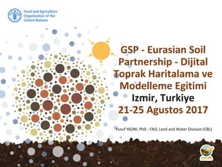
  • 1. Yusuf YIGINI, PhD - FAO, Land and Water Division (CBL) GSP - Eurasian Soil Partnership - Dijital Toprak Haritalama ve Modelleme Egitimi Izmir, Turkiye 21-25 Agustos 2017
  • 3. Background GSP - Eurasian Soil Partnership Training Workshop on Soil Mapping and Modeling- İzmir, Türkiye 21-25/08/2017 During the 5th Session of the GSP’s Intergovernmental Technical Panel on Soils (ITPS) held in March 2016, collaboration between ITPS and the Science Policy Interface (SPI) of the UNCCD, the Intergovernmental Platform on Biodiversity and Ecosystem Services (IPBES), and the Intergovernmental Panel on Climate Change (IPCC) was discussed. GSP/ITPS were requested to conduct a global SOC assessment based on country-level spatial soil data sets, combined to a new global SOC map.
  • 4. GSP - Eurasian Soil Partnership Training Workshop on Soil Mapping and Modeling- İzmir, Türkiye 21-25/08/2017 February,, 2017 .. training/capacity development
  • 5. Main request from members: Capacity development Training on SOC Mapping
  • 6. GSOCmap - Trainings ▪ FAO/GSP has been organizing 1-3 week training sessions to support countries. ▪ The aim of the trainings are for each participating country to produce a national SOC map either at the end of the trainings, or subsequent to the training with technical support from the FAO. ▪ The participants are nominated through the Focal Points and FAO Offices and screened by GSP for their suitability to participate in the training based on their CVs. ▪ The trainings are tailored to the participants experience, expertise.
  • 7. Izmir, Turkey, 21-25 August 2017 GSP - Eurasian Soil Partnership Training Workshop on Soil Mapping and Modeling- İzmir, Türkiye 21-25/08/2017
  • 9. GSP Trainings on DSM/SOC ▪ 108 Countries ▪ 65% Global Coverage* ▪ 87% Developing World Covered* *Developing and Underdeveloped Countries, (Area Coverage) *Area Coverage
  • 10. Aug 2017 GSOCmap – Trainings Jun 2017 Nov, 2016 Apr, 2017 July 2017 Jun, 2017 Oct, 2016 Nov, 2015 Aug, 2017 Mar, 2015 Status (Aug 2017)
  • 11. GSOCmap Trainings – Accra, Ghana Digital Soil Mapping training for Western and Central African countries Accra, Ghana from 16 to 27 March 2015 Accra, Ghana
  • 12. ©FAO/Daniel Dale Digital Soil Mapping Training with focus on soil Carbon Modelling, 10 to 14 October 2016, Rabat, Morocco GSOCmap Trainings – Rabat, Morocco
  • 13. Training “Digital Soil Organic Carbon Mapping: towards the development of national soil organic carbon stock maps” 24-29 April 2017 16 Participants, 15 Countries GSOCmap Trainings – Bangkok, Thailand
  • 14. - 3 weeks - 16 Countries Bolivia, Costa Rica, Cuba DRC, Egypt, Iraq, Kazakhstan, Mongolia Mozambique, Nigeria Paraguay, Ukraine Uzbekistan, Tanzania Tunisia, Zambia, Egypt Training “Digital Soil Organic Carbon Mapping: towards the development of national soil organic carbon stock maps” 06 – 23 June 2017, ISRIC, Wageningen GSOCmap Trainings – ISRIC
  • 15. - 31 Participants, Countries - 2 Trainings (Feb 2015 and July 2017) Training on Digital Soil Organic Carbon Mapping - Nairobi, Kenya 3-7 July 2017 GSOCmap Trainings – Nairobi, Kenya
  • 16. Training on Digital Soil Organic Carbon Mapping - Santiago, Chile, July 2017 GSOCmap Trainings – Santiago, Chile
  • 17. Training on Digital Soil Organic Carbon Mapping - Izmir, Turkey, August 2017 GSOCmap Trainings – Izmir, Turkey
  • 18. GSP - Tailored Trainings GSP - Eurasian Soil Partnership Training Workshop on Soil Mapping and Modeling- İzmir, Türkiye 21-25/08/2017 In August 2017, We circulated a Survey to the participants and asked about their background and experience on: GIS, Mapping, Geostatistics and Modelling Tools
  • 19. UZMANLIK ALANLARI uzaktan algılama, CBS Kuraklık, toprak nemi, havzalar Toprak Etüd ve Haritalama, CBS Toprak Bilimi toprak ve su koruma, toprak erozyonu, toprak fiziği, jeoistatistik toprak etüt ve haritalama, arazi kullanımı Uzmanlık Alanım Yok toprak Su Erozyonu, toprak muhafaza, su kaynaklarının planlanması Sulama Sulama ve Modelleme Atık suların tarımda yeniden kullanılması Toprak Fiziği, Bitki Toprak Su İlişkileri toprak&gis Ziraat Mühendisi
  • 20. GSP - Eurasian Soil Partnership Training Workshop on Soil Mapping and Modeling- İzmir, Türkiye 21-25/08/2017
  • 21. GSP - Eurasian Soil Partnership Training Workshop on Soil Mapping and Modeling- İzmir, Türkiye 21-25/08/2017
  • 22. GSP - Eurasian Soil Partnership Training Workshop on Soil Mapping and Modeling- İzmir, Türkiye 21-25/08/2017
  • 23. GSP - Eurasian Soil Partnership Training Workshop on Soil Mapping and Modeling- İzmir, Türkiye 21-25/08/2017
  • 24. GSP - Eurasian Soil Partnership Training Workshop on Soil Mapping and Modeling- İzmir, Türkiye 21-25/08/2017
  • 25. GSP - Eurasian Soil Partnership Training Workshop on Soil Mapping and Modeling- İzmir, Türkiye 21-25/08/2017
  • 26. GSP - Eurasian Soil Partnership Training Workshop on Soil Mapping and Modeling- İzmir, Türkiye 21-25/08/2017
  • 27. GSP - Eurasian Soil Partnership Training Workshop on Soil Mapping and Modeling- İzmir, Türkiye 21-25/08/2017
  • 28. GSP - Eurasian Soil Partnership Training Workshop on Soil Mapping and Modeling- İzmir, Türkiye 21-25/08/2017
  • 29.
  • 30.
  • 31.
  • 32.
  • 33.
  • 34.
  • 36. Program 1. Gün GSP - Eurasian Soil Partnership Training Workshop on Soil Mapping and Modeling- İzmir, Türkiye 21-25/08/2017
  • 37. GSP - Eurasian Soil Partnership Training Workshop on Soil Mapping and Modeling- İzmir, Türkiye 21-25/08/2017 Program 2. Gün
  • 38. GSP - Eurasian Soil Partnership Training Workshop on Soil Mapping and Modeling- İzmir, Türkiye 21-25/08/2017 Program 3. Gün
  • 39. Program 4. Gün GSP - Eurasian Soil Partnership Training Workshop on Soil Mapping and Modeling- İzmir, Türkiye 21-25/08/2017
  • 40. Program 5. Gün GSP - Eurasian Soil Partnership Training Workshop on Soil Mapping and Modeling- İzmir, Türkiye 21-25/08/2017
  • 41. GSOC Map Guidelines GSP - Eurasian Soil Partnership Training Workshop on Soil Mapping and Modeling- İzmir, Türkiye 21-25/08/2017 Download:Training Notepad
  • 42. Training Materials GSP - Eurasian Soil Partnership Training Workshop on Soil Mapping and Modeling- İzmir, Türkiye 21-25/08/2017 COOKBOOK MANUAL for Soil Property Mapping Download:Training Notepad
  • 43. Datasets GSP - Eurasian Soil Partnership Training Workshop on Soil Mapping and Modeling- İzmir, Türkiye 21-25/08/2017 We asked countries to prepare/bring their national soil profile/topsoil data to be used during the training week. National Data: Point data from the soil profile and/or topsoil databases which should be ready for spatial analyses (Soil Property Mapping Cookbook Manual Chapter 2) Step by step instructions and detailed information can be found in the GSP’s “Soil Property Mapping Cookbook Manual - Chapter: 2-Preparation of local soil property data”
  • 44. Datasets - Covariates GSP - Eurasian Soil Partnership Training Workshop on Soil Mapping and Modeling- İzmir, Türkiye 21-25/08/2017 National Spatial Covariates: Environmental covariates (Soil Map, Land Cover/Land Use Maps). ISRIC World Soil Information has established a data repository contains raster layers of various biophysical earth surface properties for each territory in the world. The data can be downloaded fro ISRIC’s ftp directories;
  • 45. Datasets - Covariates GSP - Eurasian Soil Partnership Training Workshop on Soil Mapping and Modeling- İzmir, Türkiye 21-25/08/2017 ftp://gsp.isric2.org/ (user: gsp, pwd: gspisric) or ftp://85.214.253.67/ (user: gsp, pwd: gspisric) Instructions and detailed information can be found in the GSP’s “Soil Property Mapping Cookbook Manual - Chapter: 3.6 GSOC Map - Data Repository (ISRIC, 2017)”
  • 46. Datasets - Covariates GSP - Eurasian Soil Partnership Training Workshop on Soil Mapping and Modeling- İzmir, Türkiye 21-25/08/2017 You can go now to the following ftp sites and download the covariates for your countries, ftp://gsp.isric2.org/ (user: gsp, pwd: gspisric) or ftp://85.214.253.67/ (user: gsp, pwd: gspisric)
  • 47. Datasets - Covariates GSP - Eurasian Soil Partnership Training Workshop on Soil Mapping and Modeling- İzmir, Türkiye 21-25/08/2017
  • 48. Datasets - Covariates GSP - Eurasian Soil Partnership Training Workshop on Soil Mapping and Modeling- İzmir, Türkiye 21-25/08/2017
  • 49. Datasets - Covariates GSP - Eurasian Soil Partnership Training Workshop on Soil Mapping and Modeling- İzmir, Türkiye 21-25/08/2017
  • 50. Datasets - Covariates GSP - Eurasian Soil Partnership Training Workshop on Soil Mapping and Modeling- İzmir, Türkiye 21-25/08/2017
  • 51. Datasets - Covariates GSP - Eurasian Soil Partnership Training Workshop on Soil Mapping and Modeling- İzmir, Türkiye 21-25/08/2017 ftp://gsp.isric2.org/_GISLayer_Description.xlsx
  • 52. GSP - Eurasian Soil Partnership Training Workshop on Soil Mapping and Modeling- İzmir, Türkiye 21-25/08/2017 NEXT: DSM Software Environment