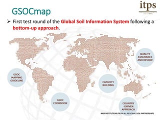
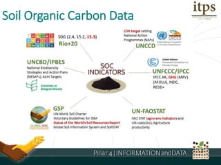
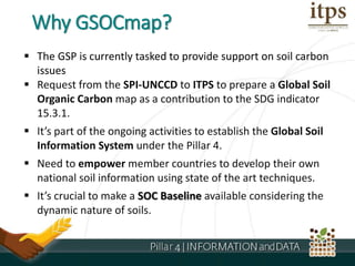
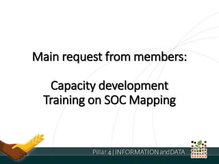
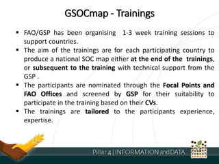
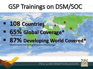
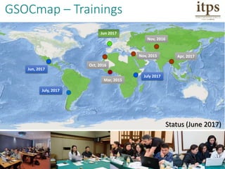
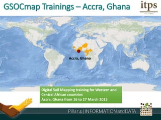
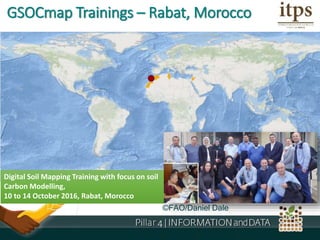
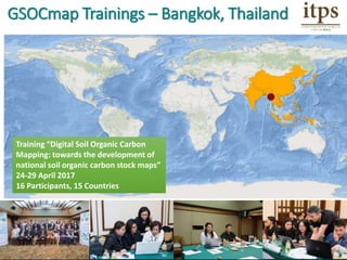
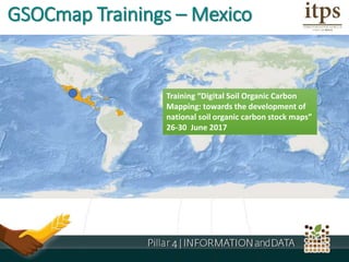
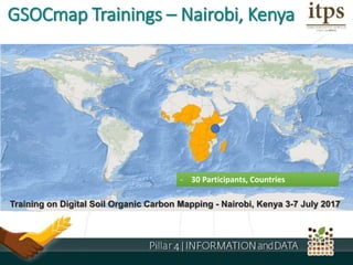
GSOCmap
 First test round of the Global Soil Information System following a
bottom-up approach.
Role of Soil Organic Carbon (SOC)
Critical functions
Ronald’s ideas: Why SOC data/information is
important? Who are the users? Here you can
refer to technical/scientific elements, as well as
the demand side on SDGs, Climate change,
World Soil Charter, etc.
Soil Organic Carbon Data
 The GSP is currently tasked to provide support on soil carbon
issues
 Request from the SPI-UNCCD to ITPS to prepare a Global Soil
Organic Carbon map as a contribution to the SDG indicator
15.3.1.
 It’s part of the ongoing activities to establish the Global Soil
Information System under the Pillar 4.
 Need to empower member countries to develop their own
national soil information using state of the art techniques.
 It’s crucial to make a SOC Baseline available considering the
dynamic nature of soils.
Why GSOCmap?
GSOCmap Product Timeline
• GSP secretariat collects the data
• After the PA, GSP Secretariat discusses details with
the SDF
• Both, inform and update the P4WG and ITPS Sub-
WG about GSOCmap, if possible intermediate
material will be prepared (map versions, first
metadata assessment, overview, gaps etc.),
considering that there is not much time for
reporting!
• Preparing ITPS and INSII, discuss crucial aspects
during the meetings
How QA/QC to be materialised?
GSOCMap–CapacityDevelopment
Technical
Documents
Data
Supply
Online
Support
Trainings
Roadmap: ...provides
• definitions and specifications for
the GSOCMap products.
• background and detailed
specifications about the required
data sources and methodologies.
The specifications were jointly
prepared with International Network
of Soil information Institutions .
GSOCmap - Technical Specifications
Roadmap:
... provides
• generic methodologies and the technical
steps to produce a SOC map.
• step-by-step guidance from data
preparation to developing 1 km grids for SOC
stocks.
• the compilation and pre-processing of
auxiliary spatial data sets, upscaling
methodologies, and uncertainty assessments.
Guidance is mainly specific to soil carbon data,
but also contains many generic sections on soil
grid development due to its relevance for other
soil properties.
GSOCmap - Technical Documents
GSOCmap – Online Support
GSOCmap Technical Support
Functional E-mail Box
Technical Inquires, Support!
GSP-GSOC-Map@fao.org
GSOCmap – Data Repository
• ISRIC World Soil Information has established a
data repository that contains GIS layers of
biophysical earth surface properties for the
countries.
• These layers to be used for Digital SOC Mapping.
171+ Covariate Layers
Empty 1km Grids
Main request from members:
Capacity development
Training on SOC Mapping
GSOCmap - Trainings
 FAO/GSP has been organising 1-3 week training sessions to
support countries.
 The aim of the trainings are for each participating country to
produce a national SOC map either at the end of the trainings,
or subsequent to the training with technical support from the
GSP .
 The participants are nominated through the Focal Points and
FAO Offices and screened by GSP for their suitability to
participate in the training based on their CVs.
 The trainings are tailored to the participants experience,
expertise.
GSP Trainings on DSM/SOC
 108 Countries
 65% Global Coverage*
 87% Developing World Covered*
*Developing and Underdeveloped Countries, (Area Coverage)
*Area Coverage
GSOCmap – Trainings
Jun 2017
Nov, 2016
Apr, 2017
July 2017
Jun, 2017
Oct, 2016
Nov, 2015
July, 2017
Mar, 2015
Status (June 2017)
GSOCmap Trainings – Accra, Ghana
Digital Soil Mapping training for Western and
Central African countries
Accra, Ghana from 16 to 27 March 2015
Accra, Ghana
©FAO/Daniel Dale
Digital Soil Mapping Training with focus on soil
Carbon Modelling,
10 to 14 October 2016, Rabat, Morocco
GSOCmap Trainings – Rabat, Morocco
Training “Digital Soil Organic Carbon
Mapping: towards the development of
national soil organic carbon stock maps”
24-29 April 2017
16 Participants, 15 Countries
GSOCmap Trainings – Bangkok, Thailand
Training “Digital Soil Organic Carbon
Mapping: towards the development of
national soil organic carbon stock maps”
26-30 June 2017
GSOCmap Trainings – Mexico
- 30 Participants, Countries
Training on Digital Soil Organic Carbon Mapping - Nairobi, Kenya 3-7 July 2017
GSOCmap Trainings – Nairobi, Kenya
Training on Digital Soil Organic Carbon Mapping - Santiago, Chile, July 2017
GSOCmap Trainings – Santiago, Chile
- 3 weeks
- 16 Countries
Bolivia, Costa Rica, Cuba
DRC, Egypt, Iraq,
Kazakhstan, Mongolia
Mozambique, Nigeria
Paraguay, Ukraine
Uzbekistan, Tanzania
Tunisia, Zambia, Egypt
Training “Digital Soil Organic Carbon Mapping: towards the development of national soil organic carbon
stock maps” 06 – 23 June 2017, ISRIC, Wageningen
GSOCmap Trainings – ISRIC
Expected Coverage
Thank You !
Yusuf Yigini, GSP
yusuf.yigini@fao.org

GSOC Map

  • 1.
    GSOCmap  First testround of the Global Soil Information System following a bottom-up approach.
  • 2.
    Role of SoilOrganic Carbon (SOC) Critical functions Ronald’s ideas: Why SOC data/information is important? Who are the users? Here you can refer to technical/scientific elements, as well as the demand side on SDGs, Climate change, World Soil Charter, etc.
  • 3.
  • 4.
     The GSPis currently tasked to provide support on soil carbon issues  Request from the SPI-UNCCD to ITPS to prepare a Global Soil Organic Carbon map as a contribution to the SDG indicator 15.3.1.  It’s part of the ongoing activities to establish the Global Soil Information System under the Pillar 4.  Need to empower member countries to develop their own national soil information using state of the art techniques.  It’s crucial to make a SOC Baseline available considering the dynamic nature of soils. Why GSOCmap?
  • 5.
  • 6.
    • GSP secretariatcollects the data • After the PA, GSP Secretariat discusses details with the SDF • Both, inform and update the P4WG and ITPS Sub- WG about GSOCmap, if possible intermediate material will be prepared (map versions, first metadata assessment, overview, gaps etc.), considering that there is not much time for reporting! • Preparing ITPS and INSII, discuss crucial aspects during the meetings How QA/QC to be materialised?
  • 7.
  • 8.
    Roadmap: ...provides • definitionsand specifications for the GSOCMap products. • background and detailed specifications about the required data sources and methodologies. The specifications were jointly prepared with International Network of Soil information Institutions . GSOCmap - Technical Specifications
  • 9.
    Roadmap: ... provides • genericmethodologies and the technical steps to produce a SOC map. • step-by-step guidance from data preparation to developing 1 km grids for SOC stocks. • the compilation and pre-processing of auxiliary spatial data sets, upscaling methodologies, and uncertainty assessments. Guidance is mainly specific to soil carbon data, but also contains many generic sections on soil grid development due to its relevance for other soil properties. GSOCmap - Technical Documents
  • 10.
    GSOCmap – OnlineSupport GSOCmap Technical Support Functional E-mail Box Technical Inquires, Support! GSP-GSOC-Map@fao.org
  • 11.
    GSOCmap – DataRepository • ISRIC World Soil Information has established a data repository that contains GIS layers of biophysical earth surface properties for the countries. • These layers to be used for Digital SOC Mapping. 171+ Covariate Layers Empty 1km Grids
  • 12.
    Main request frommembers: Capacity development Training on SOC Mapping
  • 13.
    GSOCmap - Trainings FAO/GSP has been organising 1-3 week training sessions to support countries.  The aim of the trainings are for each participating country to produce a national SOC map either at the end of the trainings, or subsequent to the training with technical support from the GSP .  The participants are nominated through the Focal Points and FAO Offices and screened by GSP for their suitability to participate in the training based on their CVs.  The trainings are tailored to the participants experience, expertise.
  • 14.
    GSP Trainings onDSM/SOC  108 Countries  65% Global Coverage*  87% Developing World Covered* *Developing and Underdeveloped Countries, (Area Coverage) *Area Coverage
  • 15.
    GSOCmap – Trainings Jun2017 Nov, 2016 Apr, 2017 July 2017 Jun, 2017 Oct, 2016 Nov, 2015 July, 2017 Mar, 2015 Status (June 2017)
  • 16.
    GSOCmap Trainings –Accra, Ghana Digital Soil Mapping training for Western and Central African countries Accra, Ghana from 16 to 27 March 2015 Accra, Ghana
  • 17.
    ©FAO/Daniel Dale Digital SoilMapping Training with focus on soil Carbon Modelling, 10 to 14 October 2016, Rabat, Morocco GSOCmap Trainings – Rabat, Morocco
  • 18.
    Training “Digital SoilOrganic Carbon Mapping: towards the development of national soil organic carbon stock maps” 24-29 April 2017 16 Participants, 15 Countries GSOCmap Trainings – Bangkok, Thailand
  • 19.
    Training “Digital SoilOrganic Carbon Mapping: towards the development of national soil organic carbon stock maps” 26-30 June 2017 GSOCmap Trainings – Mexico
  • 20.
    - 30 Participants,Countries Training on Digital Soil Organic Carbon Mapping - Nairobi, Kenya 3-7 July 2017 GSOCmap Trainings – Nairobi, Kenya
  • 21.
    Training on DigitalSoil Organic Carbon Mapping - Santiago, Chile, July 2017 GSOCmap Trainings – Santiago, Chile
  • 22.
    - 3 weeks -16 Countries Bolivia, Costa Rica, Cuba DRC, Egypt, Iraq, Kazakhstan, Mongolia Mozambique, Nigeria Paraguay, Ukraine Uzbekistan, Tanzania Tunisia, Zambia, Egypt Training “Digital Soil Organic Carbon Mapping: towards the development of national soil organic carbon stock maps” 06 – 23 June 2017, ISRIC, Wageningen GSOCmap Trainings – ISRIC
  • 23.
  • 24.
    Thank You ! YusufYigini, GSP yusuf.yigini@fao.org

Editor's Notes

  • #2  As indicated in the Pillar 4 GIP, a Global Soil Information System (GLOSIS) is the main product of the Pillar 4. And GSOCMap is the. First test round of the Global Soil Information System following a bottom-up approach IT WILL BE A COUNTRY DRIVEN PRODUCT. While we are still thinking globally, we still need to act locally! The partnership supports the development and empowering of national capacities to build countries own National Soil Information Systems. With support of the GSP, It’s already happening in member countries. The countries are already collecting and compiling SOC data They are developing their data collection strategies They already started digitizing their paper maps, extracting data in the reports They are now aware of new methods, approaches
  • #3 Soil organic matter (SOM) is a crucial soil component which affects most of the processes relevant to soil functions and food production. Changing in SOM (and hence SOC) affects the capacity of soils to buffer against environmental change and affects the provision of ecosystem services required for crop production. SOC therefore regulates the resilience of the agricultural systems to climate change.
  • #4 SOC has received great attention during the development of the greenhouse gas (GHG) reporting programme of the IPCC since the mid-nineties. Since 90s SOC data widely used and requested across various sectors! 3. A reliable global picture is needed under different un conventions *** 2.4 by 2030 ensure sustainable food production systems 15.2 By 2020, promote the implementation of sustainable management of all types of forests 15.3 By 2030, combat desertification, restore degraded land and soil, including land affected by desertification, drought and floods, and strive to achieve a land degradation-neutral world
  • #5 UNCCD Science-Policy Interface (SPI)
  • #6 The GSOCmap project was initiated in March 2016 in the 5th Working Session of the ITPS. After the kick-off GSP’s capacity development programme focused on GSOCmap. The training started also in 2016. The GSOCmap guidelines document has been published in January 2017 and the Cookbook Manual has been published on the first of JUNE. This is the first edition, the improved version will be published in November. We set end of August as the deadline for delivering the national maps. And 5th of December is the data reşease date. After the launch updating/gap filling will start.
  • #7 After the delivery deadline QA/QC will start (how QAQC to be performed)?
  • #8 To achieve the goal GSP has an intensive CAPACITY DEVELOPMENT PROGRAMME. GSOCmap capacity development programme has 4 main elements Trainings Technical Documents including GSOCMap Guidelines and Cookbook Manual for SOC Mapping A ready to use data repository Online Support (e-mail, skype or phone support)
  • #9 There are two key documents One is GSP GSOCMap Guidelines. It
  • #10 Another important document is Soil Organic Carbon Mapping Cookbook. It…
  • #11 GSP Contiuously support the countries via email, phone or skype. The functional emailbox has been recently circulated and now accepting support requests.
  • #12 We are also supporting countries with ready to use auxiliary data. There is also an empty grid is provided for each country. This empty grid will standardise the final SOC Maps in terms of the extent, projections and pixel sizes.
  • #13 Our main capacity development activity is Trainings.
  • #15 We reached 108 Countries! attended, attending or will atend in the DSM trainings. The trainings have %65 global coverage The trainings cover 87% of the developing and underdeveloped countries
  • #16 The map shows the geographical distribution of the digital soil mapping trainings .   The gray boxes show the past trainings, blue ones the upcoming trainings. A 3 week training is currently ongoing at ISRIC.
  • #17 A DSM training was held in Accra, Ghana in 2015. The metting was not directly related to the GSOCmap initiative but still on DSM and SOC Mapping.
  • #18 A training was organised in Rabat in autumn 2016. This meeting also focused on SOC Mapping
  • #19 Asian Soil Partnership Training was held in the last week of April 2017. There were 16 participants from 15 countries.
  • #20 The Central America training is starting next week on Monday in Mexico City.
  • #21 Another upcoming training will be in Africa soon in 2 weeks.
  • #22 Another upcoming training will be in Santiago, CHILE. There will be more than 10 South American Countries attending in the Training.
  • #23 These are the countries currently attending in the training at ISRIC. We have signed a Letter of Agreement with ISRIC World soil information and transferred funds for training 16 countries. Thanks ISRIC for their commitment. The participants are now working with their national datasets and some of them already produced their first national Soil Organic Carbon Maps. In the end of my presentation 5 of the ISRIC Training participants will present the situation of their countries and firs National SOC Maps.
  • #24 After all these trainings and GSP’s very well established global network, we are expecting this coverage by end of the year. We still have missing countries but most of these will be green in the coming months.