Maximizing Incident Investigation Efficacy in Oil & Gas: Techniques and Tools
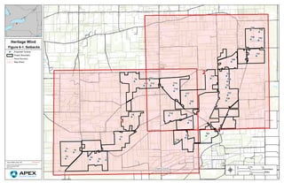
Figure 6 1. Setbacks
1. !A
!A
!A
!A !A
!A
!A
!A
!A
!A
!A
!A
!A
!A
!A
!A
!A
!A
!A
!A
!A
!A
!A
!A
!A
!A
!A
!A
!A
!A
!A
!A
!A
Genesee County
Orleans County
T1
T2
T3
T4
T5
T6
T7
T8
T9
T10
T11
T12
T13
T14
T15
T16
T17
T18
T19
T20
T21
T22
T23
T24
T25
T26
T27
T28
T29
T30
T31
T32
T33
2
1
Heritage Wind
CONFIDENTIALDate: 2/6/2020 Author: OB
DocumentPath:Y:GIS_ProjectsHER_HeritageMXDProjectHER_11x17_MeetingMapset.mxd
Coordinate System: NAD 1983 StatePlane New York West FIPS 3103 Feet
Projection: Transverse Mercator
Datum: North American 1983
Units: Foot US
!A Proposed Turbine
Project Boundary
Parcel Boundary
Map Sheet
®
0 1.50.75
Kilometers
0 10.5
Miles
Figure 6-1. Setbacks
2. Genesee County
Orleans County
115 kv
T1
T2
T3
T4
T5
T6
T7
T8
T9
T10
T11
T12
T13
T14
T15
T16
T17
T18
T19
T20
Heritage Wind
CONFIDENTIALDate: 4/29/2020 Author: OB
DocumentPath:Y:GIS_ProjectsHER_HeritageMXDProjectHER_11x17_MeetingMapset.mxd
Coordinate System: NAD 1983 StatePlane New York West FIPS 3103 Feet
Projection: Transverse Mercator
Datum: North American 1983
Units: Foot US
!A Proposed Turbine
Substation
Switchyard
O and M
Laydown Yard
Project Boundary
Existing Structures
× House - Nonparticipating
× House - Participating
") Business
") Institutional Structure
n Church
# Park
! Water Tower
G Communication Tower
Existing Transmission:
100kV - 138kV
Setback Values
Rotor Radius + 4m (278.87ft):
Setback for all Parcel
Boundaries
Tip Height x 1.1 (743.44ft):
Setback for Communication
Tower and Water Tower
1000ft: Setback for Business,
Barn and Institutional
Structures
Tip Height x 1.5 (1013.78ft):
Setback for Nonparticipating
Parcel, Transmission Line,
Public Road, Park, and Airstrip
1225ft: Setback for
Participating Dwelling
1500ft: Setback for
Nonparticipating Dwelling
®
0 10.5
Kilometers
0 0.750.375
Miles
Figure 6-1. Setbacks
3. 115 kv
T11
T12
T13
T14
T15
T17
T19
T20
T22
T23
T24
T25
T26
T27
T28
T29
T30
T31
T32
T33
Heritage Wind
CONFIDENTIALDate: 4/29/2020 Author: OB
DocumentPath:Y:GIS_ProjectsHER_HeritageMXDProjectHER_11x17_MeetingMapset.mxd
Coordinate System: NAD 1983 StatePlane New York West FIPS 3103 Feet
Projection: Transverse Mercator
Datum: North American 1983
Units: Foot US
!A Proposed Turbine
Substation
Switchyard
O and M
Project Boundary
Existing Structures
× House - Nonparticipating
× House - Participating
") Business
") Institutional Structure
n Church
# Park
! Water Tower
G Communication Tower
Existing Transmission:
100kV - 138kV
Setback Values
Rotor Radius + 4m (278.87ft):
Setback for all Parcel
Boundaries
Tip Height x 1.1 (743.44ft):
Setback for Communication
Tower and Water Tower
1000ft: Setback for Business,
Barn and Institutional
Structures
Tip Height x 1.5 (1013.78ft):
Setback for Nonparticipating
Parcel, Transmission Line,
Public Road, Park, and Airstrip
1225ft: Setback for
Participating Dwelling
1500ft: Setback for
Nonparticipating Dwelling
®
0 10.5
Kilometers
0 0.750.375
Miles
Figure 6-1. Setbacks