Assessing the Accessibility of Fire Vehicles in Khulna City
•
0 likes•52 views

This is my undergraduate thesis defense presentation. The study adopted network analysis along with different spatial analysis in ArcGIS to determine the accessibility of fire vehicles in Khulna city corporation.

Recommended
Recommended
More Related Content
Similar to Assessing the Accessibility of Fire Vehicles in Khulna City
Similar to Assessing the Accessibility of Fire Vehicles in Khulna City (20)
Recently uploaded
Recently uploaded (20)
Assessing the Accessibility of Fire Vehicles in Khulna City
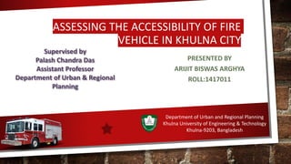
- 1. ASSESSING THE ACCESSIBILITY OF FIRE VEHICLE IN KHULNA CITY PRESENTED BY ARIJIT BISWAS ARGHYA ROLL:1417011 Supervised by Palash Chandra Das Assistant Professor Department of Urban & Regional Planning Department of Urban and Regional Planning Khulna University of Engineering & Technology Khulna-9203, Bangladesh
- 2. PRESENTATION OUTLINE ❑INTRODUCTION ❑LITERATURE REVIEW ❑METHODOLOGY ❑ANALYSIS ❑FINDINGS & CONCLUSION ❑LIMITATIONS
- 3. INTRODUCTION
- 4. 1.1 Background ❑Urban fire is one of the intense issues in developed and developing countries. ❑It is a threat to human lives and habitats. Sometimes fire becomes so destructive if any effective measure has not been taken (HOSSAIN, June 2016) ❑The urban area is more populated than the rural area. As the urban area is more densely populated and it is more prone to fire. ( Rahmawatia, et al., 2016) ❑Fire can expand in its volume within a minute and it can be said that more travel time or response time results in more losses (ESRI, 2007). ❑ Recently the fire incident of Dhaka chalk bazar killed 78 people. 1
- 5. Table 1:Year-wise number of fire incidents and economic loss in Bangladesh Year Economic loss (Billion)taka Death 2010 3.25 719 2011 2.93 1385 2012 4.82 759 2013 7.79 1385 2014 3.59 210 2015 8.56 216 2016 2.40 247 2017 2.57 269 2018 3.85 664 Source: Annual report of BFSCD 2018 2 Source:BFSCD Annual Report,2018
- 6. 1.2 Objectives •To identify the vulnerable areas in terms of accessibility. •Determining the response coverage of existing fire stations and site suitability analysis for future fire station location. •To develop a GIS-based system to identify the optimal path from the fire station to the incident spot. 3
- 8. SL NO Title Author Year Objectives Methodolgy Results 1. GIS Based Fire Emergency Response System Eric K. Forkuo and Jonathan A. Quaye-Ballar 2013 To establish a GIS (Geographic Information System) based fire emergency response services where GNFS can identify the optimal route from its location to any fire incident. Used Network analysis extension for optimal path and geospatial analysis for suggesting new locations for fire hydrants Provides a visual representation in GIS interface and shows the optimal path between Fire incident and fire station and identify the closet facility . Urban Fire Risk Assessment Using GIS: Case Study On Sharjah M.M Yagoub and Ahmed 2014 To measure the emergency time response of the fire vehicles in the city and weighted overlay analysis is utilized to propose new suitable locations for fire stations They used the AHP model for a suitable location for the new fire station based on Criteria they have selected., the weights of the criteria were given by using the AHP model. Finally, weighted overlay analysis was performed to find out the suitable location of the newly proposed fire station. Sharjah was not well served by existing fire stations which actually covered 36 % area within 6 minutes. They proposed 6 new stations fire station which will cover 75% area of Sharjah city within 6 minutes 3 Manifestation of an Analytic Hierarchy Process (AHP) Model on Fire Potential Zonation Mapping in Kathmandu Metropolitan City, Nepal Sachin Kumar Chhetri and Prabin Kayastha 2015 To prepare the fire potential zonation map of Kathmandu Metropolitan City, Nepal They used AHP method for scoring the weight of the criteria. Expert’s opinion survey was conducted for the AHP model. Then in order In order to generate fire potential index map, the linear weighted combination is used FPI value varies between 0.05- 1.03. It has been found that 58.04% area is low potential zone. About 32.92 % area is moderate and Rests belongs to the high-risk fire potential zone. 4
- 9. STUDY AREA
- 10. 3.Study Area Name X- Coordinate Y-Coordinate Daulatpur fire station 22°52'20.90"N 89°31'8.93"E Khalispur fire station 22°51'28.26"N 89°32'50.47"E Boyra fire station 22°49'52.04"N 89°32'44.76"E Tootpara fire station 22°48'19.03"N 89°34'14.42"E Table 3.1: Khulna Fire stations names and locations • Khulna is the third largest city of Bangladesh • It covers a total area of 59.57 km² • 34.04% area is residential(KCC,2012) Figure 1: Study area map 5 Source: Google Earth
- 11. Table 3.2:sources Of Data SL Name of data Source 1 Road network data KCC and open street map 2. Average vehicle speed of fire vehicle Fire service and civil defense Khulna 3. Population data, population density BBS 2011 4 Fire station and police station location Google earth 5. Waterbody KCC 6. Fire incident location Fire service and civil defense Khulna 6
- 12. METHODOLOGY
- 13. Data collection Road Network data Suitable Location • Distance from road • Distance from waterbody • Distance from fire stations • Incident density Vulnerability map Criteria selection for suitability analysis • Roads • Police Stations • Existing Fire Stations • Population density • Incident density Topology Check Road network dataset Service coverage Optimal route from closest facility O-D matrix Average speed of vehicle Previous incident location Study area selection AHP model Criteria selection for Vulnerable zone Incident pattern analysis Average neighborhood method 7 Network analysis
- 14. ANALYSIS
- 15. 5.1 Incident Pattern Analysis • The distribution of fire incidents in the Khulna city for 2016-2017 was spatially clustered with R-value 0.73 • It is found that most of the incidents from ward no 16,17,19,21 Figure 5.1.1: Incident location Figure 5.1.2: ANN report 8
- 16. Criteria Accessibility by roads Distance from the fire station Distance from waterbody Fire history Accessibility by roads 1 3 4 5 Distant from fire station 0.33 1 4 3 Distant from waterbody 0.25 0.25 1 2 Fire history 0.20 0.33 0.50 1 Eigen values 0.530376 0.275299 0.114036 0.080288 Consistency ratio 6.4% Principal Eigenvalue 4.174 Table 5.2.1:Pairwise comparison matrix of criteria of vulnerability map 10
- 17. 5.2.2 Vulnerability Map •Most of the area of ward no 23,22,29,30,31 area highly vulnerable. •Khulna shipyard area, notun bazar, rupsha area, south-central road etc are situated in the highly vulnerable zone.. •Important structures including 8 schools,5 colleges, bazar, clinic, church etc are situated in the high vulnerable zone. Figure 5.2.2: Vulnerability map11
- 18. Category Area(acres) Percentage Low vulnerable 4222 37.84% Moderate vulnerable 3498 31.35% High vulnerable 3425 30.70% Table 5.2.3: Area percentage and percentage 12
- 19. 5.3 Service Area 25.23 47.17 64.85 0 10 20 30 40 50 60 70 4 minutes 6 minutes 8 minutes PERCENTAGE OF SERVED AREA Figure 5.3.2:Service area of existing fire stations Figure 5.3.1: Percentage of served area 13
- 20. Table 5.3.3: Land Use Wise Area Coverage land use In 4 minutes(%) In 6 minutes(%) In 8 minutes(%) Commercial 66.91 86.72 89.65 Community Service 24.35 73.13 76.21 Education and Research 45.25 66.03 79.69 Government Services 44.63 77.55 68.38 Manufacturing and Processing Activity 4.62 16.16 41.57 Miscellaneous 37.03 76.55 85.11 Mixed Use 31.93 90.01 88.38 Non-Government Services 9.39 64.70 50.20 Recreation Facilities 27.41 83.56 93.46 Residential 32.14 65.27 77.69 Restricted Area 39.49 59.55 66.52 Service Activity 37.87 77.43 88.15 Transport and Communication 59.89 92.30 98.72 14
- 21. Table 5.3: Area percentage and percentage Criteria Distant from roads Distant from fire station Distance from police station Population density Incident density Distance from roads 1 2 8 7 6 Distance from fire station 0.50 1 7 6 3 Distance from police station 0.12 0.14 1 0.50 0.20 Population density 0.14 0.17 2 1 0.33 Incident density 0.17 0.33 5 3 1 Eigen values 0.487043 0.29214 0.037283 0.05617 0.127364 Consistency ratio 4.2% Principal Eigenvalue 5.188 Table 5.4.1:Pairwise comparison matrix of criteria for site suitability 16
- 22. 5.4.2 Suitable Site For Locating Future Fire Stations Figure 5.4.2: Site suitability map The most suitable area is near sher-e bangla road, Uttar para road, mujgunni area ,B.I.D.C road. Old Jessore road, MA Bari sharok 17
- 23. 5.5.1 Origin-destination Cost Matrix • Here origins are selected as the exiting fire stations and destinations are selected as the high vulnerable area generated from previously mentioned vulnerability map. • Among 143 destinations, 96 destinations can be reached by the existing fire stations in 8 minutes by the four fire stations Figure 5.5.1: Origin destination cost map 17 18
- 24. 5.5.2 Origin-Destination Cost Matrix 19 From the origin destination cost matrix it is found that the maximum time required for fire vehicle to reach the destination from the closest fire station is 17.40146 minutes and minimum times required is 0.2 minutes
- 25. 5.6.1 Optimal Path From Closest Facility ❑Figure 5.6.1.2 path required 2 minutes more than the figure A Path though the 1.5 mile away from the facility. Figure 5.6.1.1 : Optimal path based on travel time Figure 5.6.1.2: Optimal path based on distance20 ❑ For Figure 5.6.1.1 the optimal path is required 5 minutes to reach the location and it is 1.7 mile away from the facility
- 26. Direction Of Optimal Path Figure 5.6.1.3.: Direction of optimal path based on time 21 Figure 5.6.1.3.: Direction of optimal path based on distance
- 27. 6.Findings & Conclusion •From the ANN method in ArcGIS found that the incident pattern of fire incidents is clustered. •30.70% area are in high vulnerable zone in terms of accessibility. •About 69% of roads are accessible for fire vehicle •Only 25.23 % area can be covered by existing fire station with in 4 minutes •From the origin destination cost matrix it is found that to cover the high vulnerable area from the closest fire station it required 17.4014 minutes. •Road network dataset which has been prepared can be used for finding the optimal path from the closest fire station to incident spot 22
- 28. 7. Limitations •Real-time travel time is not considered. here average speed of the vehicle has been used according to the road category. • Traffic congestion is not considered as it is not constant all the day long for all the roads •Road condition was not considered, whereas vehicle speed depends on the condition of the road. 23