SlideShare a Scribd company logo
1 of 8
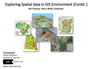
Exploring Spatial data in GIS Environment (Contd..) 
GIS Training –Day 5 @IOE, Pulchowk
Presentation Outline 
Understanding File Types 
Exercise 
Exploring data properties 
Exploring different tools within Arc Toolbox
Export to Shapefile? 
 *.shp – File that stores the feature geometry/coordinates. 
 *.dbf – File that stores the attribute information of features . 
 *.shx – File that stores the index linking geometry attributes. 
 *.sbn and *.sbx = Files that store the spatial index of the features. 
 *.prj = File that stores the coordinate system information.
Exercise
Assignment 1- 
Proportional point symbol map showing the number 
of gas stations at different municipalities. 
Hints: 
Go to : Layer Properties-Symbology-Quantities
Assignment 2- Create your own tool 
Hints: 
Go to : Customize-Customize Mode-New Toolbar
Assignment 3: Find the differences between the 
layers 
Points_w and Points_E
Exploring spatial data in GIS Environment

More Related Content

What's hot

MapInfo Discover 3D for Wind Energy Resources
MapInfo Discover 3D for Wind Energy ResourcesMapInfo Discover 3D for Wind Energy Resources
MapInfo Discover 3D for Wind Energy ResourcesPrakher Hajela Saxena
 
How to empower community by using GIS lecture 1
How to empower community by using GIS lecture 1How to empower community by using GIS lecture 1
How to empower community by using GIS lecture 1wang yaohui
 
Introduction to gis
Introduction to gisIntroduction to gis
Introduction to gisJay_mittal
 
Exploration and 3D GIS Software - MapInfo Professional Discover3D 2015
Exploration and 3D GIS Software - MapInfo Professional Discover3D 2015Exploration and 3D GIS Software - MapInfo Professional Discover3D 2015
Exploration and 3D GIS Software - MapInfo Professional Discover3D 2015Prakher Hajela Saxena
 
Subsurface 3D GIS 05nov2011
Subsurface 3D GIS 05nov2011Subsurface 3D GIS 05nov2011
Subsurface 3D GIS 05nov2011Andrew Zolnai
 
Map Making with QGIS
Map Making with QGISMap Making with QGIS
Map Making with QGISSagar Arlekar
 
How to empower community by using GIS lecture 2
How to empower community by using GIS lecture 2How to empower community by using GIS lecture 2
How to empower community by using GIS lecture 2wang yaohui
 
Integrating PostGIS in Web Applications
Integrating PostGIS in Web ApplicationsIntegrating PostGIS in Web Applications
Integrating PostGIS in Web ApplicationsCommand Prompt., Inc
 
An introduction to Hadoop for large scale data analysis
An introduction to Hadoop for large scale data analysisAn introduction to Hadoop for large scale data analysis
An introduction to Hadoop for large scale data analysisAbhijit Sharma
 
Integrating Geospatial Data to your Applications
Integrating Geospatial Data to your ApplicationsIntegrating Geospatial Data to your Applications
Integrating Geospatial Data to your ApplicationsIan Panganiban
 
Cartaro Workshop at the Geosharing Conferenc in Bern
Cartaro Workshop at the Geosharing Conferenc in BernCartaro Workshop at the Geosharing Conferenc in Bern
Cartaro Workshop at the Geosharing Conferenc in BernUli Müller
 
Data input techniques - GIS
Data input techniques - GISData input techniques - GIS
Data input techniques - GISVignesh LS
 
HEC-RAS LiDAR Cross Sections With Microstation SS3 V8i
HEC-RAS LiDAR Cross Sections With Microstation SS3 V8iHEC-RAS LiDAR Cross Sections With Microstation SS3 V8i
HEC-RAS LiDAR Cross Sections With Microstation SS3 V8iChristopher L Chatfield, P.E.
 
GIS on the Web
GIS on the WebGIS on the Web
GIS on the WebRuss White
 

What's hot (20)

MapInfo Discover 3D for Wind Energy Resources
MapInfo Discover 3D for Wind Energy ResourcesMapInfo Discover 3D for Wind Energy Resources
MapInfo Discover 3D for Wind Energy Resources
 
Arccgis skills
Arccgis skillsArccgis skills
Arccgis skills
 
How to empower community by using GIS lecture 1
How to empower community by using GIS lecture 1How to empower community by using GIS lecture 1
How to empower community by using GIS lecture 1
 
Introduction to gis
Introduction to gisIntroduction to gis
Introduction to gis
 
Exploration and 3D GIS Software - MapInfo Professional Discover3D 2015
Exploration and 3D GIS Software - MapInfo Professional Discover3D 2015Exploration and 3D GIS Software - MapInfo Professional Discover3D 2015
Exploration and 3D GIS Software - MapInfo Professional Discover3D 2015
 
Subsurface 3D GIS 05nov2011
Subsurface 3D GIS 05nov2011Subsurface 3D GIS 05nov2011
Subsurface 3D GIS 05nov2011
 
Map Making with QGIS
Map Making with QGISMap Making with QGIS
Map Making with QGIS
 
How to empower community by using GIS lecture 2
How to empower community by using GIS lecture 2How to empower community by using GIS lecture 2
How to empower community by using GIS lecture 2
 
mapProjectUpdate
mapProjectUpdatemapProjectUpdate
mapProjectUpdate
 
Integrating PostGIS in Web Applications
Integrating PostGIS in Web ApplicationsIntegrating PostGIS in Web Applications
Integrating PostGIS in Web Applications
 
Os Percy
Os PercyOs Percy
Os Percy
 
Mobile Mapping Applications
Mobile Mapping ApplicationsMobile Mapping Applications
Mobile Mapping Applications
 
An introduction to Hadoop for large scale data analysis
An introduction to Hadoop for large scale data analysisAn introduction to Hadoop for large scale data analysis
An introduction to Hadoop for large scale data analysis
 
Integrating Geospatial Data to your Applications
Integrating Geospatial Data to your ApplicationsIntegrating Geospatial Data to your Applications
Integrating Geospatial Data to your Applications
 
CONNECTING BENTLEY AND ESRI TERRAIN DATA
CONNECTING BENTLEY AND ESRI TERRAIN DATA CONNECTING BENTLEY AND ESRI TERRAIN DATA
CONNECTING BENTLEY AND ESRI TERRAIN DATA
 
Cartaro Workshop at the Geosharing Conferenc in Bern
Cartaro Workshop at the Geosharing Conferenc in BernCartaro Workshop at the Geosharing Conferenc in Bern
Cartaro Workshop at the Geosharing Conferenc in Bern
 
Data input techniques - GIS
Data input techniques - GISData input techniques - GIS
Data input techniques - GIS
 
HEC-RAS LiDAR Cross Sections With Microstation SS3 V8i
HEC-RAS LiDAR Cross Sections With Microstation SS3 V8iHEC-RAS LiDAR Cross Sections With Microstation SS3 V8i
HEC-RAS LiDAR Cross Sections With Microstation SS3 V8i
 
GIS on the Web
GIS on the WebGIS on the Web
GIS on the Web
 
Día 3
Día 3Día 3
Día 3
 

Viewers also liked

Image Classification Techniques in GIS
Image Classification Techniques in GISImage Classification Techniques in GIS
Image Classification Techniques in GISSadia Rahat
 
gis spatial data and maps
gis spatial data and mapsgis spatial data and maps
gis spatial data and mapsBandla Msengana
 
Thermal remote sensing
Thermal remote sensing   Thermal remote sensing
Thermal remote sensing Rahat Malik
 
GIS and spatial-modelling
GIS and spatial-modellingGIS and spatial-modelling
GIS and spatial-modellingJulian Swindell
 
Thermal Remote Sensing
Thermal Remote SensingThermal Remote Sensing
Thermal Remote SensingRohit Kumar
 
Introduction to Geographical Information System, GIS data models, spatial dat...
Introduction to Geographical Information System, GIS data models, spatial dat...Introduction to Geographical Information System, GIS data models, spatial dat...
Introduction to Geographical Information System, GIS data models, spatial dat...ijsrd.com
 

Viewers also liked (6)

Image Classification Techniques in GIS
Image Classification Techniques in GISImage Classification Techniques in GIS
Image Classification Techniques in GIS
 
gis spatial data and maps
gis spatial data and mapsgis spatial data and maps
gis spatial data and maps
 
Thermal remote sensing
Thermal remote sensing   Thermal remote sensing
Thermal remote sensing
 
GIS and spatial-modelling
GIS and spatial-modellingGIS and spatial-modelling
GIS and spatial-modelling
 
Thermal Remote Sensing
Thermal Remote SensingThermal Remote Sensing
Thermal Remote Sensing
 
Introduction to Geographical Information System, GIS data models, spatial dat...
Introduction to Geographical Information System, GIS data models, spatial dat...Introduction to Geographical Information System, GIS data models, spatial dat...
Introduction to Geographical Information System, GIS data models, spatial dat...
 

Similar to Exploring spatial data in GIS Environment

Basic R Learning
Basic R LearningBasic R Learning
Basic R LearningKumar P
 
FRBR Applied to Scientific Data by Joseph A. Hourclé
FRBR Applied to Scientific Data by Joseph A. HourcléFRBR Applied to Scientific Data by Joseph A. Hourclé
FRBR Applied to Scientific Data by Joseph A. HourcléPVC.ASIST
 
Object oriented programming 2 elements of programming
Object oriented programming 2 elements of programmingObject oriented programming 2 elements of programming
Object oriented programming 2 elements of programmingVaibhav Khanna
 
Analysis and print Management System in GIS
Analysis and print  Management System in GISAnalysis and print  Management System in GIS
Analysis and print Management System in GISDhrupesh Kotadiya
 
Introduction to the core.ns application framework
Introduction to the core.ns application frameworkIntroduction to the core.ns application framework
Introduction to the core.ns application frameworkVladimir Ulogov
 
Arc gis introduction-ppt
Arc gis introduction-pptArc gis introduction-ppt
Arc gis introduction-pptAshok Peddi
 
MC0077 SMU 2013 Fall Session
MC0077 SMU 2013 Fall SessionMC0077 SMU 2013 Fall Session
MC0077 SMU 2013 Fall SessionNarinder Kumar
 
"About Firebird and Flamerobin" by Marius Popa @ eLiberatica 2007
"About Firebird and Flamerobin" by Marius Popa @ eLiberatica 2007"About Firebird and Flamerobin" by Marius Popa @ eLiberatica 2007
"About Firebird and Flamerobin" by Marius Popa @ eLiberatica 2007eLiberatica
 
Analytics with arcpy package detailing of Mapping Module Properties and Data ...
Analytics with arcpy package detailing of Mapping Module Properties and Data ...Analytics with arcpy package detailing of Mapping Module Properties and Data ...
Analytics with arcpy package detailing of Mapping Module Properties and Data ...Soumik Chakraborty
 
Merge Multiple CSV in single data frame using R
Merge Multiple CSV in single data frame using RMerge Multiple CSV in single data frame using R
Merge Multiple CSV in single data frame using RYogesh Khandelwal
 
C# Summer course - Lecture 1
C# Summer course - Lecture 1C# Summer course - Lecture 1
C# Summer course - Lecture 1mohamedsamyali
 
2008-03-04 - Geoprocessing with ArcGIS.pdf
2008-03-04 - Geoprocessing with ArcGIS.pdf2008-03-04 - Geoprocessing with ArcGIS.pdf
2008-03-04 - Geoprocessing with ArcGIS.pdfssuseref75f1
 
Data and File Structure Lecture Notes
Data and File Structure Lecture NotesData and File Structure Lecture Notes
Data and File Structure Lecture NotesFellowBuddy.com
 

Similar to Exploring spatial data in GIS Environment (20)

advancedR.pdf
advancedR.pdfadvancedR.pdf
advancedR.pdf
 
Advanced r
Advanced rAdvanced r
Advanced r
 
Basic R Learning
Basic R LearningBasic R Learning
Basic R Learning
 
Advanced R cheat sheet
Advanced R cheat sheetAdvanced R cheat sheet
Advanced R cheat sheet
 
FRBR Applied to Scientific Data by Joseph A. Hourclé
FRBR Applied to Scientific Data by Joseph A. HourcléFRBR Applied to Scientific Data by Joseph A. Hourclé
FRBR Applied to Scientific Data by Joseph A. Hourclé
 
Object oriented programming 2 elements of programming
Object oriented programming 2 elements of programmingObject oriented programming 2 elements of programming
Object oriented programming 2 elements of programming
 
Analysis and print Management System in GIS
Analysis and print  Management System in GISAnalysis and print  Management System in GIS
Analysis and print Management System in GIS
 
Introduction to the core.ns application framework
Introduction to the core.ns application frameworkIntroduction to the core.ns application framework
Introduction to the core.ns application framework
 
Au09 Presentation Ut118 1
Au09 Presentation Ut118 1Au09 Presentation Ut118 1
Au09 Presentation Ut118 1
 
Arc gis introduction-ppt
Arc gis introduction-pptArc gis introduction-ppt
Arc gis introduction-ppt
 
Manual arcgis basico
Manual arcgis basicoManual arcgis basico
Manual arcgis basico
 
MC0077 SMU 2013 Fall Session
MC0077 SMU 2013 Fall SessionMC0077 SMU 2013 Fall Session
MC0077 SMU 2013 Fall Session
 
Serving and Updating Cadastral Data for Public Kiosks
Serving and Updating Cadastral Data for Public KiosksServing and Updating Cadastral Data for Public Kiosks
Serving and Updating Cadastral Data for Public Kiosks
 
"About Firebird and Flamerobin" by Marius Popa @ eLiberatica 2007
"About Firebird and Flamerobin" by Marius Popa @ eLiberatica 2007"About Firebird and Flamerobin" by Marius Popa @ eLiberatica 2007
"About Firebird and Flamerobin" by Marius Popa @ eLiberatica 2007
 
Analytics with arcpy package detailing of Mapping Module Properties and Data ...
Analytics with arcpy package detailing of Mapping Module Properties and Data ...Analytics with arcpy package detailing of Mapping Module Properties and Data ...
Analytics with arcpy package detailing of Mapping Module Properties and Data ...
 
Merge Multiple CSV in single data frame using R
Merge Multiple CSV in single data frame using RMerge Multiple CSV in single data frame using R
Merge Multiple CSV in single data frame using R
 
C# Summer course - Lecture 1
C# Summer course - Lecture 1C# Summer course - Lecture 1
C# Summer course - Lecture 1
 
Unit 08 dbms
Unit 08 dbmsUnit 08 dbms
Unit 08 dbms
 
2008-03-04 - Geoprocessing with ArcGIS.pdf
2008-03-04 - Geoprocessing with ArcGIS.pdf2008-03-04 - Geoprocessing with ArcGIS.pdf
2008-03-04 - Geoprocessing with ArcGIS.pdf
 
Data and File Structure Lecture Notes
Data and File Structure Lecture NotesData and File Structure Lecture Notes
Data and File Structure Lecture Notes
 

Recently uploaded

Thermal Engineering -unit - III & IV.ppt
Thermal Engineering -unit - III & IV.pptThermal Engineering -unit - III & IV.ppt
Thermal Engineering -unit - III & IV.pptDineshKumar4165
 
VIP Call Girls Ankleshwar 7001035870 Whatsapp Number, 24/07 Booking
VIP Call Girls Ankleshwar 7001035870 Whatsapp Number, 24/07 BookingVIP Call Girls Ankleshwar 7001035870 Whatsapp Number, 24/07 Booking
VIP Call Girls Ankleshwar 7001035870 Whatsapp Number, 24/07 Bookingdharasingh5698
 
Minimum and Maximum Modes of microprocessor 8086
Minimum and Maximum Modes of microprocessor 8086Minimum and Maximum Modes of microprocessor 8086
Minimum and Maximum Modes of microprocessor 8086anil_gaur
 
Unit 2- Effective stress & Permeability.pdf
Unit 2- Effective stress & Permeability.pdfUnit 2- Effective stress & Permeability.pdf
Unit 2- Effective stress & Permeability.pdfRagavanV2
 
chapter 5.pptx: drainage and irrigation engineering
chapter 5.pptx: drainage and irrigation engineeringchapter 5.pptx: drainage and irrigation engineering
chapter 5.pptx: drainage and irrigation engineeringmulugeta48
 
KubeKraft presentation @CloudNativeHooghly
KubeKraft presentation @CloudNativeHooghlyKubeKraft presentation @CloudNativeHooghly
KubeKraft presentation @CloudNativeHooghlysanyuktamishra911
 
DC MACHINE-Motoring and generation, Armature circuit equation
DC MACHINE-Motoring and generation, Armature circuit equationDC MACHINE-Motoring and generation, Armature circuit equation
DC MACHINE-Motoring and generation, Armature circuit equationBhangaleSonal
 
Block diagram reduction techniques in control systems.ppt
Block diagram reduction techniques in control systems.pptBlock diagram reduction techniques in control systems.ppt
Block diagram reduction techniques in control systems.pptNANDHAKUMARA10
 
A Study of Urban Area Plan for Pabna Municipality
A Study of Urban Area Plan for Pabna MunicipalityA Study of Urban Area Plan for Pabna Municipality
A Study of Urban Area Plan for Pabna MunicipalityMorshed Ahmed Rahath
 
Generative AI or GenAI technology based PPT
Generative AI or GenAI technology based PPTGenerative AI or GenAI technology based PPT
Generative AI or GenAI technology based PPTbhaskargani46
 
Call Girls Pimpri Chinchwad Call Me 7737669865 Budget Friendly No Advance Boo...
Call Girls Pimpri Chinchwad Call Me 7737669865 Budget Friendly No Advance Boo...Call Girls Pimpri Chinchwad Call Me 7737669865 Budget Friendly No Advance Boo...
Call Girls Pimpri Chinchwad Call Me 7737669865 Budget Friendly No Advance Boo...roncy bisnoi
 
XXXXXXXXXXXXXXXXXXXXXXXXXXXXXXXXXXXXXXXXXXXXXXXXXXXX
XXXXXXXXXXXXXXXXXXXXXXXXXXXXXXXXXXXXXXXXXXXXXXXXXXXXXXXXXXXXXXXXXXXXXXXXXXXXXXXXXXXXXXXXXXXXXXXXXXXXXXXX
XXXXXXXXXXXXXXXXXXXXXXXXXXXXXXXXXXXXXXXXXXXXXXXXXXXXssuser89054b
 
Call Girls In Bangalore ☎ 7737669865 🥵 Book Your One night Stand
Call Girls In Bangalore ☎ 7737669865 🥵 Book Your One night StandCall Girls In Bangalore ☎ 7737669865 🥵 Book Your One night Stand
Call Girls In Bangalore ☎ 7737669865 🥵 Book Your One night Standamitlee9823
 
UNIT - IV - Air Compressors and its Performance
UNIT - IV - Air Compressors and its PerformanceUNIT - IV - Air Compressors and its Performance
UNIT - IV - Air Compressors and its Performancesivaprakash250
 
FULL ENJOY Call Girls In Mahipalpur Delhi Contact Us 8377877756
FULL ENJOY Call Girls In Mahipalpur Delhi Contact Us 8377877756FULL ENJOY Call Girls In Mahipalpur Delhi Contact Us 8377877756
FULL ENJOY Call Girls In Mahipalpur Delhi Contact Us 8377877756dollysharma2066
 

Recently uploaded (20)

Thermal Engineering -unit - III & IV.ppt
Thermal Engineering -unit - III & IV.pptThermal Engineering -unit - III & IV.ppt
Thermal Engineering -unit - III & IV.ppt
 
VIP Call Girls Ankleshwar 7001035870 Whatsapp Number, 24/07 Booking
VIP Call Girls Ankleshwar 7001035870 Whatsapp Number, 24/07 BookingVIP Call Girls Ankleshwar 7001035870 Whatsapp Number, 24/07 Booking
VIP Call Girls Ankleshwar 7001035870 Whatsapp Number, 24/07 Booking
 
Minimum and Maximum Modes of microprocessor 8086
Minimum and Maximum Modes of microprocessor 8086Minimum and Maximum Modes of microprocessor 8086
Minimum and Maximum Modes of microprocessor 8086
 
Unit 2- Effective stress & Permeability.pdf
Unit 2- Effective stress & Permeability.pdfUnit 2- Effective stress & Permeability.pdf
Unit 2- Effective stress & Permeability.pdf
 
chapter 5.pptx: drainage and irrigation engineering
chapter 5.pptx: drainage and irrigation engineeringchapter 5.pptx: drainage and irrigation engineering
chapter 5.pptx: drainage and irrigation engineering
 
(INDIRA) Call Girl Bhosari Call Now 8617697112 Bhosari Escorts 24x7
(INDIRA) Call Girl Bhosari Call Now 8617697112 Bhosari Escorts 24x7(INDIRA) Call Girl Bhosari Call Now 8617697112 Bhosari Escorts 24x7
(INDIRA) Call Girl Bhosari Call Now 8617697112 Bhosari Escorts 24x7
 
KubeKraft presentation @CloudNativeHooghly
KubeKraft presentation @CloudNativeHooghlyKubeKraft presentation @CloudNativeHooghly
KubeKraft presentation @CloudNativeHooghly
 
DC MACHINE-Motoring and generation, Armature circuit equation
DC MACHINE-Motoring and generation, Armature circuit equationDC MACHINE-Motoring and generation, Armature circuit equation
DC MACHINE-Motoring and generation, Armature circuit equation
 
Block diagram reduction techniques in control systems.ppt
Block diagram reduction techniques in control systems.pptBlock diagram reduction techniques in control systems.ppt
Block diagram reduction techniques in control systems.ppt
 
(INDIRA) Call Girl Meerut Call Now 8617697112 Meerut Escorts 24x7
(INDIRA) Call Girl Meerut Call Now 8617697112 Meerut Escorts 24x7(INDIRA) Call Girl Meerut Call Now 8617697112 Meerut Escorts 24x7
(INDIRA) Call Girl Meerut Call Now 8617697112 Meerut Escorts 24x7
 
Cara Menggugurkan Sperma Yang Masuk Rahim Biyar Tidak Hamil
Cara Menggugurkan Sperma Yang Masuk Rahim Biyar Tidak HamilCara Menggugurkan Sperma Yang Masuk Rahim Biyar Tidak Hamil
Cara Menggugurkan Sperma Yang Masuk Rahim Biyar Tidak Hamil
 
A Study of Urban Area Plan for Pabna Municipality
A Study of Urban Area Plan for Pabna MunicipalityA Study of Urban Area Plan for Pabna Municipality
A Study of Urban Area Plan for Pabna Municipality
 
Generative AI or GenAI technology based PPT
Generative AI or GenAI technology based PPTGenerative AI or GenAI technology based PPT
Generative AI or GenAI technology based PPT
 
Call Girls Pimpri Chinchwad Call Me 7737669865 Budget Friendly No Advance Boo...
Call Girls Pimpri Chinchwad Call Me 7737669865 Budget Friendly No Advance Boo...Call Girls Pimpri Chinchwad Call Me 7737669865 Budget Friendly No Advance Boo...
Call Girls Pimpri Chinchwad Call Me 7737669865 Budget Friendly No Advance Boo...
 
XXXXXXXXXXXXXXXXXXXXXXXXXXXXXXXXXXXXXXXXXXXXXXXXXXXX
XXXXXXXXXXXXXXXXXXXXXXXXXXXXXXXXXXXXXXXXXXXXXXXXXXXXXXXXXXXXXXXXXXXXXXXXXXXXXXXXXXXXXXXXXXXXXXXXXXXXXXXX
XXXXXXXXXXXXXXXXXXXXXXXXXXXXXXXXXXXXXXXXXXXXXXXXXXXX
 
Call Girls In Bangalore ☎ 7737669865 🥵 Book Your One night Stand
Call Girls In Bangalore ☎ 7737669865 🥵 Book Your One night StandCall Girls In Bangalore ☎ 7737669865 🥵 Book Your One night Stand
Call Girls In Bangalore ☎ 7737669865 🥵 Book Your One night Stand
 
UNIT - IV - Air Compressors and its Performance
UNIT - IV - Air Compressors and its PerformanceUNIT - IV - Air Compressors and its Performance
UNIT - IV - Air Compressors and its Performance
 
FULL ENJOY Call Girls In Mahipalpur Delhi Contact Us 8377877756
FULL ENJOY Call Girls In Mahipalpur Delhi Contact Us 8377877756FULL ENJOY Call Girls In Mahipalpur Delhi Contact Us 8377877756
FULL ENJOY Call Girls In Mahipalpur Delhi Contact Us 8377877756
 
Call Girls in Ramesh Nagar Delhi 💯 Call Us 🔝9953056974 🔝 Escort Service
Call Girls in Ramesh Nagar Delhi 💯 Call Us 🔝9953056974 🔝 Escort ServiceCall Girls in Ramesh Nagar Delhi 💯 Call Us 🔝9953056974 🔝 Escort Service
Call Girls in Ramesh Nagar Delhi 💯 Call Us 🔝9953056974 🔝 Escort Service
 
Call Now ≽ 9953056974 ≼🔝 Call Girls In New Ashok Nagar ≼🔝 Delhi door step de...
Call Now ≽ 9953056974 ≼🔝 Call Girls In New Ashok Nagar  ≼🔝 Delhi door step de...Call Now ≽ 9953056974 ≼🔝 Call Girls In New Ashok Nagar  ≼🔝 Delhi door step de...
Call Now ≽ 9953056974 ≼🔝 Call Girls In New Ashok Nagar ≼🔝 Delhi door step de...
 

Exploring spatial data in GIS Environment

  • 1. Exploring Spatial data in GIS Environment (Contd..) GIS Training –Day 5 @IOE, Pulchowk
  • 2. Presentation Outline Understanding File Types Exercise Exploring data properties Exploring different tools within Arc Toolbox
  • 3. Export to Shapefile?  *.shp – File that stores the feature geometry/coordinates.  *.dbf – File that stores the attribute information of features .  *.shx – File that stores the index linking geometry attributes.  *.sbn and *.sbx = Files that store the spatial index of the features.  *.prj = File that stores the coordinate system information.
  • 5. Assignment 1- Proportional point symbol map showing the number of gas stations at different municipalities. Hints: Go to : Layer Properties-Symbology-Quantities
  • 6. Assignment 2- Create your own tool Hints: Go to : Customize-Customize Mode-New Toolbar
  • 7. Assignment 3: Find the differences between the layers Points_w and Points_E