SlideShare a Scribd company logo
1 of 20
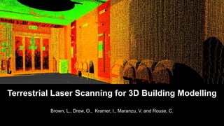
Brown, L., Drew, O., Kramer, I., Maranzu, V. and Rouse, C.
Terrestrial Laser Scanning for 3D Building Modelling
Output &
Validation
Data
Processing
Registration
Noise removal
Data
Collection
Leica C10
Site selection
3D Mapping
Available
methods
TLS
The Proposed Work
Available Methods
• Increasing demand for 3D building models
• Range of techniques available (Arayici, 2007; Mill et al., 2013):
• Traditional survey
• Tape measure
• Surveyor’s wheel
• Electronic distance meter
• Total station
• Close range photogrammetry
Terrestrial Laser Scanning
Definition:
“a ground-based, active imaging method that rapidly
acquires accurate, dense 3D point clouds of object
surfaces by laser range-finding” (Lichti, 2015)
Terrestrial Laser Scanning
Three types:
1. Triangulation-based
2. Pulse-based
3. Phase-based
• Over 1,000,000 pps
• Max. range 80m
• Comparable
accuracy
• 10,000-100,000 pps
• Max. range 300m
• 4-10mm accuracy
Terrestrial Laser Scanning
• Rapid acquisition
• Non-invasive
• Day or night operation
Source: rudi.net/files/paper/illustrations/composite.jpg
C10
Pulse-based
Green wavelength: 532nm
Point density: 50,000
Positional accuracy: 4mm
Range: 300m @ 90%
Source: http://hds.leica-geosystems.com
Data Collection
Resolution: 2cm at 20m
Max distance: 4m
Time: 7 minutes per scan
Points collected:
~21 million
Field-of-View:
270° (vertical)
360°(horizontal)
ProcessingRegistrationDatabase
Processing in Cyclone 9.0
Raw Data
• Noise Removal
• 3D Model
• Cloud-to-Cloud
• Add Constraints
Constraints (Control points)
Scan 1 Scan 2
Registered Point-clouds
People
Objects
Shadow
Outside
capture
Errors
Noise Removal
Registered Cleaned
3D Modelling
Output
Output
Object TLS (cm) Observed (cm) Error (cm)
Height
Poster frame 120.0 119.4 -0.6
Wall A 273.0 274.7 1.7
Double door 203.5 203.1 -0.4
Step 16.5 16.6 0.1
Wall B 279.0 278.3 -0.7
Width
Single door 83.5 83.4 -0.1
Double door 161.5 160.6 -0.9
Flower pot 39.5 38.4 -1.1
Step 118.0 117.4 -0.6
Chair 43.5 42.5 -1.0
RMSE 1.0
Validation
Improved Data Collection
• Full coverage
• Additional corridor
• Additional stairs
• Three stations
• Quicker
• Less accurate
• Difficult registration
• Leica P40 Scanner
• Combination of phase-based and pulse-based
• Spatial resolution: 1.2mm
• 1,000,000 pps
• Positional accuracy: 3mm
• Integrated approach
• Multiple scans of varying resolutions
• High-definition targets
• Undertake in morning/at night
• Additional software (SketchUp, AutoCAD)
Future Work
http://www.comptonmoving.com/http://hds.leica-geosystems.com/Bastonero et al., 2014http://www.coroflot.com/
Summary
References
• Arayici, Y., 2007. An approach for real world data modelling with the 3D terrestrial laser scanner for built environment, Automation in
Construction, 16, 816-829.
• Bastonero, P., et al., 2014. Fusion of 3D models derived from TLS and image-based techniques for CH enhanced documentation, ISPRS
Annals of the Photogrammetry, Remote Sensing and Spatial Information Sciences, Volume 2, ISPRS Technical Commission V
Symposium.
• El-Hakim et al., 1997. System for Indoor 3-D Mapping and Virtual Environments, SPIE, 3174, 21-35.
• Feng, Q., 2012. Advantages By Phase-based 3D Laser Scanning Techniques to Underground Construction, International Society for Rock
Mechanics.
• Lee, S.Y., et al., 2013. 3D Data Acquisition for Indoor Assets Using Terrestrial Laser Scanning, ISPRS Annals of the Photogrammetry,
Remote Sensing and Spatial Information Sciences, Volume 2, ISPRS 8th 3DGeoInfo Conference & WG II/2 Workshop, 27-29.
• Lichti, D., 2015. Special Issue "Terrestrial Laser Scanning“, Remote Sensing.
• MENSI, 2012. Technical specifications. Available from: http://mensi.free.fr/english/specsoi.htm
• Mill, T., et al., 2013. Combined 3D building surveying techniques – terrestrial laser scanning (TLS) and total station surveying for BIM data
management purposes, Journal of Civil Engineering and Management, 19, 1, S23-S32.
• Ordonez, C., et al., 2010. Measuring building facades with a low-cost closerange photogrammetry system, Automation in Construction,
19, 6, 742749.
• Williams, K.E., et al., 2012. Accuracy Assessment Of Geo-referencing Methodologies For Terrestrial Laser Scan Site Surveys, ASPRS
Annual Conference, Sacramento, California.

More Related Content

What's hot

LiDAR Data Processing and Classification
LiDAR Data Processing and ClassificationLiDAR Data Processing and Classification
LiDAR Data Processing and ClassificationMichal Bularz
 
Lecture on photogrammetry
Lecture on photogrammetryLecture on photogrammetry
Lecture on photogrammetryWaleed Liaqat
 
REMOTE SENSING A VERY USEFUL TECHNOLOGY TO MANKIND
REMOTE SENSING A VERY USEFUL TECHNOLOGY TO MANKINDREMOTE SENSING A VERY USEFUL TECHNOLOGY TO MANKIND
REMOTE SENSING A VERY USEFUL TECHNOLOGY TO MANKINDkaushikakumar
 
Introduction to lidar and its application
Introduction to lidar and its applicationIntroduction to lidar and its application
Introduction to lidar and its applicationVedant Srivastava
 
NDGeospatialSummit2019 - Drone Based Lidar and the Future of Survey/GIS
NDGeospatialSummit2019 - Drone Based Lidar and the Future of Survey/GISNDGeospatialSummit2019 - Drone Based Lidar and the Future of Survey/GIS
NDGeospatialSummit2019 - Drone Based Lidar and the Future of Survey/GISNorth Dakota GIS Hub
 
REMOTE SENSING
REMOTE SENSINGREMOTE SENSING
REMOTE SENSINGKANNAN
 
Intro to GIS and Remote Sensing
Intro to GIS and Remote SensingIntro to GIS and Remote Sensing
Intro to GIS and Remote SensingJohn Reiser
 
Distortions and displacement on aerial photograph
Distortions and displacement on aerial photographDistortions and displacement on aerial photograph
Distortions and displacement on aerial photographchandan00781
 
Introduction to remote sensing and gis
Introduction to remote sensing and gisIntroduction to remote sensing and gis
Introduction to remote sensing and gisMohsin Siddique
 
Thermal Remote Sensing
Thermal Remote SensingThermal Remote Sensing
Thermal Remote SensingRohit Kumar
 
Platforms of Remote sensing and GIS
Platforms of Remote sensing and GISPlatforms of Remote sensing and GIS
Platforms of Remote sensing and GISMouna Guru
 
Image classification, remote sensing, P K MANI
Image classification, remote sensing, P K MANIImage classification, remote sensing, P K MANI
Image classification, remote sensing, P K MANIP.K. Mani
 
hyperspectral remote sensing and its geological applications
hyperspectral remote sensing and its geological applicationshyperspectral remote sensing and its geological applications
hyperspectral remote sensing and its geological applicationsabhijeet_banerjee
 

What's hot (20)

LiDAR Data Processing and Classification
LiDAR Data Processing and ClassificationLiDAR Data Processing and Classification
LiDAR Data Processing and Classification
 
Remote Sensing ppt
Remote Sensing pptRemote Sensing ppt
Remote Sensing ppt
 
Digital terrain model
Digital terrain modelDigital terrain model
Digital terrain model
 
Lecture on photogrammetry
Lecture on photogrammetryLecture on photogrammetry
Lecture on photogrammetry
 
REMOTE SENSING A VERY USEFUL TECHNOLOGY TO MANKIND
REMOTE SENSING A VERY USEFUL TECHNOLOGY TO MANKINDREMOTE SENSING A VERY USEFUL TECHNOLOGY TO MANKIND
REMOTE SENSING A VERY USEFUL TECHNOLOGY TO MANKIND
 
Introduction to lidar and its application
Introduction to lidar and its applicationIntroduction to lidar and its application
Introduction to lidar and its application
 
NDGeospatialSummit2019 - Drone Based Lidar and the Future of Survey/GIS
NDGeospatialSummit2019 - Drone Based Lidar and the Future of Survey/GISNDGeospatialSummit2019 - Drone Based Lidar and the Future of Survey/GIS
NDGeospatialSummit2019 - Drone Based Lidar and the Future of Survey/GIS
 
REMOTE SENSING
REMOTE SENSINGREMOTE SENSING
REMOTE SENSING
 
Intro to GIS and Remote Sensing
Intro to GIS and Remote SensingIntro to GIS and Remote Sensing
Intro to GIS and Remote Sensing
 
Distortions and displacement on aerial photograph
Distortions and displacement on aerial photographDistortions and displacement on aerial photograph
Distortions and displacement on aerial photograph
 
Introduction to remote sensing and gis
Introduction to remote sensing and gisIntroduction to remote sensing and gis
Introduction to remote sensing and gis
 
Thermal Remote Sensing
Thermal Remote SensingThermal Remote Sensing
Thermal Remote Sensing
 
LIDAR
LIDARLIDAR
LIDAR
 
Land use cover pptx.
Land use cover pptx.Land use cover pptx.
Land use cover pptx.
 
Platforms of Remote sensing and GIS
Platforms of Remote sensing and GISPlatforms of Remote sensing and GIS
Platforms of Remote sensing and GIS
 
Remote sensing & gis
Remote sensing & gisRemote sensing & gis
Remote sensing & gis
 
Remote sensing
Remote sensingRemote sensing
Remote sensing
 
SPOT
SPOTSPOT
SPOT
 
Image classification, remote sensing, P K MANI
Image classification, remote sensing, P K MANIImage classification, remote sensing, P K MANI
Image classification, remote sensing, P K MANI
 
hyperspectral remote sensing and its geological applications
hyperspectral remote sensing and its geological applicationshyperspectral remote sensing and its geological applications
hyperspectral remote sensing and its geological applications
 

Similar to Terrestrial laser scanning

Digital Heritage Documentation Via TLS And Photogrammetry Case Study
Digital Heritage Documentation Via TLS And Photogrammetry Case StudyDigital Heritage Documentation Via TLS And Photogrammetry Case Study
Digital Heritage Documentation Via TLS And Photogrammetry Case Studytheijes
 
Digital Heritage Documentation Via TLS And Photogrammetry Case Study
Digital Heritage Documentation Via TLS And Photogrammetry Case StudyDigital Heritage Documentation Via TLS And Photogrammetry Case Study
Digital Heritage Documentation Via TLS And Photogrammetry Case Studytheijes
 
Civilex Presentation Laser Scanning And Gpr March 2009 Ices
Civilex Presentation Laser Scanning And Gpr  March 2009  IcesCivilex Presentation Laser Scanning And Gpr  March 2009  Ices
Civilex Presentation Laser Scanning And Gpr March 2009 Icesguesta50845
 
Coastway SCAN to BIM Presentation may 25th cita
Coastway SCAN to BIM Presentation may 25th citaCoastway SCAN to BIM Presentation may 25th cita
Coastway SCAN to BIM Presentation may 25th citaCoastway
 
Coastway SCAN to BIM Presentation may 25th cita
Coastway SCAN to BIM Presentation may 25th citaCoastway SCAN to BIM Presentation may 25th cita
Coastway SCAN to BIM Presentation may 25th citaCoastway
 
Laser-beams, spacecraft and archaeology; recent approaches to the recording, ...
Laser-beams, spacecraft and archaeology; recent approaches to the recording, ...Laser-beams, spacecraft and archaeology; recent approaches to the recording, ...
Laser-beams, spacecraft and archaeology; recent approaches to the recording, ...Paul Cripps
 
3d Modelling of Structures using terrestrial laser scanning technique
3d Modelling of Structures using terrestrial laser scanning technique3d Modelling of Structures using terrestrial laser scanning technique
3d Modelling of Structures using terrestrial laser scanning techniqueIJAEMSJORNAL
 
Unsupervised Building Extraction from High Resolution Satellite Images Irresp...
Unsupervised Building Extraction from High Resolution Satellite Images Irresp...Unsupervised Building Extraction from High Resolution Satellite Images Irresp...
Unsupervised Building Extraction from High Resolution Satellite Images Irresp...CSCJournals
 
A visualization-oriented 3D method for efficient computation of urban solar r...
A visualization-oriented 3D method for efficient computation of urban solar r...A visualization-oriented 3D method for efficient computation of urban solar r...
A visualization-oriented 3D method for efficient computation of urban solar r...Jianming Liang
 
3D Laser Scanning for Oil & Gas Facilities
3D Laser Scanning for Oil & Gas Facilities3D Laser Scanning for Oil & Gas Facilities
3D Laser Scanning for Oil & Gas FacilitiesYasser Eldegwy
 
Cnn acuracia remotesensing-08-00329
Cnn acuracia remotesensing-08-00329Cnn acuracia remotesensing-08-00329
Cnn acuracia remotesensing-08-00329Universidade Fumec
 
Geospatial Research At UCL
Geospatial Research At UCLGeospatial Research At UCL
Geospatial Research At UCLJeremy Morley
 
ts06f_01_roberts_baddley_1292
ts06f_01_roberts_baddley_1292ts06f_01_roberts_baddley_1292
ts06f_01_roberts_baddley_1292Matt Baddeley
 
Design Description of a Tentacle Based Scanning System
Design Description of a Tentacle Based Scanning SystemDesign Description of a Tentacle Based Scanning System
Design Description of a Tentacle Based Scanning SystemOyeniyi Samuel
 
PEARC17: Visual exploration and analysis of time series earthquake data
PEARC17: Visual exploration and analysis of time series earthquake dataPEARC17: Visual exploration and analysis of time series earthquake data
PEARC17: Visual exploration and analysis of time series earthquake dataAmit Chourasia
 
3D Scanners and their Economic Feasibility
3D Scanners and their Economic Feasibility3D Scanners and their Economic Feasibility
3D Scanners and their Economic FeasibilityJeffrey Funk
 
Unlocking Precision: How 3d laser scanning survey Revolutionizes Land Surveying
Unlocking Precision: How 3d laser scanning survey Revolutionizes Land SurveyingUnlocking Precision: How 3d laser scanning survey Revolutionizes Land Surveying
Unlocking Precision: How 3d laser scanning survey Revolutionizes Land Surveyingfalconsurveyme
 

Similar to Terrestrial laser scanning (20)

Digital Heritage Documentation Via TLS And Photogrammetry Case Study
Digital Heritage Documentation Via TLS And Photogrammetry Case StudyDigital Heritage Documentation Via TLS And Photogrammetry Case Study
Digital Heritage Documentation Via TLS And Photogrammetry Case Study
 
Digital Heritage Documentation Via TLS And Photogrammetry Case Study
Digital Heritage Documentation Via TLS And Photogrammetry Case StudyDigital Heritage Documentation Via TLS And Photogrammetry Case Study
Digital Heritage Documentation Via TLS And Photogrammetry Case Study
 
Civilex Presentation Laser Scanning And Gpr March 2009 Ices
Civilex Presentation Laser Scanning And Gpr  March 2009  IcesCivilex Presentation Laser Scanning And Gpr  March 2009  Ices
Civilex Presentation Laser Scanning And Gpr March 2009 Ices
 
Coastway SCAN to BIM Presentation may 25th cita
Coastway SCAN to BIM Presentation may 25th citaCoastway SCAN to BIM Presentation may 25th cita
Coastway SCAN to BIM Presentation may 25th cita
 
Coastway SCAN to BIM Presentation may 25th cita
Coastway SCAN to BIM Presentation may 25th citaCoastway SCAN to BIM Presentation may 25th cita
Coastway SCAN to BIM Presentation may 25th cita
 
Laser-beams, spacecraft and archaeology; recent approaches to the recording, ...
Laser-beams, spacecraft and archaeology; recent approaches to the recording, ...Laser-beams, spacecraft and archaeology; recent approaches to the recording, ...
Laser-beams, spacecraft and archaeology; recent approaches to the recording, ...
 
3d Modelling of Structures using terrestrial laser scanning technique
3d Modelling of Structures using terrestrial laser scanning technique3d Modelling of Structures using terrestrial laser scanning technique
3d Modelling of Structures using terrestrial laser scanning technique
 
Unsupervised Building Extraction from High Resolution Satellite Images Irresp...
Unsupervised Building Extraction from High Resolution Satellite Images Irresp...Unsupervised Building Extraction from High Resolution Satellite Images Irresp...
Unsupervised Building Extraction from High Resolution Satellite Images Irresp...
 
A visualization-oriented 3D method for efficient computation of urban solar r...
A visualization-oriented 3D method for efficient computation of urban solar r...A visualization-oriented 3D method for efficient computation of urban solar r...
A visualization-oriented 3D method for efficient computation of urban solar r...
 
3D Laser Scanning for Oil & Gas Facilities
3D Laser Scanning for Oil & Gas Facilities3D Laser Scanning for Oil & Gas Facilities
3D Laser Scanning for Oil & Gas Facilities
 
Scanning Examples
Scanning ExamplesScanning Examples
Scanning Examples
 
Cnn acuracia remotesensing-08-00329
Cnn acuracia remotesensing-08-00329Cnn acuracia remotesensing-08-00329
Cnn acuracia remotesensing-08-00329
 
Geospatial Research At UCL
Geospatial Research At UCLGeospatial Research At UCL
Geospatial Research At UCL
 
ts06f_01_roberts_baddley_1292
ts06f_01_roberts_baddley_1292ts06f_01_roberts_baddley_1292
ts06f_01_roberts_baddley_1292
 
Design Description of a Tentacle Based Scanning System
Design Description of a Tentacle Based Scanning SystemDesign Description of a Tentacle Based Scanning System
Design Description of a Tentacle Based Scanning System
 
PEARC17: Visual exploration and analysis of time series earthquake data
PEARC17: Visual exploration and analysis of time series earthquake dataPEARC17: Visual exploration and analysis of time series earthquake data
PEARC17: Visual exploration and analysis of time series earthquake data
 
3D Scanners and their Economic Feasibility
3D Scanners and their Economic Feasibility3D Scanners and their Economic Feasibility
3D Scanners and their Economic Feasibility
 
3D remote sensing of mines
3D remote sensing of mines 3D remote sensing of mines
3D remote sensing of mines
 
Scanning with drones
Scanning with dronesScanning with drones
Scanning with drones
 
Unlocking Precision: How 3d laser scanning survey Revolutionizes Land Surveying
Unlocking Precision: How 3d laser scanning survey Revolutionizes Land SurveyingUnlocking Precision: How 3d laser scanning survey Revolutionizes Land Surveying
Unlocking Precision: How 3d laser scanning survey Revolutionizes Land Surveying
 

Recently uploaded

SOCIAL AND HISTORICAL CONTEXT - LFTVD.pptx
SOCIAL AND HISTORICAL CONTEXT - LFTVD.pptxSOCIAL AND HISTORICAL CONTEXT - LFTVD.pptx
SOCIAL AND HISTORICAL CONTEXT - LFTVD.pptxiammrhaywood
 
Kisan Call Centre - To harness potential of ICT in Agriculture by answer farm...
Kisan Call Centre - To harness potential of ICT in Agriculture by answer farm...Kisan Call Centre - To harness potential of ICT in Agriculture by answer farm...
Kisan Call Centre - To harness potential of ICT in Agriculture by answer farm...Krashi Coaching
 
Advanced Views - Calendar View in Odoo 17
Advanced Views - Calendar View in Odoo 17Advanced Views - Calendar View in Odoo 17
Advanced Views - Calendar View in Odoo 17Celine George
 
Beyond the EU: DORA and NIS 2 Directive's Global Impact
Beyond the EU: DORA and NIS 2 Directive's Global ImpactBeyond the EU: DORA and NIS 2 Directive's Global Impact
Beyond the EU: DORA and NIS 2 Directive's Global ImpactPECB
 
Measures of Dispersion and Variability: Range, QD, AD and SD
Measures of Dispersion and Variability: Range, QD, AD and SDMeasures of Dispersion and Variability: Range, QD, AD and SD
Measures of Dispersion and Variability: Range, QD, AD and SDThiyagu K
 
Ecosystem Interactions Class Discussion Presentation in Blue Green Lined Styl...
Ecosystem Interactions Class Discussion Presentation in Blue Green Lined Styl...Ecosystem Interactions Class Discussion Presentation in Blue Green Lined Styl...
Ecosystem Interactions Class Discussion Presentation in Blue Green Lined Styl...fonyou31
 
1029-Danh muc Sach Giao Khoa khoi 6.pdf
1029-Danh muc Sach Giao Khoa khoi  6.pdf1029-Danh muc Sach Giao Khoa khoi  6.pdf
1029-Danh muc Sach Giao Khoa khoi 6.pdfQucHHunhnh
 
General AI for Medical Educators April 2024
General AI for Medical Educators April 2024General AI for Medical Educators April 2024
General AI for Medical Educators April 2024Janet Corral
 
Disha NEET Physics Guide for classes 11 and 12.pdf
Disha NEET Physics Guide for classes 11 and 12.pdfDisha NEET Physics Guide for classes 11 and 12.pdf
Disha NEET Physics Guide for classes 11 and 12.pdfchloefrazer622
 
microwave assisted reaction. General introduction
microwave assisted reaction. General introductionmicrowave assisted reaction. General introduction
microwave assisted reaction. General introductionMaksud Ahmed
 
Key note speaker Neum_Admir Softic_ENG.pdf
Key note speaker Neum_Admir Softic_ENG.pdfKey note speaker Neum_Admir Softic_ENG.pdf
Key note speaker Neum_Admir Softic_ENG.pdfAdmir Softic
 
BASLIQ CURRENT LOOKBOOK LOOKBOOK(1) (1).pdf
BASLIQ CURRENT LOOKBOOK  LOOKBOOK(1) (1).pdfBASLIQ CURRENT LOOKBOOK  LOOKBOOK(1) (1).pdf
BASLIQ CURRENT LOOKBOOK LOOKBOOK(1) (1).pdfSoniaTolstoy
 
Activity 01 - Artificial Culture (1).pdf
Activity 01 - Artificial Culture (1).pdfActivity 01 - Artificial Culture (1).pdf
Activity 01 - Artificial Culture (1).pdfciinovamais
 
Software Engineering Methodologies (overview)
Software Engineering Methodologies (overview)Software Engineering Methodologies (overview)
Software Engineering Methodologies (overview)eniolaolutunde
 
The basics of sentences session 2pptx copy.pptx
The basics of sentences session 2pptx copy.pptxThe basics of sentences session 2pptx copy.pptx
The basics of sentences session 2pptx copy.pptxheathfieldcps1
 
APM Welcome, APM North West Network Conference, Synergies Across Sectors
APM Welcome, APM North West Network Conference, Synergies Across SectorsAPM Welcome, APM North West Network Conference, Synergies Across Sectors
APM Welcome, APM North West Network Conference, Synergies Across SectorsAssociation for Project Management
 
Interactive Powerpoint_How to Master effective communication
Interactive Powerpoint_How to Master effective communicationInteractive Powerpoint_How to Master effective communication
Interactive Powerpoint_How to Master effective communicationnomboosow
 

Recently uploaded (20)

SOCIAL AND HISTORICAL CONTEXT - LFTVD.pptx
SOCIAL AND HISTORICAL CONTEXT - LFTVD.pptxSOCIAL AND HISTORICAL CONTEXT - LFTVD.pptx
SOCIAL AND HISTORICAL CONTEXT - LFTVD.pptx
 
Kisan Call Centre - To harness potential of ICT in Agriculture by answer farm...
Kisan Call Centre - To harness potential of ICT in Agriculture by answer farm...Kisan Call Centre - To harness potential of ICT in Agriculture by answer farm...
Kisan Call Centre - To harness potential of ICT in Agriculture by answer farm...
 
Advanced Views - Calendar View in Odoo 17
Advanced Views - Calendar View in Odoo 17Advanced Views - Calendar View in Odoo 17
Advanced Views - Calendar View in Odoo 17
 
Beyond the EU: DORA and NIS 2 Directive's Global Impact
Beyond the EU: DORA and NIS 2 Directive's Global ImpactBeyond the EU: DORA and NIS 2 Directive's Global Impact
Beyond the EU: DORA and NIS 2 Directive's Global Impact
 
Measures of Dispersion and Variability: Range, QD, AD and SD
Measures of Dispersion and Variability: Range, QD, AD and SDMeasures of Dispersion and Variability: Range, QD, AD and SD
Measures of Dispersion and Variability: Range, QD, AD and SD
 
Mattingly "AI & Prompt Design: Structured Data, Assistants, & RAG"
Mattingly "AI & Prompt Design: Structured Data, Assistants, & RAG"Mattingly "AI & Prompt Design: Structured Data, Assistants, & RAG"
Mattingly "AI & Prompt Design: Structured Data, Assistants, & RAG"
 
Ecosystem Interactions Class Discussion Presentation in Blue Green Lined Styl...
Ecosystem Interactions Class Discussion Presentation in Blue Green Lined Styl...Ecosystem Interactions Class Discussion Presentation in Blue Green Lined Styl...
Ecosystem Interactions Class Discussion Presentation in Blue Green Lined Styl...
 
1029-Danh muc Sach Giao Khoa khoi 6.pdf
1029-Danh muc Sach Giao Khoa khoi  6.pdf1029-Danh muc Sach Giao Khoa khoi  6.pdf
1029-Danh muc Sach Giao Khoa khoi 6.pdf
 
General AI for Medical Educators April 2024
General AI for Medical Educators April 2024General AI for Medical Educators April 2024
General AI for Medical Educators April 2024
 
Disha NEET Physics Guide for classes 11 and 12.pdf
Disha NEET Physics Guide for classes 11 and 12.pdfDisha NEET Physics Guide for classes 11 and 12.pdf
Disha NEET Physics Guide for classes 11 and 12.pdf
 
Mattingly "AI & Prompt Design: The Basics of Prompt Design"
Mattingly "AI & Prompt Design: The Basics of Prompt Design"Mattingly "AI & Prompt Design: The Basics of Prompt Design"
Mattingly "AI & Prompt Design: The Basics of Prompt Design"
 
microwave assisted reaction. General introduction
microwave assisted reaction. General introductionmicrowave assisted reaction. General introduction
microwave assisted reaction. General introduction
 
INDIA QUIZ 2024 RLAC DELHI UNIVERSITY.pptx
INDIA QUIZ 2024 RLAC DELHI UNIVERSITY.pptxINDIA QUIZ 2024 RLAC DELHI UNIVERSITY.pptx
INDIA QUIZ 2024 RLAC DELHI UNIVERSITY.pptx
 
Key note speaker Neum_Admir Softic_ENG.pdf
Key note speaker Neum_Admir Softic_ENG.pdfKey note speaker Neum_Admir Softic_ENG.pdf
Key note speaker Neum_Admir Softic_ENG.pdf
 
BASLIQ CURRENT LOOKBOOK LOOKBOOK(1) (1).pdf
BASLIQ CURRENT LOOKBOOK  LOOKBOOK(1) (1).pdfBASLIQ CURRENT LOOKBOOK  LOOKBOOK(1) (1).pdf
BASLIQ CURRENT LOOKBOOK LOOKBOOK(1) (1).pdf
 
Activity 01 - Artificial Culture (1).pdf
Activity 01 - Artificial Culture (1).pdfActivity 01 - Artificial Culture (1).pdf
Activity 01 - Artificial Culture (1).pdf
 
Software Engineering Methodologies (overview)
Software Engineering Methodologies (overview)Software Engineering Methodologies (overview)
Software Engineering Methodologies (overview)
 
The basics of sentences session 2pptx copy.pptx
The basics of sentences session 2pptx copy.pptxThe basics of sentences session 2pptx copy.pptx
The basics of sentences session 2pptx copy.pptx
 
APM Welcome, APM North West Network Conference, Synergies Across Sectors
APM Welcome, APM North West Network Conference, Synergies Across SectorsAPM Welcome, APM North West Network Conference, Synergies Across Sectors
APM Welcome, APM North West Network Conference, Synergies Across Sectors
 
Interactive Powerpoint_How to Master effective communication
Interactive Powerpoint_How to Master effective communicationInteractive Powerpoint_How to Master effective communication
Interactive Powerpoint_How to Master effective communication
 

Terrestrial laser scanning

  • 1. Brown, L., Drew, O., Kramer, I., Maranzu, V. and Rouse, C. Terrestrial Laser Scanning for 3D Building Modelling
  • 2. Output & Validation Data Processing Registration Noise removal Data Collection Leica C10 Site selection 3D Mapping Available methods TLS The Proposed Work
  • 3. Available Methods • Increasing demand for 3D building models • Range of techniques available (Arayici, 2007; Mill et al., 2013): • Traditional survey • Tape measure • Surveyor’s wheel • Electronic distance meter • Total station • Close range photogrammetry
  • 4. Terrestrial Laser Scanning Definition: “a ground-based, active imaging method that rapidly acquires accurate, dense 3D point clouds of object surfaces by laser range-finding” (Lichti, 2015)
  • 5. Terrestrial Laser Scanning Three types: 1. Triangulation-based 2. Pulse-based 3. Phase-based • Over 1,000,000 pps • Max. range 80m • Comparable accuracy • 10,000-100,000 pps • Max. range 300m • 4-10mm accuracy
  • 6. Terrestrial Laser Scanning • Rapid acquisition • Non-invasive • Day or night operation Source: rudi.net/files/paper/illustrations/composite.jpg
  • 7. C10 Pulse-based Green wavelength: 532nm Point density: 50,000 Positional accuracy: 4mm Range: 300m @ 90% Source: http://hds.leica-geosystems.com
  • 8. Data Collection Resolution: 2cm at 20m Max distance: 4m Time: 7 minutes per scan Points collected: ~21 million Field-of-View: 270° (vertical) 360°(horizontal)
  • 9. ProcessingRegistrationDatabase Processing in Cyclone 9.0 Raw Data • Noise Removal • 3D Model • Cloud-to-Cloud • Add Constraints
  • 16. Object TLS (cm) Observed (cm) Error (cm) Height Poster frame 120.0 119.4 -0.6 Wall A 273.0 274.7 1.7 Double door 203.5 203.1 -0.4 Step 16.5 16.6 0.1 Wall B 279.0 278.3 -0.7 Width Single door 83.5 83.4 -0.1 Double door 161.5 160.6 -0.9 Flower pot 39.5 38.4 -1.1 Step 118.0 117.4 -0.6 Chair 43.5 42.5 -1.0 RMSE 1.0 Validation
  • 17. Improved Data Collection • Full coverage • Additional corridor • Additional stairs • Three stations • Quicker • Less accurate • Difficult registration
  • 18. • Leica P40 Scanner • Combination of phase-based and pulse-based • Spatial resolution: 1.2mm • 1,000,000 pps • Positional accuracy: 3mm • Integrated approach • Multiple scans of varying resolutions • High-definition targets • Undertake in morning/at night • Additional software (SketchUp, AutoCAD) Future Work http://www.comptonmoving.com/http://hds.leica-geosystems.com/Bastonero et al., 2014http://www.coroflot.com/
  • 20. References • Arayici, Y., 2007. An approach for real world data modelling with the 3D terrestrial laser scanner for built environment, Automation in Construction, 16, 816-829. • Bastonero, P., et al., 2014. Fusion of 3D models derived from TLS and image-based techniques for CH enhanced documentation, ISPRS Annals of the Photogrammetry, Remote Sensing and Spatial Information Sciences, Volume 2, ISPRS Technical Commission V Symposium. • El-Hakim et al., 1997. System for Indoor 3-D Mapping and Virtual Environments, SPIE, 3174, 21-35. • Feng, Q., 2012. Advantages By Phase-based 3D Laser Scanning Techniques to Underground Construction, International Society for Rock Mechanics. • Lee, S.Y., et al., 2013. 3D Data Acquisition for Indoor Assets Using Terrestrial Laser Scanning, ISPRS Annals of the Photogrammetry, Remote Sensing and Spatial Information Sciences, Volume 2, ISPRS 8th 3DGeoInfo Conference & WG II/2 Workshop, 27-29. • Lichti, D., 2015. Special Issue "Terrestrial Laser Scanning“, Remote Sensing. • MENSI, 2012. Technical specifications. Available from: http://mensi.free.fr/english/specsoi.htm • Mill, T., et al., 2013. Combined 3D building surveying techniques – terrestrial laser scanning (TLS) and total station surveying for BIM data management purposes, Journal of Civil Engineering and Management, 19, 1, S23-S32. • Ordonez, C., et al., 2010. Measuring building facades with a low-cost closerange photogrammetry system, Automation in Construction, 19, 6, 742749. • Williams, K.E., et al., 2012. Accuracy Assessment Of Geo-referencing Methodologies For Terrestrial Laser Scan Site Surveys, ASPRS Annual Conference, Sacramento, California.

Editor's Notes

  1. Removed all the areas where the laser saw through the window and the blue areas are where patching has occured