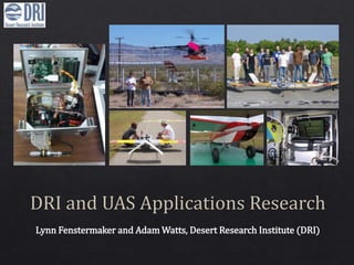
DRI and UAS Applications Research
•Download as PPTX, PDF•
1 like•2,919 views

DRI innovates research with airborne platforms. Applications include multispectral monitoring for climate change, land management, atmospheric cloud physics, field soil stability and spectral measurements with infrared images, wildfire monitoring and data visualization, and advanced cloud seeding technologies.

Recommended
More Related Content
What's hot
What's hot (17)
Viewers also liked
Viewers also liked (18)
Similar to DRI and UAS Applications Research
Similar to DRI and UAS Applications Research (20)
More from DRIscience
More from DRIscience (13)
Recently uploaded
Recently uploaded (20)
DRI and UAS Applications Research
- 1. Lynn Fenstermaker and Adam Watts, Desert Research Institute (DRI)
- 3. Large T-Probe: designed and fabricatd by J. Hallett and R. Purcell (DRI) - Simultaneously measures cloud liquid, ice and total water - Currently mounted on manned NSF aircraft - Fabricating smaller probe for UAS platform Photoacoustic instrument: designed by P. Arnott (DRI/UNR) - Measures aerosol light absorption and scattering, which is impacted by air pollution - 4 patents and commercialization of 3 versions partnering with Droplet Measurement Technology
- 5. Mojave Global Change Facility 96 plots with factorial treatments of increased summer precipitation, nitrogen deposition and soil crust disturbance Needed an efficient way to monitor whole plot treatment effect, so we developed a UAS platform with multispectral camera
- 6. Assessing Climate Change Treatment Effects with a Radio Control Helicopter Multispectral Platform Dr. Lynn Fenstermaker, Desert Research Institute ▪ Eric Knight, University of Nevada, Las Vegas UAS Platform: Class I, radio control helicopter, 55.7” length Sensor Package: Tetracam multispectral camera simulating green, red and IR Landsat bands and real time altimeter with engine and battery monitoring Multispectral CIR photoStandard color digital photo
- 7. Treatment I = irrigated, NI = not irrigated 0 kg ha-1 Nitrogen, 10 kg ha-1 Nitrogen, 40 kg ha-1 Nitrogen D = disturbed, ND = not disturbed I-0-D I-0-ND I-10-D I-10-ND I-40-D I-40-ND NI-0-D NI-0-ND NI-10-D NI-10-ND NI-40-D NI-40-ND %GreenCover 0 5 10 15 20 25
- 8. Desert Research Institute Kenneth McGwire Lynn Fenstermaker David McGraw USDA Agricultural Research Service Mark Weltz Christo Morris Julie Finzell Federal land management agencies like the USFS, BLM and the NRCS rely heavily on field measurements to monitor the health and productivity of millions of acres. UAS technology can support more efficient and comprehensive landscape characterization to meet those missions.
- 9. 9 UAS color infrared imagery used to measure leaf area in cattle allotments and set stocking rates. The very high spatial resolution of UAS imagery helps improve models for soil erosion and ecosystem function. Graph shows UAS sampling improves statistical confidence over field and satellite observations and with a significantly smaller number of observation points. Feasibility Testing Results
- 10. Moisture dynamics in the cloudy and polluted tropical atmosphere: The Cloud Aerosol Radiative Forcing Dynamics Experiment (CARDEX) Eric Wilcox, DRI, eric.wilcox@dri.edu, 775-673-7686 Rick Thomas, P. S. Praveen, Kristina Pistone, V. Ramanathan, Lynne Russell, Scripps/UCSD Frida Bender, Örjan Gustaffson , Stockholm University Yan Feng, Argonne National Laboratory Nic Beres, Hans Moosmüller, Rajan Chackrabarty, DRI Julia Remmers, Steffen Doener, Max Planck Institute, Mainz
- 11. Cloud physics aircraft measures cloud drop sizes and concentration. Flux aircraft measures high-frequency variations of vertical velocity, temperature, and humidity. Aerosol/radiation aircraft measures aerosol particle concentration, black carbon concentration and up/down solar fluxes.
- 13. CARDEX Aerosol Concentration Vertical Profile
- 14. New: Assessment of Biological Soil Crust and Impact on Soil Stability Collaborative Project: U.S. Army Corps of Engineers and DRI Sample collection and measurements of BSC polysaccharide content Field soil stability and spectral measurements sUAS (eBee, fixed wing) acquisition of high resolution color and near infrared images. Compare spectra and images with field and lab data
- 15. eBee Images Acquired March and April 2015
- 17. •1st phase: fabricate miniaturized ejectable flare technology (DONE) •Select UAS Platform: DA Savant (DONE) •Test Flights with flares (DONE) •Test Flights to eject flares (DONE) •Future Test Flights under realistic cloud seeding conditions •Wing icing •Swarm flights •BLOS
- 18. 18
- 20. RGB, NIR and Thermal Imaging Cameras Color DEM Veg + DEM
- 21. 21
Editor's Notes
- Add NSF logo here and at end
- Add BrC discussion to this and mention the DRI and