Megacities provide some of the worldโs most dynamic and stimulating places to live. But they also bring their own specific challenges. The maturity level of a city can help identify the most appropriate ICT solutions.
For more information on the Networked Society visit: http://www.ericsson.com/networkedsociety
The document discusses the proposed humanities curriculum for grades 6-8 at Shanghai American School, Pudong. It provides an overview of each grade's curriculum, which is organized into themes and incorporates literature studies, films, and other texts. The curriculum is designed to be interdisciplinary and encourage connections between subjects. It aims to develop students' skills and prepare them for an evolving global workforce through authentic learning experiences.
These students spent a week exploring Shanghai and its surroundings. Their brief was to respond digitally to one of 3 essential questions:
1. How does the way space is used within a city impact on the environment?
2. What actions can we, as individuals, take to minimize our carbon footprint?
3. What is the relationship between industry, the environment and sustainable development?
This group chose to focus on 'green work' versus 'green wash' here in Shanghai.
The United Nations Environment Programme (UNEP) released today 18.august 2009 its assessment of Shanghai's efforts to organize an environmentally-friendly Expo 2010 that aims to benefit not only the 70 million expected visitors but also leave a green legacy for the city's over 20 million residents.
Chen provides an introduction to their city of Shanghai through photos and descriptions. They describe their community, which is located near the city center and has high-rise buildings and an outdoor swimming pool. Photos show the rainy weather and local markets selling breakfast foods. Transportation options like buses, subways, taxis are mentioned. Famous areas like Yu Garden, The Bund, Lujiazui are described along with attractions like Oriental Pearl Tower. The document serves as an initial overview of Shanghai from Chen's perspective and invites the reader to contact them for more details.
The Mumbai Metropolitan Region extends over an area of 4355 sq. km and comprises Municipal Corporations of Greater Mumbai, Thane, Kalyan, Navi Mumbai and Ulhasnagar; 15 municipal towns; 7 non-municipal urban centers; and 995 villages. Its administrative limits cover Mumbai City and Mumbai Suburban Districts, and parts of Thane and Raigad District. There are 40 Planning Authorities in the Region that are responsible for the micro-level planning of the different areas.
SOCIAL CHANGE
NOTE: Cultural Change: refers to a particular group.
An alteration to the SOCIAL ORDER of a SOCIETY. CHANGE adopted by THE WHOLE SOCIETY.
CHANGE over time by cultural, religious, economic, scientific, technologies in: Values, Norms, Attitudes, Behaviour.
Six simple 'steps' to Social Change.
Finding the Issue;
What is the Goal?;
Planning - Phase 1;
Planning - Phase 2;
Measuring Success;
Monitor and Action.
Is it a VISION or a MISSION Statement?
Even though they are often confused with each otherโฆ
A VISION STATEMENT serves a different purpose from a MISSION STATEMENT.
A MISSION STATEMENT serves a different purpose from a VISION STATEMENT.
Education - a short run down on whether Cane Toads are a saviour or a menace. It begins with five, maybe, known facts and why they were introduced to northern Queensland. And now 85 years later do they hold Australian Species at ransom?
The Shame of Child Labour โ 2 - through the lens of Lewis Wickes Hine 1908-1924Yaryalitsa
ย
In 1908 Hine left his teaching position at the progressive Ethical Culture School in New York to become a staff photographer for the National Child Labor Committee. The same year, he described his pictures in a reform journal as "graphic representation of conditions and methods of work, through pictures for exhibits, reports, folders, magazine and newspaper articles, and lantern slides." Over the next decade Hine made thousands of negatives-often undercover-of children working in mills, sweatshops, factories, and various street trades, such as the delivery boy pictured here. Through a steady accumulation of specific, idiosyncratic facts, the photographer hoped to reveal the larger, hidden patterns of exploitation upon which the American city was rapidly expanding. More important, his reports and slide lectures were not meant solely as tools for labor reform but as ways of triggering a more profound, empathetic response in the viewer, one that would cause him to reconsider his relationship to society.
NOTE:
There is a Number 2 as well: The Shame of Child Labour โ 1 - through the lens of Lewis Wickes Hine 1908-1924
at the following URL in Slideshare:https://www.slideshare.net/yaryalitsa/the-shame-of-child-labour-1-through-the-lens-of-lewis-wickes-hine-19081924
The Shame of Child Labour โ 1 - through the lens of Lewis Wickes Hine 1908-1924Yaryalitsa
ย
In 1908 Hine left his teaching position at the progressive Ethical Culture School in New York to become a staff photographer for the National Child Labor Committee. The same year, he described his pictures in a reform journal as "graphic representation of conditions and methods of work, through pictures for exhibits, reports, folders, magazine and newspaper articles, and lantern slides." Over the next decade Hine made thousands of negatives-often undercover-of children working in mills, sweatshops, factories, and various street trades, such as the delivery boy pictured here. Through a steady accumulation of specific, idiosyncratic facts, the photographer hoped to reveal the larger, hidden patterns of exploitation upon which the American city was rapidly expanding. More important, his reports and slide lectures were not meant solely as tools for labor reform but as ways of triggering a more profound, empathetic response in the viewer, one that would cause him to reconsider his relationship to society.
NOTE:
There is a Number 2 as well: The Shame of Child Labour โ 2 - through the lens of Lewis Wickes Hine 1908-1924
at the following URL in Slideshare:
https://www.slideshare.net/yaryalitsa/the-shame-of-child-labour-1-through-the-lens-of-lewis-wickes-hine-19081924-77331832
S.O.L.O Taxonomy (SOLO Taxonomy for Junior Students) [Structure of the Observ...Yaryalitsa
ย
A General Look at SOLO TAXONOMY.
Overview aimed for Year 7 and 8 can be used at Year 9.
Structure of the Observed Learning Outcome
Pages are animated so required to download to see the animation.
50 +1 Strange Wonders on Earth - PowerPointYaryalitsa
ย
51 natural wonders of the world but strange at the same time, presented in a colourful PowerPoint with a small description for each.
PowerPoint needs to be downloaded to view animation on the first and last slide.
Other PowerPoints by me at the following URL on slideshare:
Top Ten Australian Landforms
http://www.slideshare.net/yaryalitsa/powerpoint-top-10-australian-landforms
Weird Landscapes โ one finds on Earth
http://www.slideshare.net/yaryalitsa/weird-landscapes-one-finds-on-earth
10 Natural Wonder of the World
http://www.slideshare.net/yaryalitsa/10-natural-wonders-of-the-world-powerpoint
PowerPoint: Chernobyl years after the nuclear disaster โ 26 April 1986 โ 26 ...Yaryalitsa
ย
On April 26, 1986, a nuclear disaster occurred at the Chernobyl Nuclear Power Plant in Ukraine, releasing radioactive material and causing the worst nuclear accident in history. The town of Pripyat near the plant was abandoned after the residents were evacuated. In 2009, Swiss photographer Timm Suess visited Pripyat and documented the abandoned buildings and infrastructure, publishing his photos and observations in his Chernobyl Journal. His photos show the eerie decay and reclamation of nature in the ghost town left behind after the residents fled following the nuclear disaster.
Lines of Latitude and Longitude โ WorksheetYaryalitsa
ย
WORKSHEET on Lines of Latitude, Lines of Longitude, Climate Zones, Equinoxes, Solstices, The Three Norths, Prime Meridian, International Date Line, Greenwich Mean Time, Coordinated Universal Time.
WORKSHEET to work with: Lines of Latitude and Longitude โ PowerPoint at:
http://www.slideshare.net/yaryalitsa/lines-of-latitude-and-longitude-powerpoint
Lines of Latitude and Longitude โ PowerPointYaryalitsa
ย
PowerPoint on Lines of Latitude, Lines of Longitude, Climate Zones, Equinoxes, Solstices, The Three Norths, Prime Meridian, International Date Line, Greenwich Mean Time, Coordinated Universal Time.
Lines of Latitude and Longitude โ Worksheet at:
http://www.slideshare.net/yaryalitsa/lines-of-latitude-and-longitude-worksheet
A collection of 10 poems about the Holocaust.
OTHER POWERPOINTS:
HOLOCAUST ART
PowerPoint: at URL: http://www.slideshare.net/yaryalitsa/powerpoint-holocaust-art
PowerPoint: Top 10 Australian Man-Made Landmarks Yaryalitsa
ย
PowerPoint: Top 10 Australian Man-Made Landmarks
includes:
* Australian States and Territories and their Capital Cities;
* Answers: What is a 'Landform'?
* Answers: What is a 'Landmark'?
* Answers: What is a 'Landscape'?
From number 10 - Number 1 (countdown):
Broome, ANZAC Cove, Ballarat, Cape Byron Lighthouse, Parliament House, Barossa Valley, Q1, MCG (Melbourne Cricket Ground), Port Arthur, Sydney Opera House
Worksheet: PowerPoint: Top 10 Australian Man-Made Landmarks at:
http://www.slideshare.net/yaryalitsa/worksheet-powerpoint-top-10-australian-manmade-landmarks
Worksheet: PowerPoint: Top 10 Australian Man-Made LandmarksYaryalitsa
ย
Worksheet: PowerPoint: Top 10 Australian Man-Made Landmarks
PowerPoint: Top 10 Australian Man-Made Landmarks at:
http://www.slideshare.net/yaryalitsa/powerpoint-top-10-australian-manmade-landmarks
* Australian States and Territories and their Capital Cities;
* Answers: What is a 'Landform'?
* Answers: What is a 'Landmark'?
* Answers: What is a 'Landscape'?
From number 10 - Number 1 (countdown):
Broome, ANZAC Cove, Ballarat, Cape Byron Lighthouse, Parliament House, Barossa Valley, Q1, MCG (Melbourne Cricket Ground), Port Arthur, Sydney Opera House
PowerPoint: Top 10 Australian Landmarks
includes:
* Australian States and Territories and their Capital Cities;
* Answers: What is a 'Landform'?
* Answers: What is a 'Landmark'?
* Answers: What is a 'Landscape'?
From number 10 - Number 1 (countdown):
Ballarat, Shark Bay, Bondi Beach, MCG (Melbourne Cricket Ground), Kangaroo Island, Kakadu National Park, Port Arthur, Heart Reef, Uluru (Ayers Rock), Sydney Opera House.
Worksheet for PowerPoint: Top 10 Australian Landmarks at:
http://www.slideshare.net/yaryalitsa/worksheet-for-powerpoint-top-10-australian-landmarks
Worksheet for PowerPoint: Top 10 Australian Landmarks Yaryalitsa
ย
Worksheet for PowerPoint: Top 10 Australian Landmarks
PowerPoint: Top 10 Australian Landmarks at:
http://www.slideshare.net/yaryalitsa/powerpoint-top-10-australian-landmarks
PowerPoint: Top 10 Australian Landmarks
includes:
* Australian States and Territories and their Capital Cities;
* Answers: What is a 'Landform'?
* Answers: What is a 'Landmark'?
* Answers: What is a 'Landscape'?
From number 10 - Number 1 (countdown):
Ballarat, Shark Bay, Bondi Beach, MCG (Melbourne Cricket Ground), Kangaroo Island, Kakadu National Park, Port Arthur, Heart Reef, Uluru (Ayers Rock), Sydney Opera House.
PowerPoint: Top 10 Australian Landforms
includes:
* Australian States and Territories and their Capital Cities;
* Answers: What is a 'Landform'?
* Answers: What is a 'Landmark'?
* Answers: What is a 'Landscape'?
From number 10 - Number 1 (countdown):
Katherine Gorge, The Twelve Apostles, Flinders Ranges, Horizontal Falls, The Three Sisters, Daintree Rainforest, Cradle Mountain, Bungle Bungle Ranges, Heart Reef, Uluru (Ayers Rock)
Worksheet for PowerPoint: Top 10 Australian Landforms at:
http://www.slideshare.net/yaryalitsa/worksheet-top-10-australian-landforms
Worksheet for PowerPoint: Top 10 Australian Landforms
PowerPoint: Top 10 Australian Landforms at:
http://www.slideshare.net/yaryalitsa/powerpoint-top-10-australian-landforms
PowerPoint: Top 10 Australian Landforms
includes:
* Australian States and Territories and their Capital Cities;
* Answers: What is a 'Landform'?
* Answers: What is a 'Landmark'?
* Answers: What is a 'Landscape'?
From number 10 - Number 1 (countdown):
Katherine Gorge, The Twelve Apostles, Flinders Ranges, Horizontal Falls, The Three Sisters, Daintree Rainforest, Cradle Mountain, Bungle Bungle Ranges, Heart Reef, Uluru (Ayers Rock)
Looks at the question of:
HOW MANY BIOMES?
There is no clear answer and the powerpoint goes through the possible answers.
It concludes to five basic biomes that include โsub-biomesโ.
You need to download PowerPoint in order to view animations.
There is a WORKSHEET that accompanies this POWERPOINT at:
http://www.slideshare.net/yaryalitsa/biomes-worksheet
Biomes Worksheet
accompanies Biomes: PowerPoint at:
http://www.slideshare.net/yaryalitsa/biomes-powerpoint
Looks at the question of:
HOW MANY BIOMES?
There is no clear answer and the powerpoint goes through the possible answers.
It concludes to five basic biomes that include โsub-biomesโ.
How to Setup Default Value for a Field in Odoo 17Celine George
ย
In Odoo, we can set a default value for a field during the creation of a record for a model. We have many methods in odoo for setting a default value to the field.
Elevate Your Nonprofit's Online Presence_ A Guide to Effective SEO Strategies...TechSoup
ย
Whether you're new to SEO or looking to refine your existing strategies, this webinar will provide you with actionable insights and practical tips to elevate your nonprofit's online presence.
Gender and Mental Health - Counselling and Family Therapy Applications and In...PsychoTech Services
ย
A proprietary approach developed by bringing together the best of learning theories from Psychology, design principles from the world of visualization, and pedagogical methods from over a decade of training experience, that enables you to: Learn better, faster!
How to Download & Install Module From the Odoo App Store in Odoo 17Celine George
ย
Custom modules offer the flexibility to extend Odoo's capabilities, address unique requirements, and optimize workflows to align seamlessly with your organization's processes. By leveraging custom modules, businesses can unlock greater efficiency, productivity, and innovation, empowering them to stay competitive in today's dynamic market landscape. In this tutorial, we'll guide you step by step on how to easily download and install modules from the Odoo App Store.
THE SACRIFICE HOW PRO-PALESTINE PROTESTS STUDENTS ARE SACRIFICING TO CHANGE T...indexPub
ย
The recent surge in pro-Palestine student activism has prompted significant responses from universities, ranging from negotiations and divestment commitments to increased transparency about investments in companies supporting the war on Gaza. This activism has led to the cessation of student encampments but also highlighted the substantial sacrifices made by students, including academic disruptions and personal risks. The primary drivers of these protests are poor university administration, lack of transparency, and inadequate communication between officials and students. This study examines the profound emotional, psychological, and professional impacts on students engaged in pro-Palestine protests, focusing on Generation Z's (Gen-Z) activism dynamics. This paper explores the significant sacrifices made by these students and even the professors supporting the pro-Palestine movement, with a focus on recent global movements. Through an in-depth analysis of printed and electronic media, the study examines the impacts of these sacrifices on the academic and personal lives of those involved. The paper highlights examples from various universities, demonstrating student activism's long-term and short-term effects, including disciplinary actions, social backlash, and career implications. The researchers also explore the broader implications of student sacrifices. The findings reveal that these sacrifices are driven by a profound commitment to justice and human rights, and are influenced by the increasing availability of information, peer interactions, and personal convictions. The study also discusses the broader implications of this activism, comparing it to historical precedents and assessing its potential to influence policy and public opinion. The emotional and psychological toll on student activists is significant, but their sense of purpose and community support mitigates some of these challenges. However, the researchers call for acknowledging the broader Impact of these sacrifices on the future global movement of FreePalestine.
Information and Communication Technology in EducationMJDuyan
ย
(๐๐๐ ๐๐๐) (๐๐๐ฌ๐ฌ๐จ๐ง 2)-๐๐ซ๐๐ฅ๐ข๐ฆ๐ฌ
๐๐ฑ๐ฉ๐ฅ๐๐ข๐ง ๐ญ๐ก๐ ๐๐๐ ๐ข๐ง ๐๐๐ฎ๐๐๐ญ๐ข๐จ๐ง:
Students will be able to explain the role and impact of Information and Communication Technology (ICT) in education. They will understand how ICT tools, such as computers, the internet, and educational software, enhance learning and teaching processes. By exploring various ICT applications, students will recognize how these technologies facilitate access to information, improve communication, support collaboration, and enable personalized learning experiences.
๐๐ข๐ฌ๐๐ฎ๐ฌ๐ฌ ๐ญ๐ก๐ ๐ซ๐๐ฅ๐ข๐๐๐ฅ๐ ๐ฌ๐จ๐ฎ๐ซ๐๐๐ฌ ๐จ๐ง ๐ญ๐ก๐ ๐ข๐ง๐ญ๐๐ซ๐ง๐๐ญ:
-Students will be able to discuss what constitutes reliable sources on the internet. They will learn to identify key characteristics of trustworthy information, such as credibility, accuracy, and authority. By examining different types of online sources, students will develop skills to evaluate the reliability of websites and content, ensuring they can distinguish between reputable information and misinformation.
Information and Communication Technology in Education
ย
World's Biggest Megacities - December, 2012
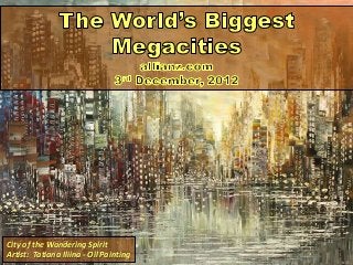
1. City of the Wandering Spirit
Artist: Tatiana Iliina - Oil Painting
2. Buenos Aires, ARGENTINA
Urban Area Population (Est.): 13.5 million people
City Area Population (Est.): 2.9 million people
URBAN DETAIL: Buenos Aires is known for its European style architecture and culture, a legacy of the
Spanish and Italian origins of most of the population. It has the highest concentration of theatres in
Latin America and is the birthplace of Tango music and dance.
(Source: Reuters)
3. Buenos Aires, ARGENTINA
Urban Area Population (Est.): 13.5 million people
City Area Population (Est.): 2.9 million people
Coordinates:
Latitude: 34 37โ South
Longitude: 58 23โ West
According to the 2012 edition of Demographia's
World Urban Areas index, the capital of Argentina is
the second largest urban area in South America after
Sao Paulo. Its per capita income is among the highest
in Latin America and its quality of life is ranked
number one in the region, although some estimates
say that 4 million people in the area live in poverty.
It is also reportedly the most visited city in Latin
America.
4. Karachi, PAKISTAN
Urban Area Population (Est.): 13.8 million people
City Area Population (Est.): 13.0 million people
URBAN DETAIL: After Pakistan won independence from the British and separated from India Karachiโs
population increased hugely as hundreds of thousands of Muslim migrants from India settled
there, transforming its demographics and economy.
(Source: Reuters)
5. Coordinates:
Latitude: 24 51โ North
Longitude: 67 02โ East
Students attend a rooftop evening class in a private
school in a slum area in Karachi, the largest city, main
seaport and financial centre of Pakistan.
Karachi is the second largest city proper in the world
after Shanghai and accounts for about 20 per cent of
Pakistanโs GDP.
It is growing rapidly due to rural-urban migration.
Karachi, PAKISTAN
Urban Area Population (Est.): 13.8 million people
City Area Population (Est.): 13.0 million people
6. Kolkata (Calcutta), INDIA
Urban Area Population (Est.): 14.4 million people
City Area Population (Est.): 4.5 million people
URBAN DETAIL: Much of the city was originally wetland and swamp. The land was reclaimed over the
centuries to accommodate the rapidly increasing population. Kolkata is where Mother Teresa began her
work caring for the poor and the sick.
(Source: Reuters)
7. Kolkata (Calcutta), INDIA
Urban Area Population (Est.): 14.4 million people
City Area Population (Est.): 4.5 million people
Coordinates:
Latitude: 22 35โ North
Longitude: 88 21โ East
Kolkata, formerly Calcutta, sits on the banks of the
River Hooghly which empties into the Bay of Bengal.
The city is Indiaโs oldest port and the commercial and
cultural capital of East India, with the third largest
economy in South Asia after Mumbai and Delhi.
Here Kolkata students smear each other with
coloured powder during Holi, the Indian festival of
colours heralding the beginning of Spring.
8. Los Angeles, USA
Urban Area Population (Est.): 14.9 million people
City Area Population (Est.): 3.8 million people
URBAN DETAIL: Los Angeles is home to the largest Mexican, Guatemalan, and Korean populations
outside of those countries. Almost 40 per cent of the cityโs population was born outside the United
States.
(Source: Reuters)
9. Los Angeles, USA
Urban Area Population (Est.): 14.9 million people
City Area Population (Est.): 3.8 million people
Coordinates:
Latitude: 34 03โ North
Longitude: 118 15โ West
Los Angeles is the second biggest city in the United
States by land size.
An extensive grid of freeways, boulevards, and
smaller neighbourhood roads spans the city.
10. Dhaka, BANGLADESH
Urban Area Population (Est.): 15.4 million people
City Area Population (Est.): 7.0 million people
URBAN DETAIL: Dhaka is known as the rickshaw capital of the world as most people get around using
cycle rickshaws or auto-rickshaws.
(Source: Reuters)
11. Dhaka, BANGLADESH
Urban Area Population (Est.): 15.4 million people
City Area Population (Est.): 7.0 million people
Coordinates:
Latitude: 23 43โ North
Longitude: 90 25โ East
One of the fastest growing cities in the world, Dhaka
has attracted economic migrants from all over
Bangladesh.
As many as one quarter of Dhakaโs residents live in
crowded slums, according to the World Bank.
12. Moscow, RUSSIA
Urban Area Population (Est.): 15.5 million people
City Area Population (Est.): 11.8 million people
URBAN DETAIL: With more passengers than New York City and London combined, Moscow has the
worldโs second busiest metro system after Tokyo. It serves more than nine million people a day, has 182
stations, and 301 kilometres (187 miles) of routes.
(Source: Reuters)
13. Moscow, RUSSIA
Urban Area Population (Est.): 15.5 million people
City Area Population (Est.): 11.8 million people
Coordinates:
Latitude: 55 45โ North
Longitude: 37 37โ East
By far Europe's biggest city, Moscow has been
swelled by rising numbers of migrants from other
parts of Russia and the former Soviet states, attracted
by higher living standards.
Russiaโs expanding economy has attracted people to
the capital which is becoming richer.
14. Guangzhou-Foshan, CHINA
Urban Area Population (Est.): 16.8 million people
City Area Population (Est.): 11.0 million people
URBAN DETAIL: Ahead of the Asian Games in 2010 many buildings were demolished to make way for
more modern developments as property prices soared and developers poured billions into real estate.
(Source: Reuters)
15. Guangzhou-Foshan, CHINA
Urban Area Population (Est.): 16.8 million people
City Area Population (Est.): 11.0 million people
Coordinates:
Latitude: 23 08โ North
Longitude: 113 16โ East
Historically known as Canton, Guangzhou is Chinaโs
third largest city and located on the Pearl River in
southern China about 120 kilometres northwest of
Hong Kong.
It is a critical trading port and capital of Chinaโs
industrial and manufacturing province of
Guangdong, which has been one of the fastest
urbanizing areas of the world for many years.
16. Mumbai, INDIA
Urban Area Population (Est.): 16.9 million people
City Area Population (Est.): 12.5 million people
URBAN DETAIL: Over half of the cityโs population lives in slums. Poor infrastructure and widespread
poverty make it very difficult to meet the demands of an ever-growing population.
(Source: Reuters)
17. Mumbai, INDIA
Urban Area Population (Est.): 16.9 million people
City Area Population (Est.): 12.5 million people
Coordinates:
Latitude: 18 57โ North
Longitude: 72 50โ East
Mumbai โ called Bombay until the name was
changed in 1995 โ is the commercial and movie
capital of India and has attracted millions of migrants
from the countryside.
With high birth rates and the continued influx of
migrants, Mumbaiโs population is expected to grow
rapidly in the future.
18. Keihanshin (Osaka-Kobe-Kyoto), Japan
Urban Area Population (Est.): 17.0 million people
City Area Population (Est.): N/A million people
URBAN DETAIL: Large parts of the city of Kobe were destroyed in the Great Hanshin Earthquake of 1995
which claimed over 6000 lives and caused about 100 billion dollars in damages. The disaster was widely
seen as a major wake up call for the Japanese emergency services and led to improvements in
construction that paid dividends during the massive 2011 earthquake.
(Source: Reuters)
19. Keihanshin (Osaka-Kobe-Kyoto), Japan
Urban Area Population (Est.): 17.0 million people
City Area Population (Est.): N/A million people
Coordinates:
Latitude: 34 40โ North
Longitude: 135 30โ East
Made up of the commercial and industrial city of
Osaka, the port of Kobe, and the ancient cultural
capital of Kyoto, the Kansai megacity encompasses all
aspects of Japanese life from the neon lit Dotonbori
shopping district in Osaka pictured here to the Zen
gardens and geisha houses of Kyoto.
It is home to about 15 per cent of Japanโs population.
20. Beijing, CHINA
Urban Area Population (Est.): 17.3 million people
City Area Population (Est.): 11.7 million people
URBAN DETAIL: Bicycles are a common means of transportation for most people in Beijing. But the
number of cars is increasing by an estimated 15,000 every day.
(Source: Reuters)
21. Beijing, CHINA
Urban Area Population (Est.): 17.3 million people
City Area Population (Est.): 11.7 million people
Coordinates:
Latitude: 39 55โ North
Longitude: 116 23โ East
Chinaโs capital hosted a spectacular if controversial
Olympic Games in 2008.
Despite spending billions to clean the city's air,
average air pollution levels remain five times above
WHO (World Health Organisation) safety standards.
WHO - Air Quality and Health Standards - Fact Sheet
22. Cairo, EGYPT
Urban Area Population (Est.): 17.8 million people
City Area Population (Est.): 6.7 million people
URBAN DETAIL: The city is also known by the name โAl-Qahirahโ, โThe Triumphantโ in Arabic. It is
home to the oldest and biggest music and film industry in the Arab world .
(Source: Reuters)
23. Cairo, EGYPT
Urban Area Population (Est.): 17.8 million people
City Area Population (Est.): 6.7 million people
Coordinates:
Latitude: 30 03โ North
Longitude: 31 14โ East
Located on the banks of the Nile River, Cairo is the
biggest urban area in Africa and in the Arab world.
Bustling bazaars and narrow lanes, the smells of
spices and pipe smoke, the call to prayer five times a
day and the cacophony of horns โ this is Cairo.
24. Mexico City, MEXICO
Urban Area Population (Est.): 19.4 million people
City Area Population (Est.): 8.8 million people
URBAN DETAIL: Security, air pollution, and traffic congestion are prime concerns in Mexico City. These
problems result from poor resource management and unstructured growth.
(Source: Reuters)
25. Mexico City, MEXICO
Urban Area Population (Est.): 19.4 million people
City Area Population (Est.): 8.8 million people
Coordinates:
Latitude: 19 25โ North
Longitude: 99 08โ West
Mexico City is ten times the size it was in 1940.
The Mexican capital generates a quarter of the
country's wealth. However, with low population
growth, the number of people in retirement is
expected to rise rapidly.
26. Sรฃo Paulo, BRAZIL
Urban Area Population (Est.): 20.2 million people
City Area Population (Est.): 11.2 million people
URBAN DETAIL: Sรฃo Paulo is a very young and ethnically diverse city. More than half of its population is
under twenty years old, and it is home to the largest Japanese community outside Japan.
(Source: Shutterstock)
27. Sรฃo Paulo, BRAZIL
Urban Area Population (Est.): 20.2 million people
City Area Population (Est.): 11.2 million people
Coordinates:
Latitude: 23 34โ South
Longitude: 46 38โ West
Sรฃo Paulo is Brazilโs richest city and the most
important financial centre in Latin America.
Poverty and crime, however, remain a problem. An
average of 6,000 people are murdered annually in
Sao Paulo.
28. New York, USA
Urban Area Population (Est.): 20.4 million people
City Area Population (Est.): 8.2 million people
URBAN DETAIL: New York has been a gateway to America ever since the first immigrants came to the
U.S. Over 170 languages are spoken there today. No single nationality or ethnicity dominates the cityโs
culturally diverse population.
(Source: Reuters)
29. New York, USA
Urban Area Population (Est.): 20.4 million people
City Area Population (Est.): 8.2 million people
Coordinates:
Latitude: 40 43โ North
Longitude: 74 01โ West
New York City, especially Manhattan, is a role model
for balancing dense development with good public
transport and access to open spaces.
New York is the only American city where most
households do not own a car.
30. Shanghai, CHINA
Urban Area Population (Est.): 20.8 million people
City Area Population (Est.): 17.8 million people
URBAN DETAIL: Shanghai has one of the world's most remarkable skylines. Thirty five structures are
taller than 200 metres, including two over 450 metres, the Oriental Pearl TV Tower and the Shanghai
World Financial Centre.
(Source: Reuters)
31. Shanghai, CHINA
Urban Area Population (Est.): 20.8 million people
City Area Population (Est.): 17.8 million people
Coordinates:
Latitude: 31 14โ North
Longitude: 121 27โ East
Shanghai has become China's financial and
commercial centre and is ranked as the planet's
largest city proper.
It has one of the worldโs busiest ports and the worldโs
most extensive bus system with more than one
thousand lines.
32. Manila, PHILIPPINES
Urban Area Population (Est.): 21.9 million people
City Area Population (Est.): 11.8 million people
URBAN DETAIL: More than 3 million people in Manila live in slums without electricity, sanitation, and
access to drinking water. Population density is extremely high, in some areas more than 100,000 people
live on one square kilometre.
(Source: Reuters)
33. Manila, PHILIPPINES
Urban Area Population (Est.): 21.9 million people
City Area Population (Est.): 11.8 million people
Coordinates:
Latitude: 14 37โ North
Longitude: 121 00โ East
Manila's colonial past is reflected in its architecture.
Intramuros, the historic centre, is surrounded by a
massive wall built by the Spanish in the 16th century.
Its parks and historic buildings have become a major
tourist attraction.
34. Delhi, INDIA
Urban Area Population (Est.): 22.2 million people
City Area Population (Est.): 11.0 million people
URBAN DETAIL: Twenty languages are spoken in Delhi. The official and most widely spoken language is
Hindi, followed by Punjabi. English is used for business and other official purposes. Urdu is common
among the Muslim community.
(Source: Shutterstock)
35. Delhi, INDIA
Urban Area Population (Est.): 22.2 million people
City Area Population (Est.): 11.0 million people
Coordinates:
Latitude: 28 40โ North
Longitude: 77 14โ East
Delhi is Indiaโs capital and recently overtook Mumbai
as the biggest city by population size. Itโs a place of
striking contrasts. Mosques, bazaars, and narrow
lanes mark the old town.
New Delhi, the capital, features grand
boulevards, business centres, and shopping malls.
36. Seoul-Incheon, SOUTH KOREA
Urban Area Population (Est.): 22.5 million people
City Area Population (Est.): 10.5 million people
URBAN DETAIL: Seoul is located 50 kilometres south of the heavily armed border with North Korea. The
city is in range of North Korean artillery. Plans to move the capital further south have already caused
much debate.
(Source: Reuters)
37. Seoul-Incheon, SOUTH KOREA
Urban Area Population (Est.): 22.5 million people
City Area Population (Est.): 10.5 million people
Coordinates:
Latitude: 37 34โ North
Longitude: 126 59โ East
Seoul has grown rapidly since the Korean War (1950-
53). Today, nearly half of the countryโs population
lives in and around Seoul.
Seoul has made remarkable progress in combating air
pollution and is one of the cleanest cities in Asia.
38. Jakarta, INDONESIA
Urban Area Population (Est.): 26.0 million people
City Area Population (Est.): 9.6 million people
URBAN DETAIL: Despite many wide roads, Jakarta suffers from terrible traffic congestion. To reduce
traffic jams, some major roads have a 'three in one' rule during rush hours, prohibiting fewer than three
passengers per car.
(Source: Reuters)
39. Jakarta, INDONESIA
Urban Area Population (Est.): 26.0 million people
City Area Population (Est.): 9.6 million people
Coordinates:
Latitude: 06 09โ South
Longitude: 106 49โ East
Jakarta has been booming since 2005 after suffering
economic crises and disasters like floods and
earthquakes in recent decades.
Jakarta's economy has boosted Indonesiaโs economy
to a growth rate of 6 per cent.
40. Tokyo-Yokohama, JAPAN
Urban Area Population (Est.): 37.2 million people
City Area Population (Est.): 8.9 million people
URBAN DETAIL: Tokyo Bay has been gradually filled up to create more living space. Odaiba, an island
made from waste, has become one of Tokyoโs most interesting tourist spots and destinations for day
trippers.
(Source: Miki Yokoyama)
41. Tokyo, JAPAN
Urban Area Population (Est.): 37.2 million people
City Area Population (Est.): 8.9 million people
Coordinates:
Latitude: 35 41โ North
Longitude: 139 42โ East
Greater Tokyo is the largest urban agglomeration in
the world, swallowing up the neighbouring cities of
Yokohama, Kawasaki, and Chiba.
Despite its size, Tokyo has very efficient public
transportation, which accounts for almost 80 per cent
of all journeys.
42. Future Megacities
Future Megacities
Kids Encyclopedia - Britannica
Megacities and the Developing World
The World's Biggest Megacities - allianz.com
World Health Organization - Homepage
Worldclocks, Coordinates, Locations