Remote sensing and its applications, DIP, GIS, GPS
•Download as PPTX, PDF•
0 likes•159 views

By Suhaib Ul Sabah, Department of Geography, University of Jammu

Recommended
More Related Content
What's hot
What's hot (20)
Similar to Remote sensing and its applications, DIP, GIS, GPS
Similar to Remote sensing and its applications, DIP, GIS, GPS (20)
Recently uploaded
Recently uploaded (20)
Remote sensing and its applications, DIP, GIS, GPS
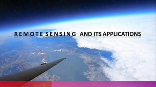
- 1. R E M O T E S E N S I N G AND ITS APPLICATIONS
- 2. REMOTESENSING? • It is defined as the technique of obtaining information about objects through the analysis of data collected by special instruments that are not in physical contact with the objects of investigation. • The electromagnetic radiation is generally used as information carrier in remote sensing
- 3. ELEMENTS INVOLVED IN REMOTE SENSING 1. Energy Source or Illumination(A) 2. Radiation and theAtmosphere (B) 3. Interaction with the Object (C) 4. Recording of Energy by the Sensor (D) 5. Transmission, Reception and Processing (E) 6. Interpretation and Analysis(F) 7.Application (G)
- 4. PLATFORMS The base on which remote sensors are placed to acquire information about the Earth surface is called platforms. 1) Ground based 2) Airborne 3) Space borne
- 5. ADVANTAGES OF REMOTE SENSING:- Provides a regionalview(largeareas). Provides repetitivelooks at thesamearea. Remotesensors "see" overabroader portionofthespectrumthanthehuman eye. Providesgeo-referenced,digitaldata. Some remotesensors operateinall seasons,at night,and inbadweather.
- 7. INTRODUCTION Digital image processing is the use of computer algorithms to perform image processing on digital images As a subcategory or field of digital signal processing, digital image processing has many advantages over analog image processing.
- 8. WHAT IS DIGITAL IMAGE ? A digital image is a representation of a two-dimensional image as a finite set of digital values, called picture elements orpixels.
- 9. WHAT IS DIGITALIMAGE PROCESSING Digital Image Processing involves : • Improvement of pictorial information for human interpretation • Processing of image data for storage, transmission and representation for autonomous machine perception
- 10. G I S ( GEOGRAPHICAL INFORMATION SYSTEM )
- 11. WHAT IS GIS ? “GIS is a computer system capable of assembling, storing, manipulating, and displaying geographically referenced information, i.e. data identified according totheir locations.” “A GIS is an organized collection of computer hardware, software, geographic data, and personnel to efficiently capture, store, update, manipulate, analyze, and display all forms of geographically referenced information.”
- 12. PRINCIPLE Data Capture Database Management and Update Geographic Analysis Preparing Result
- 13. COMPONENTS 1. Hardware : Computer System, Scanner, Printer, Plotter, Flat Board 2. Software : GIS software in use are MapInfo, ARC/Info, etc. 3. Data : A GIS will integrate spatial data with other data resources and can even use a DBMS, used by most organization to maintain their data, to manage spatial data. Geographic data and related tabular data can be collected in-house or purchased from a commercial data provider. 4. People : GIS users range from technical specialists who design and maintain. 5. Method : The map creation can either be automated raster to vector creator.
- 14. DATATYPES Vector ( Points Lines Polygons) Raster ( Cell Pixels Elements)
- 15. ADVANTAGESOF G I S GIS allows us to view, understand, and visualize data in many ways that reveal relationships, patterns, and trends in the form of maps, globes, reports, and charts. A GIS helps you answer questions and solve problems by looking at your data in a way that is quickly understood and easily shared. GIS give the accurate Data. Better Predictions and Analysis.
- 20. “Navigational Satellite Timing And Ranging Global Positioning System” (NAVSTAR GPS)
- 21. H I STORY • Navigating by stars (requires clear nights and careful measurements)most widely used for centuries • The GPS project was developed in 1973 to overcome the limitations of previous navigation systems. • GPS was created and realized by the U.S. Department of Defence and was originally run with 24 satellites. • It became fully operational in 1995. “Bradford Parkinson”, “Roger L. Easton”, and “Ivan A. Getting” are credited with inventing it.
- 22. G P S E L E M E N T S Three segments 1. Space segment. 2. Control segment. 3. User segment. Space Segment Control Segment User Segment
- 23. SPACE SEGMENT •GPS satellites fly in circular orbits at an altitude of 20,200 km and with a period of 12 hours. • Powered by solar cells. • The satellites continuously orient themselves to point their solar panels toward the sun and their antenna toward the earth. • Orbital planes are centered on the Earth. • Orbits are designed so that, at least, six satellites are always within line of sight from any location on the planet.
- 24. CONTROL SEGMENT The CS consists of 3 entities: • Master Control System • Monitor Stations • Ground Antennas
- 25. U S E R SEGMENT • GPS receivers are generally composed of 1. an antenna( tuned to the frequencies transmitted by the satellites), 2. receiver-processors, and 3.highly-stable clock( commonly a crystal oscillator). • They can also include a display for showing location and speed information to the user. • A receiver is often described by its number of channels ( this signifies how many satellites it can monitor simultaneously). • As of recent, receivers usually have between twelve and twenty channels.
- 27. THANK YOU