Archaeo historical environ of cholistan and significance of ancient agriculture in
1. 392 Journal of Food,Agriculture & Environment, Vol.5 (3&4), July-October 2007
Archaeo-historical environ of Cholistan and significance of ancient agriculture in
Pakistan
FarooqAhmad
Department of Geography, University of the Punjab, Lahore, Pakistan. e-mail: farooq@geog.pu.edu.pk
Received 7 April 2007, accepted 21 August 2007.
Abstract
The Hakra civilization, which flourished was one of the longest in the course of world history. Cholistan is the only place where the remnants of
the oldest settlements are still intact because of the desertion of the river Hakra. Archaeological ruined remains present in Cholistan indicate that
water availability in the area was higher centuries ago. The reduction of vegetation to about one third or less of its historical cover most probably
results in considerably higher near surface and surface temperature.As a result, evaporation of the scarce rainfall has increased considerably during
the last decades so reducing the effective rainfall available for range and groundwater recharge, which is well known as self-reinforcing aspect of
desertification. The aridity in Cholistan is rightly seen as a major limitation to wide-scale range improvement and management programmes.
Archaeobotanical evidences suggest that the nuclear area of Indus-Saraswati civilization was located around the Saraswati River. There was a
westward movement of crops domesticated in India to Harappa and to sites in Kashmir and Balochistan during the early and mature phases of
Indus-Saraswati civilization. High agricultural prosperity was witnessed during the mature phase when crop rotation was practiced. However,
during the late phase, with the drying of the Saraswati River, agricultural communities moved eastwards to Ganga valley and southwards to
Madhya Pradesh and Maharashtra.
Key words: Cholistan, Hakra civilization, Mehrgarh, Pakistan, Saraswati River.
www.world-food.net
Journal of Food, Agriculture & Environment Vol.5 (3&4) : 392-398. 2007
WFL Publisher
Science and Technology
Meri-Rastilantie 3 B, FI-00980
Helsinki, Finland
e-mail: info@world-food.net
Introduction
Pakistan is a sub-tropical country with vast semi-arid and arid
tracks of land spread over 68 million hectares receiving less than
250 mm of rain a year. All its provinces possess large chunks of
suchland,i.e.,Punjab119,310km2
,Sindh134,896km2
,Balochistan
149,467 km2
, and its proportion is increasing because of over-
exploitation of premature meadows beyond quick rehabilitation16
.
Disturbance of the natural equilibrium ultimately results in
economical losses, social problems and general moral decline of
the society. Degradation of natural and agricultural ecosystem
has led to a deep environmental crisis.
Cholistan is an extension of the Great Indian Desert, which
includes the Thar Desert in Sindh province of Pakistan and the
Rajasthan Desert in India, covering an area of 26,330 km2
. It lies
with in the southeast quadrant of Punjab province between 27o
42'
and 29o
45' North latitude and 69o
52' and 73o
05' East longitude 2, 4, 5,
10, 27, 32
. The word ‘Cholistan’ has been derived from a Turkish
word, ‘Chol’, which means a desert, while some historians believe
that this name has been distorted from Kurdish word, ‘Chilistan’
meaning waterless waste land 1, 3, 6, 14
, popularly Cholistan is known
as ‘Rohi’. In a dialect still spoken in some parts of Tibet, ‘roh’
means a hill, from which the name Rohilla has been attributed. In
fact, Rohi has been derived from the Pushto word ‘roh’, meaning
isasandydesert.ThemanfromRohiiscalledRohilla12,13
.However,
a reference has been made in Geography of Sindh, that the word
Cholistan has been derived from the ‘Seraiki’ word ‘Wacholo’
meaning ‘in between’. Since this desert is situated between the
Thar and Rajasthan deserts, it was called ‘Wacholo’, which later
became ‘Cholo’ and then Cholistan. This appears to be a more
probable explanation for the origin of this word 34
.
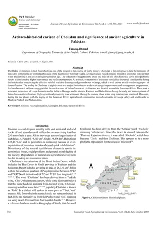
Figure 1. Cholistan Desert: Historical places.
2. Journal of Food,Agriculture & Environment, Vol.5 (3&4), July-October 2007 393
Cradle of HakraValley Civilization
Around 4000 BC Cholistan (Fig. 1) was a cradle of civilization
commonly known as Hakra valley civilization, when Hakra River
flowed through the region. The river supplied water until 1200 BC,
about 600 BC it became irregular in flow and consequently
vanished. The Hakra civilization that flourished was one of the
longest in the course of world history. Aryans were the domestic
people 12
and the earliest civilization of the Indian subcontinent.
In cultural advancement it can be compared with the
Mesopotamian, Egyptian and Harappan civilization. Probably a
variety of problems such as hostile invading contributed to the
ultimate disappearance of this great civilization.
Derawer, a well known historical place of the region was the
capital of Jats in Cholistan. In fact, it is the only Dravidian
settlement which has so far survived in the Hakra civilization.
Many other names have been assigned to this settlement from
timetotimelikeDilawar,DerajatandDera-rawal.ItsrealDravidian
name Derawer has survived from the time immemorial. The ruins
of Derawer Fort near the dried bed of Hakra River still lie in the
heart of Cholistan15
.
The phenomenon of disappearance of the mighty river Hakra or
Ghaggar is supposed to be the prehistoric times, hardly left some
clue to the geographical change, resulted in the desolation of two
thirds of the area of Bahawalpur region. In spite of its fading past,
this legendary river is still remembered by geographers as the
‘Lost River’, identified by “Sacred River Saraswati” in the hymns
of Rigveda, also praised as “the chief and purest rivers flowing
from the mountains to the ocean” 12
.According to Mahabharat it
has been called “one of the two divine rivers forming the northern
boundary of Darma Khestra (Holy Land)”. The first Aryan
settlement was also established on its bank.
Rohillas can be presumed that they were under the constant
pressure of the invading Aryans, Jats, Baluchis and Iranians.
Their social structure has not still changed. One possible reason
is the desertion of the Hakra River, which made this place
inhospitable. Invaders seem to have come and gone, leaving the
locals to face the cruelties of nature. According to Charles
Masson 35
who visited Cholistan, “Of course the portion of
desert stretching in eastward of Bahawalpur to Bikaneer is little
productive. Amongst other inhabited localities, the town of
Phulra, Marut and Mauj Garh drive a considerable trade of grain
with the neighbouring states. In this tract, camel thrives
exceedingly, and there is ample sustenance in the prickly and
saline plants, which cover the surface. These were also wanted
by numerous herds of horn cattle, however, shifting their
positions, being guided by the convenience of water. In certain
seasons of year, the proprietors abandon their villages, abode
temporarily in the spots they select, as in Bikaneer. The traveller
finds abundance of milk and butter; some times he might not
procure in the villages. In remote times river flowed, fertilized and
sterilized the country. Numerous vestiges of its beds, in the form
of burned bricks and fragments strewed in the soil of ancient
towns, are found” 14
.
The present Cholistan is known as ‘Bager Des’, the land of
warriors. In the institutes of Akbar (Aine-e-Akbari), tribes are
named Ashambetty by Abul Fazal 12
. The tribes of Joiyas are
considered the ancient Yaudheyas or warriors of the Jungle Des
or forestland, which now settled in Hariana, Bhatner and Nagar
areas. During Alexander’s stay at Uch, the warlike tribes of
Sumbracae or Sambagrae were supposed to be the present Bhatis
of Jaisalmir, the Bagris of Bikaneer, and the Joiyas settled on the
bank of the Sutlej. Pliny, a famous historian in his list of about 30
tribes of the Indus plain Jains, the oldest inhabitants of India are
still found in Cholistan. Although they are small in number, yet
their presence indicates the antiquity of the place. Mortimer
Wheeler 45
says that amongst the ruins of Indus cities, the
cemetery known to archaeology as the “Cemetery of Culture”
has only been identified at Cholistan. In the Indus plain, Cholistan
is the only place where the remains of the oldest settlements are
still intact because of the desertion of the river Hakra. Most of
the remains still bear their ‘Sanskrit’names like Ghaggar, Hakra,
Marot, Phulra and Wanj-rut, now called Bijnot and Vinjot. Wanj-
rut is supposed to be the Pichenpolo, mentioned by the Chinese
pilgrim, Hwen Thsang, as the capital of Sindh in the seventh
century. In ancient times, it was situated on the eastern bank of
the Hakra River. Marot, one of the oldest settlements of the Indus
Valley was situated on the road, connecting Delhi with Multan 14
.
In Cholistan, the relics with Aryan names are Siw-rai, Pattan
Munara andWalhar. Cunningham26
identified Siw-rai while Greek
historian identified Sodrai or Sogdoi 11
. Pattan Munara, the remains
of a Buddhist monastery still exit in Cholistan.
Mau in Rahim Yar Khan district is another ancient town, a
name according to General Haig 29
, suggested a possible
connection with Mousikanos. Some historians connect it with
Mushika, a tribe mentioned in Vishnu Puran. Mao is in fact, an
ancient Aryan word having the meaning “the moon” 12
.
Derawer, the earliest settlement of the Indus Valley and the
only habitation that has survived up till now, is also in Cholistan.
According to Mughal 40
, the highest concentration of older Indus
sites exists here. At Ganweriwala (Fig. 2) near Derawer, he
discovered ruins of a town (larger than Harappa); which was
almost as large as Moenjodaro, all suggestive of stable means of
subsistence. In the same region are represented all the known
development stages of the Indus Civilization, the Early Harappan,
the Mature Harappan and the Late Harappan. On present
evidence, it would seem that sometime around the middle of the
second millennium BC hydrographic changes that were operative
Figure 2. Location map of Ganweriwala.
3. 394 Journal of Food,Agriculture & Environment, Vol.5 (3&4), July-October 2007
since at least the third millennium had substantially reduced or
cut-off the river water-supply to the Hakra. The populations settled
alongwith Hakra were forced to move out and resettle near the
upper course of the Ghaggar and its tributaries, to the north and
the northeast of Cholistan, where water was still available
perennially or with seasonal regularity. This site when excavated
was sure to reveal the hidden mysteries of civilization that was
larger than the Babylonian or the Egyptian empires.
Archaeologically and historically, another place of great
importance is Uch, built byAlexander. The town was then named
as Askaland Usah. Cunningham supposed it to be the Iskander
of Chachnameh, which was taken by Chach on his voyage against
Multan. In the 12th
century, Uch was known as Deo-garh.
Changes in the courses of the Indus and the Hakra River system
of the Indus Valley have profoundly influenced the settlement
patterns and have induced significant cultural changes which
have not been documented archaeologically. The evidence
suggests that the origin, climax and decline of the Indus Valley
Civilization between the late fourth and second millennium BC,
were intimately linked with the environmental changes generated
by the shifting river regimes. The relationship between the rivers
and the development of civilization is best exemplified in the east
central IndusValley comprising the Cholistan desert of Pakistan14,
39
.
The Cholistani people have inherited a rich cultural heritage
from their ancestors, who dwelt for centuries in the HakraValley,
which is now acclaimed as the fore-runner of the Indus Valley
civilization.
Archaic Views about Hakra Depression
The depression of Hakra is still visible in Bikaneer, Bahawalpur
and Sindh province. Its width is about three km and length not
less than 200 km. Half of its course passes through Sindh, where
the present Nara canal is, in fact the continuation of Hakra River.
The map illustrated by Thomas Pennant, Hakra as rising in the
Himalayas, east of the Sutlej and flowing down the town of
Umerkot and ending into the Gulf of Kutch 14
. There it is called
Ghaggar.
Local people still remember the lost river in their folk songs and
folklore. They tend to indicate some important phenomenon of
the past, which even historians have failed to record. The lost
river is now an event of the past but it still reverberates in the
desert poetry. In fact, it looks very strange when even people
sing about a river, they have never seen. The following prophecy
about the lost river exists in the annals of Sindh. “Haq whando
Hacro bhajandi bundAror, Bih machi on lorh wendi Samme sukri”
(The Hakra shall become a perennial stream and dikes of Aror
shall burst, and thus shall production of lakes and streams be
carried to the Samma clan as present). “Hakra phir vi wahsi nadyan
chalsin near, Na jamman na jamsi Sodha Rao Hamir” (Hakra will
flow again and its tributaries will be full of water, But alas! A
prince like Sodha Hamir will never be born again).
According to a Seraiki song, the inhabitants of Cholistan suffered
two losses at the same time. First, the river dried up and secondly,
their benevolent ruler Hamir, passed away. Hamir was the ruler of
Pattan Munara, also known as Fatan, Patan Pur and Sej. The people
of Cholistan reconciled with the loss of the river and hoped that it
would flow again but the loss of Prince Hamir was lasting and
could not be compensated 11
. Such legends are very common in
the annals of the Sindh and almost connected with each ruined
city of the past.
Whitehead discussed the problem during canal survey levelling
in the Punjab and opined that, the river Jumna at one time took a
course in the westward, which is now represented by the beds of
Chitang and the ‘Hakra’. Hakra and Nara formed a single
independent river as far as the Rann of Kutch is concerned. In
comparatively recent times the ‘Nara’ was separately fed by spill
water from the Indus aboveAlor, but the Sutlej never contributed
to the forming of the ‘Hakra’ 14
.
Sir Aural Stein 42
surveyed the deserted course of the ‘Lost
River’. He mentioned that “it would be hazardous to co-relate the
archaeologically attested changes of conditions along the
Ghaggar-Hakra bed with reference found in the Vedic texts to the
Saraswati River, but the evidence shows that down to historical
timestheGhaggarcarriedwaterforirrigationunderexistingclimatic
conditions much farther than it does now.This makes it intelligible
how the Saraswati has included in hymns of Rigveda to be praised
as a ‘Great River’. The interval between the time, when the notion
found expression in Vedic poetry and the time when the Ghaggar
was joined by the branch of Sutlej, may not have been so great as
to efface traditional knowledge of the entire river, having once
been large enough to make its way as far as the Panjnad and the
Indus. The width of the Ghaggar-Hakra bed is so great that even
now it is mentioned in the local folklores. A great change has
affected the Saraswati River or Ghaggar since reference was made
in Vedic texts, which is scarcely composed before the second
millennium BC at the earliest. This change may be attributed to
two distinct physical causes. As regards the upper portion of the
ancient bed, archaeological evidence attests a drying up during
historical times, which is likely to have been at work in prehistoric
periods. It might have been hastened by the diversion of
floodwater for irrigation, brought about by more settled conditions
and the resulting pressure of population”. Down on the Hakra,
the main change was due to the Sutlej having in late prehistoric
times, abandoned bed, which before had joined the Ghaggar, the
result of a law, affected all rivers course lies over alluvial plains.
We have clear evidence that the drying up was gradual, at least in
the historical period 42
.
Ghosh’s 28
report on “Exploration in Bikaneer” was read in the
All-India History Conference in 1951 at Jaipur. He says: “In
Bikaneer, the dried up bed is clearly traced in a westerly direction
until it reaches the town of Hanumangarh, renamed in the last
decade as Sadulgarh, but anciently known as Bhatner. Here the
channel is met by another, from the northwest, now known as
Naiwala, identified as ancient bed of Sutlej, which formed the part
of Saraswati system and had not captured the Beas, thus to flow
into the Indus in ancient times”.
Beyond Suratgarh the river, as indicated by the sandbanks now
attaining great heights, flowed past another but smaller town of
Anupgarh and beyond 10 km or so is Bahawalpur. In the Saraswati
Valley, colossal mound of Kali Bangan stands, as it were as the
eastern most outpost of this great culture. The discovery of these
mounds brings the Harappan culture much nearer to the heart of
India and reveals how deeply it had taken its roots in the Indian
soil28
.
Wilhelmy examined and suggested during the 1960s that from
the Tertiary times the drainage of North India was very different
to that of the present day, which has been influenced by the up-
4. Journal of Food,Agriculture & Environment, Vol.5 (3&4), July-October 2007 395
thrust of Himalayas. In more recent geological times (Late
Pleistocene and Early Holocene), there were three major river
systems; Indus, Saraswati and Ganges. The Saraswati flowed in
the Ghaggar-Hakra channel, receiving water of both the Ur-Jumna
and the Sutlej. In Rigvadic times (around 1000 BC) the Ur-Jumna
had already been captured by the Ganges system, and in
Mahabharat (around the beginning of the Christian era) the water
of the Sutlej was largely captured by the Indus.Wilhelmy suggested
that the Ghaggar or Hakra channels continued to serve as flood
channels of the Sutlej and the Indus, which were utilized for
irrigation8
.
The ‘Lost River’played a vital role in the demise of Hakra Valley
civilization after it dried up or changed its course. Geographers
are still trying hard to find the real cause of disappearance of
Hakra River keeping in view, its traces, depressions, chronology
of physical changes and geographical history of the region where
the river once flowed.
Cholistan was once green and prosperous, where cultivation
was practiced. The source of irrigation water was Hakra River 7
.
With the drying of the river, the area was deserted through
desertification processes and left only as grazing lands.
The people of Cholistan have three kinds of prayers. They pray
for the clouds to appear and the rain to fall. When the clouds
appear they pray for the wind, not to blow as it drives them away.
When the rain occurs and there is water all around, they pray for
wind to blow as it dries the paths, so that the stranded caravans
and herds of livestock can move again.
In fact, Masson has given a true picture of Cholistan. In the
rainy season, ponds “tobas” were filled with water, there was
grass on sand dunes, bushes and stunted trees provided food for
camels, cows, sheep and goats. Temporary settlements always
encircle and rohillas keep on moving from place to place in search
of better grasslands. In winter, they return to their permanent
settlements. Their life is hard but not without rewards. The desert
has more attraction for rohillas. They love its mystique. The one
who leaves the desert is like a tree which has been uprooted. Can
a tree survive without roots? The dwellers of this desert ask.
The relationship of the animals with the people is particularly
close; one cannot live without the other. They live on the milk of
the cows and goats. Sometimes curd is put to novel uses, one of
them being the service of flute. The shepherds fill up the hollow
of the flute with curds. They allow the curd to stay a few days
inside the hollow. When they finally shake the curd out, they
think that the sound of the flute has become mellow and indeed, it
is fit to be used for rendering all kinds of tunes on it.
Avast majority of the population of Cholistan continues to lead
a nomadic existence, and for the small proportion of the population,
who has chosen to settle down to agriculture, the dramatic changes
have proved traumatic in many ways. The vastness and beauty of
Cholistan still haunts the people who have moved from the desert
to settle down in chaks on its peripheries, but the radical change
in their circumstances following their switch from a nomadic to a
peasant way of life is seen as a mixed blessing by most of the
desert people. The nomads of the parched, thirsty land of
Cholistan, who are denied the fruits of overall development of the
country, are living a StoneAge existence. They do not have access
to the most basic facilities such as clean drinking water, food and
basic health care. In the vastness of the Cholistan desert, the
Hindu Bhaggats, mostly Maighwal and Bheels, are keeping alive
the tradition of music, dance and versification, all being very much
part of the spirit of the Hakra civilization.
Cholistan offers tremendous opportunities for those seeking to
gain a deeper understanding of its rich cultural heritage. As one
expert puts it, the area has a “unique romanticism, distinguished
poetry, literature, folklore and music”. The land of golden sand
and white sunshine has a great attraction for Arab rulers. They
feel pleasure as they are in their own home in the shades of its
oases. For anArab, Cholistan provides all the attraction he needs.
In Cholistan two systems, nomadic and transhumanie are
observed. Pastoralists stay in the desert at rainwater harvesting
sites during monsoon and migrate to semi-permanent settlements
due to scarcity of water and harsh climate. Pastoralists manage
their mixed livestock in such a way that milking cows are moved
nearby the urban centres where milk is sold readily while other
animals like camels, goats and sheep are kept in the desert for
grazing. Silvopastoral system is the oldest system and occurs
where forages and trees are cultivated and reared animal together
on the same unit of land. This system is limited today though still
found in the Mediterranean region and more widely in the tropics.
Silvopastoral systems are deliberately, managed agroecosystems,
opinions differ regarding the role of range management and
extensive grazing under trees, but grazing under forests has a
long history with the production of both animals and tree crops.
Patterns of movement (Fig. 3) are location specific and dictated
by a traditional system of land tenure 9
. The timing of irrigation is
determined by the onset of the monsoon and rainfall distribution:
· July/August (monsoon): Movement is from the irrigated and
riverine areas to traditionally owned tobas in Lesser or Greater
Cholistan. The distances covered vary from 10 to more than 100
km. Several tobas belonging to the same clan may be located
within a 1 km radius.At the start of the season, livestock generally
graze within a few kilometers of the toba; but this distance
increases to around 15 km by the end of the season.
· October/November: as water or forage is depleted at the tobas,
migration is to semi-permanent settlements having wells and
kunds.
· March/April: Migration is back towards the fringe of the
irrigated areas and after wheat harvest, to the Sutlej River for
those with traditional, riverine rights. Irrigation canals are the
water sources, but feed supplies are differentiated according to
two sub-systems:
- Pastoral sub-system herds are partly fed on dried forage, on
vegetation along canal banks, roadsides, and partly on
purchased fodder. Some stubble is available after the wheat
harvest in May;
Figure 3. Monthwise migratory patterns of nomad pastoralists in
Cholistan.
5. 396 Journal of Food,Agriculture & Environment, Vol.5 (3&4), July-October 2007
- Agro-pastoral systems herds are partly fed on dried forage but
depend heavily on fodder crops and residues since their owners
possess irrigated land.
Transhumanie system, being heavily dependent on the timing
and quantity of rainfall, can be severely disrupted by drought.
Significance ofAgriculture
One of the most fascinating changes in the history of humankind
was the transition from mobile hunting and gathering to settled
herding and farming, during what is called the Neolithic era - from
approximately 10,000 BC to 3,000 BC. The warmer climate that
developed at the end of the last IceAge (or Pleistocene Era around
12,000 years ago), brought about great environmental changes in
the biogeography of the earth. On no account should we assume
that hunter-gatherers willingly and immediately switched to
farming; farming is and was hard work! “Agriculture was
apparently forced on them by a short sharp period of drought,
which threatened the productivity of the wild resources they had
been collecting. One response was to replant seeds of the wild
grasses people had been collecting, in the hope that this would
assure supplies. It was their bad luck that harvesting and
replanting caused a genetic change in the grasses - a non-
shattering seed head. Once this happened the plants could no
longer reproduce by themselves, but for ever had to be replanted
by humans - an unforeseeable catastrophe”. However, it cannot
be assumed that these people simply gave up their mobility and
settled down to the sedentary life of farming. There is evidence
that foragers can go in and out of cultivation and herding with
some ease, even in the modern world; and that cultivation does
not in itself have to tie populations down to one geographic spot.
Near the end of the Neolithic period, after cereals had been
domesticated and cultivated, and stock-breeding was established,
people had developed farming methods geared to open up
landscapes. The harvesting of grain, in turn, stimulated the
development of tools such as stone sickle blades and grinding
stones, and also the building of storage facilities; all of these
developments gradually and eventually led to the emergence and
growing use of agricultural settlements. It also gave rise somewhat
later to the establishment of relatively urban settlements and a
consequential increase in the population of mankind. “This shift
from nomadic to sedentary life led to the growth of population
and village settlement, the development of crafts such as pottery
and metallurgy, and eventually to centralized city states which
institutionalized social inequalities - in a word to ‘civilization’.”
The term Indus Valley Tradition is used to incorporate the long-
term cultural trajectory that characterizes the large geographical
region of the Indus and Ghaggar-Hakra river valleys 33
. This area
extends from the highlands of Balochistan, Pakistan on the west
across the vast Indus alluvial plains to the deserts of Cholistan
and Thar that form the border between Pakistan and India. From
north to south the region stretches from the foothills of the
Himalaya to the coastal regions of Makran, Pakistan and the
islands and mainland of Gujarat, India. This vast geographical
area provides numerous diverse resource areas for raw materials
as well as subsistence activities. The juxtaposition of these
resources provides a stimulus for the establishment of exchange
networks that were facilitated by numerous passes between the
highlands and alluvial plain, the presence of rivers and relatively
accessible coastal regions.
The beginning of agriculture: The earliest evidence for settled
agriculture in Pakistan comes from a ceramic Neolithic level IAat
Mehrgarh, situated on the North Kachi plain at the foot of the
Bolan Pass in the zone of transition between the Iranian Plateau
and the Indus Basin. The paleosols of period I A at Mehrgarh
suggest that the earliest occupation was close to 7000 BC or 6500
BC 30, 41
. Thousands of impressions, in mud bricks, were
identified21, 23
belonging to the naked six-rowed barley (91% of
the seed and imprints identified), wild and domesticated hulled,
two-rowed barleys (2.5%); domesticated, hulled, six-rowed barley
(1.8%) and free thrashing wheat (hard, hulled einkorn and emmer
wheats 4%, free–thrashing T. durum/T. aestivum and 0.75%). If
one considers the relative percentages of plant impressions as
indicators of relative areas and importance of each crop species,
one would conclude that agriculture started in Phase I, using
mostly the naked barley, but other cereals were also taken into
cultivation to varying extent. The naked barley, a local
domesticate, must have been their main staple. Date palms (stones
from period Ib and II levels, ceramic Neolithic) provided additional
food to which species of Ziziphus and Prunus were added in
Phase II. Woods of tamarinds and mimosas (Prosopies sp. and
Acacia sp.) provided most of the fuel 43, 44
.
In the Ceramic Phase II (ca. 5500-4700 BC, seven calibrated
determinations 30
; the processes of plant and animal
domestications were almost completed 21, 23, 31, 38
. The subsistence
changes were gradually brought about through several initiatives,
viz., by (i) domesticating sheep (Ovis aries), goat (Capra hircus-
aegagrus) and cattle (Bos indicus) and practicing animal
husbandry using domesticated animals; (ii) by incorporating high
yielding bread or hard, club (Triticum compactum) and dwarf
wheats in the cropping pattern; (iii) replacing low yielding two-
rowed barley with high yielding six-rowed naked and hulled
barleys; and (iv) intensive cultivation of grapes (pips from Period
V onwards and seeds recovered), besides the collection of wild
fruits. At Bir-kot - Ghwandai and Loebanr 3 of Period IV of the
Swat sequence, horses and donkeys were present, but camels
appeared much later in the second millennium BC 18
.
Neolithic settlements (Saraikhola, ca. 3100-2800 BC; Ghalegay,
in Swat, ca. 2970-2920 BC) continued in Balochistan, when other
areas had already entered the Chalcolithic period. Farmers
cultivated six-rowed hulled barley, wheat (Triticum sp.), lentil
and field-pea in winter and rice in summer season at Loebanr
(Period III, ca. 2300-1500 BC) in the sequence of Ghaligay
settlements (grain impressions and silicized remains of cultivated
rice on potsherds of Period II and III). The presence of West
Asian legumes and Indian rice would indicate contacts with the
western and eastern cultures, respectively. Major innovation
was crop rotation, under which rice cultivation was followed by
winter-grown legumes and cereals, leading to a year around work
for farmers and surplus food production.
During the fourth and third millennia BC, several peasant
communities flourished in the Quetta and Zhob valleys of
Balochistan. These communities did not cultivate all species of
crops grown at Mehrgarh. People cultivated specific crop species
depending on their availability and adaptation to local
environments. They also accepted crops not grown at Mehrgarh.
Thus, only six-rowed hulled barley, vetch (Vicia sp.), jujube
(Ziziphus sp.) and melon or gourd (Cucumis sp.) were cultivated
at Balakot, Southern Balochistan (ca. 4000-2900 BC), a small site
6. Journal of Food,Agriculture & Environment, Vol.5 (3&4), July-October 2007 397
located near the Arabian Sea coast, about 90 km. Northwest of
Karachi, in Bela district 37
. The identification of pollen of a weed,
Nothrosaerva brachiata, which occurs only in the irrigated
fields36
to infer that farmers practiced irrigation. Plant remains
from Nindowari (third millennium BC), Ornach Valley, Pakistan,
belonged to grapes, (Vitis vinifera, one complete grape, several
pips and wood fragments); bread wheat and six-rowed hulled
barley23
.
Pirak located on a small hill, rising out of the North Kachi plain,
about 20 km east of Mehrgarh and Nausharo and 10 km south of
the town of Sibi, and between the Nari river and the road from
Sibi to Jacobabad, Balochistan. It lies in the Kachi plain which
forms a valley embayment inside the mountains and corrugated
landscape between the Kirthar and Sulaiman ridges. It had three
occupational levels (I-ca 3023 - 2205 BC 37
). A huge deposit of
rice straw was reported from Level I 19,20
, the other crops being
dwarf, bread and club wheats, 2-rowed barley, 6-row hulled barley
and naked barley, Panicum miliaceum, flax and species of Avena
and Sorghum, along with fruits of Ziziphus jujuba, grapes and
Citrullus colocynthus 23, 25
. It seems that farmers mostly cultivated
minor millets, but they began to replace its cultivation with more
productive Sorghum sp., under dry land farming.
No grain legumes were cultivated at Pirak, but rice was cultivated
during all phases of occupation. Amajor change in the subsistence
system occurred due to the innovation of crop rotation so that
farmers could grow locally domesticated proso-millet and West
Asian cereals in winter and Indian rice and African sorghum in
summer. The farming system, under which different crops suited
to different edaphic environments, sowing times and seasons
could be cultivated, resulted in high surplus food production.
At Nausharo (from mid to late third millennium BC levels),
situated near Mehrgarh, 7 km to the south of sector-M1, in the
North Kachi plain, the cropping pattern comprised wheat (dwarf,
club, bread), six-rowed barley (hulled, naked, small seeded), lentil
and flax/linseed during the pre-Harappan phase, to which einkorn
and emmer wheats, field-pea, were added during the Harappan
phase 22, 24
. Inhabitants collected or even seem to have also started
cultivating date palm, grapes, and jujube during the Pre-Harappan
period; and gathered fruits of Prunus during the Harappan period.
Ways of cultivation: The contemporary observation by some
experts that wheat and barley, the principal food grains on the
flood plains of Punjab, were cultivated without ploughing,
manuring or providing additional water may by the manner by
which the Harappans grew these crops 17
. Fields may also have
been surrounded by the earth embankments, possibly along the
banks of natural flood channels. The natural fertility of the
alluvium was exploited together with the annual inundation, just
as is done today. This is supported by the absence of tools used
for agriculture in the Harappan sites. There is no factual evidence
for either a rake or a harrow; although some believe the latter to
have been used. The recent archaeo-botanical discoveries in
Greece have shown that the region for domestication of wheat
and barley extended far beyond the Fertile Crescent. It is
interesting to note that northwest India is included by
cytogeneticists in the vast centre in which wheat and barley are
believed to have been domesticated.
Conclusions
Cholistan was once green and prosperous land, where cultivation
was practiced. The source of irrigation water was Hakra River.
The river supplied water until 1200 BC, about 600 BC it became
irregularinflowandconsequentlyvanished.TheHakracivilization,
which flourished was one of the longest in the course of world
history. Cholistan is the only place where the remnants of the
oldest settlements are still intact because of the desertion of the
river Hakra.With the drying of the river, area was deserted through
desertification processes and left only as grazing lands.
Archaeological ruined remains present in Cholistan indicate that
water availability in the area was higher a few centuries ago. The
reduction of vegetation to about one third or less of its historical
cover most probably, results in considerably higher near surface
and surface temperature. As a result, evaporation of the scarce
rainfall has increased considerably during the last decades so
reducing the effective rainfall available for range and groundwater
recharge, which is well known as self-reinforcing aspect of
desertification. The aridity in Cholistan is rightly seen as a major
limitation to wide-scale range improvement and management
programmes. However, aridity prevents high incidence of many
crops and livestock diseases as well as nutrient leaching from
soils.
Three phases (early, mature and late) of Indus - Saraswati
civilization are recognized. A few crops were cultivated in the
early phase, but during the mature phase, crop rotation and
diversification, using several crops, were practiced in diverse agro-
climatic regions of Indus and Saraswati river valleys.Agricultural
production was, thus, very high, and the produce was even
exported abroad under a centrally administered marketing regime,
which included standardized weights and measures.
Acknowledgements
The author wishes to thank Dr. Mohammad Arshad, Cholistan
Institute of Desert Studies, Islamia University, Bahawalpur,
Pakistan, for providing technical assistance during the field study
of Cholistan desert and valuable comments on a draft-version of
this paper.
References
1
Ahmad, F. 1998. Combating desertification: Role of rainwater harvesting
in Cholistan. Proceedings of an International Symposium & 2nd
Chinese
National Conference on Rainwater Utilization, September 8-12, 1998,
Xuzhou, China, pp. 82-89.
2
Ahmad, F. 1999. Ecological restoration in Cholistan. Journal Geographic
2(1):34-38.
3
Ahmad, F. 1999. Eco-regeneration and runoff collection in Cholistan.
UNEP: Desertification Control Bulletin 35:50-54.
4
Ahmad, F. 2005. Historical and archaeological perspectives of soil
degradation in Cholistan. Journal Geographic 8(10):31-35.
5
Ahmad, F. 2005. Agro-pastoral systems in Cholistan. Pakistan
Geographical Review 60(2):65-69.
6
Ahmad, T.F., Akbar, G., Tahir, M.B. and Ahmad, I. 1992. Developing
Cholistan desert – a perspective. Progressive Farming 12(6):35-40.
7
Akbar, G., Khan, T.N. andArshad, M. 1996. Cholistan desert, Pakistan.
Rangelands 18(4):124-128.
8
Allchin, B., Coudie, A. and Hedge, K. 1978. The Prehistory and
Palaeogeography of the Great Indian Desert. pp.18-211.
9
Arshad, M., Altaf-ur-Rehman Rao and Akbar, G. 1999. Masters of
disaster in Cholistan desert. Pakistan: Pattern of nomadic migration.
UNEP Desertification Control Bulletin 35:33-38.
7. 398 Journal of Food,Agriculture & Environment, Vol.5 (3&4), July-October 2007
10
Arshad, M.,Altaf-ur-Rehman Rao andAkbar, G. 1995. Cholistan desert
in a state of flux. UNEP: Desertification Control Bulletin 26:55-58.
11
Auj, Nurul Zaman A. 1984. Cholistan – Centre of Indus civilization.
March 23, Pakistan Times, Lahore, Pakistan.
12
Auj, Nurul ZamanA. 1987.Ancient Bahawalpur. Caravan Book Centre,
Multan, Pakistan.
13
Auj, Nurul ZamanA. 1991. Cholistan: Land and people. Caravan Book
Centre, Multan, Pakistan.
14
Auj, Nurul ZamanA. 1995. Legacy of Cholistan. Caravan Book Centre,
Multan, Pakistan.
15
Auj, Nurul ZamanA. 1998. Harappan heritage. Caravan Book Centre,
Multan, Pakistan.
16
Babaev,A.G. 1999. Desertification processes and ways of their control
in the Aral Sea basin. Proceedings of an International Conference on
Desertification and Soil Degradation, 11-15 November 1999, Moscow,
pp.99-107.
17
Chaudhry, Nazir A. 2002. Harappa: The cradle of our civilization.
Sang-e-Meel Publications, Lahore, Pakistan, pp.79-84.
18
Costantini, L. 1977. Notes on the palaeoethnobotany of proto-historical
Swat. Paper presented in the Fourth International Conference of South
Asian Archaeologists in Western Europe, Naples, Italy, South Asian
Archaeology 2:703-708.
19
Costantini, L. 1979. Plant remains at Pirak, Pakistan. In Jarrige, J.F.
and Santoni, M. (eds). Fouilles de Pirak, Vol.1, Diffusion de Boccard,
Paris, France, pp. 326-333.
20
Costantini, L. 1981. Palaeoethnobotany at Pirak: A contribution to
the 2nd
millennium BC agriculture of the Sibi-Kachi Plain, Pakistan.
In Hertel, H. (ed.). SouthAsian Archaeology 1979, Dietrich Reimer,
Berlin, pp.271-277.
21
Costantini, L. 1984. The beginning of agriculture in the Kachi plain:
The evidence from Mehrgarh. In Allchin. B. (ed.). South Asian
Archaeology 1981, Cambridge University Press, Cambridge, pp.29-
33.
22
Costantini, L. 1990. Harappan agriculture in Pakistan: The evidence
of Nausharo. In Taddei, M. (ed.). South Asian Archaeology 1987,
Instituto Italiano per it Medio ed Estremo Orientale, Rome, Italy.
23
Costantini, L. and Costantini-Biasini, L. 1985.Agriculture in Balochistan
between the 7th
and 3rd
millennium BC. Newsletter of Balochistan
Studies.
24
Costantini, L. and Lentini,A. 1991.Agricultura e ambiente della piana
di Mehrgarh (Pakistan) durante il 40
- 30
millennio a.C. Paleoecologia e
Aequeologia II (Queiroga, f. and Dinis, A.P., eds.), Vila Nova de
Familicao, pp.173-186.
25
Costantini, L., Costantini-Biasini, L. and Lentini, A. 1996. Archaeo-
botanical investigations at Pirak, Balochistan, Pakistan. Giornale
Botanico Italiano 130(1):308.
26
Cunningham, Sir A. 1875. Harappa. Archaeological Survey, Report
1872-73, pp.105-108.
27
FAO/ADB 1993. Cholistan area development project. Report No. 59/
53 ADB-PAK 58, Food and Agriculture Organization (FAO), Rome,
Italy.
28
Ghosh, A. 1953. Exploration in Bikaneer. East and West 4(1):31-43.
29
Haig, M.R. 1972.The Indus Delta Country. Indus Publications, Karachi,
Pakistan.
30
Jarriage, J.F. 1984. Chronology of the earlier periods of the Greater
Indus as seen from Mehrgarh. In Allchin, B. (ed.). South Asian
Archaeology. Cambridge University Press, Cambridge, pp.21-28.
31
Jarriage, J.F. and Meadow, R.H. 1980. The antecedents of civilization
in the Indus valley. Scient. Am. 243(2): 102-110.
32
Jowkar, F., Khan, M. Ajmal and Khan, M. 1996. Socioeconomic
dimensions of resource management in Cholistan. Institute for
Development Anthropology, Binghampton, New York.
33
Kenoyer, J. M. 1998. Ancient cities of the Indus valley civilization.
Oxford University Press, Karachi, Pakistan.
34
Khan, Sardar R.A. 1992. Agricultural Development Potential of
Cholistan Desert. Linkers Publishers, Lahore, Pakistan.
35
Masson, C. 1842. A Narrative of Various Journeys in Baluchistan,
Afghanistan and the Punjab. Vol. II, Bently, London, pp. 139.
36
Mckean, M.B. 1983. The Palynology of Balakot, a Pre-Harappan and
HarappanAge Site in Las Bela, Pakistan. Ph.D. dissertation, Southern
Methodist University, Dallas, Texas, University Microfilms
International No.8408244,AnnArbor, Michigan, USA.
37
Meadow, R.H. 1989. Continuity and change in the agriculture of the
Greater IndusValley:The palaeoethnobotanical and zoo-archaeological
evidence. In Kenoyer, J.M. (ed.). Old Problems and New Perspectives
in theArchaeology of SouthAsia. WisconsinArchaeological Reports
2, Department of Anthropology, University of Wisconsin, Madison,
Wisconsin, USA, pp. 61-74.
38
Meadow, R.H. 1993.Animal domestication in the Middle East:Arevised
view from the eastern margin. In Possehl, G. (ed.). Harappan
Civilization:AContemporary Perspective. Oxford and IBH Publishing,
New Delhi, pp.295-320.
39
Mughal, M. R. 1992. The consequences of river changes for the
Harappan settlements in Cholistan. Eastern Anthropologist
45(1&2):105-116.
40
Mughal, M. R. 1997.Ancient Cholistan –Archeology andArchitecture.
Ferozsons (Pvt) Ltd, Lahore, Pakistan.
41
Possehl, G.L. 1988. Radiocarbon dates from south Asia. Man and
Environment 12:169-196.
42
Stein, Sir A. 1942.Asurvey of ancient sites along theThe Lost Saraswati
River. The Geographical Journal XCIX:173-182.
43
Thiebault, S. 1988. Palaeoenvironment and ancient vegetation of
Balochistan based on charcoal analysis of archaeological sites.
Proceedings of the National ScienceAcademy 54A:501-509.
44
Thiebault, S. 1988. L’evolution de la vegetation a Mehrgarh. In Jarriage,
J.F. (ed.). Les Cites Oubliees de l’Indus. Association Francaise d’Action
Artistique, Paris, France, pp. 44-45.
45
Wheeler, R.E. M. 1953. The Indus Civilization. Cambridge University
Press, Cambridge.