
Download to read offline


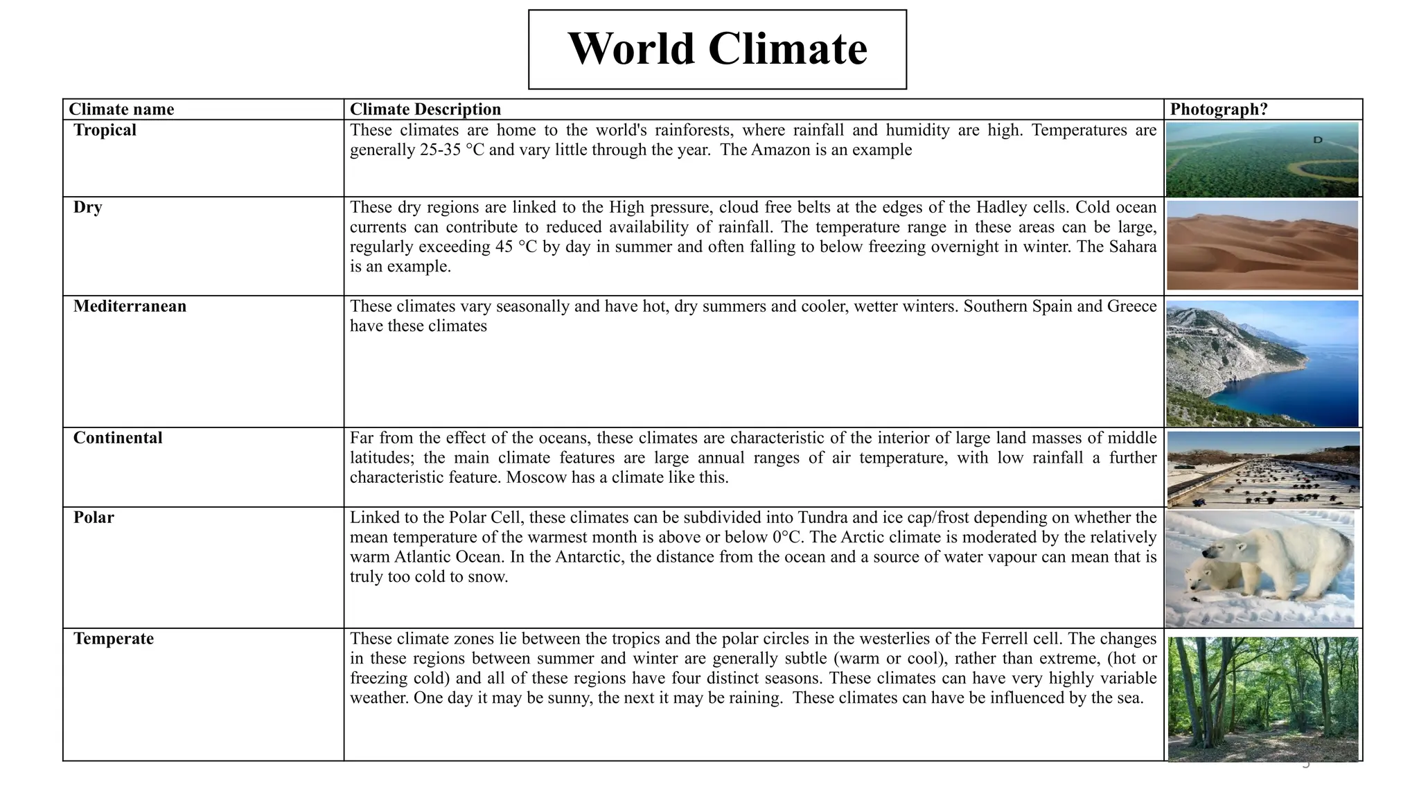


The document presents a comprehensive overview of world climate classification, detailing various climate types based on factors like temperature, precipitation, and geographical location. It categorizes climates into low-latitude, mid-latitude, and high-latitude groups, each with distinct characteristics and examples. Additionally, it emphasizes the importance of understanding these climates amid ongoing climate change for ecological and cultural development.


