Impacts Assessment of the Ethiopian Renaissance Dam and It's implications on ...B B
With this topic, I tried to look current arguments set by the Egyptian government about impacts of the Ethiopian Renaissance dam construction and further tried to asses its effects on the NBI.
Ethiopia Congo Country Investment Benefits from the Nile Basin Initiative. A publication of the Nile Equatorial Lakes Subsidiary Action Program (NELSAP-CU) an investment arm of the Nile Basin Initiative (NBI)
DRAINAGE SYSTEMS and WATER RESOURCE of ETHIOPIA & THE HORN Chapter 4 ( GeES 1011)
0.7 % of the surface of Ethiopia is covered with water including lakes, swamps and rivers. This power point is prepared on the bases of the module with additional explanation and it is best for all freshman first year students to understand the objective of the Course GeES 1011 (Geography of Ethiopia and the Horn)
objectives:-
At the end of this chapter you will be able to:
Describe the major drainage systems in Ethiopia and the Horn,
Examine the surface and ground water resource potentials of Ethiopia,
Understand economic potentials of the water sector in Ethiopia.
DOMESTIC WATER SUPPLY SOURCES AND DISTRIBUTION ISSUES IN ILESHA WEST LOCAL CO...IAEME Publication
The problem of adequate water supply is a recurring decimal in the calculation of water supply issues facing Ilesha town for more than 40 years. This study attempts to bring to the fore the issues that are accountable , focusin g on Ilesha West Local Government Area of Osun State, Nigeria . Sources of water that can be tapped for domestic use c onsider ed adequacy of rivers and streams, hand dug wells, boreholes, water though vendors and sachet or pure waters. Previous and present efforts of concerned State government s a re presented. The various issues are harvested. Issues bothering on water supply and distribution ar e considered for each of the sources of water. Field study, oral interview, collection of data from appropriate quarters was used to obtain information on the problems of management practices used in provision of potable water to the community by private a nd public agencies.
Explore the innovative world of trenchless pipe repair with our comprehensive guide, "The Benefits and Techniques of Trenchless Pipe Repair." This document delves into the modern methods of repairing underground pipes without the need for extensive excavation, highlighting the numerous advantages and the latest techniques used in the industry.
Learn about the cost savings, reduced environmental impact, and minimal disruption associated with trenchless technology. Discover detailed explanations of popular techniques such as pipe bursting, cured-in-place pipe (CIPP) lining, and directional drilling. Understand how these methods can be applied to various types of infrastructure, from residential plumbing to large-scale municipal systems.
Ideal for homeowners, contractors, engineers, and anyone interested in modern plumbing solutions, this guide provides valuable insights into why trenchless pipe repair is becoming the preferred choice for pipe rehabilitation. Stay informed about the latest advancements and best practices in the field.
CFD Simulation of By-pass Flow in a HRSG module by R&R Consult.pptxR&R Consult
CFD analysis is incredibly effective at solving mysteries and improving the performance of complex systems!
Here's a great example: At a large natural gas-fired power plant, where they use waste heat to generate steam and energy, they were puzzled that their boiler wasn't producing as much steam as expected.
R&R and Tetra Engineering Group Inc. were asked to solve the issue with reduced steam production.
An inspection had shown that a significant amount of hot flue gas was bypassing the boiler tubes, where the heat was supposed to be transferred.
R&R Consult conducted a CFD analysis, which revealed that 6.3% of the flue gas was bypassing the boiler tubes without transferring heat. The analysis also showed that the flue gas was instead being directed along the sides of the boiler and between the modules that were supposed to capture the heat. This was the cause of the reduced performance.
Based on our results, Tetra Engineering installed covering plates to reduce the bypass flow. This improved the boiler's performance and increased electricity production.
It is always satisfying when we can help solve complex challenges like this. Do your systems also need a check-up or optimization? Give us a call!
Work done in cooperation with James Malloy and David Moelling from Tetra Engineering.
More examples of our work https://www.r-r-consult.dk/en/cases-en/
About
Indigenized remote control interface card suitable for MAFI system CCR equipment. Compatible for IDM8000 CCR. Backplane mounted serial and TCP/Ethernet communication module for CCR remote access. IDM 8000 CCR remote control on serial and TCP protocol.
• Remote control: Parallel or serial interface.
• Compatible with MAFI CCR system.
• Compatible with IDM8000 CCR.
• Compatible with Backplane mount serial communication.
• Compatible with commercial and Defence aviation CCR system.
• Remote control system for accessing CCR and allied system over serial or TCP.
• Indigenized local Support/presence in India.
• Easy in configuration using DIP switches.
Technical Specifications
Indigenized remote control interface card suitable for MAFI system CCR equipment. Compatible for IDM8000 CCR. Backplane mounted serial and TCP/Ethernet communication module for CCR remote access. IDM 8000 CCR remote control on serial and TCP protocol.
Key Features
Indigenized remote control interface card suitable for MAFI system CCR equipment. Compatible for IDM8000 CCR. Backplane mounted serial and TCP/Ethernet communication module for CCR remote access. IDM 8000 CCR remote control on serial and TCP protocol.
• Remote control: Parallel or serial interface
• Compatible with MAFI CCR system
• Copatiable with IDM8000 CCR
• Compatible with Backplane mount serial communication.
• Compatible with commercial and Defence aviation CCR system.
• Remote control system for accessing CCR and allied system over serial or TCP.
• Indigenized local Support/presence in India.
Application
• Remote control: Parallel or serial interface.
• Compatible with MAFI CCR system.
• Compatible with IDM8000 CCR.
• Compatible with Backplane mount serial communication.
• Compatible with commercial and Defence aviation CCR system.
• Remote control system for accessing CCR and allied system over serial or TCP.
• Indigenized local Support/presence in India.
• Easy in configuration using DIP switches.
Overview of the fundamental roles in Hydropower generation and the components involved in wider Electrical Engineering.
This paper presents the design and construction of hydroelectric dams from the hydrologist’s survey of the valley before construction, all aspects and involved disciplines, fluid dynamics, structural engineering, generation and mains frequency regulation to the very transmission of power through the network in the United Kingdom.
Author: Robbie Edward Sayers
Collaborators and co editors: Charlie Sims and Connor Healey.
(C) 2024 Robbie E. Sayers
Final project report on grocery store management system..pdfKamal Acharya
In today’s fast-changing business environment, it’s extremely important to be able to respond to client needs in the most effective and timely manner. If your customers wish to see your business online and have instant access to your products or services.
Online Grocery Store is an e-commerce website, which retails various grocery products. This project allows viewing various products available enables registered users to purchase desired products instantly using Paytm, UPI payment processor (Instant Pay) and also can place order by using Cash on Delivery (Pay Later) option. This project provides an easy access to Administrators and Managers to view orders placed using Pay Later and Instant Pay options.
In order to develop an e-commerce website, a number of Technologies must be studied and understood. These include multi-tiered architecture, server and client-side scripting techniques, implementation technologies, programming language (such as PHP, HTML, CSS, JavaScript) and MySQL relational databases. This is a project with the objective to develop a basic website where a consumer is provided with a shopping cart website and also to know about the technologies used to develop such a website.
This document will discuss each of the underlying technologies to create and implement an e- commerce website.
Saudi Arabia stands as a titan in the global energy landscape, renowned for its abundant oil and gas resources. It's the largest exporter of petroleum and holds some of the world's most significant reserves. Let's delve into the top 10 oil and gas projects shaping Saudi Arabia's energy future in 2024.
Sachpazis:Terzaghi Bearing Capacity Estimation in simple terms with Calculati...Dr.Costas Sachpazis
Terzaghi's soil bearing capacity theory, developed by Karl Terzaghi, is a fundamental principle in geotechnical engineering used to determine the bearing capacity of shallow foundations. This theory provides a method to calculate the ultimate bearing capacity of soil, which is the maximum load per unit area that the soil can support without undergoing shear failure. The Calculation HTML Code included.
Immunizing Image Classifiers Against Localized Adversary Attacksgerogepatton
This paper addresses the vulnerability of deep learning models, particularly convolutional neural networks
(CNN)s, to adversarial attacks and presents a proactive training technique designed to counter them. We
introduce a novel volumization algorithm, which transforms 2D images into 3D volumetric representations.
When combined with 3D convolution and deep curriculum learning optimization (CLO), itsignificantly improves
the immunity of models against localized universal attacks by up to 40%. We evaluate our proposed approach
using contemporary CNN architectures and the modified Canadian Institute for Advanced Research (CIFAR-10
and CIFAR-100) and ImageNet Large Scale Visual Recognition Challenge (ILSVRC12) datasets, showcasing
accuracy improvements over previous techniques. The results indicate that the combination of the volumetric
input and curriculum learning holds significant promise for mitigating adversarial attacks without necessitating
adversary training.
Hybrid optimization of pumped hydro system and solar- Engr. Abdul-Azeez.pdffxintegritypublishin
Advancements in technology unveil a myriad of electrical and electronic breakthroughs geared towards efficiently harnessing limited resources to meet human energy demands. The optimization of hybrid solar PV panels and pumped hydro energy supply systems plays a pivotal role in utilizing natural resources effectively. This initiative not only benefits humanity but also fosters environmental sustainability. The study investigated the design optimization of these hybrid systems, focusing on understanding solar radiation patterns, identifying geographical influences on solar radiation, formulating a mathematical model for system optimization, and determining the optimal configuration of PV panels and pumped hydro storage. Through a comparative analysis approach and eight weeks of data collection, the study addressed key research questions related to solar radiation patterns and optimal system design. The findings highlighted regions with heightened solar radiation levels, showcasing substantial potential for power generation and emphasizing the system's efficiency. Optimizing system design significantly boosted power generation, promoted renewable energy utilization, and enhanced energy storage capacity. The study underscored the benefits of optimizing hybrid solar PV panels and pumped hydro energy supply systems for sustainable energy usage. Optimizing the design of solar PV panels and pumped hydro energy supply systems as examined across diverse climatic conditions in a developing country, not only enhances power generation but also improves the integration of renewable energy sources and boosts energy storage capacities, particularly beneficial for less economically prosperous regions. Additionally, the study provides valuable insights for advancing energy research in economically viable areas. Recommendations included conducting site-specific assessments, utilizing advanced modeling tools, implementing regular maintenance protocols, and enhancing communication among system components.
Student information management system project report ii.pdfKamal Acharya
Our project explains about the student management. This project mainly explains the various actions related to student details. This project shows some ease in adding, editing and deleting the student details. It also provides a less time consuming process for viewing, adding, editing and deleting the marks of the students.
Student information management system project report ii.pdf
Water source and irrigation potential of Ethiopia.pptx
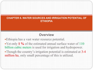
1. Overview
Ethiopia has a vast water resource potential.
Yet only 1 % of the estimated annual surface water of 110
billion cubic meters is used for irrigation and hydropower.
Though the country’s irrigation potential is estimated at 3-4
million ha, only small percentage of this is utilized.
CHAPTER 8. WATER SOURCES AND IRRIGATION POTENTIAL OF
ETHIOPIA
2. 8.1. Water sources of Ethiopia
⚫Ethiopia is endowed with a substantial amount of
water resources.
⚫The surface water resource potential is
impressive, but little developed.
⚫The country possesses twelve major river basins,
which form four major drainage systems:
3. Drainage systems
⚫ The Nile basin (including Abbay or Blue Nile, Baro-
Akobo, Setit-Tekeze/Atbara and Mereb) covers 33
percent of the country and drains the northern and
central parts westwards;
⚫ The Rift Valley (including Awash, Denakil, Omo-
Gibe and Central Lakes) covers 28 percent of the
country;
⚫ The Shebelli−Juba basin (including Wabi-Shebelle
and Genale-Dawa) covers 33 percent of the country
and drains the southeastern mountains towards
Somalia and the Indian Ocean;
⚫ The North-East Coast (including the Ogaden and
Gulf of Aden basins) covers 6 percent of the country.
4. Table 1 Ethiopia’s surface water resources by major river basins
(km3)
Major drainage system River Basin Area (km2) As % of the total
area
Annual Runoff
(km3/yr)
As % of total
runoff
Nile Basin 368,812 32.40 84.55 69.0
Abbay 199,812 17.60 52.6 42.90
Baro-Akobo 74,100 6.50 23.6 19.30
Setit-Tekeze/Atbara 89,000 7.80 7.63 6.20
Mereb 5,900 0.50 0.5 0.60
Rift Valley 317,640 27.90 29.02 23.70
Awash 112,700 9.90 4.6 3.70
Denakil 74,000 6.50 0.86 0.70
Omo-Gibe 78,200 6.90 17.96 14.70
Central Lake 52,740 4.60 5.60 4.60
Shebelli-Juba 371,264 32.70 8.95 7.30
Wabe Shebele 200,214 17.60 3.15 2.60
Genale-Dawa 171,050 15.10 5.80 4.70
North East Coast 79,300
Ogaden 77,100 6.80 0
Aysha 2,200 0.20 0
Total 1,137,016 100.0 122.52 100.0
5. Water source of Ethiopia
⚫ Most of the rivers in Ethiopia are seasonal and about
70 percent of the total runoff is obtained during the
period June-August.
⚫ Dry season flow originates from springs which provide
base-flows for small-scale irrigation.
⚫ The groundwater potential of the country is estimated
at about 2.6 billion cubic meters of water, but so far
only a small fraction of it has been developed and this
mainly for local water supply purposes.
⚫ Traditional wells are widely used by nomads.
⚫ Neither desalinization nor treatment of wastewater is
practiced in Ethiopia
6. Water source of Ethiopia
⚫ Intense rainfall sometimes causes flooding particularly
along the Awash river and in the lower Baro-Akobo
and Wabe-Shebelle river basins, causing damage to
standing crops and infrastructures.
⚫ Ethiopia has several lakes (an area of about 7000
km2), a number of saline and crater lakes as well as
several wetland areas.
⚫ All the lakes, except Lake Tana which is the source of
Abbay River in the Nile Basin, are found in the Rift
Valley and
⚫ Among these lakes only Zway has fresh water while
the others are all saline.
⚫ Rising water levels in Lake Tana and Lake Hawassa
after intense rainfall have been creating concern.
7. Water source of Ethiopia
⚫Large wetlands serve as a source of water for
large rivers, flood retention and groundwater
recharge.
⚫They are critical resources because they are
areas of high biodiversity and vital to the
livelihood strategies of local communities through
the provision of environmental services and
socio-economic benefits.
⚫Ethiopia has so far put no emphasis on
developing and protecting the large wetlands,
although external initiatives are emerging.
8. Water source of Ethiopia
⚫Ethiopia has many small, medium and large
reservoir dams constructed for
⚫hydropower generation,
⚫irrigation and
⚫drinking water supply.
⚫Small dams are less than 15 m high and have a
capacity of less than 3 million m3.
⚫The height of the medium and large dams in
Ethiopia is 15−50 m and their capacity ranges
from 4 to 1900 million m3.
9. Water source of Ethiopia
⚫In total, there are nine medium and large dams
with a total capacity of almost 3.5 km3.
⚫Two large dams are used for hydropower
generation only,
⚫one dam is used both for hydropower generation
and irrigation supply,
⚫Two dams are used for irrigation supply only and
⚫The remaining four for water supply to the city of
Addis Ababa and the town of Gondar.
⚫Small dams (micro-dams) constructed for
irrigation supply are concentrated in the Amhara
and Tigray regional states.
10. Name
Installed
capacity
Commissioning Basin Remarks
Koka 42 MW 1960 Awash River
Awash II 36 MW 1966 Awash River
Awash III 36 MW 1971 Awash River
Fincha 134 MW 1973 Fincha (Blue Nile) also for irrigation
Gilgel Gibe I 180 MW 2004 Gilgel Gibe River
Tekezé 300 MW 2009 Tekeze (Atbara) producing 300 MW
Beles 460 MW 2010 Lake Tana (Blue Nile) Irrigation of 140,000 ha
Gilgel Gibe II 420 MW 2010
Omo River (no dam,
fed)
Gilgel Gibe III 1,870 MW 2015 Omo River
faces stiff environmental criticism but work in
progress (75% completed as of Oct. 2013)
Fincha Amerti Nesse (FAN) 100 MW 2012 Fincha (Blue Nile)
Halele Worabese 440 MW 2014 Omo River
Gilgel Gibe IV 2,000 MW 2015 Omo River
Chemoga Yeda 278 MW 2013
tributary of the Blue
Nile, near Debre
Markos
Will consist of 5 interconnected dams
Tendaho Irrigation Dam none 2014 Awash River No power, just irrigation and drinking water
Genale Dawa III 256 MW awarded in 2009
between Oromia and
Somali state
Feasibility study by Lahmeyer with funding from
theAfDB
Grand Ethiopian
Renaissance Dam
6000 MW 2018 Blue Nile River
Awarded without competitive bid (30% completed as
of Oct. 2013)
Koysha hydro 2,200MW --- Gibe River
secured a grant from an Italian credit firm to fund the
project 2016.
11. Water use
⚫ Written information on water use is not available, but
agriculture is obviously the main water-consuming
sector.
⚫ Based on the total irrigated area, cropping pattern and
calendar, annual agricultural water use is estimated to
be in the order of 5.2 km3, while domestic and
industrial water withdrawals are estimated to be about
0.33 and 0.02 km3 respectively.
⚫ Groundwater has not yet been considered for
irrigation development, mainly due to high investment
and running costs, but pilot schemes to use
groundwater for irrigation have been started
⚫ There is growing concern about water use because of
the conflict between the environment and agriculture
particularly in lowland rural areas, where total base
flows are diverted for irrigation without releasing water
for ecological conservation
12. International water issues
⚫ Most of the rivers of Ethiopia originate within the
country and flow across the borders to neighboring
countries, thus becoming trans-boundary rivers.
⚫ Sharing the water resources of these trans-boundary
rivers is very challenging, i.e. Nile tributaries (Abbay,
Tekeze and Baro-Akobo) with the downstream
riparian countries Sudan and Egypt.
⚫ Recently, under an international law supporting the
equitable utilization of the water resources, positive
progress has been observed now that riparian
countries are deciding on common water
development programs.
⚫ The Nile Basin Initiative has been created and a
Strategic Action Program prepared which consists of
two sub-programs: the Shared Vision Program (SVP)
and the Subsidiary Action Program (SAP).
13. International water issues
⚫ SVP is to help create an enabling environment for
action on the ground through building trust and skill,
while SAP is aimed at the delivery of actual
development projects involving two or more countries.
⚫ Projects are selected by individual riparian countries
for implementation and submitted to the Council of
Ministers of the Nile Basin Initiative for approval.
⚫ The council has already accepted four hydropower
and four irrigation development projects proposed by
Ethiopia.
⚫ Sudan, Ethiopia and Egypt have also adopted a
strategy of cooperation in which all projects to be
launched concerning the river should seek the
common benefit of all member states and this aspect
should be included in the accompanying feasibility
studies.
14. 8.2. Irrigation and drainage development
8.2.1. Evolution of irrigation development
Basins Potential irrigable area (ha) Actual irrigated area (ha) % Utilized
Abay (Blue Nile 977,915 21,010 2.10
Rift Valley Lakes 122,300 12,270 10.00
Awash 204,400 69,900 34.20
Omo-Ghibe 450,120 27,310 6.10
Genale-Dawa 435,300 80 0.02
Wabi-Shebele 204,000 20,290 9.90
Baro-Akobo 748,500 350 0.05
Tekeze 312,700 1,800 0.57
Afar 3,000 - -
Mereb 37,560 8,000 21.30
Total 3,495,795 161,010 4.07
Table 2 Potential irrigable and actual irrigated area of the drainage basins, Ethiopia
15. Irrigation
⚫Irrigation in Ethiopia dates back several centuries,
if not millennia, while “modern” irrigation was
started by the commercial irrigated sugar estate
established in the early 1950s during Imperial
Government of Ethiopia
⚫Therefore, the area under irrigation can be
considered more or less similar to the area
equipped for irrigation.
⚫Four categories of irrigation schemes can be
distinguished:
16. Such as:
⚫ Traditional irrigation schemes: These schemes are
constructed under self-help programmes carried out
by farmers on their own initiative and vary from less
than 1 ha to 100 ha.
⚫ Modern small-scale irrigation schemes: These
schemes use technologies for irrigating up to 200 ha
and are constructed by the government/NGOs with
farmer participation.
⚫ Modern private irrigation: Private investment in
irrigation has recently reemerged with the adoption of
a market-based economy policy in the early 1980s.
⚫ Public irrigation schemes: These schemes comprise
medium- and large-scale irrigation schemes with
areas of 200−3000 ha and above 3000 ha
respectively and a total estimated area of about
97,700 ha. They are constructed, owned and
operated by public enterprises.
17. Table 3 Existing irrigation schemes in Ethiopia by Region
Region Irrigation Potential (ha)
Current Irrigation activities
Traditional (ha)
Modern Irrigation (ha)
Small Mediurn & large
Oromia 1,350,000 56,807 17,690 31,980
Amhara 500,000 54,035 5,752 -
SNNP 700,000 2000 11,577 6,076
Tigrai 300,000 2,607 10,000 -
Afar 163,554 2,440 - 21,000
Ben Shangul Gumz 121,177 400 200 -
Gambella 600,000 46 70 -
Somalia 500,000 8,200 1,800 2,000
Hareri 19,200 812 125 -
Dire Dawa 2,000 640 860 -
Addis Ababa 526 352 - -
Total 4,256,457 138,339 48,074 61,057
Source: Tilahun and Paulos, 2004.
18. ⚫ About 62 percent of the area equipped for irrigation is located
in the Rift Valley, while 29 percent of the area equipped for
irrigation is located in the Nile basin.
⚫ The remaining 9 percent is located in the Shebelli-Juba
basin.
⚫ Region-wise, about 39 percent of the irrigated area is in
Oromia in central Ethiopia, followed by 24 percent in Amhara
in the north, 15 percent in Afar in the northeast and 12
percent in SNNPR, while the remaining 10 percent is in the
other regions.
⚫ Nearly 100 percent of the irrigated land is supplied from
surface water, while groundwater use has just been started
on a pilot scale in East Amhara.
⚫ Sprinkler irrigation is practiced on about 2 percent of the
irrigated area for sugar cane production by government
enterprises, while localized irrigation has recently started in
the Tigray and Amhara regions Pump irrigation by a group of
farm households and private farms is practiced in some
areas, while human-powered (treadle pump) irrigation has
also recently started in the Tigray and Amhara regions.
⚫ Though quantitative information is not available, spate
19. 8.2.2. Role of irrigation in agricultural production, economy
and society
⚫ Both irrigated and rainfed agriculture is important in
the Ethiopian economy.
⚫ Virtually all food crops in Ethiopia come from rainfed
agriculture with the irrigation sub-sector accounting
for only about 3 percent of the food crops.
⚫ Export crops such as coffee, oilseed and pulses are
also mostly rainfed, but industrial crops such as sugar
cane, cotton and fruit are irrigated.
⚫ Other important irrigated crops include vegetables
and fruit trees in medium- and large-scale schemes
and maize, wheat, vegetables, potatoes, sweet
potatoes and bananas in small-scale schemes.
⚫ There is a marked value added in irrigated agriculture
20. 8.3. Status and Evolution of Drainage
Systems
⚫ Drainage is as important as irrigation, particularly in the
highlands of Ethiopia.
⚫ However, except in irrigated lands, drainage is not given the
required attention in rainfed agriculture.
⚫ Because of irregularity in cross-sections and longitudinal slopes
as well as inadequate capacities, the drains are usually
converted to gullies if the same drains are adopted year after
year.
⚫ To avoid this happening, drain lines are changed every year.
⚫ Designs of small-scale irrigation schemes incorporate drainage
systems but these are not properly implemented.
⚫ The typology of the drainage system used in the country is the
surface drainage system (gravity drainage).
⚫ The construction of subsurface drainage systems was started for
one large-scale irrigation scheme in the Awash Valley for salinity
control, but was discontinued.
⚫ Separate information on the cost of drainage systems is not
21. 8.4. Water management, policies and legislation related to
water use in agriculture Institutions
⚫Several water sector institutions have been
established at federal and regional levels under
the regionalization and decentralization policy.
⚫ At the federal level, the public institutions
involved in water resources development include:
⚫The Ministry of Water Resources (MoWR)
⚫The Awash Basin Water Resources Management
Agency (ABWRMA)
⚫The Ministry of Agriculture (MoA)
⚫The Environmental Protection Authority
22. The regional/sub-national institutions involved in the water sector include:
⚫The Bureaus of Water, Mines and Energy
(BoWME) and/or Bureaus of Water Resources
Development (BoWRD)
⚫The Commissions for Sustainable Agriculture and
Environmental Rehabilitation (Co-SAER) and the
Irrigation Development Authorities
⚫The Bureaus of Agriculture (BoA)
⚫Several NGOs are involved in the water sector
See the details on page 72
23. Water Management
⚫ Medium and large-scale irrigation schemes are
managed by government enterprises.
⚫ The water management of small-scale irrigation
schemes is the responsibility of the farmers
themselves, mainly through informal/traditional
community groups.
⚫ Some formal Water Users Associations (WUAs) have
been established.
⚫ Apart from the provision of extension and training
services to the WUAs on the part of the MoA/ BoA, no
institution is directly involved in water management in
smallholder-irrigated agriculture.
⚫ Once the construction of irrigation schemes is
completed, they are handed over to the beneficiaries
but maintenance remains within the responsibility of
the regional governments.
24. ⚫The absence of any appropriate local-level organs to
cater for small-scale irrigation has resulted in a lack of
guidance in irrigation operation and maintenance at a
community level.
⚫With an increase in irrigated areas and more users,
irrigation water management and rules for water
allocation are becoming more complex and problematic.
⚫Disputes are already common, especially between
upstream and downstream users.
⚫A decentralization process is under way with regional
and lower level administrative organs which are
becoming more autonomous in aspects related to
irrigation development and water management.
⚫The strategy is to establish WUAs before projects are
implemented and to strengthen them through both
training and involvement in the process so that they can
take over the responsibility of operation and water
25. 9. WATER HARVESTING: PRINCIPLES AND
PRACTICES
1. Definitions and classification
⚫ Water harvesting in its broadest sense will be defined as
the "collection of runoff for its productive use".
⚫ Runoff may be harvested from roofs and ground surfaces
as well as from intermittent or ephemeral watercourses.
⚫ Water harvesting techniques which harvest runoff from
roofs or ground surfaces fall under the term: RAINWATER
HARVESTING
⚫ while all systems which collect discharges from
watercourses are grouped under the term: FLOODWATER
HARVESTING
⚫ A wide variety of water harvesting techniques for many
different applications are known.
⚫ Productive uses include provision of domestic and stock
water, concentration of runoff for crops, fodder and tree
26. 9.2. Basic categories of water harvesting systems for plant
production
⚫The water harvesting techniques described in this
course fall under three basic categories :
1. Micro-catchments (rainwater harvesting):
(sometimes referred to as "Within-Field
Catchment System")
Main characteristics:
overland flow harvested from short catchment length
catchment length usually between 1 and 30 meters
runoff stored in soil profile
ratio catchment: cultivated area usually 1:1 to 3:1
normally no provision for overflow
plant growth is even
27. rainwater harvesting
⚫Typical Examples:
Negarim Micro catchments (for trees)
Contour Bunds (for trees)
Contour Ridges (for crops)
Semi-Circular Bunds (for range and fodder)
Figure 9.1. Micro-catchment
system: Negarim micro-
catchment for trees
28. 2. External catchment systems (rainwater
harvesting): (Long Slope Catchment
Technique)
Main Characteristics:
overland flow or rill flow harvested
runoff stored in soil profile
catchment usually 30 - 200 metres in length
ratio catchment: cultivated area usually 2:1 to 10:1
provision for overflow of excess water
uneven plant growth unless land levelled
⚫Typical Examples:
⚫Trapezoidal Bunds (for crops)
⚫Contour Stone Bunds (for crops)
29. Figure 9.2. External catchment system: trapezoidal bunds for crops (Source:
Critchley and Reij 1989)
30. 3. Floodwater farming (floodwater harvesting):
(often referred to as "Water Spreading" and
sometimes "Spate Irrigation")
Main Characteristics:
turbulent channel flow harvested either (a) by
diversion or (b) by spreading within channel
bed/valley floor
runoff stored in soil profile
catchment long (may be several kilometres)
ratio catchment: cultivated area above 10:1
provision for overflow of excess water
⚫Typical Examples:
⚫Permeable Rock Dams (for crops)
⚫Water Spreading Bunds (for crops)
31. Figure 9.3. Floodwater farming systems: (a) spreading within channel bed; (b)
diversion system
32. 9.3. Water requirements of crops
⚫For the design of water harvesting systems, it is
necessary to assess the water requirement of the
crop intended to be grown.
⚫There have been various methods developed to
determine the water requirements for specific
plants.
⚫An excellent guide to the details of these
calculations and different methods is the FAO
Irrigation and Drainage Paper 24 "Crop Water
Requirements".
⚫It should however be noted that formulae which
give high accuracy also require a high accuracy
of measured input data which in most places
where water harvesting is practiced will not be
33. 9.3.1. Factors influencing crop water
requirements
⚫Influence of climate
⚫Influence of crop type on crop water needs
34. 9.4. Soil requirements for water harvesting
⚫ Texture
⚫ Structure
⚫ Depth
⚫ Fertility
⚫ Salinity/sodicity
⚫ Infiltration rate
⚫ Available water capacity (AWC)
⚫ Constructional characteristics