
Recommended
Recommended
More Related Content
What's hot
What's hot (20)
Similar to Chapter4.pptx
Similar to Chapter4.pptx (20)
Recently uploaded
Recently uploaded (20)
Chapter4.pptx
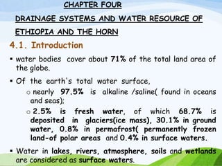
- 1. CHAPTER FOUR DRAINAGE SYSTEMS AND WATER RESOURCE OF ETHIOPIA AND THE HORN 4.1. Introduction water bodies cover about 71% of the total land area of the globe. Of the earth's total water surface, o nearly 97.5% is alkaline /saline( found in oceans and seas); o 2.5% is fresh water, of which 68.7% is deposited in glaciers(ice mass), 30.1% in ground water, 0.8% in permafrost( permanently frozen land-of polar areas and 0.4% in surface waters. Water in lakes, rivers, atmosphere, soils and wetlands are considered as surface waters. 1
- 2. • Surface and ground waters are by far the most abundant and easily available fresh waters. • However, fresh water is distributed unevenly throughout the world following varied latitudinal locations, climatic and topographic setups, wide variation in seasonal and annual precipitation • As already mentioned , the topographic setup of Ethiopia is characterized by complex blend of massive highlands, rugged terrain, and low plains. • Ethiopia have a larger volume of ground and surface water due to its: • The diverse topographical setup, • relatively higher rainfall and • its nearness to equator made. • Around 0.7 % of the total land mass of Ethiopia is covered by water bodies. • The country's surface water potential is estimated to be 124.4 billion cubic meters (BCM). • Ethiopia is a mountainous country from where many rivers emerge, as a result , many call Ethiopia, the water tower of “Eastern Africa”.
- 3. Many call Ethiopia, the water tower of ’’Easter Africa’’. But from the total land mass of Ethiopia, only 0.7% covered by water bodies. Why Ethiopia is known as ‘’The Roof of East Africa’’? Because of its high altitude or largest proportion of elevated land. Why Ethiopia is known as ‘’water Tower of East Africa’’? Because of its great rivers that flow towards the neighbouring countries, including the origins of the Blue Nile
- 5. 4.2. Major Drainage System of Ethiopia The flow of water through well-defined channel is known as drainage. The regular patter or flow of a river A drainage system is made up of a principal river and its tributaries (the rivers that flow into it). A river system begin at a place called the source or headwater and ends at a point called mouth. Therefore, a drainage system is branched network of stream channels together with the adjacent land slopes they drain. The drainage pattern of an area is the outcome of the geological processes, nature and structure of rocks, topography, slope, amount and the periodicity of the flow. 5
- 6. A drainage basin is the topographic region from which a river and its tributaries collect both the surface runoff and subsurface flow. It is bounded by and separated from other river basins by a water divide or topographic divide. The general patterns of major river basins in Ethiopia are determined by topographical structures which can be clarified as: a) The topography of the outward sloping of the Western and South eastern plateaus b) The structural formation of the Rift Valley with its in-ward-sloping escarpments resulting mainly in an inland drainage system. c) Faults and joints that structurally influence part of the courses of many rivers.
- 7. 4.2. Major Drainage Systems Following the complex physiographic setup( topographical structures) and geological makeup, Ethiopia possesses three broadly classified drainage systems. namely I. Western, II. Southeastern and III. Rift Valley Drainage Systems. western and south eastern drainage systems are separated by Rift valley system
- 8. 4.2.1. The Western Drainage Systems • The Western Drainage Systems are the largest of all drainage systems • Drains(covers) 40% of the total area of the country and carry 60% of the annual water flow. • Most of the catchment area coextends with the westward sloping part of the western highlands and western lowlands. • This drainage system comprises four major river basins namely Tekeze Abay Baro-Akobo Ghibe (Omo) Unlike other river basins in the system, the Ghibe( omo) flows southward. The Abay, Tekeze and Baro flow westward ultimately joining the Nile which finally ends at Mediterranean sea
- 9. Abay River Basin • The largest river in the region both in volumetric discharge and coverage. • The basin covers an area of 199,812 km2 (covers parts of Amhara, Oromia and Benishangul-Gumuz regional states). Together with its tributaries, most of which are 43 left-bank; it carries about 65 % of the annual water flow of the region. Abay which rises from Lake Tana (some sources indicate its origin from Sekela, Choke mountain) flows about 1,450 kilometers and joins the White Nile in Khartoum, Sudan to form the Nile River. • More than 60 streams drain into Tana lake. The largest of these is Ghilgel Abay (Little Abay). • Abay flows eastward, and turns 180° to make a large bend and after cutting an impressive and deep gorge emerges out in the west.
- 10. Tekeze River Basin With its tributaries, carries about 12 percent of the annual water flow of the region. Drains about 82,350 Km2 of area of land surface. Erosion in the basin resulted in large tablelands, plateau blocks and isolated mountain groups. The basin has two main tributaries (Angereb and Goang) which rises in the central highlands of Ethiopia. Tekeze River is termed Atbara in Sudan, which is a tributary of the Nile. The total mean annual flow from the basin is estimated to be 8.2 billion metric cubes (BMC, here after).
- 11. The Baro-Akobo and Ghibe / Omo rivers drain the wettest highlands in the south and southwestern Ethiopia. They carry 17 percent and 6 percent of the annual water flow respectively. The Ghibe/ Omo river basin drains an area of 79,000 km2. with an estimated mean annual flow of 16.6 BMC. In the lower course, the Baro River flows across an extensive marshy land. Baro Akobo river basin has an area of 75,912km2, covering parts of the Benishangul Gumuz, Gambella, Oromia, and SNNPR. The total mean annual flow from the river basin is estimated to be 23.6 BMC. The Baro together with Akobo forms the Sobat River in South Sudan. The Ghibe/Omo River finally empties in to the Chew-Bahir at the mouth of Lake Turkana (an elongated Rift Valley lake) thereby forming an inland drainage.
- 12. 4.2.2. The Southeastern Drainage Systems Nearly the entire physiographic region of southeastern part of Ethiopia is drained by the southeastern drainage systems. The region is mainly drained south east wards by Wabishebelle and Ghenale rivers , across large water deficient plains. Major highlands of this basin include plateaus of Arsi, Bale, Sidama and Harerghe. Wabshebelle and Ghenale rivers cross the border into Somalia, carrying 25 % of the annual water flow of Ethiopia. Ghenale River basin covers an area of 171,042 km2 of land covering parts of Oromia, SNNPR, and Somali regions. It has fewer tributaries but carries more water than Wabishebelle, reaches the Indian Ocean.
- 13. • The basin flows is estimated to be 5.8 BMC with elevation of ranging b/n 171-4385 meters above sea level • It is named as Juba in Somalia. • Wabishebelle with a total catchment area of 202,697 km2, is the largest river in terms catchment area. • It is the longest river in Ethiopia. • Its tributaries are mainly left bank and, most of them, are intermittent. • its water disappears in the sands of Somalia before it reaches Indian Ocean. • It drains parts of oromia, somali and Harari regions. • Why wabishebele fails to reach the indian ocean? • The Wabishebele river’s name is derived from the Somali term Wabi shabeelle, meaning ‘’Leopard River’’ • During heavy- rain periods in Ethiopia, the Shebeli river joins the jubba( Giuba), and combined waters then flow to the indian ocean. In drier years the Shebeli disappears in a series of marshs and sand flats northeast of the jubba confluences
- 14. Drainage Basins of Ethiopia
- 15. 4.2.3. The Rift Valley Drainage System The Rift Valley drainage system is an area of small amount of rainfall, high evaporation and small catchment area. The size of the drainage area is restricted by the outward sloping highlands, which starts right from the edge of the escarpment. The Rift Valley drainage system is therefore left with the slopes of the escarpment and the Rift Valley floor itself as the catchment area. The only major river basin is that of the Awash.
- 16. The Awash River Originates from in shewa plateau central highlands of Ethiopia, and flows 1250 kms. It drains parts of the Amhara, Oromia, Afar, Somali, Dire Dawa, and Addis Ababa City Administration. is the most utilized river in the country for irrigation. Follows the Rift Valley orientation, and flows in a northeast direction. It finally ends at Lake Abe on the Ethio-Djibouti border. The Afar drainage sub-basin of rift valley ohas practically no stream flow. oIt is an area of little rain, overy high temperature and overy high evaporation.
- 17. Lake Afrera and Asale are the only main surface waters in the basin which are not the result of any meaningful surface flow. Their formation is related to tectonic activities. The Southern part of the Rift Valley sub-basin is characterized by a number of lakes and small streams. • It is also described as lakes region. • The lakes occupy fault depression. • There are small streams that drain down from the nearby mountain slopes which supply water to the lakes. For example, Meki and Katar Rivers flow into Ziway; Bilate into Abaya; and Segen into Chew Bahir. • Likewise, some of these lakes are interconnected. Lakes Ziway and Langano drain into Lake Abijiata through the small streams of Bulbula and Horocolo respectively.
- 18. 4.3. Water Resources: Rivers, Lakes and Sub- Surface Water 4.3.1. The Ethiopian Rivers Unlike many other African countries, Ethiopia is endowed with many rivers. Majority of the rivers originate from highland areas and cross the Ethiopian boundary: trans boundary Al together, Ethiopian rivers form 12 major watersheds (see fig. 4.1) separating the Mediterranean Sea from the Indian Ocean drainage systems. 18
- 20. Owing to the highland nature of the Ethiopian landmass, surface ruggedness, the outward inclination of the highlands, and the climatic conditions, Ethiopian rivers have the following characteristics. Almost all major rivers originate from the highlands elevating more than 1500 meters above sea level Majority of Ethiopian rivers are trans-boundary, Due to the marked seasonality of rainfall, the rivers are characterized by extreme seasonal fluctuation. General Characteristics of Ethiopian Rivers 20
- 21. In the wet season, • runoff is higher and rivers are full bursting their banks, destroying small bridges, damage roads and flooding low lands; • during the dry seasons they became mere trickles of water or even dry up, Due to surface ruggedness they have rapids and waterfalls along their course, They have cuts, steep-sided river valleys and deep gorges along their courses, Rivers in Ethiopia flow on steep slopes having steep profiles. Some of the rivers serve as boundaries, both international and domestic administrative units.
- 22. 4.3.2. The Ethiopian Lakes • Relatively Ethiopia is rich in lakes. • Almost all Ethiopian lakes are result of tectonic process that took place during Quaternary period of Cenozoic era. • Except few Ethiopian lakes, majority of lakes are located within the Rift Valley System. • The lakes in the drainage are mainly formed on faulted depressions and are clustered along the system forming linear pattern. • Lakes in Ethiopia is classified as Rift valley and Highlands lakes • Lake Tana, the largest lake in Ethiopia occupies a shallow depression in the highlands. • The Tana depression is believed to be formed following slower sinking and reservoir by lava flow between Gojjam and Gonder massifs.
- 23. Ethiopia is also gifted with crater lakes( tectonic process: volcanic eruption). These include the lakes at and around Bishoftu, Wonchi (near Ambo), Hayk (near Dessie) and the Crater Lake on top of Mount Zikwala. Lake Ashenge (Tigray) is formed on a tectonic basin. Other types of lakes in Ethiopia are man-made such as Lakes Koka, Fincha and Melka Wakena,and many other lakes dammed following hydroelectric power generation projects. Cluster of lakes are lined up within main Ethiopian rift valley lakes. Lake Abaya is the largest of all the lakes in the system. The southern tip of the Rift Valley forms the marshy land called the Chew Bahir which is drained by Segan and Woito. Shala and Ziway are the shallowest and the deepest lakes in the central Ethiopian Rift
- 24. Lake Area (km2) Max. Depth(m) Tana 3600 9 Abaya 1162.The largest 13.1. Chamo 551 13 Ziway 442 8.95. The shallowest Shala 409 266*. Deepest Koka 205 9 Abijata 205 14 Awassa 129 10 Ashenge 20 25 Hayk 5 23 Beseka 48.5 11 Area and depth of some of Ethiopian Lakes
- 25. 4.3.3. Subsurface (Ground) Water Resource of Ethiopia As compared to surface water resources, Ethiopia has lower ground water potential. However, there exists higher total exploitable groundwater potential. Climatic and geophysical conditions determine the availability of groundwater resource. Based on existing scanty knowledge, the groundwater potential of Ethiopia is estimated to be 2.6 - 6.5 BMC. However, this estimate is now considered underestimated. Considering various separate studies, Ethiopian potential of groundwater is believed to range between 12-30 BMC.
- 26. 4.4. Water Resources Potentials and Development in Ethiopia The enormous water resource potential of Ethiopia is underutilized due to so many factors. However, there are plenteous of opportunities that can transform the resource into our collective social and economic needs. The followings are some of potential development uses of water resource of Ethiopia. • Hydro-electric Potential • Irrigation and Transportation • Fishing and Recreation
- 27. Hydro-electric Potential Ethiopian rivers have a very high potential for generating electricity. The exploitable potential of hydroelectric power is estimated at about 45000 megawatts. The first hydroelectric power generation plant was installed on Akaki River (Aba Samuel) in 1932. Currently many hydroelectric power dams are operating and many others are under construction to realize Ethiopia's ambitious energy goals. Grand Ethiopian Renaissance Dam (GERD) is the country's largest dam under construction aiming to generate 6400 megawatts. Why Ethiopia’s river have a very high potential for generating electricity. The rivers are originate from the highlands Dissected and rugged topography and surface ruggedness resulted rapids and waterfalls
- 28. • Gilgel Gibe III hydropower project has gone operational generating 1870 megawatts. • Currently Ethiopia is administering 14 hydroelectric power plants constructed on Lake Aba Samuel, Koka, Tis Abay, Awash, Melka Wakena, Sor, Fincha, Gibe/Omo, Tana Beles and Tekeze, generating close to 4000 megawatts of energy. • Besides the domestic use of generated electricity, the country is exporting electricity to the neighboring countries. • The major problem related to the use of Ethiopian rivers for the generation of hydroelectric power is the seasonal flow fluctuations and impact of climate change and variabilities. • The severe erosion from the highlands and sedimentation in the reservoirs is also a critical problem for hydroelectric power generation.
- 29. Irrigation and Transportation • The terrain in Ethiopia is so rugged that it limits the uses of Ethiopian rivers both for irrigation and transportation. • In the highlands, steep slopes, rapids, waterfalls, narrow and deep valleys and gorges are important obstacles. • But on the lowlands, their demand for irrigation is high. Irrigation • Regardless of existing physiographic setups, Ethiopia's potential of irrigation is estimated to be 5.3 million hectares. • The Baro-Akobo and Genale Dawa river systems have large irrigation potential compared to other basins. • Despite the untapped irrigation practice, more than 60% of the area under irrigation so far is located in Rift Valley Drainage System. • Except few, majority of hydro-electric reservoirs are multi- purpose and are expected to contribute for irrigation.
- 30. Transportation • Majority of Ethiopian rivers are not suitable for transportation. • The Baro at its lower course is the only navigable river. • Comparatively, Ethiopian lakes are much suitable for transportation than rivers. Lake Tana and Abaya are relatively the most used for transportation. Fishing and Recreation Fishing • The majority of Ethiopian lakes are rich in fish. Currently the annual production of fish is estimated to be 31.5 thousand tons. • The exploitable potential is however, by far greater than the current production. • Exploitable fish potential in lakes varies. Currently Lake Tana leads the potential by estimated 8,000-10,000 tons per year. • Fish production from Lake Chamo is estimated at 4,500 tons per year. However, more than 60% of fish supplies are coming from Ethiopian main Rift Valley lakes.
- 31. But, currently some of the lakes are threatened by sedimentation, invasive species (water hyacinth), over exploitation and expansion of investments around lakes. Recreation There are a variety of fish, birds and other aquatic life forms in the lakes. This and the scenic beauty of the lakes, the hot springs around them, the spectacular river gorges and the most impressive waterfalls make Ethiopian rivers and lakes important recreational and tourist attractions. As they are the natural habitat of a variety of wild life, some of which are only endemic to Ethiopia, their value for scientific purposes is immense.
Editor's Notes
- There are two basic components of a drainage system or watershed. Land area or place; Every drainage has a defined bounday. Channel or river: it is a stream or lakes over which water from the sorrounding areas reaches at outlets