Downloaded 23 times
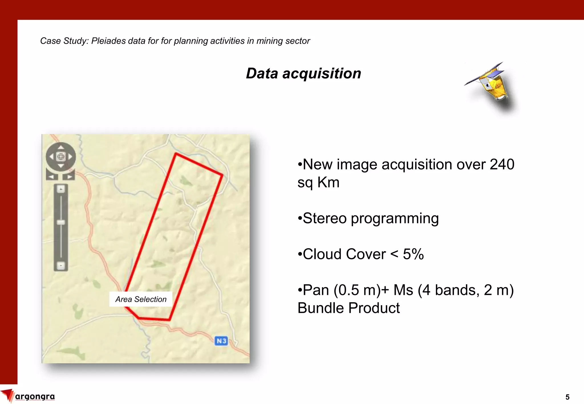
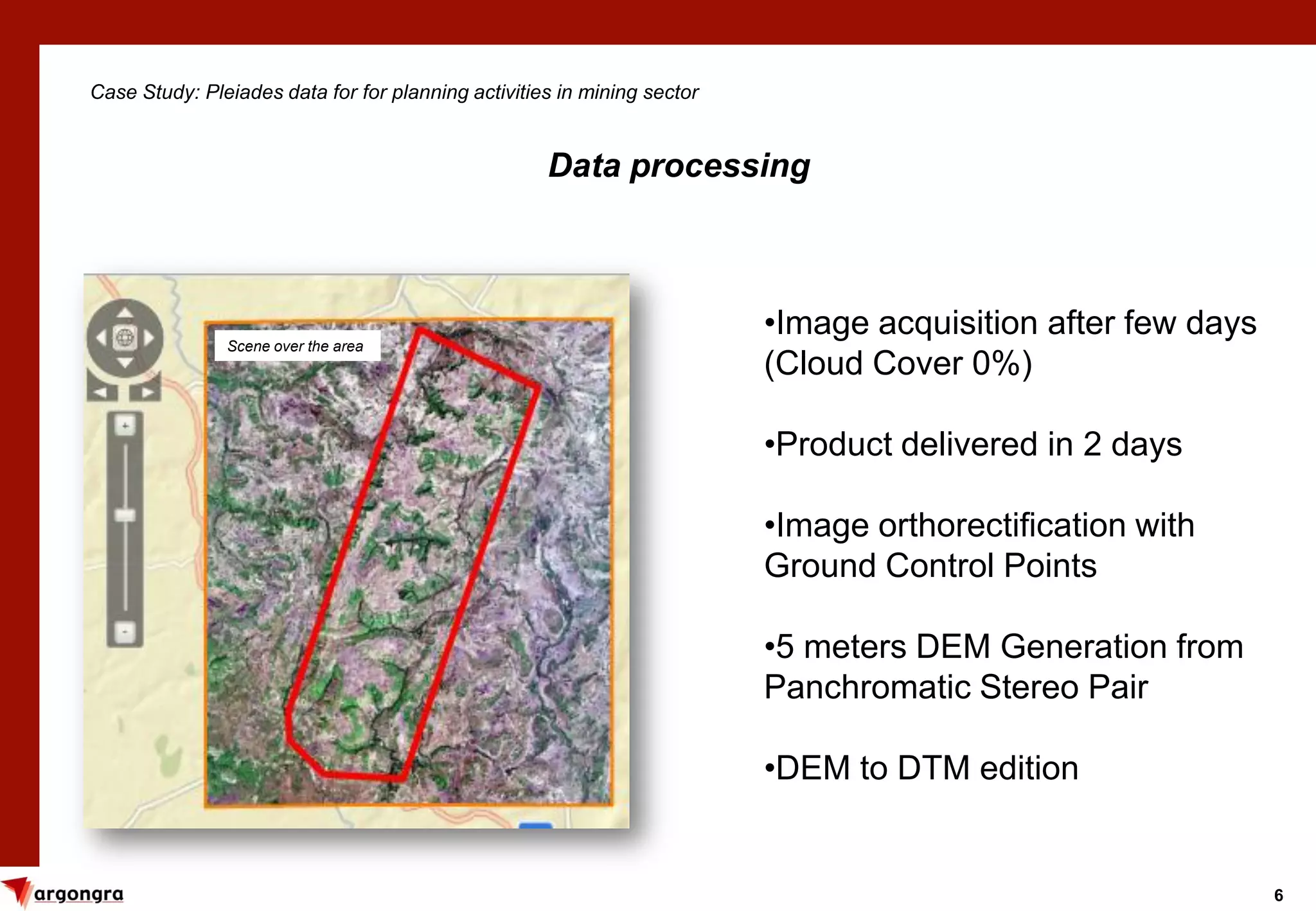
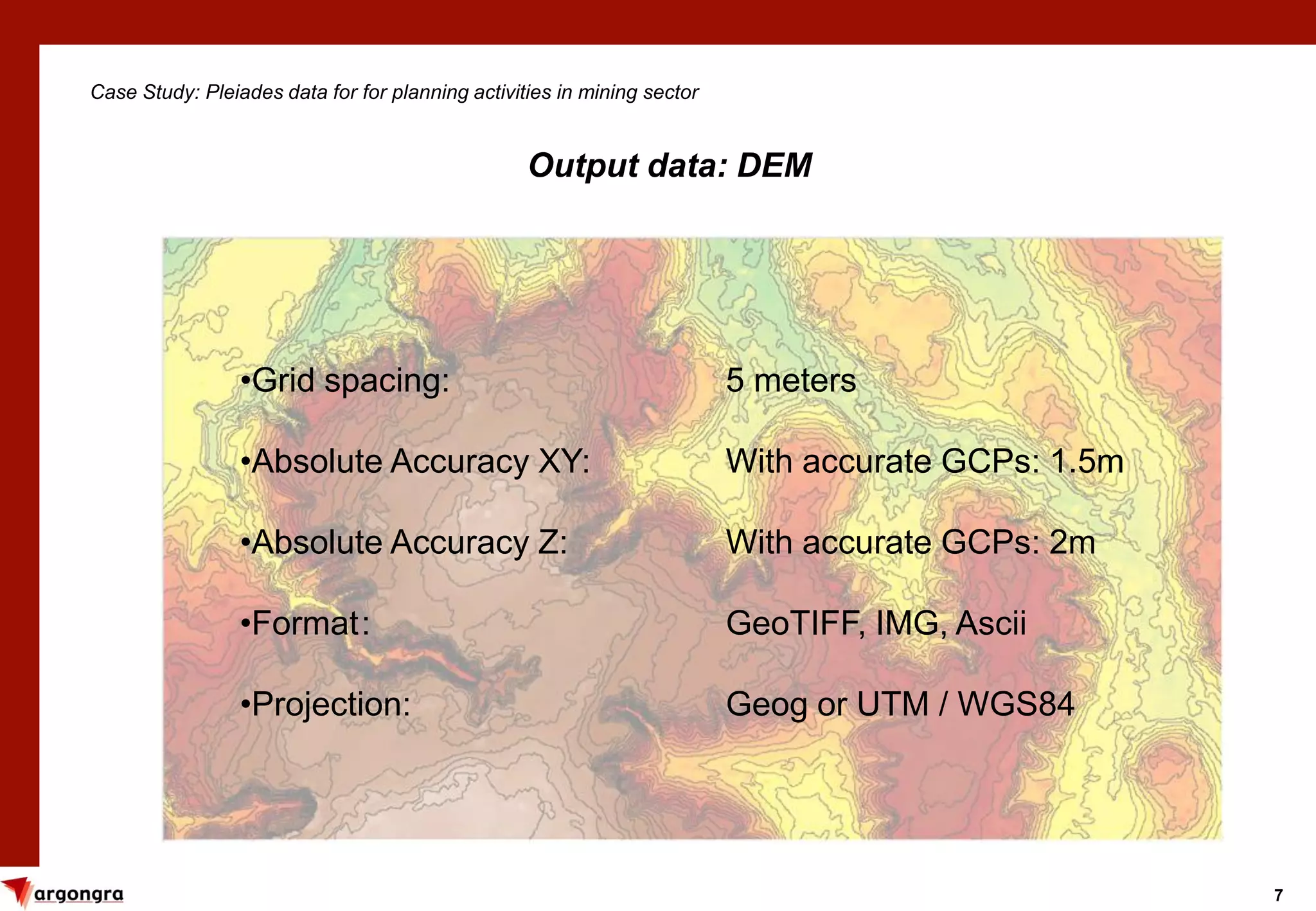
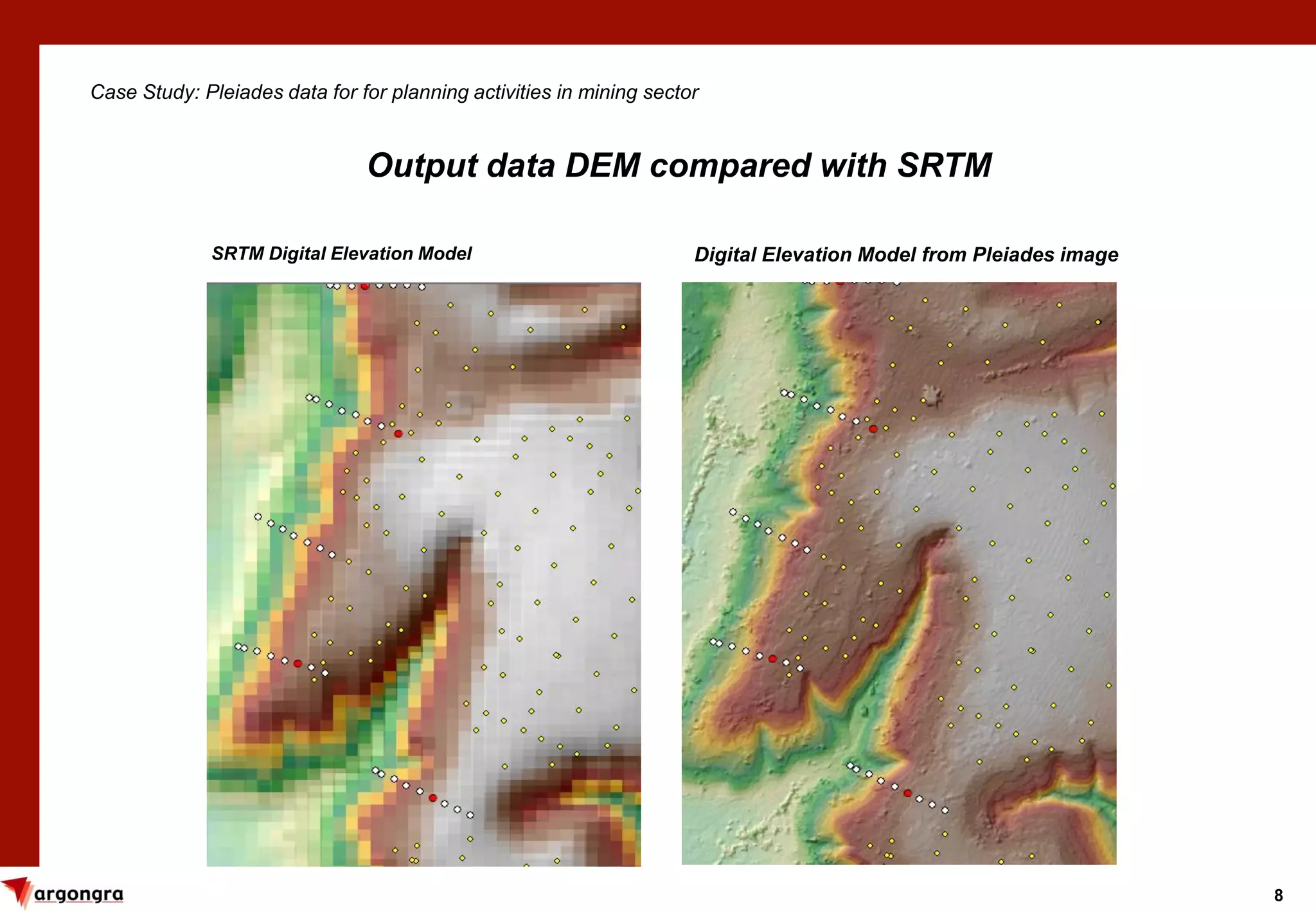
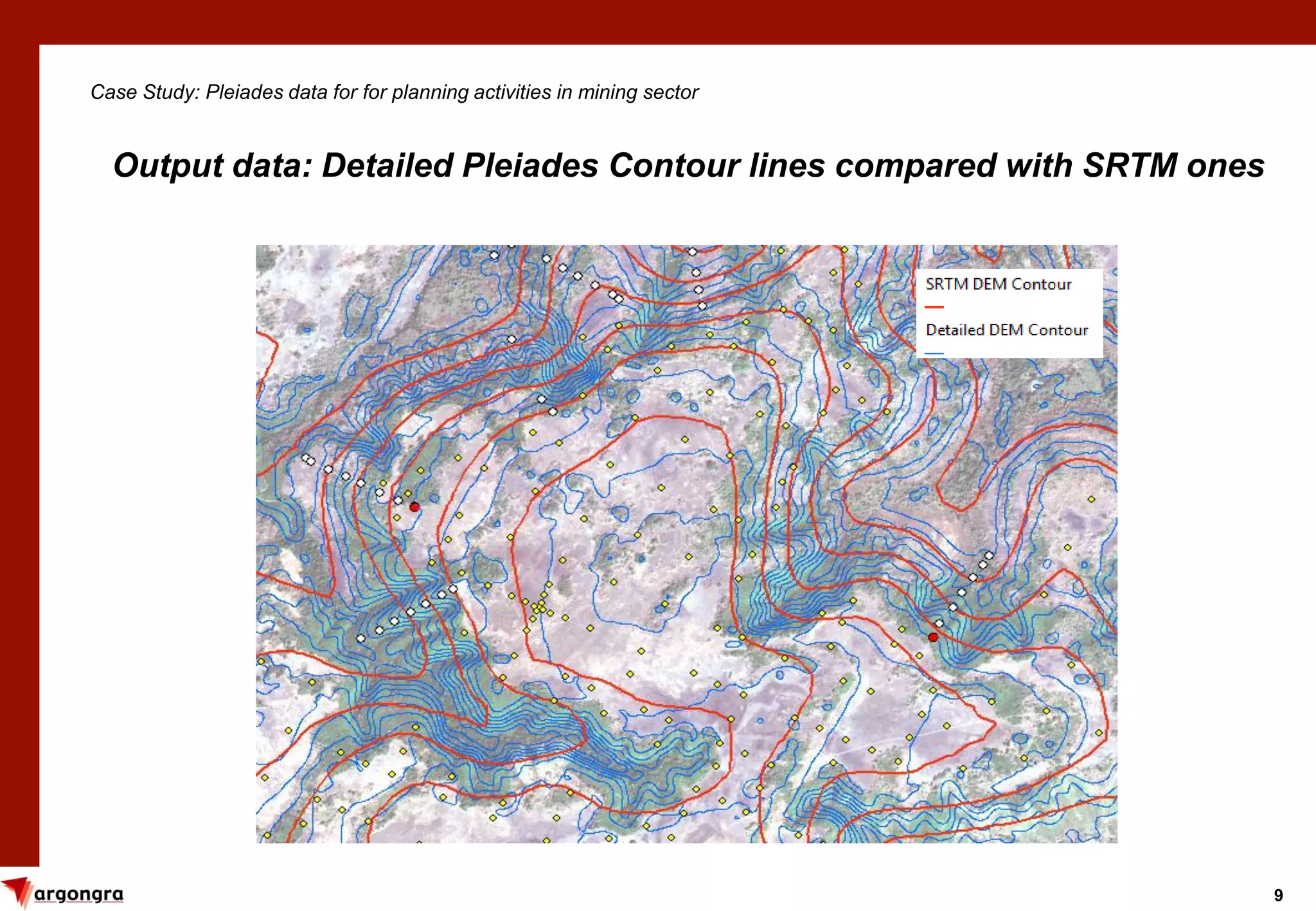
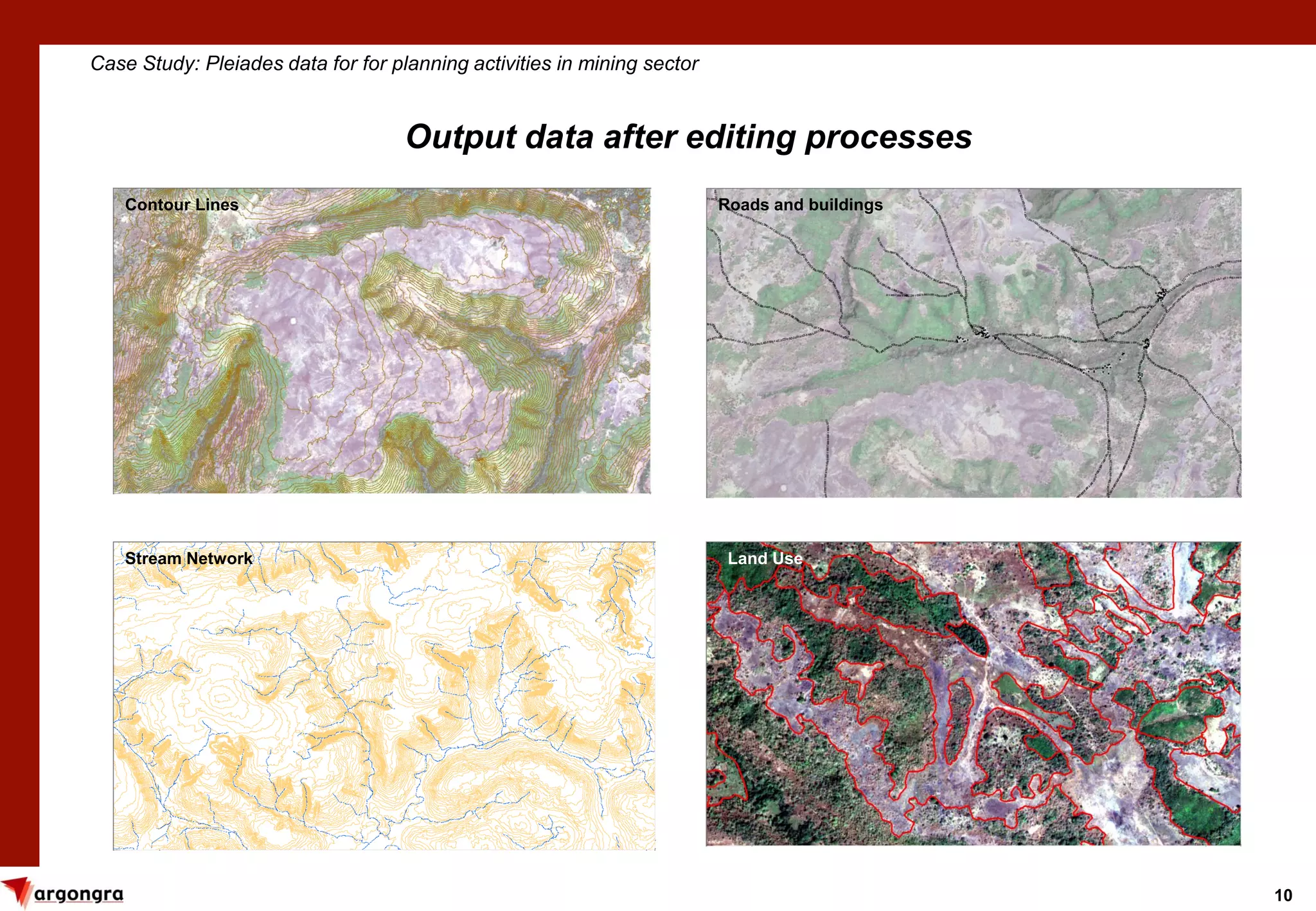
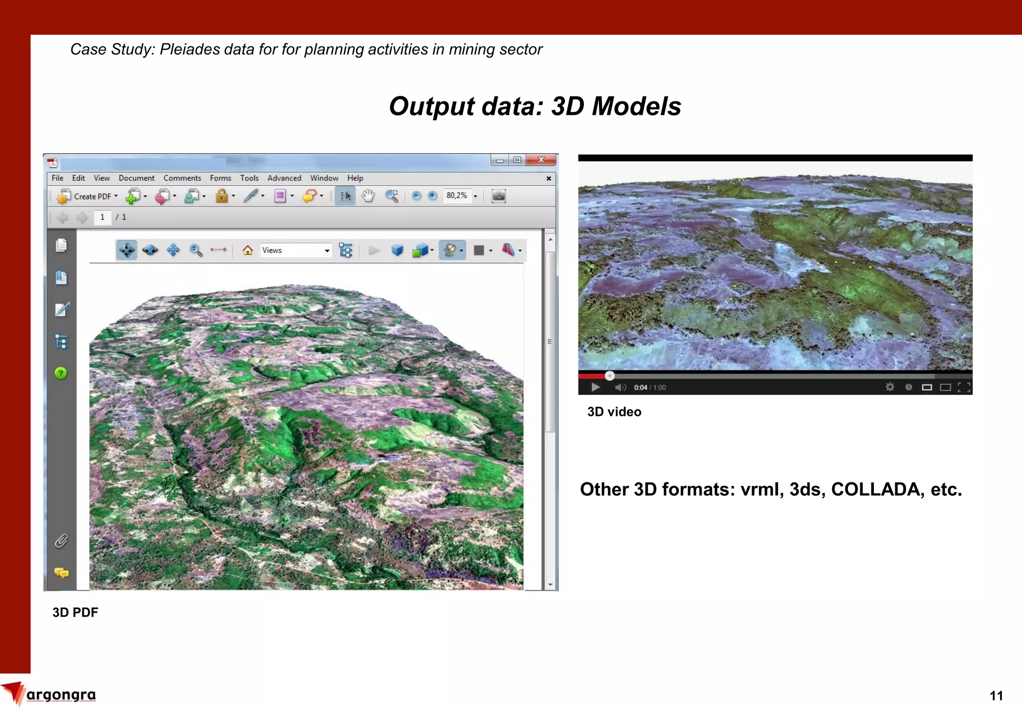

Pleiades satellite imagery can be used to generate high-resolution digital elevation models, contour lines, and 3D models for mining sector planning activities. A case study acquired 240 sq km of Pleiades stereo imagery with less than 5% cloud cover to generate a 5m DEM and detailed contour lines and 3D visualizations. The Pleiades data provided more accurate topographic information than existing SRTM data for environmental studies, monitoring mining volume changes, and other planning purposes in the mining sector.


![Vibe Coding vs. Spec-Driven Development [Free Meetup]](https://cdn.slidesharecdn.com/ss_thumbnails/vibecodingvsspecdrivendevelopment-251209105622-43f455e7-thumbnail.jpg?width=640&height=640&fit=bounds)