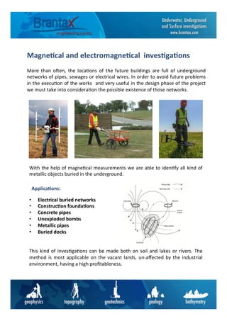
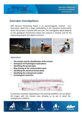
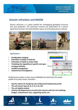
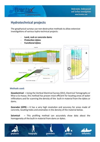
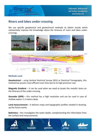
Downloaded 21 times

The document outlines various engineering geophysical and geotechnical methods used in infrastructure projects, including topographical surveys, geoelectrical investigations, and magnetic measurements for underground utilities. Essential applications are detailed, such as bathymetrical investigations for water bodies, seismic analysis for geological structures, and the use of advanced technology like drones for aerial photography. The text emphasizes the importance of precise measurements and understanding ground conditions to ensure the successful completion of engineering projects.


