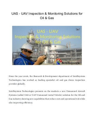
UAS - UAV Inspection & Monitoring Solutions for Oil & Gas

Since the year 2006, the Research & Development department of Intellisystem Technologies has worked as leading specialist oil and gas drone inspection provider globally. Intellisystem Technologies presents on the markets a new Unmanned Aircraft Systems (called UAS or UAV Unmanned Aerial Vehicle) solution for the Oil and Gas industry showing new capabilities that reduce cost and operational risk while also improving efficiency. Our solutions is able to produce 4K and full HD video, 3D full HD, High Resolution Pictures, High Resolution 3D Picture, thermal video and imagery. All the drones collected data are fed into our company’s proprietary data platform, analysed and delivered to the client as a technical report. Each part of this process involve our highly qualified, in-house team engineers of global industry experts in flare systems and structural engineering. Our UAS service can be used to measure and quantify oil spills, determine how the oil is moving in water and provide information and imagery to the command center. Infrared (IR) and thermal imaging can be extremely helpful to survey oil spills making it easier to see where the oil is spreading. This critical information increases the situational awareness of first responders to the incident, increasing safety and the ability to make better decisions in the clean-up planning efforts. All of this involve: • Less staff requirement with more safety. Traditional methods like industrial mountaineering and height works with scaffold services or helicopter operations involve high risk and are cost-intensive. • Less time required. Quickly airborne. Quick live image analysis. Immediately processable data. • No loss of production. Eliminates the need to take your facilities off the grid, reduced downtime and allows surveys during production or construction. Another use of our UAS solution service is monitoring pipelines. IR and thermal image capabilities enable the unmanned aircraft to detect leaks that would otherwise not be visible. Additionally, specialized sensors can be used to detect emissions of gas leaks. Applications from asset security, ice monitoring and terrain mapping are just a few ways this highly effective technology can be utilized today.

Recommended
More Related Content
Viewers also liked
Viewers also liked (12)
More from Cristian Randieri PhD
More from Cristian Randieri PhD (20)
Recently uploaded
Recently uploaded (20)
UAS - UAV Inspection & Monitoring Solutions for Oil & Gas
- 1. UAS - UAV Inspection & Monitoring Solutions for Oil & Gas Since the year 2006, the Research & Development department of Intellisystem Technologies has worked as leading specialist oil and gas drone inspection provider globally. Intellisystem Technologies presents on the markets a new Unmanned Aircraft Systems (called UAS or UAV Unmanned Aerial Vehicle) solution for the Oil and Gas industry showing new capabilities that reduce cost and operational risk while also improving efficiency.
- 2. Our solutions is able to produce 4K and full HD video, 3D full HD, High Resolution Pictures, High Resolution 3D Picture, thermal video and imagery. All the drones collected data are fed into our company’s proprietary data platform, analysed and delivered to the client as a technical report. Each part of this process involve our highly qualified, in-house team engineers of global industry experts in flare systems and structural engineering. Our UAS service can be used to measure and quantify oil spills, determine how the oil is moving in water and provide information and imagery to the command center. Infrared (IR) and thermal imaging can be extremely helpful to survey oil spills making it easier to see where the oil is spreading.
- 3. This critical information increases the situational awareness of first responders to the incident, increasing safety and the ability to make better decisions in the clean- up planning efforts. All of this involve: Less staff requirement with more safety.Traditional methods like industrial mountaineering and height works with scaffold services or helicopter operations involve high risk and are cost-intensive. Less time required. Quickly airborne.Quick live image analysis. Immediately processable data. No loss of production.Eliminates the need to take your facilities off the grid, reduced downtime and allows surveys during production or construction. Another use of our UAS solution service is monitoring pipelines. IR and thermal image capabilities enable the unmanned aircraft to detect leaks that would otherwise not be visible. Additionally, specialized sensors can be used to detect emissions of gas leaks. Applications from asset security, ice monitoring and terrain mapping are just a few ways this highly effective technology can be utilized today.
- 4. Intellisystem Technologies over the years has reached a big aviation experience, providing live flare, structural and under deck inspections onshore and offshore. The business is growing fast, and is set to continue to scale as the world’s leading drone inspection operator in oil and gas.
- 5. Intellisystem Technologies’ unmanned aircraft systems offer the oil & gas industry valuable capabilities that will reduce all the operational cost and risk, while improving security and efficiency. Our services can be delivered globally across five regions of the world on safe, cost effective and fast way. Our business unit is headquartered in Siracusa (Italy). Range of UAV drone-based inspection applications: Type pf offshore inspection of oil and gas platforms:
- 6. Infrastructure like bridges, roads, railways, power lines & equipment, viaducts, subways, tunnels, level crossings, dams, reservoirs, retaining walls etc. Wind farm & power stations. Solar park & PV modules. Thermal energy efficiency inspections. Drilling rigs, pipelines & transmission network. Operation in preventive action or emergency cases. Asset, environmental & wildlife surveying. Oil spill detection. Oil spill damage assessment. Oil/Gas pipeline surveillance incident mapping. Search and rescue (SAR). Coastline monitoring. Sea ice monitoring. Terrain mapping. Facility security. Specialties Unmanned Aerial Vehicles (UAV) inspection services for Oil and Gas, Safety Overwatch Service, Rapid Response Service.
- 7. By Cristian Randieri, PhD President & Ceo Of Intellisystem Technologies Follow our updates -> https://www.linkedin.com/company/intellisystem-technologies- s-r-l- _______ About Cristian Randieri, Phd Cristian Randieri is a brilliant intelligent and great proactivity person and an effective communicator and visionary. He has built a strong (and deserved) reputation as someone with vision, diligence and honour. Cristian is not a simple engineer but he is a real Scientist. His knowledge is not restricted to the area it covers, but its impressive passion for all the technical topics led him to acquire great skills even in areas far from his original studies. Cristian is able to address and solve complex technical problems with excellent results. He is a valuable writer with great scientific background formed with more than 15 years of active research on experimental Nuclear Physics performed in the most famous international research laboratories such as CERN, ESRF, INF. He write about HI- Tech solutions topics and advanced research study applied to industry. With more than 150 scientific & technical publications, he is also, a technical and famous writer in Italy due to his interviews released to the most famous Industrial Italian magazines. Actually, he is the President & CEO of Intellisystem Technologies an Italian Research & Developments company committed to develop and sell innovative and advanced solutions.
- 8. More info about Cristian Randieri on his Professional Website & Blog http://www.randieri.com As active LinkedIn Pulse Author, you may read all his articles. __________ For more question you can contact Cristian Randieri, Phd YOU ARE WELCOME INTO MY LinkedIn PROFESSIONAL NETWORK!!! Let's connect ----> crandieri@hotmail.com OneClickInvitation> https://www.linkedin.com/inviteFromProfile?from=profile&key= 460284&firstName=Cristian&lastName=Randieri YOU ARE ALSO INVITED TO JOINT TO THE "ITALIAN LION Networker - ITALY LI.O.N. Open Network" GROUP ! Follow this link -> https://www.linkedin.com/grp/home?gid=8345817 ___________ Dott. Ing. Cristian Randieri, Ph.D.
- 9. President & CEO Intellisystem Technologies S.r.l. Via Augusto Murri, 1 96100 Siracusa (Italy) Tel +39 (0)931-1756256 | +39 (0)2-87167549 Mobile +39 335-1880035 MSN: crandieri@hotmail.com | SKYPE: intellisystem_technologies email: randieri@intellisystem.it web: http://www.intellisystem.it Facebook https://www.facebook.com/intellisystem Linkedin https://www.linkedin.com/in/cristianrandieri Twitter https://twitter.com/C_Randieri ResearchGate: http://www.researchgate.net/profile/Cristian_Randieri Academia.edu: https://unict.academia.edu/CristianRandieri YouTube Channel: https://www.youtube.com/c/intellisystemit Google+: https://plus.google.com/+IntellisystemIt beBee: https://www.bebee.com/profile/cristian-randieri