Presentation of a co-authored paper with Christian Sailer, David Rudi, Kuno Kurzhals, Martin Raubal (ETH Zurich GIS, Switzerland)
mLearn19 September 16.- 18. 2019, Delft (NL)
Presented at #mlearn19 in Delft, NL
http://iamlearn.org/mlearn/
Spatial is (not) special - Adventures in location-based dataThierry Gregorius
Delivered to the BCS Data Management forum, an overview of GIS/Geospatial trends, the need for spatial integrity, why spatial intelligence doesn't need a map, and creative curveballs like the enduring benefits of analog tools and handmade craftsmanship.
This document discusses how 3D technologies can benefit education and research. It describes how 3D modeling can widen audience reach, preserve fragile collections, increase understanding through data harvesting, enable knowledge gains through simulation, and allow for sharing of 3D data objects. Specific benefits mentioned include protecting collections from overhandling, generating surrogate objects, and creating opportunities for immersive learning through activities like 3D printing and gamification. Various methods for creating 3D models like approximation, laser scanning, structured light, and photogrammetry are also outlined.
This document discusses how data visualization can make data science more tangible and accessible. It provides examples of using maps and interactive visualization to tell stories with data and simplify complex datasets. Visualization tools can turn raw data into insights by aggregating information over space and time. The document advocates using all dimensions of data, like integrating 3D models with spatiotemporal data, to better understand assets and dynamic systems.
Science Media & Data Visualization - XOOMS (English)充彦 保田
XOOMS is a group of content-creators specialized in Science & Technology field. Our mission is to build a bridge between the science & technology field and our society through 'visualization'.
This presentation summarizes what we have done and What we're doing.
The document discusses the evolution of geographic information systems (GIS) and their relationship to social web technologies. It provides a brief history of GIS, from early mapping efforts to modern systems created in the 1960s-1990s by ESRI. It then discusses how GIS provides data that can be used to create mashups and geospatial applications on the social web. One example discussed is extending wiki systems to allow users to geographically tag and edit map data, creating a "wikified" GIS archive. The document concludes that GIS serves as a backend for geospatial applications on the social web by allowing users to collaboratively contribute and update map layers.
ECCK Innovation Forum 2018 - Industry Renaissance with 3DEXPERIENCE PlatformJangHee Lee
The document discusses the industry renaissance enabled by the 3DEXPERIENCE platform. It covers trends like the new industrial revolution driven by data, digital transformation, and product lifecycles. Digital twins are described as virtual representations of physical assets that can be used across the lifecycle for simulation, prediction, and decision making. The 3DEXPERIENCE platform facilitates virtual validation and multi-physics multi-scale simulations to ideate new systems without physical prototypes.
Presentation by Nils Walravens at Open Belgium 2018 - http://2018.openbelgium.be/session/smart-flanders-how-flemish-cities-are-tackling-urban-challenges-together-through-open-data
This document discusses emerging technologies including cloud computing, social media, mobile devices, HTML5, and pervasive computing. It provides details on what each technology is, how it works, who is using it, why it is significant, potential downsides, future directions, and implications for higher education. Key topics covered include the growth of cloud services, integration of mobile and social media, widespread adoption of smartphones and tablets, advances in HTML5, and the rise of pervasive and adaptive computing technologies.
Cite as: Kamel Boulos MN. VRGIS and big data for smarter, healthier cities (within the Invited Session on 'Digital technologies and the impact in biometry', Chair: R Assunção, Discussant: A Charpentie, Presenters: MN Kamel Boulos, J Mills Flemming, G Câmara). XXIXth International Biometric Conference, Barcelona International Convention Centre, Barcelona, Spain, 10 July 2018.
-----------------------
Abstract:
-----------------------
The latest generation of virtual and mixed reality hardware has rekindled interest in VRGIS (Virtual Reality GIS) and ARGIS (Augmented Reality GIS) applications in health, and opened up new and exciting opportunities and possibilities for using these technologies in the personal and public health arenas (Kamel Boulos et al., 2017). This presentation will offer a snapshot of some of the most remarkable VRGIS and ARGIS solutions that rely on big data, including real-time data, to deliver the vision of smart healthy cities (Kamel Boulos et al., 2015).
1. Kamel Boulos et al. From urban planning and emergency training to Pokémon Go: applications of virtual reality GIS (VRGIS) and augmented reality GIS (ARGIS) in personal, public and environmental health. Int J Health Geogr. 2017, 16:7. DOI: 10.1186/s12942-017-0081-0
2. Kamel Boulos et al. 'Social, innovative and smart cities are happy and resilient': insights from the WHO EURO 2014 International Healthy Cities Conference. Int J Health Geogr. 2015, 14:3. DOI: 10.1186/1476-072X-14-3
If you took a Geography course over 20 years ago, you might recall the subject involving little more than memorizing the locations of continents, countries, cities, as well as climate and cultural facts. In that time, many universities have expanded their geography programs by entering the world of Geographic Information Systems, or GIS for short. In the beginning GIS was an obscure field of specialized hardware, software, and cryptic keyboard commands that allowed a skilled professional to query data to get answers to geographic-based inquiries. Queries, such as the quantity of forested acres within an area, were the beginning of the geographicbased analysis revolution that has since unfolded. But today’s leading geography programs are teaching students more than just the where, what, who, and why of our world, but also bring to the table an interdisciplinary approach to solving today’s local, regional, national, and global problems. Many of these programs are not limited to just universities, now involving the K-12 space, tapping into young people’s minds to unleash innovative ideas in what is now an interdisciplinary field. To maintain a competitive advantage in today’s world, leading countries, companies, and research organizations are embracing these new capabilities and the talent that is available in the marketplace.
This document summarizes the eROSA project, which received funding from the European Union's Horizon 2020 research and innovation programme. The 18-month project aims to build a community around developing roadmaps for an e-infrastructure for open science in agriculture. It will conduct stakeholder mapping and stocktaking activities to understand current relevant infrastructures, projects, and policies. The project is a coordination and support action with partners from France, the Netherlands, and Greece and seeks to support the development of small foresight roadmaps and identify potential collaborations across scientific domains and geographic areas.
This document describes a child tracking system project that uses GPS and GSM technologies. The system uses an Arduino board, GPS module, GSM module, and battery. It tracks a child's location using GPS coordinates and sends the location to the parent's phone via text message using the GSM module. The project aims to help parents monitor their children's location and ensure their safety.
Imagining a Physical Future for Digital JournalismDataJournalismUK
The document provides information about a "Data Driven News Installations" cookbook for journalists. The cookbook contains recipes for three data journalism projects that have been turned into physical installations: a "Data Walk", a "3D Data Map", and "Light Data Bars". Each recipe section outlines the goals of the project, provides photos and diagrams of a prototype, and explains the digital fabrication techniques involved in creating the installation, such as 3D modeling, fabrication, and assembly. The overall aim is to promote skills in digital fabrication among journalists and encourage more experiential forms of data storytelling.
The Path to Net Positive: Principles, Practical Models and Progress to Date A...Sustainable Brands
The document discusses moving businesses towards a net positive impact through sustainable innovation. It outlines how Dassault Systemes' 3DEXPERIENCE platform can help companies eco-design products, engineer more sustainably, enable green manufacturing, and optimize product use through simulation, virtual prototyping, and data analytics apps. The goal is to promote better design practices that grow customers' "handprints" by measurably improving environmental and social performance across the product lifecycle.
The document discusses how augmented reality (AR) and 3D imaging can be used in education. It defines AR as live views of the real world augmented with computer-generated information. The document outlines several AR apps and describes various uses of AR in the classroom, library, and special education. It also discusses 3D imaging software, how 3D printing can benefit education, and the growing Maker Movement where students design and create their own projects.
Introduction to Digital Mapping for UG StudentsAbhijitZende3
Digital mapping involves converting traditional paper maps into digital formats. Etak was a pioneer in digital mapping and automotive navigation systems. It was founded in 1983 and created the first digital maps and navigation system for cars called the Etak Navigator in 1985. Over time, digital mapping has expanded and improved, allowing for applications like tracking diseases and monitoring natural disasters. Issues remain around data sharing and costs, but digital mapping provides important benefits for research, emergency response, and more. Google Earth further advanced digital mapping by providing satellite imagery and street views of locations around the world, though it also raised privacy and security concerns for some.
This document discusses technology trends in digital services, including how to serve users across multiple devices and provide smart interaction and targeted content. It notes the rise of mobile screens and other new platforms like electronic paper, smart TVs, glasses, and watches. It emphasizes separating content from presentation to allow publishing across channels and moving content between devices. Methods of smart interaction through touch, speech, gestures and augmented reality are presented. Targeting content by user context, location, tasks, interests and social networks is also discussed.
My closing keynote at GISRUK 2019 - a call to arms for a human approach in a digital world, reflecting in a light-hearted and personal way on GIS industry trends, careers and how to succeed in GIS deployments and applications.
GISRUK is an annual GIS research conference attracting around 200 academic researchers from around the UK and beyond, each year held at a different university. The 2019 conference took place in Newcastle upon Tyne in April 2019. Info: https://gis.geos.ed.ac.uk/gisruk/gisruk.html
The document discusses various online tools for visualizing and sharing data on the participatory web. It provides examples of tools for mapping and spatial data visualization, including ProgrammableWeb, GeoCommons, and OpenStreetMap. It also lists tools for numeric data visualization like Graphwise, Numbrary, and Swivel. The document questions whether these types of online data visualization tools are just a temporary phenomenon or have more lasting potential to support academic research and open data initiatives.
The document discusses open data and its impacts. It notes that open data must be freely accessible, in reusable formats, and under an open license. Open data can impact politics, society, and the economy by enabling open innovation and business opportunities. Implementing an open data policy faces challenges regarding policy, regulation, capacity, and technology. The Open Data Charter provides principles for open data policies. OpenDataSoft is a company that helps make data scale and create value through visualizations, APIs, and enabling data reuse. It discusses using open data in areas like transportation, smart cities, and performance management.
ETH GIS and Geoinformation Lab 2018: Discovering Mixed Reality (final present...Christian Sailer
ETH lecture about mobile Geoinformation Technologies
http://gis-lab.ethz.ch/
The purpose of this lab is using cutting-edge technologies to make geoinformation fun, interesting and intuitive.
More Related Content
Similar to Towards Seamless Mobile Learning with Mixed Reality on Head-Mounted Displays
ECCK Innovation Forum 2018 - Industry Renaissance with 3DEXPERIENCE PlatformJangHee Lee
The document discusses the industry renaissance enabled by the 3DEXPERIENCE platform. It covers trends like the new industrial revolution driven by data, digital transformation, and product lifecycles. Digital twins are described as virtual representations of physical assets that can be used across the lifecycle for simulation, prediction, and decision making. The 3DEXPERIENCE platform facilitates virtual validation and multi-physics multi-scale simulations to ideate new systems without physical prototypes.
Presentation by Nils Walravens at Open Belgium 2018 - http://2018.openbelgium.be/session/smart-flanders-how-flemish-cities-are-tackling-urban-challenges-together-through-open-data
This document discusses emerging technologies including cloud computing, social media, mobile devices, HTML5, and pervasive computing. It provides details on what each technology is, how it works, who is using it, why it is significant, potential downsides, future directions, and implications for higher education. Key topics covered include the growth of cloud services, integration of mobile and social media, widespread adoption of smartphones and tablets, advances in HTML5, and the rise of pervasive and adaptive computing technologies.
Cite as: Kamel Boulos MN. VRGIS and big data for smarter, healthier cities (within the Invited Session on 'Digital technologies and the impact in biometry', Chair: R Assunção, Discussant: A Charpentie, Presenters: MN Kamel Boulos, J Mills Flemming, G Câmara). XXIXth International Biometric Conference, Barcelona International Convention Centre, Barcelona, Spain, 10 July 2018.
-----------------------
Abstract:
-----------------------
The latest generation of virtual and mixed reality hardware has rekindled interest in VRGIS (Virtual Reality GIS) and ARGIS (Augmented Reality GIS) applications in health, and opened up new and exciting opportunities and possibilities for using these technologies in the personal and public health arenas (Kamel Boulos et al., 2017). This presentation will offer a snapshot of some of the most remarkable VRGIS and ARGIS solutions that rely on big data, including real-time data, to deliver the vision of smart healthy cities (Kamel Boulos et al., 2015).
1. Kamel Boulos et al. From urban planning and emergency training to Pokémon Go: applications of virtual reality GIS (VRGIS) and augmented reality GIS (ARGIS) in personal, public and environmental health. Int J Health Geogr. 2017, 16:7. DOI: 10.1186/s12942-017-0081-0
2. Kamel Boulos et al. 'Social, innovative and smart cities are happy and resilient': insights from the WHO EURO 2014 International Healthy Cities Conference. Int J Health Geogr. 2015, 14:3. DOI: 10.1186/1476-072X-14-3
If you took a Geography course over 20 years ago, you might recall the subject involving little more than memorizing the locations of continents, countries, cities, as well as climate and cultural facts. In that time, many universities have expanded their geography programs by entering the world of Geographic Information Systems, or GIS for short. In the beginning GIS was an obscure field of specialized hardware, software, and cryptic keyboard commands that allowed a skilled professional to query data to get answers to geographic-based inquiries. Queries, such as the quantity of forested acres within an area, were the beginning of the geographicbased analysis revolution that has since unfolded. But today’s leading geography programs are teaching students more than just the where, what, who, and why of our world, but also bring to the table an interdisciplinary approach to solving today’s local, regional, national, and global problems. Many of these programs are not limited to just universities, now involving the K-12 space, tapping into young people’s minds to unleash innovative ideas in what is now an interdisciplinary field. To maintain a competitive advantage in today’s world, leading countries, companies, and research organizations are embracing these new capabilities and the talent that is available in the marketplace.
This document summarizes the eROSA project, which received funding from the European Union's Horizon 2020 research and innovation programme. The 18-month project aims to build a community around developing roadmaps for an e-infrastructure for open science in agriculture. It will conduct stakeholder mapping and stocktaking activities to understand current relevant infrastructures, projects, and policies. The project is a coordination and support action with partners from France, the Netherlands, and Greece and seeks to support the development of small foresight roadmaps and identify potential collaborations across scientific domains and geographic areas.
This document describes a child tracking system project that uses GPS and GSM technologies. The system uses an Arduino board, GPS module, GSM module, and battery. It tracks a child's location using GPS coordinates and sends the location to the parent's phone via text message using the GSM module. The project aims to help parents monitor their children's location and ensure their safety.
Imagining a Physical Future for Digital JournalismDataJournalismUK
The document provides information about a "Data Driven News Installations" cookbook for journalists. The cookbook contains recipes for three data journalism projects that have been turned into physical installations: a "Data Walk", a "3D Data Map", and "Light Data Bars". Each recipe section outlines the goals of the project, provides photos and diagrams of a prototype, and explains the digital fabrication techniques involved in creating the installation, such as 3D modeling, fabrication, and assembly. The overall aim is to promote skills in digital fabrication among journalists and encourage more experiential forms of data storytelling.
The Path to Net Positive: Principles, Practical Models and Progress to Date A...Sustainable Brands
The document discusses moving businesses towards a net positive impact through sustainable innovation. It outlines how Dassault Systemes' 3DEXPERIENCE platform can help companies eco-design products, engineer more sustainably, enable green manufacturing, and optimize product use through simulation, virtual prototyping, and data analytics apps. The goal is to promote better design practices that grow customers' "handprints" by measurably improving environmental and social performance across the product lifecycle.
The document discusses how augmented reality (AR) and 3D imaging can be used in education. It defines AR as live views of the real world augmented with computer-generated information. The document outlines several AR apps and describes various uses of AR in the classroom, library, and special education. It also discusses 3D imaging software, how 3D printing can benefit education, and the growing Maker Movement where students design and create their own projects.
Introduction to Digital Mapping for UG StudentsAbhijitZende3
Digital mapping involves converting traditional paper maps into digital formats. Etak was a pioneer in digital mapping and automotive navigation systems. It was founded in 1983 and created the first digital maps and navigation system for cars called the Etak Navigator in 1985. Over time, digital mapping has expanded and improved, allowing for applications like tracking diseases and monitoring natural disasters. Issues remain around data sharing and costs, but digital mapping provides important benefits for research, emergency response, and more. Google Earth further advanced digital mapping by providing satellite imagery and street views of locations around the world, though it also raised privacy and security concerns for some.
This document discusses technology trends in digital services, including how to serve users across multiple devices and provide smart interaction and targeted content. It notes the rise of mobile screens and other new platforms like electronic paper, smart TVs, glasses, and watches. It emphasizes separating content from presentation to allow publishing across channels and moving content between devices. Methods of smart interaction through touch, speech, gestures and augmented reality are presented. Targeting content by user context, location, tasks, interests and social networks is also discussed.
My closing keynote at GISRUK 2019 - a call to arms for a human approach in a digital world, reflecting in a light-hearted and personal way on GIS industry trends, careers and how to succeed in GIS deployments and applications.
GISRUK is an annual GIS research conference attracting around 200 academic researchers from around the UK and beyond, each year held at a different university. The 2019 conference took place in Newcastle upon Tyne in April 2019. Info: https://gis.geos.ed.ac.uk/gisruk/gisruk.html
The document discusses various online tools for visualizing and sharing data on the participatory web. It provides examples of tools for mapping and spatial data visualization, including ProgrammableWeb, GeoCommons, and OpenStreetMap. It also lists tools for numeric data visualization like Graphwise, Numbrary, and Swivel. The document questions whether these types of online data visualization tools are just a temporary phenomenon or have more lasting potential to support academic research and open data initiatives.
The document discusses open data and its impacts. It notes that open data must be freely accessible, in reusable formats, and under an open license. Open data can impact politics, society, and the economy by enabling open innovation and business opportunities. Implementing an open data policy faces challenges regarding policy, regulation, capacity, and technology. The Open Data Charter provides principles for open data policies. OpenDataSoft is a company that helps make data scale and create value through visualizations, APIs, and enabling data reuse. It discusses using open data in areas like transportation, smart cities, and performance management.
Similar to Towards Seamless Mobile Learning with Mixed Reality on Head-Mounted Displays (20)
ETH GIS and Geoinformation Lab 2018: Discovering Mixed Reality (final present...Christian Sailer
ETH lecture about mobile Geoinformation Technologies
http://gis-lab.ethz.ch/
The purpose of this lab is using cutting-edge technologies to make geoinformation fun, interesting and intuitive.
The document discusses location-based mobile learning using mobile devices and apps. It describes using mobile learning for field trips and outdoor education activities. Students can explore locations, collect data, measure things and analyze their findings. The learning is situated in real world contexts and supports collaboration, peer learning, and assessment. Students may be given missions or tasks to complete at different locations, and their progress and paths can be tracked over time and space. The document provides an example case study of a mobile learning activity at an historic garden site.
This one-page document discusses Generation Mobile and GEOSchoolDay 2017. It mentions Christian Sailer and provides the website geoschoolday.ch, suggesting it relates to an event on that date focused on mobile technology and education.
Teachers matter - Challenges of using a location-based mobile learning platformChristian Sailer
Description of the location-based mobile learning platoform
Description og 5 challenges: Environment, technology, learners, teaching, spatio-cognitive competences of teachers
An evaluation method for location-based mobile learning based on spatio-tempo...Christian Sailer
The evaluation of location-based mobile learning (LBML) concepts and technologies is typically performed using methods known from classical usability engineering, such as questionnaires or interviews. In this paper, we argue that many problems that may occur during LBML become apparent in the learner’s spatio-temporal behavior (i.e., her trajectory). We systematically explore how location tracking and spatial analyses can be used for the evaluation of LBML. Examples with trajectories recorded during a real learning session are presented.
Gamification of Geoinformation in Swiss Education and ResearchChristian Sailer
The ubiquitous availability of mobile devices at the youth generation affords new concepts of education especially in the field of Geoinformation. Switzerlands' educators and researchers are very active providing new applications for K12 and higher Education. Gamification of such apps is increasing and impacts the GI Education in a positive way.
This presentation was shared at Esri Education Userconference 2015 in San Diego.
Mobile Learning 2015, Madeira - AN INTEGRATED LEARNING MANAGEMENT SYSTEM FOR ...Christian Sailer
This document discusses an integrated learning management system for location-based mobile learning. It describes how the system allows educators to create location-based learning modules that students can engage with using a mobile app. The system aims to bridge the gap between theoretical classroom learning and hands-on experiences in the field. Requirements for the system include being integrated, interdisciplinary, easy for users, and adaptable to new technologies. Future work may include additional technical capabilities, user interface improvements, and research for a PhD on location-based activities and social learning features.
Temple of Asclepius in Thrace. Excavation resultsKrassimira Luka
The temple and the sanctuary around were dedicated to Asklepios Zmidrenus. This name has been known since 1875 when an inscription dedicated to him was discovered in Rome. The inscription is dated in 227 AD and was left by soldiers originating from the city of Philippopolis (modern Plovdiv).
This presentation was provided by Racquel Jemison, Ph.D., Christina MacLaughlin, Ph.D., and Paulomi Majumder. Ph.D., all of the American Chemical Society, for the second session of NISO's 2024 Training Series "DEIA in the Scholarly Landscape." Session Two: 'Expanding Pathways to Publishing Careers,' was held June 13, 2024.
A Free 200-Page eBook ~ Brain and Mind Exercise.pptxOH TEIK BIN
(A Free eBook comprising 3 Sets of Presentation of a selection of Puzzles, Brain Teasers and Thinking Problems to exercise both the mind and the Right and Left Brain. To help keep the mind and brain fit and healthy. Good for both the young and old alike.
Answers are given for all the puzzles and problems.)
With Metta,
Bro. Oh Teik Bin 🙏🤓🤔🥰
CapTechTalks Webinar Slides June 2024 Donovan Wright.pptxCapitolTechU
Slides from a Capitol Technology University webinar held June 20, 2024. The webinar featured Dr. Donovan Wright, presenting on the Department of Defense Digital Transformation.
🔥🔥🔥🔥🔥🔥🔥🔥🔥
إضغ بين إيديكم من أقوى الملازم التي صممتها
ملزمة تشريح الجهاز الهيكلي (نظري 3)
💀💀💀💀💀💀💀💀💀💀
تتميز هذهِ الملزمة بعِدة مُميزات :
1- مُترجمة ترجمة تُناسب جميع المستويات
2- تحتوي على 78 رسم توضيحي لكل كلمة موجودة بالملزمة (لكل كلمة !!!!)
#فهم_ماكو_درخ
3- دقة الكتابة والصور عالية جداً جداً جداً
4- هُنالك بعض المعلومات تم توضيحها بشكل تفصيلي جداً (تُعتبر لدى الطالب أو الطالبة بإنها معلومات مُبهمة ومع ذلك تم توضيح هذهِ المعلومات المُبهمة بشكل تفصيلي جداً
5- الملزمة تشرح نفسها ب نفسها بس تكلك تعال اقراني
6- تحتوي الملزمة في اول سلايد على خارطة تتضمن جميع تفرُعات معلومات الجهاز الهيكلي المذكورة في هذهِ الملزمة
واخيراً هذهِ الملزمة حلالٌ عليكم وإتمنى منكم إن تدعولي بالخير والصحة والعافية فقط
كل التوفيق زملائي وزميلاتي ، زميلكم محمد الذهبي 💊💊
🔥🔥🔥🔥🔥🔥🔥🔥🔥
Towards Seamless Mobile Learning with Mixed Reality on Head-Mounted Displays
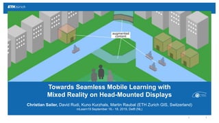
1. ||
Christian Sailer, David Rudi, Kuno Kurzhals, Martin Raubal (ETH Zurich GIS, Switzerland)
mLearn19 September 16.- 18. 2019, Delft (NL)
Towards Seamless Mobile Learning with
Mixed Reality on Head-Mounted Displays
2. ||
Christian Sailer, David Rudi, Kuno Kurzhals, Martin Raubal (ETH Zurich GIS, Switzerland)
mLearn19 September 16.- 18. 2019, Delft (NL)
Towards Seamless Mobile Learning with
Mixed Reality on Head-Mounted Displays
6. ||
Defiences in self-regulated and seamless
mobile learning on hand-held devices
Screen
Size
Field of
View
Human-Computer
Interaction
13.06.2019Towards Seamless Mobile Learning with Mixed Reality on HMDs
8. ||
Contextual support Peer-to-peer communication
Inquiry-based learning activities (Suàrez et al. 2018)
13.06.2019Towards Seamless Mobile Learning with Mixed Reality on HMDs
Suárez,Á.,Specht,M.,Prinsen,F.,Kalz,M.,&Ternier,S.(2018).Areviewofthetypesofmobile
activitiesinmobileinquiry-basedlearning.Computers&Education,118,38–55.
9. ||
for Seamless Mobile Learning Scenarios with
Mixed Reality on Head-Mounted Displays
A set of design examples and research directions
10. ||
A set of design examples and research directions for
Seamless Mobile Learning Scenarios
GIS Interactions
(Contextual Support)
Immersive simulations
Geographical modeling
Geospatial analysis
Human Interactions
(Peer-to-Peer Communication)
Gaze-based interaction
Close Collaboration
Remote Collaboration
12. ||
3D simulations of past and future scenarios
Immersivesimulations
Top:
ArcGISWebScene
https://arcg.is/1rHei4
Data:https://www.kadaster.nl/producten/woning/kadastrale-kaart
Bottom:
GoogleStreetView
https://www.google.ch/maps/@52.0042625,4.3615689,3a,75y,139.18h,89.57t/data=!3m6!1e1!3m4!1s1s_Wpx8pnZQ38OLQg-
wKiQ!2e0!7i13312!8i6656
13. ||
Construction of physical and abstract models
Geographicalmodeling
Top:
ArcGISWebScene
https://arcg.is/1rHei4
Data:https://www.kadaster.nl/producten/woning/kadastrale-kaart
Bottom:
GoogleStreetView
https://www.google.ch/maps/@52.0042625,4.3615689,3a,75y,139.18h,89.57t/data=!3m6!1e1!3m4!1s1s_Wpx8pnZQ38OLQg-
wKiQ!2e0!7i13312!8i6656
17. ||
Recording and playback of face-to-face events
CloseCollabarotion
OMLETHFieldtripTecDayChurOMLETH:
https://www.satw.ch/fileadmin/user_upload/documents/03_Dialog/02_TecDays_TecNights/TecDay_Chur_2016.pdf
10:25
AM
19. ||
Current shortcoming
Image: HYPER-REALITY
A provocative and kaleidoscopic new vision of the future, where physical and virtual realities have merged, and the city is saturated in media…
13.06.2019
Hardware Limitations
Notification Terror
Misconceptions Real-World Problems ?
20. ||
We identify several opportunities for seamless mobile learning activities
concerning contextual support and peer-to-peer interactions presented in
Suárez et al. (2018).
We state challenges (e.g., hardware limitations, cognitive overload, situational
awareness distractions).
We believe AR technology will built into normal glasses, or even into contact
lenses.
13.06.2019
Conclusion
21. ||
We extracted six research directions
for Seamless Mobile Learning Scenarios
with Mixed Reality on Head-Mounted Displays
• Immersive simulations
(3D simulations of past and
future scenarios)
• Geographical modeling
(Construction of physical and
abstract models)
• Geospatial analysis
(Shadow calculations)
Gaze-based interaction
(Visual and tactile examination,
voice feedback)
Close Collaboration
(Recording and playback of face-
to-face events)
Remote Collaboration
(Holographic telepresence and
remote inquiries)
Future Work