

Recommended
More Related Content
Similar to Topsy Turvy Mapping
Similar to Topsy Turvy Mapping (20)
More from GeoBlogs
More from GeoBlogs (20)
Recently uploaded
Recently uploaded (20)
Topsy Turvy Mapping
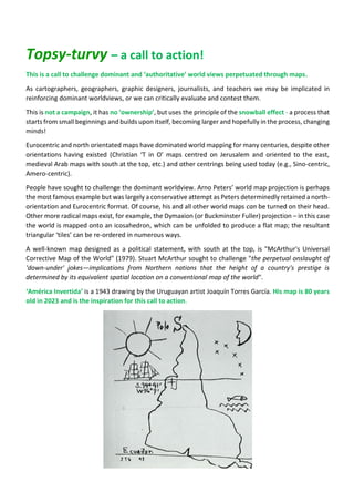
- 1. Topsy-turvy – a call to action! This is a call to challenge dominant and ‘authoritative’ world views perpetuated through maps. As cartographers, geographers, graphic designers, journalists, and teachers we may be implicated in reinforcing dominant worldviews, or we can critically evaluate and contest them. This is not a campaign, it has no ‘ownership’, but uses the principle of the snowball effect - a process that starts from small beginnings and builds upon itself, becoming larger and hopefully in the process, changing minds! Eurocentric and north orientated maps have dominated world mapping for many centuries, despite other orientations having existed (Christian ‘T in O’ maps centred on Jerusalem and oriented to the east, medieval Arab maps with south at the top, etc.) and other centrings being used today (e.g., Sino-centric, Amero-centric). People have sought to challenge the dominant worldview. Arno Peters’ world map projection is perhaps the most famous example but was largely a conservative attempt as Peters determinedly retained a north- orientation and Eurocentric format. Of course, his and all other world maps can be turned on their head. Other more radical maps exist, for example, the Dymaxion (or Buckminster Fuller) projection – in this case the world is mapped onto an icosahedron, which can be unfolded to produce a flat map; the resultant triangular ‘tiles’ can be re-ordered in numerous ways. A well-known map designed as a political statement, with south at the top, is "McArthur's Universal Corrective Map of the World" (1979). Stuart McArthur sought to challenge "the perpetual onslaught of 'down-under' jokes—implications from Northern nations that the height of a country's prestige is determined by its equivalent spatial location on a conventional map of the world". ‘América Invertida’ is a 1943 drawing by the Uruguayan artist Joaquín Torres García. His map is 80 years old in 2023 and is the inspiration for this call to action.
- 2. García prefigured his map in a statement in his “The School of the South” manifesto (1936): … in reality, our north is the south. There must not be north for us, except in opposition to our south. Therefore, we now turn the map upside down, and then we have a true idea of our position, and not as the rest of the world wishes. The point of America, from now on, forever, insistently points to the South, our north. https://uma.wordsinspace.net/2011/2011/11/30/inverted-map-of-south-america/ ‘Topsy-turvy’ - a call to mapmakers and map users to make 2023 a year of ‘cartographic decentring’. If you are an educator, your involvement could be as simple at taking down traditional world or world- regional maps in your school, college or university and re-hang them with south, east, or west at the top – do not worry that the labels are now up-side down – it may prompt useful questions! You might cut-off any detailed marginal information and pin up to be legible! Get students to create ‘topsy-turvy’ maps of their own or label map outlines in ways that challenge the dominant mode. If you are a mapmaker, editor, publisher, the means to challenge dominant worldviews is in your hands. Not all maps need to be re-orientated to the south, east or west. Be inventive– how might a map of Europe with the east to the top change our view? Polar centred maps provide alternative viewpoints. Use some of the more unusual projections available and as appropriate to your audiences. The focus here is on world and world regional mapping, but challenging maps as dominant discourses can be at all scales, from global to the local. For example, poorly designed maps may exclude certain groups or may stigmatise people and places. Are urban maps child or disability friendly? Please pass this document on to others, ‘snow-balling’ by organisations (without formal endorsement) is welcomed. I only ask that you share your actions including posts to the Topsy Turvy Facebook group and keep me posted! Send details of what you have done to me by email and include images please. I will seek to publish some of the outcomes, but you are encouraged to do the same… START SNOWBALLING and adapting your use of maps! Peter Vujakovic, Geographer (UK) Email: peter.vujakovic@canterbury.ac.uk Twitter @PeterVujakovic #topsyturvymaps Facebook – Topsy Turvy Maps - https://www.facebook.com/groups/1773990192967129 Peter has been teaching, researching, and making maps since the 1980s. His recent chapter on the power of maps ‘Dark cartographies: the mapping of slow violence’ is published in O’Lear, S. (ed.) (2021) Geographies of Slow Violence, Edward Elgar Press.pp.205-224. Peter is Emeritus Professor of Geography at Canterbury Christ Church University, and a member of International Cartographic Association (ICA) Commissions on ‘Education & Training’, ‘Cartography & Children’, and ‘History of Cartography’. He is part of the Meaningful Maps project team http://meaningfulmaps.org/