Teaching & learning slides for Northern Mountains of Pakistan
Aimed to address the learning needs of 0 level Cambridge students for Environment of Pakistan 2059/2
Teaching & learning slides for Western Mountains of Pakistan
Aimed to address the learning needs of 0 level Cambridge students for Environment of Pakistan 2059/2
The document provides information on the topography and physical geography of Pakistan. It discusses the following key points:
- Pakistan has varied topography including plateaus, mountains, deserts and coastal areas. The largest plateau is the Balochistan plateau, located in southwestern Pakistan.
- The two major plateaus discussed are the Balochistan plateau and Potwar plateau. The Balochistan plateau covers most of Balochistan province, while the Potwar plateau is located in northern Punjab province.
- The plateaus have different climates, soils and agricultural practices based on their terrain and environment. People have adapted livelihoods like herding and rain-fed farming to the physical geography of the plateaus
This document provides an overview of the geography of Pakistan. It discusses the country's provinces and special areas, as well as its major cities and regions. Pakistan has diverse terrain that includes mountains, deserts, and fertile plains watered by rivers like the Indus. The document outlines Pakistan's climate, agriculture, transportation infrastructure, energy resources, and international borders. In summary, it covers the key physical features and administrative divisions of Pakistan's landscape.
The document provides information on the topography and physical features of northern mountains in Pakistan. It discusses the three main mountain ranges: the Karakoram, Himalaya, and Hindu Kush ranges. Key details include the high altitudes and glaciers of the Karakoram range, location and peaks of the Himalaya range, and rivers that flow from the Hindu Kush mountains. It also summarizes important valleys, passes, crops, and way of life in the northern mountain regions of Pakistan.
Pakistan has diverse topography due to its location between the Himalayas, Karakoram, and Hindu Kush mountain ranges. It can be divided into six regions: 1) the Northern and North-Western Mountains which include the Karakoram, Himalayas, and Hindu Kush ranges, 2) the Western Mountains, 3) the Baluchistan Plateau, 4) the Potwar Plateau and Salt Range, 5) the Indus Plain, and 6) desert areas. The Indus Plain makes up most of Punjab and Sindh provinces and features an active flood plain and old flood plains formed by sediment deposition along the Indus River and its tributaries. Pakistan's cities are
Pakistan is located in South Asia, bordering India, Afghanistan, Iran and China. It has a diverse geography that includes the Himalayan and Karakoram mountain ranges in the north and the Indus River plain in the east, which has supported major civilizations. Pakistan has a varied climate influenced by western disturbances in the winter and monsoons in the summer. It has significant natural resources including water from the Indus River system and its tributaries, extensive natural gas and petroleum reserves, coal fields, and hydropower potential. Forests cover only 4% of the land but provide important resources. Pakistan also has deposits of minerals including salt, limestone, copper and gold.
This document provides an overview of the geography of Pakistan. It discusses the country's provinces and special areas, as well as its major cities and regions. Pakistan has diverse terrain that includes mountains, deserts, and fertile plains watered by rivers like the Indus. Agriculture is an important economic sector, with crops like wheat, rice, cotton, and sugarcane. Transportation within Pakistan includes roads, railways, and domestic and international air travel. The document also briefly touches on Pakistan's climate, natural resources, environment, and international disputes.
Importance And Comparison Between Northern And Western Mountains of Pakistan ...AmeersHamza
The document compares and contrasts the Northern and Western mountains of Pakistan. The Northern mountains are higher in altitude, averaging 6000 meters, and are covered in rock, ice, and glaciers. They are richer in water resources and have cooler climates, supporting less population but more agriculture and forests. The Western mountains have lower and barer heights, scarcer water availability, and a dry climate unable to support much vegetation beyond scattered plants. They are richer in mineral resources like limestone but have been less explored due to lack of financing. Overall, the document examines the topographical differences between the two mountainous regions.
This presentation provides an overview of the geography of Pakistan. It discusses Pakistan's location between India and Central Asia, its provinces, natural diversity including mountains, rivers, deserts and lakes, climatic conditions with variations in temperature, and its agriculture and natural resources like coal, natural gas, and minerals. The presentation contains a map of Pakistan and details its neighbors, provinces, and the physical features and economic activities within the country.
Pakistan has an extensive mountain range that includes some of the highest peaks in the world. Some of the major mountain ranges discussed in the document include the Karakoram, Himalaya, Hindu Kush, and others. These mountain ranges are home to K2, the second highest peak in the world, and four of the fourteen highest peaks globally. The ranges contain heavily glaciated areas and provide the source for major river systems. Pakistan is also home to several deserts, including the Thar, Cholistan, and others.
Pakistan has several physical regions defined by differences in terrain, climate, and agriculture. The major regions are the mountain ranges of the north including the Himalayas, Karakoram, and Hindu Kush mountains, the Potohar and Balochistan plateaus, the fertile Indus plain, desert areas, and coastal areas along the Arabian Sea. People's lives and livelihoods vary between the regions depending on the climate and agricultural opportunities available.
Balochistan is located in southwestern Pakistan, bordering Iran, Afghanistan, and other Pakistani provinces. It has a varied terrain including deserts, mountains, rivers, and forests. The population is mostly Baloch and Pashtun ethnic groups. The climate ranges from hot desert areas to cooler mountainous regions, with low annual rainfall across most of the province. Major geographical features include the Makran coastal mountains, Kharan desert, Bolan river, and Quetta valley.
The document summarizes the major rivers of Pakistan. It discusses the five main rivers of the Punjab region (Jhelum, Chenab, Ravi, Sutlej, Indus), as well as other notable rivers like the Soan and rivers in Balochistan, Sindh, KPK, and Gilgit. It provides details on the origins, lengths, tributaries, and other key facts about Pakistan's various river systems.
Pakistan has many beautiful valleys, mountain ranges, glaciers, rivers and deserts that provide scenic beauty and tourism opportunities. Some of the major valleys discussed in the document include the Swat, Rama, Kaghan, Naran, Gilgit, Hunza and Palas valleys. The document also describes several mountain ranges like the Himalayas and Hindukush and mountain passes like Khyber, Bolan and Karakoram that connect Pakistan with other countries. Significant glaciers, rivers and deserts of Pakistan are also outlined.
Pakistan has diverse physical features ranging from mountains to deserts. It has several mountain ranges including the Karakoram, Hindu Kush, and Western Highlands which contain the country's highest points. The Indus River flows through extensive northern and southern plains. Deserts like Thar and Kharan cover large areas in the southeast and southwest. Plateaus like the Baluchistan Plateau and Potwar Plateau are also significant physical regions of Pakistan.
Pakistan has diverse physical features including mountains, plains, plateaus and deserts. It is bordered by India, China, Afghanistan and Iran. The northern mountains include the Karakoram, Himalaya, Hindukush and Western mountain ranges. The plains include the Indus plains which are divided into upper, lower and deltaic plains. Pakistan also contains the Thar, Thal and Kharan deserts as well as the Baluchistan plateau and Potwar plateau. The highest point is K2 at 8,611 meters and the lowest point is sea level.
The document discusses the China Pakistan Economic Corridor (CPEC), a project to build a road connecting Kashgar, China to Gwadar Port in Pakistan. CPEC aims to improve energy and communication infrastructure in Pakistan and regional connectivity. At a cost of $46-51 billion, CPEC will shorten China's oil import route from the Middle East by 12,000 km. CPEC passes through several Pakistani provinces and regions and ends in the disputed territory of Kashmir. The project is expected to boost Pakistan's economy, but some note disadvantages like threats to local industries and issues in the Balochistan region where part of CPEC is being constructed.
The Karakoram Range is a 480+ km mountain range located in central Asia spanning parts of Pakistan, India, China and other countries. It contains some of the world's highest peaks over 8000m including K2, the second highest mountain. The range has deep valleys, sharp peaks and glaciers, and over 28-50% of its area is covered in glaciers. It is one of the most heavily glaciated areas outside the polar regions. The climate is semi-arid with low population densities concentrated in a few towns. Agriculture and cattle breeding are the main livelihoods for the local population.
Pakistan has a diverse geography ranging from plains to deserts, forests, hills and plateaus. It lies between latitudes 23-37 degrees north and longitudes 61-77 degrees east, sharing borders with India, Afghanistan, Iran and China. Pakistan's provinces include Punjab, Sindh, Balochistan, Khyber Pakhtunkhwa and Azad Kashmir. The country features the Karakoram, Hindu Kush and Himalaya mountain ranges, the Indus River, Thar and Cholistan deserts, and natural resources including coal, natural gas and gold deposits.
This document summarizes the physiography and physical geography of Pakistan. It describes Pakistan's location between latitudes 24°35’north and 37°05’ north and longitude 61°East to 78° East. It then outlines Pakistan's major physiographic divisions from north to south: the Northern Mountains including the Karakoram Range, Himalayas, and Hindukush mountains, followed by the Balochistan Plateau, Potwar Plateau, Salt Range, Indus Plain, and coastal areas. It provides details on the terrain, climate, and economic activities of each region.
The document discusses the Upper Indus Plain and Lower Indus Plain in Pakistan. The Upper Indus Plain extends from Jehlum River to Mitthan Kot and contains the confluence of the Indus River and its tributaries. It has a network of canals for irrigation and is suitable for agriculture. The Lower Indus Plain stretches from Mitthan Kot to the Arabian Sea, containing only the Indus River which deposits silt as it flows towards the sea and forms features like meanders and ox-bow lakes. It is also suitable for irrigation-based agriculture.
The document summarizes the Salt Range and Potwar Plateau regions of Pakistan. The Salt Range is a series of low hills and mountains between the Indus and Jhelum rivers containing large salt deposits like at Khewra salt mines. The Potwar Plateau lies between the rivers and contains historic sites like Taxila and Rohtas Fort. The climate is arid and agriculture is limited without irrigation, but the regions have mineral resources and oil/gas fields that are economically important.
In the extreme north-East, Common border with China.
In the west , a long border known as “ Durand Line” with Afghanistan.
To the North-west “Wakhan” is a narrow strip of Afghan territory that separates Pakistan from Tajikistan.
To the South-West Pakistan has a common border with Iran.
Arabian Sea as Southern Border.
In the East, a long border with India
1:-The Northern Mountains
The Indus River is one of the longest rivers in Asia at 3,180 km long. It originates in Tibet near Mount Kailash and Lake Manasarovar and flows through Ladakh, Gilgit-Baltistan, and Khyber Pakhtunkhwa in Pakistan before emptying into the Arabian Sea near Thatta, Sindh. Along its course it passes many other rivers that also eventually flow into the Indus and it is the longest and most important river for Pakistan.
The document discusses climate and weather patterns in Pakistan. It covers factors that influence climate such as altitude, distance from the sea, latitude, ocean currents, prevailing winds. It then discusses temperature variations and records in Pakistan. It describes monsoon winds and rainfall, western depressions, convectional and relief rainfall. It also covers air pressure, winds, and tropical cyclones that can impact Pakistan's climate.
Plains, plateaus and deserts in pakistanAqsa Manzoor
The document summarizes the major geographic features of Pakistan, including plains, plateaus, and deserts. It describes the Indus Plain and its tributaries, and divides the Indus Plain into three sections: the Upper Indus Plain, Lower Indus Plain, and Indus Deltaic Plain. It also discusses the Potwar Plateau, Salt Range, Balochistan Plateau, Thal Desert, Cholistan Desert, and Nara and Thar Deserts. The document provides details on the locations, elevations, soils, irrigation, and other characteristics of each of these key geographic regions in Pakistan.
Kyrgyzstan is a mountainous country located in Central Asia along the ancient Silk Road. It has a continental climate with cold winters and warm summers. The population is over 5.8 million, with Kyrgyz people making up around 65% of the population. Kyrgyzstan has significant natural resources like gold, coal, oil, and other minerals. However, exploiting these resources in the rugged terrain has been challenging. The country also has potential in hydropower and agriculture.
This document provides an overview of Pakistan, including its geography, climate, agriculture, and cultural relationships with China. It notes that Pakistan has diverse terrain including northern highlands, the Indus plain, and deserts. The country's geography has both traditional and modern geopolitical importance. Agriculture, especially wheat, rice, cotton, and sugarcane, is a key part of Pakistan's economy. The document also discusses Pakistan gaining independence in 1947 and establishing diplomatic relations with China in 1950 and 1951.
This document provides a summary of key geographic and topographic features of Balochistan province in Pakistan. It discusses 15 notable locations in the province, including Saindak copper-gold mine, Ziarat residency, Hazarganji Chiltan national park, Hanna lake, Moola chotok waterfalls, Bolan pass, Pir Ghaib waterfalls, Gwadar, Hingol national park, Gadani beach, Astola island, and Jiwani. It also provides brief descriptions of the geographic characteristics and points of interest for each location.
The presentation was presented at Jiangsu University of Science and Technology, China to represent Pakistan, its history, culture, and living standard with tourism.
Oman is an arid country located in the Middle East with a population of around 3 million. It has a diverse landscape that includes desert plains, rugged mountains, and beaches. Oman relies heavily on oil exports for its economy but is trying to diversify. The culture places importance on traditions and Islam is the dominant religion.
Svalbard is a remote Norwegian archipelago located in the Arctic Ocean with a population under 3,000. Over 60% of the land is covered by glaciers and snow. The climate is Arctic with cold winters. The economy relies on mining and tourism focused on wildlife like polar bears.
This document provides an overview of the geography of Pakistan. It describes Pakistan's location between India and Central Asia, its provinces, and its diverse landscapes ranging from plains to deserts to forests to mountains. It also discusses Pakistan's climate, agriculture, transportation systems, and natural resources like coal, natural gas, and gold deposits.
Geo-strategic Worth And Location of Pakistan - CPEC - 2017FaHaD .H. NooR
CPEC Game changer
IT will help you finding why Pakistan is impotant to China. Cpec importance worth
The geography of Pakistan is a profound blend of landscapes varying from plains to deserts, forests, hills, and plateaus ranging from the coastal areas of the Arabian Sea in the south to the mountains of the Karakoram range in the north. Pakistan geologically overlaps both with the Indian and the Eurasian tectonic plates where its Sindh and Punjab provinces lie on the north-western corner of the Indian plate while Balochistan and most of the Khyber Pakhtunkhwa lie within the Eurasian plate which mainly comprises the Iranian Plateau. Gilgit-Baltistan and Azad Kashmir lie along the edge of the Indian plate and hence are prone to violent earthquakes where the two tectonic plates collide.
Pakistan is bordered by India to the east, Afghanistan to the west and Iran to the southwest while China borders the country in the northeast. The nation is geopolitically placed within some of the most controversial regional boundaries which share disputes and have many-a-times escalated military tensions between the nations, e.g., that of Kashmir with India and the Durand Line with Afghanistan. Its western borders include the Khyber Pass and Bolan Pass that have served as traditional migration routes between Central Eurasia and South Asia
Pakistan is located in Asia, with four provinces: Punjab, Sind, Baluchistan, and NWFP. Its capital is Islamabad. Tourism opportunities include beaches, mountains with peaks over 8,000m, and colorful festivals. Pakistan has the world's second highest mountain (K2) and largest non-polar glacier. The climate varies from hot and dry in the south to cooler in the north. Pakistan was founded in 1947 and has experienced wars, gained independence for Bangladesh, and become a nuclear power. Traditional dress is the shalwar kameez, foods include biryani and nihari, the national flower is jasmine, and the national animal is the ibex. Hockey is the national
1) Gilgit-Baltistan is a region in northern Pakistan that borders China and Kashmir.
2) The region has extreme terrain ranging from the Karakoram and western Himalayan mountain ranges to the Deosai Plains, the second highest plateau in the world.
3) The economy relies on agriculture, trade along the Silk Road, and increasingly on tourism drawn to the mountain scenery and peaks, including K2.
The geography of pakistanis a profound blend of landscapes varying from plain...malikdanishmehmood
Pakistan has a unique and strategically important geography, located between Central Asia, West Asia, South Asia, and China. It borders Afghanistan, Iran, India, and China. Pakistan connects these regions and provides access to ports, trade routes like the Silk Road, and potential markets. Its location has given it geopolitical significance, with the US and other powers interested in the region. Pakistan plays a key role in issues like containing China's rise, addressing terrorism threats from Afghanistan, and tensions with India.
Gilgit-Baltistan is the northernmost region of Pakistan. It has an area of 72000 sqkm and a population of 2 million people. The region has great tourism potential due to its beautiful mountains, lakes, glaciers and valleys. It is also strategically important for Pakistan due to the China-Pakistan Economic Corridor that passes through the region. Gilgit-Baltistan has a diverse culture and is known for its educated population, local cuisine, traditional music and polo. The people of Gilgit-Baltistan are friendly and hospitality.
Pakistan has a total area of 796,095 sq km and a population of over 207 million people. It borders Afghanistan, Iran, India and China. Major geographical features include the Indus River and its tributaries, the Himalayan and Karakoram mountain ranges, the Thar and Cholistan deserts. Agriculture is important to Pakistan's economy, with major crops including wheat, rice, cotton, and sugarcane.
This document provides information about the location and geography of Pakistan. It begins with an introduction to Pakistan's creation and capital. It then discusses Pakistan's neighboring countries of China, Afghanistan, India, and Iran and the relationships between Pakistan and each. The document also covers Pakistan's geography, including its provinces, landforms, climate, importance, and physical features. It provides details on the administration division, neighboring country borders, and climatic conditions in tables.
This document summarizes key geographical features of northern and western mountains in Pakistan. It discusses several mountain ranges including the Himalayas and Karakoram Range. It notes the high altitudes, snowcapped peaks, valleys, and passes. It also outlines the nomadic lifestyles of residents and importance of the mountains in providing natural borders and resources. Environmental issues are mentioned like deforestation, floods, and soil erosion. The document also briefly touches on other geographical regions of Pakistan like the Balochistan Plateau, Potwar Plateau, Indus Plain, and deserts.
The fishing industry in Pakistan contributes to GDP and foreign exchange earnings, including marine fishing off the coasts of Sindh and Makran as well as inland fishing in lakes and fish farms. While fishing provides food and income, overfishing and pollution pose threats that sustainable practices could help address by increasing exports and skills while preserving the resource.
India is located in South Asia and has a population of over 1 billion people. It has diverse geography that includes the Himalayan mountains in the north and the Deccan Plateau in the south. Agriculture is important to the economy, with farming of crops like rice, wheat and cotton. The population is very diverse and the Hindu caste system has historically influenced society.
23rd November 1976: The convention on wetlands came into force for Pakistan
1976: Total wetland surface area 7,800 sq km with 9 wetlands of global significance
2001: Number raised to 16
2013:Among 1,888 Ramsar sites, 19 sites of Pakistan bear global importance
Total surface area of Pakistan Ramsar sites is 1,343,627 hectares
Pakistan’s 19 sites Internationally recognized by Ramsar Convention (RC) Bureau
2PK009
Astola (Haft Talar) Island, Balochistan
Russel’s viper (Echis carinatus astolae), is an endemic species and a highly poisonous snake, which is reported only from this Island
Deh Akro-II wetland supports more than 18 species of mammals, 16 species of reptiles, 14 species of fish, and 101 species of birds and regularly supports over 20,000 waterbirds. The fauna includes waterfowl, crocodiles, otters and fish.
The surrounding hills are the home of Urial, Sindh wild goat, Chinkara gazelle, Wolf, Jackal, Common fox, Pangolin and numerous other birds and reptiles.
The Indus river dolphin is one of the world's rarest mammal and most endangered cetaceans. Only about 1,000 of this unique species exist today in the lower reaches of the Indus River in Pakistan.Water pollution, poaching and habitat fragmentation due to dams and irrigation systems are all threatening the dolphin's survival. WWF works to conserve their habitat and has been involved in a number of rescue missions where individual dolphins find themselves trapped in canals
The document provides information on the wildlife of Pakistan. It discusses the country's geographical features and climate. It notes that Pakistan has a moderately rich diversity of animal and plant species despite human impacts like urbanization, hunting, and habitat loss that have led to population declines. Tables show the number of species in major taxonomic groups and the conservation status of different animal species found in Pakistan. The document also describes the different vegetation zones and their characteristic wildlife.
Pakistan is located in southern Asia, bordering the Arabian Sea between India and Iran/Afghanistan. Islamabad is the capital city. Pakistan has diverse geography that includes the highest mountain ranges in the world and one of the largest deserts. It also has the largest deep sea port and irrigation system globally. The population is predominantly Muslim and Urdu and English are the most common languages.
Similar to Topography of pakistan northern mountains (20)
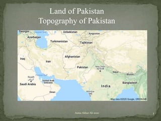
There are different learning styles that are best fitted for any individual's intelligence . It is best to style your learning that best befits you." learn how to learn"
Teaching is a science of art. Teaching is most effective when it is fun and when it matches the learners ambitions and abilities . Learn more of it.............
Nurses play a critical role as health educators to help patients understand their conditions and make informed health decisions. Effective communication is essential for nurses to develop relationships with patients, understand their needs and concerns, and ensure treatment plans are followed. Some key aspects of effective communication include active listening, speaking clearly, maintaining appropriate verbal and nonverbal communication, being culturally aware, and overcoming potential barriers like differences in language, stress, or disabilities. Proper documentation is also important for communicating treatment plans and progress to the entire care team.
As time changes and new inventions are introduced , the life pattern and practices for nurture and parenting also makes new demand . It is essential to open up to new ideas and understand the changing parenting trends in demand for effective children development.
These are discussion slides on the strategies that teachers can adopt for making education and classroom experience interactive and learning friendly. It is essential to understand that differences have to be acknowledged and be addressed. Because that is what makes the learning effective. Diversity is strength - use it for making learning to happen!
The document discusses modern parenting challenges and provides guidance on grooming care. It notes that family structures have changed from extended to nuclear and parenting tools now include influences from social media, technology, and peer groups. Providing good grooming care requires having compassionate relationships with children, reflecting knowledge, demonstrating rules and behaviors, and acknowledging new social challenges. Identifying social partners can help with the challenges of lack of time, teaching moral values, work-life imbalance, lack of trust, nutrition, and technology overuse. Being a mother is a complex role that impacts children daily through modeling behavior and directing the family role play.
Pakistan has large reserves of minerals including coal, gold, copper, and iron ore. Minerals are formed through the cooling and crystallization of magma underground over hundreds of years. Mining involves extracting rocks and minerals from the earth through surface or underground methods. Surface mining includes open-cast mining while underground mining uses adit or shaft mining. Mining is important for Pakistan's economy, contributing to industries like construction, agriculture, and electricity generation as well as employment and trade. However, challenges include lack of investment, technical skills, and environmental impacts such as deforestation, pollution, and damage to landscapes.
Guide for developing answer script for 0 level students
1. Response should be meaningful, less wordy and more content. The rationale should be clearly stated and the content be well connected.
2. Students may dissect the above response and apply the marking scheme for enhancing understanding and requirement of an answer script.
The document discusses the Indus Water Treaty signed in 1960 between India and Pakistan to share the water from the Indus River and its tributaries. It summarizes the key terms of the treaty, including that Western rivers like the Indus, Jhelum, and Chenab were allocated to Pakistan, while Eastern rivers like the Sutlej, Beas, and Ravi were allocated to India. It also discusses subsequent disputes between the countries over construction of hydroelectric projects on shared rivers and the need to periodically review and modernize the treaty terms.
Floods in Pakistan : The slides discuss the types, causes , effects and management of floods at both the preventive level as well as mitigation and response . The post floods benefits are listed
A full teaching learning slides on climate of Pakistan aimed for the support of 0 level students and teachers in the subject Environment of Pakistan 2059/2
The slides discuss six types of renewable energy ( hydro, solar wind, Geo, tidal and biomass) , explain the method used for producing electricity in each type followed by the advantages and disadvantages of each. Lastly it explores the potential of renewable energy in Pakistan
The document discusses various modes of transportation in Pakistan. It describes land transportation including traditional methods like bullock carts as well as the modern railway and road systems. It outlines the railway network and gauges, as well as challenges like outdated infrastructure. Road transportation is also analyzed, comparing highways, motorways and their advantages like flexibility but also disadvantages like traffic congestion. Air, water and pipeline transportation are briefly covered as well. The document provides a comprehensive overview of Pakistan's transportation systems, the infrastructure that supports different modes, and their benefits and limitations.
A Strategic Approach: GenAI in EducationPeter Windle
Artificial Intelligence (AI) technologies such as Generative AI, Image Generators and Large Language Models have had a dramatic impact on teaching, learning and assessment over the past 18 months. The most immediate threat AI posed was to Academic Integrity with Higher Education Institutes (HEIs) focusing their efforts on combating the use of GenAI in assessment. Guidelines were developed for staff and students, policies put in place too. Innovative educators have forged paths in the use of Generative AI for teaching, learning and assessments leading to pockets of transformation springing up across HEIs, often with little or no top-down guidance, support or direction.
This Gasta posits a strategic approach to integrating AI into HEIs to prepare staff, students and the curriculum for an evolving world and workplace. We will highlight the advantages of working with these technologies beyond the realm of teaching, learning and assessment by considering prompt engineering skills, industry impact, curriculum changes, and the need for staff upskilling. In contrast, not engaging strategically with Generative AI poses risks, including falling behind peers, missed opportunities and failing to ensure our graduates remain employable. The rapid evolution of AI technologies necessitates a proactive and strategic approach if we are to remain relevant.
How to Manage Your Lost Opportunities in Odoo 17 CRMCeline George
Odoo 17 CRM allows us to track why we lose sales opportunities with "Lost Reasons." This helps analyze our sales process and identify areas for improvement. Here's how to configure lost reasons in Odoo 17 CRM
Exploiting Artificial Intelligence for Empowering Researchers and Faculty, In...Dr. Vinod Kumar Kanvaria
Exploiting Artificial Intelligence for Empowering Researchers and Faculty,
International FDP on Fundamentals of Research in Social Sciences
at Integral University, Lucknow, 06.06.2024
By Dr. Vinod Kumar Kanvaria
Main Java[All of the Base Concepts}.docxadhitya5119
This is part 1 of my Java Learning Journey. This Contains Custom methods, classes, constructors, packages, multithreading , try- catch block, finally block and more.
This presentation was provided by Steph Pollock of The American Psychological Association’s Journals Program, and Damita Snow, of The American Society of Civil Engineers (ASCE), for the initial session of NISO's 2024 Training Series "DEIA in the Scholarly Landscape." Session One: 'Setting Expectations: a DEIA Primer,' was held June 6, 2024.
it describes the bony anatomy including the femoral head , acetabulum, labrum . also discusses the capsule , ligaments . muscle that act on the hip joint and the range of motion are outlined. factors affecting hip joint stability and weight transmission through the joint are summarized.
How to Build a Module in Odoo 17 Using the Scaffold MethodCeline George
Odoo provides an option for creating a module by using a single line command. By using this command the user can make a whole structure of a module. It is very easy for a beginner to make a module. There is no need to make each file manually. This slide will show how to create a module using the scaffold method.
This presentation includes basic of PCOS their pathology and treatment and also Ayurveda correlation of PCOS and Ayurvedic line of treatment mentioned in classics.
The simplified electron and muon model, Oscillating Spacetime: The Foundation...RitikBhardwaj56
Discover the Simplified Electron and Muon Model: A New Wave-Based Approach to Understanding Particles delves into a groundbreaking theory that presents electrons and muons as rotating soliton waves within oscillating spacetime. Geared towards students, researchers, and science buffs, this book breaks down complex ideas into simple explanations. It covers topics such as electron waves, temporal dynamics, and the implications of this model on particle physics. With clear illustrations and easy-to-follow explanations, readers will gain a new outlook on the universe's fundamental nature.
2. 1. Official Name is Islamic Republic of Pakistan
2. It is a country in South Asia region
3. It is world's 5th (fifth)-most populous country
4. Population is 212.2 million
5. It is the 33rd-largest country by area
6. It covers 881,913 square kilometers
Land: 97.13%
Water: 2.87%
Coastline: 1,046 km
2Asma Akbar Ali 2020
3. Pakistan has 4 provinces, 2 autonomous territories, and 1
federal territory.
1. Provinces
Baluchistan, Khyber Pakhtunkhwa, Punjab, and Sindh.
1. Autonomous Territories
Azad Jammu and Kashmir (AJK) and Gilgit-Baltistan.
1. Federal Territory
Islamabad Capital Territory.
3Asma Akbar Ali 2020
5. 5
Direction Country Length of
border
Name of
border
Transit point
East India 1650 Radcliffe Line Wagha Border
West Afghanistan 2250 Durand line Khyber Pass
North China 592 -600 Pak Sino line Karakoram
Highway
(KKH)
South West Iran 900 Gold Smith
line
Taftan Border
South No country
Arabian Sea
Asma Akbar Ali 2020
10. Asma Akbar Ali 2020 10
Mountains direction
Running East to West
Mountains direction
Running North to South
11. Mountain Direction Altitude Highest peak Stretch
Karakoram
Ranges
East to west Average 6000 meters
Ranges from
4000 to 8610 meters
8610 meters
K2
Second highest
peak in the
world
400 km
Himalayas East to West Average 4000 meters
Ranges from 500 to
8126 meters
•Siwaliks 500-1200 m
•Lesser 1200 – 4500 m
•Central 4500 - 8126 m
8126 meters
Nanga Parbat
2500
kms
Hindu Kush North to
South
Average altitude 5000
meters
4000 to 7690 meters
7690 meters
Trich mir
11Asma Akbar Ali 2020
13. A valley is a low area between mountains typically with a
river running through it. The terms U-shaped and V-
shaped are descriptive terms used to describe its
characteristics
13Asma Akbar Ali 2020
14. Asma Akbar Ali 2020 14
Mountains Valleys
Karakoram 1. Gilgit
2. Hunza
3. Baltistan
Himalayas 1. Murree
2. Kaghan
Hindu Kush 1. Swat
2. Chitral
3. Dir
15. 1. Melting of the snow & glaciers fills up the river Indus
2. A natural border to china & Pakistan
3. High altitude mountains protect from cold winds from
central Asia that is why the temperature does not go
below freezing point at the lower plains
4. Natural attractions – water and forest resources
5. Source of minerals , timber and fruits
6. Historical passes
15Asma Akbar Ali 2020
19. 1. Roads are closed in winter
2. Limited food production
3. Stock food
4. Gas cylinders for cooking – no sui gas pipelines
Health issues especially water born diseases like
dysentery, diarrhea and typhoid
5. Shortage of safe drinking water
6. Avalanches and landslides
19Asma Akbar Ali 2020
20. 1. Increasing population – limited development
2. Deforestation at the foothills
3. Overgrazing
20Asma Akbar Ali 2020
22. Asma Akbar Ali 2020 22
Shandur Polo Festival is one of the big festivals in Pakistan.
This festival is held from 7 to 9 July every year on Shandur Pass in
Chitral District of Khyber Pakhtunkhwa. The polo match is played
between the teams of Chitral District and districts of Gilgit-
Baltistan, is a free style game. ( Video)
https://www.youtube.com/watch?v=rEpMNsrjups
23. 1. Article for reading – impacts on the life of people
2. Quiz for the week online
23
https://www.thethirdpole.net/2018/07/27/small-hydropower-transforms-
lives-in-pakistans-mountains/
Asma Akbar Ali 2020