The Central Valley Project Slideshow: Building California
•
3 likes•16,483 views

A photo tour of the Central Valley Project, California's largest water infrastructure project.

Recommended
More Related Content
What's hot
What's hot (20)
Viewers also liked
Viewers also liked (20)
Similar to The Central Valley Project Slideshow: Building California
Similar to The Central Valley Project Slideshow: Building California (20)
Recently uploaded
Recently uploaded (20)
The Central Valley Project Slideshow: Building California
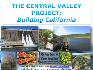
- 1. An exclusive production of Maven’s Notebook, Page 1 a California water news, science and policy blog
- 2. The Central Valley Project is a complex operation with facilities that reach from the rugged Cascade Range north of Redding 400 miles south to the semi-arid plains surrounding Bakersfield at the foot of the Tehachapi Mountains. The project is the largest in the state, delivering on average 7 Page 2 million acre-feet of water – about 20% of the state’s supply.
- 3. Page 3 Water from the CVP irrigates 3 million acres of farmland in the Sacramento and San Joaquin valleys, as well as provides drinking water for 1 million households.
- 4. Page 4 Central Valley Project facilities span 35 of the state’s 58 counties and harnesses the state’s two main rivers, the Sacramento River and the San Joaquin River.
- 5. Page 5 Central Valley Project facilities consist of … 18 dams … 11 power plants … 3 fish hatcheries … … and 500 miles of aqueducts.
- 6. Shasta Dam and reservoir mark the start of the Central Valley Project infrastructure. Located at the north end of the Sacramento Valley just north of Redding, the dam gathers water from the 6665-square mile drainage area that Page 6 includes the Sacramento, Pit and McCloud rivers. Photo by Bureau of Reclamation
- 7. At 602-feet high, Shasta Dam is the ninth tallest dam in the United States. Shasta Reservoir has a capacity of 4.5 million acre-feet and is California’s largest reservoir. Page 7 Photo by Bureau of Reclamation
- 8. Besides providing storage for about 64% of the CVP supply, Shasta Dam also provides flood protection for downstream communities, maintains navigation flows and provides flows for salmon and other native Page 8 species. Photo source: Wikimedia
- 9. Construction on Shasta Dam began in 1938, and despite floods and difficulties with supplies due to WW II, the dam was completed by 1945 – twenty six months ahead Photos by Bureau of Reclamation Page 9 of schedule. For a historical photo tour of Shasta dam, click here: https://www.usbr.gov/mp/ncao/shasta/virtual_tour.pdf
- 10. At the base of the dam is the 710 MW Shasta Dam power plant. The power plant is operated as a peaking plant with releases varying hourly, daily, and Page 10 seasonally as water and power demands fluctuate. Photo by Bureau of Reclamation
- 11. Page 11 Five penstocks at the base of the dam, each 15-feet in diameter, deliver water to the five generators below. The Shasta Power Plant accounts for 42% of the CVP’s total hydropower production. How is hydropower generated? Photo by Bureau of Reclamation Click here to find out.
- 12. The Shasta Power plant stands 156-feet tall, equivalent to a fifteen story building, and is one of the largest hydropower plants in California. The power plant has been in operation since 1944, producing power for the war Page 12 effort even before the dam was officially completed. Photo by Bureau of Reclamation
- 13. Just to the northwest, Trinity Dam forms Trinity Lake. At more than 2.4 MAF, it is the second largest storage reservoir in the Central Valley Project system with about half Page 13 the capacity of Shasta Lake. Photo by Bureau of Reclamation
- 14. Page 14 Releases from Trinity Dam flow downstream to Lewiston Dam, where water is diverted through a series of tunnels to meet with the Sacramento River at Keswick Reservoir.
- 15. The 23,800 acre-foot Keswick Reservoir is located 9 miles downstream from Shasta and serves as an afterbay for the releases from Shasta’s power plant, as well as the receiving reservoir for the waters from the Trinity River. An afterbay is a body of water, such as a pond or a reservoir, located at the outlet of a hydroelectric power plant that is used to regulate (or smooth out) downstream releases. Page 15 Photo by Bureau of Reclamation
- 16. From Keswick Reservoir, the Sacramento River, now boosted with the flows from the Page 16 Trinity River, continues south. Photo by Bureau of Reclamation
- 17. Page 17 Further downstream on the Sacramento River, the Sacramento Canals Unit of the CVP diverts water from the river for the irrigation over 100,000 acres in Tehama, Glenn, and Colusa counties. Photo by NCRS Photo by NCRS
- 18. The Red Bluff Diversion Dam is located two miles southeast of Red Bluff. The dam has a number of gates that when lowered, would raise the level of the river to use gravity to divert water from into the Tehama-Colusa and Corning canals. However, the dam was an impediment to upstream and downstream fish migration. Page 18 Photo by Bureau of Reclamation Photo by Bureau of Reclamation
- 19. The gates of the diversion dam have been permanently placed in the open position. Page 19 So in 2012, the diversion dam was replaced with a pumping facility with state of the art fish screens nearly 1200 feet long. Fish screens under construction Photo by Bureau of Reclamation Photo by Bureau of Reclamation
- 20. From there, the Sacramento River flows south to meet with the Feather River Page 20 at Verona, about 5 miles north of the Sacramento Airport. Photo by DWR
- 21. Over to the east, the headwaters of the American River originate in the Page 21 peaks of the Sierra Nevada and flow west towards Sacramento. North fork of the American River, photo by Greg Keene
- 22. Twenty five miles east of Sacramento, Folsom Dam catches the flow of the American River, providing flood protection for the Sacramento area. The dam also provides Page 22 water for agricultural and urban use, as well as hydropower. Photo by Bureau of Reclamation
- 23. Page 23 Folsom Dam, completed in 1955, was built by the Army Corps of Engineers and turned over to the Bureau of Reclamation upon completion.
- 24. Seven miles downstream of Folsom Dam is Nimbus Dam, the afterbay for Folsom Dam power plant as well as the diversion structure for the Folsom South Canal. The dam also produces a small amount of hydropower. PhotPo bayg Vein c2e4
- 25. The American River joins the Sacramento River at Discovery Park near downtown Sacramento, and from there, the rivers flow into the Sacramento-San Joaquin Delta. Page 25 Photo by Chris Austin
- 26. Page 26 Releases from Shasta Lake, together with downstream flows on the American River and other tributaries provide protection against salinity in the Delta and supplies for export through the Delta.
- 27. At Walnut Grove, the Cross Channel moves a portion of the waters from the Sacramento River south through the to the Central Valley Project export facilities Page 27 at the southern edge of the Delta. Photo by Bureau of Reclamation
- 28. In the Delta, the Contra Costa Canal conveys water from either Rock Slough in Eastern Contra Costa County or Old River near Discovery Bay, conveying the water Page 28 48 miles to a terminal reservoir in Martinez.
- 29. Page 29 Water flows through the channels, heading south to the pumping facilities located in the south Delta. Photo by Bureau of Reclamation
- 30. Page 30 When the water arrives at the pumping facilities, it first goes through the Tracy Fish Collection Facility, which collects the fish before they enter the pumps. Photo by Bureau of Reclamation Photo by Bureau of Reclamation
- 31. The facility was built in the 1950s as mitigation for the mortality of fish who were being caught in the intake pumps. Best available technology in the 50s were louvers which direct fish towards collection tanks, which are emptied several times a day and the fish taken by tanker truck to be released in the north Delta. Reclamation has been working on upgrading the facilities. Page 31
- 32. From the Tracy Fish Facility, the water then flows on to the Bill Page 32 Jones Pumping Plant. Photo by Chris Austin Photo by Chris Austin
- 33. At the pumping plant, six 22,500 horsepower motors lift the water up about 200-feet through 15-foot diameter pipes to put the water in the Delta Mendota Canal. The Page 33 pumping plant is capable of moving 8500 acre-feet per day. Photo by Chris Austin
- 34. Page 34 From the Bill Jones Pumping Plant, the Delta Mendota Canal then begins its journey 117 miles south. Photo by Chris Austin
- 35. Seventy miles downstream from the Delta is the San Luis Joint-Use Complex, a facility that serves both the Central Valley Project and the State Water Project. Joint facilities here consist of O’Niell Dam and Forebay, Sisk Dam and San Luis Reservoir, Gianelli Pumping/Generating Plant, the Dos Amigos Pumping Plant Facility, and a 103-mile Page 35 portion of the California Aqueduct referred to as the San Luis Canal.
- 36. President Kennedy was on hand with Governor Brown in August of 1962 for the reservoir’s groundbreaking ceremonies, setting off a blast of multicolored smoke Page 36 grenades along the axis of the future dam. Click here to view President Kennedy’s speech on YouTube.
- 37. Page 37 Water from the Delta Mendota Canal enters O’Niell Forebay through an intake channel at the base of O’Niell Dam. Photo by DWR
- 38. Water in the Delta Mendota Canal that is not diverted into the facilities at San Luis continues on for about 47 miles to terminate at the Page 38 Mendota Pool. Located at the confluence of the San Joaquin River, the Delta Mendota Canal, and the Fresno Slough, the Mendota Pool is a small reservoir that is used to redistribute water conveyed by the Delta Mendota Canal to the various water users. Photo by Chris Austin Photo by Chris Austin
- 39. From the O’Niell Forebay, water is lifted into San Luis Reservoir by the Giannelli Pumping & Generating Plant. When water is released from the reservoir, the Page 39 Giannelli facility then generates hydropower. Photo by DWR
- 40. The San Luis Reservoir has a capacity of 2 million acre-feet; it is the largest off-stream Page 40 reservoir in the United States. Photo by Chris Austin
- 41. The federal portion of the water stored at San Luis Reservoir,1.25 million acre-feet, is used to supply supplemental irrigation water to irrigation water for 600,000 acres Page 41 on the west side of the Valley. Photo by Chris Austin
- 42. CVP facilities located on the west side of San Luis Reservoir convey water through the Pacheco Conduit to irrigate 63,500 acres of farmland in San Benito County … Page 42 Photo by Chris Austin
- 43. … as well as provide a portion for urban use in the Santa Clara Valley. Page 43 Photo source: Wikimedia
- 44. Page 44 The state-owned California Aqueduct flows directly into O’Niell Forebay. Water not being diverted into San Luis Reservoir from the California Aqueduct flows through the forebay into the San Luis Canal. Photo by Chris Austin
- 45. Water for irrigation is released from O’Niell Forebay into the San Luis Canal. Page 45 Photo source: Wikimedia
- 46. Page 46 The water then flows by gravity to Dos Amigos Pumping Plant where it is lifted more than 100 feet to continue flowing south to Coalinga. Photo by DWR
- 47. The federal portion of the canal terminates at Kettleman City, and the canal then continues on as the state-operated California Aqueduct, conveying State Water Project to Kern County, the Central Coast, and Southern California. Page 47 Photo by DWR
- 48. Further south on the west side, Friant Dam on the San Joaquin River creates the 520,000 AF Millerton Lake, and provides flood control as well as irrigation water for one million acres of farmland in Fresno, Kern, Madera and Tulare counties. Page 48 Photo by Chris Austin
- 49. Page 49 Friant Dam was built between 1939 and 1942. Photos by Bureau of Reclamation
- 50. Water from Friant Dam can either be sent northward through the 36-mile Madera Canal to Madera County, or south 152 miles through the Friant-Kern Canal to Bakersfield. Page 50 Photo by Bureau of Reclamation
- 51. On the east side of the San Joaquin Valley, lies the New Melones Dam on the Stanislaus River. It is one of the more controversial water projects in California history, and in many ways, the difficulties around its construction signaled that the end of large dam construction had finally come to an end. Page 51 Photo by Bureau of Reclamation
- 52. The dam was fiercely opposed by the Sierra Club and other groups who felt that the Stanislaus River itself – and the whitewater rapids through the deepest limestone canyon in the western U.S. – were more important than the reservoir itself. The controversy raged on for decades even after its construction with extreme tactics employed until 1983 when record floods filled the reservoir Page 52 enough to overflow the spillway. Photo by Bureau of Reclamation
- 53. At 2.4 million acre-feet, New Melones Lake rivals Trinity Lake as the second largest reservoir in the CVP system, but the reservoir stores on average 1.4 MAF and is only Page 53 filled in the wettest of years. As it turns out, estimates of the amount of water that would be made available by construction of the dam were later found to be significantly off. Contracts made based on these original estimates have resulted in lawsuits. Photo by Bureau of Reclamation
- 54. In addition, the New Melones dam submerged the old Melones Dam, built in 1926. When the level of the lake gets below 350,000 acre-feet, the old disused dam prevents cold water from reaching the outlet works, making the water temperatures too high for the fish downstream. So when the lake level drops, power operations are suspended – a temporary solution only that results in Page 54 reduced revenues from hydropower generation. Photo source: Wikimedia
- 55. Due to the controversy, the mis-estimated water yields, and other problems, the Bureau of Reclamation has called it "a case study of all that can go wrong with a project." Photo by Keith Werner. Page 55
- 56. Page 56 Coordination with the State Water Project Photo by DWR
- 57. Page 57 Both the Central Valley Project and the State Water Project both export water from the Delta as well as operate multiple facilities statewide . The operations of the two water projects are coordinated through a Coordinated Operating Agreement. The agreement is both an operations agreement and a water rights settlement, whose purpose is to ensure that each project obtains its share of water as well as bears its share of obligation to protect beneficial uses and meet water quality standards. The COA contains the procedures for coordination of operations, specifies formulas for sharing joint responsibilities for meeting Delta water quality standards and other legal uses of water, identifies how unstored flow will be shared, and sets up a framework for exchange of water and services between the SWP and CVP.
- 58. The Delta Mendota Canal and the California Aqueduct are connected by way of an intertie which connects the two aqueducts with two 108-feet diameter pipes 500 feet long. The project, a joint state and federal improvement, was completed in 2012. The intertie addresses conveyance conditions which restricted the use of the Jones Pumping Plant, restoring as much as 35,000 AF of Central Valley Supplies. The intertie also makes it possible to fill CVP San Luis earlier and more frequently, as well as providing Page 58 flexibility during CVP or SWP maintenance activities or emergencies. Photo by DWR
- 59. Page 59 Benefits and Impacts The Central Valley Project is not only the California’s largest water project, but also perhaps its most controversial. Certainly, the benefits of the Central Valley Project to the state and to the nation have been incalculable. The construction of the Central Valley Project helped propel California to the top as the largest agricultural state in the country, providing inexpensive food and fiber to the nation and to the world. Photo source: Wikimedia
- 60. California has led the nation in agricultural and dairy Page 60 production for the last 50 years … The Central Valley and the Delta produce 25% of the nation’s table food on only 1% of the country’s farmland … Fresno County is the most productive county in the nation, growing 350 crops worth more than $1 billion … … and six of the state’s top ten agricultural counties are in the San Joaquin Valley.
- 61. Page 61 In addition, the availability of water and power from the Central Valley Project and other water development projects brought manufacturing and commerce to the state and created millions of jobs in the process. Central Valley Project facilities have prevented billions of dollars of damage from floods, and allowed cities and farms to grow and prosper on the valley floor.
- 62. However these benefits have not come Page 62 without a heavy price. In Northern California, the filling of the reservoirs inundated traditional Native American lands and the diversion of up to 90% of the flow of the Trinity River water into the Sacramento River basin has decimated salmon and steelhead populations on the Trinity River, creating intense conflict between the United States and Native American tribes in the area. Photo by Vivienna Orcutt, Hoopa Valley Tribe Photo by Dan Bacher Photo by Dan Bacher
- 63. Page 63 The construction of Shasta, Friant and other dams did not include fish ladders, and so the dams blocked access to much of the spawning grounds on the upper Sacramento and San Joaquin rivers and tributaries. Attempts to offset the losses through using hatcheries have essentially failed. Many native species, including several runs of salmon, have been listed as endangered. Source: Public Policy Institute of California Managing California’s Water, 2011
- 64. Further downstream, freshwater wetlands that once provided habitat for a myriad of fish, migratory birds, and terrestrial species were drained and reclaimed for farming. Page 64 Source: Public Policy Institute of California Managing California’s Water, 2011
- 65. The San Joaquin River has paid a heavy price when the entire flow of the river was diverted at Friant Dam, leaving an intermittently dry riverbed for 150 miles. Since construction of the dam, the riverbed below Friant Dam has functioned Page 65 primarily as a regional drain and flood control channel. The 1992 passage of the Central Valley Project Improvement Act, the San Joaquin River Restoration Program and Trinity River Restoration Program have attempted to address these impacts, but have met with limited success. Photo by Bureau of Reclamation
- 66. Photo by Bureau of Reclamation Page 66 The construction of the Central Valley Project was a major factor in propelling California to the agricultural and economic powerhouse that it is today; however, it has come at considerable cost to the environment. Today, California still struggles to find the balance between water that is needed to sustain our economy and our population while at the same time, leaving enough water behind to sustain our environment and native species. Photo by Dan Bacher
- 67. Page 67 For more information on the Central Valley Project For more history, information, and resources Click here to visit the Notebook page on the Central Valley Project. See also: •About the Central Valley Project, from the Bureau of Reclamation: Details on Central Valley Project facilities and their history •Central Valley Project Operations Office: Bureau of Reclamation webpage with the latest water operations, reservoir reports, and more.
- 68. The Central Valley Project may be the largest in state, but it is only one of several of water systems in the state. Learn more about California’s other water infrastructure systems here: California’s Water Systems For up-to-the-minute and detailed coverage of California water news, meetings, and events, visit: www.MavensNotebook.com Page 68
- 69. Page 69 This has been an exclusive presentation by Chris Austin Maven’s Notebook www.MavensNotebook.com Thank you for looking!