Introducing open_defra_scripted_slide_packMichael Rose
This is the slide deck used by me at Civil Service Live on 22 September 2015 to introduce and discuss the Open Defra project work and the culture change needed to release 8000 Defra datasets by June 2016.
Prepare to Launch! Guidelines for Accessing, Designing, and Building Launch Sites for Carry-in Watercraft. Updated April 2018.
A Guide to help facility and water trail planners and park and recreation project leaders plan, build or update an access site tailored to the needs of canoeists, kayakers, tubers, stand-up paddlers, or small craft sailors. It guides a reader through the development process from conception to design creation, and provides a variety of launch construction options.
Prepare to Launch! Guidelines for Assessing, Designing, and Building Launch ...rshimoda2014
One of the key questions that needs to be addressed when connecting people to their rivers and waterways is how do they get in and out?
Prepare to Launch! is a resource designed to help river managers, parks planners and water trail managers being to answer this question. Drawing on existing case studies, this image heavy document focuses on how managers can build ‘put-in and take out’ sites as they address the evolving needs of paddlers and other users of non-motorized or hybrid (launches that welcome both non-motorized and motorized) watercraft.
This presentation will dive into the Prepare to Launch! online platform, with the opportunity for session attendees to become familiar with the tools and resources available. The session will highlight an innovative partnership developed launch case study. Participants will also have the opportunity to evaluate the good the bad and the ugly as we continue to evolve the best practices for the development of launch sites.
Session attendees are encouraged to bring their own stories and lessons learned to share as we evaluate and discuss how to improve the body of knowledge for launch access.
The City of Manitou Springs is planning a creek walk along Fountain Creek, an aspirational goal for over two decades. The question is: how to unite a diverse set of stakeholders with competing interests to agree on a preferred route, that incorporates their values and priorities? The answer was to use geodesign.
Geodesign is a powerful participatory planning method that uses stakeholder input and geospatial analytics to show the possible impact of design scenarios. It gets its strength in two ways: 1) from the diversity of participants—proving the adage that two heads are indeed better than one—and 2) from the power of spatial analytics, which allow the visualization of the world both as it is, and as it could be.
The presentation will focus on how geodesign methods where used to define stakeholder groups, clarify values, and prioritize criteria to help decision makers evaluate planning scenarios. Esri ArcGIS Pro was utilized to develop models—such as bikeability, walkability, ADA compliance, and more—that were used to both visualize and evaluate the impacts of each route segment. The spatial analysis resulted in an innovative solution that addressed both the concerns of both government and public stakeholders.
Attendees of this session will learn how to use geodesign as a systems approach for informed decision-making. More importantly, they will learn how to use spatial technology to guide conversations among diverse stakeholders to come up with plans that people understand and are happy with.
Connect how salt practices in the Hudson River watershed impact the salinity of local streams.
Session from a management-based forum hosted by the Cary Institute of Ecosystem Studies about the impact of road salt on natural areas and drinking water supplies, with a focus on successful salt reduction strategies being used regionally and nationally. Presenter: Eli Dueker, Assistant Professor of Biology and Environmental and Urban Studies, Bard College.
Catchment Data & Evidence Forum 28/09/18 - Westcountry Rivers TrustCaBASupport
The CaBA Catchment Data & Evidence Forum brought together around 60 data and evidence professionals from the CaBA community to share knowledge, identify opportunities and discuss future development of the data and evidence sharing landscape, in the light of the government's 25 year plan for the environment.
This slide pack contains the presentation given by Westcountry Rivers Trust on their use of data and evidence to support their local CaBA partnerships
MWDL as a Service Hub for the Digital Public Library of America: Updates and ...Rebekah Cummings
In this presentation, Sandra and Rebekah talk about how MWDL became a Service Hub for the DPLA and what being a Service Hub entails. They will also discuss upcoming MWDL/DPLA announcements and events such as the digitization mini-contracts program and the DPLA Community Representatives program.
Flood forecasting methodology in Alberta - Evan FriesenhanYourAlberta
Evan, Acting Director of River Forecasting with Alberta Environment and Sustainable, presented at Alberta’s Watershed Management Symposium: Flood and Drought Mitigation. He explained Alberta’s approach to river forecasting, warning systems, and tools and resources to keep the public informed.
Lovingly crafting a mountain, not by hand: managing piles of metadataGalen Charlton
Presentation at the British Columbia Library Conference on 1 April 2014.
Economics, time, and the burgeoning increase in the numbers of resources that libraries are acquiring or providing access to all conspire against being able to spend much time getting a metadata record perfect. Sometimes, getting a record barely good enough can be a challenge -- one record down, 50,000 more to go. In this session, Galen Charlton will discuss tools and techniques for managing ever-larger piles of metadata using open source tools, with an emphasis on iterative improvement and distributed collaboration.
Mountain West Digital Library as a Service Hub for the Digital Public Library...Sandra McIntyre
Webinar from the Mountain West Digital Library
Sandra McIntyre, MWDL Director
Rebekah Cummings, MWDL Assistant Director/Outreach Librarian
The Mountain West Digital Library (MWDL) provides a central search portal to over 800,000 digital resources from memory institutions in Utah, Nevada, Idaho, Arizona, and Hawaii. As a program of the Utah Academic Library Consortium for the last twelve years, MWDL brings together 122 partners, including academic libraries, public libraries, archives, museums, historical societies, and government agencies, to share expertise and resources for digitization, hosting, and aggregated search. As one of the first six Service Hubs to the Digital Public Library of America, MWDL provides the on-ramp for DPLA participation to memory institutions in the Mountain West.
Sandra and Rebekah will talk about how MWDL became a Service Hub for the DPLA and what being a Service Hub entails. They will also discuss upcoming MWDL/DPLA announcements and events such as the digitization mini-contracts program and the DPLA Community Representatives program.
Eastern Panhandle GIS Users Group Meeting held on 14 September 2016 in Martinsburg, WV. Presenters Kathryn Wesson & Margaret Markham, Chesapeake Conservancy
Prepare to Launch! Guidelines for Accessing, Designing, and Building Launch S...rshimoda2014
If you would like to view the fully functional version of this presentation, you can download from this site, or visit http://www.river-management.org/prepare-to-launch- for additional formats and more information!
Prepare to Launch was created to help facility and trail planners, and park and recreation project leaders when planning, building, or updating access sites that are tailored to the needs of the canoeists, kayakers, tubers, stand-up paddlers, rowers, or small craft sailors (commonly referred to as “paddlers” in this document).
Prepare to Launch! will help:
-Understand Launch Locations by river, lake, and bay shoreline characteristics
-Address Users’ Launch Needs by looking at the various types of users and watercraft, amount of traffic, and accessibility needs
-Understand Launch Design Criteria that can be shared with a contractor, engineer, or designer, depending on the complexity of the site
-Promote Your Launch Project by offering tips to help make decisions about appropriate launch design and construction and by helping to organize examples that can then help gain community support and fundraising
WaterSmart Software WaterSide Chat: Best Practices to Gain Support for Rate I...Norm Watersmart
Generating stable revenues is essential for every water utility, and rate increases are often necessary to improve the financial health of the utility. Unfortunately, these increases can attract significant public scrutiny and can derail implementation, further eroding financial health.
2017 Open Space Conference - Communications: Building a Bridge Between Messag...OpenSpaceCouncil
*Please note that animations in this presentations are not visible when viewed through Slideshare.
Communications: Building a Bridge Between Message Research and Delivery - Breakout Group (2)
- Deb Callahan, Executive Director, Bay Area Open Space Council (Moderator)
- Liz Deering, Communications Director, Conservation Minnesota
- Robin Pressman, Consultant, Robin Pressman Consulting
- Dave Metz, Partner, Fairbank, Maslin, Maullin, Metz & Associates (FM3)
These panelists spoke at the 2017 Open Space Conference, Eyes on the Horizon, Boots on the Trail on May 18, 2017 at the Craneway Pavilion in Richmond, CA. More info on the Bay Area Open Space Council's website: http://openspacecouncil.org/community-events/conference/
Technology Tools for Transportation: Virginia's New River ValleyRPO America
Presentation by Elijah Sharp, New River Valley Planning District Commission, at the National Rural Transportation Peer Learning Conference, December 3 - 5, 2014 in Cincinnati, OH.
Catchment Data & Evidence Forum 28/09/18 - Lightning TalksCaBASupport
The CaBA Catchment Data & Evidence Forum brought together around 60 data and evidence professionals from the CaBA community to share knowledge, identify opportunities and discuss future development of the data and evidence sharing landscape, in the light of the government's 25 year plan for the environment.
This slide pack contains all of the 5 minute 'lightning talks' given by attendees.
Dr. Alicia Monroe (Rowan University): Internships as Opportunities for Experi...The Watershed Institute
Dr. Alicia Monroe, Assistant Director of the Career Management Center at Rowan University, covers her most important takeaways and best practices for nonprofits in finding and managing interns.
Laura Szwak, Director of Education and Outreach at the New Jersey Conservation Foundation, describes her top ten suggestions for successfully and effectively working with interns.
More Related Content
Similar to Telling the Water Quality Story through Report Cards
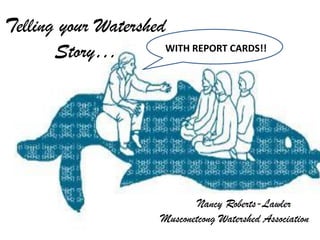
Connect how salt practices in the Hudson River watershed impact the salinity of local streams.
Session from a management-based forum hosted by the Cary Institute of Ecosystem Studies about the impact of road salt on natural areas and drinking water supplies, with a focus on successful salt reduction strategies being used regionally and nationally. Presenter: Eli Dueker, Assistant Professor of Biology and Environmental and Urban Studies, Bard College.
Catchment Data & Evidence Forum 28/09/18 - Westcountry Rivers TrustCaBASupport
The CaBA Catchment Data & Evidence Forum brought together around 60 data and evidence professionals from the CaBA community to share knowledge, identify opportunities and discuss future development of the data and evidence sharing landscape, in the light of the government's 25 year plan for the environment.
This slide pack contains the presentation given by Westcountry Rivers Trust on their use of data and evidence to support their local CaBA partnerships
MWDL as a Service Hub for the Digital Public Library of America: Updates and ...Rebekah Cummings
In this presentation, Sandra and Rebekah talk about how MWDL became a Service Hub for the DPLA and what being a Service Hub entails. They will also discuss upcoming MWDL/DPLA announcements and events such as the digitization mini-contracts program and the DPLA Community Representatives program.
Flood forecasting methodology in Alberta - Evan FriesenhanYourAlberta
Evan, Acting Director of River Forecasting with Alberta Environment and Sustainable, presented at Alberta’s Watershed Management Symposium: Flood and Drought Mitigation. He explained Alberta’s approach to river forecasting, warning systems, and tools and resources to keep the public informed.
Lovingly crafting a mountain, not by hand: managing piles of metadataGalen Charlton
Presentation at the British Columbia Library Conference on 1 April 2014.
Economics, time, and the burgeoning increase in the numbers of resources that libraries are acquiring or providing access to all conspire against being able to spend much time getting a metadata record perfect. Sometimes, getting a record barely good enough can be a challenge -- one record down, 50,000 more to go. In this session, Galen Charlton will discuss tools and techniques for managing ever-larger piles of metadata using open source tools, with an emphasis on iterative improvement and distributed collaboration.
Mountain West Digital Library as a Service Hub for the Digital Public Library...Sandra McIntyre
Webinar from the Mountain West Digital Library
Sandra McIntyre, MWDL Director
Rebekah Cummings, MWDL Assistant Director/Outreach Librarian
The Mountain West Digital Library (MWDL) provides a central search portal to over 800,000 digital resources from memory institutions in Utah, Nevada, Idaho, Arizona, and Hawaii. As a program of the Utah Academic Library Consortium for the last twelve years, MWDL brings together 122 partners, including academic libraries, public libraries, archives, museums, historical societies, and government agencies, to share expertise and resources for digitization, hosting, and aggregated search. As one of the first six Service Hubs to the Digital Public Library of America, MWDL provides the on-ramp for DPLA participation to memory institutions in the Mountain West.
Sandra and Rebekah will talk about how MWDL became a Service Hub for the DPLA and what being a Service Hub entails. They will also discuss upcoming MWDL/DPLA announcements and events such as the digitization mini-contracts program and the DPLA Community Representatives program.
Eastern Panhandle GIS Users Group Meeting held on 14 September 2016 in Martinsburg, WV. Presenters Kathryn Wesson & Margaret Markham, Chesapeake Conservancy
Prepare to Launch! Guidelines for Accessing, Designing, and Building Launch S...rshimoda2014
If you would like to view the fully functional version of this presentation, you can download from this site, or visit http://www.river-management.org/prepare-to-launch- for additional formats and more information!
Prepare to Launch was created to help facility and trail planners, and park and recreation project leaders when planning, building, or updating access sites that are tailored to the needs of the canoeists, kayakers, tubers, stand-up paddlers, rowers, or small craft sailors (commonly referred to as “paddlers” in this document).
Prepare to Launch! will help:
-Understand Launch Locations by river, lake, and bay shoreline characteristics
-Address Users’ Launch Needs by looking at the various types of users and watercraft, amount of traffic, and accessibility needs
-Understand Launch Design Criteria that can be shared with a contractor, engineer, or designer, depending on the complexity of the site
-Promote Your Launch Project by offering tips to help make decisions about appropriate launch design and construction and by helping to organize examples that can then help gain community support and fundraising
WaterSmart Software WaterSide Chat: Best Practices to Gain Support for Rate I...Norm Watersmart
Generating stable revenues is essential for every water utility, and rate increases are often necessary to improve the financial health of the utility. Unfortunately, these increases can attract significant public scrutiny and can derail implementation, further eroding financial health.
2017 Open Space Conference - Communications: Building a Bridge Between Messag...OpenSpaceCouncil
*Please note that animations in this presentations are not visible when viewed through Slideshare.
Communications: Building a Bridge Between Message Research and Delivery - Breakout Group (2)
- Deb Callahan, Executive Director, Bay Area Open Space Council (Moderator)
- Liz Deering, Communications Director, Conservation Minnesota
- Robin Pressman, Consultant, Robin Pressman Consulting
- Dave Metz, Partner, Fairbank, Maslin, Maullin, Metz & Associates (FM3)
These panelists spoke at the 2017 Open Space Conference, Eyes on the Horizon, Boots on the Trail on May 18, 2017 at the Craneway Pavilion in Richmond, CA. More info on the Bay Area Open Space Council's website: http://openspacecouncil.org/community-events/conference/
Technology Tools for Transportation: Virginia's New River ValleyRPO America
Presentation by Elijah Sharp, New River Valley Planning District Commission, at the National Rural Transportation Peer Learning Conference, December 3 - 5, 2014 in Cincinnati, OH.
Catchment Data & Evidence Forum 28/09/18 - Lightning TalksCaBASupport
The CaBA Catchment Data & Evidence Forum brought together around 60 data and evidence professionals from the CaBA community to share knowledge, identify opportunities and discuss future development of the data and evidence sharing landscape, in the light of the government's 25 year plan for the environment.
This slide pack contains all of the 5 minute 'lightning talks' given by attendees.
Dr. Alicia Monroe (Rowan University): Internships as Opportunities for Experi...The Watershed Institute
Dr. Alicia Monroe, Assistant Director of the Career Management Center at Rowan University, covers her most important takeaways and best practices for nonprofits in finding and managing interns.
Laura Szwak, Director of Education and Outreach at the New Jersey Conservation Foundation, describes her top ten suggestions for successfully and effectively working with interns.
This presentation was given by Dr. Matthew Weber of Rutgers University's School of Communication and Information at the "Marketing Planning for Nonprofits" workshop on 3/24/15.
WRI’s brand new “Food Service Playbook for Promoting Sustainable Food Choices” gives food service operators the very latest strategies for creating dining environments that empower consumers to choose sustainable, plant-rich dishes. This research builds off our first guide for food service, now with industry experience and insights from nearly 350 academic trials.
Characterization and the Kinetics of drying at the drying oven and with micro...Open Access Research Paper
The objective of this work is to contribute to valorization de Nephelium lappaceum by the characterization of kinetics of drying of seeds of Nephelium lappaceum. The seeds were dehydrated until a constant mass respectively in a drying oven and a microwawe oven. The temperatures and the powers of drying are respectively: 50, 60 and 70°C and 140, 280 and 420 W. The results show that the curves of drying of seeds of Nephelium lappaceum do not present a phase of constant kinetics. The coefficients of diffusion vary between 2.09.10-8 to 2.98. 10-8m-2/s in the interval of 50°C at 70°C and between 4.83×10-07 at 9.04×10-07 m-8/s for the powers going of 140 W with 420 W the relation between Arrhenius and a value of energy of activation of 16.49 kJ. mol-1 expressed the effect of the temperature on effective diffusivity.
"Understanding the Carbon Cycle: Processes, Human Impacts, and Strategies for...MMariSelvam4
The carbon cycle is a critical component of Earth's environmental system, governing the movement and transformation of carbon through various reservoirs, including the atmosphere, oceans, soil, and living organisms. This complex cycle involves several key processes such as photosynthesis, respiration, decomposition, and carbon sequestration, each contributing to the regulation of carbon levels on the planet.
Human activities, particularly fossil fuel combustion and deforestation, have significantly altered the natural carbon cycle, leading to increased atmospheric carbon dioxide concentrations and driving climate change. Understanding the intricacies of the carbon cycle is essential for assessing the impacts of these changes and developing effective mitigation strategies.
By studying the carbon cycle, scientists can identify carbon sources and sinks, measure carbon fluxes, and predict future trends. This knowledge is crucial for crafting policies aimed at reducing carbon emissions, enhancing carbon storage, and promoting sustainable practices. The carbon cycle's interplay with climate systems, ecosystems, and human activities underscores its importance in maintaining a stable and healthy planet.
In-depth exploration of the carbon cycle reveals the delicate balance required to sustain life and the urgent need to address anthropogenic influences. Through research, education, and policy, we can work towards restoring equilibrium in the carbon cycle and ensuring a sustainable future for generations to come.
UNDERSTANDING WHAT GREEN WASHING IS!.pdfJulietMogola
Many companies today use green washing to lure the public into thinking they are conserving the environment but in real sense they are doing more harm. There have been such several cases from very big companies here in Kenya and also globally. This ranges from various sectors from manufacturing and goes to consumer products. Educating people on greenwashing will enable people to make better choices based on their analysis and not on what they see on marketing sites.
Artificial Reefs by Kuddle Life Foundation - May 2024punit537210
Situated in Pondicherry, India, Kuddle Life Foundation is a charitable, non-profit and non-governmental organization (NGO) dedicated to improving the living standards of coastal communities and simultaneously placing a strong emphasis on the protection of marine ecosystems.
One of the key areas we work in is Artificial Reefs. This presentation captures our journey so far and our learnings. We hope you get as excited about marine conservation and artificial reefs as we are.
Please visit our website: https://kuddlelife.org
Our Instagram channel:
@kuddlelifefoundation
Our Linkedin Page:
https://www.linkedin.com/company/kuddlelifefoundation/
and write to us if you have any questions:
info@kuddlelife.org
Natural farming @ Dr. Siddhartha S. Jena.pptxsidjena70
A brief about organic farming/ Natural farming/ Zero budget natural farming/ Subash Palekar Natural farming which keeps us and environment safe and healthy. Next gen Agricultural practices of chemical free farming.
6. Once upon a time…
VM Collected Data
– Engage & Educate Public
– To understand our river
• Current year and trends
• Baseline vs restoration
• Basis for advocacy
– Elicit public project support
– Cost low but still…
– Were we answering a need?
7. Who Read the Report?
• Executive Director
• 2 highly committed
volunteers
….What were we doing
wrong?
8. What We Wanted
I’m replacing
my lawn
with native
plants!
Our
citizens
should
test their
wells!
Our data shows that
the % sensitive bugs is
declining, average nitrates
are 3.0mg/l , the RBP
Habitat Score is under 100!Time to
create a
septic
ordinance!
MWA
9. Our Audience
Puedo comer
la trucha?
Should I
drink
bottled
water?
Our data shows that
the % sensitive bugs is
declining, average nitrates
are 3.0mg/l , the RBP
Habitat Score is under
100!
Why aren’t
you collecting
data by the
Walmart?
MWA
13. Water Monitoring World Focus
Collect
Credible Data
Communicate
Problem or Question Study Design to Answer
Question
Analyze Data
Process into
Information
ACTION?
14. Focus Needed
Collect Credible Data
Communicate
to Target
Audience
Listen to
Community
Questions
Study Designed to Answer
Question
Analyze Data
Process into
Information
Community needs
ACTION!
15. Typical Source for the Audience
Audience Type
Scientific
Management
Decision makers
Public
Source
Primary/documentation
Technical Documents
Summary Reports, NJGeoWeb
Newspaper articles, TV, Social
media!
16. Typical Source for the Audience
Audience Type
Scientific
Management
Decision makers
Public
Source
Primary/documentation
Technical Documents
Summary Reports, NJGeoWeb
Newspaper articles, TV, Social
media!
REPORT NOT PICKED UP BY
MEDIA!!
17. Back to the Drawing Board
• Action desired should
relate to mission
• Our mission: protect &
restore our river
• We want readers to
HELP US protect &
restore!!
18. Start at the End of the Story
• What did we want
people to do or feel?
– Identify MWA as credible
information source
– MWA cares about them
– Identify challenges AND
SOLUTIONS
– EMPOWER THEM to help
raise the water quality!
• How were we going to
communicate that?
21. Why Report Cards?
• Give air of authority
• People understand
purpose
– Easy to read
– People understand
grades. layout
• But…Hardly ever
includes direction for
improvement
22. Maybe More Engaging Content?
• Value of watershed
• Measurement explanations
• Value of data for
– Wildlife
– People
• Easy to Read
• Visually interesting
• Give direction
• Easy to re-use format (¢)
24. What Parameters Tell Story?
• Samples
– All (DO,Temp, pH, NO3,
Macros, Habitat)
– Easiest to understand?
– Most relevant to audience
• What metric?
– Averages, min/max
– Scores
– Statistics
• Graphs
– Points
– Trends
– Site Comparisons
25. Does Format Support Goal?
• In tables
• Assessments
– Grade (A -F)
– Evaluation (Excellent/Poor)
• Grades goal-oriented
– Fishing, swimming,
drinking
– Standards/criteria oriented
• DO/Temp, TP, NO3
• macroinvertebrate index
“C” is average!
We are typical!
27. What should it look like?
• Entice people to read?
• Attractive
– Cover?
– Font?
– Color?
– How many pages?
– Layout
– How to fit?
– Pictures
– Photos?
29. Hire A Creative Team
Editor/Writer
• You develop content
• Independent editor
– Improves readability
– Keeps consistent
– Help you reach audience
• Proofreading is not editing
• BTW: Word--grammar, also
readability stats
Graphic Artist
• More professional looking
• Favorable impression
• May wish to consider
– Data visualization specialist
– Illustrator
30. Creative Team Considerations
• Professional vs student
• Understand your issues?
• Copyright/Contract
• Time
• Who will Proofread?
– Copy
– Graphics & placement
– Photos
• Final Draft-Who has control?
31. MWA Report Card Content
• Cover
• Introduction
– Report basis
– Links to more
information
• Map of site locations
• Environmental
Indicators
• Site Report Cards
• Conclusion—first steps!
32. Map: Where nearest site?
• Sites-
– Roads
– Municipalities
– Read in color /B&W
• Options
– Satellite?
– Symbols?
– Color?
• Impervious surface?
• Forest coverage
34. Actions to Improve
Each Environmental Indicator
• Three to four actions
• Icons
– Planting
– Seek expert advice
– Replace when able
– Change practice
• Designed for focus
35. To Control Parameter, Which Actions?
• Parameters
– Source & Importance
– Control options
• MWA chose
– Temperature (Max)
– Nitrates (Average)
– Aquatic Life (Score)
– Habitat (Score)
Sub-optimal
temperature
Improve riparian
buffer
Sub-optimal
nitrates
Test well, maintain
septic system, test
well
36. Site Report
• Photos
– Shot in same direction
– With people best
• Assessment with
graphics
• Site Meaning & Actions
– Site value
– What are challenges
– Recommendations
37. Grading System
• Concern-
– “Good” or “B”= INACTION
– “Poor” or “F”=Fear or GIVE UP
• Kept Optimal, Sub-optimal,
Fair, Poor
• Icon for each Grade
OPTIMAL SUB-OPTIMAL
MARGINAL POOR
38. Conclusion
• Actions for residents/municipalities
– Increasing buffers
– Decreasing impervious pavement
– Could take years
• Interim actions
– Work with MWA
– Look for grant $$
– Encourage small steps
39. Don’t Forget…
• Direct to links
• Direct to partners
• Footnotes
• Mention funder…
• Release to public
• Pre and Post Survey