The Value Proposition of 3D and 4D Marine Seismic DataTaylor Goss
An explanation of what 3D/4D Seismic is and why it is valuable for the Oil & Gas industry. How it helps to reduce risk in exploration, and helps to monitor the reservoir.
Integrated hydro-geological risk for Mallero basin (Alpine Italy) – part 2: h...Alireza Babaee
Presentation of project in the course " Hydro-Geological Risks in Mountain Area (Hydraulic Assessment Part)" for M.Sc. "Civil Engineering for Risk Mitigation" at Politecnico di Milano.
Submitted by:
Maryam Izadifar, Alireza Babaee, Budiwan Adi Tirta, Ahmed Hassan El-Banna
Submitted to:
Professor Alessio Radice
The oxford dictionary defines an attribute as, “a quality ascribed to any person or thing”. We have extended this definition to: “seismic attributes are all the information obtained from seismic data, either by direct measurements or by logical or experience based reasoning
In reflection seismology : aseismic attributes is a quality extracted or derived from seismic data that can be analyzed in order to enhance information that might be more subtle in a traditional seismic image , leading to a better geological or geophysical interpretation of the data
Over the past decades, we have witnessed attribute developments track breakthroughs in reflector acquisition and mapping, fault identification, bright spot identification, frequency loss, thin bed tuning, seismic stratigraphy.
Integrated hydro-geological risk for Mallero basin (Alpine Italy) – part 1: g...Alireza Babaee
Presentation of project in the course " Hydro-Geological Risks in Mountain Area (Geological Assessment Part)" for M.Sc. "Civil Engineering for Risk Mitigation" at Politecnico di Milano.
Submitted by:
Maryam Izadifar, Alireza Babaee
Submitted to:
Professor Laura Longoni
Seismic data Interpretation On Dhodak field PakistanJamal Ahmad
I (Jamal Ahmad) presented this on 21 Feb, 2009 to defend my M.Phil dissertation in Geophysics at QAU, Islamabad, Pakistan. For more information about this, you may contact me directly at jamal.qau@gmail.com.
Delineation of Hydrocarbon Bearing Reservoirs from Surface Seismic and Well L...IOSR Journals
Hydrocarbon reservoir has been delineated and their boundaries mapped using direct indicators from 3-D seismic and well log data from an oil field in Nembe creek, Niger Delta region. Well log signatures were employed to identify hydrocarbon bearing sands. Well to seismic correlation revealed that these reservoirs tied with direct hydrocarbon indicators on the seismic section. The results of the interpreted well logs revealed that the hydrocarbon interval in the area occurs between 6450ft to 6533ft for well A, 6449ft to 6537ft for well B and 6629ft to 6704ft for well C; which were delineated using the resistivity, water saturation and gamma ray logs. Cross plot analysis was carried out to validate the sensitivity of the rock attributes to reservoir saturation condition. Analysis of the extracted seismic attribute slices revealed HD5000 as hydrocarbon bearing reservoir.
River hydraulic modelling for river Serio (Northern Italy), 2014Alireza Babaee
Presentation of project in the course "River Hydraulic for Flood Risk Evaluation" for M.Sc. "Civil Engineering for Risk Mitigation" at Politecnico di Milano.
Submitted by:
Alireza Babaee, Maryam Izadifar, Ahmed El-Banna, Budiwan Adi Tirta, Svilen Zlatev
Submitted to:
Professor Alessio Radice
Hydrological Application of Remote – Sensing and GIS for Handling of Excess R...IDES Editor
A GIS based hydrological analysis has been carried
out to explore the possibility of diverting storm runoff
generated from the upper catchment safely through a canal
system constructed at the foothill to avoid flooding at
downstream. The study area consisted of Kalapahar-Udyachal
hills (5.38 km sq) in the Kahilipara- Odalbakra area, situated
in the city of Guwahati, Assam. The Digital Elevation Model
(DEM) of the study area was developed from the Survey of
India(SOI) toposheet (1972) using Arcgis software. Watershed
delineation and derivation of required topographic parameters
for for calculating the peak discharge from different
watersheds were done with the help of the generated DEM.
Based on the hydrological analysis, means of safe diversion
of runoff water from hillocks was found out and canal
design of varying geometry capable of handling the peak
discharge suggested.
Flood Risk Assessment Using GIS Tools, By Dr. Omar Elbadawy, CEDARE, Land and Water Days in Near East & North Africa, 15-18 December 2013, Amman, Jordan
The concepts related of the New Model of River Adige, and especially an analysys of the existing OMS components ready and their interpretation on the basis of travel time approaches
The Final Seminar of the Project for Assessment of Earthquake Disaster Risk for the Kathmandu Valley in Nepal was held on 14 February 2018.
The public seminar was held three times during the project.
The Final Seminar, “ Understanding Disaster Risks and Moving Towards DRR and Resilience”, presented on the activities and accomplishment of the project, construction of robust and resilient society against natural disaster risk.
Thank you all for your support and enthusiastic participation in this seminar.
Presentation: Overview of Hazard Assessment Results
Use of MIKE 21/3 in the Hydraulic Analysis for the Dublin Port ABR Project - ...Stephen Flood
2015 DHI UK & Ireland Symposium
KEYNOTE: Use of MIKE 21/3 in the Hydraulic Analysis for the Dublin Port ABR Project
Adrian Bell (RPS),
Tuesday 21 April 2015 at 10:30 - 11:00
This project essentially looked at the stability of a deepened approach channel and examined the impact of the dredging and disposal for the scheme in support of a public planning hearing. The modelling used coupled MIKE 21 FM HD-SW-ST models as well as well as MIKE 21 and MIKE 3 FM HD and MT models.
DSD-INT 2017 Lake Kivu - Development of a 3D (500 z-layers) model to study st...Deltares
Presentation by Meinard Tiessen, Deltares, Netherlands, at the Delft3D - User Days (Day 1: Hydrodynamics), during Delft Software Days - Edition 2017. Monday, 30 October 2017, Delft.
Analytical modelling of groundwater wells and well systems: how to get it r...Anton Nikulenkov
Aquifer tests are probably the most widely used methods to obtain hydrogeological properties that are vital for any mine dewatering or environmental impact assessments. Numerous softwares and methods currently exist that provide quick and easy tests interpretation by fitting theoretical and measured drawdown curves. However, misinterpreting a-priory groundwater concepts and not accounting correctly for such factors as skin-effect, well storage or partial penetration may result in hydraulic conductivity errors by several hundred precents. As illustrated by case studies from WA, both numerical and analytical models generally suffer from non-uniqueness that can be overcome by understanding a-priory groundwater concepts and implementing them appropriately into the interpretation algorithms.
The presentation also discusses an analytical approach for well systems design. The methodology is presently incorporated in ANSDIMAT software package that is developed by the Russian Academy of Sciences. The method uses standard and research analytical solutions and it is based on the principle of superposition. Unlike numerical models, the method allows calculating drawdowns inside a pumping well and regional drawdowns, for example, on an open pit contour. A particle tracking component, incorporated into the methodology, provides a practical alternative to numerical models for simplified environmental impact assessments.
FAST Danube – Hydraulic and sediment transport modelling with MIKE 21 FM mode...Stephen Flood
The objective of the FAST Danube project is to propose navigation improvement solutions on the Romanian-Bulgarian common sector of the River Danube. The proposed technical solutions would ensure that the required navigation parameters (navigation channel width, depth and bend radius) are achieved at the specified lowest navigation water levels. This would enable safe navigation and transport activities on the Romanian-Bulgarian common sector of the River Danube throughout the entire year.
MIKE 21 FM hydrodynamic and sediment transport models have been developed to help understand the behaviour of the river and the reasons for the changes in river morphology, which result in constraints to navigation at the critical locations. The MIKE 21 FM models are required to support the selection of solution options by providing a first assessment of the relative performance of navigation improvement solutions in maintaining the required navigation fairway parameters. In addition, the MIKE 21 FM models will also provide outputs to support the assessment of the potential impacts of the solutions on navigation conditions and on the river environment. Furthermore, the models will also be used as tools in future management of the river in the project area.
This presentation will focus on the numerical modelling conducted with the MIKE 21 FM model within the FAST Danube project, and how the MIKE 21 FM models are used in the development of navigation improvement solutions and options appraisal process.
Presented at the DHI UK Symposium 2018.
A REVIEW ON RESERVOIR SEDIMENTATION STUDIES USING SATELLITE REMOTE SENSING TE...ijiert bestjournal
Sedimentation in the reservoir gradually reduces it s storage capacity. By keeping a check on the sedimentation and by providing control measures for the same,the reservoir life can be maintained. Uj jani dam was constructed for irrigation,water supply an d power generation schemes. It lies in Solapur dist rict which is a drought prone area. This makes Ujjani a socially and economically significant project for t he state. In the present study,reservoir sedimentatio n for Ujjani reservoir is assessed for monitoring p urpose. Two techniques namely Satellite Remote Sensing Tech nique (SRST) and mathematical modeling using HEC RAS,were used in the study for estimating sedi mentation. Owing to advantages like low cost,time saving,less manpower requirement,accuracy in esti mation and capability of carrying out past surveys,the Satellite Remote Sensing Technique is gaining impor tance over the time consuming and high cost conventional hydrographic surveys. The water spread areas for different reservoir levels were delineat ed from the satellite images of Ujjain Reservoir using ARC GIS software. Volume between two water levels was calculated using prismoidul formula. The presen t volume of reservoir was compared with the initial volume during impoundment of reservoir. This gave t he loss of volume which was due to sedimentation.
Experimental conceptualisation of the Flow Net system construction inside the...Dr.Costas Sachpazis
ABSTRACT
By means of a drainage and seepage tank, an experimental flow net system inside the body of a homogeneous earth embankment dam model, formed from Leighton Buzzard Silica sand, was developed and studied in this experimental research paper.
Water flow through dams is one of the basic problems for geotechnical engineers. Seepage analysis in an important factor to be considered in the proper design of many civil engineering structures. Seepage can occur in both through the structure itself as the case of earth dams and under foundations of an engineering structure. Successful seepage analysis is achieved on the proper and accurate construction of a flow net.
Amongst the various existing methods of seepage analysis, the “Finite Element Method” and the method of “Experimental Flow Nets” are the most widely used ones.
Construction of a flow net is mainly used for solving water flow problems through porous media where the geometry makes sometimes analytical solutions impractical. This method is usually used in soil mechanics, geotechnical or civil engineering as an initial check for problems of water flow under hydraulic structures like embankments or dams. As such, a grid obtained by drawing a series of equipotential lines and stream or flow lines is called a flow net. In this procedure the Laplace equation principles must be satisfied.
Hence, the construction of a flow net is an important tool in analysing two-dimensional irrotational flow problems and provides an approximate solution to the flow problem by following simple rules, as initially set out by Forchheimer, 1900, and later refined by Casagrande,1937. It can also be very useful tool even for problems with complex geometries, as proven in this experimental research paper.
The objectives of this experimental research paper are:
• To determine the position and shape of the flow line representing the uppermost free water surface inside the body of a dam by using a drainage and seepage tank,
• To conceptualise the flow lines system and to demonstrate that each flow line starts perpendicular to the upstream slope of the dam and that that slope is a boundary equipotential line,
• To construct an experimental flow net and subsequently to verify and analyse it by the FEA method,
• To calculate the rate of seepage through the dam body, and
• To summarise the calculations and experimental findings in a concise and readable format.
In order to achieve these objectives, an experimental flow net system inside the body of a homogeneous earth embankment dam model was formulated by using a drainage and seepage tank.
From the constructed flow net in the present experimental research paper, an attempt has been made to analyze, determine and present the following parameters:
The pressure drop from one side of the embankment to the other,
The seepage flow rate in each flow “channel”,
The total seepage flow rate, and
The pore pressure ratio, ru, for the embankment.
DSD-INT 2018 The Ems estuary - long term morphological modelling as calibrati...Deltares
Presentation by Reinier Schrijvershof, Deltares, The Netherlands, at the Delft3D - User Days (Day 3: Sediment transport and morphology), during Delft Software Days - Edition 2018. Wednesday, 14 November 2018, Delft.
Multi-source connectivity as the driver of solar wind variability in the heli...Sérgio Sacani
The ambient solar wind that flls the heliosphere originates from multiple
sources in the solar corona and is highly structured. It is often described
as high-speed, relatively homogeneous, plasma streams from coronal
holes and slow-speed, highly variable, streams whose source regions are
under debate. A key goal of ESA/NASA’s Solar Orbiter mission is to identify
solar wind sources and understand what drives the complexity seen in the
heliosphere. By combining magnetic feld modelling and spectroscopic
techniques with high-resolution observations and measurements, we show
that the solar wind variability detected in situ by Solar Orbiter in March
2022 is driven by spatio-temporal changes in the magnetic connectivity to
multiple sources in the solar atmosphere. The magnetic feld footpoints
connected to the spacecraft moved from the boundaries of a coronal hole
to one active region (12961) and then across to another region (12957). This
is refected in the in situ measurements, which show the transition from fast
to highly Alfvénic then to slow solar wind that is disrupted by the arrival of
a coronal mass ejection. Our results describe solar wind variability at 0.5 au
but are applicable to near-Earth observatories.
Introduction:
RNA interference (RNAi) or Post-Transcriptional Gene Silencing (PTGS) is an important biological process for modulating eukaryotic gene expression.
It is highly conserved process of posttranscriptional gene silencing by which double stranded RNA (dsRNA) causes sequence-specific degradation of mRNA sequences.
dsRNA-induced gene silencing (RNAi) is reported in a wide range of eukaryotes ranging from worms, insects, mammals and plants.
This process mediates resistance to both endogenous parasitic and exogenous pathogenic nucleic acids, and regulates the expression of protein-coding genes.
What are small ncRNAs?
micro RNA (miRNA)
short interfering RNA (siRNA)
Properties of small non-coding RNA:
Involved in silencing mRNA transcripts.
Called “small” because they are usually only about 21-24 nucleotides long.
Synthesized by first cutting up longer precursor sequences (like the 61nt one that Lee discovered).
Silence an mRNA by base pairing with some sequence on the mRNA.
Discovery of siRNA?
The first small RNA:
In 1993 Rosalind Lee (Victor Ambros lab) was studying a non- coding gene in C. elegans, lin-4, that was involved in silencing of another gene, lin-14, at the appropriate time in the
development of the worm C. elegans.
Two small transcripts of lin-4 (22nt and 61nt) were found to be complementary to a sequence in the 3' UTR of lin-14.
Because lin-4 encoded no protein, she deduced that it must be these transcripts that are causing the silencing by RNA-RNA interactions.
Types of RNAi ( non coding RNA)
MiRNA
Length (23-25 nt)
Trans acting
Binds with target MRNA in mismatch
Translation inhibition
Si RNA
Length 21 nt.
Cis acting
Bind with target Mrna in perfect complementary sequence
Piwi-RNA
Length ; 25 to 36 nt.
Expressed in Germ Cells
Regulates trnasposomes activity
MECHANISM OF RNAI:
First the double-stranded RNA teams up with a protein complex named Dicer, which cuts the long RNA into short pieces.
Then another protein complex called RISC (RNA-induced silencing complex) discards one of the two RNA strands.
The RISC-docked, single-stranded RNA then pairs with the homologous mRNA and destroys it.
THE RISC COMPLEX:
RISC is large(>500kD) RNA multi- protein Binding complex which triggers MRNA degradation in response to MRNA
Unwinding of double stranded Si RNA by ATP independent Helicase
Active component of RISC is Ago proteins( ENDONUCLEASE) which cleave target MRNA.
DICER: endonuclease (RNase Family III)
Argonaute: Central Component of the RNA-Induced Silencing Complex (RISC)
One strand of the dsRNA produced by Dicer is retained in the RISC complex in association with Argonaute
ARGONAUTE PROTEIN :
1.PAZ(PIWI/Argonaute/ Zwille)- Recognition of target MRNA
2.PIWI (p-element induced wimpy Testis)- breaks Phosphodiester bond of mRNA.)RNAse H activity.
MiRNA:
The Double-stranded RNAs are naturally produced in eukaryotic cells during development, and they have a key role in regulating gene expression .
Observation of Io’s Resurfacing via Plume Deposition Using Ground-based Adapt...Sérgio Sacani
Since volcanic activity was first discovered on Io from Voyager images in 1979, changes
on Io’s surface have been monitored from both spacecraft and ground-based telescopes.
Here, we present the highest spatial resolution images of Io ever obtained from a groundbased telescope. These images, acquired by the SHARK-VIS instrument on the Large
Binocular Telescope, show evidence of a major resurfacing event on Io’s trailing hemisphere. When compared to the most recent spacecraft images, the SHARK-VIS images
show that a plume deposit from a powerful eruption at Pillan Patera has covered part
of the long-lived Pele plume deposit. Although this type of resurfacing event may be common on Io, few have been detected due to the rarity of spacecraft visits and the previously low spatial resolution available from Earth-based telescopes. The SHARK-VIS instrument ushers in a new era of high resolution imaging of Io’s surface using adaptive
optics at visible wavelengths.
Nutraceutical market, scope and growth: Herbal drug technologyLokesh Patil
As consumer awareness of health and wellness rises, the nutraceutical market—which includes goods like functional meals, drinks, and dietary supplements that provide health advantages beyond basic nutrition—is growing significantly. As healthcare expenses rise, the population ages, and people want natural and preventative health solutions more and more, this industry is increasing quickly. Further driving market expansion are product formulation innovations and the use of cutting-edge technology for customized nutrition. With its worldwide reach, the nutraceutical industry is expected to keep growing and provide significant chances for research and investment in a number of categories, including vitamins, minerals, probiotics, and herbal supplements.
Richard's entangled aventures in wonderlandRichard Gill
Since the loophole-free Bell experiments of 2020 and the Nobel prizes in physics of 2022, critics of Bell's work have retreated to the fortress of super-determinism. Now, super-determinism is a derogatory word - it just means "determinism". Palmer, Hance and Hossenfelder argue that quantum mechanics and determinism are not incompatible, using a sophisticated mathematical construction based on a subtle thinning of allowed states and measurements in quantum mechanics, such that what is left appears to make Bell's argument fail, without altering the empirical predictions of quantum mechanics. I think however that it is a smoke screen, and the slogan "lost in math" comes to my mind. I will discuss some other recent disproofs of Bell's theorem using the language of causality based on causal graphs. Causal thinking is also central to law and justice. I will mention surprising connections to my work on serial killer nurse cases, in particular the Dutch case of Lucia de Berk and the current UK case of Lucy Letby.
Professional air quality monitoring systems provide immediate, on-site data for analysis, compliance, and decision-making.
Monitor common gases, weather parameters, particulates.
Slide 1: Title Slide
Extrachromosomal Inheritance
Slide 2: Introduction to Extrachromosomal Inheritance
Definition: Extrachromosomal inheritance refers to the transmission of genetic material that is not found within the nucleus.
Key Components: Involves genes located in mitochondria, chloroplasts, and plasmids.
Slide 3: Mitochondrial Inheritance
Mitochondria: Organelles responsible for energy production.
Mitochondrial DNA (mtDNA): Circular DNA molecule found in mitochondria.
Inheritance Pattern: Maternally inherited, meaning it is passed from mothers to all their offspring.
Diseases: Examples include Leber’s hereditary optic neuropathy (LHON) and mitochondrial myopathy.
Slide 4: Chloroplast Inheritance
Chloroplasts: Organelles responsible for photosynthesis in plants.
Chloroplast DNA (cpDNA): Circular DNA molecule found in chloroplasts.
Inheritance Pattern: Often maternally inherited in most plants, but can vary in some species.
Examples: Variegation in plants, where leaf color patterns are determined by chloroplast DNA.
Slide 5: Plasmid Inheritance
Plasmids: Small, circular DNA molecules found in bacteria and some eukaryotes.
Features: Can carry antibiotic resistance genes and can be transferred between cells through processes like conjugation.
Significance: Important in biotechnology for gene cloning and genetic engineering.
Slide 6: Mechanisms of Extrachromosomal Inheritance
Non-Mendelian Patterns: Do not follow Mendel’s laws of inheritance.
Cytoplasmic Segregation: During cell division, organelles like mitochondria and chloroplasts are randomly distributed to daughter cells.
Heteroplasmy: Presence of more than one type of organellar genome within a cell, leading to variation in expression.
Slide 7: Examples of Extrachromosomal Inheritance
Four O’clock Plant (Mirabilis jalapa): Shows variegated leaves due to different cpDNA in leaf cells.
Petite Mutants in Yeast: Result from mutations in mitochondrial DNA affecting respiration.
Slide 8: Importance of Extrachromosomal Inheritance
Evolution: Provides insight into the evolution of eukaryotic cells.
Medicine: Understanding mitochondrial inheritance helps in diagnosing and treating mitochondrial diseases.
Agriculture: Chloroplast inheritance can be used in plant breeding and genetic modification.
Slide 9: Recent Research and Advances
Gene Editing: Techniques like CRISPR-Cas9 are being used to edit mitochondrial and chloroplast DNA.
Therapies: Development of mitochondrial replacement therapy (MRT) for preventing mitochondrial diseases.
Slide 10: Conclusion
Summary: Extrachromosomal inheritance involves the transmission of genetic material outside the nucleus and plays a crucial role in genetics, medicine, and biotechnology.
Future Directions: Continued research and technological advancements hold promise for new treatments and applications.
Slide 11: Questions and Discussion
Invite Audience: Open the floor for any questions or further discussion on the topic.
Comparative structure of adrenal gland in vertebrates
Taurus Libra North Idku - slope channel 3D seismic modelling, Egypt
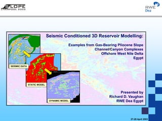
1. Seismic Conditioned 3D Reservoir Modelling: Examples from Gas-Bearing Pliocene Slope
Channel/Canyon Complexes, Offshore Nile Delta, Egypt
27-28 April 2003
SEISMIC DATA
STATIC MODEL
DYNAMIC MODEL
Seismic Conditioned 3D Reservoir Modelling:
Examples from Gas-Bearing Pliocene Slope
Channel/Canyon Complexes
Offshore West Nile Delta
Egypt
Presented by
Richard D. Vaughan
RWE Dea Egypt
2. Seismic Conditioned 3D Reservoir Modelling: Examples from Gas-Bearing Pliocene Slope
Channel/Canyon Complexes, Offshore Nile Delta, Egypt
27-28 April 2003
Agenda
Modelling Objectives
Modelling Assumptions and Workflow
– Data Analysis
– Seismic Conditioned Reservoir Modelling Parameters
Parameters 3D Modelling as a E & P Risk Reduction tool
– Taurus Prospect Evaluation
– Libra Prospect Evaluation
– North Idku Slope Channel Evaluation
Conclusions
3. Seismic Conditioned 3D Reservoir Modelling: Examples from Gas-Bearing Pliocene Slope
Channel/Canyon Complexes, Offshore Nile Delta, Egypt
27-28 April 2003
Agenda
Modelling Objectives
Modelling Assumptions and Workflow
– Data Analysis
– Seismic Conditioned Reservoir Modelling Parameters
Parameters 3D Modelling as a E & P Risk Reduction tool
– Taurus Prospect Evaluation
– Libra Prospect Evaluation
– North Idku Slope Channel Evaluation
Conclusions
4. Seismic Conditioned 3D Reservoir Modelling: Examples from Gas-Bearing Pliocene Slope
Channel/Canyon Complexes, Offshore Nile Delta, Egypt
27-28 April 2003
Modelling Objectives
To create seismic conditioned 3D static modelling grids to assist with:
• 3D reservoir characterisation of slope canyon & channel turbidite systems
• Understand 3D distribution reservoir architecture and heterogeneity
• Pre-drill Independent assessment of GIIP
• Up-Scaling & Forward modelling
Well location optimisation
Minimum compartment size/well
Estimate Well deliverability
Evaluate various development plan strategies
5. Seismic Conditioned 3D Reservoir Modelling: Examples from Gas-Bearing Pliocene Slope
Channel/Canyon Complexes, Offshore Nile Delta, Egypt
27-28 April 2003
Increasingsinuosity
Increasinglateralmigration
Increasingwidth-depthratio
ConfinedUnconfined
Increasing rate of sediment accumulation
Channel stacking patterns related to sinuosity, rate of sediment accumulation,
sand/mud ratio of sediment supplied (net to gross) and degree of channel confinement
After Pickering & Clark, 1998
What type of turbidite reservoir architecture are we exploring for and/or trying to develop?
6. Seismic Conditioned 3D Reservoir Modelling: Examples from Gas-Bearing Pliocene Slope
Channel/Canyon Complexes, Offshore Nile Delta, Egypt
27-28 April 2003
Overbank Shales
Channel sands Levee Heterolithics
Positive & negative amplitudes show
vertical – lateral stacking patterns
consistent with laterally offset stacked
submarine channel-levee deposits
“Negative Amp”
channels
Flooding Surface
Base Channel Complex
Taurus-1X
“Positive Amp”
channels
“East Taurus Complex”
“West Taurus Complex”
7. Seismic Conditioned 3D Reservoir Modelling: Examples from Gas-Bearing Pliocene Slope
Channel/Canyon Complexes, Offshore Nile Delta, Egypt
27-28 April 2003
Agenda
Modelling Objectives
Modelling Assumptions and Workflow
– Data Analysis
– Seismic Conditioned Reservoir Modelling Parameters
Parameters 3D Modelling as a E & P Risk Reduction tool
– Taurus Prospect Evaluation
– Libra Prospect Evaluation
– North Idku Slope Channel Evaluation
Conclusions
8. Seismic Conditioned 3D Reservoir Modelling: Examples from Gas-Bearing Pliocene Slope
Channel/Canyon Complexes, Offshore Nile Delta, Egypt
27-28 April 2003
Modelling Assumptions and Workflow
• The inherent 3D distribution of seismic amplitude and extracted attributes
can be interpreted geologically (seismic facies analysis)
• Meaningful relationship between data at the well scale (cm to metre-scale)
and seismic scale (12.5m x 25m bins)
• Calibration wells are correctly located within the grids
• Top depth converted map surface and internal model layers are
chronostratigraphically consistent
9. Seismic Conditioned 3D Reservoir Modelling: Examples from Gas-Bearing Pliocene Slope
Channel/Canyon Complexes, Offshore Nile Delta, Egypt
27-28 April 2003
North Idku-4X Canyon Complex
25 Layer grid = 3D Model
3D volume
attribute (10ms
window) inserted
as 2D Trend
3D Grid: 25 x 25x (10msec) = c. 9.5m
Depth converted time
map 250msec below top
Depth Structure Maps
Artificial Base
Top
Chronostratigraphic Flooding surface
10. Seismic Conditioned 3D Reservoir Modelling: Examples from Gas-Bearing Pliocene Slope
Channel/Canyon Complexes, Offshore Nile Delta, Egypt
27-28 April 2003
Base Slope
Channel
Depth map
25242322212019181716151413121110987654321Top Taurus Slope Channel depth map
4 Km
Taurus-1X
Note: East and West Taurus
Slope channel complexes
11. Seismic Conditioned 3D Reservoir Modelling: Examples from Gas-Bearing Pliocene Slope
Channel/Canyon Complexes, Offshore Nile Delta, Egypt
27-28 April 2003
Proroportional grid of Route Mean Squared of Amplitude
Cell Size X = 12.5m & Y = 25m
Top grid surface
= layer 6
826 rows
(Y)
25 layers
(Z)
1778Columns
(X)
2000 mTaurus-1X
12. Seismic Conditioned 3D Reservoir Modelling: Examples from Gas-Bearing Pliocene Slope
Channel/Canyon Complexes, Offshore Nile Delta, Egypt
27-28 April 2003
Data Analysis
• Derive relationship between seismic attributes at the well location and facies
types and petrophysical properties
• Condition and threshold attribute data with well data /rock type
• Generate facies, net:gross and porosity models (multiple realisations)
13. Seismic Conditioned 3D Reservoir Modelling: Examples from Gas-Bearing Pliocene Slope
Channel/Canyon Complexes, Offshore Nile Delta, Egypt
27-28 April 2003
Seismic Conditioned Reservoir
Modelling Parameters
• Facies Model
• Net:gross Model
• Porosity Model
• Gas expansion factor
• Water saturation
• GWC
Fixed -
seismic conditioned
by multiple realisations
Variable
(p10 – p50 – p90)
• Cap Press, Rel Perm, PVcomp – Data Conditioned
14. Seismic Conditioned 3D Reservoir Modelling: Examples from Gas-Bearing Pliocene Slope
Channel/Canyon Complexes, Offshore Nile Delta, Egypt
27-28 April 2003
RMS Amplitude thresholds and Seismic facies types
Shale Heterolithic Sand
Non Res Net reservoir
3000 4500
Data source: migrated 16 bit data
15. Seismic Conditioned 3D Reservoir Modelling: Examples from Gas-Bearing Pliocene Slope
Channel/Canyon Complexes, Offshore Nile Delta, Egypt
27-28 April 2003
RMS amplitude threshold 1800-3000
RMS amplitude threshold 3000-4500
RMS amplitude threshold 4200-6000
Too little sand and heterolithic facies
Too much sand and heterolithic facies
Sand and heterolithic facies constrained at well location
Facies Model Realisations – Threshold Sensitivity
Column 890: oblique dip section
16. Seismic Conditioned 3D Reservoir Modelling: Examples from Gas-Bearing Pliocene Slope
Channel/Canyon Complexes, Offshore Nile Delta, Egypt
27-28 April 2003
Seismic Crossline 18825
Final Facies Model cross section
Taurus-1X
Taurus-1X
“East Taurus Complex”
“West Taurus Complex”
17. Seismic Conditioned 3D Reservoir Modelling: Examples from Gas-Bearing Pliocene Slope
Channel/Canyon Complexes, Offshore Nile Delta, Egypt
27-28 April 2003
Interpolated Porosity
Interpolated
well porosities
Sand = 0.3
Heterolithic = 0.2
3D Model Parameters
Net to gross
Deterministic Porosity
Facies
18. Seismic Conditioned 3D Reservoir Modelling: Examples from Gas-Bearing Pliocene Slope
Channel/Canyon Complexes, Offshore Nile Delta, Egypt
27-28 April 2003
500m range
3000m range
Final Stochastic Porosity Realisation
2000m range parallel
to channel belt orientation
Stochastic Porosity Realisations (controlled by variograms)
19. Seismic Conditioned 3D Reservoir Modelling: Examples from Gas-Bearing Pliocene Slope
Channel/Canyon Complexes, Offshore Nile Delta, Egypt
27-28 April 2003
Agenda
Modelling Objectives
Modelling Assumptions and Workflow
– Data Analysis
– Seismic Conditioned Reservoir Modelling Parameters
Parameters 3D Modelling as a E & P Risk Reduction tool
– Taurus Prospect Evaluation
– Libra Prospect Evaluation
– North Idku Slope Channel Evaluation
Conclusions
20. Seismic Conditioned 3D Reservoir Modelling: Examples from Gas-Bearing Pliocene Slope
Channel/Canyon Complexes, Offshore Nile Delta, Egypt
27-28 April 2003
3D Modelling as a E & P Risk Reduction tool:
• Optimisation of exploration well locations
• Multiple scenarios for development/production well locations to assess
effective well drainage and deliverability
• Up-scaled models for forward dynamic simulation predictions
21. Seismic Conditioned 3D Reservoir Modelling: Examples from Gas-Bearing Pliocene Slope
Channel/Canyon Complexes, Offshore Nile Delta, Egypt
27-28 April 2003
Taurus Prospect Evaluation
22. Seismic Conditioned 3D Reservoir Modelling: Examples from Gas-Bearing Pliocene Slope
Channel/Canyon Complexes, Offshore Nile Delta, Egypt
27-28 April 2003
1
2
3
4
5
A
Proximal levee-channel
Channel
sand
Proximal levee
heterolithics
Layer 5: Slice through a sinuous laterally and vertically
amalgamated channel complex
50metres
CanyonFill–stackedchannelleveecomplex
(proximal–distalrelationshipsrecordedbywellpath)
300 metres
A A’
WELL
A’
Distal levee-
Overbank
Outcrop analogue
Bell Canyon Formation, West Texas
Well
Taurus-1X
From Kendrick, 2000
Postwell
Predicted
Seismic
Facies
H-pelagic
slope
DST – 1A
Pign
RMS Amp
23. Seismic Conditioned 3D Reservoir Modelling: Examples from Gas-Bearing Pliocene Slope
Channel/Canyon Complexes, Offshore Nile Delta, Egypt
27-28 April 2003
Max GWC 1980m TVDSS
DST–1A recorded rapid buildup due to lateral communication
between heterolithic levee-overbank thin beds with adjacent channel
N SW NES
Min GWC 1950m TVDSS
DST-1A
Taurus-1X
Channels connected to
Levees
24. Seismic Conditioned 3D Reservoir Modelling: Examples from Gas-Bearing Pliocene Slope
Channel/Canyon Complexes, Offshore Nile Delta, Egypt
27-28 April 2003
Libra Prospect Evaluation
25. Seismic Conditioned 3D Reservoir Modelling: Examples from Gas-Bearing Pliocene Slope
Channel/Canyon Complexes, Offshore Nile Delta, Egypt
27-28 April 2003
1700m TVDss
2000m TVDss
1900m TVDss
GWC’s
Sensitivity
Libra Prospect canyon / channel complex – dip section
Confined canyon feeder
Ponded fan complex
Change in slope angle across faults
26. Seismic Conditioned 3D Reservoir Modelling: Examples from Gas-Bearing Pliocene Slope
Channel/Canyon Complexes, Offshore Nile Delta, Egypt
27-28 April 2003
Libra Prospect canyon / channel complex – strike section
1700m TVDss
2000m TVDss
1900m TVDss
GWC’s
Sensitivity
27. Seismic Conditioned 3D Reservoir Modelling: Examples from Gas-Bearing Pliocene Slope
Channel/Canyon Complexes, Offshore Nile Delta, Egypt
27-28 April 2003
FaciesRMS Amp
Pre-drill facies predictions Well Libra-1X3D Model Layers
Dip section through 3D facies model
Strike section through 3D facies model
Libra-1X
Libra-1X
K- Libra
Canyon 3D
Reservoir model
Results
ELAN Interpretation
Post Drill
Adjustment
-12m Shift
6
7
8
9
10
11
12
13
14
GDT
GDT
Main Findings
• Model predicts
main pay interval
• Over-estimates
net-to-gross
Confined canyon feeder
Ponded fan complex
Libra-1x
Change
in slope
angle
across
fault
GDT
WUT
6
7
8
9
10
11
12
13
14
6
7
8
9
10
11
12
13
14
28. Seismic Conditioned 3D Reservoir Modelling: Examples from Gas-Bearing Pliocene Slope
Channel/Canyon Complexes, Offshore Nile Delta, Egypt
27-28 April 2003
North Idku Slope Channel
Evaluation
29. Seismic Conditioned 3D Reservoir Modelling: Examples from Gas-Bearing Pliocene Slope
Channel/Canyon Complexes, Offshore Nile Delta, Egypt
27-28 April 2003
NI-2x NI- 4x
Cut off in
gas-bearing
sequence
Cut off in
water-bearing
sequence
High RMS
amplitude
associated
with
gas-bearing
sequence
RMS
AMP
Seismic
Facies
30. Seismic Conditioned 3D Reservoir Modelling: Examples from Gas-Bearing Pliocene Slope
Channel/Canyon Complexes, Offshore Nile Delta, Egypt
27-28 April 2003
North Idku LeaseWest Med
Deep Marine
North Alex.
Block B
North Abu Qir Dev. Lease
North Idku-4x
Discovery
North Idku
Lease
ARMADILLO
Prospect
North Idku-2X
Discovery
7.5 Km
2.5 Km
Depth Map
&
Static
Model
(25m x 25m x c. 9.5m grid)
31. Seismic Conditioned 3D Reservoir Modelling: Examples from Gas-Bearing Pliocene Slope
Channel/Canyon Complexes, Offshore Nile Delta, Egypt
27-28 April 2003
Depth Map
&
Static
Model
North Idku-4x
N 2.5 km
Reservoir below
1511.5m TVDss
Reservoir above
GWC @ 1511.5m TVDss
North Alex B North Idku Concession
C.I =10m
1530
Seismic Facies
“Sand”
>6000 RMS AMP
“Heterolithic”
>4500<6000
“Non-Reservoir”
<4500
32. Seismic Conditioned 3D Reservoir Modelling: Examples from Gas-Bearing Pliocene Slope
Channel/Canyon Complexes, Offshore Nile Delta, Egypt
27-28 April 2003
Simgrid: 100 x 100 x c. 9.5m
GWC
Projected
through model
Depth Map &
Simulation
Model
Connected volume
in red
33. Seismic Conditioned 3D Reservoir Modelling: Examples from Gas-Bearing Pliocene Slope
Channel/Canyon Complexes, Offshore Nile Delta, Egypt
27-28 April 2003
Dynamic Simulation Model with 4 “Virtual” wells and a discovery well
Well V1
Well V2
GWC @ 1511.5m TVDss
based on NI-4x results
Initial Gas Saturation
Well V3
Well NI - 4x
discovery
Initial Gas Saturation
Armadillo
Viper Canyon
Including NI-4x
NI-2x
Dynamic Simulation
Model
400m
Well V4
34. Seismic Conditioned 3D Reservoir Modelling: Examples from Gas-Bearing Pliocene Slope
Channel/Canyon Complexes, Offshore Nile Delta, Egypt
27-28 April 2003
Up-scaled
simulation model
Produced Gas over 25 years
Cell Size
100 x 100 x 9.5m
35. Seismic Conditioned 3D Reservoir Modelling: Examples from Gas-Bearing Pliocene Slope
Channel/Canyon Complexes, Offshore Nile Delta, Egypt
27-28 April 2003
Agenda
Modelling Objectives
Modelling Assumptions and Workflow
– Data Analysis
– Seismic Conditioned Reservoir Modelling Parameters
Parameters 3D Modelling as a E & P Risk Reduction tool
– Taurus Prospect Evaluation
– Libra Prospect Evaluation
– North Idku Slope Channel Evaluation
Conclusions
36. Seismic Conditioned 3D Reservoir Modelling: Examples from Gas-Bearing Pliocene Slope
Channel/Canyon Complexes, Offshore Nile Delta, Egypt
27-28 April 2003
Conclusions
• Static models allow visualisation of reservoir complexity
(architecture & heterogeneity – connected / drainable volumes)
• Multiple realisations can be modelled rapidly, testing sensitivities
to different rock and fluid parameters
• Independent check of GIIP
• Dynamic simulation studies
• Various development plans can be evaluated
37. Seismic Conditioned 3D Reservoir Modelling: Examples from Gas-Bearing Pliocene Slope
Channel/Canyon Complexes, Offshore Nile Delta, Egypt
27-28 April 2003
Acknowledgements
The author would like to thank RWE Dea, bp Egypt and EGAS
for permission to present this material
EGAS