Downloaded 69 times


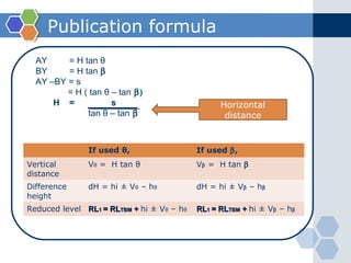
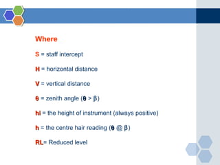
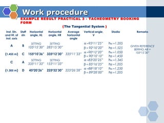
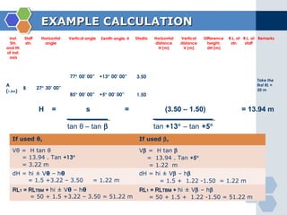


This document provides instruction on using the tangential tachymetry system to calculate horizontal distances, vertical distances, and reduced levels between stations. It includes the key formulas and principles, such as using the staff intercept (s) and vertical angles (θ and β) to calculate the horizontal distance (H). It also provides examples of field book layout and calculations. The goal is to use vertical angles and stadia readings to determine horizontal distances, vertical distances, and reduced levels between stations to map topographical features and surfaces.