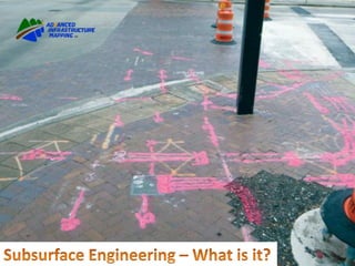
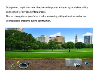
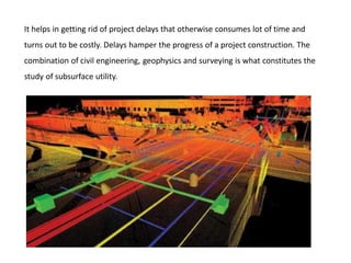
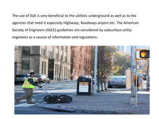
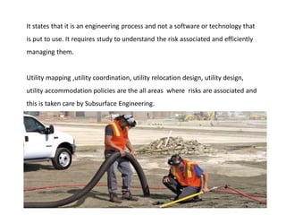
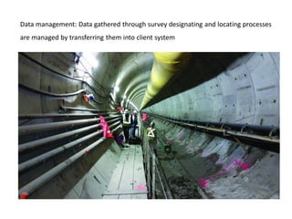
Advanced Infrastructure Mapping, LLC is an established SUBSURFACE
UTILITY ENGINEERING firm, based in the Mid-Atlantic.
Our vast knowledge of underground utility investigation techniques help
us strive to provide our customers with the most accurate information
possible.
Obtaining reliable underground utility information was quite a problem for
Highway designers.
Not only Highway engineers, it has been useful at airports, railways, military
work, sanitation and any other projects related to the government concerned.
In short whenever underground utilities problems are confronted subsurface utility
Engineering has proven with great solution.
Subservice surface utility engineering is the solution to the conflicts that take place in
utility mapping, Locating, designating. New and existing processes are used to
accurately map the future construction projects.
Earlier the standard methods to locate underground utilities were not sufficient, were
costly, inefficient and highly risky.
Due to subsurface engineering vertical and horizontal locations are easily available
quickly, without any difficulty and also inexpensive.
Storage tank, septic tanks etc. that are underground are map by subsurface utility
engineering for environmental purpose.
This technology is very useful as it helps in avoiding utility relocations and other
unpredictable problems during construction.
It helps in getting rid of project delays that otherwise consumes lot of time and
turns out to be costly. Delays hamper the progress of a project construction. The
combination of civil engineering, geophysics and surveying is what constitutes the
study of subsurface utility.
The use of SUE is very beneficial to the utilities underground as well as to the
agencies that need it especially Highways, Roadways airport etc. The American
Society of Engineers (ASCE) guidelines are considered by subsurface utility
engineers as a source of information and regulations.
It states that it is an engineering process and not a software or technology that
is put to use. It requires study to understand the risk associated and efficiently
managing them.
Utility mapping ,utility coordination, utility relocation design, utility design,
utility accommodation policies are the all areas where risks are associated and
this is taken care by Subsurface Engineering.
The quality levels are designed to decide what and how much information is
required by project owners to apply for risk Management. The ACSE’s standard
guidelines defines quality levels of utility as Quality level D, Quality level C, Quality
level B, Quality level A.
Quality level D is the recording of information through gathering data. This is lowest
level of information as the data could have limitations to it or source of data is
unknown. The data is derived from oral i.e. through enquiring people or talking
them about the site, past records, internet search, digital records etc.
Quality level C is done by whatever information is visible above ground and relating it
with quality level D. If the surveying is already performed, the accuracy of the
surveyed information is checked. Most of the time there is conflict between Quality
level D and quality level C.
Quality level B is designating the underground utilities information obtained by
applying geophysical methods to understand the existence and horizontal position of
subsurface utilities
Quality level A is the physical involvement in locating utility which is done
horizontally and vertically by survey measurements.
The major activities that are involved in SUE process are as follows:-
Scope of work: The SUE work plan is developed and then agreed upon by the
SUE service provider and the client. The work plan mostly consists level of
service, risk that is involved and its allocation, scheduling the project and the
project delivery time.
Designating: Geophysical method is used in interpreting the subset of utility presence
and then horizontal position on the ground surface is marked
Locating: - Precise vertical and horizontal location is recorded.
Data management: Data gathered through survey designating and locating processes
are managed by transferring them into client system
Conflict analysis: Conflicts arising are analyzed and resolved.
Advanced Infrastructure Mapping (A.I.M.) is a Small, Veteran Owned, SWaM
Certified Utility Mapping Company, based in Virginia Beach, Va. We have been in
the Utility Locating business for 27+ years.
We provide Underground Utility Locating and Mapping services for clients such
as Engineering Companies, Surveying Companies, Construction Companies,
Municipalities, and as simple as a single homeowner.
GET IN TOUCH
Address: 2216 Mansion Cross Ln., Virginia Beach, VA 23456
Phone: 757-785-5177
Mail: info@aimlocatingva.com
Hours: Monday – Saturday: 8:00 am – 5:00 pm
Sunday: Closed

Subsurface Engineering – What is it

  • 2.
    Advanced Infrastructure Mapping,LLC is an established SUBSURFACE UTILITY ENGINEERING firm, based in the Mid-Atlantic. Our vast knowledge of underground utility investigation techniques help us strive to provide our customers with the most accurate information possible.
  • 3.
    Obtaining reliable undergroundutility information was quite a problem for Highway designers. Not only Highway engineers, it has been useful at airports, railways, military work, sanitation and any other projects related to the government concerned.
  • 4.
    In short wheneverunderground utilities problems are confronted subsurface utility Engineering has proven with great solution. Subservice surface utility engineering is the solution to the conflicts that take place in utility mapping, Locating, designating. New and existing processes are used to accurately map the future construction projects.
  • 5.
    Earlier the standardmethods to locate underground utilities were not sufficient, were costly, inefficient and highly risky. Due to subsurface engineering vertical and horizontal locations are easily available quickly, without any difficulty and also inexpensive.
  • 6.
    Storage tank, septictanks etc. that are underground are map by subsurface utility engineering for environmental purpose. This technology is very useful as it helps in avoiding utility relocations and other unpredictable problems during construction.
  • 7.
    It helps ingetting rid of project delays that otherwise consumes lot of time and turns out to be costly. Delays hamper the progress of a project construction. The combination of civil engineering, geophysics and surveying is what constitutes the study of subsurface utility.
  • 8.
    The use ofSUE is very beneficial to the utilities underground as well as to the agencies that need it especially Highways, Roadways airport etc. The American Society of Engineers (ASCE) guidelines are considered by subsurface utility engineers as a source of information and regulations.
  • 9.
    It states thatit is an engineering process and not a software or technology that is put to use. It requires study to understand the risk associated and efficiently managing them. Utility mapping ,utility coordination, utility relocation design, utility design, utility accommodation policies are the all areas where risks are associated and this is taken care by Subsurface Engineering.
  • 11.
    The quality levelsare designed to decide what and how much information is required by project owners to apply for risk Management. The ACSE’s standard guidelines defines quality levels of utility as Quality level D, Quality level C, Quality level B, Quality level A.
  • 12.
    Quality level Dis the recording of information through gathering data. This is lowest level of information as the data could have limitations to it or source of data is unknown. The data is derived from oral i.e. through enquiring people or talking them about the site, past records, internet search, digital records etc.
  • 13.
    Quality level Cis done by whatever information is visible above ground and relating it with quality level D. If the surveying is already performed, the accuracy of the surveyed information is checked. Most of the time there is conflict between Quality level D and quality level C.
  • 14.
    Quality level Bis designating the underground utilities information obtained by applying geophysical methods to understand the existence and horizontal position of subsurface utilities
  • 15.
    Quality level Ais the physical involvement in locating utility which is done horizontally and vertically by survey measurements.
  • 16.
    The major activitiesthat are involved in SUE process are as follows:-
  • 17.
    Scope of work:The SUE work plan is developed and then agreed upon by the SUE service provider and the client. The work plan mostly consists level of service, risk that is involved and its allocation, scheduling the project and the project delivery time.
  • 18.
    Designating: Geophysical methodis used in interpreting the subset of utility presence and then horizontal position on the ground surface is marked
  • 19.
    Locating: - Precisevertical and horizontal location is recorded.
  • 20.
    Data management: Datagathered through survey designating and locating processes are managed by transferring them into client system
  • 21.
    Conflict analysis: Conflictsarising are analyzed and resolved.
  • 22.
    Advanced Infrastructure Mapping(A.I.M.) is a Small, Veteran Owned, SWaM Certified Utility Mapping Company, based in Virginia Beach, Va. We have been in the Utility Locating business for 27+ years. We provide Underground Utility Locating and Mapping services for clients such as Engineering Companies, Surveying Companies, Construction Companies, Municipalities, and as simple as a single homeowner.
  • 23.
    GET IN TOUCH Address:2216 Mansion Cross Ln., Virginia Beach, VA 23456 Phone: 757-785-5177 Mail: info@aimlocatingva.com Hours: Monday – Saturday: 8:00 am – 5:00 pm Sunday: Closed