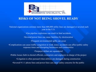
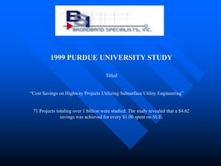
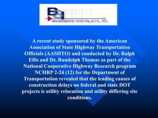
This document discusses the importance of subsurface utility engineering (SUE) for infrastructure projects. It notes that $130 billion in federal stimulus is being used for public works projects and that failing to accurately locate underground utilities beforehand can result in damaged utilities, delays, cost overruns, safety issues and litigation. It cites a study finding $4.62 in savings for every $1 spent on SUE. The document describes tools that can be used to identify underground utilities and provides contact information for a SUE firm.
Digital Image of the City - Infrastructure
Bowdoin College
Fall 2014
Rachel Barnes, Ezra Duplissie-Cyr, Ike May, Kote Mushegian, Luis Paniagua, Mingo Sanchez, Vivian Yang
Presentation given on 12/10/14
Digital Image of the City - Infrastructure
Bowdoin College
Fall 2014
Roya Moussapour, Alex N'Diaye, Karl Reinhardt, Alexi Robbins, James Wang, Max Wolf
Presentation given on 12/10/14
Digital Image of the City - Infrastructure
Bowdoin College
Fall 2014
Rachel Barnes, Ezra Duplissie-Cyr, Ike May, Kote Mushegian, Luis Paniagua, Mingo Sanchez, Vivian Yang
Presentation given on 12/10/14
Digital Image of the City - Infrastructure
Bowdoin College
Fall 2014
Roya Moussapour, Alex N'Diaye, Karl Reinhardt, Alexi Robbins, James Wang, Max Wolf
Presentation given on 12/10/14
Civil engineering is a branch of engineering which deals with people, civilization of a country, their needs and basic facilities. So as long as there are humans and as long as we have natural phenomenon like earthquakes and tornadoes civil engineers will be required.
A returning favorite! Most organizations start into GIS as a tool for maintaining land records information, but not everyone leverages that investment for the greatest return to their community. Join us to see how organizations are taking full advantage of their system and using it for planning and problem solving. The session will focus on innovation in problem solving but will also showcase some favorite examples from past years.
"Introduction to Civil Engineering" is a PowerPoint that provides an overview of civil engineering, and areas of specialization within the field, for primary and secondary students. Designed by Dr. Larry Rillet - Director of the Nebraska Transportation Center at the University of Nebraska-Lincoln - and his educational outreach team members, the aim of this PowerPoint is to provide students with further exposure as to who civil engineers are and what they do. This lesson can be paired with a "Penny Boat" activity.
Chalet Moderno en Nova Santa Ponsa a la venta - MallorcaPamela Adam
<iframe height="420" width="510" src="//www.slideshare.net/slideshow/embed_code/46543642"> </iframe> <div> <strong> <a>Modern Villa in Nova Santa Ponsa</a> </strong> from <strong><a>Pamela Adam</a></strong> </div>
A presentation given to the Dayton ASCE Chapter on 4/21/11 regarding ASCE efforts in sustainability and the future of sustainability for civil and infrastructure engienering including the IgCC.
Fairgrounds Roadway Widening Public Meeting (Sept. 23, 2014)City of Midland
The proposed project is needed to address increasing traffic volumes due to increased regional commercial and residential development as a result of energy sector growth.
The purpose of the project is to improve capacity of the roadway by providing additional through lanes as well as auxiliary lanes for turning movements. The additional capacity of the proposed arterial will facilitate the mixed use traffic, including those containing hazardous materials, and will be consistent with the City of Midland Master Thoroughfare Plan.
A low cost method of real time pavement condition data sharing to expedite ma...UVision
A low cost method of real time pavement condition data sharing to expedite maintenance intervention
Pavements for roads in cities and highways are degraded with potholes, cracking, and rutting distresses. There is a strong need to identify these locations and sections with undesired longitudinal roughness quickly and accurately every year. Traditionally, expensive standalone survey vehicles for roughness measurements and more expensive multi-function vehicles are employed by highway agencies or through contract services, which most cities and local agencies can’t afford. The primary objective of this study is to describe a low cost method to collect essential pavement condition data and share real time to expedite maintenance intervention needs. This facilitates rapid identification of pavement sections with undesired longitudinal roughness and local defects. This paper discusses the impact of social media, crowd sourcing, and advances in cheaper accurate motion sensors and cloud server data processing. These tools make it possible to develop easy-to-use low cost methods, which are affordable by city public work and smaller road agencies.
Economic Development 411 | 2015 | Robert PalterOne Columbus
Robert Palter—director, McKinsey & Company—leads the global Infrastructure Practice at McKinsey & Company, and specializes in helping clients identify infrastructure investment opportunities and manage infrastructure assets.
Phil Jones, PE, OC Public Works Design Division, Bruce Phillips, PE, PACE and Scott Taylor, PE, Michael Baker International present "Engineering Analysis for Urban Drainage Systems" for the Environmental Water Resources Institute of ASCE OC.
Infrastructure inspections go robotic and provide asset owners with real date. No more manual subjective inspections. Fewer lane closures, traffic disruptions and a much safer inspection both for the traveling public and the inspectors
The Executive Summary of the draft Environmental Impact Statement (EIS) from the Federal Energy Regulatory Commission. It is a review of the potential impacts from building a 125-mile natural gas pipeline from Susquehanna County, PA north into central New York where it will connect with two interstate natural gas transmission pipelines, delivering up to 650,000 dekatherms of natural gas per day to New York and New England--something badly needed. The EIS says there will be negative effects on the environment--but that those effects can be mitigated to "less than significant levels" if certain things are done.
FERC Draft Environmental Impact Statement for Constitution Pipeline
Subsurface Utilities
1. 1700 S. Peachtree Rd. Balch Springs TX 75180
SUBSURFACE UTILITY ENGINEERING (SUE)
With billions in federal stimulus flowing into state and
local budgets this year and next, states and
municipalities are prioritizing shovel ready projects.
$ 130,000,000,000.00 is set aside for construction of
highways, buildings and other public works.
2. States and municipalities, to keep from wasting tax
dollars, must consider requiring their contractors to
consider one very important question in order to keep
their projects on time, and within budget.
“Do you know where your underground utilities are
located before you dig?”
3. RISKS OF NOT BEING SHOVEL READY
National organizations estimate more than 400,000 utility lines are damaged or severed each
year in the U.S.
•Gas pipeline explosions can result in fatal accidents
•Severed power lines can cause fatalities by electrocution
•Frequent environmental spills can occur
•Complications can cause traffic congestion in work zones, accidents can affect public safety
response times and disrupting businesses and communities
•Taxpayer dollars are squandered
•Public looses faith in elected officials, contractors and engineers in charge of the project
•Litigation is often pursued when utilities are damaged during construction
•Severed 9-1-1 phone lines and power lines can cause safety concerns for the public
4. 1999 PURDUE UNIVERSITY STUDY
Titled
“Cost Savings on Highway Projects Utilizing Subsurface Utility Engineering”
71 Projects totaling over 1 billion were studied. The study revealed that a $4.62
savings was achieved for every $1.00 spent on SUE.
5. A recent study sponsored by the American
Association of State Highway Transportation
Officials (AASHTO) and conducted by Dr. Ralph
Ellis and Dr. Randolph Thomas as part of the
National Cooperative Highway Research program
NCHRP 2-24 (12) for the Department of
Transportation revealed that the leading causes of
construction delays on federal and state DOT
projects is utility relocation and utility differing site
conditions.
6. DOT Projects have far-reaching impacts and
commonly intersect with an abundance of
underground utilities, including:
Metropolitan areas
Airports
Bridges
Plant access roads
The potential negative impacts are obvious.
7. TOOLS TO LIMIT DAMAGES
We have a variety of tools and techniques at our disposal with which to
identify underground utilities.
•Computerized Aided Design combining many different aspects of the project
into a base map
•Consolidate right of way maps
•Vacuum Extraction, which provides a nondestructive method of removing
dirt to expose utilities
•Geographic Information Systems (GIS) and Global Positioning Systems
(GPS) to combine software and hardware to develop database using
coordinates of various land features and mapping techniques
8. 1700 S. Peachtree Rd. Balch Springs TX 75180
For more information,
Gerry Locke
1-877-559-0531
Broadband.networks@bsicable.com
www.bsicable.com
HUB /Native American / Women & Minority Owned Firm