The document discusses spacecraft technology developed at the University of Dundee, including SpaceWire, a standard interface for onboard data handling. It describes how SpaceWire connects instruments and processors on spacecraft. It also discusses STAR-Dundee, a successful spin-off company that produces SpaceWire chips and test equipment used on over 100 spacecraft. The document outlines work done at Dundee on vision-based navigation for planetary landers, including a prototype camera and simulator called PANGU for testing navigation algorithms.
Surveying Areas in Developing Regions Through Context Aware Drone MobilityAlessandro Montanari
Developing regions are often characterized by large areas that are
poorly reachable or explored. The mapping of these regions and the census of roaming populations in these areas are often difficult and sporadic.
In this paper we put forward an approach to aid area surveying
which relies on autonomous drone mobility. In particular we
illustrate the two main components of the approach. An efficient on device object detection component, built on Convolutional Neural Networks, capable of detecting human settlements and animals on the ground with acceptable performance (latency and accuracy) and a path planning component, informed by the object identification module, which exploits Artificial Potential Fields to dynamically adapt the flight in order to gather useful information of the environment, while keeping optimal flight paths. We report some initial performance results of the on board visual perception module and describe our experimental platform based on a fixed-wing aircraft.
Basic description about how to do a Space Project, based on experiences with XaTcobeo cubesat, a University of Vigo project for ESA education, with the help of INTA.
License: Breogan Costa, University of Vigo, CERN, JINR.
The document discusses small satellites and their components. Small satellites are increasingly being used for applications like weather monitoring, communications, and Earth observation, often supplementing larger satellites. A typical small satellite consists of subsystems for structure, power, thermal control, attitude control, onboard data handling, communications, a payload like a camera, and sometimes propulsion. Each subsystem faces challenges to operate reliably in the space environment with stringent mass and power constraints. Developing small satellites provides opportunities for research and education.
Mars CubeSat Telecom Relay Constellation_JPL FinalRohan Deshmukh
The document proposes a 4-CubeSat constellation in Mars orbit to augment telecommunications relay capabilities for surface assets. The CubeSats would be deployed from a 2022 Mars Telecom Orbiter into a 350 km circular orbit with 70 degree inclination. Each 6U CubeSat would carry an IRIS transponder, Ka-band reflectarray antenna, and UHF antennas to provide direct-to/from-Earth relay and cross-link relay with orbiters. Analysis showed the design could meet power and propulsion requirements to operate for two Mars years.
The document discusses the role of science and operations in developing the James Webb Space Telescope mission. It describes the science goals that JWST aims to address, including detecting the first galaxies and studying star and planet formation. It outlines the key instruments onboard and discusses how STScI will manage science operations and the ground system. STScI has provided input during development to optimize science return and operations efficiency. Challenges include balancing momentum management with stray light avoidance and ensuring sufficient early funding.
This document discusses 5-sense computing in robots for remote monitoring applications. It describes how giving robots human-like senses such as sight, hearing, smell, taste and touch would allow them to be used for remote inspection in hazardous environments. Current robotic sensing capabilities are outlined and examples of using multi-sensory robots for remote quality control, tank inspections and underground mine monitoring are provided. The networking requirements for transmitting multi-sensory data from robots in real-time are also summarized.
Space Situational Awareness Forum
Following another very successful conference in London in November 2014, Space Situational Awareness 2015 took place in Hyattsville, Maryland in May 2015, with over 60 SSA experts from all over the globe coming together to discuss the most pressing SSA challenges.
With increasing dependence on space-based services, the ability to protect space infrastructure has become essential to our society. Any shutdown of even a part of space infrastructures could have significant consequences for the well-functioning of economic activities and our citizens’ safety, and would impair the provision of emergency services.
However, space infrastructures are increasingly threatened by the risk of collision between spacecraft and more importantly, between spacecraft and space debris. As a matter of fact, space debris has become the most serious threat to the sustainability of certain space activities.
In order to mitigate the risk of collision it is necessary to identify and monitor satellites and space debris, catalogue their positions, and track their movements (trajectory) when a potential risk of collision has been identified, so that satellite operators can be alerted to move their satellites. This activity is known as space surveillance and tracking (SST), and is today mostly based on ground-based sensors such as telescopes and radars.
With a focus on solving the political issues but not ignoring the technical, Space Situational Awareness 2015 the leading gathering of dedicated SSA experts from the USA, Europe and beyond, to discuss and debate the business, political and technical challenges that lie ahead.
Take a look at our previous Space Situation Awareness event…
Who should attend Space Situational Awareness?
Space Situational Awareness 2015 is a community of experts from Government, Space Agencies, Satellite/Spacecraft Operators, Space Lawyers, Space Insurance providers and Defense who are looking to understand and predict the physical location of natural and manmade objects in orbit around the Earth, with the objective of avoiding collisions.
How can you get involved in Space Situational Awareness?
If you feel that you could add to the debate and discussion at Space Situational Awareness, we’d be delighted to hear from you. Please drop us a line on +44(0)7769157787 or email me at adam.plom@coriniumintelligence.com.
CSIRO has conducted extensive research into automating heavy equipment used in mining operations. This includes developing technologies like dragline swing assist to automate parts of a dragline's operation, digital terrain mapping to aid operators, and autonomous systems for rope shovels, load haul dump vehicles, excavators, and explosive loading. CSIRO is currently working on projects involving automated draglines, wireless sensor networks, and automation of other mining equipment. The research aims to improve safety and productivity through autonomous technologies.
The document discusses Pakistan's space program, including its history, current projects, research and development infrastructure, and human resource development efforts. Some of Pakistan's current space projects include Paksat-1, the Pakistan Communication Satellite System (Paksat-1R), and plans for a Remote Sensing Satellite System. SUPARCO is developing satellite and space technologies through various research labs and facilities. It also has an ambitious human resource development program that includes training scientists and engineers both locally and abroad.
In this we have studied survey of how NASA build their first Machine Learning enabled Rover to send it on Mars. Hope you Like it! If any improvements or copyright content removal needed feel free to communicate.
The document discusses the role of science and operations in developing the James Webb Space Telescope mission. It describes the science goals that JWST aims to address, including detecting the first galaxies and studying star and planet formation. It outlines the key instruments onboard and discusses how STScI will manage science operations and the ground system once JWST is launched. STScI has been influencing mission development to help achieve the science objectives through activities like simulations, requirements development, and system trades.
The document discusses the role of science and operations in developing the James Webb Space Telescope mission. It describes the science goals that JWST aims to address, including detecting the first galaxies and studying star and planet formation. It outlines the key instruments onboard and discusses how STScI will manage science operations and the ground system. STScI has provided input during development to optimize science return and operations efficiency. Challenges include balancing momentum management with stray light avoidance and ensuring sufficient early funding.
The document discusses the role of science and operations in developing the James Webb Space Telescope mission. It describes the science goals that JWST aims to address, including detecting the first galaxies and studying star and planet formation. It outlines the key instruments onboard and discusses how STScI will manage science operations and the ground system once JWST is launched. STScI has been influencing mission development to help achieve the science objectives through activities like simulations, requirements development, and system trades.
The document describes the University of Surrey's proposal for the Selene lunar rover for a lunar robotics challenge. The proposal involves converting a Pioneer 3-AT mobile robot into a tracked lunar rover with a deployable relay nanorover to assist with communications and localization. Key aspects of the rover design include the tracked mobility system, stereoscopic vision for navigation, and a robotic arm for sample collection.
Richard Reinhart, NASA Glenn Research Center: "Space Communications and Navigation (SCaN) Testbed." Presented at the 2013 International Space Station Research and Development Conference, http://www.astronautical.org/issrdc/2013.
The document provides a catalogue of products and services including aerospace projects, unmanned aerial systems, control systems, and embedded electronics with a focus on developing onboard software, ground support equipment, data processing solutions, and unmanned aerial vehicles including an aerial target drone.
Victor Pashkov's CV outlines his education and experience developing optical and electronic instruments, including a LIDAR system, improving the GLONASS navigation message, simulating an optical electronic instrument with CCD matrices for space navigation, designing an optical switch and laser projection system, and managing projects for an optical projection TV and LED backlight unit for LCD displays.
The document proposes a mission to send an unmanned prospector craft called Aquila Aurealis to the Moon to search for water ice and other resources. It provides details on the estimated $30 million budget, timeline, technical specifications of the craft and its subsystems, communication plans, and addresses relevant legal and ethical considerations regarding extracting lunar resources and transmitting data and images. The overall goal is to accelerate solar system exploration and make resources available beyond Earth.
The document provides an introduction to the Global Positioning System (GPS). It discusses the history and components of GPS, including how GPS satellites and receivers work to determine location. Key points include:
- GPS was developed by the US Department of Defense and uses a constellation of 24 satellites that continuously transmit location and time data.
- Handheld GPS receivers can calculate latitude, longitude, altitude and velocity by receiving signals from 4 or more satellites.
- GPS has both military and civilian applications and is used for navigation, tracking, mapping, and precise timing worldwide.
The document provides an introduction to the Global Positioning System (GPS). It discusses the history and components of GPS, including how GPS satellites transmit position and time data to receivers, which then calculate location details. GPS was developed by the US Department of Defense and launched its first satellites in 1978. It became fully operational in 1995 and accessible to all users in 2000. The system includes space, user, and ground control segments. It allows devices to determine their precise location using signals from multiple satellites.
AI Research and OpenPOWER at the NASA Frontier Development LabGanesan Narayanasamy
The Frontier Development Lab is an AI research accelerator combining capabilities from NASA, academia, and private companies to support NASA's science goals. In 2017, examples of its work included using deep learning to automate creating 3D models of asteroids from radar data in hours instead of weeks. It also built a model to predict geomagnetic field variability and uncover patterns related to geomagnetic storms. Additionally, convolutional neural networks were used to improve solar flare predictions from UV images. The SETI Institute is a member of the OpenPOWER Foundation involved with the Frontier Development Lab.
1. The document describes the concept for a future generation of intelligent Earth observing satellites that would provide real-time satellite imagery and data to end users.
2. Key elements of the proposed system include a network of low Earth orbit satellites linked to geostationary satellites, with on-board processing and high-speed data transmission to allow direct downlinking of imagery and data to users.
3. The system is designed around user needs, with components like handheld receivers and mobile antennas allowing real-time access to satellite data, as well as user software to process and display the data.
Wind river NASA Real-Time Constrained Control SystemsM Reza Rahmati
Wind River's VxWorks real-time operating system plays a central role in NASA's Mars rover Curiosity mission by controlling the rover's functions from launch to completion of its mission. VxWorks manages critical operations like navigation, descent, landing, collecting science data, and transmitting data back to Earth. It helped enable the complex and risky landing sequence within a small target zone on Mars. VxWorks has supported over 20 NASA missions due to its reliable and resilient nature which is essential for missions with no room for failure.
A COMMUNICATIONS AND PNT INTEGRATED NETWORK INFRASTRUCTURE FOR THE MOON VILLAGEMarco Lisi
This document discusses proposals for establishing a communications and navigation network to support human and robotic exploration of the Moon. It summarizes past ESA studies on using GPS and developing lunar navigation and communication satellites. It then proposes a modular, expandable approach using commercial off-the-shelf (COTS) technologies like LTE and the forthcoming 5G standard. This COTS-based lunar network would provide reliable communication and navigation services to support colonization of the Moon and Mars through permanent base stations. It would satisfy requirements for performance, reliability, affordability and sustainability by leveraging commercial technologies and allowing incremental expansion over time.
The document provides information about several projects undertaken by the Aerospace Enterprise student group at Michigan Technological University, including:
1) The Oculus satellite project which involves over 70 students across various subsystem teams designing a CubeSat for a competition.
2) The Ion Propulsion Lab which conducts experiments on electric propulsion thrusters and was founded in 2000.
3) A lunar penetrator project to develop a system to insert a 1-meter rod into the lunar surface to take measurements.
4) Participation in NASA's reduced gravity C-9 aircraft experiments on topics like boom vibration and electron propulsion.
5) The CanSat project which involves launching a satellite
The document describes Project ELSA, which aims to design and construct a low-cost spherical probe called the NeoPod to collect and transmit scientific data from the surface of Europa. A team of undergraduate students designed the NeoPod over 8 months to fit within a 25cm diameter sphere and weigh less than 10kg. The NeoPod integrates two sensors (a magnetometer and Geiger counter), an avionics package with an FPGA, a communications system, and a power system to operate for 100 hours. Simulation results show the NeoPod could transmit up to 301MB of data if located at Europa's poles. The project aims to demonstrate the feasibility of using low-cost probes to explore Europa and other planetary
The document describes the A.L.F.R.E.D. project which aims to design and develop a robotic platform to autonomously fetch items in a set environment. The plan is for the robot to communicate with sensors, localize itself within the environment, detect items, avoid obstacles, and retrieve items using a drone or arm. Challenges faced include learning ROS, integrating different systems, SLAM instability, and hardware issues. Future work includes reintegrating the drone, improving item detection, enhancing navigation, and developing a fully functional household robot.
ISO/IEC 27001, ISO/IEC 42001, and GDPR: Best Practices for Implementation and...PECB
Denis is a dynamic and results-driven Chief Information Officer (CIO) with a distinguished career spanning information systems analysis and technical project management. With a proven track record of spearheading the design and delivery of cutting-edge Information Management solutions, he has consistently elevated business operations, streamlined reporting functions, and maximized process efficiency.
Certified as an ISO/IEC 27001: Information Security Management Systems (ISMS) Lead Implementer, Data Protection Officer, and Cyber Risks Analyst, Denis brings a heightened focus on data security, privacy, and cyber resilience to every endeavor.
His expertise extends across a diverse spectrum of reporting, database, and web development applications, underpinned by an exceptional grasp of data storage and virtualization technologies. His proficiency in application testing, database administration, and data cleansing ensures seamless execution of complex projects.
What sets Denis apart is his comprehensive understanding of Business and Systems Analysis technologies, honed through involvement in all phases of the Software Development Lifecycle (SDLC). From meticulous requirements gathering to precise analysis, innovative design, rigorous development, thorough testing, and successful implementation, he has consistently delivered exceptional results.
Throughout his career, he has taken on multifaceted roles, from leading technical project management teams to owning solutions that drive operational excellence. His conscientious and proactive approach is unwavering, whether he is working independently or collaboratively within a team. His ability to connect with colleagues on a personal level underscores his commitment to fostering a harmonious and productive workplace environment.
Date: May 29, 2024
Tags: Information Security, ISO/IEC 27001, ISO/IEC 42001, Artificial Intelligence, GDPR
-------------------------------------------------------------------------------
Find out more about ISO training and certification services
Training: ISO/IEC 27001 Information Security Management System - EN | PECB
ISO/IEC 42001 Artificial Intelligence Management System - EN | PECB
General Data Protection Regulation (GDPR) - Training Courses - EN | PECB
Webinars: https://pecb.com/webinars
Article: https://pecb.com/article
-------------------------------------------------------------------------------
For more information about PECB:
Website: https://pecb.com/
LinkedIn: https://www.linkedin.com/company/pecb/
Facebook: https://www.facebook.com/PECBInternational/
Slideshare: http://www.slideshare.net/PECBCERTIFICATION
This presentation was provided by Steph Pollock of The American Psychological Association’s Journals Program, and Damita Snow, of The American Society of Civil Engineers (ASCE), for the initial session of NISO's 2024 Training Series "DEIA in the Scholarly Landscape." Session One: 'Setting Expectations: a DEIA Primer,' was held June 6, 2024.
it describes the bony anatomy including the femoral head , acetabulum, labrum . also discusses the capsule , ligaments . muscle that act on the hip joint and the range of motion are outlined. factors affecting hip joint stability and weight transmission through the joint are summarized.
How to Add Chatter in the odoo 17 ERP ModuleCeline George
In Odoo, the chatter is like a chat tool that helps you work together on records. You can leave notes and track things, making it easier to talk with your team and partners. Inside chatter, all communication history, activity, and changes will be displayed.
বাংলাদেশের অর্থনৈতিক সমীক্ষা ২০২৪ [Bangladesh Economic Review 2024 Bangla.pdf] কম্পিউটার , ট্যাব ও স্মার্ট ফোন ভার্সন সহ সম্পূর্ণ বাংলা ই-বুক বা pdf বই " সুচিপত্র ...বুকমার্ক মেনু 🔖 ও হাইপার লিংক মেনু 📝👆 যুক্ত ..
আমাদের সবার জন্য খুব খুব গুরুত্বপূর্ণ একটি বই ..বিসিএস, ব্যাংক, ইউনিভার্সিটি ভর্তি ও যে কোন প্রতিযোগিতা মূলক পরীক্ষার জন্য এর খুব ইম্পরট্যান্ট একটি বিষয় ...তাছাড়া বাংলাদেশের সাম্প্রতিক যে কোন ডাটা বা তথ্য এই বইতে পাবেন ...
তাই একজন নাগরিক হিসাবে এই তথ্য গুলো আপনার জানা প্রয়োজন ...।
বিসিএস ও ব্যাংক এর লিখিত পরীক্ষা ...+এছাড়া মাধ্যমিক ও উচ্চমাধ্যমিকের স্টুডেন্টদের জন্য অনেক কাজে আসবে ...
How to Fix the Import Error in the Odoo 17Celine George
An import error occurs when a program fails to import a module or library, disrupting its execution. In languages like Python, this issue arises when the specified module cannot be found or accessed, hindering the program's functionality. Resolving import errors is crucial for maintaining smooth software operation and uninterrupted development processes.
हिंदी वर्णमाला पीपीटी, hindi alphabet PPT presentation, hindi varnamala PPT, Hindi Varnamala pdf, हिंदी स्वर, हिंदी व्यंजन, sikhiye hindi varnmala, dr. mulla adam ali, hindi language and literature, hindi alphabet with drawing, hindi alphabet pdf, hindi varnamala for childrens, hindi language, hindi varnamala practice for kids, https://www.drmullaadamali.com
Thinking of getting a dog? Be aware that breeds like Pit Bulls, Rottweilers, and German Shepherds can be loyal and dangerous. Proper training and socialization are crucial to preventing aggressive behaviors. Ensure safety by understanding their needs and always supervising interactions. Stay safe, and enjoy your furry friends!
This slide is special for master students (MIBS & MIFB) in UUM. Also useful for readers who are interested in the topic of contemporary Islamic banking.
How to Manage Your Lost Opportunities in Odoo 17 CRMCeline George
Odoo 17 CRM allows us to track why we lose sales opportunities with "Lost Reasons." This helps analyze our sales process and identify areas for improvement. Here's how to configure lost reasons in Odoo 17 CRM
How to Manage Your Lost Opportunities in Odoo 17 CRM
Space wire illustrated map
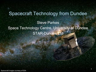
1. Spacecraft Technology from Dundee
Steve Parkes
Space Technology Centre, University of Dundee
STAR-Dundee Ltd
Spacecraft images courtesy of ESA
1
2. Spacecraft onboard data-handling
Computer network technology for spacecraft
– SpaceWire
Connects together data-handling elements
onboard a spacecraft:
–
–
–
–
Instruments
Processors
Mass memory
Telemetry and Telecommand
Standard interface
Forms the nervous system of a spacecraft
2
8. SpaceWire Key Features
Similar purpose to USB
– Different technology
8
Designed for space applications
Simple
Implementation requires few logic gates
High performance
Flexible architecture
25. SpaceWire
SpaceWire standard
– Written by University of Dundee
– With inputs from international spacecraft
engineers
SpaceWire technology
– Being used or designed into over 100 spacecraft
– Over $15 billion worth of spacecraft rely on it
Scientific, Exploration, Earth observation, Commercial
Dundee SpaceWire chip technology
designed into
– European, Japanese, USA, Chinese spacecraft
Successful spin-out company STAR-Dundee
25
30. Planetary Landers
How to land a spacecraft on a distant planet?
–
–
–
–
Without a pilot on board
Long communication delays
Precision landing
In potentially hazardous terrain
Robotic pilot
Eyes of robotic pilot
– Computer vision
– Measure spacecraft motion relative to the surface
– Visual information combined with information from
other navigation sensors
– Used to guide the spacecraft
30
34. Eyes for Spacecraft Robotic Pilot
NPAL Camera Prototype
– Navigation for Planetary Approach and Landing
Team
– EADS Astrium (France)
– Selex Galileo (Italy)
– University of Dundee
Image Memory
Image
Proc.
Control
Proc.
Imaging
Chip
SpW
To
OBC
35. Testing Vision Based Navigation
Having built a lander navigation system
– How can we test it?
Simulation
– PANGU:
Planet and Asteroid Natural-scene Generation Utility
– Software tool
Simulates planets and asteroids
Simulates cameras and other sensors viewing those
bodies
Developed specifically to test vision based GNC
algorithms
Realistic and high performance
Extensively tested and validated so that it can be used
for testing space flight systems
35
– Being used for lander, rover, orbiter simulation
36. Descent videos: Malapert Ridge
– Based on a 960 m DEM centred on Malapert
Ridge near the South Pole Model with resolution
varying from 960 m to 47 cm.
36
40. Landmark Recognition
Landmarks: sites of prominent Harris corners
Connected by a surface mesh
Surface mesh allows tracking of landmarks
– Lying over the asteroid horizon
– and in concave areas
40
41. Landmark Recognition
Landmarks are projected into the image
– Using an estimate of the spacecraft position &
orientation
Matches are made with features in the
current navigation imagery
Estimated spacecraft position & orientation
optimised
– By minimising the difference between
– Expected and observed landmark position in the
image
41
43. Planetary Landers
Navigation camera
– Prototype built and tested
– Engineering model currently under development
– Dundee providing image processing chip design
Test system
– PANGU simulator designed and built at Dundee
– Widely used in Europe for testing vision-based
navigation systems
43
Descent and landing, e.g. Lunar Polar
Asteroid landing, e.g. Marco Polo
Rover navigation, e.g. ExoMars
Spacecraft rendezvous and docking, e.g. Mars Sample
Return
44. Earth Observation Data Reception
Dundee Satellite Receiving Station
One of main receiving stations in UK
Funded by NERC
– Natural Environment Research Council
Part of NEODAAS
– NERC Earth Observation Data Acquisition and
Analysis Service
SpaceWire is a data-handling network technology specifically designed or use onboard spacecraft.It connects together instruments, processors, mass memory and the telemetry/telecommand subsystem.SpaceWire provides a standard interface between all these elements, which simplifies integration and testing of the onboard data-handling system.Instruments and other units designed with SpaceWire interfaces are easy to reuse on other spacecraft,The SpaceWire standard was written by the University of Dundee with input from spacecraft engineers from across Europe.
SpaceWire is attractive for spacecraft designers because it is simple requiring relatively few logic gates to implement and is easy to use in a wide range of applications.It has a high performance providing high-speed, bidirectional communication at up to 200 Mbits/s.SpaceWire sends information in packets.SpaceWire is also extremely flexible, being adaptable to many different data-handling architectures.It has some special features like time-codes which are not present in other networks.
Launched June 2009
View from Surveyor 3 (landed April20,1967) to Apollo 12 Intrepid (landed Nov 19, 1969)I watched this on TV as a 13 year old.40 years later technology that I helped developed was being used to photograph the footsteps of these courageous explorers.It is humbling to think of what engineers in the 60’s achieved with the technology they had at hand.
GAIA:is an ESA star mapping mission with an extremely high resolution CCD.SpaceWire is being used to transfer images from the CCD to the onboard mass memory. SpaceWire was an enabling technology for this mission, with 16 SpaceWire links being used to transfer the data.
GAIA service unit
Bepi Colombo is the joint ESA/JAXA mission to Mercury.SpaceWire is being used for almost all the onboard data handling in both ESA and JAXA spacecraft
James Webb Space Telescope is the big brother of the Hubble Space Telescope. Hubble had a 2.5 m diameter mirror. JWST has a 6.5 m diameter mirror!JWST is a NASA mission with some ESA instruments.SpaceWire used for all the onboard data handling except for one star-tracker.
JWST NIR Camera
The purpose of ASTRO-H is to explore the structure and evolution of Universe with the following observational capabilities:One of the first imaging and spectroscopic observations with the hard X-ray telescope.The first spectroscopic observations with an extremely high energy resolution of the micro-calorimeter.The most sensitive wideband observation over an energy range from 0.3 to 600 keV.Launch 2014 "Illustration: Akihiro Ikeshita / JAXA".
The Sentinel-3 mission's main objective is to measure sea-surface topography, sea- and land-surface temperature and ocean- and land-surface colour with high-end accuracy and reliability in support of ocean forecasting systems, and for environmental and climate monitoring.The first Sentinel-3 satellite is expected to launch in 2013, followed by the second to provide the required level of coverage for GMES services
STAR-Dundee is a spin-out company from the Univesity of Dundee, set up to support users of SpaceWire with an extensive range of SpaceWire evaluation, development and test equipment.SpaceWire related IP is also available.
STAR-Dundee’s team has evolved over the past seven years, starting with a few people working part time, to 17 people now, 14 full-time equivalent staff. There are 7 PhDs and other highly skilled people covering a mix of technical skills. Sales and support are highly technical, but we now have one person responsible for sales, one responsible for the Chinese market, and an Administrator.