This document discusses the establishment of the International Society for Integrated Disaster Risk Management (IDRiM Society). It summarizes a decade of conferences on Integrated Disaster Risk Management hosted by IIASA and DPRI. The document outlines the objectives of the IDRiM Society to promote interdisciplinary research, knowledge transfer, and the concept of integrated disaster risk management. It also summarizes activities like research meetings, publishing an academic journal, and fostering knowledge exchange to reduce disaster risks.
Early warning System Disaster ManagementVraj Pandya
Description on early warning technologies in Earth quake, flood cyclone and various other characteristics are provided here, it would be quite beneficial for you people to use it. there is no simple copy paste, its really amazing and useful
This document outlines the syllabus for a disaster management course. The syllabus covers 5 units: (1) introduction to disasters including definitions, causes and impacts of disasters like earthquakes, floods and droughts; (2) approaches to disaster risk reduction including the disaster cycle and roles of different stakeholders; (3) relationship between disasters and development; (4) disaster risk management in India; and (5) case studies and field works related to different disasters. Key concepts covered include hazards, vulnerability, resilience, and structural vs non-structural disaster risk reduction measures. The syllabus aims to equip students with knowledge on different types of disasters, their impacts and management.
The document summarizes a coastal vulnerability assessment conducted by Dr. Danika van Proosdij and Greg Baker in multiple locations. The assessment included field characterization of coastal features, modeling of coastal exposure under sea level rise scenarios, and analysis of communities' adaptive capacities. Key findings were that accommodation space is limited for relocation due to topography, and adaptation strategies should consider sediment budgets to avoid maladaptation. Recommendations included using vulnerability maps for community decision making, increasing education on coastal protection techniques, and integrating local knowledge into responses.
India is a country of Disasters. We are looking into Disaster Management as a basic problem of India. Our own work in the field of Earthquakes is also discussed.
The document defines disasters as unexpected events that severely disrupt people's lives and communities. It discusses different types of natural and man-made disasters and defines disaster management as the coordinated process of planning for, responding to, and recovering from disasters through prevention, mitigation, capacity building, preparedness, response, assessment, and rehabilitation/reconstruction efforts. Additionally, it notes that many parts of India are vulnerable to disasters like earthquakes, droughts, floods, and cyclones and outlines the key phases of the disaster management cycle.
The document discusses different types of flooding including coastal (storm surge), river (fluvial), flash floods, and surface water floods. It provides details on the causes and impacts of each type. Coastal flooding is caused by storm surge which is when high winds and low pressure push water inland, increasing water levels and flooding. River flooding occurs when heavy rain or snowmelt causes water levels to rise over river banks. Flash floods are sudden, high velocity floods caused by intense rainfall. Surface water floods happen when drainage systems are overwhelmed by rain.
1) An earthquake in Gujarat in 2001 caused the deaths of over 1,000 schoolchildren when many school buildings collapsed, as they had been poorly constructed without earthquake resistance.
2) The Sendai Framework is an agreement to reduce disaster risk adopted in 2015, focusing on understanding risk, governance, investing in resilience, and disaster preparedness.
3) Disaster management involves preparing for, responding to, and recovering from both natural and man-made disasters to minimize human and economic losses and disruptions.
Disaster management using Remote sensing and GISHarsh Singh
The document discusses the roles of remote sensing and GIS in disaster management. It provides definitions of disaster and disaster management. GIS and remote sensing help in all phases of disaster management including planning, mitigation, preparedness, response and recovery. Specific examples are given of how they assist with cyclones, floods and droughts. A case study is summarized showing how GIS was used to generate maps to help manage flooding in a district in India.
The role of government in a disaster managementSunny Chauhan
What is Disaster?,What is disaster management ?,Components of Disaster Management, Principles of Disaster Management,Role of Government,CAPABILITIES & STRENGTH OF NDRF,ROLE OF NDRF,
The document discusses three stages of disaster management: pre-disaster, emergency, and post-disaster. The pre-disaster stage involves preparedness and mitigation. The emergency stage is when damage occurs and efforts are made to provide assistance and minimize problems. The post-disaster stage focuses on restoring normalcy through rebuilding shelters and infrastructure, education, and counseling.
This document discusses using space technology for disaster management. It introduces how satellite data can help with hazards mapping, monitoring volcanoes and ground deformation, and discriminating damage from tsunamis, floods, landslides, and more. International frameworks like Sentinel Asia and the International Charter on Space & Major Disasters are also covered, which provide satellite data during disasters. Overall, the document outlines how space technology can improve disaster response and prevention by allowing around-the-clock monitoring from space when conditions on the ground limit visibility and access.
GPS has both military and civilian applications across many industries including public safety, environmental monitoring, aviation, recreation, and business. It provides location data through satellite signals that can track devices, guide users to waypoints, and calculate speed and elevation. GPS is integrated into vehicle navigation systems, geographic information systems, aviation safety and traffic control, emergency response systems, and scientific research applications like atmospheric sensing and wildlife tracking.
This document provides an overview of an environmental impact assessment (EIA) prepared by students for a project. It defines what an EIA is, explains why they are needed, and outlines the EIA process and methodology. The EIA process involves screening, scoping, predicting and mitigating impacts, management and monitoring, and auditing. Common methodologies include checklists, matrices, and networks. The document also lists strategic objectives for EIAs and provides examples of environmental data collected for EIAs, such as land use and population information. It concludes with some notes on EIA legislation and practices in India.
Explain the link between disasters and development.Turja Deb
Disasters and development are closely linked in both positive and negative ways. Development initiatives can increase an area's vulnerability to disasters but can also decrease susceptibility if designed properly. Disasters destroy prior development work but also create opportunities to restart development. Policymakers must consider this relationship to ensure projects incorporate disaster recovery and long-term development goals.
The document discusses various technologies that can be used for disaster management, organized into the following categories: dashboards and workflows, crowdsourcing/microtasking, SMS, networks, open data, and security. Several specific tools are described for each category, including their purpose and website. The tools aim to provide situational awareness, coordinate response efforts, and analyze data through visualization, crowdsourcing, and communication technologies.
This document discusses different early warning systems for disasters. It describes earthquake warning systems that detect P-waves to warn of impending shaking. Flood warning systems use sensors along riverbanks to detect rising water levels and wirelessly transmit warnings. Tsunami warning systems use sea level gauges and DART buoys to detect changes underwater and issue alerts to evacuate coastal areas. The goal of early warning systems is to provide timely information to communities to prepare for and reduce harm from disasters.
Disaster Management System in India - Notes Pramoda Raj
1) Disasters can cause widespread damage and loss of life. The Sendai Framework provides priorities for disaster risk reduction including understanding risk, strengthening governance, investing in reduction, and enhancing preparedness.
2) Disaster management involves preparing for, responding to, and recovering from disasters to minimize impacts. It aims to make India resilient to disasters and reduce losses of life and assets.
3) International organizations like the UN Office for Disaster Risk Reduction coordinate global efforts in disaster risk reduction, with the Sendai Framework as the guiding document following the Hyogo Framework.
This document classifies and defines different types of natural and man-made disasters. It discusses how disasters can be categorized based on their speed of onset, cause, or predominant agent. Natural disasters are divided into climate/wind related, climate/water related, earth related, ocean related, space related, and temperature related events. Man-made disasters include wars, industrial accidents, pollution, and more. Some disasters like epidemics are considered hybrid as they can have both natural and man-made influences. The document also provides definitions and descriptions of specific natural disaster terms like blizzards, droughts, earthquakes, floods, volcanoes, and more.
The document outlines Sri Lanka's legal and institutional frameworks for disaster risk management. It establishes the Disaster Management Centre (DMC) as the lead agency for DRM. The Sri Lanka Disaster Management Act of 2005 provides a holistic framework addressing disasters proactively rather than just responding to them. Hazards covered include floods, droughts, landslides, industrial hazards, tsunamis, earthquakes, epidemics and more. The National Council for Disaster Management oversees DRM efforts. The DMC coordinates response and has devolved frameworks down to the local level.
Vulnerability describes the characteristics and circumstances of a community, system or asset that make it susceptible to the damaging effects of a hazard. There are many aspects of vulnerability, arising from various physical, social, economic, and environmental factors.
The probability that a community’s structure or geographic area is to be damaged or disrupted by the impact of a particular hazard, on account of their nature, construction, and proximity to a hazardous area.
Coping Capacity is the ability of people, organizations and systems, using available skills and resources, to face and manage adverse conditions, emergencies or disasters.
1. The document discusses various types of natural and man-made disasters including volcanic eruptions, earthquakes, floods, landslides, terrorist incidents, industrial accidents, wars, and pandemics.
2. Specific examples of disasters mentioned include the Bhopal gas tragedy, World Wars I and II, the 2009 H1N1 pandemic, HIV/AIDS epidemic, and the ongoing 2014 Ebola outbreak in West Africa.
3. Risk factors, impacts, and death tolls of different disasters are presented along with brief summaries of some significant historical events.
GPS measurements are affected by random and systematic errors that impact accuracy. Errors originate from satellites, signal propagation through the atmosphere, and receivers. Satellite errors include orbital inaccuracies and clock errors. Signals pass through the ionosphere, a dispersive layer, causing refraction dependent on frequency. Receivers have clock errors. Combining dual-frequency measurements eliminates ionospheric delay, the main source of error.
Role of GIS and remote sensing in Disaster ManagementLeema Margret A
GIS and remote sensing can help manage various natural disasters in several ways:
1) For drought, they can provide early warnings, help target groundwater exploration, and monitor desertification.
2) For earthquakes, they can create seismic hazard maps, identify faults, and detect potential earthquake zones.
3) For floods, they can map inundated areas, identify flood plains, and assist post-flood assessment and management.
4) For landslides, they can provide land use data to predict occurrences, recognize landslide characteristics, and create landslide hazard zonation maps.
GPS uses a constellation of 24 satellites orbiting Earth to enable GPS receivers to determine their precise location. The system works by using triangulation based on distance measurements from at least three satellites. The GPS segments include the space segment (satellites), control segment (ground stations that monitor satellites), and user segment (GPS receivers). GPS has both military and civilian applications including navigation, mapping, vehicle tracking, and monitoring fishing fleets.
A Presentation on "Disaster Preparedness and Management " Presented by Mr. Sh...CDRN
A Presentation on "Disaster Preparedness and Management " Presented by Mr. Shivaji Singh -Senior Specialist NDRF at Workshop on " Preparedness & Response for Emergencies and Times of Natural Disaster " Organised By :- Corporate Disaster Resource Network on 28th April 2011 , Patna, Bihar-India, For reports please go to www.cdrn.org.in
Role of central government in disaster management in indianirvarna gr
The document outlines India's disaster management framework and the roles of central and state governments. It discusses the nodal agencies responsible for different disaster types and the national response mechanism. Key parts of the framework include the National Disaster Management Authority (NDMA) which oversees relief efforts and develops policy. State-level authorities also coordinate response at the local level. The central government provides support to supplement state relief efforts during major disasters.
The document summarizes the Geospatial Information and Space Technology Development Agency (GISTDA) of Thailand's use of space technology for disaster risk reduction. GISTDA utilizes satellite data and imagery to monitor and map natural disasters such as droughts, forest fires, and floods affecting Thailand. Satellite data from THEOS, SPOT, RADARSAT, and other satellites are used to detect hazards, assess damage from events, and disseminate information to authorities and the public through online maps and reports.
How Technology is Changing Disaster ManagementGisli Olafsson
A presentation given in Taiwan on how technology is affecting the field of disaster management.
Smart use of technology is disrupting the way we prepare for, respond to, and recover from disasters. Ever increasing computing power allows for more complex prediction and forecasting to be done, enabling better early warning systems to be developed. Human and electronic sensors are now able to provide disaster managers with information about the situation on the ground in the immediate aftermath of a disaster. Explosive growth in mobile phone ownership also enables citizens to become active participants in the disaster response process instead of being simply receivers of assistance. Social networks and mobile platforms allow communities to coordinate their own response and recovery effort, often faster and more efficient than the government can. In this session, we will discuss how we disaster managers can harness these changes instead of fearing them.
This document discusses effective coordination for disaster management from an international perspective. It emphasizes taking a comprehensive approach that moves from disaster response to risk management. It also stresses that disaster risk information needs to be shared with scientists, responders, and citizens. Coordination beyond capacity is important, and disasters are inherently political events that trigger discussions over resource allocation.
1. The National Disaster Operation Centre (NDOC) was established in 1998 to coordinate disaster management in Kenya in response to adverse weather events and terrorist attacks.
2. NDOC monitors disasters 24/7, coordinates response efforts between government ministries and other stakeholders, and works to build national disaster preparedness and response capacity.
3. Climate change is increasing the frequency and severity of disasters in Kenya through impacts like increased flooding, droughts, disease outbreaks, and damage to agriculture and biodiversity. NDOC plays a key role in national climate change adaptation efforts through its coordination of mitigation and response activities.
Space technologies and remote sensing satellites have significantly helped India in predicting, monitoring and managing natural disasters across its vast geography. The Indian Space Research Organization operates various communication, remote sensing, weather and earth observation satellites. The Disaster Management Support program utilizes data from these satellites to generate maps and images during pre-disaster, during-disaster and post-disaster phases to aid preparedness, relief and recovery efforts for floods, droughts, cyclones and earthquakes. Satellite imagery has been crucial in assessing flood damage, predicting drought conditions by monitoring vegetation, tracking cyclones and monitoring seismic activity.
Remote sensing and GIS can play an important role in disaster management by providing tools and techniques for monitoring, mapping, and modeling disasters. This includes early warning systems, finding safe areas, rescue routing, and assessing damage. Some key capabilities are disaster mapping and monitoring, scenario simulation, emergency response support, and vulnerability analysis to help with preparedness, relief, recovery, reconstruction, and mitigation efforts.
Introduction to the 10th IEEE International Conference on Software Testing, Verification and Validation (ICST 2017) held on 13-17 March, 2017 in Tokyo, Japan.
This document summarizes a case study on building local capacity in Bangladesh to adapt to climate change impacts like flooding and coastal hazards. The study focuses on 3 locations: a coastal area, an inner coastal area, and a central floodplain area. It describes climate change impacts on livelihoods, health, and poverty in these regions. The goal is to enhance community resilience by improving understanding of climate risks, building adaptive capacity, and demonstrating adaptation options. The project uses a participatory approach involving communities, NGOs, and local governments.
This ppt is about the basic information about Remote Sensing and GIS and their Apps. in Environmental Management (Prepared by Mandeep Poonia at GJU S&T, Hisar (Haryana) ,India)
This document analyzes drought conditions in Kolar District using remote sensing and GIS techniques. It begins with an introduction to the study area and analysis of rainfall data. Various drought parameters like percentage rainfall departure, standardized precipitation index, moisture adequacy index, and normalized difference vegetation index are calculated. Maps and tables of these parameters from 2011-2015 are presented. Based on the analysis, 6 of the 27 hoblis in Kolar District met the criteria for drought during the 2015 southwest monsoon season. The document concludes with recommendations for drought management and mitigation.
Application of gis and remote sensing in disease prevention and control withDr. Ramkesh Prasad
Remote sensing uses sensors to acquire information about objects or areas without direct contact. It can be passive, using natural radiation sources, or active, using artificial sources. GIS organizes spatial data in databases and allows for visualization and analysis. Both tools have many applications in public health, including disease surveillance, outbreak prediction and response, health resource allocation, and monitoring interventions over time. In Assam, a project used remote sensing and GIS along with epidemiological data to develop an early warning system for Japanese encephalitis outbreaks from 2002-2006. The NRHM in Assam has also created a web-based GIS system for health facility planning and management. Overall, remote sensing and GIS are valuable tools for improving public health when
This document discusses initiatives in Indonesia to strengthen climate resilience through better coordination between climate change adaptation and disaster risk management. It outlines the roles of the National Council on Climate Change and the Adaptation Working Group in setting national policy. The document also examines how climate change can slow sustainable development goals and how development must support adaptation and adaptive capacity. Key priorities for adaptation are identified as food security, water resources, and public health.
This document discusses the application of radar remote sensing in flood management. It begins with introductions to radar remote sensing and flood management. Radar can be used for near real-time flood monitoring, assessing the nature of floods, and mapping of flood prone areas. Both ground-based and satellite radar data can be integrated. Digital elevation models generated from radar and other data sources are useful for flood management tasks like delineating watersheds and drainage networks. The document provides examples of how synthetic aperture radar images can be used to map flood extent, even in areas obscured by vegetation.
1. It is important to be prepared for disasters by knowing the risks in your area and having an emergency plan. This includes learning evacuation routes and identifying shelter locations.
2. Your emergency plan should include how to contact family members and reconnect if separated. Designate an out-of-area contact since local networks may be down.
3. Prepare emergency kits with necessities like food, water and first aid supplies. Make sure to consider any special needs of family members like children, elderly or disabled individuals. Also prepare for pets.
This document summarizes the key issues around climate change and disaster preparedness in the Asia-Pacific region. It notes that the number of natural disasters has increased dramatically since 1950, with 90% related to extreme weather. The poor are most vulnerable to disasters, as they suffer the greatest losses and have the lowest capacity to cope. Many countries in the Asia-Pacific lie in hazard-prone areas and experience frequent disasters like typhoons, floods, droughts, landslides, earthquakes, tsunamis and volcanoes. Disasters can severely impact development and leave lasting psychological impacts.
This document discusses the use of Geographic Information Systems (GIS) in disaster management. It begins with introductions to disaster management and GIS. It then reviews literature on previous applications of GIS to flood risk management and urbanization. The document presents two case studies, one on using GIS to manage flood risk in Allahabad, India, and another on tsunami risk analysis and evacuation planning in Gocek, Turkey. Both cases demonstrate how GIS can be used to map hazardous areas, infrastructure, and plan emergency responses. The document concludes that GIS is a valuable tool for disaster managers to obtain spatial data and visualize information needed for planning and response.
This document outlines disaster preparedness and emergency response plans for the Philippines, specifically the island of Miagao. It establishes councils at the national, municipal, and barangay (smallest administrative division) levels to reduce risks from natural disasters like storms, earthquakes, landslides, and tsunamis which frequently impact the archipelago. The barangay of Guibongan's committee is reconstituted due to risks of water-related incidents and vehicular accidents. Evacuation centers are designated and emergency procedures are provided, including conducting awareness drives, not panicking, applying first aid, informing authorities, and assessing damage after an emergency occurs.
Turning Black into Green - Incorporating DRR into Social and Economic Develop...Global Risk Forum GRFDavos
6th International Disaster and Risk Conference IDRC 2016 Integrative Risk Management - Towards Resilient Cities. 28 August - 01 September 2016 in Davos, Switzerland
5th International Disaster and Risk Conference IDRC 2014 Integrative Risk Management - The role of science, technology & practice 24-28 August 2014 in Davos, Switzerland
The UNISDR originated in the 1960s in response to major earthquakes and hurricanes. During the 1970s-1980s, the UN focused on disaster assistance. The 1990s were declared the International Decade for Natural Disaster Reduction. In 2000, the UNISDR was established to support disaster risk reduction efforts. It has helped coordinate global frameworks like the Hyogo Framework (2005-2015) and Sendai Framework (2015-2030) to build resilience to disasters.
The document summarizes the Global Alliance of Disaster Research Institutes (GADRI). GADRI is a global network of over 100 disaster research institutes that aims to enhance disaster risk reduction through knowledge sharing. It holds symposia, workshops, and other events on topics like flash floods, earthquakes, and geohazards. Notable upcoming events include the Third Global Summit of Research Institutes for Disaster Risk Reduction in 2017. GADRI's goals are to establish collaborative research initiatives, form international working groups, and disseminate findings to influence disaster policy.
This document discusses the Integrated Research for Disaster Risk and the DATA project. It provides an introduction to the IRDR, which is a research program that takes a multi-disciplinary approach to strengthening disaster risk reduction. It also introduces the IRDR DATA project, which aims to improve disaster loss data quality and identify data needs. The document discusses how the 2015 Sendai Framework for Disaster Risk Reduction called for better data to understand disaster risk and monitor progress. It provides some examples of challenges with disaster data availability and ideas for improving data sharing and knowledge.
5th International Disaster and Risk Conference IDRC 2014 Integrative Risk Management - The role of science, technology & practice 24-28 August 2014 in Davos, Switzerland
A short introduction to GEO governance, the GEO Work Programme and the GEO community for the FOSS4G audience. Contributions on GEOGLOWS, eShape and GEOHack19 from Julia Wagemann, Valentina Balcan and Diana Mastracci.
This document summarizes a UNESCO project on building codes and disaster risk reduction. It discusses the objectives of the project to raise awareness of policymakers in earthquake-prone countries. It also analyzes questionnaires received from 31 countries on their building legislation, codes, and retrofitting policies. Key findings include that Central/South American countries have adopted a wide range of policies while Asian countries' policies are less balanced. The document concludes with recommendations for holistic, cross-border approaches and continuous improvement of building safety systems.
Scientific and technical platforms/ networks: Acievements and future goals b...Global Risk Forum GRFDavos
Presentation at the Consultion Day event about: Scientific and Technical Platforms / Networks: Achievements and Future Goals during the Global Platform for Disaster Risk Reduction GPDRR 2013 in Geneva
The document provides information about the Space Situational Awareness 2015 conference taking place May 12-13, 2015 in Baltimore, USA. The conference will discuss comprehensive space situational awareness and international collaboration to address technical, operational, legal and political challenges to ensure long term safety, security and sustainability of space activities. It lists speakers from organizations like NASA, US Air Force, UK Space Agency, and Secure World Foundation that will discuss topics like space situational tracking and protection of space assets.
Call for Papers (Extended Abstracts): 5th International Conference of the UNE...Graciela Mariani
The Second call for Papers (Extended Abstracts) for the 5th International Conference of the UNESCO Chair in Technologies for Development has been officially launched.
Tech4Dev 2018, gives you an opportunity to:
Ø Present your research at a unique multidisciplinary Conference focused on innovative technology for social impact in the Global South.
Ø Network across disciplines and fields of technology, to promote the development, deployment, adaptation, and scaling of new solutions for the Global South.
Ø Identify opportunities for collaboration with diverse stakeholders – academics, students, engineers, entrepreneurs, policymakers, practitioners, and social scientists- interested in technological innovation in the Global South.
Ø Participate in the fabulous social event of the conference that will take place in the Lavaux Vineyards, a UNESCO World Heritage Site.
Ø Build capacity among students and young professionals to engage in multidisciplinary problem solving for social impact.
Tech4Dev 2018 invites researchers, students, practitioners, industry or anyone interested in critical issues in Technologies for Development to submit proposals for Papers (Extended Abstracts). Submissions should emphasize the value of technological innovation while also acknowledging the limits of technology in generating inclusive social and economic development.
Further information, templates and material can be found on the conference website https://cooperation.epfl.ch/Tech4Dev2018.
International Norms in Disaster Risk Reduction by Roberto Aponte Toro, Univer...Madhukar Sanap
The document discusses the evolution of international frameworks and agreements related to disaster risk reduction and management. It outlines key frameworks and agreements over time, including:
1) The International Decade for Natural Disaster Reduction from 1989-1999 which promoted disaster reduction efforts.
2) The 1994 Yokohama Strategy and Plan of Action which emphasized socio-economic aspects of disaster prevention.
3) The 2000 International Strategy for Disaster Reduction which increased commitment to reducing disaster risks and linking these efforts to sustainable development.
4) The 2005 Hyogo Framework for Action which laid out strategic goals and priorities for disaster risk reduction from 2005-2015.
The document summarizes a presentation by Dr. Riyanti Djalante on urban disaster risk reduction. It provides an overview of her background and research interests, which include conceptual frameworks for hazards, risks, vulnerability and resilience. It then outlines key concepts related to disaster risk reduction and frameworks such as the Hyogo Framework and Sendai Framework. The presentation discusses how cities face increased disaster risks due to factors like population concentration, infrastructure development, and effects of climate change. It analyzes the risks cities face from hazards like flooding, earthquakes and storms. The presentation emphasizes the importance of understanding risk and implementing measures to strengthen urban resilience and disaster preparedness.
Roles of Scientific Commuinities in Disaster Risk Reduction Solutions Perspec...Global Risk Forum GRFDavos
6th International Disaster and Risk Conference IDRC 2016 Integrative Risk Management - Towards Resilient Cities. 28 August - 01 September 2016 in Davos, Switzerland
Disaster Risk Management ‘enlarged actions’ by Ivan Petiteville, co-chair, CE...Global Risk Forum GRFDavos
Presentation at the Consultion Day event about: Scientific and Technical Platforms / Networks: Achievements and Future Goals during the Global Platform for Disaster Risk Reduction GPDRR 2013 in Geneva
The document discusses disaster risk management and preparedness in Southeast Asia. It notes that disasters are increasing in the region due to climate change and highlights key risks like floods, storms, droughts and sea level rise. Effective preparedness requires understanding hazards, exposure, and vulnerability as well as building resilience through both structural and non-structural measures. The recommendations emphasize investing in prevention over relief, involving communities, and using an inclusive, participatory approach to disaster management.
Disaster Risk Management ‘enlarged actions’ 2 by Ivan Petiteville, co-chair, ...Global Risk Forum GRFDavos
The Committee on Earth Observation Satellites (CEOS) aims to increase the contribution of satellite data to disaster risk management through coordinated efforts. CEOS plans to define an observation strategy and implement pilots focused on floods, volcanoes, and seismic hazards. The volcano pilot would demonstrate systematic space-based monitoring of volcanoes globally and regionally through activities like providing data to observatories and building capacity. It involves partners from space agencies, research, and operations to develop products and train end users.
International strategies for disaster reduction tam 2014-04Vijay Kumar
Disaster Risk Reduction (DRR) aims to minimize vulnerabilities and disaster risks by preventing or limiting the adverse impacts of hazards through sustainable development. It consists of ways and means to avoid losses from natural hazards. The International Strategy for Disaster Reduction (ISDR) pursues cooperation and commitments from policymakers to build disaster-resilient communities and reduce human and economic losses from natural disasters.
Similar to Space Technologies for Disaster Management (20)
Presentation by Rebecca Sachs and Joshua Varcie, analysts in CBO’s Health Analysis Division, at the 13th Annual Conference of the American Society of Health Economists.
Disampaikan pada FGD Kepmen Pertahanan tentang Organisasi Profesi JF Analis Pertahanan Negara
Jakarta, 20 Juni 2024
Dr. Tri Widodo W. Utomo, SH. MA.
Deputi Bidang Kajian Kebijakan dan Inovasi Administrasi Negara LAN RI
Presentation by Julie Topoleski, CBO’s Director of Labor, Income Security, and Long-Term Analysis, at the 16th Annual Meeting of the OECD Working Party of Parliamentary Budget Officials and Independent Fiscal Institutions.
Jennifer Schaus and Associates hosts a complimentary webinar series on The FAR in 2024. Join the webinars on Wednesdays and Fridays at noon, eastern.
Recordings are on YouTube and the company website.
https://www.youtube.com/@jenniferschaus/videos
Call Girls in Kolkata (West Bengal) call me [🔝9352988975🔝] Escort In Kolkata ...
Space Technologies for Disaster Management
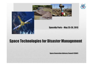
1. Space Technologies for Disaster Management
Space Generation Advisory Council (SGAC)
UNISDR
ESA
UNISDR
SpaceUp Paris – May 25-26, 2013
2. Introduction and Outline
Great potential of Space applications
• What is Disaster Management?
• Which role play Space Technologies?
• The Space Generation Advisory Council (SGAC)
• Conclusions
Space ApplicationsDisaster Management SGAC Conclusion
3. What are Disasters?
Environmental events:
earthquake, volcanic eruption, landslides, drought, cyclone,
floods, wild fire, tsunami, …
… and human-related events: humanitarian crisis, epidemic,
famine or nuclear disaster
• But also long lead events related to climate change and human
activities such as erosion & land cover change, see level rise,
oil spills, building instability…
Space ApplicationsDisaster Management SGAC Conclusion
Astrium
Astrium
Astrium
4. What cost Disasters?
Space ApplicationsDisaster Management SGAC Conclusion
Astrium
Astrium
Direct economic losses in 40 countries as
estimated from national and global loss
databases, 1981–2011
Source: United Nations Global Assessment Report on Disaster Risk Reduction 2013
http://www.preventionweb.net/english/hyogo/gar/2013/en/gar-pdf/GAR2013_EN.pdf
5. What cost Disasters?
Space ApplicationsDisaster Management SGAC Conclusion
Astrium
Astrium
Source: United Nations Global Assessment Report on Disaster Risk Reduction 2013
http://www.preventionweb.net/english/hyogo/gar/2013/en/gar-pdf/GAR2013_EN.pdf
Hazard-related business disruptions: of major
concern and that actually had been experienced
during the last five years
6. What is Disaster Management?
• Disaster Management activities
• do not only cover the disastrous event
but are seen as a cycle
Include long term, long lead-time activities
Involve organizations such as the United Nations (UN-
SPIDER, UNISDR, UNESCO), International Charter,
NGOs, private sector, etc.
Space ApplicationsDisaster Management SGAC Conclusion
Astrium
7. Which role play Space Technologies?
• Navigation: positioning
• Telecommunications: e.g. emergency communications
• Earth Observation: e.g. remote sensing, meteorology
• Science: e.g. atmosphere monitoring, gravity measurement
Space ApplicationsDisaster Management SGAC Conclusion
Astrium
ESA
DLR
8. Which role play Space Technologies?
• Unique capabilities: weather
independent and reliable
measurements
• Synergies with other
technologies (e.g. in-situ, air-
borne)
Space ApplicationsDisaster Management SGAC Conclusion
SRTM-Elevation Model, New Orleans
DLR
9. Beyond Disaster Management…
• Key word of resilience!
• Space technologies are not sufficient…
• Need for a global approach:
• Long term public policies and monitoring strategies
• Synergy of budgets
• ICTs improvement
• Increased role of private actors
• Role of crowdsourcing
Space ApplicationsDisaster Management SGAC Conclusion
10. The SGAC
Space Generation Advisory Council's Vision:
To employ the creativity and vigor of youth in advancing humanity through
the peaceful uses of outer space
SGAC's Goal is...
...to provide access to our members to inject their thoughts, views and opinions on the
direction of international space policy
...to undertake projects on key topics of relevance to international space policy and
our members
...to present the student and young professional viewpoint around the world
...to provide a dynamic forum in which students and young professionals can expand
their knowledge of international space policy issues, build networks and think
creatively about the future direction of humanity’s use of space
Join Us, support Us!
Space ApplicationsDisaster Management SGAC Conclusion
SGAC
SGAC
11. The STDM Project Group
The Space Technologies for Disaster Management Project Group
(STDM) aims at raising awareness about how space technologies
contribute throughout the Disaster Management cycle.
The main objectives of the STDM Project Group are:
• to inform general public about how space-derived information are
valuable in Disaster Management,
• to provide channel for new perspectives for research efforts used in
space disaster management
• to provide an interdisciplinary forum to those who have an interest
in disaster management as well as space activities
Join us on LinkedIn
…. Find us on Facebook
…. Follow us on Twitter : @ STDM_SGAC
Space ApplicationsDisaster Management SGAC Conclusion
12. More Information…
Space Generation Advisory Council (SGAC): http://spacegeneration.org
Space Technologies for Disaster Management Project Group:
http://spacegeneration.org/index.php/activities/current-projects/space-
technologies-for-diaster-mgmt
UNSPIDER: http://www.un-spider.org/
UNISDR: http://www.unisdr.org/
International Charter: http://www.disasterscharter.org/home
PreventionWeb: http://www.preventionweb.net/
International Telecommunications Union (ITU): http://www.itu.int/ITU-
D/emergencytelecoms/
Space ApplicationsDisaster Management SGAC Conclusion