Download to read offline

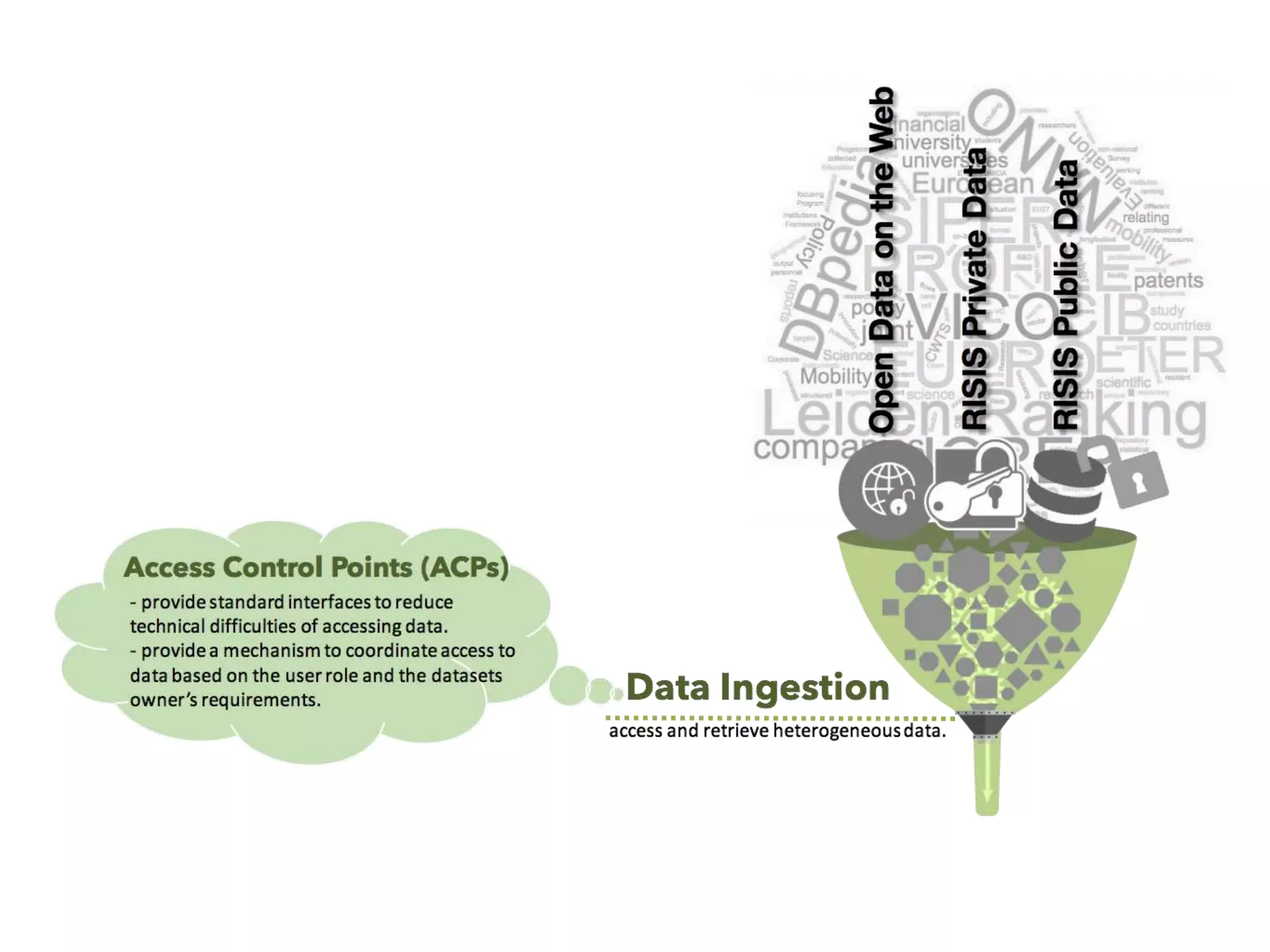
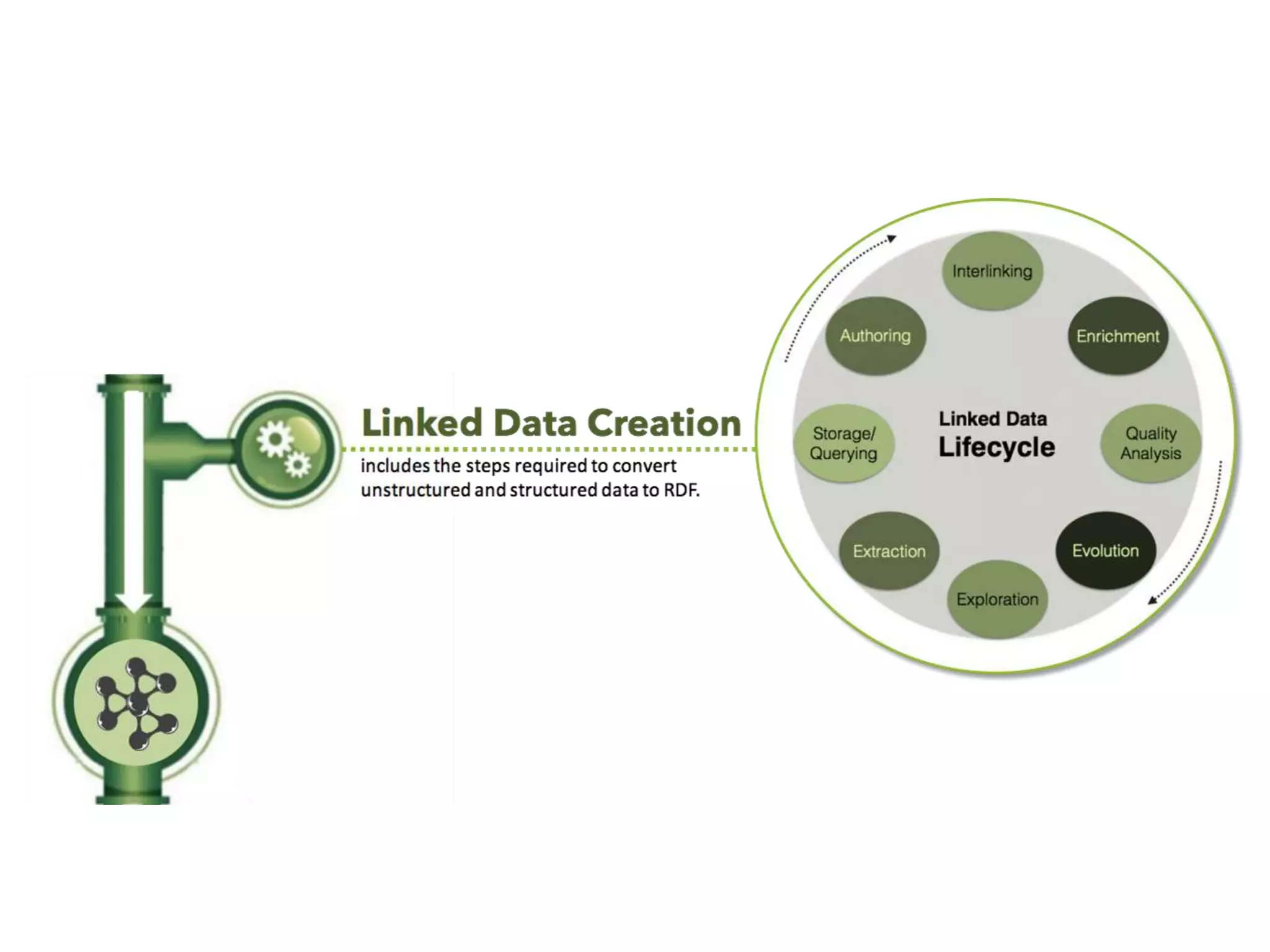
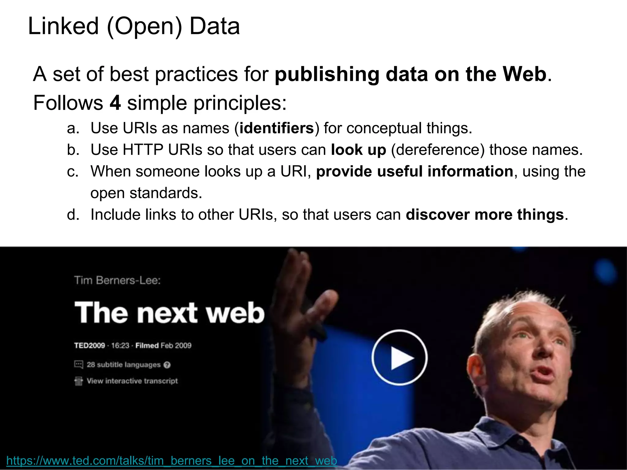
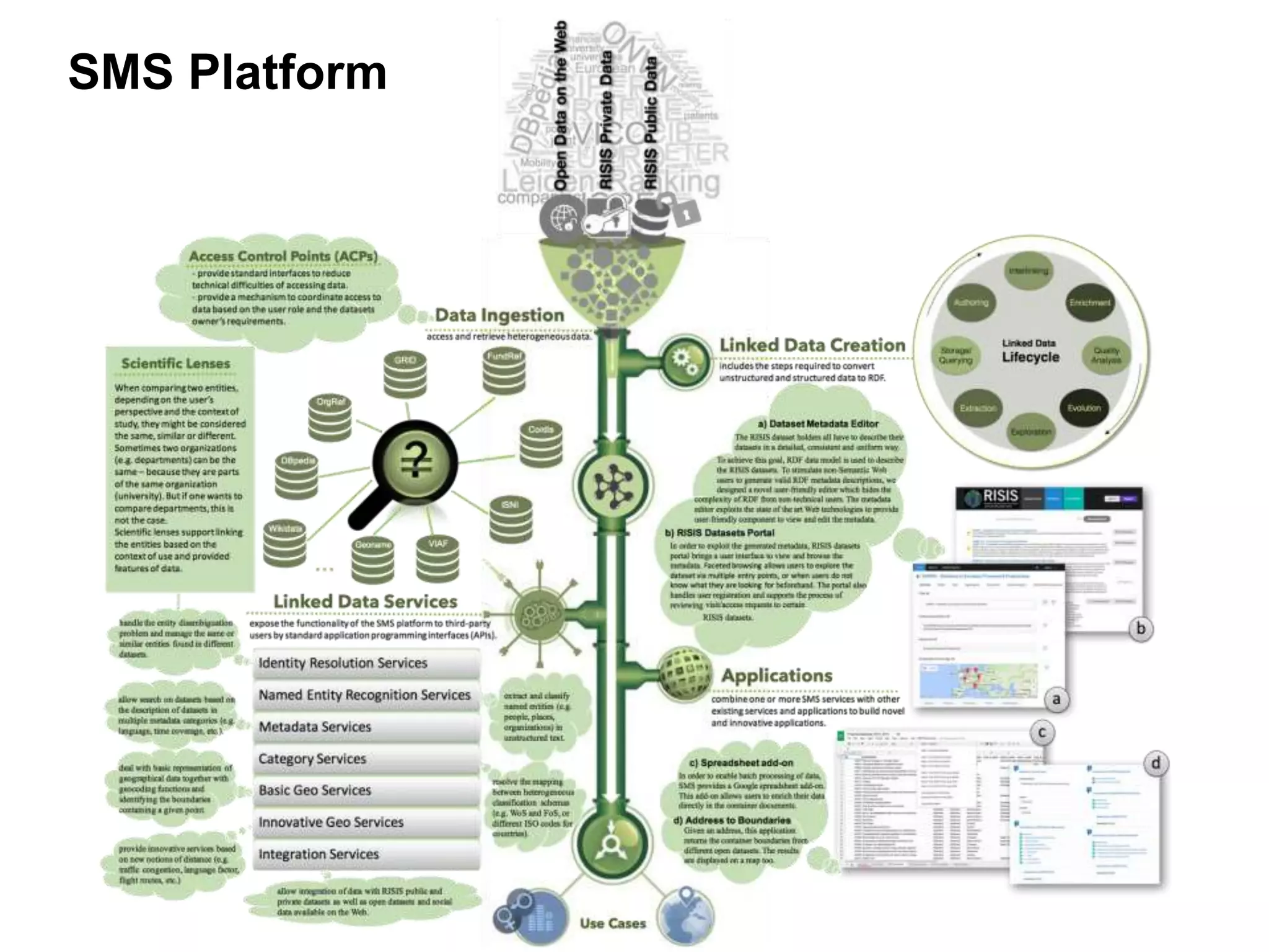
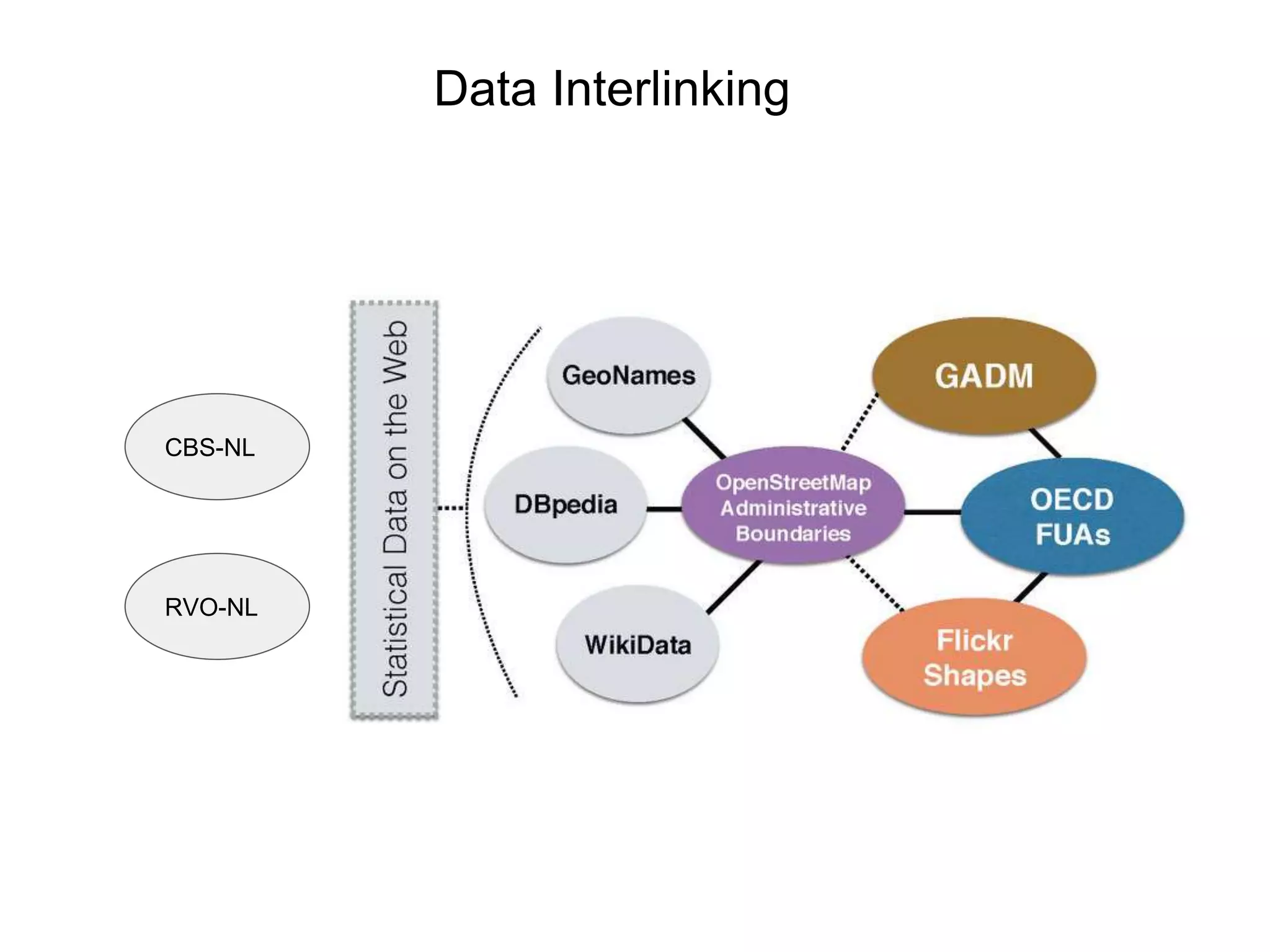
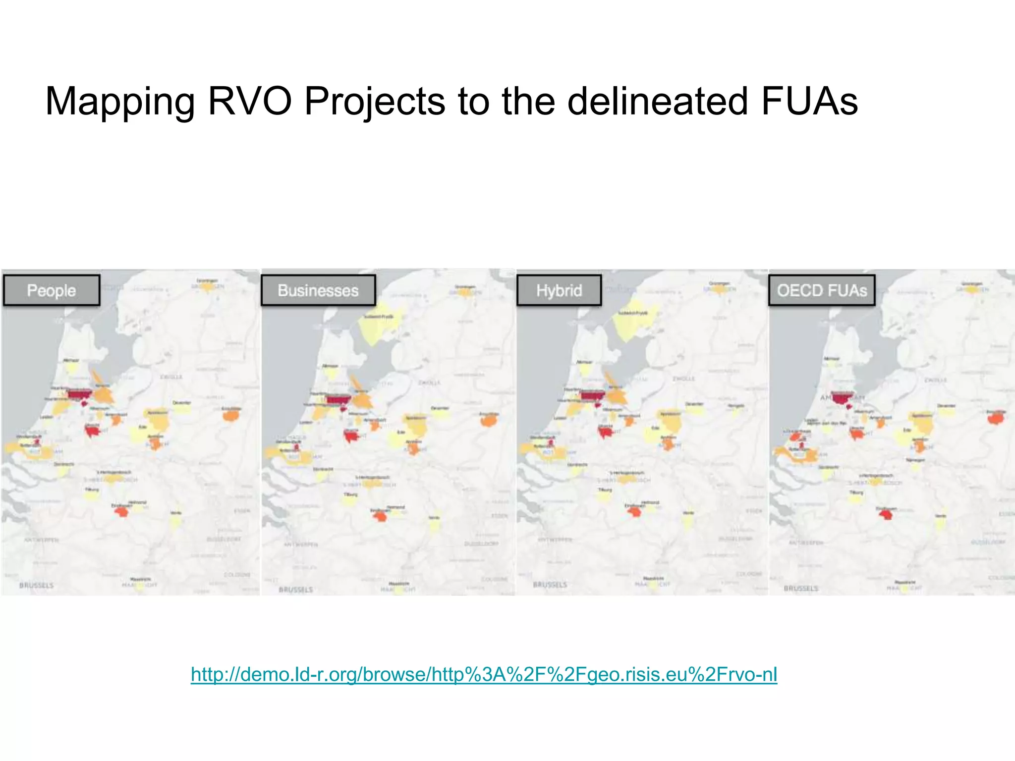

The document discusses the development of the Semantically Mapping Science (SMS) platform, designed to integrate diverse data sources for science and innovation studies. It outlines best practices for publishing linked open data, emphasizing the use of URIs for identification and information retrieval. The SMS platform aims to enhance social research by providing richer data, particularly through the analysis of functional urban areas and their socio-economic impacts on innovation activities.