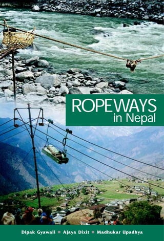
Ropeways in nepal a report by dipak gewali, ajaya dixit and madhukar upadhyaya
•
5 likes•5,671 views

A study report on the prospect of Development of Ropeways in Nepal.

Recommended
More Related Content
What's hot
What's hot (20)
Viewers also liked
Viewers also liked (20)
Similar to Ropeways in nepal a report by dipak gewali, ajaya dixit and madhukar upadhyaya
Similar to Ropeways in nepal a report by dipak gewali, ajaya dixit and madhukar upadhyaya (16)
More from Bhim Upadhyaya
More from Bhim Upadhyaya (20)
Recently uploaded
Recently uploaded (20)
Ropeways in nepal a report by dipak gewali, ajaya dixit and madhukar upadhyaya
- 1. xxiii ROPEWAYS in Nepal
- 2. ROPEWAYS in Nepal Context, Constraints and Co-evolution
- 3. 2004, Nepal Water Conservation Foundation (NWCF) No part of this book may be reproduced without prior permission of NWCF. Permission will generally be given for non-profit educational purposes if the section sought to be reproduced is specific, limited and due acknowledgment is assured in writing. The views expressed in this book are those of the authors alone and do not necessarily reflect those of the publishers and other organizations supporting the work. First Edition: 700 August, 2004 Price: NRs 350/- (Soft cover) Price: NRs 500/- (Hard cover) ISBN: 99933-795-1-4 (Soft cover) ISBN: 99933-795-4-9 (Hard cover) Published by Nepal Water Conservation Foundation Patan Dhoka, Lalitpur Tel: 5528111, 5542354 Email: nwcf@wlink.com.np Web: www.nwcf.org.np P. O. Box 2221, Kathmandu, Nepal With Kathmandu Electric Vehicle Alliance (KEVA) 1103/68 Devkota Marg, Baneswor P. O. Box: 1312, Kathmandu, Nepal Tel: 4467087 Email: KEVA@winrock.org.np Cover photo Crossing the Arun River on a rattan rope taken by Toni Hagen in 1956, and Barpak Ropeway in operation against the background of Barpak village by Bir Bahadur Ghale in 1998. Design and typesetting Nepal Water Conservation Foundation Printed at Format Printing Press, Kathmandu, Nepal
- 4. Dedicated to the memory of Toni Hagen karma bhoomi who made Nepal his karma bhoomi and inspired many 1917 – 2003 (from the visitors’ book at the Bhattedanda Milkway, which Toni Hagen is seen signing in the photograph above)
- 5. iv
- 6. v FOREWORD Some years ago a Thai friend of mine, an economist, was abruptly fired from his job as a newspaper editor in Bangkok. On his way home he met another friend who complained that he was financing the construction of a hotel and didn’t have a project manager. The earlier one had resigned in despair at the problems he faced. My friend immediately offered to take on the task. When asked what technical qualifications he had, he replied that he had none but that he had been educated at Cambridge and that a Renaissance man could turn his hand to anything. He was given the job and built a great hotel. Perhaps the issue of ropeways demands a similar approach, one based on self-confidence and a willingness to accept an unquantifiable challenge. In Nepal, distance from the nearest road is a crucial determinant of development, which suggests that the obvious answer to the need to boost living standard is to build more roads. Yet in a mountainous environment where roads are technically very difficult to build and transaction costs very high, the obvious answer may not be the right one. Perhaps the first step is essentially conceptual: to think in terms of rural access rather than road construction. In March 1996, Dipak Gyawali and Ajaya Dixit published a paper arguing that ropeways could complement roads in Nepal. They provided many detailed supporting calculations. But the most honest and perhaps the most crucial element in the paper was the section which admitted that the only real way to discover whether ropeways would work would be to build one and see. It was on that basis that the British Embassy contributed to the funding for the Barpak Ropeway in an endeavour to take the academic debate forward in a practical way. The lessons learned from Barpak form a part of the wider pool of knowledge assembled in this book, which I hope will, in turn, stimulate the building of more ropeways and the learning of more lessons. L. Barnaby Smith Former British Ambassador to Nepal
- 7. vi
- 8. vii PREFACE This book is being published after an eight-year gestation period. Going through our respective diaries, we have found amusing notes that chronicle the unforeseen shifts in the course of our research. It all began in June 1995, when Bhola Shrestha of ITDG-Nepal* asked Dipak Gyawali and Ajaya Dixit if they were interested in carrying out a study on the future of ropeways in Nepal. The idea of writing a book was not even a seed of imagination at that time; that ambition arose much later. Our main objective then was to figure out if ropeways could improve the load factor of small and isolated micro-hydropower plants (MHPs) and thus help them earn enough money to become economically self-sustaining. Most small hydel plants are idle for much of the day and come to life only for a few hours in the evening to provide electric light. In some cases, the daytime productive load is practically zero; in others, attempts have been made to introduce bakeries, furniture factories and other electricity-consuming enterprises. If MHPs were not to be perpetually propped up by life-support subsidies, we concluded, some innovative ideas had to be forthcoming. One idea we discussed at that meeting was powering small ropeways with electricity generated from MHPs. The emphasis was on the word ‘small,’ for none of us was thinking in terms of the existing Hetauda-Kathmandu Ropeway or the proposed Surkhet-Jumla Ropeway models. We asked a number of questions: Does it even make sense to think along these lines? Are small ropeways feasible? If so, in what kinds of places? Would porters be displaced and made redundant by this new technology? Would ropeways just end up as yet another white elephant requiring eternal subsidies? Thus began a long process of discussions, field trips, meetings, debates, investigations, discoveries and, of course, moments of exuberance followed by days of depression. We began by trying to prepare a conceptual analysis of the context for, and viability of, goods-carrying ropeways in Nepal. After visiting an innovative, functioning ropeway like the Milkway in Bhattedanda (see chapter 8), we would feel elated; when we had to walk through ghost towns like Teku Bhansar or Hetauda stations of the moribund Nepal Ropeway, we would come back totally depressed. When Bir Bahadur Ghale, an entrepreneur from Barpak, came to our office to bang on the table and insist that his village be included in our list of potential pilot project areas, our faith in the creative potential of Nepali villagers increased manifold. When Ajaya broke his leg at Rangrung on the way to Barpak and had to be carried back * ITDG: Intermediate Technology Development Group, a Schumacher-inspired, Prince Charles-patronised, non-profit NGO advocating people-centric technology development.
- 9. viii to the roadhead at Gorkha Bazaar using 20-minutes stretches of relay portering in a thunche, we realised the Herculean odds villagers had to surmount just to survive. ‘What will they have to do to build and sustain a technology as sophisticated as a ropeway?’ we wondered. As our study picked up speed, so did a few crucial events that were to have interesting consequences not only for ropeway but also for hydropower development in Nepal. Our investigations were invigorated by the ethos of local capacity building that fed the campaign against the Arun-3 hydroelectric project, which His Majesty’s Government of Nepal (HMG/N) and its donors pursued so single-mindedly. The thinking about local ropeways was, to this dissident collegium, an extension of that campaign. By mid-August 1995, the World Bank had pulled out of the Arun-3 project and thereby set into motion a chain of other events hithertofore suppressed. A vacuum had been exposed in the country’s power generation scene and there was a need to fill the gap with whatever was available. Alternative projects, including small and medium-scale hydroelectric schemes run by private as well as community efforts, found new openings. At the start of what would soon be a rapidly changing development terrain, we conducted our study and produced a report for ITDG-Nepal.* To the question ‘Do ropeways have any future in Nepal?’ our report boldly said, ‘Yes!’ but only if several conceptual shifts were made. The first was to think of ropeway as short-haul (see Chapter 14 for more about such one- to three-kilometre gaun-besi ropeways) rural ropeways providing access to only the most difficult of climbs or the steepest of valleys. The second and more important conceptual shift was to develop ropeways as an industry born out of the marriage of two well-established industries catering to rural Nepal: MHPs and suspension bridges. Both have built up Nepali capacities significantly and both boast successful track records several decades long. Indeed, in a crude way, it can be said that a ropeway is only a suspension bridge with pulleys and gears suspended on towers similar to those for transmission lines and powered by electricity from a MHP. Our report was presented at the Galyang Ropeways Seminar in Syanja on 17-18 April, 1996. The Seminar brought together an interesting mix of individuals who thought unconventionally and had either worked on or studied ropeways. Many of them ended up writing chapters for this book. Meanwhile, Bikash Pandey, the ITDG-Nepal’s chief at the time and one of the principal advocates of the ‘alternate’ approach to hydropower development left for Berkeley, California, to pursue higher studies and Bhola Shrestha took over as the * Gyawali, G. and Dixit, A., 1996: ‘Ropeways in Nepal: Conceptual Analysis of Context and Viability’, report prepared for ITDG Nepal by GD Associates Interdisciplinary Analysts, Kathmandu, March.
- 10. ix organisation’s chief. Also at this time, Nepal’s premier micro-hydro entrepreneur, Akkal Man Nakarmi, was contacted by a Nepali tourism investor to design a cable car to Hattiban in Kathmandu. Akkal Man, in turn, had requested a programme called Swiss Contact to provide the services of a volunteer expert in ropeway systems. Gottfried Rohrer, who ran a ropeway manufacturing company called Lasso Technik Ag and who had recently handed over the company’s management to his son-in-law, came to help Akkal Man. Unfortunately, it turned out that Rohrer’s expertise was in goods transport, whereas the tourism investor wanted a passenger-carrying cable car. Although Akkal Man could not use the services of Rohrer, Bir Bahadur Ghale took him to Barpak with the idea of exploring the possibility of constructing a goods carrying ropeway between Rangrung and Barpak. Once in Barpak, Rohrer was appalled to find that there were no toilets. He felt that it would be a long time before one could talk of constructing a passenger ropeway in such a ‘primitive’ settlement and instead suggested that an ‘as-good-as-new’ Swiss Army ropeway kept in stock for emergencies could be acquired and installed for as little as three-and-a-half million rupees. Rohrer’s suggestion encouraged both Bhola Shrestha and Bir Bahadur Ghale, who were seeking financing in order to buy a ropeway. Bir Bahadur was already in contact with ITDG-Nepal, which was providing support to the Barpak MHP. He had asked ITDG-Nepal also to help him install a ropeway at Barpak. The ropeway project faced other hurdles too, because rural transport was not in the programme horizon of ITDG-UK and its Nepal office provided support only to electricity end-use programmes. Though such a project was not within the mandate of ITDG-Nepal, Bhola Shrestha agreed to help Bir Bahadur install a ropeway at Barpak in an advisory capacity, arguing that the new technology would use the energy of the MHP during daytime. He suggested that the community of Barpak implement the project when the time came. Later, Bhola helped prepare a proposal for installing a ropeway at Barpak and sent it, along with Dipak and Ajaya’s report, to British Ambassador L. Barnaby Smith. This chain of events had both positive and negative consequences: the good side was that a pilot project was successfully undertaken, while the not-so- happy aspects were the unforeseen lessons that had to be learnt the hard way (see chapters 9 and 10). After reading our report, Barney (as he was popularly known in Kathmandu) called the two of us (Dipak and Ajaya), for discussions. He was convinced of the need to try something innovative if access to Nepal’s hill hinterlands was to be speedily developed. He took the plunge, risking his Ambassador’s Fund and warning the two of us that he held us ‘morally responsible’ for talking him into it (see his foreword, which argues why we should take risks in development).
- 11. x While Bir Bahadur Ghale and Bhola Shrestha were trying to find ways to get a Swiss Army ropeway, they ran into Nepal Yantra Shala’s Shyam Raj Pradhan, who was then working with Karl Mueller, a friend of Toni Hagen. When he was told of the plan for Barpak and the three-and-a-half-million-rupee proposal, Mueller asked for the source of this estimate. Told about Gottfried Rohrer, he said, ‘In Switzerland, a man of that age does not tell lies’. Mueller ended up approaching the Nepal Swiss Friendship Association, which got Hans Aschmann to carry out the mission of inspecting the ropeline in question. All these doings reached the ears of Toni Hagen. In the true Swiss style of substantive (rather than procedural) efficiency, he simply landed in Kathmandu in April 1997 with a copy of the shipping documents for a Swiss Army ropeway auctioned for twenty-five thousand Swiss francs (1 Re = 10 SFr). Because the money for the ropeway had already been secured, the problem now was to get the equipment shipped to Barpak in hot haste! The Barpak initiative seemed to enthuse Toni Hagen so much that he suggested importing 10 smaller unused Swiss Army ropeways to Nepal at a total cost of Rs 25 million. Toni Hagen, Bhola Shrestha and Bir Bahadur Ghale had approached Swiss Development Corporation (SDC) for help. The SDC bureaucrats, however, were too reticent to support such a pioneering enterprise. As a result, we decided that no matter what happened with the Barpak experiment, we had to document the process as a lesson for future Nepali entrepreneurs. That was when we decided that we would bring out a book about this experience and all other experiences till Galyang and afterwards. The book has fourteen chapters grouped into three parts, many of which were written by those who had gathered in Galyang and a few by others with whom we came into contact later. Part I discusses background issues as well as the policy context. Toni Hagen, excited by the alternative entrepreneurship he saw, contributed a chapter. He shows how Nepal, with its exclusive focus on roads rather than ropeways in low-traffic hilly terrain, took a wrong turn in transportation development. Switzerland, on the other hand, had opted to complement arterial highways with many ropeways branching out from them. He describes how the area near Lake Lucerne, which is similar to Kathmandu Valley, is served by many cable cars and ropeways and points out with regret that Kathmandu has none. He also provided the photograph he took in the Arun Valley in 1956 of a villager crossing the Arun River in a wicker basket sliding along a non-metallic, organic rope. This image is on the cover of our book. The montage photo is of the Barpak Ropeway whose construction he contributed to. The 1956 picture is a traditional Nepali ropeway which later served as an inspiration for improved steel cable ghirlings (see Chapter 12). Because
- 12. xi of his commitment to ropeways and Nepal’s development for half a century, we have dedicated this book to his memory. In the second chapter, Surendra Lal Shrestha draws upon his many years of experience in the National Planning Commission (NPC) to summarise the role ropeways have played (or not played) in the conceptual horizon of Nepal’s development managers. He shows that the institutional gap, which prevented the spread of ropeway technology, stemmed from the bureaucratic proclivity for building roads and only roads and from the failure of local district governments to take up creative initiatives. The third chapter, by Urmila Shimkhada and Drona Upadhyaya, is an attempt to summarise the key findings of all the ropeway studies conducted in the past that they were able to lay their hands on. It may not be exhaustive, but it is our hope that future researchers and entrepreneurs can begin with this book confident that they will not need to search for other endeavours not described in its pages. The second part consists of nine case studies of various ropeways in Nepal. Before they are discussed, in the fourth chapter Madhukar Upadhya and Kirtan Ram Bhandary introduce the technical aspects of a ropeway. This chapter is aimed at introducing the technicalities of ropeways to potential investors who wish to get a quick grasp of the artefact’s basics: for specific details, they can consult specialised writings. This chapter is the outcome of our own attempt to make sense of different terminologies and conflicting details. Like this book itself, it started as an attempt to provide a glossary of technical terms but ended up becoming a full-fledged chapter. Upadhya and Bhandary describe the technology which was introduced to Nepal during the reign of Chandra Shamsher in the 1920s and later in the 1960s by USAID. Our hope with this chapter is that it will obviate the need for potential investors to run from pillar to post and even the Alps, as some of us did in the 1990s, searching for basic information of what building a ropeway entails. In the fifth chapter, Shyam Sundar Shrestha describes the problems faced by the institution that inherited and maintained the oldest ropeway in Nepal, the Nepal Ropeway. He shows how the lack of policy commitment to replace imported fossil fuel with local hydro energy as well as the absence of attendant institutional support contributed to its slow death. In sharp contrast, Resham Raj Dhakal’s chapter describes the cost effectiveness and success of temporary construction ropeways, which obviate the need to build expensive roads that won’t be used after a project has been completed. In a similar vein, Ganesh Kumar Singh describes how the cement factory in Hetauda has successfully used ropeways. He explores the importance of a ‘maintenance culture’ as well as the unique problems faced in integrating ropeway operation with industrial production.
- 13. xii In Chapter 8 Madhukar Upadhya describes the Bhattedanda Milkway. This unique project has had its share of successes as well as institutional failures. The Milkway had just been commissioned when our first meeting at ITDG-Nepal took place and, as is the case with all externally-induced development, those involved in its promotion had little idea of the social consequences of its operation and maintenance. The results, from commissioning success to institutional breakdown to revitalisation, were yet to be lived through. The experience has been recorded and analysed in this chapter. Chapters 9 and 10 document the experience in Barpak from two perspectives. Bir Bahadur Ghale provides the testimony of a Nepali entrepreneur’s encounter with ropeways. His account brings forth a grassroots perspective as well as his personal touch of commitment to his village and society. His account was translated into English from Nepali. Bhola Shrestha brings forth the perspective of an engineer who took on the role of a development catalyst. He shows how calculations of technical and economic feasibility do not effortlessly dovetail into institutional feasibility during either construction or operation. We were impressed with the leadership and charisma of Bir Bahadur Ghale from the moment he showed up unexpectedly in our office as we were preparing the ITDG report. He had somehow got wind of the fact that we were going to recommend prospective sites for a pilot project and had come to lobby for Barpak. We were impressed with his forceful views, and we recommended Barpak as a premier pilot site because of the existing MHP and the strong community base. Several years later, when the Barpak Ropeway was in full swing, we asked his fellow villagers how Bir Bahadur was faring, and the answer was: ‘He is busy minting money!’ (U ta note chhapya chhapai chha, sir!). Then, in May 1999, tragedy struck in the form of both an accident and the washing away of the lower station by a catastrophic flood in the Rangrung River. What is exceptional about Bir Bahadur is his invincibility and indefatigability: a bit wiser after his pilot project experience, he is now engaged in re-establishing the Barpak Ropeway as well as expanding the capacity of his MHP. Chapter 11 is also an entrepreneur’s account, but one by a sophisticated urban scion of a national business house, not by a village entrepreneur. Rajesh Babu Shrestha’s account of the difficulties he faced in establishing the popular Manakamana Cable Car shows how a rent-seeking bureaucratic culture discourages Nepal’s risk takers from investing their money even when profit stares them in the face. Chapter 12 by Ajaya Dixit and Madhukar Upadhya is an attempt to bring to salience a Nepali transport technology that has remained in the shadows of development discourse. This preliminary examination of ghirling shows how the indigenised ropeway served as a common mode of transport in the hills. The challenge is to improve the comfort,
- 14. xiii safety and reliability of a ghirling. The last two chapters of Part III attempt to take stock of where the industry stands. Dale Nafziger, with his long years of work with the United Mission to Nepal (UMN), sounds a cautionary note, but he concludes by saying that visionary individuals need to take calculated risks to provide the evidence that proves or disproves that ropeway technology can be an agent of rural transformation. Finally in Chapter 14 Dipak Gyawali and Ajaya Dixit describe how ropeways can complement roads in rural transportation and discuss the seven sins that need to be avoided if ropeway technology is to grow roots in Nepal. This book would not have been possible without the immense support we as editors have received from many from the start, during its long gestation period, and right up to the finish. All the participants of the Galyang seminar and the many who agreed to be authors had to put up with the slow process that publishing a book, unlike writing a consultancy report, entails. They have exhibited the patience of angels. Special sraddha suman goes to the late Ganesh Bahadur Gurung, a retired Gorkha soldier from Simjung, who was there with his first-aid kit when Ajaya Dixit broke his leg on the way to Barpak. The Gorkha-based staff of Rural Self-reliance Development Center, too, provided help and support at a critical time. The staff of the Bagmati Watershed Project must also be thanked for their enthusiasm and dedication in the construction and maintenance of the Bhattedanda Milkway. The late Gerold Muller need special mention as does Ganesh Pathak, who continues to provide technical support for its maintenance. Chandra Bahadur Dulal and villagers of Bhattedanda and Ikudol have served as inspiration for us; it is their commitment to this alternate mode of transport development that goaded us, as editors, to see the book through. We also thank the Ford Foundation, New Delhi and International Development Research Centre (IDRC), New Delhi for their support to the Nepal Water Conservation Foundation (NWCF). Their institutional support for other water-related research gave us the base that allowed us to pursue doggedly over the years many ideas examine in this book. The support from people with their hearts in the right places helped us see the book through the critical final stages of editing and publishing. Bikash Pandey, Ratna Sansar Shrestha, Suman Basnet and Bibek Chapagain at Winrock International Nepal were helpful in providing the resources to print the book. We also acknowledge the help provided by Binod Devkota, Bhim Ghotane, Narendra Nyachho, Dayananda Bajracharya, Dinesh Bhuju, Gyani Shakya, Shiva Basnet, Pratibha Manaen, Susan Ghimire, Surendra Pradhan, Pramod Amatya, Maya Nath Bhattarai, Shiva Bisangkhe Ramesh Chaudhary, Aarjan Dixit, Jayendra Rimal, Dhruba Raj Regmi, Murali Gopal Ranjitkar, and David Sowerwine. Monica Hagen, daughter of Toni Hagen, helped us with names and data related to Switzerland when her father was incapacitated and
- 15. xiv subsequently after he passed away. Kanchan Mani Dixit, Narayan Adhikari, Ganga Shrestha, Geeta Bhomi, Sunita Munankarmi and Chandika Dhital provided crucial support in the production process. We deeply appreciate Perry Thapa for her help. None of those mentioned above, individuals or institutions, are, however, responsible for any error in the book. They are ours, and ours alone. Dipak Gyawali, Ajaya Dixit and Madhukar Upadhya Patan Dhoka, Lalitpur, Nepal. August, 2004
- 16. CONTENTS Foreword v Preface vii Part I: Policy Context 1-53 1. Ropeways and Tourism: Toni Hagen 3-19 Swiss Experience and Lessons for Nepal 2. State Promotion of Ropeways: Moving Surendra Lal Shrestha 21-32 from Stagnation to Change in Nepal's Policy Environment 3. The Study of Ropeways: Urmila Shimkhada 33-53 A Review of Past Efforts and Drona Upadhyaya Part II: Case Studies 55-206 4. Understanding the Madhukar Upadhya 57-70 Technicalities of Ropeways and Kirtan Ram Bhandary 5. A Pioneer Falters: Shyam Sundar Shrestha 71-83 The Status of the Nepal Ropeway 6. Construction Ropeways in Nepal Resham Raj Dhakal 85-96 7. Industrial Ropeway at Hetauda Ganesh Kumar Singh 97-106 Cement Factory 8. Bhattedanda Milkway: Making Markets Madhukar Upadhya 107-142 Accessible to Marginalised Farmers 9. Barpak Experience: An Entrepreneur’s Bir Bahadur Ghale 143-155 Testimony 10. Building Barpak’s Community Ropeway: Bhola Shrestha 157-174 An Engineer’s Experience with Low-cost Goods Transport in the Hills 11. Manakamana Cable Car: Rajesh Babu Shrestha 175-183 Path Breaking Step in Promoting Domestic Tourism 12. The Ghirling: Arrested Development Ajaya Dixit and 185-206 of Nepal's River Crossing Technology Madhukar Upadhya Part III: Conceptual Reflections 207-250 13. Galyang Goals: A Synopsis of the Generic Ropeway Beast Dale Lee Nafziger 209-213 14. Gaun-Besi Ropeways: Dipak Gyawali and 215-250 An Alternative Future? Ajaya Dixit Annexes 251-258 Index 259-264 Photo Credits and Sources 265
- 17. xvi TABLES Table 1.1: Aerial ropeways registered by the SFFSO as of 1997 8 Table 1.2: Small cargo-cum-passenger aerial ropeways licensed by cantons 10 Table 1.3: Rigi Mountain: some facts 11 Table 1.4: Tourists transported by the three types of ropeways 14 Table 1.5: Cogwheel railways, cableways and aerial ropeways in the Lucerne Lake area 15 Table 1.6: Fashionable hill resorts without road connections 15 Table 2.1: Populations and their political representation by geographical region 21 Table 2.2: Fifty years of transport infrastructure development 23 Table 2.3: Public sector outlay on different development sectors under periodic plans 23 Table 2.4: Expenditure incurred in the development of transport infrastructure from 1975 to 2000 24 Table 2.5: Development of roads by type after 1990 26 Table 3.1: Demand for the transport of goods between Chatara and Bhojpur 37 Table 3.2: Net benefit and present worth of the Chatara-Bhojpur Ropeway 38 Table 3.3: Forecast of goods to be transported along the Hetauda-Kathmandu corridor 39 Table 3.4: Hetauda-Kathmandu Ropeway traffic and operating costs 1970-1975 39 Table 3.5: Flow of vehicles into and out of Kathmandu in 1992 41 Table 3.6: Financial viability of the Hetauda-Kathmandu Cable Car project 42 Table 3.7: Number of people visiting Manakamana as estimated in 1988 44 Table 3.8: Expected growth in the number of passengers to Manakamana 46 Table 3.9: Financial viability of the proposed Khaireni-Manakamana ropeway 47 Table 3.10: Comparative costs of different modes of transportation between Surkhet and Jumla 52 Table 4.1: Types of ropeways used in Nepal 66 Table 5.1: Income and expenditure account for 1972/73 79 Table 5.2: Income and expenditure accounts for 1991/92 to 1995/96 79 Table 5.3: Details of goods transported by the NR 80 Table 5.4: Transportation of goods from fiscal year 1975/76 to 1995/96 80 Table 6.1: Salient features of Himal Hydro's ropeways 92 Table 6.2: Comparing ropeways with roads 94 Table 8.1: Goods transported by the Milkway 119 Table 8.2: Income and expenditure of the milkway 120 Table 8.3: Goods carried and cash earned by Milkway 135 Table 10.1: Comparison of a road and a ropeway between Rangrung and Barpak 164 Table 10.2: Construction cost of the Barpak Ropeway 165
- 18. xvii Table 10.3: Income from the Barpak Ropeway 166 Table 14.1: Comparison of energy consumption and CO2 emissions between roads and railways for passenger and freight transport 229 Table 14.2: Cost of constructing and maintaining hill roads in Nepal 231 Table 14.3: Road tax collected 233 Table 14.4: Generating internal resources for replacing petroleum with indigenous hydropower 246 ANNEXES A: Comparison of cost efficiencies of Khimti Ropeway with an equivalent road 253 B: System information: Hetauda Cement Ropeway 255 C: System information: Bhattedanda Milkway 256 D: System information: Barpak Ropeway 257 E: System information: Manakamana Cable Car 258 F: Initial financial projection: Manakamana Cable Car 258
- 19. xviii FIGURES Figure 1.1: Ropeway density in the Ticino/Maggia Valley 10 Figure 1.2: Ropeways around Lake Lucerne 13 Figure 2.1: Road network in Nepal 26 Figure 3.1: Location of ropeways studied 34 Figure 4.1: Constructions of ropes 58 Figure 4.2: Lays of ropes 59 Figure 4.3: Ropeway carrier 59 Figure 4.4: Ropeway's tower with accessories 61 Figure 4.5: Bi-cable ropeway system 63 Figure 4.6: Mono-cable ropeway system 64 Figure 4.7: Drum-type non-circulating bi-cable ropeway system 65 Figure 4.8: Looped non-circulating bi-cable ropeway system 65 Figure 4.9: Gravity ropeways 67 Figure 4.10: Cable crane 68 Figure 5.1: Alignment and profile of the Hetauda-Kathmandu Ropeway 76 Figure 5.2: Load carried 81 Figure 5.3: Organogram position of the NR within MoWT 82 Figure 6.1: Profile of Andhi Khola Ropeway 88 Figure 6.2: Profile of Jhimruk Ropeway 89 Figure 6.3: Profile of Khimti Ropeway 91 Figure 7.1: Profile of ropeway from loading to unloading stations 99 Figure 7.2: Loading station at Hetauda Cement Factory 100 Figure 8.1: Map of Lalitpur District 108 Figure 8.2: Khuwa producing areas of Lalitpur District 110 Figure 8.3: Milk producers isolated from the market by valleys: A conceptual scheme of economic gradient in South Lalitpur 112 Figure 8.4: Correcting economic gradient: short-haul ropeways provide access to markets and favour farmers deep in the hinterlands 113 Figure 8.5: Comparison between returns from milk and khuwa at different fat contents 115 Figure 8.6: The Milkway’s longitudinal profile 116 Figure 8.7: Load carried by the Milkway 120 Figure 8.8: Income and expenditure of the Milkway 121 Figure 10.1: Barpak in Gorkha District 163 Figure 12.1: A khit-khite 193 Figure 12.2: Improved carriage 200 Figure 12.3: A perspective view of the NFFB system 201 Figure 12.4: Proposed auto wire bridge 203
- 20. xix ACRONYMS ACAP Annapurna Conservation Area Project ADBN Agriculture Development Bank of Nepal AECP Alternative Energy Promotion Centre AHREP Andhi Khola Hydro and Rural Electrification Project ATCHA Association for Technical Cooperation to the Himalayan Areas BBLL Bridge Building at Local Level BIWMP Bagmati Integrated Watershed Management Programme BPC Butwal Power Company BRECO British Engineering Co., Ltd. BWP Bagmati Watershed Project BYS Balaju Yantra Shala CB Community bridge CEDA Centre for Economic Development and Administration CGI Corrugated Galvanised Iron CPN Communist Party of Nepal DAO District Administration Office DC Dairy Development Corporation DDC District Development Committee DoLIDAR Department of Local Infrastructure Development and Agriculture Road DoR Department of Roads DWIDP Department of Water Induced Disaster Prevention EIA Environmental Impact Assessment ESC Economic Services Centre ESCAP Economic and Social Commission for Asia and the Pacific EU European Union FAO Food and Agriculture Organisation FC Fibre core GTZ German Technical Cooperation, Nepal HMG/N His Majesty’s Government of Nepal ICIMOD International Centre for Integrated Mountain Development IDA Interdisciplinary Analysts INGO International Non-governmental Organisation INPS Integrated Nepal Power System IOE Institute of Engineering IRR Internal rate of return ITDG Intermediate Technology Development Group IWRC Independent wire rope core
- 21. xx KAAA BGN Kadoorie Agricultural Aid Association British Gurkha Nepal KE Khawa Engineering KEVA Kathmandu Electric Vehicle Alliance KLDP Karnali Local Development Programme KMI Kathmandu Metal Industries KMTNC King Mahendra Trust for Nature Conservation kW Kilo Watt LSTB Long span trail bridge MBL Maximum Breaking Load MHP Micro-hydropower Plant MLD Ministry of Local Development MoF Ministry of Finance MoFSC Ministry of Forest and Soil Conservation MoWT Ministry of Works and Transport MP Members of Parliament MPPU Multipurpose power unit NC Nepali Congress NEWAH Nepal Water for Health NFFB Natural force ferry boat NGDG Northern Gorkha Development Group NGO Non-governmental organisation NOMPL Nepal Orind Magnesite P. Ltd. NPC National Planning Commission NR Nepal Ropeway NRSL Nepal Ropeways System Ltd. NTC Nepal Transportation Corporation NWCF Nepal Water Conservation Foundation OECD Organisation for Economic Cooperation and Development PF Pressure frame RADC Remote Area Development Committee RCC Ropeway Construction Committee RCUP Resource Conservation and Utilization Project RMC Ropeway Management Committee ROC Ropeway Operating Committee RONAST Royal Nepal Academy of Science and Technology RUC Ropeway User’s Committee SBD Suspension Bridge Division SinKaLaMa Sindhupalchok, Kavrepalanchok, Lalitpur and Makawanpur Integrated Rural Development Project SFFSO Swiss Federal Flight Security Office SNF Solid-not-fat
- 22. xxi SNV Netherlands Volunteer Agency SBB Swiss Federal Railways STOL Short take off and landing TBSSP Trail Bridge Sub-sector Project TRD Track rope divide ULS Unloading station UML United Marxist-Leninist UNDP United Nations Development Programme UNIDO United Nations Industrial Development Organisation USAID United States Agency for International Development USOM United States Organisation Mission VCS Vikash Consultancy Services VDC Village Development Committee WSC Wire strand core
- 23. PART I Policy Context
- 24. C H A P T E R Ropeways and Tourism: Swiss Experience and Lessons for Nepal TONI HAGEN MIXED TRANSPORTATION DEVELOPMENT IN SWITZERLAND After obtaining independence from colonial rule, most developing countries embarked on a single-focus programme of road building and have continued such programmes today without considering better options and more economic alternatives. Switzerland, on the other hand, modernised its transportation system using a mix of railways, roads and ropeways. Its balanced policy fostered the development of a judicious blend of transport technologies suitable to specific areas in the Swiss Alps and meeting economic requirements. With government support a robust ropeway industry flourished. In rugged mountainous terrain, the advantages of ropeways over other means of transport are many. First, they are much cheaper to build, operate and maintain than roads. In addition, they cause negligible harm to the environment. They need much less space than motorable roads and there is no need for parking places. In fact, except for the foundations and supporting steel towers, ropeways do not require much construction work on the ground at all. Since very little earth is moved, mountain slopes are not destabilised as they are when road alignments are excavated. While roads are ugly gashes cut into mountain slopes, ropeways do not mar nature’s beauty. Ropeways, unlike hill roads, do not trigger landslides, nor are they as vulnerable to floods and cloudbursts. They have no expensive bridges to be periodically rebuilt after they are washed away. Because they can be powered by hydroelectricity—a resource abundant in the mountains if a government promotes local investment in decentralised hydropower plants—ropeways do not pollute the air as motor vehicles do. And, critically important for tourism, ropeways are silent.
- 25. 4 Hagen, T. The Swiss Alps have historically been a formidable barrier to transport. The building of trails across the mountains to facilitate the transport of pack animals started in the 13th century, when Swiss democracy began, although some trails must have existed much earlier, in Roman times. Hannibal, for example, on his way to conquer Rome from the north, started from Carthage and reached the Alps via Gibraltar. His army and elephants crossed three high mountain passes in what is today Switzerland. In the 18th century some of the ancient transit routes, including the famous Gotthard Horse Coach Road, used by horse-drawn passenger coaches were upgraded to roads. These primitive roads were improved to motorable standards only at the beginning of the 20th century. Even then, the government of the Canton of Grison thought motorcars were too noisy, too dangerous and too polluting and banned them until 1926. At that time, road construction and maintenance was basically the decentralised responsibility of Swiss cantons and municipalities. It was only in the 1960s, when Switzerland decided to construct a modern national highway system, that the federal government became involved in road building in more ways than just paying subsidies. Among other activities, it set nation-wide standards and specifications, passed laws and regulations to ensure the compatibility of road plans with environmental concerns, issued tenders for private construction companies to do the work and checked the quality and standard of the results. Since then, the federal government has covered up to 90 per cent of the cost of constructing highways, while respective cantons pay the rest. Funding for the national highway system is generated through a special tax on the retail price of gasoline and diesel amounting to over half of that price. From 1961 till 2001 Switzerland spent 60.445 billion Swiss francs (US$ 43.175 billion at today’s rate of 1.39 SFr to one US$) to build, maintain and operate a highway grid of 1,673 kilometres; the cost per kilometre was roughly US$ 25.8 million. As of 2001, Switzerland had also built 51,357 kilometres of village roads and 18,115 kilometres of urban roads at the respective costs of US$ 0.36 and US$ 1.2 million per kilometre. Switzerland’s road system is probably the densest of any mountain country in the world. Its achievement is the result of full decentralisation and of participation by authorities as well as people at all levels. Railway construction began in the mid-19th century at the initiative of several private enterprises. In 1847 the Spanisch Brotli Bahn, the first railway in Switzerland, started running from Zurich to Baden. The name derived from the high society of Zurich, for whom the train brought sweets from a well-known bakery in Baden on Sundays. Another important railway of the Gotthard was built in 1869. The total length of track in 1855 was just 210 kilometres, but it was extended to 17,727 kilometres in just 15 years. The Vitznau-Rigi train, the first mountain railway in Europe, was opened in 1871. The Pilatus Railway, which runs from Alpnachstad—a town readily
- 26. Ropeways and Tourism 5 accessible from Lucerne by boat, train or road—to Pilatus Kulm at an elevation of 1,838 metres was opened in 1889. It used steam engines, at first, then converted to electricity in 1937 because the cogwheel system used before that was unable to provide protection against slippage at the extreme gradient of nearly 1:2. Because of the steep angle of carriage, a special system with a vertical toothed gearwheel, together with a transverse boiler for the engine, was devised. Reaching a maximum gradient of 48 per cent, the Pilatus is still the steepest rack railway in the world. Construction of the Jungfrau-Bahn, whose designation is Jungfraujoch, started in 1896 and was completed in 1912. Attaining a height of 3,300 metres, it is the highest railway in Europe. Most of the line (where the steepest gradient is 1:4) employs a rack system with overhead trolleys, but there is also a short section (of gradient 1:14) which uses an ordinary or adhesive system. A connection between Weggis and Rigi was opened in 1968. To complement these private endeavours, Swiss Federal Railways, SBB, was established in 1902. In order to expand train services to remote and poor areas, SSB merged several major Swiss railway systems which had been nationalised in 1897. These routes produced little or no profit for the private sector and needed cross-subsidisation through government intervention. All tourist railways, as well as some smaller lines and mountain railways, have remained private. The drive for railway construction reached its peak in 1882, when the Gotthard Transit Route was built through the Alps. This 19-kilometre-long tunnel was the longest in the world until the recent opening of the Channel Tunnel between France and England. It was a masterpiece of tunnel engineering, which used labour-intensive construction techniques rather than the drilling rigs and other heavy equipment available at that time. Furthermore, the alignment of the Gotthard Railway, with its several loops and tunnels on both sides of the Gotthard River was extraordinarily farsighted. The same alignment is still in use today and allows trains of up to 800 tonnes—the heaviest in the world—to be towed by the most powerful electric locomotives in the world at a speed of 80 kilometres per hour. The line climbs from 400 metres at Erstfeld to 1100 metres at the entrance of the tunnel at Goschenen and then descends to 200 metres on the southern side. For access to the most rugged and remote mountain areas, however, the construction of railways and roads proved to be too difficult and costly. Ropeways, it turned out, were a cheaper and more convenient alternative. They were to play a very important role even before steam and combustion engines were invented or electric power was made available. Motorcars did not ply Switzerland’s roads until the 1920s and the boom in road building began only after the end of the Second World War. In contrast, the first boom in ropeways establishment in Switzerland took place in the 19th century; these ropeway routes have only partly been replaced by
- 27. 6 Hagen, T. motorable roads and, in the last few decades, by helicopters. When the potential of Switzerland for tourism was discovered in the middle of the 19th century, ropeways of all kinds and sizes enjoyed an unparalleled boom. SWISS ROPEWAY SYSTEMS Ropeway systems exist in different parts of the world and different definitions are found in many different languages. In order to clarify terminology and to prevent misinterpretation or misunderstanding, the definitions in use in Switzerland are elucidated below. There are two main types of ropeway systems: 1. Cable cars, and 2. Aerial ropeways, which, in turn, are further classified into two types: a. Circulating mono-rope aerial ropeways, each with a single endless steel rope which carries and drives loads at the same time. b. Commuting bi-rope aerial ropeways with one strong steel rope for carrying loads and a second one for providing traction on loads. Cable cars: These are essentially railway cars that are towed along a rail track on the ground using a steel cable which is powered at a hill station. A car is attached to each end of the cable, and both cars run simultaneously, one up and the other down, crossing each other halfway in between. Simple cable cars have been built in considerable number, not only in tourist areas but also in towns situated in hilly areas. In Lausanne, for example, cable cars carry passengers from the harbour on the lake to the centre of the town, and, in Zurich, from the city centre up to the university quarters. In St. Gallen, a cable car which was run by gravity once operated from the city centre to the elevated parts of the town. Making use of the country’s abundant water resources, cars were equipped with tanks which could be filled with water from a nearby brook to make the downhill run. The tide of electrification that swept across Switzerland after 1930 eliminated steam traction from the mountains. Electric motors replaced steam locomotives and gravity because it took too long to fill up tanks and because the passenger carrying capacity had to be increased. The basic engineering advantage of cable cars on steep terrain is that, unlike roads, which need a long serpentine gradient, tracks can be built straight from the valley bottom to the hilltop. Simple cable cars are by no means obsolete. While it is true that new cable cars are not being built due to the prohibitively high cost of right-of- way clearance, which requires the demolition of existing buildings, very old cable cars are being renewed and upgraded in modern Swiss towns. It is unthinkable to many Swiss people that roads will replace city cable cars.
- 28. Ropeways and Tourism 7 Aerial ropeways: Aerial ropeways, or sky rails, transport goods and passengers suspended on steel ropes through the air. Six kinds of aerial ropeways are in use in Switzerland: 1. Gravity-driven, one-way, mono-rope aerial ropeways: These have only one carrying steel rope, which stretches in a single span from an elevated point down to the terminal. There is no pulling rope since gravity acts as the driving force. These ropeways do not have any brakes. These are the simplest and most primitive ropeways and can obviously be used only for downhill cargo transport. Local farmers built them to transport timber and bales of hay. Government permission is not needed to build one though the Swiss Federal Flight Security Office (SFFSO) has to be informed. 2. Commuting two-way, bi-rope aerial ropeways: These ropeways have a strong steel track rope and a separate traction rope. In this system, tanks are filled with water to artificially increase the force of gravity for the downhill run and then are emptied for the uphill run. The difference in the weights of the two ends of the steel rope lifts the cargo upwards. Many of these systems have now been upgraded and electric motors or combustion engines have been added as power sources. 3. Circulating, mono-rope, open-air, multi-seater aerial ropeways (chair lifts): This third type of aerial ropeway has chairs or benches with up to four seats, each suspended on a steel rope driven in a loop. The chairs, which are fastened to the rope using a gripping mechanism, may be independently disconnected from the rope and transferred to a separate suspended rail at terminal points for embarking and disembarking. A ride in such an open-air chair lift is a fascinating experience for lovers of nature; it is a smooth and totally silent gliding over a landscape of forests, jungles, rivers, villages, pastureland and rocks. The panoramic view that unfolds as one gains altitude is overwhelmingly spectacular. 4. Circulating, mono-rope, mini-cabin aerial ropeways: These ropeways are a further development of open-air chair lifts; they provide seats for four to six passengers per cabin. The mini cabins are detachable from the main carrying-cum- driving steel rope and come to an almost complete standstill to make it easy for passengers to get on and off. While an open-air ride is an unmatched delight, mini-cabins are very convenient in winter, in generally cold climates or at higher altitudes. 5. Mono-cable tow-lifts, or ground ski lifts: These are driven by a continuous steel rope mounted on two large driving wheels with vertical axes, one at the
- 29. 8 Hagen, T. bottom and the other at the top station of the ski lift. The wheel at the bottom station is powered by electric motors. Skiers standing their own skis hold onto small individual steel ropes fixed to the main rope and are towed upward. Tow-lifts fall between cable cars, in which the load carried is dragged along the ground, and aerial ropeways, in which the load is suspended on cables in the air. If the distance between the lower and the upper terminal is too long, small towers between the main terminal stations support the driving steel rope. With this simple system, skiers can enjoy sliding downhill without tiring themselves by trudging up slopes. Small loads can also be suspended on the driving steel rope and transported up or downhill. Because simple tow lifts are often uncomfortable and have limited capacity, they are gradually being replaced by open-air chair lifts, which have the additional advantage of being usable in the summer. 6. Commuting bi-rope, large-cabin aerial ropeways: These differ from mini-cabin ropeways in that, instead of a continuous rope, they have a strong steel carrying rope and a separate steel driving rope with one large cabin at each end. One cabin is pulled uphill as the other one moves simultaneously downhill, thereby getting gravity to do part of the work of pulling the load uphill. The cabins used are very large—the size of a city bus. The largest one in use in the Swiss Alps is the ropeway from Zermat to the summit of Rothorn Mountain. Each cabin can hold 150 passengers. Swiss aerial ropeways have two different purposes: to provide access to remote mountain villages and high pastureland and to foster tourism. Tourist ropeways have much higher capacities and stricter safety regulations than village ropeways. They also have to be licensed by the Swiss federal government or, if they are small, by the canton or municipality in which they are located. The SFFSO enters all ropeways, even the smallest village one, on a topographical cadastral map, which is distributed to all pilots flying in or over Switzerland (Table 1.1). This is because ropeways, if undetected, can be a great hazard for aircraft and helicopters. TABLE 1.1 Aerial ropeways registered by the SFFSO as of 1997 Ropeway type Major tourist aerial Small cargo and local Simple cargo aerial Total Jurisdiction Registered and licensed by Swiss federal government Registered and licensed by cantons* Registered by municipalities and the SFFSO Number 5 67 244 2,057 2,868 * Some of these are licensed for tourism too.
- 30. Ropeways and Tourism 9 HIGH PASTURES, REMOTE MOUNTAIN VILLAGES AND TOURISM The building of these six types of ropeways in Switzerland started in the 19th century. The early ones were very simple and small, built (except for the steel rope) by local village blacksmiths and other craftsmen. The simplest ropeway was used to transport hay from mountain pastures down to villages so that there would be a stock of animal feed during the winter. These simple ropeways had neither engines nor brakes. The cargo was just suspended on a wheel and the load sped down to the valley, where it stopped at the end of the rope when it hit a bale of hay. Thousands of such very primitive ropeways have been used all over the hills of Switzerland. The next stage was building simple, two-way ropeways for transporting cargo both uphill and downhill. Simple combustion engines, frequently those of old motorcars, powered these systems, which served primarily to transport cheese produced in mountain pastures during the summer down to villages and roads for marketing. Hundreds of ropeways were used in forests to bring timber down to roads; even today, modern mobile ropeway units serve the same purpose. Improved ropeways also increasingly served to transport passengers. For a long time, ropeways were the only connection between many villages and summer settlements and lowlands and valley roads. Temporary ropeways are used to protect construction works situated on steep mountain slopes above the tree line against avalanches. In the second half of the 20th century, temporary ropeways of all sizes were used while constructing hydroelectric dams and barrages. Some of them have survived and are used today to transport tourists. The oldest aerial ropeway still in operation in Switzerland today dates to 1917. Building feeder ropeways to gain access to remote mountain villages is by no means an obsolete transport policy. As late as the period between 1991 and 1995, fourteen new ropeways were built in Switzerland, an achievement which suggests that building difficult feeder roads to remote mountain villages is by no means the only or even the most appropriate solution to meeting the need for mountain transport. In addition to building new ropeways, old ones have been upgraded with devices that increase their safety and capacity. Of the 70 ropeways that had been constructed by 1959, fifty were upgraded after twenty to thirty years of operation. Out of the 126 ropeways that were built between 1960 and 1980, twenty-five were upgraded. An additional nineteen ropeways were upgraded between 1990 and 1995. Even today in a country as rich as Switzerland feeder ropeways are an important means of accessing poor villages in backward cantons. Table 1.2 shows that the four poorest mountain cantons of Switzerland have the largest number of feeder ropeways per inhabitant, or inversely, the fewest inhabitants per ropeway. In contrast, the rich canton of Zurich has just one feeder ropeway for its population of over a million people.
- 31. 10 Hagen, T.
- 32. FIGURE 1.1 Ropeway density in the Ticino/Maggia Valley
- 35. ! !
- 36. #
- 37. # $
- 38. % '
- 39. ( #
- 40. '
- 41. ( #'
- 42. ()
- 43. $
- 44. #
- 45. In the canton of Ticino, many small feeder ropeways operate along the Gotthard Route, which is the main highway through the Alps connecting northern and southern Europe (Figure 1.1). TABLE 1.2 Small cargo-cum-passenger aerial ropeways licensed by cantons No. of aerial Canton size Inhabitants per Canton ropeways (km2) Population ropeway Uri 53 1,100 36,000 679 Ticino 31 2,800 305,000 9,838 Obwalden 30 490 31,000 1,033 Nidwalden 28 280 37,000 1,321 Berne 27 6,000 942,000 34,889 Valais 24 5,200 270,000 11,250 Grisons 16 7,100 185,000 11,563 Glarus 11 690 39,000 3,545 Vaud 11 3,200 606,000 55,091 St.Gallen 8 2,000 440,000 55,000 Lucerne 6 1,500 340,000 56,667 Argovie 3 1,400 53,000 17,667 Zug 1 250 92,000 92,000 Zurich 1 1,700 1,176,000 1,176,000 Total 250 33,710 4,552,000 18,208 N
- 46. Ropeways and Tourism 11 One important institution whose skills and institutional capacity regarding the use of ropeways for emergency are highly developed is the Swiss Army, which keeps a large number of mobile aerial cargo ropeways of different lengths and capacities in stock. One of them was brought to Nepal and installed in the village of Barpak in Gorkha District (see chapters 9 and 10). Setting it up took Nepalis about four months but professionals in the Swiss Army could have installed this 300 kilogramme cargo ropeway within 19 hours. Despite such well-maintained governmental capability, ropeways in Switzerland are primarily a private sector enterprise. Tourism did trigger a boom in the construction of mountain railways, cogwheel trains, tow-lifts, open-seat ropeways, mini-cabin ropeways and high-capacity ropeways, but all these were initiated, planned, financed and run entirely by private enterprises. Hundreds of mountains in Switzerland with beautiful panoramic views are accessible by aerial ropeways and cogwheel railways which were put in place in the 19th and the early decades of the 20th centuries. As of 1995, the Swiss federal government had licensed 567 major tourist aerial ropeways in addition to the numerous cogwheel railways and cable cars. Roughly twenty per cent (or 120) of these tourist ropeways are in the canton of Grisons, which is called the ‘vacation corner of Switzerland’. Since Grisons covers an area of 7,100 square kilometres and has a local population of 185,000, there is one major tourist ropeway for every 59 square kilometres and every 1,541 inhabitants. In 1847, the 1,800-metre Rigi Mountain in Central Switzerland, famous for its panoramic view, was opened from the northern side with the first cogwheel railway in the world. Following its success, a second cogwheel railway was built in 1871 from the south, starting in Vitznau (436 metres) on the bank of Lake Lucerne. In 1868, the first ropeway from Weggis was built on the same lake. Hotels were built on the top of Rigi Mountain, whose reputation as the most beautiful location for mountain resorts in the world is due not only to the extraordinarily beautiful panoramic view but also to the fact that there are no access roads and consequently no motorcars, no noise and no pollution (Table 1.3). In 1937, electric trains replaced steam engines, but when marketing experts recently discovered the potential value of nostalgia, the old steam engine of 1847 was taken out of the National Transport Museum in Lucerne, TABLE 1.3 Rigi Mountain: some facts 1847 Construction of the world’s first cogwheel railway with a steam locomotive 1937 Replacement of the old steam locomotive with electric traction 1996 Still no access road; access only through two cogwheel railways and one aerial ropeway 1997 Reinstallation of old steam locomotives dating to 1847. Nostalgia-inspiring old-fashioned trains a grand success
- 47. 12 Hagen, T. Large cabin aerial ropeway in Central Switzerland. View from Mt. Stanserhorn over the lake of Lucerne.
- 48. Ropeways and Tourism 13 FIGURE 1.2: Ropeways around Lake Lucerne (area 500 km2)
- 49. 66
- 50. ' #
- 51. '
- 52. (
- 53. $
- 54. *+
- 55. #'
- 56. ( +
- 57. #'
- 58. (
- 59. % '
- 60. (
- 61. #
- 62. '
- 63. ( , '
- 64. -, ' . /0! #$
- 65. !1! % 233 N 4
- 66. 1
- 67. 5 6 5 $
- 68. $ /1
- 69. $, /1/ 7 '(
- 70. '
- 71. ( 4 8
- 72. % '
- 73. ( $ , 4
- 74. +
- 75. 9
- 76. ' + 02! 5 $:#$
- 77. +
- 78. 6
- 79. restored and, in 1977, put into service for tourist excursions with great success. In that first year alone, with only 150 days of operation, it transported over 45 thousand tourists to the top of Rigi Mountain. The maximum daily visits using the two cogwheel railways and the aerial ropeway together amounted to not less than 5,000 passengers. Another pioneering effort was the construction of a cogwheel from the town of Interlaken (566 metres) to Jungfraujoch (3,454 metres). To do so, a tunnel had to be built through the northern face of the famous Eiger Mountain up to the glacier plateau. From this point one gets a thrilling view of the high mountains of the Bernese Overland as well as of the 40-kilometre-long Aletsch Glacier, the longest in the Alps. On peak days, there can be up to 8,000 visitors. In the jubilee year, 23,000 people used the system of Jungfrau in one day (Table 1.4).
- 80. 14 Hagen, T. TABLE 1.4 Tourists transported by the three types of ropeways Average per day in good years 3,000-4,000 Peak days 5,000 Annually 500,000 Hotels built 13 Hotel beds 551 Beds in youth hostels 150 Annual arrivals in hotels 18,718 Nights spent in hotels per year 35,336 Average duration of stay About 2 days The 27-kilometre-long and 18-kilometre-wide Lucerne Lake in the historic heart of Switzerland is one of the main tourist areas in the country. It has developed into the densest tourist area because none of the surrounding mountains and hill resorts has been opened up using roads. The Lucerne area is comparable in size to the Kathmandu Valley, which is about 25 kilometres from Sanga in the east to Thankot in the west, and about 27 kilometres from Shivapuri in the north to Phulchoki or Chandragiri in the south. Its population, however, is much smaller. Lucerne is home to just 600,000 people, while Kathmandu City has over one-and-a-half million and the whole valley is home to approximately two million people. Another difference is that though cogwheel railways, cable cars and major aerial ropeways have opened five mountains and three hill resorts around Lucerne (Figure 1.2), the Kathmandu Valley has no such transport technology. These eight destinations are briefly described below. Mt. Pilatus (2,121 metres): The steepest cogwheel railway in the world (with a gradient of 48 per cent) was built in 1889 from Alpnach (436 metres) on the southern side. In 1954, an aerial ropeway with four-seater cabins was installed from Kriens, a village near the town of Lucerne, to Frankmüntegg. The connection between Frankmüntegg and Pilatus was opened in 1956. Burgenstock (1,128 metres): One 874-metre-long cable car and one vertical lift to the top of a perpendicular rockwall have been built. Stanserhorn (1,898 metres) is served by one cable car in two sections. Klewenalp (1,593 metres) has one aerial ropeway. Seelisberg (766 metres) has one cable car. Stoos (1,275 metres) has one cable cars and one aerial ropeway. Fronalpstock (1,922 metres) has one aerial ropeway. Rigi Mountain (1,800 metres): This, the most famous mountain in Switzerland, has no access by road but is served by two cogwheel railways and one aerial ropeway, which starts at 400 metres and goes right to the top.
- 81. Ropeways and Tourism 15 TABLE 1.5 Cogwheel railways, cableways and aerial ropeways in the Lucerne Lake area Major Lesser local Climb Cogwheel ropeways to ropeways and (m) railways Cableways the top chair lifts Lucerne town 200 3 Mt. Pilatus 1,700 1 1 2 Burgenstock 450 1 1 (chair lift) Stanserhorn 1,450 1 Klevenalp 1,150 1 Seelisberg 240 1 Morschach 400 1 Stoos 1,200 1 Fronalpstock 700 1 Mt. Rigi 1,400 2 1 3 Others 10 Total 3 8 4 16 In the area surrounding St. Moritz (1,800 metres) in Grisons, which is the top alpine vacation centre for the international jet set, five famous mountains were opened with cable cars and aerial ropeways. There is no access by road. Zermatt (1,616 metres) and the Matterhorn (4,478 metres), a fashionable hill vacation and mountain sports centre respectively, are not accessible by road either. A cogwheel railway provides access to the Gornergrat (3,132 metres) and an aerial ropeway takes passengers from there up to the Stockhorn (3,532 metres). The highest ropeway in the Alps carries tourists from Zermatt to the little Matterhorn (3,884 metres). There are nine major hill resorts in Switzerland which have either no access by road or do not allow motorcars to enter (Table 1.6). Cable cars provide the only access TABLE 1.6 Fashionable hill resorts without road connections Altitude Number of Resort (m) tourist beds Type of access Bettmeralp 1,950 400 Aerial ropeway Braunwald 1,400 1,660 Cable car Murren 1,650 2,000 Cable car Riederalp 1,950 7,500 Aerial ropeway Rigi-Kaltbad 1,400 570 Two cogwheel railways, one aerial ropeway Saas Fee 2,000 7,300 No cars in villages; road and parking outside only Stoos 1,300 2,300 Cable car and aerial ropeway Wengen 1,300 3,300 Cogwheel railway Zermatt 1,620 13,500 Mountain railway with road ending a few kilometres below
- 82. 16 Hagen, T. to these tourist centres of international repute. Together they have 53,230 beds, almost five times as many as the 11,661 beds in the Kathmandu Valley. Most other reputed tourist centres try to curb private motor traffic as much as possible either by building parking spaces in the periphery and running public bus services free of cost or by prohibiting driving at night. Some tourist areas close to villages use barriers which residents alone can open electronically with a code. LESSONS FOR NEPAL Not in terms of the spirit of its people but certainly in terms of its market economy, Nepal is one of the poorest countries in the world. For marginalised hill people in areas difficult to access, simple feeder ropeways seem to be an appropriate means of establishing connections. They are appropriate both technically due to their low maintenance costs and environmentally due to their low vulnerability to landslides and floods. Building ropeways to access remote mountain villages is by no means a backward transport policy for Nepal, as the example of mountainous and land-locked Switzerland has shown. Feeder ropeways are a highly economical alternative; they are not meant to displace feeder roads but to complement them. At the same time, ropeways should not be seen as just a continuation of feeder roads; they should be pursued as an independent component of a mountain-friendly transport policy in inaccessible remote areas as well as in prospective sites for tourist resorts. Nepal had a successful early start in ropeway building. In 1922, Maharaja Chandra Shamsher started building a 22-kilometre-long cargo ropeway from Dhorshing over the Chisapanigarhi and Chandragiri hills and passing into the Kathmandu Valley.* This deed was every bit as farsighted as the pioneering construction of the Gotthard Railway and its tunnel 150 years ago in Switzerland. In 1964, the United States Agency for International Development (USAID) rightly replaced and extended the old ropeway by a new 42-kilometre-long system from Hetauda. It followed the alignment of the old one, yet had a higher capacity (equivalent to 24 truckloads during its daily operation of eight hours). Institutional problems prevented it from operating at full capacity despite the fact that transporting cargo by ropeway cost half of what using trucks on the Tribhuban Highway did. With the introduction of foreign development aid to Nepal, policy changed. In early Five-Year Plans, road construction enjoyed high priority. The World Bank and bilateral donors assisted successive governments in their road-building programmes. The theory at that time, which was espoused by the World Bank, was that roads are * The ropeway, whose construction began in 1922, came into full-fledged operation in 1927 (also see Chapter 5). In 1924, a four-kilometre ropeway from Halchok to Lainchaur was also built.
- 83. Ropeways and Tourism 17 the backbone of development. The assumption was that development in other areas would automatically follow road construction. This was, of course, a false assumption, like another theory widely propagated by the World Bank, that aid to central governments would trickle-down to poor villages. For some time the World Bank seemed to have learned from its mistakes. In its ‘Nepal Country Report of 1976’, the Bank wrote that the construction and maintenance of roads in a rugged mountainous country was too costly and other means of transport should be found. Today, however, all the early lessons seem to have been forgotten: road building is booming despite the extremely high cost of maintenance and the damage they cause to fragile mountain environment. Ropeways have played an important role in Switzerland for over a century. Nepal could learn much not only from its example but also from the examples of other mountain-blessed countries that have promoted the development of ropeways, especially simple freight ropeways, which are by no means the monopoly of Switzerland. In Bangladesh, a Swiss firm had, as of 1997, opened fifty remote villages in the hill district of Chitagong with not less than 60 simple ropeways. In Australia, a World Heritage nature reserve has been opened by a ropeway that crosses very scenic coral reefs, tropical forests, and mountains to end, after a 7.5-kilometre journey, at a fashionable hill resort which has no access road. Malaysia also has a number of scenic tourist ropeways to reach resort centres on mountain tops that are not served by access roads. On all continents, fruit plantations, mining enterprises and many other industries use a great number of ropeways to transport goods. The development of transport in Nepal has been quite different: major highways are built and even repaired by foreign contractors. If national contractors are involved, they are mostly Kathmandu-based. Even to construct remote feeder roads in the districts, central agencies such as the Department of Roads (DoR) or the Department of Local Infrastructure Development and Agricultural Roads (DoLIDAR) are involved. It is not local governments but contractors from Kathmandu that benefit. An excellent model of involving local people and authorities in the construction of environmentally friendly roads was, however, developed in the 1980s in Nepal: green roads. These roads, which were first implemented in the Tinau Watershed (later Palpa Development) Project and then in the Dhading District Development Project, operate on the principle of ‘food-for-work’ or income generating activities for self-organised rural groups. They not only make remote rural areas accessible, but also help alleviate poverty. Despite the success of green roads, they are not the complete answer to transportation problems in the hills of the Himalaya. Given the formidable challenge of seeing that these roads do not deteriorate after a short time (rendering driving through the desecrated scenic beauty a painful experience and resulting in a public
- 84. 18 Hagen, T. relations disaster for tourism promotion), green roads need to be complemented with an active programme of ropeway building. Nepal has great potential for opening up its poor hinterlands to international tourists, yet roads are the only way with which mountains have been opened to seekers of a unique panoramic view. Nagarkot, Phulchoki, Hattiban and Shivapuri in the Kathmandu Valley as well as Sarangkot and Naudanda near Pokhara are all accessible by road only. The roads are in notoriously bad shape, parking places are few and tourists are engulfed by clouds of dust and polluted air. The construction of roads without attention to protecting the environment ruins beautiful scenery. If Nepal had hired experts in destroying unique tourist sites and mountain scenes, they could not have done better. Ropeways for tourists are not just a means to get from one place to another. Nor, for that matter is a road, but a gentle ride to the top of the mountains in a comfortable cabin or open chairs is a unique thrill. A ropeway carrier glides as slowly and gently as a helicopter but without the ear-splitting noise. Travelling on ropeways would be still more thrilling when Kathmandu is covered with dense fog and even aircrafts are not allowed to take-off. Rising smoothly out of and above the fog and smog, the ride would offer a breathtaking experience and a panoramic view of the Himalayan mountains. In the Kathmandu Valley, aerial ropeways could start at the outskirts of town, at the Ring Road encircling Kathmandu. The annoying drive on bad roads with their dust and traffic congestion could be avoided and tourists could glide over picturesque villages and beautiful rice fields where hardworking yet content farmers work. These ropeways could also promote treks of one or two days in the beautiful hills around the outer rim of the Kathmandu Valley. The great potential for establishing hotels in the Kathmandu Valley has so far been unexploited, but Nepal, like Switzerland, has spectacular aerial ropeway rides to offer. The most incredible ride in the Alps is that on an aerial ropeway on Mont Blanc, France, whose awe-inspiring scenery certainly rivals that in Nepal. The 34-kilometre ropeway crosses the whole Mont Blanc range, which has the highest peak in the Alps (4,807 metres). The ropeway starts from Chamonix (1,100 metres) and proceeds via Aiguille du Midi (3,842 metres) over the Glacier de Geant and the Col du Geant (3,171 metres) into the Italian mountain resort of Entreves (1,306 metres). If Thak Khola were opened section-wise by a similar ropeway, the glide from Pokhara over Ghorepani, with its beautiful Gurung villages, down to Tatopani and on through the world’s deepest gorge to Jomsom with peaks on either side, would be simply overwhelming. No other country in the world can offer the unique experience of silently gliding over the 8000-metre-high range of the Himalaya. Trekkers could to choose to
- 85. Ropeways and Tourism 19 ride on the ropeway across the steepest and most tiresome sections of the trek, while trekking along other portions. This would allow them much more flexibility in making choices about the length, duration and stress of a trek. Why did the individuals responsible for tourist development in Nepal make such harmful and irreversible mistakes as building roads to the panoramic mountains around Kathmandu and Pokhara? Why do they continue to make these same mistakes today? Why are roads preferred for opening high mountain valleys such as Thak Khola when aerial ropeways would be cheaper to build and maintain since they would be much less vulnerable to natural disasters like floods and landslides? Why is Nepal dominated by regimes that are obsessed with a road mania? Part of the answer is certainly the fact that, for big donors, whether international or bilateral, modern road construction is good business: up to 90 per cent of the money invested returns to the donor. An example is the high-tech project implemented to stabilise the landslide on the Jiri Road at a cost of over eight million SFr. Another main reason for the unfortunate prevalence of a wrong notion about transport development is that none of those responsible have so far taken pains to study alpine hill tourism beginning with its fundamentals and to learn from that study. Instead, they only visit incestuous international tourist conferences with hackneyed themes in places like Berlin, London or Paris, where the same people make the same statements again and again, reinforcing their own and each other’s views. They may thus make themselves happy, but they do not make any contribution to proper tourism development or to the happiness of the marginalised poor in the Himalaya.
- 86. State Promotion of Ropeways: Moving from Stagnation to Change in Nepal’s Policy Environment SURENDRA LAL SHRESTHA Nepal’s scenic terrain is a transporter’s nightmare. Its hills and mountains, which comprise about two-thirds of the country’s area, are criss-crossed by rivers that flow through gorges, churn in rapids and create waterfalls. The steep slopes and valleys associated with river formation severely hamper the movement of people and goods from one location to another. Many of Nepal’s mountainous districts are still inaccessible by road; they are classified as ‘durgam kshetra’ or ‘remote areas’. Given how weak the country’s economy is, roads serving these areas will not be constructed for quite some time. More than half of the country’s population still lives in the mountains and hills (Table 2.1). Though this ratio is expected to decline in the years ahead as more people migrate to the Tarai and to urban areas, those that remain behind will still need a transportation system of some sort. Because hill settlements are scattered and comprise just a few hamlets with a dozen or so households each, the task of providing transportation services is daunting. TABLE 2.1 Populations and their political representation by geographical region Geographical region a) Mountains b) Hills Total (a+b) c) Tarai Grand total Population Parliament members 28 (13.6) 89 (43.4) 117 (57.0) 88 (43.0) 205 (100) District Development Committee members 176 (14.9) 663 (56.3) 839 (71.2) 340 (28.8) 1,179 (100) Source: CBS, 1991 and 2001 and Election Commission, 2001 1991 1,443,130 (7.8) 8,419,891 (45.5) 9,863,021 (53.3) 8,628,079 (46.7) 18,491,100 (100) 2001 1,690,263 (7.3) 10,271,506 (44.2) 11,961,769 (51.5) 11,252,912 (48.5) 23,214,681 (100) The numbers in parenthesis are percentages. C H A P T E R
- 87. 22 Shrestha, S. L. If one considers that Nepal has 2,418 village development committees (VDCs) in the hills, each with nine wards, which may, in turn, include several scattered hamlets, it is clear that the cost of developing transportation facilities is prohibitively expensive. Nevertheless, it is the state’s responsibility to meet the aspirations of the people who live in remote areas to be better provided with modern services, including transportation, which makes access to all other services possible. If local economies are to improve and poverty is to be alleviated, then local communities must be provided with access to markets. Modes of transport that are cost effective and suited to specific areas are essential, and government policies must facilitate their realisation if the national goals of social and economic upliftment are to be fulfilled. In Nepal, roads, though much needed, are not universally feasible; in their stead, ropeways, if properly planned, can facilitate access to even the remotest of hill hamlets. TRANSPORT SECTOR IN NATIONAL PLANS When the Rana regime was overthrown in 1951, Nepal’s entire transport system consisted of 376 kilometres of motorable roads, one airport, 100 kilometres of narrow-gauged railway line connecting Janakpur with Jayanagar in India and Raxaul with Amlekhgunj, and 22 kilometres of mono-cable ropeway that transported cargo from Dhorshing to Matatirtha in Kathmandu. Today, Nepal has more than fifteen thousand kilometres of motorable roads aligned north-south as well as east-west to connect various parts of the country. Forty-three airports have been built and Kathmandu’s international airport handles wide-bodied jets. In contrast, growth in other modes of transport has been negligible. The extent of ropeway development for instance, has been limited to the institution of a now defunct 42-kilometre bi-cable cargo line from Hetauda to Kathmandu, a three-kilometre ropeway in Bhattedanda and a three-kilometre passenger cable car line to Manakamana. From 100 kilometres, the length of railway line dropped to 53 kilometres when the Raxaul- Amlekhgunj line fell into disuse. Also during those fifty years an electric trolley bus system was installed to operate along the 13-kilometre stretch between Tripureswar in Kathmandu, and Surya Binayak in Bhaktapur. Inland navigation in Nepal is limited to ferries and dugout canoes which are used only along certain stretches of the Kosi, Narayani and Karnali rivers. None of these transport systems are mentioned in the transport sector of Nepal’s National Five-Year Plans. The achievements of the transport sector over the last five decades are shown in Table 2.2. When Nepal first promulgated centralised development planning as its state policy in 1956, attention was turned toward improving transportation facilities. As Table 2.3 shows, the First National Plan allocated the bulk of the government’s resources to the transport sector and accorded the implementation of its activities top priority.
- 88. State Promotion of Ropeways 23 TABLE 2.2 Fifty years of transport infrastructure development Year 1951 1956 1961 1971 1981 1991 2001 Unit Transport infrastructure Roads km 376 624 1,711 2,730 5,270 8,328 15,458* Earthen km 288 365 1,010 1,474 2,229 3,064 7,185 All-weather 88 256 701 1,256 3,041 5,264 8,273 Gravel km 83 122 Na 435 719 2,181 3,696 Blacktop km 5 137 Na 821 2,322 3,083 4,577 Air strips No. 1 5 12 21 39 43 43 All-weather No. - 1 1 4 4 4 4 Fair-weather No. 1 4 11 11 14 15 15 STOL No. - - - 6 21 24 24 Ropeway km. 26+ 26+ 26+ 42++ 42++ 42++ 6.03+++ Railway km. 99.4 99.4 99.4 52.0 52.0 52.0 52.0 Trolley km. - - - 12.5 12.5 12.5 12.5 Foot trail km. NA NA NA Na 10,000 15,000 15,000** Suspension bridge No. 30 30 55 65 143 408 955 +++ Manakamana-Kurintar (3.02 km) and Jhankridanda- Bhattedanda (3.01 km). C ceased to operate but physical system has not been dismantled and theoretically can be restarted. The list does not include industrial and construction ropeways. The industrial ropeways are at cement factories in Hetauda (see Chapter 7) and Udaipur. Another industrial ropeway to transport magnesite did not function (see Chapter 3). Sources: Periodic plans and progress reports of NPC Nepal: Economic Survey FY 2001/02, Ministry of Finance 2002, Nepal; Department of Roads; Suspension Bridge Division, Main Trail Bridge Statistics, 1997 Nepal TABLE 2.3 Public sector outlay on different development sectors under periodic plans National Five- Year Plans 1956-2002 Total outlay for the period Transport and communication Agriculture and related sectors Social and others Allocation Per cent Allocation Per cent Allocation Per cent (1956-2002) Rs x 106 * As reflected in the Tenth Plan Approach Paper, NPC/ HMG/N, 2002 Source: National Planning Commission, HMG/Nepal, First to Tenth, National Development Plans Nepal * Collected by DoR for first eight months. ** This figure is estimated based on the trail map prepared by the Trail Improvement Programme. + A: Dhorshing-Matatirtha (22 km) and B: Halchok-Lainchaur (4 km). ++ C: A is replaced and extended by Hetauda-Kathmandu (42 km), B ceased to operate. First (1956-61) 330 124 37.60 94 28.60 11 33.80 Second (1962-65) 600 143.5 23.90 97 16.20 359 59.90 Third (1965-70) 1,740 875 50.30 377 21.70 487 28.00 Fourth (1970-75) 2,750 1,050 38.20 663 24.10 1,037 37.70 Fifth (1975-80) 7,540 1,990 26.40 2278 30.20 3,272 43.50 Sixth (1980-85) 21,750 4,230 19.40 6,600 30.40 10,920 50.20 Seventh (1985-90) 29,000 5,132 17.70 8,976 30.60 14,992 51.70 Eighth (1992-97) 113,479 20,030 17.70 29,193 25.70 64,256 55.60 Ninth (1997-02) 189,580 33,340 17.60 51,284 27.00 104,856 55.30 Tenth* (2002-07) 264,000 41,130 15.60 63,260 24.00 169,440 60.40
- 89. 24 Shrestha, S. L. The Third Five-Year Plan allocated the highest proportion of public sector resources (50 per cent) to developing transport and communication infrastructure. Since then the share of budgetary allocation has declined steadily. With the exception of the Seventh Five-Year Plan, which earmarked a relatively high proportion—29 per cent—other plans allocated less than a fifth of their budgets to the transport sector. The Ninth Five-Year Plan, for example, budgeted only 17 per cent and the Tenth Five-Year Plan about 16 per cent. The actual expenditure on developing various modes of transport from the Fifth Five-Year Plan period through the first three years of the Ninth Five- Year Plan period is presented in Table 2.4. Within the transport sector, the highest priority—between 73 and 83 per cent of total expenditures—has been consistently given to developing roads. Civil aviation has taken up the next largest share, constituting between 11 and 18 per cent. The expenditure on all other modes of transport was less than one per cent of the total amount. Ropeways, which are included under ‘other modes,’ have received little attention. After the restoration of multi-party democracy in 1990, during a ‘plan holiday’ period (1991-1992), about 20 per cent was spent on the transport sector. Expenditure on ‘other modes’ of transport was only about 0.5 per cent. In the 1950s, Nepal had virtually no modern transport facilities, and the little there was, was limited to Kathmandu and a few other cities. As transport infrastructure (particularly road and civil aviation) has expanded over the past five decades, so has the import of petroleum-based fuel. Unfortunately, ropeways and electric railways, which could have been operated using locally-generated hydropower, received little TABLE 2.4 Expenditure incurred in the development of transport infrastructure from 1975 to 2000 (Rs x106) Transport sector Fifth Plan Sixth Plan Seventh Plan Gap years Eighth Plan Ninth Plan* 1975-1980 1980-1985 1985-1990 1991-1992 1992-1997 1997-2000 Roads 1,830.30 2,774.70 4,799.30 3,434.90 15,379.70 14,400.30+ (83.00) (76.70) (75.40) (78.77) (75.06) (89.13 ) Bridges 108.60 250.00 400.80 287.10 1,693.80 (5.95) (6.90) (6.30) (6.56) (8.27) - Civil aviation 253.10 589.80 1,120.40 615.30 3,230.40 1,756.00 (11.55) (16.30) (17.60) (14.11) (15.76) (10.87) Others - 2.90 43.70 23.20 187.50 (0.08) (0.69) (0.53) (0.92) - Total 2,192.00 3,617.40 6,365.00 4,360.50 20,491.50 16,156.30 Development expenditure 8,852.40 22,092.50 48,345.50 32,492.30 111,919.80 90,767.00 Per cent share 24.76 16.37 13.17 13.42 18.31 17.80 Source: Economic Survey, Ministry of Finance, 1998/99 Numbers in parentheses are percentages * First three years expenditure only + Includes bridges
- 90. State Promotion of Ropeways 25 priority. Furthermore, existing ‘other modes’ deteriorated due to the lack of government support and poor operation and maintenance. During the Ninth Five-Year Plan period, three ropeways, one each in Bhattedanda, Barpak and Kurintar, were built. The Manakamana Ropeway was built by the private sector; it is the only people carrier operating in the country. The government wrote off the services of the Nepal Ropeway (NR) in the last year of the Ninth Five-Year Plan period. A few months later the electrically-operated trolley bus between Bhaktapur and Kathmandu also stopped running. It was revived in October 2003 and now operates along a three-kilometre section between Tripureswar and Koteswar. The completion of the Birgunj-Hetauda section of the Tribhuban Highway created competition for the Raxaul-Amlekhgunj Railway, which gradually fell into disuse. Road transport has, among other benefits, the advantage of enabling trucks to deliver consignments to the doors of dealers. Due to the additional loading and unloading costs that shipment by rail entails, the railway could not compete. In the list of demands for development projects that local representatives put forward, roads are often at the top: local populations clearly aspire to improve access to their villages. Despite the dramatic extension of roads accomplished by the Five- Year Plans, many rural areas are still without access. The present level of growth in road construction, however, cannot meet the existing and latent demand for improved access, and civil aviation will provide too little support. Besides, though both these modes of transport ease the movement of people and materials, the country’s poverty makes the problem of finding adequate resources a major hurdle. One major challenge is the maintenance of completed roads. Another is improving their economic viability. Because the volume of traffic is low—less than 200 to 300 vehicles per day—most hill roads are economically unproductive; their under-utilisation makes them a liability rather than an asset. To make a road productive, movement on it must be increased; to do that a road must meet the demands of not only rural communities but also of other sectors of the economy. For example, the development of a feeder road system connected with a network of farm roads could help increase the area of influence of a highway and thereby promote its economic viability. Though being able to afford the cost of maintenance and rehabilitation is a challenge, more traffic would generate more revenue and thereby meet a greater proportion of maintenance costs. This concept has gained acceptance and a programme of constructing feeder and district roads has been implemented since 1990. As a consequence, the total length of feeder and district roads increased by 10 and 34 per cent respectively from 1990 to 1998. The ratio of national highways to feeder/district roads was 1:1.95 in 1990, but rose to 1:2.91 in 1998, as shown in Table 2.5. Fifty-one feeder roads now
- 91. 26 Shrestha, S. L. FIGURE 2.1 Road network in Nepal !
- 94. # ! $% N Source: DoR (1995) 2000 2,974 1,820 9,060 2,051 15,905* TABLE 2.5 Development of roads by type after 1990 (km) 1990 2,111 1,822 2,299 1,098 7,330 Type of roads Highway Feeder District Urban Total Year Source: DoR Nepal Road Statistics, NRS, 2000 * According to the Economic Survey (2004) the total length of roads in Nepal is 16,042 kilometres. connect different highways in the kingdom (DoR, 1995). Major road networks are shown in Figure 2.1. Despite the promise of a feeder road system, limitations exist. If road systems branching out from main highways are insufficiently developed, feeder roads cannot generate enough traffic to be self-sustaining. Because the alignments of village roads are set according to political pressures rather than economic rationality, they are often inappropriately laid, insufficiently travelled and cost ineffective. In addition, the construction of these roads has not been environmentally friendly. Green road technology has been adopted very recently as a major innovation in Himalayan road building. Green roads are built without using heavy equipment or blasting. Instead, they use labour-intensive methods to widen a road over a four-year periods: after a track is opened, trees and other vegetation are planted and retention walls are built at strategic points. Cut material is used for filling rather than being dumping over the side. The objective is to stabilise slopes naturally. Green roads include
- 95. State Promotion of Ropeways 27 the Tansen-Arghakhanchi and the Arya Bhanjyang-Rampur roads in Palpa District, the Dhading-Malekhu Road in Dhading District and the Galyan-Chapakot Road in Syanja District. Some green roads have been implemented with donor assistance. The German government built two: the 52-kilometre Besi-Salyantar-Sanetar and the 24- kilometre Bhimdhunga-Lamidanda roads in Dhading District (GTZ, 1991). The Swiss have helped in Palpa. These roads have met the transport needs of hinterland areas although the green approach to road building places limitations on the type of vehicles which can be used and the loads they can carry. Low-cost green roads are ideally open to traffic only in the dry season and heavy loads are debarred. Failure to impose these regulations results in an astronomic rise in maintenance costs. In the Ninth Five-Year Plan period, HMG/N created the DoLIDAR under the Ministry of Local Development (MLD) in order to promote rural roads and thereby agriculture development. Linking rural agriculture roads to feeder roads, district roads and national highways are expected to increase the density of traffic on existing roads. In the past, the national transportation development policy did not take into consideration all modes of transport. Instead, it was biased towards promoting road and air transportation systems. The implementation of green roads combined with local ropeway development would be an exciting new approach. In addition, the development of ropeways can be planned to complement roads and airports and thereby reduce the cost of developing the overall transport infrastructure. A ropeway is a viable alternative to a road if one compares their financial and environmental costs. Ropeways can make use of roads or even airfields and helipads which have already been constructed in remote areas. Ropeways (simple, short, valley-bottom-to- ridge-top type) can promote agriculture, forestry, dairy farming, mining, cottage and small-scale industry and local tourism. As a result of an institutional gap, the ropeway as an alternative mode of transportation was not pursued in Nepal in the past. There is no separate department with responsibility for developing ropeways and railways, and the unit in the Ministry of Works and Transport (MoWT) which was assigned this task was ineffective in putting forth any programmes to develop these alternatives. The potential for ropeways is high, though it must be borne in mind that a ropeway transport system would require a very different approach from that used in the past. The following sections discuss why the past approaches led nowhere and what a new planning approach might look like. NATIONAL PLANS AND POLICIES FOR ROPEWAY Since ropeway transport can make a positive contribution to rural economies, previous national development plans, particularly those from the Fifth Five-Year Plan onwards,
- 96. 28 Shrestha, S. L. incorporated policies and programmes for improving and extending the existing ropeway services. With grant assistance from the US government, the old 22-kilometre-long, low-capacity mono-cable system operating between Dhorshing and Kathmandu was replaced and extended during the Second Five-Year Plan period with a 42- kilometre-long bi-cable ropeway operating between Hetauda and Kathmandu. The ropeway was owned by HMG/N and operated by NR under the parastatal Nepal Transport Corporation (NTC). No other ropeway lines were introduced although some repair and maintenance as well as rehabilitation work was undertaken. The Sixth Five-Year Plan proposed developing gravity ropeways in the hills and mountains in order to transport daily necessities. The plan also aimed to initiate arrangements for constructing the Surkhet-Dailekh section of the proposed Surkhet-Jumla Ropeway. Restoring the original carrying capacity of the NR was also mentioned. Although six million rupees was allocated for ropeway development, nothing except the strengthening of the NR happened. The Surkhet-Dailekh Ropeway could not be constructed for two reasons: there was neither a reliable supply of electricity nor any donor assistance. The Seventh Five-Year Plan also included a programme for developing ropeways and specified policies for building gravity ropeways. This programme aimed to involve private entrepreneurs in ropeway development. However, no tangible achievement was made during this plan period either, other than that some money was spent on the routine maintenance of the NR. The Eighth Five-Year Plan, which came with the restoration of multi-party democracy, included a programme for developing ropeways under the sub-sector ‘other modes of transport’. The Plan’s ropeway development policy stated that existing ropeways would be consolidated and operated at full capacity, that the private sector would be encouraged to develop short-haul ropeways for promoting tourism and that the public would be mobilised in developing gravity ropeways. The Plan’s objective was to develop a ropeway system in line with the overall objectives and policies of the transport sector. Programmes such as the construction of the Surkhet-Jumla Ropeway, the installation of gravity ropeways on an experimental basis and the consolidation and renovation of the NR were included. For these purposes the Plan allocated 158 million rupees. A study of Surkhet- Jumla Ropeway was carried out but it did not go beyond that. Some investments in renovating the NR, which was still operating then, were made, but the installation of gravity ropeways was not initiated. The Ninth Five-Year Plan included a policy for developing ropeway transport systems which would support tourism with private sector involvement. The Plan was committed to a twenty year National Transport Master Plan that included a cable car/ropeway development programme. It stated that actions would be initiated to privatise the NR so that it could be operated more effectively. During the first three years of the planning