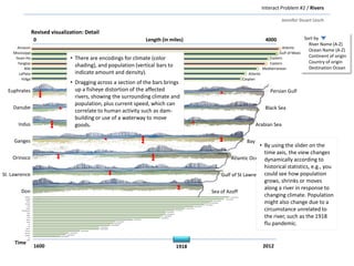
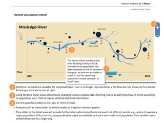
The document discusses an interactive visualization project aimed at representing historical and contemporary data about the world's rivers and mountains, particularly focusing on their lengths and associated climates. It highlights the limitations of existing maps in conveying detailed information and proposes enhancements for exploring river dynamics over time. The revised visualization will feature interactive elements like a time slider, climate and population data encoding, and detailed river representations to facilitate analysis of historical changes.