Download to read offline


![Urban Planning and Landscape Architecture
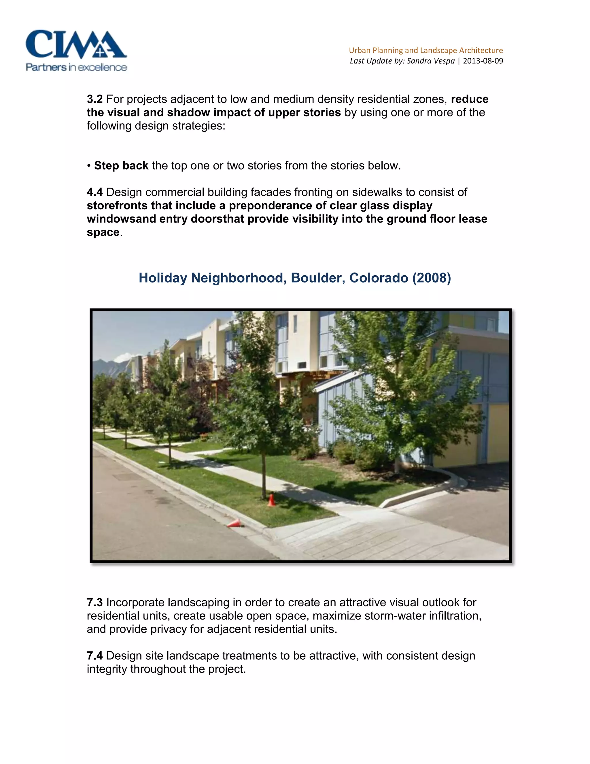
Last Update by: Sandra Vespa | 2013-08-09
Many large-scale developments are by a waterfront or make an effort to bring
civilian attention and activity to a nearby waterfront. This is true in all areas
studied.
Most developments have integrated sustainable practices in their infrastructure
i.e. gray-water systems, photovoltaic cellular structures, radiant heating […]
and/or strive to achieve sustainable practices recognition from LEED or
BREEAM. This is mostly true in the United States, Canada and Europe. It is
especially true in The Middle-East and Chine where all projects studied have
integrated sustainable practices in their concepts.
Striving for affordable housing is a common goal for the city council and
developer of mixed-use developments centered on residential communities. This
is especially true in the United States.
- by contrast, projects that are oriented towards accommodating office or
retail spaces will more often than not have middle- to higher-income
housing. This is mostly true in all areas studied.
Mixed-use projects strive to promote knowledge-based industry and stimulate the
economy via the creative class. It is common to see bistros, art galleries and
locally-owned businesses on the ground floor rather than restaurant chains or
department stores. This is not true in the United States wherein mixed-use
developments are marketed differently than elsewhere and often promote chains
and large department stores as an integral part of the site.
Bike paths are heavily encouraged as part of the street scape and street design.
This is especially true for Europe and relatively true for Canada. Though there
are isolated cases; in large part, the mixed-use developments in the United
States do not promote bike paths nor do they support initiatives to encourage
cycling as a means of transportation.
Proximity to amenities and services is used in the marketing scheme
ofdevelopments and included in the design concept and scheme. This is
especially true in all cases including developments wherein different land uses
are integrated in single structures.
Almost all developments were found near a means of transportation and/or street
node; highway, bridge, overpass, train tracks, canal, Laguna, round-about. This
is especially true in all areas studied except for Africa (mainly Marocco).](https://image.slidesharecdn.com/rapportfinaldraft-croquis-130809142653-phpapp02/75/Rapport-final-draft-croquis-9-2048.jpg)


The document provides an overview of design guidelines and policies for mixed-use developments across several world regions. It summarizes guidelines from Alameda County and Mendocino County in California concerning building orientation, commercial and residential uses, building height and form, building design, setbacks, parking, landscaping, open space, transportation, and waste management. It then provides general research findings on trends in mixed-use developments globally, such as an emphasis on sustainable practices, proximity to amenities, redevelopment of brownfield sites, and inclusion of residential uses.


